
Adambakkam is a neighbourhood of Chennai, India. It is primarily a residential locality situated in South Chennai. Adambakkam area comes under Velachery taluk and Alandur taluk, Chennai District of Chennai Corporation. Adambakkam is surrounded by areas namely, Alandur in the North-West, Nanganallur in the West, Madipakkam in the South, Velachery in the East and Guindy in the North. Earlier, one part of Adambakkam was under the direct governance of Chennai Corporation. From October 2011 onwards, the entire area was merged with the Chennai Corporation. Upon completion of the MRTS extension line, the neighbourhood will be served by Adambakkam railway station. Its Proximity to commercial localities like Velachery, accessible railway stations, Metro Stations and road transport routes makes Adambakkam an ideal choice of location to live.

Avadi is a Municipal Corporation within the Chennai Metropolitan Area, located in the Thiruvallur district of Tamil Nadu, India, about 22 kilometres (14 mi) from Chennai Central Railway Station. It is surrounded by major defence establishments and is home to various universities and engineering colleges. The city is served by Avadi Railway Station of the Chennai Suburban Railway. As of 2011, Avadi had a population of 345,996, which is 10th most populous place in Tamil Nadu. It is home to the Heavy Vehicles Factory (HVF), Ordnance Factory Board (ODF) which houses Engine Factory and Combat Vehicles Research and Development Establishment (CVRDE). The lake in Avadi was known as Paaleripattu, which is now found only in very old land documents.

Thyagaraya Nagar, commonly known as T. Nagar, and historically known as East Mambalam, is a very affluent commercial and residential neighbourhood in Chennai, Tamil Nadu, India. It is surrounded by Nungambakkam in the North, Teynampet in the East, Nandanam in the South-East, C.I.T. Nagar in the South and West Mambalam and Kodambakkam in the West. The stretch between Duraiswamy Road and T. Nagar Bus Stand has some of the costliest real estates in Chennai. It was constructed between 1923 and 1925 by the Madras Presidency government of the Raja of Panagal as a part of town planning activities initiated according to the Madras Town Planning Act of 1920. The town was named after P. Thyagaraya Chetty. The streets, parks and localities in the new neighbourhood were named after important officials in the provincial government.

Transport in Chennai includes various modes of air, sea, road and rail transportation in the city and its suburbs. Chennai's economic development has been closely tied to its port and transport infrastructure, and it is considered one of the best infrastructure systems in India.
Ambattur is located in northwestern part of Chennai City, in Ambattur taluk of the Chennai District, surrounded by Avadi, Anna Nagar, Padi, Mogappair, Kallikuppam, Surapet, Korattur, Ayappakkam, Athipet and Thiruverkadu. It covers an area of 45 km2 (17 sq mi). The neighbourhood is served by Ambattur railway station of the Chennai Suburban Railway. Ambattur has its origins in a village of the same name which can be located at present as areas opposite to Ambattur telephone exchange. Ambattur was a village with large extents of agricultural farm lands irrigated by the once-sprawling Ambattur Lake. In 2011, the neighbourhood had a population 466,205.

Chennai Central, officially Puratchi Thalaivar Dr. M.G. Ramachandran Central Railway Station, and formerly known as Madras Central, is the main railway terminus in the city of Chennai, Tamil Nadu, India. It is the busiest railway station in South India and one of the most important hubs in the country. It is connected to Moore Market Complex railway station, Chennai Central metro station, Chennai Park railway station, and Chennai Park Town railway station. It is about 1.8 km (1.1 mi) from the Chennai Egmore railway station. The terminus connects the city to northern India, including Kolkata, Mumbai, and New Delhi, and all the different parts of India.
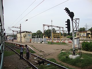
Basin Bridge Junction is a station on the Chennai Suburban Railway and serves the locality of Pulianthope & Moolakothalam, the confluence on the Otteri Nullah and Buckingham Canal, in Chennai, India. The station is located at the southern end of the 'diamond' junction in Chennai, where all the lines of the Chennai Suburban Railway meet. It is the first station after Chennai Central. At this station, the line divides into three: one going towards Avadi and Arakkonam, the other towards Ennore and Gummidipoondi, and the third towards Chennai Beach and Chennai Egmore. Thus, the station acts as the entry point to Chennai Central terminus where inbound trains from all the three lines are stopped before assigning a platform at Chennai Central. It also contains a railway maintenance shed with 19 pit-lines, each measuring 3-ft deep to accommodate about 24 coaches. The station has an elevation of 7 m above sea level.

Chennai architecture is a confluence of many architectural styles. From ancient Tamil temples built by the Pallavas, to the Indo-Saracenic style of the colonial era, to 20th-century steel and chrome of skyscrapers. Chennai has a colonial core in the port area, surrounded by progressively newer areas as one travels away from the port, punctuated with old temples, churches and mosques.
Pammal is a neighbourhood of Tambaram, Tamil Nadu, India. It is located 22 kilometers from Chennai Central Railway Station. It is located next to Pallavaram on the western side. It lies on the western side of the Grand Southern Trunk Road and close to Chennai International Airport. It is 7 kilometers away from Tambaram. The neighborhood is served by Pallavaram Railway Station of the Chennai Suburban Railway Network. Pammal falls under Chengalpattu District.
West Mambalam is a residential and commercial area in Chennai, India. It is known for its shops, bazaars and Hindu temples. It is bounded by Kodambakkam to the north and Saidapet to the south. T. Nagar and Nandanam stretch all along its eastern frontiers while Ashok Nagar lies to its west. The Ayodhya Mandapam is an important landmark.

The Chennai Suburban Railway is a commuter rail system in the city of Chennai, Tamil Nadu, India, operated by the Southern Railways branch of Indian Railways. It is the second largest suburban rail network in terms of route length and the third largest in terms of commuters in India. Around 1,000 services are operated daily between 4:00 a.m. and midnight. It is the longest suburban circular route in India covering of 235.5 km (146.3 mi).

George Town is a neighbourhood in Chennai, Tamil Nadu, India. It is near the Fort Saint George, Chennai. It is also known as Muthialpet and Parry's corner. It is an historical area of Chennai city from where its expansion began in the 1640s. It extends from the Bay of Bengal in the east to Park town on the west. The Fort St. George is on the south, to Royapuram in the north. The Fort St. George houses the Tamil Nadu Legislative Assembly and the Secretariat. The High court of Tamil Nadu at Chennai, Dr. Ambedkar Law College, Stanley Medical College and Hospital are located here.
Mogappair is a residential neighborhood in north-western Chennai, India. It is located west of the Jawaharlal Nehru Road and is part of the Ambattur zone (7) of the Greater Chennai Corporation. There are industrial estates to the north and west, namely, Padi and Ambattur.

Royapuram railway station is a railway station at Royapuram, on the Chennai Beach–Walajapet section of the Chennai Suburban Railway network in Chennai, India. It is the second oldest railway station currently operational in India after Howrah railway station situated in Howrah, West Bengal and the first railway station of South India. The first train of South India started operating in June 1856 from Royapuram railway station. The station also remained the headquarters of the Madras and Southern Mahratta Railway till 1922, when the headquarters was shifted to Egmore. Since the original structures of Bombay and Thane stations no longer exist, Royapuram station remains the oldest railway station in the entire subcontinent.

Washermanpet railway station is one of the railway stations in Chennai, India. It is one of the stations of the Chennai Beach–Gummidipoondi and Chennai Beach-Arakkonam sections of the Chennai Suburban Railway Network. It serves the neighbourhood of Washermanpet, Korukkupet and Tondiarpet. It is situated at Washermanpet, with an elevation of 9 m above sea level. The station lies at the eastern end of the 'diamond' junction of Chennai's railway network, where all the lines of the Chennai Suburban Railway meet.

Rajaji Salai, also known as North Beach Road or First Line Beach, is one of the main thoroughfares of the commercial centre of George Town in Chennai, India. The road connects Royapuram in the north with Quibble Island in the south. As the main thoroughfare connecting the erstwhile Whitetown and Blacktown, the road has several historical landmarks dating back to the colonial era.
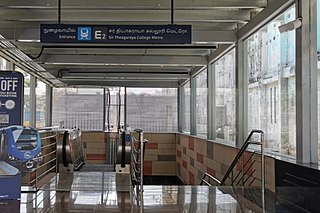
Sir Theagaraya College is an underground metro station on the North-South Corridor of the Line 1 Extension of the Blue Line of Chennai Metro in Chennai, India. This station will serve the neighbourhoods of Old Washermanpet and other northern suburbs of Chennai.
Singanallur is a major residential locality of the city of Coimbatore in Tamil Nadu, India. It is located on the banks of Noyyal river, which runs to the southern boundary of the locality. It is situated in the eastern part of the city, and is a major hub for the inter-city bus services towards Southern and Central districts of Tamilnadu from the city. It is one of the well developed neighborhoods in the city and has been part of Coimbatore Corporation since 1981. The East Zone Office of Coimbatore City Municipal Corporation is located at Singanallur.
Kasimedu is a hamlet in the neighbourhood of Royapuram, in Chennai district of Tamil Nadu state in the peninsular India. This hamlet is occupied by fishermen whose families depend on the fishing harbour and the fish market nearby. It stretches for about 2 km, near Ennore fishing harbour along the shore, north of Chennai Port. Large numbers of victims from Kasimedu fishing community were found during the tsunami observed on 26 December 2004. Kasimedu is located at about 5 km from Chennai Beach railway station. Near about 200 tons of fishes are brought to Kasimedu, daily. State Highway 114 passes through Kasimedu.
Basin bridge is a neighbourhood in Chennai district of Tamil Nadu state in the peninsular India. It is located at an altitude of about 28 m above the mean sea level with the geographical coordinates of 13°06′23.5″N80°16′31.2″E. George Town, Royapuram, Kondithope, Mannadi Vannarapettai, Tondiarpet, Sowcarpet, Vallalar Nagar and Kasimedu are some of the important neighbourhoods of Basin Bridge area.


