Harrisburg–Carlisle metropolitan statistical area

Last updated • 6 min readFrom Wikipedia, The Free Encyclopedia

Harrisburg–Carlisle, Pennsylvania MSA
Susquehanna Valley
Harrisburg, PA Skyline 2021.jpg
Carlisle, Pennsylvania.jpg
Hershey, Pennsylvania.JPG
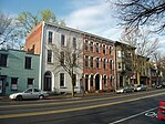
Clockwise from top left: Harrisburg, Carlisle, and Hershey
Harrisburg-Carlisle Metropolitan Area.png
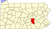
The Harrisburg–Carlisle MSA in Pennsylvania is highlighted in red.
Coordinates: 40°16′N76°52′W / 40.27°N 76.87°W / 40.27; -76.87
Country Flag of the United States.svg United States
State Flag of Pennsylvania.svg Pennsylvania
Principal cities Harrisburg
Carlisle
Area
   Metropolitan area 1,656 sq mi (4,290 km2)
Population
 (2010 est.)
   Urban
444,474 (87th) [1]
   MSA
549,475 (98th) [2]
   CSA
1,271,801 (46th) [2]
GDP
[3]
  MSA$47.815 billion (2022)
Time zone UTC-5 (ET)
  Summer (DST) UTC-4 (EDT)

The Harrisburg–Carlisle metropolitan statistical area, officially the Harrisburg–Carlisle, PA Metropolitan Statistical Area, and also referred to as the Susquehanna Valley , is defined by the Office of Management and Budget as an area consisting of three counties in South Central Pennsylvania, anchored by the cities of Harrisburg and Carlisle.

Contents

As of the 2020 census, [4] the metropolitan statistical area (MSA) had a population of 591,712, making it the fourth-most-populous metropolitan area in Pennsylvania, after the Delaware Valley, Greater Pittsburgh, and the Lehigh Valley.

Since 2012, it has been defined as part of the Harrisburg–York–Lebanon combined statistical area, which also includes York, Lebanon, and Adams counties. [5]

Components

The Harrisburg–Carlisle Metropolitan Area consists of three counties, located entirely within the Commonwealth of Pennsylvania. The following three counties are designated as being part of the greater Harrisburg–Carlisle area: [5]

Officially, Lebanon County is not part of the Harrisburg–Carlisle metropolitan statistical area, and has nt been since 2003. It is rather part of combined statistical area, but it is culturally considered to be part of Greater Harrisburg, with Harrisburg suburbs extending into the county.

Combined statistical area

Additionally, three more counties are included as part of the Harrisburg–York–Lebanon, PA combined statistical area. [5] Collectively, they have a population of 1,271,801 people, making it the 46th-most-populous combined statistical area (CSA) in the United States, and the 3rd-most-populous CSA in the state of Pennsylvania. [2]

Statistical history

Geography and climate

Geography

Harrisburg–Carlisle is located in the Susquehanna River's valley, which makes the terrain rolling, with occasional flat land and tall hills. The metropolitan area is underlain with limestone, which makes the land ideal for farming. Much of the region is within the piedmont region of the United States.

Climate

The Harrisburg metropolitan area has a humid continental climate, experiencing four mild seasons: summer, autumn, winter, and spring. The average high temperature is 62 °F, while the average low is 44 °F. Harrisburg receives about 41 inches of rainfall annually. [13]

Communities

Demographics

Historical population
CensusPop.Note
1990 474,242
2000 509,0747.3%
2010 549,4757.9%
2020 591,7127.7%
US Decennial Census

As of the 2000 census, [14] there were 509,074 people, 202,380 households, and 134,557 families residing within the MSA. The racial makeup of the MSA was 86.20% White, 9.39% African American, 0.15% Native American, 1.68% Asian, 0.03% Pacific Islander, 1.17% from other races, and 1.37% from two or more races. Hispanic or Latino people of any race were 2.67% of the population.

The median income for a household in the MSA was $43,374, and the median income for a family was $51,792. Males had a median income of $36,368 versus $26,793 for females. The per capita income for the MSA was $21,432.

In 2009, the urban population of the MSA increased to 383,008 from 362,782 in 2000, a change of 20,226 people. [15]

County 2022 estimate2020 CensusChangeAreaDensity
Cumberland County 268,579259,469+3.51%550 sq mi (1,400 km2)
Dauphin County 288,800286,401+0.84%558 sq mi (1,450 km2)
Perry County 46,11445,842+0.59%556 sq mi (1,440 km2)
Total603,493591,712+1.99%1,664 sq mi (4,310 km2)

Transportation

Roads and highways

The Harrisburg–Carlisle metropolitan area is served by a number of interstates, US routes, and state highways that help facilitate the movement of people and goods throughout the region. Major routes in the region include: [16]

Air

Harrisburg International Airport (MDT) is the primary airport for the Harrisburg–Carlisle area. Located in Middletown, the airport serviced 1.137 million passengers in 2017. It is Pennsylvania's 3rd-busiest airport. [17] [18] It is owned and operated by the Susquehanna Area Regional Airport Authority, which also operates several other airports throughout South Central Pennsylvania. [19]

Some residents use Baltimore/Washington, Ronald Reagan Washington, and Philadelphia airports for a wider selection of destinations and airlines.

Rail

Harrisburg–Carlisle is served by Amtrak's Keystone Service and Pennsylvanian. Amtrak's Keystone Service, which terminates at Harrisburg Transportation Center, allows for rail trips to points east, including Philadelphia and New York City. The Pennsylvanian connects Harrisburg–Carlisle with Pittsburgh and New York City (by way of Philadelphia). [20] [21]

Currently, the Harrisburg–Carlisle region is not served by any commuter rail; however, there were plans to bring it to the metropolitan and combined statistical areas. Plans included a commuter rail line, called the Capital Red Rose Corridor, running from Lancaster to Harrisburg, with a possible extension to Carlisle. [22]

Bus

The region is interconnected by bus services, which offer service for local and regional trips, as well as for intercity trips. The primary bus service provider for the region is Capital Area Transit (CAT). CAT provides local and commuter bus service in eastern Cumberland and southern Dauphin counties. Its services are used by about 8,000 daily riders. [23] Intercity bus service is primarily provided by Greyhound Lines and Fullington Trailways. [24] [25]

Colleges and universities

The Harrisburg–Carlisle metropolitan area is home to several universities. The following is a list of non-profit colleges and universities within Harrisburg–Carlisle:

Cumberland County

Dauphin County

Media

The Harrisburg–Carlisle metropolitan area is located entirely within the Harrisburg–York–Lebanon media market. It is the 42nd largest in the United States, with 772,810 households as of 2021. [26] [27]

Newspapers

Television

The Harrisburg TV market is served by:

Radio

The Harrisburg area's radio market is ranked 78th in the nation. [28]

This is a list of FM stations in the Harrisburg–Carlisle metropolitan area:

Callsign MHzBand"Name", format, owner City of license
WDCV 88.3FMIndie/College Rock, Dickinson College Carlisle
WXPH 88.7FM WXPN relay, University of Pennsylvania Harrisburg
WSYC 88.7FMAlternative, Shippensburg University Shippensburg
WITF-FM 89.5FM NPR Harrisburg
WVMM 90.7FMIndie/College Rock, Messiah College Grantham
WJAZ 91.7FM WRTI relay, Classical/Jazz, Temple University Harrisburg
WKHL 92.1FM"K-Love" Contemporary ChristianPalmyra
WPPY 92.7FM"Happy 92.7" Adult ContemporaryStarview
WTPA-FM 93.5FM"93.5 WTPA" Classic RockMechanicsburg
WRBT 94.9FM"Bob" CountryHarrisburg
WLAN 96.9FM"FM 97" CHRLancaster
WRVV 97.3FM"The River" Classic Hits and the Best of Today's RockHarrisburg
WYCR 98.5FM"98.5 The Peak" Classic HitsYork
WQLV 98.9FM98.9 WQLVMillersburg
WHKF 99.3FM"Kiss-FM" CHRHarrisburg
WFVY 100.1FMAdult ContemporaryLebanon
WROZ 101.3FM"101 The Rose" Hot ACLancaster
WARM 103.3FM"Warm 103" Hot ACYork
WNNK 104.1FM"Wink 104" Hot ACHarrisburg
WQXA 105.7FM"105.7 The X" Active RockYork
WWKL 106.7FM"Hot 106.7" CHRHershey
WGTY 107.7FM"Great Country"York

This is a list of AM stations in the Harrisburg–Carlisle metropolitan area:

CallsignkHzBandFormatCity of license
WHP (AM) 580AMConservative News/TalkHarrisburg
WHYF 720AM EWTN Global Catholic Radio NetworkShiremanstown
WSBA (AM) 910AMNews/TalkYork
WADV 940AMGospelLebanon
WHYL 960AMAdult StandardsCarlisle
WIOO 1000AMClassic CountryCarlisle
WKBO 1230AMChristian ContemporaryHarrisburg
WQXA 1250AMCountryYork
WLBR 1270AMTalkLebanon
WHGB 1400AMESPN Radio (Formerly Adult R&B: The Touch)Harrisburg
WTKT 1460AMsports: "The Ticket"Harrisburg
WRDD 1480AMCountryShippensburg
WRKY 1490AMClassic rockLancaster
WPDC 1600AMSportElizabethtown
Penndot 1670AMNOAA Weather and TravelSeveral

Area codes

The entire Harrisburg–Carlisle metropolitan area is served by two area codes: [29]

See also

Related Research Articles

<span class="mw-page-title-main">Adams County, Pennsylvania</span> County in Pennsylvania, United States

Adams County is a county in the Commonwealth of Pennsylvania. As of the 2020 census, the population was 103,852. Its county seat is Gettysburg. The county was created on January 22, 1800, from part of York County, and was named for the second President of the United States, John Adams. On July 1–3, 1863, a crucial battle of the American Civil War was fought near Gettysburg; Adams County, as a result, is a center for Civil War-related tourism. The county is part of the South Central Pennsylvania region of the state. Adams County comprises the Gettysburg metropolitan statistical area, which is also included in the Harrisburg–York–Lebanon combined statistical area.

In the United States, a metropolitan statistical area (MSA) is a geographical region with a relatively high population density at its core and close economic ties throughout the region. Such regions are not legally incorporated as a city or town would be and are not legal administrative divisions like counties or separate entities such as states. As a result, sometimes the precise definition of a given metropolitan area will vary between sources. The statistical criteria for a standard metropolitan area were defined in 1949 and redefined as a metropolitan statistical area in 1983.

<span class="mw-page-title-main">York County, Pennsylvania</span> County in Pennsylvania, United States

York County is a county in the Commonwealth of Pennsylvania, United States. As of the 2020 census, the population was 456,438. Its county seat is York. The county was created on August 19, 1749, from part of Lancaster County and named either after the Duke of York, an early patron of the Penn family, or for the city and county of York in England. The county is part of the South Central region of the state.

<span class="mw-page-title-main">Lebanon County, Pennsylvania</span> County in Pennsylvania, United States

LebanonCounty is a county in the Commonwealth of Pennsylvania, United States. As of the 2020 census, the population was 143,257. Its county seat is the city of Lebanon. It lies 72 miles northwest of Philadelphia, which is the nearest major city. The county is part of the South Central Pennsylvania region of the state.
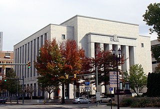
<span class="mw-page-title-main">Dauphin County, Pennsylvania</span> County in Pennsylvania, United States

Dauphin County is a county in the Commonwealth of Pennsylvania. As of the 2020 census, the population was 286,401. The county seat is Harrisburg, Pennsylvania's state capital and ninth-most populous city. The county was created on March 4, 1785, from part of Lancaster County and was named after Louis Joseph, Dauphin of France, the first son of King Louis XVI. The county is part of the South Central Pennsylvania region of the state.

<span class="mw-page-title-main">Delaware Valley</span> Combined Statistical Area in the United States

The Delaware Valley, sometimes referred to as Greater Philadelphia or the Philadelphia metropolitan area, is a major metropolitan region in the Northeast United States that centers on Philadelphia, the nation's sixth-most populous city, and spans parts of four U.S. states: southeastern Pennsylvania, southern New Jersey, northern Delaware, and the northern Eastern Shore of Maryland. With a core metropolitan statistical area population of 6.288 million residents and a combined statistical area population of 7.366 million as of the 2020 census, the Delaware Valley is the eighth-largest metropolitan region in the United States and the 68th-largest metropolitan region in the world.

<span class="mw-page-title-main">New Orleans metropolitan area</span> Metropolitan area

The New Orleans metropolitan area, designated the New Orleans–Metairie metropolitan statistical area by the U.S. Office of Management and Budget, or simply Greater New Orleans, is a metropolitan statistical area designated by the United States Census Bureau encompassing seven Louisiana parishes—the equivalent of counties in other U.S. states—centered on the city of New Orleans. The population of Greater New Orleans was 1,271,845 in 2020, up from 1,189,166 at the 2010 United States census. Greater New Orleans is the most populous metropolitan area in Louisiana, and the 45th most populous in the United States. According to 2017 census estimates, the broader New Orleans–Metairie–Slidell combined statistical area (CSA) had a population of 1,510,562.

<span class="mw-page-title-main">Louisville metropolitan area</span> Geographic region in Kentucky and southern Indiana, US

The Louisville metropolitan area is the 43rd largest metropolitan statistical area (MSA) in the United States. It had a population of 1,395,855 in 2020 according to the latest official census, and its principal city is Louisville, Kentucky.

<span class="mw-page-title-main">Greater Pittsburgh</span> Region in the U.S. State of Pennsylvania

Greater Pittsburgh is the metropolitan area surrounding the city of Pittsburgh in Western Pennsylvania, United States. The region includes Allegheny County, Pittsburgh's urban core county and economic hub, and seven adjacent Pennsylvania counties: Armstrong, Beaver, Butler, Fayette, Lawrence, Washington, and Westmoreland in Western Pennsylvania, which constitutes the Pittsburgh, PA Metropolitan Statistical Area MSA as defined by the U.S. Office of Management and Budget.

<span class="mw-page-title-main">Cumberland County, Pennsylvania</span> County in Pennsylvania, United States

Cumberland County is a county in the Commonwealth of Pennsylvania. As of the 2020 census, the population was 259,469. Its county seat is Carlisle. The county is part of the South Central Pennsylvania region of the state.

<span class="mw-page-title-main">Pennsylvania metropolitan areas</span>

Pennsylvania has 14 U.S. Census Bureau-designated metropolitan statistical areas (MSAs) and four combined statistical areas (CSAs). As of 2020, Philadelphia, the seventh-largest United States metropolitan area, is the state's largest metropolitan area followed by Pittsburgh and Allentown.

<span class="mw-page-title-main">Baton Rouge metropolitan area</span> Metropolitan statistical area in Louisiana, United States

The Baton Rouge metropolitan statistical area, as defined by the United States Office of Management and Budget, or simply the Baton Rouge metropolitan area or Greater Baton Rouge, is a sprawling metropolitan statistical area surrounding the city of Baton Rouge. Including the western edge of the Florida Parishes regions, it is known as "Plantation Country", the "Capital Region", and "The 225". At the 2010 U.S. census, the metropolitan area had a population of 802,484, up from 705,973 in 2000. At the 2020 census, its population increased to 870,569, up from 2020 estimates at 858,571.

<span class="mw-page-title-main">Alexandria metropolitan area, Louisiana</span> Metropolitan statistical area in Louisiana, United States

The Alexandria Metropolitan Statistical Area is a metropolitan area in central Louisiana that covers two parishes – Rapides and Grant. As of the 2020 census, the MSA had a population of 152,192.

<span class="mw-page-title-main">Sarasota metropolitan area</span> Metropolitan area in Florida, United States

The Sarasota metropolitan area is a metropolitan area located in Southwest Florida. The metropolitan area is defined by the Office of Management and Budget (OMB) as the North Port–Bradenton–Sarasota Metropolitan Statistical Area, a metropolitan statistical area (MSA) consisting of Manatee County and Sarasota County. The principal cities listed by the OMB for the MSA are North Port, Bradenton, Sarasota, Lakewood Ranch, and Venice. At the 2020 census, the MSA had a population of 833,716. The Census Bureau estimates that its population was 891,411 in 2022.
<span class="mw-page-title-main">Portland metropolitan area, Maine</span> Metropolitan area in United States of America

The city of Portland, Maine, is the hub city of a metropolitan area in southern Maine. The region is commonly known as Greater Portland or the Portland metropolitan area. For statistical purposes, the U.S. federal government defines three different representations of the Portland metropolitan area. The Portland–South Portland, Maine, metropolitan statistical area is a region consisting of three counties in Maine, anchored by the city of Portland and the smaller city of South Portland. As of the 2020 census, the MSA had a population of 551,740. A larger combined statistical area (CSA), the Portland–Lewiston–South Portland combined statistical area, is defined as the combination of this metropolitan statistical area (MSA) with the adjacent Lewiston–Auburn MSA. The CSA comprises four counties in southern Maine. The Portland–South Portland metropolitan New England city and town area is defined on the basis of cities and towns rather than entire counties. It consists of most of Cumberland and York counties plus the town of Durham in Androscoggin County. The Greater Portland area has emerged as an important center for the creative economy, which is also bringing gentrification.
<span class="mw-page-title-main">Kiryas Joel–Poughkeepsie–Newburgh metropolitan area</span> Metropolitan statistical area in New York, United States

The Kiryas Joel–Poughkeepsie–Newburgh, NY Metropolitan Statistical Area, as defined by the United States Office of Management and Budget, is an area consisting of two counties in New York's Hudson Valley, with the municipalities of Kiryas Joel, Poughkeepsie, and Newburgh as its principal cities. As of the 2020 census, the MSA had a population of 679,221. The area was centered on the urban area of Poughkeepsie-Newburgh. Prior to July 2023, it was known as the Poughkeepsie–Newburgh–Middletown, NY Metropolitan Statistical Area; whereupon it was renamed to its current name, to reflect population changes among its largest municipalities.

The Lima metropolitan statistical area, as defined by the United States Census Bureau, is an area consisting of one county – Allen – in Northwest Ohio, anchored by the city of Lima. As of the 2000 census, the MSA had a population of 108,473.

<span class="mw-page-title-main">Mansfield Metropolitan Statistical Area</span> Metropolitan Statistical Area

The Mansfield Metropolitan Statistical Area, as defined by the United States Census Bureau, is an area consisting of one county – Richland – in north central Ohio, anchored by the city of Mansfield. As of the 2020 census, the MSA had a population of 124,936. The MSA forms the eastern half of the Mansfield–Ashland–Bucyrus, OH CSA.
<span class="mw-page-title-main">Timeline of Harrisburg, Pennsylvania history</span>

This is a timeline of the major events in the history of Harrisburg, Pennsylvania and vicinity.

<span class="mw-page-title-main">Harrisburg–York–Lebanon combined statistical area</span> Combined statistical area in Pennsylvania, United States

The Harrisburg–York–Lebanon, PA combined statistical area (CSA) is a region assigned by the U.S. Office of Management Budget that includes six cities in the Harrisburg and York areas along with several metropolitan statistical areas of Pennsylvania that combine to form a combined statistical area. As of the 2010 United States census, the CSA had a population total of 1,219,422, and ranked the third most populous CSA in Pennsylvania and 43rd most populous in the nation.
References

  1. "Census Urban Area List". United States Census Bureau . Retrieved March 2, 2021.
  2. 1 2 3 "Metropolitan and Micropolitan Statistical Areas Totals: 2010-2019". The United States Census Bureau. Retrieved March 2, 2021.
  3. "Total Gross Domestic Product for Harrisburg-Carlisle, PA (MSA)". Federal Reserve Economic Data . Federal Reserve Bank of St. Louis.
  4. "2010 Census". census.gov. Retrieved May 25, 2014.
  5. 1 2 3 "0MB BULLETIN NO. 20-01" (PDF). Office of Management and Budget . Retrieved March 2, 2021.
  6. "Standard Metropolitan Areas (SMAs) and Components" (TXT). Standard Metropolitan Areas defined by the Bureau of the Budget, October 13, 1950. United States Census Bureau, Population Division. December 14, 2000. Retrieved October 20, 2008.
  7. 1 2 "About Metropolitan and Micropolitan Statistical Areas". United States Census Bureau, Population Division. Retrieved October 20, 2008.
  8. "Standard Metropolitan Statistical Areas (SMSAs) and Components, 1963" (TXT). Standard Metropolitan Statistical Areas defined by Office of Management and Budget, October 18, 1963. United States Census Bureau, Population Division. October 25, 2000. Retrieved October 20, 2008.
  9. "Metropolitan Areas and Components, 1983" (TXT). Metropolitan Statistical Areas defined by Office of Management and Budget, June 27, 1983. United States Census Bureau, Population Division. March 1, 2001. Retrieved October 20, 2008.
  10. "Metropolitan Statistical Areas and Components, 2003" (TXT). Metropolitan statistical areas defined by Office of Management and Budget, June 6, 2003. United States Census Bureau, Population Division. July 10, 2003. Retrieved October 20, 2008.
  11. America's Urban Agglomerations 2010 Proximity, Retrieved January 21, 2011.
  12. Harrisburg-York-Lebanon, PA Combined Statistical Area United States Census Bureau, Retrieved April 2, 2015.
  13. "Weather averages Harrisburg, Pennsylvania". www.usclimatedata.com. Retrieved March 3, 2021.
  14. "U.S. Census website". United States Census Bureau . Retrieved January 31, 2008.
  15. America's Urban Population: Patterns & Characteristics 2000-2009 Proximity, 2009 data, Retrieved January 21, 2011.
  16. "Harrisburg and Vicinity Transportation Map" (PDF). PennDOT. Retrieved March 2, 2021.
  17. "HAI Airport Passenger and Operational Statistics" (PDF). Retrieved March 2, 2021.
  18. "Commercial Service Airports by State and Type of Carrier" (PDF). Retrieved March 2, 2021.
  19. "History of the Airport". Harrisburg International Airport. Retrieved March 2, 2021.
  20. "Keystone Service Train | Amtrak". www.amtrak.com. Retrieved March 2, 2021.
  21. "Pennsylvanian Train | Amtrak". www.amtrak.com. Retrieved March 2, 2021.
  22. "Corridor One in the Harrisburg Region". Tri-County Regional Planning Commission. 2006. Archived from the original on 1 January 2007. Retrieved 24 January 2007.
  23. "General Information". Capital Area Transit. Retrieved March 2, 2021.
  24. "Harrisburg Bus Station in Harrisburg, Pennsylvania | Greyhound". www.greyhound.com. Retrieved March 2, 2021.
  25. "Fullington Tours, Clearfield, Pennsylvania - Tours, Cruises and Travel Packages". www.fullingtontours.com. Retrieved March 2, 2021.
  26. "Designated Regional Market List by State". www.truckads.com. Retrieved March 2, 2021.
  27. AdeptPlus. "Nielsen DMA 2021 Rankings". MediaTracks Communications. Retrieved March 2, 2021.
  28. "Audio | Nielsen". Arbitron.com. Retrieved January 28, 2017.
  29. "NANPA : Number Resources - NPA (Area) Codes". www.nationalnanpa.com. Retrieved March 2, 2021.