List of road routes in New South Wales (numeric)

Last updated

Road routes in New South Wales pre-alphanumeric (until 2013) Map of NSW Highways.png
Road routes in New South Wales pre-alphanumeric (until 2013)

Road routes in New South Wales assist drivers navigating roads throughout the state, as roads may change names several times between destinations, or have a second local name in addition to a primary name. New South Wales previously used an older, numerical shield-based system (which this article focuses on) until 2013, when it was completely replaced (except for Tourist Routes) with a newer, alphanumeric system.

Contents

New South Wales implemented the federally-issued National Routes system between 1954 and 1955, using white-and-black shields highlighting interstate links between major regional centres; some of these routes were later upgraded into National Highways using green-and-gold shields when the National Roads Act was passed in 1974.

Sydney's initial shield system was the Ring Road system, with three routes rolled out in 1964. These were eventually replaced by a specialised Freeway Routes system in 1973, and a state-wide shield-based numbering scheme, allocating blue-and-white shields across Sydney in 1974, numbered to fit around existing National Routes, with separate allocations for rural New South Wales, the Hunter (Greater Newcastle) and Illawarra (Greater Wollongong) regions; this system received sporadic updates throughout the 1990s and 2000s. These were augmented by the Metroad system in 1992–93, with its blue-on-white hexagonal shields identifying major routes through Sydney, with additional routes added through the late 1990s.

The new alphanumeric system, introduced in 2013, has now replaced the previous scheme across the entire state. It consists of alphanumeric routes, a one-to-three digit number prefixed with a letter (M, A, B, or D) that denotes the grade and importance of the road, and (apart from Tourist Routes) is now the state's only road route numbering system.

Some routes, in part or in their entirety, may have been made obsolete by the alphanumeric designation: these replacement routes are noted but not listed in full here. Some also may follow older alignments or routes later changed even after the new system was introduced, and are included here for the sake of completion. Roads are described in either a west–east or north–south alignment.

National Routes

National Routes were the first type of route numbering to be attempted in Australia on a large scale, signed with a white shield and black writing (similar in shape to the shield that appears on the Australian coat of arms), with New South Wales receiving routes in 1954. They highlighted the interstate links connecting major population, industrial and principal regions of New South Wales to the rest of the Australia, in a way that was readily identifiable to interstate travellers. The system was prepared by COSRA (Conference of State Road Authorities), held between 1953 and 1954: once each state road authority agreed to the scheme, it was rolled out federally.

In 1954, the Hume Highway was trialled as National Route 31, chosen due to its prominence as a transport corridor connecting Australia's largest cities (Sydney and Melbourne). Soon after, other National Routes across the state were allocated. Selected routes were later upgraded into National Highways when the National Roads Act was passed in 1974.

New South Wales' National Routes were initially replaced within the boundaries of Sydney with the Metroad system in 1992–93, and eventually replaced entirely across the state by the alphanumeric system in 2013: each route was converted to an alphanumeric route number, rendering the previous shields redundant. Many National Routes across New South Wales were renumbered during the conversion, while some others were not replaced at all and became unsigned.

RouteComponent roadsFromViaToLengthNotes
Australian national route 1.svg
National Route 1
Pacific Highway (I) (Tweed Heads section)NSW/QLD borderNSW/VIC border1,466 km (911 mi)Reallocated along Tweed Heads bypass when it opened in 1992, later replaced by Australian state route 2.svg when Tugun Bypass opened in 2008, renamed Gold Coast Highway in 2009
Progressively reallocated along Pacific Motorway sections as they opened, replaced by AUS Alphanumeric Route M1.svg/AUS Alphanumeric Route A1.svg
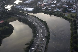
Construction of Sydney–Newcastle Freeway sections bypassing Pacific Highway built between Berowra and Ourimbah between 1964 and 1973 (old alignments eventually allocated Australian state route 83.svg in 1979), entire freeway replaced by Australian national highway 1.svg in 1974 (and progressively extended at both ends until 1998)
– re-aligned through North Sydney from Pacific Highway to Berry/Arthur/Mount Streets (one-way southbound) and Pacific Highway (one-way northbound) when the Warringah Freeway opened in 1968;
– re-aligned through central Sydney from Pacific and Bradfield Highways, York and George Streets, Broadway, City Road, King Street and Princes Highway to York Street (one-way southbound) and Clarence Street (one-way northbound) in 1972;
– re-aligned through central Sydney from York/Clarence and George Streets to Western Distributor, Harris Street and Broadway in 1986;
– re-aligned through central Sydney from Harris Street to Wattle/Fig Streets (one-way northbound) and Harris Street (one-way southbound) when the Fig Street Connection opened in 1990;
– re-aligned through northern, central and southern Sydney from Pacific and Bradfield Highways, Western Distributor, Wattle/Fig/Harris Streets, Broadway, City Road, King Street and Princes Highway, to current alignment when Gore Hill Freeway and Sydney Harbour Tunnel opened in 1992;
– replaced by AUS Metroad 1.svg in 1993 [1]
Progressively reallocated along Princes Motorway sections as they opened, replaced by AUS Alphanumeric Route M1.svg/AUS Alphanumeric Route A1.svg
Australian national route ALT1.svg
Alternative
National Route 1
  • George Street
  • Bridge Road
  • Jersey Street North
Asquith Hornsby 2.6 km (2 mi)Alternative route through Hornsby (east of railway line): allocated 1975, replaced by Australian state route 83.svg when Sydney-Newcastle Freeway extended to Wahroonga in 1989
Princes Highway Waterfall Dapto 57 km (35 mi)Former Australian national route 1.svg route through Wollongong: allocated 1975, replaced by Australian state route 60.svg in 1989
Australian national route 15.svg
National Route 15
New England Highway NSW/QLD border Hexham 584 km (363 mi)– replaced by Australian national highway 15.svg in 1974
– concurrency with Australian national route 34.svg along Oxley Highway from Bendemeer to Tamworth
Australian national route 16.svg
National Route 16
Murray Valley Highway Euston NSW/VIC border3 km (2 mi)Decommissioned in 2013, now unallocated
Australian national route 18.svg
National Route 18
Snowy Mountains Highway Mount AdrahStony Creek333 km (207 mi)– replaced by AUS Alphanumeric Route B72.svg
– concurrency with Australian national route 23.svg along Monaro Highway from Cooma to Steeple Flat
Australian national route 20.svg
National Route 20
Sturt Highway NSW/VIC border Tarcutta 597 km (371 mi)– replaced by Australian national highway 20.svg in 1992
– concurrency with Australian national route 41.svg along Olympic Highway from Moorong to Wagga Wagga
Australian national route 23.svg
National Route 23
Federal Highway Yarra NSW/ACT border55 km (34 mi)Replaced by Australian national highway 23.svg in 1974
Monaro Highway NSW/ACT border
NSW/VIC border206 km (128 mi)– replaced by AUS Alphanumeric Route B23.svg
– concurrency with Australian national route 18.svg along Snowy Mountains Highway from Cooma to Steeple Flat
Australian national route 24.svg
National Route 24
Mid-Western Highway Hay Bathurst 518 km (322 mi)– replaced by: AUS Alphanumeric Route B64.svg from Hay to Cowra; AUS Alphanumeric Route A41.svg from Cowra to Bathurst
– concurrency with Australian national highway 39.svg along Newell Highway from West Wyalong to Caragabal
Australian national route 25.svg
National Route 25
Barton Highway Yass Murrumbateman NSW/ACT border40 km (25 mi)Allocated when road sealing and upgrades completed in 1956, replaced by Australian national highway 25.svg in 1974
Australian national route 31.svg
National Route 31
Hume Highway Haberfield NSW/VIC border543 km (337 mi)– re-aligned through Camden when Camden bypass opened in 1974
– replaced along Hume Highway from Casula to the border by Australian national highway 31.svg in 1974, allocation from Haberfield to Casula left as Australian national route 31.svg
– replaced from Haberfield to Chullora, and from Liverpool to Casula, by AUS Metroad 5.svg when allocated in 1993, unallocated otherwise
– replaced from Warwick Farm to Casula by AUS Metroad 7.svg (replacing AUS Metroad 5.svg), and from Chullora to Warwick Farm by Australian state route 31.svg, when Casula bypass opened in 1994
– replaced from Haberfield to Chullora by Australian state route 31.svg (replacing AUS Metroad 5.svg) when M5 East Motorway opened in 2001
– replaced by: AUS Alphanumeric Route A22.svg from Haberfield to Warwick Farm; AUS Alphanumeric Route A28.svg from Warwick Farm to Prestons
Australian national route 32.svg
National Route 32
NSW/SA border Lapstone 1,146 km (712 mi)– allocation originally along entire length of Great Western Highway and Parramatta Road through Sydney to Ultimo
– progressively reallocated along Western Motorway as sections opened (older allocations along Great Western Highway replaced by Australian state route 44.svg)
– truncated to Emu Plains, and replaced along Western Motorway by AUS Metroad 4.svg, in 1992
– truncated further back to Lapstone when Western Motorway extension opened in 1993
– replaced by AUS Alphanumeric Route A32.svg
Australian national route 34.svg
National Route 34
Oxley Highway Nevertire Port Macquarie 645 km (401 mi)– replaced by AUS Alphanumeric Route B56.svg from Coonabarabran to Port Macquarie, unallocated otherwise
– concurrency with Australian national highway 15.svg along New England Highway from Tamworth to Bendemeer
Australian national route 37.svg
National Route 37
Kamilaroi Highway Bourke Willow Tree 597 km (371 mi)– allocated in 1974 from Narrabri to Willow Tree, western end extended to Bourke in 1999
– replaced by: AUS Alphanumeric Route B76.svg from Bourke to Walgett; AUS Alphanumeric Route B51.svg from Narrabri to Willow Tree; unallocated otherwise
Australian national route 38.svg
National Route 38
Gwydir Highway Walgett South Grafton 568 km (353 mi)– allocated in 1962 from Collarenebri to South Grafton, western end extended to Walgett in 1993
– replaced by AUS Alphanumeric Route B76.svg
Australian national route 39.svg
National Route 39
Newell Highway NSW/QLD borderNSW/VIC border1,058 km (657 mi)– allocated in 1962, replaced by Australian national highway 39.svg in 1992
– concurrencies: with Australian national route 24.svg along Mid-Western Highway from Caragabal to West Wyalong; with Australian state route 94.svg along Burley Griffin Way from Mirrool to Ardlethan
Australian national route 41.svg
National Route 41
Olympic Highway Cowra Table Top 317 km (197 mi)– allocated in 1974, replaced by AUS Alphanumeric Route A41.svg
– concurrency with Australian national highway 20.svg along Sturt Highway from Wagga Wagga to Moorong

National Route 43
Balranald-Tooleybuc Road Balranald Tooleybuc NSW/VIC border49 km (30 mi)Decommissioned in early 2000s, allocation never properly signed as parts of it were not initially sealed
Australian national route 44.svg
National Route 44
Bruxner Highway Tenterfield West Ballina 185 km (115 mi)Allocated in 1974, replaced by AUS Alphanumeric Route B60.svg
Australian national route 46.svg
National Route 46
Carnarvon Highway NSW/QLD border Mungindi Moree 120 km (75 mi)Allocated in 1997, decommissioned in 2013, now unallocated
Australian national route 48.svg
National Route 48
Illawarra Highway Sutton Forest Albion Park Rail 62 km (39 mi)Allocated in 1974, replaced by AUS Alphanumeric Route A48.svg
Australian national route 52.svg
National Route 52
NSW/ACT border Queanbeyan NSW/ACT border12.4 km (8 mi)– allocated in 1974
– re-aligned through Queanbeyan from Uriarra Road and Crawford Street (and Norse Road in ACT) to current alignment (eliminating level crossing with Bombala railway line) in 1982
– replaced by AUS Alphanumeric Route B52.svg
Kings Highway NSW/ACT border Batemans Bay 115 km (71 mi)– allocated in 1974, replaced by AUS Alphanumeric Route B52.svg
Australian national route 55.svg
National Route 55
Castlereagh Highway NSW/QLD border Gilgandra 343 km (213 mi)– allocated in 1974 from Walgett to Gilgandra, northern end extended to NSW/QLD border in 1983
– replaced by AUS Alphanumeric Route B55.svg
Australian national route 58.svg
National Route 58
Riverina Highway Deniliquin
NSW/VIC border228 km (142 mi)Allocated in 1974, replaced by AUS Alphanumeric Route B58.svg from Deniliquin to Albury, unallocated otherwise
Australian national route 71.svg
National Route 71
Mitchell Highway NSW/QLD border
Nyngan 339 km (211 mi)Replaced by AUS Alphanumeric Route B71.svg
Australian national route 75.svg
National Route 75
Cobb Highway Wilcannia NSW/VIC border571 km (355 mi)Replaced by AUS Alphanumeric Route B75.svg
Australian national route 79.svg
National Route 79
NSW/QLD borderNSW/VIC border636 km (395 mi)Replaced by AUS Alphanumeric Route B79.svg between NSW/QLD border and Curlwaa: while Australian national route 79.svg allocation originally continued into Victoria, AUS Alphanumeric Route B79.svg detours to terminate in Buronga
  Decommissioned or unsigned route

National Highways

With the passing of the National Roads Act in 1974, selected National Routes were further upgraded to the status of a National Highway: interstate roads linking Australia's capital cities and major regional centres that received federal funding, and were of higher importance than other National Routes. These new routes were symbolised by green shields with gold writing, and the word "National" along the top of the shield. Most of New South Wales' National Highways were declared in 1974 and their shields converted in the following years, with National Highways 20 and 39 later declared in 1992.

Like National Routes, New South Wales' National Highways were also replaced with the alphanumeric system, introduced across the state in 2013: each route was converted to an alphanumeric route number, with all keeping their number during the conversion.

RouteComponent roadsFromViaToLengthNotes
Australian national highway 1.svg
National Highway 1
Sydney–Newcastle Freeway Beresfield Wahroonga 127 km (79 mi)Progressively reallocated along Sydney–Newcastle Freeway (F3) sections (already existing between Ourimbah–Berowra when Australian national highway 1.svg replaced Australian national route 1.svg in 1974) as they opened:
– re-aligned from Pacific Highway (Kangy Angy–Doyalson, replaced by Australian state route 83.svg) when freeway's Kangy Angy–Wallarah stage and Motorway Link (Wallarah–Doyalson) opened in 1983
– re-aligned from Motorway Link and Pacific Highway (Wallarah–Newcastle, replaced by Australian state route 111.svg) to Freemans/Leggetts Drives (concurrency with Australian state route 82.svg), Leggetts Drive, Stamford/Railway Streets to Kurri Kurri (concurrency with Australian state route 135.svg), Tarro/Mulbring Streets and John Renshaw Drive (concurrency with Australian state route 132.svg) when freeway's Mandalong–Freemans Waterhole stage opened in 1988
– re-aligned from Pacific Highway (Berowra–Wahroonga) when freeway's replacement stage opened in 1989
– re-aligned from Freemans/Leggetts Drives, Stamford/Railway/Tarro/Mulbring Streets and John Renshaw Drive (Freemans Waterhole-Beresfield) to Lenaghans Drive when freeway's Ryhope–Minmi stage opened in 1993
– re-aligned from Pacific Highway (Ourimbah–Kangy Angy) when freeway's replacement stage opened in 1997
– re-aligned from Lenaghans Drive (Minmi–Beresfield) to current alignment when freeway's final replacement stage opened in 1998
– replaced by AUS Alphanumeric Route M1.svg, renamed Pacific Motorway
Australian national highway 15.svg
National Highway 15
New England Highway NSW/QLD border Beresfield 578 km (359 mi)– southern end truncated from Hexham to Beresfield when interim Australian national highway 1.svg route via Kurri Kurri allocated in 1988
– replaced by AUS Alphanumeric Route A15.svg, later by AUS Alphanumeric Route A43.svg (from Lower Belford to Beresfield) when Hunter Expressway opened in 2014
Australian national highway 20.svg
National Highway 20
Sturt Highway NSW/VIC border Tarcutta 597 km (371 mi)Replaced by AUS Alphanumeric Route A20.svg
Australian national highway 23.svg
National Highway 23
Federal Highway Yarra NSW/ACT border55 km (34 mi)Replaced by AUS Alphanumeric Route M23.svg
Australian national highway 25.svg
National Highway 25
Barton Highway Yass Murrumbateman NSW/ACT border40 km (25 mi)Replaced by AUS Alphanumeric Route A25.svg
Australian national highway 31.svg
National Highway 31
Prestons NSW/VIC border543 km (337 mi)Progressively reallocated along upgraded Hume Highway and South Western Freeway (F5) sections as they opened:
– re-aligned from Hume Highway (Yanderra–Aylmerton, eventually replaced by Australian state route 89.svg in 1980), when freeway's replacement stage opened in 1977
– re-aligned from Hume Highway (Casula–Yanderra (replaced by Australian state route 89.svg) to South Western Freeway, when freeway's Campbelltown–Yanderra stage opened in 1980
– northern end extended from Casula to Prestons when Casula bypass opened in 1994, South Western Freeway renamed South West Motorway
– signage along Hume Highway (from Berrima to the border) progressively replaced with AUS Alphanumeric Route A31.svg, along Hume Highway and South West Motorway (from Prestons to Berrima) replaced with AUS Alphanumeric Route M31.svg, from 1997
– northern end truncated from Prestons to Campbelltown (replaced by AUS Metroad 5.svg) when AUS Metroad 9.svg allocated in 1999
– northern end restored back to Prestons, South West Motorway renamed Hume Motorway (from Prestons to Berrima), officially replaced along entire allocation with AUS Alphanumeric Route M31.svg in 2013
Australian national highway 39.svg
National Highway 39
Newell Highway NSW/QLD borderNSW/VIC border1,057 km (657 mi)Replaced by AUS Alphanumeric Route A39.svg
  Decommissioned or unsigned route

Metroads

These routes, characterised by their blue and white hexagonal shields, were phased in across Sydney between 1992 and 1993, better highlighting major routes into and around the city. A total of 9 routes existed, numbered from 1 to 10, covering Sydney's major radial and circumferential arteries. Metroad 4 was fully signed in December 1992, and Metroads 1, 2, 3, 5 and 7 followed in 1993. A second stage was rolled out a few years later: Metroads 9 and 10 were added in 1998, and Metroad 6 was added in 1999; there was no Metroad 8. These were eventually replaced with the alphanumeric system, introduced across the state in 2013: each route was converted to an alphanumeric route number, keeping their number during the conversion (with the exception of Metroad 10, which became A8).

RouteComponent roadsFromViaToLengthNotes
AUS Metroad 1.svg
Metroad 1
Pacific Highway Wahroonga Waterfall 67 km (42 mi)Replaced by AUS Alphanumeric Route A1.svg [1]
– re-aligned through central Sydney from Palmer and Bourke Streets (southbound)/Campbell and Crown Streets, Sir John Young Crescent (northbound), Flinders and South Dowling Streets to current alignment when Eastern Distributor opened in 1999
– replaced by AUS Alphanumeric Route M1.svg
Replaced by AUS Alphanumeric Route A1.svg
AUS Metroad 2.svg
Metroad 2
Windsor Lane Cove 46 km (29 mi)– western end re-aligned from Windsor and Showground Roads, Old Northern and Castle Hill Roads, Pennant Hills and Beecroft Roads, and Epping Road to current alignment when Hills Motorway opened in 1997
– replaced by AUS Alphanumeric Route A2.svg [2]
– eastern end along Longueville Road, Gore Hill and Warringah Freeways, Bradfield Highway, Western Distributor, Wattle and Fig Streets (one-way southbound)/Harris and Regent Streets (one-way northbound), Cleveland Street terminating at Ultimo truncated to current alignment when Lane Cove Tunnel opened in 2007
- replaced by AUS Alphanumeric Route M2.svg
AUS Metroad 3.svg
Metroad 3
Mona Vale Blakehurst 51 km (32 mi)Replaced by AUS Alphanumeric Route A3.svg [3]
AUS Metroad 4.svg
Metroad 4
Western Motorway Lapstone Sydney 58 km (36 mi)– western end extended along Western Motorway from Emu Plains to Lapstone when extension opened in 1993
– replaced by AUS Alphanumeric Route M4.svg [4]
– eastern end re-aligned from Parramatta Road, City Road and Cleveland Street terminating at Moore Park to current alignment when City West Link opened in 2000
– replaced by AUS Alphanumeric Route A4.svg, later by AUS Alphanumeric Route A44.svg from Strathfield to Haberfield when M4 East Motorway opened in 2019
AUS Metroad 5.svg
Metroad 5
Campbelltown Mascot 44 km (27 mi)– western end re-aligned from Hume Highway terminating at Casula (replaced by AUS Metroad 7.svg) to South West Motorway terminating at Prestons when Casula bypass opened in 1994
– western end extended along South West Motorway from Prestons to Campbelltown (replacing Australian national highway 31.svg) when AUS Metroad 9.svg allocated in 1999
– eastern end re-aligned from King Georges Road, Wiley Avenue, Roberts Road, Hume Highway, Parramatta Road and Broadway terminating at Ultimo to current alignment when M5 East Motorway opened in 2001
– replaced by AUS Alphanumeric Route M5.svg, western end retracted back to Prestons (replaced by AUS Alphanumeric Route M31.svg) [5]
AUS Metroad 6.svg
Metroad 6
  • Pennant Hills Road
  • Marsden Road
  • Stewart Street
  • Silverwater Road
  • St Hilliers Road
  • Rawson Street
  • Boorea Street
  • Olympic Drive
  • Joseph Street
  • Rookwood Road
  • Stacey Street
  • Fairford Road
  • Davies Road
  • Alfords Point Road
  • New Illawara Road
  • Heathcote Road
Beecroft Heathcote 43 km (27 mi)– northern end extended along Pennant Hills Road from Carlingford to Beecroft when Westlink M7 opened (replacing AUS Metroad 7.svg) in 2005
– progressively re-aligned from Old Illawarra Road to New Illawarra Road between Menai and Barden Ridge as sections of the Bangor Bypass project completed between 2005 and 2011
– replaced by AUS Alphanumeric Route A6.svg, northern end retracted back to Carlingford (replaced by AUS Alphanumeric Route A28.svg) [6]
AUS Metroad 7.svg
Metroad 7
Casula Wahroonga 41 km (25 mi)– original alignment through Liverpool from Hume Highway, Macquarie and Terminus Streets, Newbridge and Heathcote Roads terminating at Heathcote changed to South-West Motorway and Heathcote Road, with spur along Hume Highway to Casula added (replacing AUS Metroad 5.svg), when Casula bypass opened in 1994
– allocation removed from South-West Motorway and Heathcote Road (partially replaced by AUS Metroad 6.svg), with spur now assuming current alignment, when AUS Metroad 6.svg allocated in 1999
– majority of allocation abolished by new route AUS Alphanumeric Route M7.svg along Westlink M7 when opened in 2005; partial allocation along Pennant Hills Road between Beecroft and Wahroonga retained (replacement by AUS Alphanumeric Route A7.svg proposed)
– eventually replaced along entire (former and current) allocation by AUS Alphanumeric Route A28.svg [7]
AUS Metroad 9.svg
Metroad 9
  • George Street
  • Macquarie Street
  • Richmond Road (I)
  • The Northern Road (I)
  • Richmond Road (II)
  • Parker Street
  • The Northern Road (II)
  • Narellan Road
Windsor Campbelltown 63 km (39 mi)– replaced by AUS Alphanumeric Route A9.svg
– concurrency with Australian Tourist Drive 14.svgAustralian Tourist Drive 18.svg [8]
AUS Metroad 10.svg
Metroad 10
Mona Vale North Sydney 23 km (14 mi)– western end along Falcon Street and Pacific Highway terminating at Lane Cove truncated to current alignment when Lane Cove Tunnel opened in 2007
– replaced by AUS Alphanumeric Route A8.svg [9]
  Decommissioned or unsigned route

State Routes

After planning by the Department of Main Roads, the State Route system – a new route numbering system across the state of New South Wales – was introduced in 1974. The route numbering scheme was symbolised by blue rounded shields with white writing – much like the Freeway Routes, except without the red crests – with focus points in Sydney, Newcastle, and Wollongong. They were allocated to fit around the existing National Routes system and Sydney's Freeway Routes, and to also replace Sydney's existing Ring Roads, marking out urban arterial routes and secondary rural highways. The system had two minor updates when Metroads were introduced across Sydney (in 1992–93, and again in 1998–99), and received sporadic updates (mostly route decommissioning) in the years following.

They were allocated as follows:

State Routes were eventually replaced by the alphanumeric system in 2013; as many had been decommissioned beforehand, very few survived to be converted into an alphanumeric route number. Those converted in rural areas usually kept their number; some in Greater Sydney were renumbered during the conversion, while most were not replaced at all and became unsigned.

Sydney

RouteComponent roadsFromViaToLengthNotes
Australian state route 11.svg
State Route 11
  • Bank Street
  • Pyrmont Bridge Road
Pyrmont Rushcutters Bay 6.8 km (4.2 mi)Decommissioned in 1993, not replaced
  • Wattle/Abercrombie Streets (n/bound)
  • Watte/Fig/Harris/Regent Streets (s/bound)
– re-aligned through central Sydney from Wattle and Abercrombie Streets to current alignment when the Fig Street Connection opened in 1990
– replaced by AUS Metroad 2.svg in 1993, later removed when Lane Cove Tunnel opened in 2007
Cleveland Street Replaced by AUS Metroad 4.svg in 1992, later removed when City West Link opened in 2000
South Dowling StreetReplaced by AUS Metroad 1.svg in 1993, later removed when Eastern Distributor opened in 1999
  • Barcom Avenue
  • Boundary Street
  • McLachlan Avenue (n/bound)
  • Neild Avenue (s/bound)
– re-aligned through Darlinghurst from Boundary Street and Neild Avenue to current alignment in the late 1980s
– decommissioned in 1993, not replaced
Australian state route 12.svg
State Route 12
  • Pittwater Road
  • Belgrave Street
  • Sydney Road
Brookvale Manly Seaforth 7.3 km (4.5 mi)– southern end extended along Sydney Road through Balgowlah to Seaforth when Burnt Bridge Creek Deviation opened (replacing Australian state route 14.svg) in 1985
- northern end re-aligned from Howard Avenue/The Strand/Griffin Road/Adams and Oliver Streets terminating in Dee Why to current alignment in 1993
– decommissioned in 1995 [10] [ self-published source? ]
Australian state route 14.svg
State Route 14
Barrenjoey Road Palm Beach Artarmon 43 km (27 mi)Decommissioned in 1998, not replaced
– re-aligned through Balgowlah from Sydney Road and Condamine Street to current alignment when Burnt Bridge Creek Deviation opened (replaced by Australian state route 12.svg) in 1985
– southern end extended along Falcon Street and Pacific Highway from Neutral Bay to current alignment when Gore Hill Freeway opened in 1992
– replaced by AUS Metroad 10.svg in 1998, later by AUS Alphanumeric Route A8.svg in 2013
Australian state route 17.svg
State Route 17
  • Canal Road
  • Ricketty Street
  • Kent Road
  • Gardeners Road
St Peters Rosebery Kingsford 5.4 km (3.4 mi)Decommissioned in 1998 [11]
Australian state route 21.svg
State Route 21
  • Great North Road
  • Lyons Road
  • Bayswater Street (n/bound)
  • Marlborough Street (s/bound)
  • Westbourne Street
  • Victoria Road
  • Burns Bay Road
  • Centennial Avenue
Five Dock Castlecrag 14.8 km (9.2 mi)– northern end terminating in Castlecrag truncated to Lane Cove West in 1995
– decommissioned in 2004 [12]
  • Mowbray Road
  • Alpha Road
  • Edinburgh Road
Decommissioned in 1995
Australian state route 22.svg
State Route 22
  • Sydney Road
  • Frenchs Forest Road
  • Clontarf Street
  • Wakehurst Parkway
Seaforth Frenchs Forest North Narrabeen 15.8 km (9.8 mi)Decommissioned in 2004 [13]
Australian state route 26.svg
State Route 26
  • Eastern Valley Way
  • Sailors Bay Road
  • Strathallen Avenue
  • Miller Street
Roseville Castlecrag North Sydney 6.5 km (4.0 mi)Decommissioned in 2004 [14]
Australian state route 27.svg
State Route 27
  • Concord Road
  • Leicester Avenue
  • Raw Square
  • Redmyre Road
  • The Boulevard
  • Coronation Parade
  • Punchbowl Road
Concord West Wiley Park 10.5 km (6.5 mi)– allocated when Strathfield bypass opened (replacing Australian state route 33.svg) in 1992
- decommissioned in 2004 [15]
Australian state route 28.svg
State Route 28
Carlingford Road Carlingford Sydney 21.9 km (14 mi)Decommissioned in 1993, not replaced
Replaced by AUS Metroad 2.svg in 1993, later removed when Hills Motorway opened in 1997
– eastern end extended along Gore Hill and Warringah Freeways and Bradfield Highway from Artarmon to Sydney CBD when Gore Hill Freeway opened in 1992
– replaced by AUS Metroad 2.svg in 1993, later removed when Lane Cove Tunnel opened in 2007
Australian state route 29.svg
State Route 29
  • Delhi Road
  • Millwood Avenue
  • Fullers Road
  • Pacific Highway
  • Boundary Street
  • Babbage Road
  • Warringah Road
North Ryde Dee Why 17.8 km (11 mi)Replaced by AUS Alphanumeric Route A38.svg in 2013
Australian state route 30.svg
State Route 30
Castle Hill Ryde 20.5 km (13 mi)Replaced by AUS Metroad 2.svg in 1993, later removed when Hills Motorway opened in 1997
  • Blaxland Road
  • Devlin Street
Decommissioned in 1993, not replaced
Australian state route 31.svg
State Route 31
Liverpool Ultimo 31 km (19 mi)– allocated along Hume Highway from Warwick Farm to Chullora when Casula bypass opened (replacing Australian national route 31.svg) in 1994
– eastern end extended along Hume Highway and Parramatta Road from Chullora to Ultimo when M5 East Motorway opened in 2001
– replaced by AUS Alphanumeric Route A22.svg in 2013
Australian state route 33.svg
State Route 33
Mona Vale Blakehurst 51 km (32 mi)– re-aligned through Strathfield from Concord Road, Leicester Avenue, Raw Square, Redmyre Road, The Boulevard, Coronation Parade and Punchbowl Road to current alignment when Strathfield bypass opened (replaced by Australian state route 27.svg) in 1992
– replaced by AUS Metroad 3.svg in 1993, later by AUS Alphanumeric Route A3.svg in 2013
Australian state route 36.svg
State Route 36
Baulkham Hills Somersby 118 km (73 mi)– northern end re-aligned from George Downes Drive and Peats Ridge Road terminating in Calga to current alignment when the Calga–Somersby section of the F3 opened in 1986
– decommissioned in 2004
Australian state route 40.svg
State Route 40
  • Main Street
  • Lithgow Street
  • Mort Street
  • Eddy Street
  • Chifley Road
  • Bells Line of Road
  • Kurrajong Road
  • March Street
  • East Market Street
  • Windsor Street
  • Windsor Road, Richmond
  • Richmond Road
Lithgow Sydney 142 km (88 mi)Replaced by AUS Alphanumeric Route B59.svg in 2013; Windsor and Richmond Roads renamed Hawkesbury Valley Way
Decommissioned in 2013, not replaced
– re-aligned between Kellyville and Parramatta from Windsor Road, Church Street and Victoria Road to current alignment in 2007
– replaced by AUS Alphanumeric Route A40.svg from Seven Hills to Parramatta in 2013, allocation removed and not replaced otherwise
Victoria Road Replaced by AUS Alphanumeric Route A40.svg in 2013
Western Distributor Decommissioned in 2013, not replaced
Australian state route 42.svg
State Route 42
Oakhurst Blacktown Prospect 11.9 km (7.4 mi)Allocated in 1985 but never properly signed, replaced by Australian state route 63.svg in 1992
Australian state route 44.svg
State Route 44
Lapstone Strathfield 43 km (27 mi)– allocated along Great Western Highway from Emu Plains to Prospect when Eastern Creek to Prospect section of Western Freeway opened (replacing Australian national route 32.svg) in 1974
– eastern end extended from Prospect to Strathfield when Auburn to Strathfield section of Western Freeway opened in 1982
– re-aligned through Penrith from High Street to current alignment in 1993
– western end extended along Russell Street from Emu Plains to Lapstone when Western Freeway extension opened in 1993
– replaced by AUS Alphanumeric Route A44.svg in 2013
Australian state route 45.svg
State Route 45
  • Marsden Road
  • Stewart Street
  • Silverwater Road
  • St Hilliers Road
  • Rawson Street
  • Boorea Street
  • Olympic Drive
  • Joseph Street
  • Rookwood Road
  • Stacey Street
  • Fairford Road
  • Davies Road
  • Alfords Point Road
  • Old Illawara Road
  • New Illawara Road
Carlingford Heathcote 41 km (25 mi)– re-aligned through Lidcombe from Olympic Drive, Bridge Street and Joseph Street to current alignment when Lidcombe bypass opened in 1982
– re-aligned through southern Bankstown from Stacey Street and Canterbury and Fairford Roads to current alignment when Fairford Road extension opened in 1985
– re-aligned through Illawong and Menai from Old Illawarra Road to current alignment when Alfords Point deviation opened in 1992
– northern end extended along Stewart Street and Marsden Road from Ermington to Carlingford when Silverwater Road extension opened in 1996
– re-aligned through northern Bankstown from Rookwood Road, Hume Highway and Stacey Street to current alignment when Stacey Street extension opened in 1999
– replaced by AUS Metroad 6.svg in 1999, later by AUS Alphanumeric Route A6.svg in 2013
Heathcote Road Replaced by AUS Metroad 7.svg in 1993, later by AUS Metroad 6.svg in 1999, and AUS Alphanumeric Route A6.svg in 2013
Australian state route 50.svg
State Route 50
Wallacia Cabramatta 31 km (19 mi)Decommissioned in 1998 [16]
Australian state route 53.svg
State Route 53
Constitution Hill Parramatta Clyde 8 km (5.0 mi)– allocated along James Ruse Drive from Clyde to North Parramatta when Parramatta to North Parramatta section of James Ruse Drive opened in 1977
– western end extended from North Parramatta to Northmead when North Parramatta to Northmead section of James Ruse Drive opened in 1979
– western end extended from Northmead to Constitution Hill when Northmead to Constitution Hill section of James Ruse Drive opened in 1981
– replaced by Australian state route 77.svg (from Constitution Hill to North Parramatta) and Australian state route 55.svg (from North Parramatta to Clyde) in 1988
Australian state route 54.svg
State Route 54
  • Macquarie Street
  • Terminus Street
  • Newbridge Road
  • Milperra Road
  • (New) Canterbury Road
  • Stanmore Road
  • Enmore Road
Liverpool Ultimo 28.4 km (18 mi)Replaced by AUS Alphanumeric Route A34.svg in 2013
– eastern end extended from Newtown to Ultimo along current alignment (replacing Australian state route 66.svg) in 1993
– replaced by AUS Alphanumeric Route A36.svg in 2013
Australian state route 55.svg
State Route 55
Parramatta Arncliffe 42 km (26 mi)– northern end re-aligned from Pennant Hills Road (replaced by Australian state route 77.svg) and Church Street terminating in Wahroonga to current alignment (replacing Australian state route 53.svg along James Ruse Drive) in 1988
– decommissioned in 2004
– re-aligned through Hurstville from Forest Road to current alignment in 1993
– decommissioned in 2004
Australian state route 56.svg
State Route 56
  • Campbelltown Road
  • Moore Street
  • Oxley Street
  • Narellan Road
  • Gilchrist Drive
  • Kellicar Road
  • Geary Street
  • Menangle Road
  • Picton Road
  • Menangle Street
Glenfield Picton 46 km (29 mi)– re-aligned through Leumeah from Hollylea Road to current alignment in 1979
– re-aligned through eastern Campbelltown from Queen Street to current alignment in 1980
– re-aligned through western Campbelltown from Camden and Menangle Roads to current alignment in 1997
– decommissioned in 2013
Australian state route 61.svg
State Route 61
  • East Market Street
  • Lennox Street
  • Blacktown Road
  • Richmond Road
  • Rooty Hill Road North
  • Woodstock Avenue
  • Philip Parkway
  • Eastern Road
  • Rooty Hill Road South
  • Wallgrove Road
  • Elizabeth Drive
Richmond Liverpool 45 km (28 mi)– re-aligned through Rooty Hill from Rooty Hill Road to Woodstock Avenue, Duke and Railway Streets, Frances Road eliminating level crossing in 1980
– re-aligned through Rooty Hill from Woodstock Avenue, Duke and Railway Streets, Frances Road to current alignment when Philip Parkway opened in 1992
– decommissioned when Westlink M7 opened in 2005
– re-aligned through Liverpool from Macquarie and Scott Streets to Bigge Street (northbound)/George Street (southbound) in the early 1980s
– re-aligned through Liverpool from Bigge/George Streets and Newbridge Road to current alignment when Moorebank section of South-Western Freeway opened in 1985
– replaced by AUS Metroad 7.svg in 1993, later removed (with Heathcote Road partially allocated AUS Metroad 6.svg) in 1999
Australian state route 63.svg
State Route 63
  • Erskine Park Road
  • Roper Road
  • Carlisle Avenue
  • Woodstock Avenue
  • Rooty Hill Road North
  • Richmond Road
  • Patrick Street
  • Newton Road
  • Main Street
  • Blacktown Road
  • Prospect Highway
Erskine Park Prospect 26.3 km (16.3 mi)Allocated in 1992 (replacing Australian state route 42.svg), decommissioned in 1998
Australian state route 64.svg
State Route 64
Darlinghurst Kirrawee 26.9 km (16.7 mi)– re-aligned through Mascot from Wentworth Avenue, Botany and Mill Pond Roads to current alignment when Southern Cross Drive southern extension opened in 1988
– replaced by Australian national route 1.svg from Darlinghurst to Brighton-Le-Sands when Sydney Harbour Tunnel opened in 1992; later by AUS Metroad 1.svg in 1993, and AUS Alphanumeric Route M1.svg in 2013
  • The Grand Parade
  • Sandringham Street
  • Rocky Point Road
  • Taren Point Road
  • Kingsway
Decommissioned in 2004
Australian state route 65.svg
State Route 65
  • Pitt Town Road
  • Bathurst Street
  • Chatham Street
  • Eldon Street
  • Cattai Road
  • Wisemans Ferry Road
McGraths Hill Maroota 28.8 km (17.9 mi)Decommissioned in 1998 [17]
Australian state route 66.svg
State Route 66
  • Regent Street (s/bound)
  • Henderson Road/Wyndham/Gibbons Streets (n/bound)
  • Botany Road
  • McEvoy Street
  • Euston Road
  • Sydney Park Road
  • Princes Highway
Ultimo Kogarah 12.4 km (7.7 mi)– allocated (replacing Australian national route 1.svg) when Sydney Harbour Tunnel opened in 1992
– northern end re-aligned from Princes Highway, King Street and City Road (replaced by Australian state route 54.svg) to current alignment in 1993
– decommissioned in 2004 [18]
Australian state route 67.svg
State Route 67
Mamre Road St Marys Erskine Park Kemps Creek 13.4 km (8.3 mi)Allocated in 1992, decommissioned in 1998 [19]
Australian state route 68.svg
State Route 68
  • Farnell Avenue
  • Audley Road
  • Sir Betram Stevens Drive
  • Lady Wakehurst Drive
  • Lawrence Hargarve Drive
Loftus Bulli 40 km (25 mi) Royal National Park route, decommissioned in 2004 [20]
Australian state route 69.svg
State Route 69
Singleton Thirroul 272 km (169 mi)Decommissioned in 2013
  • George Street
  • Macquarie Street
  • Richmond Road
  • The Northern Road (I)
  • Richmond Road, Penrith
  • Parker Street
  • The Northern Road (II)
  • Narellan Road
Replaced by AUS Metroad 9.svg in 1998, later by AUS Alphanumeric Route A9.svg in 2013
Appin Road Replaced by AUS Alphanumeric Route B69.svg in 2013
Australian state route 70.svg
State Route 70
Moore Park La Perouse 13.3 km (8.3 mi)– southern end truncated from La Perouse to Matraville in 1994
– decommissioned in 2004 [21]
Australian state route 73.svg
State Route 73
  • Bosworth Street
  • Castlereagh Road
  • Mulgoa Road
Richmond Wallacia 38 km (24 mi)Decommissioned in 1998 [22]
Australian state route 76.svg
State Route 76
  • William Street
  • Kings Cross Tunnel
  • Bayswater Road (e/bound)
  • Craigend Street (w/bound)
  • New South Head Road
Woolloomooloo Double Bay Vaucluse 8 km (5.0 mi)– allocated when Kings Cross Tunnel opened in 1976
– eastern end re-aligned from Hopetoun Avenue terminating in Watsons Bay to current alignment in 1994
– decommissioned in 2004 [23]
Australian state route 77.svg
State Route 77
Liverpool Wahroonga 35 km (22 mi)– allocated when Cumberland Highway declared (replacing Australian state route 53.svg from Constitution Hill to North Parramatta, and Australian state route 55.svg from North Parramatta to Wahroonga) in 1988
– replaced by AUS Metroad 7.svg in 1993, later removed (from Liverpool to Carlingford) when Westlink M7 opened in 2005; eventually replaced by AUS Alphanumeric Route A28.svg in 2013
  Decommissioned or unsigned route

Rural New South Wales

RouteComponent roadsFromViaToLengthNotes
Australian state route 2.svg
State Route 2
Gold Coast Highway NSW/QLD borderTweed Heads2.5 km (1.6 mi)– allocated when Tugun Bypass opened in 2008 as an extension of the Queensland route into NSW (replacing Australian national route 1.svg), currently the only active state route in New South Wales
– continues north as Australian state route 2.svg along Gold Coast Highway into QLD to Pacific Pines
Australian state route 78.svg
State Route 78
Waterfall Way Armidale Raleigh 170 km (106 mi)Replaced by AUS Alphanumeric Route B78.svg in 2013
Australian state route 79.svg
State Route 79
  • Old Hume Highway
  • Bowral Road
  • Mittagong Road
  • Bong Bong Street
  • Station Street
  • Funston Street
  • Kangaloon Road
  • Sheepwash Road
  • Nowra Road
  • Moss Vale Road
Aylmerton Bomaderry 68 km (42 mi)– northern end extended along Old Hume Highway from Mittagong to Aylmerton in 1996
– replaced by AUS Alphanumeric Route B73.svg in 2013
Australian state route 80.svg
State Route 80
  • Centennial Road
  • Kirkham Road
Berrima Kiama 68 km (42 mi)Decommissioned in 1989
  • Kangaloon Road
  • Sheepwash Road
  • Illawarra Highway
  • Jamberoo Mountain Road
  • Jamberoo Road
  • Terralong Street
– western end truncated to Bowral when Berrima bypass opened in 1989
– decommissioned in 2013 [24]
Australian state route 81.svg
State Route 81
Molong Bowning 215 km (134 mi)Replaced by AUS Alphanumeric Route B81.svg in 2013
Australian state route 82.svg
State Route 82
  • Wine Country Drive
  • Allandale Road
  • Vincent Street
  • Aberdare Road
  • Greta Street
  • Caledonia Street
  • Allandale Street
  • Lake Road
  • Leggetts Drive
  • Freemans Drive
Branxton Cooranbong 50 km (31 mi)Replaced by AUS Alphanumeric Route B82.svg in 2013
Australian state route 83.svg
State Route 83
Wahroonga Doyalson 98 km (61 mi)– allocated along Pacific Highway between Berowra and Ourimbah (which Sydney–Newcastle Freeway had previously bypassed) in 1979
– northern end extended to Doyalson when Kangy Angy–Wallarah section of Sydney–Newcastle Freeway opened (replacing Australian national highway 1.svg) in 1983
– southern end extended to Wahroonga when Berowra–Wahroonga section of Sydney–Newcastle Freeway opened (replacing Australian national highway 1.svg, and Australian national route ALT1.svg through Hornsby) in 1989
– replaced by AUS Alphanumeric Route B83.svg (Wahroonga to Kariong) and AUS Alphanumeric Route A49.svg (Kariong to Gosford) in 2013, unallocated otherwise
Australian state route 84.svg
State Route 84
Golden Highway Dubbo Whittingham 313 km (194 mi)– eastern end re-aligned from Denman Road terminating in Muswellbrook to current alignment in 1997
– replaced by AUS Alphanumeric Route B84.svg in 2013
Australian state route 85.svg
State Route 85
Goldfields Way Wyalong Temora Old Junee 116 km (72 mi)Replaced by AUS Alphanumeric Route B85.svg in 2013
Australian state route 86.svg
State Route 86
Castlereagh Highway Gilgandra Marrangaroo 281 km (175 mi)Replaced by AUS Alphanumeric Route B55.svg in 2013
  • Honour Avenue
  • Federation Way
Corowa NSW/VIC border3 km (1.9 mi)Wasn't on RTA's database when RTA was in force. Route still active (and signposted) however no longer official.
Australian state route 87.svg
State Route 87
Kidman Way Bourke Bundure 643 km (400 mi)– northern end extended from Hillston to Bourke when road sealing completed in 2001
– replaced by AUS Alphanumeric Route B87.svg in 2013
Australian state route 88.svg
State Route 88
Picton Road Picton Wilton Fairy Meadow 44 km (27 mi)– re-aligned through Maldon and Wilton from Maldon Bridge/Wilton Park/Berwick Park/Condell Park Roads and Hornby Street to current alignment in 1980
– re-aligned through Wilton from Almond Street, Wilton Road and MacArthur Drive to current alignment when Wilton bypass opened in 1993
– replaced by AUS Alphanumeric Route B88.svg (from Wilton to Cataract) in 2013, allocation removed and not replaced otherwise
Australian state route 89.svg
State Route 89
Prestons Alpine 83 km (52 mi)– allocated along former Hume Highway alignment when Campbelltown to Yanderra section of South Western Freeway opened (replacing Australian national highway 31.svg) in 1980
– uncertainty on which sections called "Old Hume Highway" and "Remembrance Driveway"
– replaced by Australian Tourist Drive 12.svg
Australian state route 90.svg
State Route 90
  • Bathurst Street
  • Denison Street
  • Parkes Road
  • Henry Parkes Way (I)
  • Dalton Street
  • Clarinda Street
  • Henry Parkes Way (II)
  • The Escort Way
  • Forbes Road
Condobolin Parkes Orange 198 km (123 mi)Decommissioned in 2013 [25]
Australian state route 91.svg
State Route 91
Summerland Way NSW/QLD border South Grafton 199 km (124 mi)Replaced by AUS Alphanumeric Route B91.svg in 2013 [26]
Australian state route 94.svg
State Route 94
Griffith Bowning 279 km (173 mi)Replaced by AUS Alphanumeric Route B94.svg in 2013
Australian state route 95.svg
State Route 95
Warialda Road Yetman Tamworth 274 km (170 mi)Decommissioned in 2013
Fossickers Way Replaced by AUS Alphanumeric Route B95.svg in 2013
  Decommissioned or unsigned route

Hunter region

RouteComponent roadsFromViaToLengthNotes
Australian state route 111.svg
State Route 111
Wallarah
Hexham 74 km (46 mi)– allocated when Mandalong–Freemans Waterhole section of Sydney–Newcastle Freeway opened (replacing Australian national highway 1.svg) in 1988
– replaced by AUS Alphanumeric Route A43.svg in 2013 [27]
Australian state route 121.svg
State Route 121
  • Northcott Drive
  • Bridges Road
  • Turton Road
  • Station Street
  • Platt Street
  • Railway Street
  • Hanbury Street
  • Vine Street
  • Industrial Drive
  • Tourle Street
  • Cormorant Road
  • Teal Street
  • Nelson Bay Road
Adamstown Heights Ferodale 44 km (27 mi)– northern end truncated to Williamtown in 1994
– replaced by AUS Alphanumeric Route B63.svg in 2013
Medowie RoadDecommissioned in 1994
Australian state route 122.svg
State Route 122
  • Tomago Road
  • Cabbage Tree Road
Hexham Shoal Bay 51 km (32 mi)Decommissioned in 2013
  • Nelson Bay Road
  • Stockton Street
– eastern end truncated to Nelson Bay in 1994
– replaced by AUS Alphanumeric Route B63.svg in 2013
  • Church Street
  • Government Road
  • Victoria Parade
  • Shoal Bay Road
Decommissioned in 1994
Australian state route 123.svg
State Route 123
Sandgate Bennetts Green 16.4 km (10 mi)– re-aligned through Jesmond from Sandgate Road, Vale/Moore Streets and Blue Gum Road to current alignment when first northern section of Newcastle Inner City Bypass opened in 1993
– replaced by AUS Alphanumeric Route A37.svg in 2013
  • Newcastle Road
  • Croudace Street
  • Lookout Road
  • Charlestown Road
Replaced by AUS Alphanumeric Route A37.svg in 2013
Newcastle Inner City Bypass (II)– re-aligned from Charlestown Road terminating at Charlestown to current alignment when southern section of Newcastle Inner City Bypass opened in 2003
– replaced by AUS Alphanumeric Route A37.svg in 2013
Australian state route 124.svg
State Route 124
  • Industrial Drive
  • Hannell Street
  • Stewart Avenue
Mayfield West Newcastle West 7.4 km (4.6 mi)– southern end re-aligned from Hannell/Hunter Streets to current alignment when Stewart Street extension opened in 2000
– replaced by AUS Alphanumeric Route A43.svg in 2013 [28]
Australian state route 128.svg
State Route 128
  • George Booth Drive
  • Main Road
  • Cardiff Road
  • Lookout Road
  • Russell Road
  • Rugby Road
  • Alma Road
  • Lambton Road
  • Belford Street
  • Tudor Street
Buchanan Newcastle West 32 km (20 mi)Replaced by AUS Alphanumeric Route B89.svg (from West Wallsend to Cardiff) in 2013, [29] allocation removed and not replaced otherwise
Australian state route 131.svg
State Route 131
  • Sandgate Road
  • Tillie Street
  • Cameron Street
  • Longworth Avenue
  • Thomas Street
  • Lake Road
  • Main Road
Shortland Belmont 24.3 km (15.1 mi)Replaced by Australian state route 133.svg when Five Islands Deviation extension opened in 1977
  • The Esplanade
  • Bareki Road
  • Macquarie Drive
  • Croudace Bay Road
  • Lewers Street
  • Ross Street
  • Brooks Parade
  • Macquarie Street
– northern end terminating in Shortland truncated to Speers Point (replaced by Australian state route 133.svg) in 1977
– replaced by AUS Alphanumeric Route B57.svg (from Speers Point to Warners Bay) and AUS Alphanumeric Route B89.svg (from Warners Bay to Belmont)
Australian state route 132.svg
State Route 132
  • Maitland Road
  • Cessnock Road
  • Station Street
  • First Street
  • Northcote Street
  • Mitchell Avenue
  • Victoria Street
  • Tarro Street
  • Mulbring Street
  • John Renshaw Drive
Cessnock Beresfield 30 km (19 mi)Replaced by AUS Alphanumeric Route B68.svg in 2013
Australian state route 133.svg
State Route 133
  • Mandalong Road
  • Dora Street
  • Macquarie Street
  • Wangi Road
  • Mt Waring Road
  • Excelsior Parade
  • Cary Street
  • Anzac Parade
  • Main Road
  • Toronto Road
  • Five Islands Road
  • T.C Frith Avenue
  • Lake Road
  • Thomas Street
  • Longworth Avenue
  • Cameron Street
  • Tillie Street
  • Sandgate Road
Morisset Shortland 40 km (25 mi)– northern end extended from Speers Point to Shortland along current alignment (replacing Australian state route 131.svg) when Five Islands Deviation extension opened in 1977
– southern end extended through Morisset to Sydney–Newcastle Freeway after Wallarah Creek to Mandalong Road section opened, in 1988
– re-aligned through Wallsend from Lake Road and Cowper Street to current alignment when Wallsend bypass opened in 1993
– replaced by AUS Alphanumeric Route B53.svg from Morisset to Wallsend in 2013, [30] allocation removed and not replaced otherwise
Australian state route 135.svg
State Route 135
  • Cessnock Road
  • Main Road
  • Lang Street
  • Victoria Street
  • Railway Street
  • Stanford Street
  • Leggetts Drive
Maitland Kurri Kurri Mulbring 20 km (12 mi)– southern end re-aligned through Mulbring from Whitebridge and Maitland Roads, Child and Palmer Streets to current alignment when road upgrades completed in 1988
– northern end re-aligned through Maitland from Regent Street (and now Mount Dee Road) to current alignment when Maitland bypass opened in 1988
– decommissioned in 2013
  Decommissioned or unsigned route

Illawarra region

RouteComponent roadsFromViaToLengthNotes
Australian state route 60.svg
State Route 60
Waterfall Dapto 57 km (35 mi)– allocated along Princes Highway through Wollongong (replacing Australian national route ALT1.svg) in 1989
– re-aligned from Princes Highway to Northern Distributor and Bellambi Lane when the second carriageway of Towradgi to Bellambi section opened in 1993
– decommissioned in 2004, eventually replaced by AUS Alphanumeric Route B65.svg (from Thirroul to North Wollongong in 2009); Northern Distributor renamed Memorial Drive in 2010
Australian state route 151.svg
State Route 151
  • Bourke Street
  • Kembla Street
  • Corrimal Street
  • Springhill Road
  • Five Islands Road
  • King Street
  • Primbee Deviation
  • Windang Road
  • Shellharbour Road
North Wollongong Flinders 24.3 km (15.1 mi)Replaced by AUS Alphanumeric Route B65.svg in 2013
Australian state route 153.svg
State Route 153
  • The Avenue
  • Masters Road
Figtree Spring Hill 2.1 km (1 mi)Decommissioned in 2013
Australian state route 155.svg
State Route 155
  • Five Islands Road
  • Flinders Street
  • Old Port Road
  • Military Road
  • Church Street
  • Illawarra Street
  • Northcliffe Drive
Unanderra Port Kembla Kembla Grange 16.4 km (10.2 mi)Decommissioned in 2013
Australian state route 157.svg
State Route 157
Albion Park Warilla 9.1 km (5.7 mi)Decommissioned in 2013
Australian state route 266.svg
State Route 266
Terry Street Albion Park TBCNot fully signed (wasn't on RTA's database when RTA was in force), decommissioned in 2013
  Decommissioned or unsigned route

Freeway Routes

A new system, specifically designed for freeways in New South Wales, was introduced in 1973. They were symbolised by blue rounded shields with white writing crowned by red crests, in an imitation of the American Interstate shield. Planning, and resulting land reservation, for these freeways had already been made by the Department of Main Roads in 1951 (with the exception of the F2, which was planned later in 1967), and signage on existing roads in these reservations was rolled out between 1973 and 1974; while extensions or freeway segments were signed as they opened throughout the 1970s, signage became neglected during the 1980s and subsequent extensions to existing signed Freeways Routes were rarely marked (particularly since plans and construction of many of the proposed freeways were cancelled by the state government in 1977). Eight routes were planned, but only five were ever signed. The system was never officially decommissioned, but virtually all signage was removed when Metroads were introduced in 1992.

RouteComponent roadsFromViaToLengthNotes
New South Wales freeway F1.svg
F1
Frenchs Forest North Sydney approx
15 km (9.3 mi)
Fully signed across Warringah Freeway (North Sydney to Naremburn, constructed in stages between 1968 and 1978) in 1974. Extension from Naremburn to Frenchs Forest (including conversion of Wakehurst Parkway to freeway standards) never built, and cancelled in 1977.
New South Wales freeway F2.svg
F2
Castlereagh Freeway Castlereagh North Ryde approx
50 km (31 mi)
Never signed. Castlereagh Freeway proposed between Castlereagh and Macquarie Park, to connect with proposed Lane Cove Valley (LCV) Expressway (F3), and was extended further east to meet Epping Road in North Ryde when LCV Expressway cancelled in 1977. Westlink M7 (from Oakhurst, opened in 2005) and Hills Motorway (opened in 1997) built in Castlereagh Freeway reservation after Freeway Routes were phased out.
New South Wales freeway F3.svg
F3
Beresfield Sydney CBD approx
150 km (93 mi)
Never signed. First part of North Western Expressway from Drummoyne to Linley Point (including Gladesville, Tarban Creek and Fig Tree Bridges, now Victoria Road) built between 1959 and 1965; second part from Sydney CBD to Pyrmont (now Western Distributor) built between 1971 and 1976; remaining part between Pyrmont and Drummoyne cancelled in 1977. Part of Hills Motorway (opened in 1997) built in Lane Cove Valley Expressway reservation (from North Ryde to Macquarie Park). Sydney-Newcastle Freeway built in segments between 1964 and 1998, portions were actually a tollway for a time, and Freeway Routes phased out when fully built. Still commonly referred to as F3 on government documents and colloquially.
New South Wales freeway F4.svg
F4
Western Freeway Penrith Strathfield 44 km (27 mi)Fully signed across western section of freeway (Emu Plains to Prospect) in 1974, but not signed after eastern section of freeway (Auburn to Strathfield) opened (in stages between 1982 and 1985).
New South Wales freeway F5.svg
F5
South Western Freeway Crossroads Raby Campbelltown 15 km (9.3 mi)Fully signed between Crossroads and Raby when South Western Freeway opened in 1973, extended to Campbelltown when section opened in 1974. Sections north of Crossroads within reservation bypassing Liverpool were constructed after Freeway Routes were phased out. Still commonly referred to as F5 on government documents and colloquially.
New South Wales freeway F6.svg
F6
Southern Freeway Ultimo Yallah approx
95 km (59 mi)
Fully signed between Gwynneville and Unanderra in 1973, extended north when Waterfall to Bulli Tops section opened in 1975, extended south to Kanahooka when section opened in 1978. Captain Cook Bridge, crossing the Georges River in southern Sydney, was built in Southern Freeway reservation in 1965, but project was cancelled north of Waterfall in 1977. Scattered signage still remains today; still commonly referred to as F6 on government documents and colloquially.
New South Wales freeway F7.svg
F7
Sydney CBD Darlinghurst Bondi Junction approx
8 km (5.0 mi)
Never signed. Cahill Expressway opened in stages between 1958 and 1962 but not signed; Eastern Distributor opened in 1999 after Freeway Routes were phased out. Eastern Freeway was not built, but the Bondi Junction bypass was built in its reservation in 1979 (renamed Syd Einfeld Drive in 1988).
New South Wales freeway F8.svg
F8
Northern Distributor Bulli Wollongong Gwynneville 9.4 km (5.8 mi)Fully signed between Gwynneville and North Wollongong in 1973, but not signed when next extension north to Towradgi opened in 1990. Extended north within reservation from Towradgi to Bellambi in 1992, and from Bellambi to Bulli in 2009; renamed Memorial Drive in 2010.
  Decommissioned or unsigned route

Ring Roads

The Ring Roads system was introduced in 1964 as a way to highlight major routes around Sydney (on circumferential routes), complimenting the existing National Route system (which were all radial routes into and out of Sydney). Ring Roads carried a blue and white circular shield with a dotted outline. Three Ring Roads were proclaimed, but this system lasted for only 10 years before being replaced by the State Routes system in 1974.

RouteComponent roadsFromViaToLengthNotes
Sydney Ring Road 1.svg

Ring Road 1

  • Wattle Street
  • Abercrombie Street
  • Cleveland Street
  • South Dowling Street
  • Barcom Avenue
  • Boundary Street
  • Neild Avenue
Pyrmont Rushcutters Bay 5.9 km (3.7 mi)Replaced by Australian state route 11.svg in 1974 [31]
Sydney Ring Road 3.svg

Ring Road 3

Mona Vale Blakehurst 51 km (32 mi)– re-aligned through Strathfield from Albert Road, Strathfield Square and The Boulevard to current alignment when Raw Square extension opened in 1972
– replaced by Australian state route 33.svg in 1974 [31]
Sydney Ring Road 5.svg

Ring Road 5

Wahroonga Hurstville 49 km (30 mi)Replaced by Australian state route 55.svg in 1974 [31]
  Decommissioned or unsigned route

Related Research Articles

<span class="mw-page-title-main">Highways in Australia</span>

Highways in Australia are generally high capacity roads managed by state and territory government agencies, though Australia's federal government contributes funding for important links between capital cities and major regional centres. Prior to European settlement, the earliest needs for trade and travel were met by narrow bush tracks, used by tribes of Indigenous Australians. The formal construction of roads began in 1788, after the founding of the colony of New South Wales, and a network of three major roads across the colony emerged by the 1820s. Similar road networks were established in the other colonies of Australia. Road construction programs in the early 19th century were generally underfunded, as they were dependent on government budgets, loans, and tolls; while there was a huge increase in road usage, due to the Australian gold rushes. Local government authorities, often known as Road Boards, were therefore established to be primarily responsible for funding and undertaking road construction and maintenance. The early 1900s saw both the increasingly widespread use of motorised transportation, and the creation of state road authorities in each state, between 1913 and 1926. These authorities managed each state's road network, with the main arterial roads controlled and maintained by the state, and other roads remaining the responsibility of local governments. The federal government became involved in road funding in the 1920s, distributing funding to the states. The depression of the 1930s slowed the funding and development of the major road network until the onset on World War II. Supply roads leading to the north of the country were considered vital, resulting in the construction of Barkly, Stuart, and Eyre Highways.

<span class="mw-page-title-main">Pacific Highway (Australia)</span> Highway in New South Wales and Queensland

Pacific Highway is a 790-kilometre-long (491 mi) national highway and major transport route along the central east coast of Australia, with the majority of it being part of Australia's Highway 1. The highway and its adjoining Pacific Motorway between Brisbane and Brunswick Heads and Pacific Motorway between Sydney and Newcastle links the state capitals of Sydney in New South Wales with Brisbane in Queensland, approximately paralleling the Tasman Sea and the Coral Sea of the South Pacific Ocean coast, via regional cities and towns like Gosford, Newcastle, Taree, Port Macquarie, Kempsey, Coffs Harbour, Grafton, Ballina, Byron Bay, Tweed Heads and the Gold Coast, which is part of Queensland. Additionally, between Brunswick Heads and Port Macquarie, the road is also signed as Pacific Motorway, but has not been legally gazetted as such.

Metroads were the primary road routes serving the Sydney and Brisbane metropolitan areas from the 1990s to the early 2010s. The Metroads formed a network of radial and circumferential routes throughout the cities, simplifying navigation. Metroads have been progressively phased out in both Sydney and Brisbane, replaced by alphanumeric route numbers. Brisbane is the only city currently retaining the Metroad system.

The M2 is a route in Sydney, New South Wales, Australia, that links Sydney suburbs from Artarmon in the south-east to Bella Vista in the north-west. The route consists of two separately named motorways, the M2 Hills Motorway and the Lane Cove Tunnel.

A routenumber, designation or abbreviation is an identifying numeric designation assigned by a highway authority to a particular stretch of roadway to distinguish it from other routes and, in many cases, also to indicate its classification, general geographical location and/or orientation. The numbers chosen may be used solely for internal administrative purposes; however, in most cases they are also displayed on roadside signage and indicated on maps.

<span class="mw-page-title-main">Pacific Motorway (Sydney–Newcastle)</span> Motorway in New South Wales, Australia

M1 Pacific Motorway is a 127-kilometre motorway linking Sydney to Newcastle via the Central Coast and Hunter regions of New South Wales. Formerly known but still commonly referred to by both the public and the government as the F3 Freeway, Sydney–Newcastle Freeway, and Sydney–Newcastle Expressway, it is part of the AusLink road corridor between Sydney and Brisbane.

<span class="mw-page-title-main">Gore Hill Freeway</span> Freeway in Sydney, Australia

Gore Hill Freeway is a 4-kilometre (2.5 mi) divided freeway located in Sydney, New South Wales that is part of the Sydney Orbital Network and Highway 1. The primary function of the freeway is to provide an alternative high-grade route from Lane Cove to Naremburn and to reduce traffic demands on Pacific Highway throughout Sydney's lower north shore, bypassing St Leonards and Gore Hill.

<span class="mw-page-title-main">Bradfield Highway (Sydney)</span> Highway in Sydney, Australia

Bradfield Highway is a 2.1-kilometre (1.3 mi) highway that crosses the Sydney Harbour Bridge in Sydney, New South Wales and is one of the shortest highways in Australia. It opened along with the bridge itself on 19 March 1932 and was named in honour of John Bradfield, the engineer who designed and helped construct it.

<span class="mw-page-title-main">Warringah Freeway</span> Freeway in Sydney, Australia

Warringah Freeway is a 3.5-kilometre (2.2 mi) divided freeway in Sydney, New South Wales that is part of the Sydney Orbital Network. The primary function of the freeway is to provide an alternative high-grade route from the Sydney Harbour Tunnel and Bradfield Highway at Milsons Point to the A8 and Gore Hill Freeway. The freeway reduces traffic demands on Pacific Highway throughout Sydney's Lower North Shore, bypassing North Sydney and Crows Nest, and provides a vital link to access most of the suburbs in Sydney and is also a major route to the north, south, east and west of the central business district.

<span class="mw-page-title-main">Cahill Expressway</span> Highway in Sydney, Australia

Cahill Expressway is an urban freeway in Sydney and was the first freeway constructed in Australia, with the first section, from the Bradfield Highway to Conservatorium Place being opened to traffic in March 1958. It links the southern end of the Sydney Harbour Bridge, via an elevated roadway, a tunnel and cuttings between the Royal Botanic Garden and The Domain, to Woolloomooloo in Sydney's inner-eastern suburbs.

<span class="mw-page-title-main">M4 Motorway (Sydney)</span> Motorway in Sydney

The M4 Motorway is a 55-kilometre (34 mi) series of partially tolled dual carriageway motorways in Sydney designated as route M4. The M4 designation is part of the wider A4 and M4 route designation, the M4 runs parallel and/or below ground to Great Western Highway, Parramatta Road and City West Link, which are part of route A44.

<span class="mw-page-title-main">Southern Cross Drive</span> Road in Sydney, Australia

Southern Cross Drive is a 4.8 km (3 mi) dual carriage untolled motorway in Sydney, New South Wales, Australia. Part of the M1 and Sydney Orbital Network, the road, a freeway that opened in 1969, links South Dowling Street at Kensington in the north to General Holmes Drive at Sydney Airport in the south.

<span class="mw-page-title-main">King Georges Road, Sydney</span> Road in Sydney, Australia

King Georges Road is a 9.0-kilometre-long (5.6 mi) major suburban arterial road through south-western Sydney, Australia. It is a constituent part of the A3 route.

<span class="mw-page-title-main">Western Distributor (Sydney)</span> Motorway in New South Wales, Australia

Western Distributor is a 4.3-kilometre-long (2.7 mi) grade-separated motorway that is primarily elevated for the majority of its route on the western fringe of the Sydney central business district. It links the southern end of Bradfield Highway at the Sydney Harbour Bridge to Victoria Road in Rozelle, at its western terminus near White Bay. It is a constituent part of the A4 route.

Burnt Bridge Creek Deviation is a 1.7-kilometre-long (1.1 mi) major arterial road in the Northern Beaches area of Sydney, Australia, and is a constituent part of the A8 route. It takes its name from Burnt Bridge Creek which flows beneath the road, although there is no sign of the "burnt bridge" which gives the creek its name.

<span class="mw-page-title-main">A8 (Sydney)</span> Road in New South Wales, Australia

The A8 is a route designation of a major metropolitan arterial route through suburban north-eastern Sydney. This name covers a few consecutive roads and is widely known to most drivers, but the entire allocation is also known – and signposted – by the names of its constituent parts: Pittwater Road, Condamine Street, Burnt Bridge Creek Deviation, Manly Road, Spit Road and Military Road.

Camden Valley Way is a 23-kilometre (14 mi) arterial road between the southwestern fringes of suburban Sydney and the historic town of Camden. It is a former alignment of Hume Highway.

Ryde Road is a 3.3-kilometre-long (2.1 mi) arterial road in Sydney, Australia. It is a constituent part of the A3 (Sydney) route.

<span class="mw-page-title-main">Highway 1 (New South Wales)</span> Road route in New South Wales, Australia

In New South Wales, Highway 1 is a 1,351-kilometre (839 mi) long route that crosses the state, from the Queensland/New South Wales border near Tweed Heads to the Victorian border near Timbillica. It provides the main coastal route between Brisbane and Melbourne via Sydney. Highway 1 continues around the rest of Australia, joining all mainland state capitals, and connecting major centres in Tasmania.

References

  1. 1 2 "Road Photos & Information: New South Wales: Pacific Highway, Gore Hill Freeway, Warringah Freeway, Sydney Harbour Tunnel, Cahill Expressway, Eastern Distributor, Southern Cross Drive, General Holmes Drive, The Grand Parade, President Avenue & Princes Highway (Metroad 1) (Decommissioned)". expressway.online. Retrieved 3 May 2021.
  2. "Road Photos & Information: New South Wales: Lane Cove Tunnel, Hills Motorway, Old Windsor Road, Windsor Road & Bridge Street (Metroad 2) (Decommissioned)". expressway.online. Retrieved 3 May 2021.
  3. "Road Photos & Information: New South Wales: King Georges Road, Wiley Avenue, Roberts Road, Centenary Drive, Homebush Bay Drive, Concord Road, Ryde Bridge, Church Street, Devlin Street, Lane Cove Road, Ryde Road & Mona Vale Road (Metroad 3) (Decommissioned)". expressway.online. Retrieved 3 May 2021.
  4. "Road Photos & Information: New South Wales: Western Distributor, The Crescent, City West Link, Dobroyd Parade, Wattle Street, Parramatta Road & Western Motorway (Metroad 4) (Decommissioned)". expressway.online. Retrieved 3 May 2021.
  5. "Road Photos & Information: New South Wales: Hume Highway (South Western Freeway) & South Western Motorway (Decommissioned)". expressway.online. Retrieved 3 May 2021.
  6. "Road Photos & Information: New South Wales: Pennant Hills Road, Marsden Road, Stewart Street, Kissing Point Road, Silverwater Road, St HilliersRoad, Rawson Street, Olympic Drive, Joseph Street, Rookwood Road,Stacey Street, Fairford Road, Davies Road, Alfords Point Road, NewIllawarra Road & Heathcote Road (Metroad 6) (Decommissioned)". expressway.online. Retrieved 3 May 2021.
  7. "Road Photos & Information: New South Wales: Pennant Hills Road (Cumberland Highway) (Metroad 7) (Decommissioned)". expressway.online. Retrieved 3 May 2021.
  8. "Road Photos & Information: New South Wales: Macquarie Street, George Street, The Northern Road, Richmond Road, Parker Street, The Northern Road, Camden Valley Way & Narellan Road (Metroad 9) (Decommissioned)". expressway.online. Retrieved 3 May 2021.
  9. "Road Photos & Information: New South Wales: Falcon Street, Military Road, Spit Road, Spit Bridge, Manly Road, Burnt Bridge Creek Deviation, Condamine Street & Pittwater Road (Metroad 10) (Decommissioned)". expressway.online. Retrieved 3 May 2021.
  10. "Ozroads: NSW State Route 12". ozroads.com.au. Retrieved 28 February 2021.
  11. "Ozroads: NSW State Route 17". ozroads.com.au. Retrieved 27 February 2021.
  12. "Ozroads: NSW State Route 21". ozroads.com.au. Retrieved 28 February 2021.
  13. "Ozroads: NSW State Route 22". ozroads.com.au. Retrieved 28 February 2021.
  14. "Ozroads: NSW State Route 26". ozroads.com.au. Retrieved 28 February 2021.
  15. "Ozroads: NSW State Route 27". ozroads.com.au. Retrieved 28 February 2021.
  16. "Ozroads: NSW State Route 50". ozroads.com.au. Retrieved 3 March 2021.
  17. "Ozroads: Former NSW State Route 65". ozroads.com.au. Retrieved 7 March 2021.
  18. "Ozroads: NSW State Route 66". ozroads.com.au. Retrieved 7 March 2021.
  19. "Ozroads: State Route 67". ozroads.com.au. Retrieved 28 February 2021.
  20. "Ozroads: NSW State Route 68". ozroads.com.au. Retrieved 28 February 2021.
  21. "Ozroads: NSW State Route 70". ozroads.com.au. Retrieved 7 March 2021.
  22. "Ozroads: NSW State Route 73". ozroads.com.au. Retrieved 7 March 2021.
  23. "Ozroads: NSW State Route 76". ozroads.com.au. Retrieved 7 March 2021.
  24. "Ozroads: NSW State Route 80". ozroads.com.au. Retrieved 7 March 2021.
  25. "Ozroads: NSW State Route 90". ozroads.com.au. Retrieved 8 March 2021.
  26. "Ozroads: Summerland Way (NSW SR91)". ozroads.com.au. Retrieved 8 March 2021.
  27. "Ozroads: NSW State Route 111". ozroads.com.au. Retrieved 8 March 2021.
  28. "Ozroads: NSW State Route 124". ozroads.com.au. Retrieved 8 March 2021.
  29. "Ozroads: NSW State Route 128". ozroads.com.au. Retrieved 8 March 2021.
  30. "Ozroads: NSW State Route 133". ozroads.com.au. Retrieved 8 March 2021.
  31. 1 2 3 "Ozroads: Sydney Ring Roads". ozroads.com.au. Retrieved 25 October 2020.