Lowndes County | |
---|---|
Coordinates: 33°28′N88°26′W / 33.47°N 88.44°W | |
Country | United States |
State | Mississippi |
Founded | 1830 |
Named for | William Jones Lowndes |
Seat | Columbus |
Largest city | Columbus |
Area | |
• Total | 516 sq mi (1,340 km2) |
• Land | 506 sq mi (1,310 km2) |
• Water | 11 sq mi (30 km2) 2.1% |
Population (2020) | |
• Total | 58,879 |
• Density | 110/sq mi (44/km2) |
Time zone | UTC−6 (Central) |
• Summer (DST) | UTC−5 (CDT) |
Congressional district | 1st |
Website | lowndescountyms |
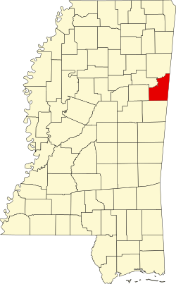
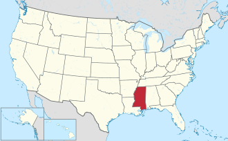
Lowndes County is a county on the eastern border of the U.S. state of Mississippi. As of the 2020 United States Census, the population was 58,879. [1] Its county seat is Columbus. [2] The county is named for U.S. Congressman William Jones Lowndes. [3]
Lowndes County comprises the Columbus, MS Micropolitan Statistical Area. [4] Since the late 20th century, it has been designated as one of three counties in the Golden Triangle region of the state.
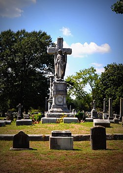
This upland area was settled by European Americans who wanted to develop cotton plantations to produce what became the largest commodity crop in the state.
In the period from 1877 to 1950, Lowndes County had 19 documented lynchings of African Americans, third to Carroll and Leflore counties, which had 29 and 48, respectively. This form of racial terrorism was at its height in the decades around the turn of the 20th century, which followed the state's disenfranchisement of most blacks in 1890 through creating barriers to voter registration. [5]
Lowndes County lies on the east side of Mississippi, bordering the U.S. state of Alabama. Its terrain was completely wooded before settlement; at present its more level areas have been cleared and turned to agricultural or urban use, with the drainages (about 40% of the total area) still wooded. [6] The Tennessee−Tombigbee Waterway flows south-southeastward through the center of the county, with a significant lock system (John C. Stennis Lock and Dam) near Columbus. The county's highest point (450 feet/140 meters ASL) is a small rise near the county's NE corner. [7]
According to the United States Census Bureau, the county has a total area of 516 square miles (1,340 km2), of which 506 square miles (1,310 km2) is land and 11 square miles (28 km2) (2.1%) is water. [8]
Census | Pop. | Note | %± |
---|---|---|---|
1830 | 3,173 | — | |
1840 | 14,513 | 357.4% | |
1850 | 19,544 | 34.7% | |
1860 | 23,625 | 20.9% | |
1870 | 30,502 | 29.1% | |
1880 | 28,244 | −7.4% | |
1890 | 27,047 | −4.2% | |
1900 | 29,095 | 7.6% | |
1910 | 30,703 | 5.5% | |
1920 | 27,632 | −10.0% | |
1930 | 29,987 | 8.5% | |
1940 | 35,245 | 17.5% | |
1950 | 37,852 | 7.4% | |
1960 | 46,639 | 23.2% | |
1970 | 49,700 | 6.6% | |
1980 | 57,304 | 15.3% | |
1990 | 59,308 | 3.5% | |
2000 | 61,586 | 3.8% | |
2010 | 59,779 | −2.9% | |
2020 | 58,879 | −1.5% | |
2023 (est.) | 57,283 | [9] | −2.7% |
US Decennial Census [10] 1790-1960 [11] 1900-1990 [12] 1990-2000 [13] 2010-2013 [14] |
Race | Num. | Perc. |
---|---|---|
White | 29,363 | 49.87% |
Black or African American | 25,885 | 43.96% |
Native American | 110 | 0.19% |
Asian | 514 | 0.87% |
Pacific Islander | 16 | 0.03% |
Other/Mixed | 1,668 | 2.83% |
Hispanic or Latino | 1,323 | 2.25% |
As of the 2020 United States Census, there were 58,879 people, 22,436 households, and 14,654 families residing in the county.
As of the 2010 United States Census, there were 59,779 people in the county. 54.0% were White, 43.5% Black or African American, 0.7% Asian, 0.2% Native American, 0.1% Pacific Islander, 0.6% of some other race and 1.1% of two or more races. 1.5% were Hispanic or Latino (of any race).
As of the 2000 United States Census, [16] there were 61,586 people, 22,849 households, and 16,405 families in the county. The population density was 123 people per square mile (47 people/km2). There were 25,104 housing units at an average density of 50 units per square mile (19 units/km2). The racial makeup of the county was 56.47% White, 41.56% Black or African American, 0.17% Native American, 0.54% Asian, 0.03% Pacific Islander, 0.39% from other races, and 0.85% from two or more races. 1.11% of the population were Hispanic or Latino of any race.
There were 22,849 households, out of which 36.50% had children under the age of 18 living with them, 49.20% were married couples living together, 18.70% had a female householder with no husband present, and 28.20% were non-families. 24.60% of all households were made up of individuals, and 8.90% had someone living alone who was 65 years of age or older. The average household size was 2.61 and the average family size was 3.13.
The county population contained 28.60% under the age of 18, 10.60% from 18 to 24, 29.20% from 25 to 44, 20.40% from 45 to 64, and 11.20% who were 65 years of age or older. The median age was 33 years. For every 100 females there were 89.90 males. For every 100 females age 18 and over, there were 84.20 males.
The median income for a household in the county was $32,123, and the median income for a family was $38,248. Males had a median income of $31,792 versus $20,640 for females. The per capita income for the county was $16,514. About 18.00% of families and 21.30% of the population were below the poverty line, including 31.80% of those under age 18 and 16.80% of those age 65 or over.
Portions of Lowndes County are served by the Columbus Municipal School District, Lowndes County School District, and the Mississippi Association of Independent Schools – Lowndes County Division.
The Columbus Municipal School District includes:
The Lowndes County School District has three areas, each with an elementary school, a middle school, and a high school
The Mississippi Association of Independent Schools – Lowndes County Division has provided five private and parochial schools for Lowndes County
Mississippi University for Women is located in Columbus. Lowndes County is within the service area of the East Mississippi Community College system. [17] The Golden Triangle Campus is located in Mayhew, an unincorporated area in Lowndes County. The system also offers classes at the Columbus Air Force Base Extension in Columbus. [18]
Year | Republican | Democratic | Third party(ies) | |||
---|---|---|---|---|---|---|
No. | % | No. | % | No. | % | |
2024 | 13,087 | 53.58% | 11,096 | 45.43% | 243 | 0.99% |
2020 | 13,800 | 50.66% | 13,087 | 48.04% | 354 | 1.30% |
2016 | 13,271 | 51.65% | 11,819 | 46.00% | 605 | 2.35% |
2012 | 13,518 | 49.78% | 13,388 | 49.30% | 252 | 0.93% |
2008 | 13,994 | 50.95% | 13,209 | 48.09% | 262 | 0.95% |
2004 | 13,690 | 56.41% | 10,408 | 42.88% | 172 | 0.71% |
2000 | 11,404 | 59.30% | 7,537 | 39.19% | 289 | 1.50% |
1996 | 9,169 | 56.40% | 6,220 | 38.26% | 869 | 5.35% |
1992 | 10,509 | 55.80% | 6,552 | 34.79% | 1,774 | 9.42% |
1988 | 11,258 | 64.96% | 5,993 | 34.58% | 80 | 0.46% |
1984 | 12,049 | 66.29% | 6,078 | 33.44% | 50 | 0.28% |
1980 | 9,973 | 60.98% | 6,187 | 37.83% | 195 | 1.19% |
1976 | 8,003 | 54.44% | 6,181 | 42.05% | 516 | 3.51% |
1972 | 10,098 | 78.70% | 2,398 | 18.69% | 335 | 2.61% |
1968 | 1,968 | 17.85% | 2,229 | 20.22% | 6,829 | 61.94% |
1964 | 6,135 | 92.01% | 533 | 7.99% | 0 | 0.00% |
1960 | 2,010 | 42.95% | 1,240 | 26.50% | 1,430 | 30.56% |
1956 | 1,205 | 29.21% | 2,308 | 55.94% | 613 | 14.86% |
1952 | 2,670 | 62.27% | 1,618 | 37.73% | 0 | 0.00% |
1948 | 66 | 2.25% | 116 | 3.95% | 2,755 | 93.80% |
1944 | 360 | 13.98% | 2,216 | 86.02% | 0 | 0.00% |
1940 | 147 | 6.08% | 2,268 | 93.80% | 3 | 0.12% |
1936 | 56 | 2.34% | 2,328 | 97.24% | 10 | 0.42% |
1932 | 50 | 2.12% | 2,305 | 97.50% | 9 | 0.38% |
1928 | 185 | 7.97% | 2,136 | 92.03% | 0 | 0.00% |
1924 | 62 | 3.61% | 1,655 | 96.39% | 0 | 0.00% |
1920 | 51 | 5.16% | 928 | 93.93% | 9 | 0.91% |
1916 | 29 | 2.72% | 1,028 | 96.53% | 8 | 0.75% |
1912 | 12 | 1.32% | 872 | 95.82% | 26 | 2.86% |
Clay County is a county in the U.S. state of Mississippi. As of the 2020 census, the population was 18,636. Its county seat is West Point. Its name is in honor of American statesman Henry Clay, member of the United States Senate from Kentucky and United States Secretary of State in the 19th century. J. Wesley Caradine, an African American, was the first state representative for Clay County after it was established in 1871. The federal government formerly designated Clay County as the West Point Micropolitan Statistical Area, but the county lost that status in 2013. It is part of the Golden Triangle region of the state.
Marion County is a county of the U.S. state of Alabama. As of the 2020 census the population was 29,341. The county seat is Hamilton. The county was created by an act of the Alabama Territorial General Assembly on February 13, 1818. The county seat was originally established in Pikeville in 1820, and moved to Hamilton in 1881. The county was named by planter and US Indian agent John Dabney Terrell, Sr., in recognition of General Francis Marion of South Carolina.
Walthall County is a county located in the U.S. state of Mississippi. As of the 2020 census, the population was 13,884. Its county seat is Tylertown. The county is named after Civil War Confederate general and Mississippi Senator Edward C. Walthall.
Union County is a county located in the U.S. state of Mississippi. It was formed in 1870 from Tippah and Pontotoc counties, and in 1874 a portion of Lee County was added. As of the 2020 census, the population was 27,777. Its county seat is New Albany. According to most sources, the county received its name by being a union of pieces of several large counties, like other Union counties in other states. However, other sources say that the name was meant to mark the re-union of Mississippi and the other Confederate states after the Civil War.
Tippah County is a county located on the northern border of the U.S. state of Mississippi. As of the 2020 census, the population was 21,815. Its county seat is Ripley. The name "Tippah" is derived from a Chickasaw language word meaning "cut off." It was taken from the creek of the same name that flows across much of the original county from northeast to southwest before emptying into the Tallahatchie River. The creek probably was so named because it, and the ridges on either side, "cut off" the western part of the region from the eastern portion.
Prentiss County is a county located in the U.S. state of Mississippi. As of the 2020 census, the population was 25,008. Its county seat is Booneville. The county is named for Seargent Smith Prentiss, a noted speaker and US Congressman from Natchez.
Noxubee County is a county located in the U.S. state of Mississippi. As of the 2020 census, its population was 10,285. Its county seat is Macon. The name is derived from the Choctaw word nakshobi meaning "to stink".
Chickasaw is a city in Mobile County, Alabama, United States. As of the 2020 census the population was 6,457, up from 6,106 at the 2010 census. It is part of the Mobile metropolitan area.
French Camp is a town in Choctaw County, Mississippi, United States. The population was 174 at the 2010 census, down from 393 in 2000.
Big Point is an unincorporated community and census-designated place (CDP) in Jackson County, Mississippi, United States. It is part of the Pascagoula, Mississippi Metropolitan Statistical Area. Per the 2020 Census, the population was 618.
Escatawpa is an unincorporated community and census-designated place (CDP) in Jackson County, Mississippi, United States. It is part of the Pascagoula Metropolitan Statistical Area. The population was 3,254 at the 2020 census.
Hurley is an unincorporated community and census-designated place (CDP) in Jackson County, Mississippi, United States. It is part of the Pascagoula Metropolitan Statistical Area. The population was 1,551 at the 2010 census, up from 985 at the 2000 census.
Redwater is a census-designated place (CDP) in Leake County, Mississippi, United States. It is one of the eight communities of the Mississippi Band of Choctaw Indians Reservation, and the population is 61% Choctaw. The population was 633 at the 2010 census, up from 409 at the 2000 census.
Artesia is a town in Lowndes County, Mississippi. The population was 304 at the 2020 census, down from 440 at the 2010 census.
Caledonia is a town in Lowndes County, Mississippi, United States, northeast of Columbus. The population was 1,041 at the 2010 census.
Ripley is a city in Tippah County, Mississippi, United States. The population was 5,395 at the 2010 census. It is the county seat of Tippah County.
Vancleave is an unincorporated community and census-designated place (CDP) in Jackson County, Mississippi, United States. It is part of the Pascagoula Metropolitan Statistical Area. The population was 5,886 at the 2010 census, up from 4,910 at the 2000 census.
West Hattiesburg is an unincorporated area and census-designated place (CDP) in Lamar County, Mississippi, west of the city of Hattiesburg and east of the community of Oak Grove. It is part of the Hattiesburg metropolitan area. It had a decline in population from 6,305 at the 2000 census to 5,909 at the 2010 census.
New Ellenton is a city in Aiken County, South Carolina, United States. The population was 2,210 at the 2020 census. It is part of the Augusta, Georgia metropolitan area.
Bogue Chitto is a census-designated place (CDP) situated in Kemper and Neshoba counties, Mississippi. The population was 864 at the 2020 census. It is part of the Mississippi Band of Choctaw Indians Reservation and the population is 93% Choctaw.