Clyde River (New South Wales)

Last updated

Clyde River
Batemans Bay.jpg
Clyde River flowing under the bridge at Batemans Bay
Etymology River Clyde, Scotland (1821) [1] [2]
Native nameBhundoo (Dhurga) [3]
Location
Country Australia
State New South Wales
Region South East Corner (IBRA), South Coast
Local government areas Shoalhaven, Eurobodalla
City Batemans Bay
Physical characteristics
Source Budawang Mountains, Great Dividing Range
  locationnear Kangaroo Hill, within Budawang National Park
  elevation597 m (1,959 ft)
Mouth Tasman Sea, South Pacific Ocean
  location
Batemans Bay
Length102 km (63 mi)
Basin size1,723 km2 (665 sq mi)
Depth 
  average3 m (9.8 ft)
Basin features
Tributaries 
  leftClaydons Creek, Pigeon House Creek, Boyne Creek, Cockwhy Creek
  right Yadboro River, Crooked Creek (Clyde River)|Crooked Creek, Bimberamala River, Currowan Creek, Buckenbowra River
[4] [5] [1]

The Clyde River (Dhurga: Bhundoo) is an open intermediate tide-dominated drowned valley estuary [5] or perennial river [1] that flows into the Tasman Sea at Batemans Bay, located in the South Coast region of New South Wales, Australia.

Contents

Course and features

The Clyde River rises below Kangaroo Hill in the Budawang Range, part of the Great Dividing Range, within Budawang National Park, south of the locality of Sassafras, and flows generally southwards parallel to the east coast, joined by nine tributaries including the Bimberamala, Yadboro, and Buckenbowra rivers, before turning east and reaching its mouth of the Tasman Sea at Batemans Bay. The river descends 601 metres (1,972 ft) over its 102 kilometres (63 mi) course. [4]

The lower reaches of the Clyde River form a substantial estuary up to 30 kilometres (19 mi) from its mouth [6] which is navigable by small vessels to Nelligen, with a tidal ebb of up to 1.28 metres (4 ft 2 in). The coastal estuary covers a catchment area of 1,723 square kilometres (665 sq mi) and contains approximately 50,737 megalitres (1,791.8×10^6 cu ft) of water over an estimated surface area of 17.5 square kilometres (6.8 sq mi); and at an average depth of 3 metres (9.8 ft). [7]

The river is one of the last major rivers in eastern Australia that has not been dammed. [6] Porters Creek, a tributary of one of the Clyde's tributaries, Pigeon House Creek, is dammed by the Porters Creek Dam, which supplies water to coastal towns. [8] [9]

In its upper reaches, the river forms within the Budawang National Park; while in its lower reaches, the river flows through the Clyde River National Park.

Water quality of the basin is very good. The upper catchment is heavily timbered (state forests and national parks); there is a small amount of logging in the Yadboro State Forest. [10] There are no polluting industries in its catchment, nor any sewage outflows, and thus the river has a reputation for the cleanest, least polluted waters of any major river in eastern Australia. [6]

History and naming

A decorative sign on the northern foreshore at the completion of the Batemans Bay Bridge replacement project telling an Indigenous story of the Bhundoo (Clyde River). Batemans Bay Bridge Post Construction Northern Foreshore July 2022.jpg
A decorative sign on the northern foreshore at the completion of the Batemans Bay Bridge replacement project telling an Indigenous story of the Bhundoo (Clyde River).

The region was first occupied by the Walbunja people from the Yuin nation. Their name for the river, Bhundoo, means "Deep Water". [6] [11]

The river was given the name Clyde River after the River Clyde in Glasgow, Scotland, by Lieutenant Robert Johnston, who navigated the river aboard the cutter Snapper on 1 December 1821. [2] [12]

Crossings

The river crossings, from its headwaters to its river mouth, include:

See also

Related Research Articles

<span class="mw-page-title-main">Georges River</span> River in Sydney, New South Wales, Australia

The Georges River, also known as Tucoerah River, is an intermediate tide-dominated drowned valley estuary, that is located in Sydney in the state of New South Wales, Australia. The Georges River is located south and south-west from the Sydney CBD, with the mouth of the river being at Botany Bay.

<span class="mw-page-title-main">Parramatta River</span> River in Australia

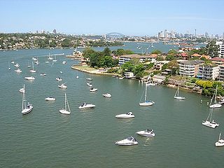
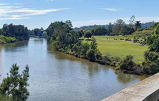
The Parramatta River is an intermediate tide-dominated, drowned valley estuary located in Sydney, New South Wales, Australia. With an average depth of 5.1 metres (17 ft), the Parramatta River is the main tributary of Sydney Harbour, a branch of Port Jackson. Secondary tributaries include the smaller Lane Cove and Duck rivers.

<span class="mw-page-title-main">Hawkesbury River</span> River in New South Wales, Australia

The Hawkesbury River, or Hawkesbury-Nepean River, is a river located northwest of Sydney, New South Wales, Australia. The Hawkesbury River and its associated main tributary, the Nepean River, almost encircle the metropolitan region of Sydney. Between Wisemans Ferry and the Pacific Ocean marks the boundary of Greater Metropolitan Sydney in the south and the Central Coast region to the north.

<span class="mw-page-title-main">Middle Harbour</span> Northern arm of Port Jackson in Sydney

Middle Harbour, a semi–mature tide dominated drowned valley estuary, is the northern arm of Port Jackson, an inlet of the Tasman Sea located north of Sydney central business district on the coast of New South Wales, Australia.

<span class="mw-page-title-main">Shoalhaven River</span> River in Australia

The Shoalhaven River is a perennial river that rises from the Southern Tablelands and flows into an open mature wave dominated barrier estuary near Nowra on the South Coast of New South Wales, Australia.

<span class="mw-page-title-main">Kings Highway (Australia)</span> Highway in the Australian Capital Territory and New South Wales

Kings Highway is an interstate highway located within the Australian Capital Territory and New South Wales, Australia. The highway connects Canberra with Batemans Bay on the South Coast. It is designated route B52.

<span class="mw-page-title-main">Budawang Range</span>

The Budawang Range, commonly called The Budawangs, a rugged mountain range within the Budawang National Park and the Morton National Park, are part of a spur off the Great Dividing Range and are located in the South Coast region of New South Wales, Australia.

<span class="mw-page-title-main">Berowra Creek</span> River in New South Wales, Australia

The Berowra Creek, a watercourse that is part of the Hawkesbury-Nepean catchment, is located to the north of the Sydney central business district in the Hornsby Shire of New South Wales, Australia.

<span class="mw-page-title-main">Nelligen, New South Wales</span> Town in New South Wales, Australia

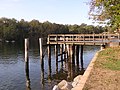
Nelligen is a village on the Clyde River on the South Coast of New South Wales, Australia. It is located on the Kings Highway.

<span class="mw-page-title-main">Clyde Mountain</span>

Clyde Mountain, at an elevation of 874 metres (2,867 ft) AHD , is a mountain in the Southern Tablelands region of New South Wales, Australia.

<span class="mw-page-title-main">Haslams Creek</span> River in Australia

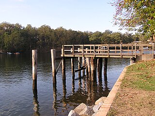
Haslams Creek, a southern tributary of the Parramatta River, is a creek west of Sydney Harbour, located in Sydney, Australia. It flows through Sydney Olympic Park and joins Parramatta River at Homebush Bay. In 1793, the first grants were made to free settlers, with Samuel Haslam receiving his first grant in 1806. A 50 acre grant north of Parramatta Road, the first grant, was followed by a second small grant south of Parramatta Road and east of Haslams Creek. Haslams Creek flowed through the holdings of the Sydney Meat Preserving Company Ltd 1876-1965, which at one point damned the creek. When opened, Lidcombe railway station actually bore the name Haslams Creek Station

Bimberamala River, a perennial river of the Clyde River catchment, is located in the Southern Tablelands and the upper ranges of the South Coast regions of New South Wales, Australia.

Buckenbowra River, a perennial river of the Clyde River catchment, is located in the upper ranges of the South Coast region of New South Wales, Australia.

The Towamba River is an open mature wave dominated barrier estuary or perennial river, located in the South Coast region of New South Wales, Australia.

<span class="mw-page-title-main">Tuross River</span> River in New South Wales, Australia

The Tuross River, an open semi-mature wave dominated barrier estuary or perennial stream, is located in the South Coast region of New South Wales, Australia.

The Wonboyn River, an open youthful wave dominated barrier estuary or perennial stream, is located in the South Coast region of New South Wales, Australia.

<span class="mw-page-title-main">Yadboro River</span> River in New South Wales, Australia

Yadboro River, a perennial river of the Clyde River catchment, is located in the Southern Tablelands and the upper ranges of the South Coast regions of New South Wales, Australia.

<span class="mw-page-title-main">St Georges Basin (New South Wales)</span> Lake in the state of New South Wales, Australia

St Georges Basin is an open intermediate estuary, or inland sea, located in the South Coast region of New South Wales, adjacent to the Jervis Bay Territory.

<span class="mw-page-title-main">Batemans Bay (bay)</span> Bay in South Coast, New South Wales

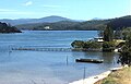
Batemans Bay is an open oceanic embayment that is located in the South Coast region of New South Wales, Australia. The bay forms the mouth of the Clyde River and its primary outflow is to the Tasman Sea of the South Pacific Ocean.

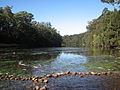
The Corn Trail was an early bridle track linking the Southern Tablelands to the coastal valley of the Buckenbowra River, in New South Wales, Australia. It was restored and reopened as a walking track in 1988.

References

  1. 1 2 3 "Clyde River". Geographical Names Register (GNR) of NSW. Geographical Names Board of New South Wales . Retrieved 25 May 2013. OOjs UI icon edit-ltr-progressive.svg
  2. 1 2 "Report from Robert Johnston to Governor Macquarie on the discovery and naming of the River Clyde". The Sydney Gazette and New South Wales Advertiser. 15 December 1821 via National Library of Australia.
  3. "Yangary and Bhundoo" (PDF). NSW Government. Archived from the original on 23 July 2022. Retrieved 23 July 2022.{{cite web}}: CS1 maint: bot: original URL status unknown (link)
  4. 1 2 "Map of Clyde River, NSW". Bonzle Digital Atlas of Australia. Retrieved 25 May 2013.
  5. 1 2 Roy, P. S.; Williams, R. J.; Jones, A. R.; Yassini, I.; et al. (2001). "Structure and Function of South-east Australian Estuaries". Estuarine, Coastal and Shelf Science . 53 (3): 351–384. doi:10.1006/ecss.2001.0796.
  6. 1 2 3 4 "Bhundoo (The Clyde River)". Welcome to the Clyde Coast. clydecoast.com.au. Retrieved 14 January 2008.
  7. "Clyde River: Physical characteristics". Coastal and floodplain management: Coastal zone management: Estuaries of NSW. NSW Environment & Heritage. 26 April 2012. Retrieved 25 May 2013.
  8. "Our Water Supply". shoalwater.nsw.gov.au. Retrieved 27 January 2021.
  9. "Porters Creek Dam". Google Maps. Retrieved 27 January 2021.
  10. "Surface water quality in Clyde River". Water resources – Quality – New South Wales:- Basin: Clyde River – Jervis Bay. Australian Natural Resources Atlas: Australian Department of the Environment and Water Resources. 16 November 2007. Archived from the original on 30 July 2008. Retrieved 14 January 2008.
  11. "Sites and storylines". Beach campground. National Parks & Wildlife Service. Archived from the original on 10 November 2019. Retrieved 11 March 2021.
  12. Moore, Dennis (2002). "The Inlet That Eluded Bass, Batemans Bay – South Coast NSW". Morningside Internet. Archived from the original on 10 April 2013. Retrieved 14 June 2006.
  13. NSW Government (November 2018). "Nelligen Bridge Replacement" (PDF).
  14. "Batemans Bay Bridge replacement project" . Retrieved 29 July 2021.

35°25′S150°14′E / 35.417°S 150.233°E / -35.417; 150.233