Sandton is a financial, commercial and residential area, located in the northern part of the City of Johannesburg Metropolitan Municipality. Formerly an independent municipality, Sandton's name came from the combination of two of its suburbs, Sandown and Bryanston.

Burwood is an inner eastern suburb of Melbourne, Victoria, Australia, 14 kilometres east of Melbourne's Central Business District, located within the Cities of Monash and Whitehorse local government areas. Burwood recorded a population of 15,147 at the 2021 census.

Midrand is a town in central Gauteng, South Africa. It is situated in-between Centurion and Sandton. Formerly an independent municipality, Midrand now forms part of the City of Johannesburg Metropolitan Municipality.

Thomastown is a suburb of Melbourne, Victoria, Australia, 16 km driving distance approximately 30 minutes north of Melbourne's central business district, located within the City of Whittlesea local government area. Thomastown recorded a population of 14,234 at the 2021 census.

Oakleigh is a suburb in Melbourne, Victoria, Australia 14 km south-east of Melbourne's Central Business District, located within the City of Monash local government area. Oakleigh recorded a population of 8,442 at the 2021 census.

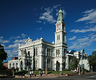
Leichhardt is a suburb in the Inner West of Sydney, in the state of New South Wales, Australia. Leichhardt is located 5 kilometres west of the Sydney central business district (CBD) and is the administrative centre for the local government area (LGA) of the Inner West Council. The suburb is bordered by Haberfield to the west, Annandale to the east, Lilyfield to the north and Petersham, Lewisham and Stanmore to the south.

Randburg is an area located in the Gauteng province of South Africa. Formerly a separate municipality, its administration devolved to the newly created City of Johannesburg Metropolitan Municipality, along with neighbouring Sandton and Roodepoort, in the late 1990s. During the transitional period of 1996–2000, Randburg was part of the Northern Metropolitan Local Council (MLC).
The area referred to as Fourways is the fastest-developing commercial and residential hub in Sandton, north of Johannesburg, South Africa. The main access routes to Fourways are off the N1 at R511 Winnie Mandela Drive, or alternatively along R564 Witkoppen Road. It is located mostly in Region E of the City of Johannesburg Metropolitan Municipality. It is roughly as far as one can go in the Johannesburg Metropolitan area before it dissolves into rolling hills, game farms and the capital Pretoria, 55 kilometres to the northeast. Hartebeespoort Dam and the Magaliesberg Mountains lie half an hour to the north-west. It is bordered by Bryanston to the east and south and Randburg to the west.

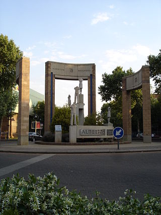
Alberton is a town situated on the southern part of the East Rand of the Gauteng Province in South Africa and is situated very close to the major urban centre of Johannesburg.

The suburbs of Johannesburg are officially demarcated areas within the City of Johannesburg Metropolitan Municipality, South Africa. As in other Commonwealth countries, the term suburb refers to a "neighbourhood", although in South Africa most "suburbs" have legally recognised borders and often separate postal codes. The municipal functions for the area, such as municipal policing and social services, are still managed by the city government.

Bedfordview is an affluent suburb in western Ekurhuleni, sharing an administrative boundary with the City of Johannesburg Metropolitan Municipality, Gauteng, South Africa. Bedfordview has been part of the City of Ekurhuleni Metropolitan Municipality since 2000. The Eastgate Shopping Centre, one of the biggest in Africa when first built, is also located here.
Glenvista is a suburb in the south of Johannesburg, South Africa. It is located in Region F of the City of Johannesburg Metropolitan Municipality. It has a large Portuguese community and a distinctly cosmopolitan character. Alberton is located 5 kilometres to the East of Glenvista.
Liefde en Vrede is a suburb of Johannesburg, South Africa. It is located in Region F of the City of Johannesburg Metropolitan Municipality.
Ferndale is a suburb of Randburg, South Africa. It is located in Region B of the City of Johannesburg Metropolitan Municipality. The area is very central and has a good mix of residential homes, shops and commercial property.
Kensington is a hilly suburb of Johannesburg, South Africa. It was established in 1897 by Max Langermann. It is located in Region F of the City of Johannesburg Metropolitan Municipality and is bounded to the west by the suburb of Troyeville, to the east by Bedfordview and the north by Bruma and Cyrildene.

Clarkson is an outer northern suburb of Perth, Western Australia, located 34 kilometres north of Perth's central business district in the City of Wanneroo.
Landsdale is a northern suburb of Perth, Western Australia located within the local government area of the City of Wanneroo. It is mixed use, with residential, commercial and light manufacturing areas.
Randpark Ridge is an upmarket suburb of Randburg, South Africa. It is located in Region C of the City of Johannesburg. It fell into the town of Randburg during the apartheid era. Developed in the early 1980s and still relatively new, Randpark Ridge is bordered by several other suburbs including Weltevreden Park, Sundowner, Boskruin, Bromhof, Honeydew and Fairland.
Bassonia is a southern suburb of Johannesburg, South Africa.
The M68 is a short metropolitan route in the City of Johannesburg, South Africa. It connects the south-western part of Soweto with Mulbarton via Diepkloof, Southgate and Glenvista.


