2020 census
As of the 2020 census, Coldspring had a population of 819. The median age was 39.0 years, 22.6% of residents were under the age of 18, and 20.0% of residents were 65 years of age or older. For every 100 females there were 64.8 males, and for every 100 females age 18 and over there were 55.4 males age 18 and over. [9]
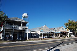
According to the 2020 census data, 0% of residents lived in urban areas while 100.0% lived in rural areas. [10]
There were 291 households in Coldspring, of which 34.0% had children under the age of 18 living in them. Of all households, 39.5% were married-couple households, 17.5% were households with a male householder and no spouse or partner present, and 39.2% were households with a female householder and no spouse or partner present. About 29.5% of all households were made up of individuals and 15.4% had someone living alone who was 65 years of age or older. [9]
There were 339 housing units, of which 14.2% were vacant. Among occupied housing units, 62.2% were owner-occupied and 37.8% were renter-occupied. The homeowner vacancy rate was 6.0% and the rental vacancy rate was 6.8%. [9]
2000 census
As of the 2000 census [2] , 691 people, 263 households, and 180 families were living in the city. The population density was 375 inhabitants per square mile (145/km2). The 313 housing units averaged 170 per square mile (65.7/km2). The racial makeup of the city was 66.28% White, 31.40% African American, 0.43% Native American, 0.58% Asian, and 1.30% from two or more races. Hispanics or Latinos of any race were 3.18% of the population.
Of the 263 households, 34.6% had children under the age of 18 living with them, 44.1% were married couples living together, 20.5% had a female householder with no husband present, and 31.2% were not families. About 28.1% of all households were made up of individuals, and 12.5% had someone living alone who was 65 years of age or older. The average household size was 2.44, and the average family size was 2.91.
In the city, the population was distributed as 27.8% under the age of 18, 10.6% from 18 to 24, 26.8% from 25 to 44, 20.1% from 45 to 64, and 14.8% who were 65 years of age or older. The median age was 34 years. For every 100 females, there were 95.8 males. For every 100 females age 18 and over, there were 86.9 males.
The median income for a household in the city was $27,083, and the median income for a family was $30,729. Males had a median income of $31,667 versus $23,750 for females. The per capita income for the city was $16,777. About 19.7% of families and 19.6% of the population were below the poverty line, including 18.9% of those under age 18 and 13.6% of those age 65 or over.