Erie County is a county along the shore of Lake Erie in western New York State. As of the 2020 census, the population was 954,236.[1] However, in 2023 the estimated population was 946,147.[2] The county seat is Buffalo, which makes up about 28% of the county's population.[3] Both the county and Lake Erie were named for the regional Iroquoian language-speaking Erie tribe of Native Americans, who lived in the area before 1654. They were later pushed out by the more powerful Iroquoian nations tribes. The county is part of the Western New York region of the state.
When counties were established by the English colonial authorities in the Province of New York in 1683, present-day Erie County was inhabited by the Iroquois. Significant colonization by White Americans did not begin until after the United States had gained independence with the end of the American Revolutionary War in 1783.[5][pagesneeded] The U.S. forced the Iroquois to cede most of their lands, as many had been allies of the British during the conflict.
About 1800, the Holland Land Company, formed by American businessmen and their Dutch associates, extinguished aboriginal claims by purchasing the land from New York, acquired the title to the territory of what are today the eight westernmost counties of New York, surveyed their holdings, established towns and began selling lots to individuals. The state was eager to attract settlers and have homesteads and businesses developed. At this time, all of western New York was included in Ontario County.
As the population increased, the state legislature created Genesee County in 1802 out of part of Ontario County. In 1808, Niagara County was created out of Genesee County. In 1821, Erie County was created out of Niagara County, encompassing all the land between Tonawanda Creek and Cattaraugus Creek.[6] The first towns formed in present-day Erie County were the Town of Clarence and the Town of Willink. Clarence and Willink comprised the northern and southern portions of Erie county, respectively. Clarence is still a distinct town, but Willink was quickly subdivided into other towns. When Erie County was established in 1821, it consisted of the towns of Amherst, Aurora, Boston, Clarence, Collins, Concord, Eden, Evans, Hamburg, Holland, Sardinia and Wales.
In 1861, the hamlet of Town Line in the Town of Lancaster voted 85–40 to secede from the Union.[8] Town Line never sought admission into the Confederate States of America and there is no evidence that men from the community ever fought for the Confederacy. Some reporting from that time indicates the vote was a joke. On January 24, 1946, as part of a nationally reported event, Town Line voted to officially return to the Union after 85 years of Union secession.[9]
Geography
According to the U.S. Census Bureau, the county has a total area of 1,227 square miles (3,180km2), of which 1,043 square miles (2,700km2) (85%) is land and 184 square miles (480km2) (15%) is water.[10]
Erie County is in the western portion of upstate New York, bordering on the lake of the same name. Part of the industrial area that has included Buffalo, it is the most populous county in upstate New York outside of the New York City metropolitan area. The county also lies on the international border between the United States and Canada, bordering the Province of Ontario.
The northern border of the county is Tonawanda Creek. Part of the southern border is Cattaraugus Creek. Other major streams include Buffalo Creek (Buffalo River), Cayuga Creek, Cazenovia Creek, Scajaquada Creek, Eighteen Mile Creek and Ellicott Creek. The county's northern half, including Buffalo and its suburbs, is known as the Northtowns and is relatively flat and rises gently up from the lake. The southern half, known as the Southtowns,[4] is much hillier. It has the northwesternmost foothills of the Appalachian Mountains. The highest elevation in the county is a hill in the Town of Sardinia that tops out at around 1,940 feet (590m) above sea level. The lowest ground is about 560 feet (170m), on Grand Island at the Niagara River. The Onondaga Escarpment runs through the northern part of Erie County.
U.S. Decennial Census[12] 1790-1960[13] 1900-1990[14] 1990-2000[15] 2010-2014[1]
As of the 2023,[16] there were 954,236 people living in the county. The population density was 915 inhabitants per square mile (353/km2). There were 438,747 housing units at an average density of 421 per square mile (163/km2). The racial makeup of the county was 77.8 White, 13.9% Black or African American, 0.8% Native American, 5.0% Asian, 0.01% Pacific Islander, 2.4% from other races and 5.4% from two or more races. 6.4% of the population were Hispanic or Latino of any race. 19.6% were of German, 17.2% Polish, 14.9% Italian, 11.7% Irish and 5.0% English ancestry according to Census 2000. 91.1% spoke English, 3% Spanish and 1.6% Polish as their first language.
Erie County population
There were 380,873 households, out of which 29.6% had children under the age of 18 living with them, 46.5% were married couples living together, 13.7% had a female householder with no husband present and 36.1% were non-families. 30.5% of all households were made up of individuals, and 12.5% had someone living alone who was 65 years of age or older. The average household size was 2.41 and the average family size was 3.04. In the county, the population was spread out, with 24.3% under 18, 8.7% from 18 to 24, 28.4% from 25 to 44, 22.7% from 45 to 64, and 15.9% older than 65. The median age was 38 years. For every 100 females, there were 91.6 males. For every 100 females age 18 and over, there were 87.8 males.
The median income for a household in the county was $38,567 and the median income for a family was $49,490. Males had a median income of $38,703 versus $26,510 for females. The per capita income for the county was $20,357. About 9.2% of families and 12.2% of the population were below the poverty line, including 17.3% of those under 18 and 7.8% of those older than 65.
2020 census
Erie County, New York – Racial and ethnic composition Note: the US Census treats Hispanic/Latino as an ethnic category. This table excludes Latinos from the racial categories and assigns them to a separate category. Hispanics/Latinos may be of any race.
Prior to 1936, Erie County predominantly backed Republican Party candidates, with only four Democratic Party candidates winning the county in a presidential election - James Buchanan in 1856, George B. McClellan in 1864, Grover Cleveland in 1892 and Woodrow Wilson in 1912. However, starting with the 1936 election, it has turned predominantly Democratic since then, with only two Republicans carrying the county in a presidential election-- Dwight D. Eisenhower in 1952 and 1956 and Richard Nixon in 1972, with Nixon being the most recent. In 2016, like many other counties in the Rust Belt, Donald Trump expanded the Republican vote share thanks to his appeal to working-class whites and Ethnic-Catholic voters, keeping the margin in single digits for the first time since 1984. Four years later, in 2020, Joe Biden won 267,270 votes in Erie County, more than Barack Obama in 2008. Biden's margin of victory, however, was smaller than Obama's 2008 victory within the county and Trump's margin, though declining, was still higher than any Republican since 1988 (aside from his 2016 margin).
United States presidential election results for Erie County, New York[27]
Erie County Department of Parks, Recreation and Forestry
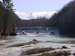
The Erie County Department of Parks, Recreation and Forestry was established in 1925 with four parks spanning 2,280 acres (9.2km2). As of 2003, the county managed 38 properties, totaling approximately 11,000 acres (45km2) of land. Management objectives include providing and maintaining recreational space and the conservation of the county's natural and historic resources.[43] A 2003 Master Plan identified several broad categories of parks operated by the county, including heritage parks, waterfront parks, conservation parks, special purpose parks and forest management areas.[43]
Erie County's heritage parks include the five original county parks that were established during the 1920s and 1930s. These parks are examples of multiple-use sites with significant scenic, natural and historic features. Each park has unique man-made structures of historical character, many constructed as part of the Works Progress Administration movement in the 1930s.[44]
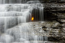
Akron Falls Park (established in 1933, acquired by Erie County in 1947)
These largely-undeveloped parks are managed primarily for conservation of the natural environment and passive nature-based outdoor recreation activities. These lands are intended to generally remain in a natural state.[44]
Forest management areas are managed by the Erie County Bureau of Forestry, which was established in 1927. These areas include several thousand acres of mostly-coniferous plantation style forest, much of which was planted on abandoned farmland by the Civilian Conservation Corps in the 1930s. These areas are located mostly in the rural southern portion of the county.[45] These lands have limited recreation potential, mostly in the form of trails. Management of these lands is focused on natural resource conservation, in addition to potential commercial resource extraction of timber products or maple syrup.[44][45]
↑"Find a County". National Association of Counties. Archived from the original on May 31, 2011. Retrieved June 7, 2011.
12Smyczynski, Christine A. (2005). "Southern Erie County - "The Southtowns"". Western New York: From Niagara Falls and Southern Ontario to the Western Edge of the Finger Lakes. The Countryman Press. p.136. ISBN0-88150-655-9.
12Erie County (N.Y.) Department of Parks, Recreation, & Forestry; Erie County (N.Y.) Department of Environment & Planning; Parsons; Envision: The Hough Group; Paradigm Consulting; Wendel-Duchscherer Architects & Engineers (2003). Erie County Parks System Master Plan - Executive Summary(PDF). Erie County. pp.1–16. Archived(PDF) from the original on April 2, 2015. Retrieved March 7, 2015.{{cite book}}: CS1 maint: multiple names: authors list (link)
12345Erie County (N.Y.) Department of Parks, Recreation, & Forestry; Erie County (N.Y.) Department of Environment & Planning; Parsons; Envision: The Hough Group; Paradigm Consulting; Wendel-Duchscherer Architects & Engineers (2003). Erie County Parks System Master Plan, Volume 1, Section 3 - Overall System Framework(PDF). Erie County. pp.1–13. Archived(PDF) from the original on May 4, 2015. Retrieved March 6, 2015.{{cite book}}: CS1 maint: multiple names: authors list (link)
12"Bureau of Forestry". Erie County Department of Parks, Recreation and Forestry (Erie.gov). Archived from the original on February 21, 2015. Retrieved March 7, 2015.
This page is based on this Wikipedia article Text is available under the CC BY-SA 4.0 license; additional terms may apply. Images, videos and audio are available under their respective licenses.