Bristol County is a county in the Commonwealth of Massachusetts, United States. As of the 2020 census, the population was 579,200.[1] The shire town is Taunton.[2] Some governmental functions are performed by the Commonwealth of Massachusetts, others by the county, and others by local towns and cities. The county is the sixth most populous county in Massachusetts. Bristol County is part of the Providence metropolitan area, which is also included in Greater Boston. The county is adjacent to the state of Rhode Island. It is geographically adjacent to the Massachusetts counties of Plymouth, Norfolk, and Dukes (via water), and the Rhode Island counties of Bristol, Newport, and Providence.
After the departure of Bristol, Taunton was made the shire town of the county. A second county courthouse was constructed in 1828 in the growing town of New Bedford (designed a "half-shire town"). In 1862, a part of Seekonk (that portion of which is now East Providence, Rhode Island) and the entirety of East Pawtucket were transferred to Providence County, Rhode Island. At the same time, land ceded from Rhode Island was added to Fall River and Westport. The growing Fall River became the site of the third county courthouse in 1877.[4]
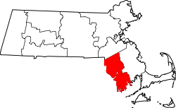
Geography
According to the U.S. Census Bureau, the county has a total area of 691 square miles (1,790km2), of which 553 square miles (1,430km2) is land and 138 square miles (360km2) (20%) is water.[5] The highest point in Bristol County is Sunrise Hill (Watery Hill) at 390 feet (120m) above sea level located in World War I Memorial Park in North Attleborough. It is also to note that Bristol, Plymouth and Taunton are all places in South West England. Their Massachusetts cousins were named after the originals as South West England was the focal point for sailing and discovery at the time of America's discovery. John Cabot set sail from Bristol and sailed down the Severn on which lies Newport in Wales.
U.S. Decennial Census[7] 1790–1960[8] 1900–1990[9] 1990–2000[10] 2010–2020[11]
2020 census
As of the 2020 census, the county had a population of 579,200. Of the residents, 20.3% were under the age of 18 and 17.8% were 65 years of age or older; the median age was 41.5 years. For every 100 females there were 94.1 males, and for every 100 females age 18 and over there were 91.8 males. 89.6% of residents lived in urban areas and 10.4% lived in rural areas.[12][13][14]
There were 229,293 households in the county, of which 29.0% had children under the age of 18 living with them and 28.9% had a female householder with no spouse or partner present. About 28.6% of all households were made up of individuals and 12.2% had someone living alone who was 65 years of age or older.[13]
There were 243,464 housing units, of which 5.8% were vacant. Among occupied housing units, 61.0% were owner-occupied and 39.0% were renter-occupied. The homeowner vacancy rate was 0.9% and the rental vacancy rate was 4.5%.[13]
Bristol County, Massachusetts – Racial and ethnic composition Note: the US Census treats Hispanic/Latino as an ethnic category. This table excludes Latinos from the racial categories and assigns them to a separate category. Hispanics/Latinos may be of any race.
At the 2010 census, there were 548,285people, 213,010households, and 141,338families in the county.[18] The population density was 991.3 inhabitants per square mile (382.7/km2). There were 230,535 housing units at an average density of 416.8 per square mile (160.9/km2).[19] The racial makeup of the county was 88.4% white, 3.3% black, 1.9% Asian, 0.4% American Indian, 3.4% from other races, and 2.6% from two or more races. Those of Hispanic or Latino origin made up 6.0% of the population.[18] The largest ancestry groups were:[20]
30.1% Portuguese
19.2% Irish
13.1% French
12.5% English
9.3% Italian
5.7% French Canadian
5.0% German
4.5% Polish
3.4% Puerto Rican
3.3% Sub-Saharan African
2.5% American
2.0% Scottish
1.4% Swedish
1.3% Scotch-Irish
1.0% Arab
Of the 213,010households, 32.6% had children under the age of 18 living with them, 47.5% were married couples living together, 14.0% had a female householder with no husband present, 33.6% were non-families, and 27.4% of households were made up of individuals. The average household size was 2.50 and the average family size was 3.06. The median age was 39.8 years.[18]
The median household income was $54,955 and the median family income was $70,161. Males had a median income of $51,785 versus $39,714 for females. The per capita income for the county was $27,736. About 8.8% of families and 11.3% of the population were below the poverty line, including 15.7% of those under age 18 and 10.4% of those age 65 or over.[21]
Population density of Bristol County by census block (2020)
2000 census
At the 2000 census there were 534,678 people, 205,411 households, and 140,706 families in the county. The population density was 962 inhabitants per square mile (371/km2). There were 216,918 housing units at an average density of 390 per square mile (150/km2). The racial makeup of the county was 90.98% White, 2.03% Black or African American, 0.24% Native American, 1.26% Asian, 0.03% Pacific Islander, 3.12% from other races, and 2.34% from two or more races. 3.60%[23] was Hispanic or Latino of any race. 29.7% were of Portuguese, 13.0% Irish, 8.9% French, 8.2% English, 6.8% Italian and 6.4% French Canadian ancestry according to Census 2000. 79.1% spoke English, 13.9% Portuguese, 2.9% Spanish and 1.6% French as their first language. The United States Census Bureau reported Bristol County as being one of two counties in the United States with a plurality of people of Portuguese ancestry[24] (the other being the contiguous Bristol County, Rhode Island).
Of the 205,411 households 33.00% had children under the age of 18 living with them, 51.60% were married couples living together, 13.00% had a female householder with no husband present, and 31.50% were non-families. Of all households 26.50% were one person and 11.00% were one person aged 65 or older. The average household size was 2.54 and the average family size was 3.08.
The age distribution was 24.60% under the age of 18, 8.50% from 18 to 24, 30.50% from 25 to 44, 22.20% from 45 to 64, and 14.10% 65 or older. The median age was 37 years. For every 100 females, there were 92.40 males. For every 100 females age 18 and over, there were 88.50 males.
The median household income was $43,496 and the median family income was $53,733. Males had a median income of $39,361 versus $27,516 for females. The per capita income for the county was $20,978. About 7.80% of families and 10.00% of the population were below the poverty line, including 13.00% of those under age 18 and 12.00% of that age 65 or over.
The ranking of unincorporated communities that are included on the list are reflective if the census designated locations and villages were included as cities or towns. Data is from the 2007–2011 American Community Survey 5-Year Estimates.[25][26][27]
Bristol County has voted for the presidential nominee of the Democratic Party in every election since 1960 and, with the exception of Dwight D. Eisenhower's victorious campaigns of 1952 and 1956, for the Democratic nominee since 1928, before which it was a Republican stronghold.
However, in 2024, Republican Donald Trump came the closest to winning the county since 1984 (when Ronald Reagan came within less than 800 votes of winning), with Democrat Kamala Harris winning only 49.6% of the vote. It was also the closest any Massachusetts county came to flipping Republican since 1988, as all counties have been won by the Democratic candidate since 1992.
United States presidential election results for Bristol County, Massachusetts[28]
Bernard McDonald—Register of Deeds, Fall River District
Frederick M. Kalisz—Register of Deeds, Southern District
Marc Santos—Clerk of Courts
The Bristol County Sheriff's Office maintains its administrative headquarters and operates several jail facilities in the Dartmouth Complex in North Dartmouth in Dartmouth. Jail facilities in the Dartmouth Complex include the Bristol County House Of Correction and Jail, the Bristol County Sheriff's Office Women's Center, and the C. Carlos Carreiro Immigration Detention Center. The office also operates the Ash Street Jail and Regional Lock-Up and the Juvenile Secure Alternative Lock Up Program (JALP) in New Bedford.[30]
The Bristol County House Of Correction and Jail has room for 1,100 prisoners. It houses men convicted of crimes who have been sentenced to 2+1⁄2 years or less. It also houses high-security male pre-trial prisoners, high-security female prisoners, and pre-trial female prisoners.[30]
The women's center, a medium security jail, can house up to 106 women. The self-contained women's center had opened as a minimum security pre-release center for male prisoners in 1990 which could house up to 106 prisoners. When it was a pre-release facility it only housed an average of 60 prisoners because the county sheriff imposed strict conditions upon the pre-release program. In 1999 the sheriff received a federal grant to convert the pre-release center into a women's center, and he moved the pre-release program to modular units at the main jail.[30]
The Carreiro jail houses detained individuals who are scheduled for deportation and individuals who are engaging in proceedings with the Immigration and Customs Enforcement (ICE). The Ash Street jail houses over 200 pre-trial prisoners and a few sentenced inmate workers for the system. JALP houses up to 12 pre-arraingment juvenile prisoners.[30]
Voter registration
Voter registration and party enrollment as of February 2024[31]
Transportation authorities providing public bus service include the Greater Attleboro Taunton Regional Transit Authority; and the Southeastern Regional Transit Authority serving the Fall River and New Bedford areas.
The Providence/Stoughton Line of the MBTA commuter rail has stops in Mansfield, Attleboro, and South Attleboro. The line provides connections to Providence and Boston (at Back Bay Station and South Station), as well as intermediate stops. An extension has been completed that connects to T. F. Green Airport.
12History of Bristol County, Massachusetts with Biographical Sketches of many of its Pioneers and Prominent Men, Part 1 edited by Duane Hamilton Hurd. J. W. Lewis and Co., 1883. . p. 1.
1234"Facilities." Bristol County Sheriff's Office. Retrieved on January 30, 2012. "400 Faunce Corner Road, Dartmouth, MA 0274" and "Bristol County House Of Correction and Jail 400 Faunce Corner Road North Dartmouth, MA 02747" and "Bristol County Sheriff's Office Women’s Center 400 Faunce Corner Road North Dartmouth, MA 02747" and "C. Carlos Carreiro Immigration Detention Center: 400 Faunce Corner Road North Dartmouth, MA 02747" and "Juvenile Secure Alternative Lock Up Program 323 Mill Street New Bedford, MA 02740 " and "Ash Street Jail and Regional Lock-Up 226 Ash Street New Bedford, MA 02740 "
History of Bristol County, Massachusetts with Biographical Sketches of many of its Pioneers and Prominent Men, Part 1 edited by Duane Hamilton Hurd. J.W. Lewis and Co., 1883.
This page is based on this Wikipedia article Text is available under the CC BY-SA 4.0 license; additional terms may apply. Images, videos and audio are available under their respective licenses.