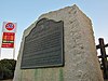
This list includes properties and districts listed on the California Historical Landmark listing in Tulare County, California. Click the "Map of all coordinates" link to the right to view a Google map of all properties and districts with latitude and longitude coordinates in the table below.

California Historical Landmarks (CHLs) are buildings, structures, sites, or places in the U.S. state of California that have been determined to have statewide historical landmark significance.

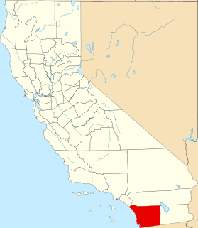
Tulare County is a county in the U.S. state of California. As of the 2010 census, the population was 442,179. Its county seat is Visalia. The county is named for Tulare Lake, once the largest freshwater lake west of the Great Lakes. Drained for agricultural development, the site is now in Kings County, which was created in 1893 from the western portion of the formerly larger Tulare County.
| Image | [1] | Landmark name | Location | City or town | Summary |
|---|---|---|---|---|---|
 | 471 | Butterfield Stage Route | SW corner of Hermosa St. and State Hwy. 65 | Lindsay | |
| 410 | Election Tree | Charter Oak Dr. 36°21′30″N119°10′35″W / 36.358433°N 119.176433°W | Visalia | ||
| 388 | First Tule River Reservation | Alta Vista School, 2293 E. Crabtree Ave. 36°03′30″N118°58′00″W / 36.058283°N 118.966617°W | Porterville | ||
| 648 | Fountain Springs | County Rds. J22 and M 109 35°53′28″N118°54′56″W / 35.891111°N 118.915556°W | Fountain Springs | ||
| 389 | Kaweah Post Office, Kaweah Colony | 43795 N Fork Dr. 36°28′11″N118°55′06″W / 36.469722°N 118.918333°W | Kaweah | ||
| 413 | Tailholt | County Hwy M109 and County Hwy MI2 35°48′40″N118°50′34″W / 35.811111°N 118.842778°W | White River | ||
| 934 | Tulare Assembly Center | Tulare County Fairgrounds | Tulare | ||
| 473 | Tule River Stage Station | Porterville Public Park | Porterville |