
Since the 17th century, 171 subtropical or tropical cyclones have affected the U.S. State of New York. The state of New York is located along the East Coast of the United States, in the Northeastern portion of the country. The strongest of these storms was the 1938 New England hurricane, which struck Long Island as a Category 3 storm on the Saffir–Simpson hurricane scale. Killing more than 60 people, it was also the deadliest. Tropical cyclones have affected the state primarily in September but have also hit during every month of the hurricane season and on rare occasions in the off-season. Tropical cyclones rarely make landfall in the state, although it is common for Post-tropical cyclones to produce heavy rainfall and flash flooding either in the NYC metropolitan area, Long Island, or Upstate New York. Tropical cyclones that are offshore the East Coast of the United States or in the open Atlantic are known to also produce rip currents, gusty winds, beach erosion, and coastal flooding, along the New York coastline. The most recent storm to affect the state was Hurricane Melissa in 2025.
Contents
- Before 1600
- 1600–1799
- 1800–1899
- 1804
- 1815
- 1816
- 1817
- 1821
- 1825
- 1827
- 1830
- 1841
- 1846
- 1849
- 1850
- 1854
- 1858
- 1869
- 1872
- 1874
- 1876
- 1878
- 1888
- 1893
- 1894
- 1900–1949
- 1900
- 1903
- 1904
- 1908
- 1916
- 1933
- 1934
- 1936
- 1938
- 1944
- 1945
- 1949
- 1950–1974
- 1950
- 1952
- 1953
- 1954
- 1955
- 1956
- 1957
- 1959
- 1960
- 1961
- 1962
- 1964
- 1968
- 1969
- 1971
- 1972
- 1973
- 1975–1999
- 1975
- 1976
- 1978
- 1979
- 1981
- 1983
- 1984
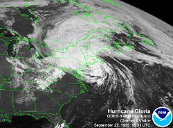
- 1985
- 1987
- 1988
- 1989
- 1990
- 1991
- 1992
- 1993
- 1994
- 1995
- 1996
- 1997
- 1998
- 1999
- 2000–2009
- 2000
- 2001
- 2002
- 2003
- 2004
- 2005
- 2006
- 2007
- 2008
- 2009
- 2010–2019
- 2010
- 2011
- 2012
- 2013
- 2014
- 2015
- 2016
- 2017
- 2018
- 2019
- 2020–present
- 2020
- 2021
- 2022
- 2023
- 2024
- 2025
- Climatological Statistics
- Deadliest Storms
- See also
- References
- External links


