Marshall County, Mississippi

Last updated

Marshall County
Marshall county mississppi courthouse 2007.jpg
The Marshall County courthouse in Holly Springs
Map of Mississippi highlighting Marshall County.svg
Location within the U.S. state of Mississippi
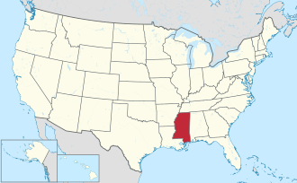
Mississippi in United States.svg
Mississippi's location within the U.S.
Coordinates: 34°46′N89°31′W / 34.77°N 89.51°W / 34.77; -89.51
CountryFlag of the United States.svg United States
StateFlag of Mississippi.svg  Mississippi
Founded1836
Named for John Marshall
Seat Holly Springs
Largest cityHolly Springs
Area
  Total
710 sq mi (1,800 km2)
  Land706 sq mi (1,830 km2)
  Water3.6 sq mi (9 km2)  0.5%
Population
 (2020)
  Total
33,752
  Estimate 
(2023)
34,123 Increase2.svg
  Density48/sq mi (18/km2)
Time zone UTC−6 (Central)
  Summer (DST) UTC−5 (CDT)
Congressional district 1st
Website www.marshall-county.com

Marshall County is a county located on the north central border of the U.S. state of Mississippi. As of the 2020 census, the population was 33,752. [1] Its county seat is Holly Springs. [2] The county is named for Chief Justice of the United States John Marshall, who presided in the early nineteenth century. [3] Marshall County is part of the Memphis, TN-MS-AR Metropolitan Statistical Area.

Contents

Geography

According to the U.S. Census Bureau, the county has a total area of 710 square miles (1,800 km2), of which 706 square miles (1,830 km2) is land and 3.6 square miles (9.3 km2) (0.5%) is water. [4]

Major highways

Adjacent counties

National protected area

Demographics

Historical population
CensusPop.Note
1840 17,526
1850 29,68969.4%
1860 28,823−2.9%
1870 29,4162.1%
1880 29,330−0.3%
1890 26,043−11.2%
1900 27,6746.3%
1910 26,796−3.2%
1920 26,105−2.6%
1930 24,869−4.7%
1940 25,5222.6%
1950 25,106−1.6%
1960 24,503−2.4%
1970 24,027−1.9%
1980 29,29621.9%
1990 30,3613.6%
2000 34,99315.3%
2010 37,1446.1%
2020 33,752−9.1%
2023 (est.)34,123 [5] 1.1%
U.S. Decennial Census [6]
1790-1960 [7] 1900-1990 [8]
1990-2000 [9] 2010-2013 [10]

2020 census

Marshall County, Mississippi – Racial and ethnic composition
Note: the US Census treats Hispanic/Latino as an ethnic category. This table excludes Latinos from the racial categories and assigns them to a separate category. Hispanics/Latinos may be of any race.
Race / Ethnicity (NH = Non-Hispanic)Pop 2000 [11] Pop 2010 [12] Pop 2020 [13] % 2000% 2010% 2020
White alone (NH)16,77418,16116,28447.94%48.89%48.25%
Black or African American alone (NH)17,49617,36914,88050.00%46.76%44.09%
Native American or Alaska Native alone (NH)5467550.15%0.18%0.16%
Asian alone (NH)3874740.11%0.20%0.22%
Pacific Islander alone (NH)56200.01%0.02%0.06%
Some Other Race alone (NH)524670.01%0.06%0.20%
Mixed race or Multiracial (NH)1962518320.56%0.68%2.47%
Hispanic or Latino (any race)4251,1921,5401.21%3.21%4.56%
Total34,99337,14433,752100.00%100.00%100.00%

As of the 2020 United States Census, there were 33,752 people, 12,772 households, and 8,832 families residing in the county.

2010 census

As of the 2010 United States census, there were 37,144 people living in the county. 50.1% were White, 46.9% Black or African American, 0.2% Native American, 0.2% Asian, 1.7% of some other race and 0.8% of two or more races. 3.2% were Hispanic or Latino (of any race).

2000 census

At the 2000 census, [14] there were 34,993 people, 12,163 households and 9,110 families living in the county. The population density was 50 inhabitants per square mile (19/km2). There were 13,252 housing units at an average density of 19 per square mile (7.3/km2). The racial makeup of the county was 50.36% Black or African American, 48.37% White, 0.17% Native American, 0.11% Asian, 0.01% Pacific Islander, 0.37% from other races, and 0.62% from two or more races. 1.21% of the population were Hispanic or Latino of any race.

According to the census [14] of 2000, the largest ancestry groups in Marshall County were African 50.36%, English 31.87%, Scottish 7.1%, Scots-Irish 3.13%, Irish 1.2% and Welsh 1.1%

There were 12,163 households, of which 34.30% had children under the age of 18 living with them, 49.60% were married couples living together, 20.10% had a female householder with no husband present, and 25.10% were non-families. 22.00% of all households were made up of individuals, and 7.90% had someone living alone who was 65 years of age or older. The average household size was 2.74 and the average family size was 3.19.

Age distribution was 26.60% under the age of 18, 11.80% from 18 to 24, 28.60% from 25 to 44, 22.00% from 45 to 64, and 11.10% who were 65 years of age or older. The median age was 34 years. For every 100 females there were 98.00 males. For every 100 females age 18 and over, there were 96.50 males.

The median household income was $28,756, and the median family income was $33,125. Males had a median income of $28,852 versus $21,227 for females. The per capita income for the county was $14,028. About 18.00% of families and 21.90% of the population were below the poverty line, including 28.70% of those under age 18 and 23.10% of those age 65 or over.

Communities

City

Towns

Census-designated places

Unincorporated communities

Politics

Democratic presidential candidates carried the county in every election since 1976, until the 2024 election, when it was won by Republican Donald Trump. The smallest percentage margin was in 2020, when Joe Biden won the county by 3.1% over incumbent Donald Trump.

United States presidential election results for Marshall County, Mississippi [15]
Year Republican Democratic Third party(ies)
No.%No.%No.%
2024 7,97753.24%6,88845.97%1180.79%
2020 7,56647.83%8,05750.94%1941.23%
2016 6,58744.39%8,02354.07%2291.54%
2012 6,47339.86%9,65059.42%1170.72%
2008 6,68340.56%9,68558.78%1100.67%
2004 5,97540.79%8,59158.65%830.57%
2000 4,72337.51%7,73561.43%1341.06%
1996 3,27228.85%7,52166.32%5474.82%
1992 3,84730.75%7,91363.24%7526.01%
1988 4,66839.72%6,98259.42%1010.86%
1984 4,38942.70%5,84556.87%440.43%
1980 3,45531.85%7,15365.94%2402.21%
1976 2,24224.30%6,76973.37%2152.33%
1972 3,32662.10%1,87535.01%1552.89%
1968 5779.19%2,90746.30%2,79444.50%
1964 2,25186.78%34313.22%00.00%
1960 40422.63%68138.15%70039.22%
1956 28716.94%1,19270.37%21512.69%
1952 60424.64%1,84775.36%00.00%
1948 292.08%15210.88%1,21687.04%
1944 634.19%1,44195.81%00.00%
1940 483.31%1,40396.69%00.00%
1936 221.94%1,11197.97%10.09%
1932 382.88%1,28197.05%10.08%
1928 1006.57%1,42293.43%00.00%
1924 403.38%1,14296.62%00.00%
1920 303.50%82396.14%30.35%
1916 80.78%1,01799.12%10.10%
1912 91.08%77993.18%485.74%

See also

Related Research Articles

<span class="mw-page-title-main">Chambers County, Alabama</span> County in Alabama, United States

Chambers County is a county located in the east central portion of the U.S. state of Alabama. As of the 2020 census the population was 34,772. Its county seat is LaFayette. Its largest city is Valley. Its name is in honor of Henry H. Chambers, who served as a United States Senator from Alabama.

<span class="mw-page-title-main">Etowah County, Alabama</span> County in Alabama, United States

Etowah County is a county located in the northeastern part of the U.S. state of Alabama. As of the 2020 census the population was 103,436. Its county seat is Gadsden. Its name is from a Cherokee word meaning "edible tree". In total area, it is the smallest county in Alabama, albeit one of the most densely populated. Etowah County comprises the Gadsden Metropolitan Statistical Area.

<span class="mw-page-title-main">Lawrence County, Alabama</span> County in Alabama, United States

Lawrence County is a county in the northern part of the U.S. state of Alabama. As of the 2020 census, the population was 33,073. The county seat is Moulton. The county was named after James Lawrence, a captain in the United States Navy from New Jersey.

<span class="mw-page-title-main">Marion County, Alabama</span> County in Alabama, United States

Marion County is a county of the U.S. state of Alabama. As of the 2020 census the population was 29,341. The county seat is Hamilton. The county was created by an act of the Alabama Territorial General Assembly on February 13, 1818. The county seat was originally established in Pikeville in 1820, and moved to Hamilton in 1881. The county was named by planter and US Indian agent John Dabney Terrell, Sr., in recognition of General Francis Marion of South Carolina.

<span class="mw-page-title-main">Marshall County, Alabama</span> County in Alabama, United States

Marshall County is a county of the state of Alabama, United States. As of the 2020 census the population was 97,612. Its county seat is Guntersville. A second courthouse is in Albertville. Its name is in honor of John Marshall, famous Chief Justice of the United States. Marshall County is a dry county, with the exception of the five cities of Albertville, Arab, Grant, Guntersville, and Boaz. Marshall County comprises the Albertville, AL Micropolitan Statistical Area, which is also included in the Huntsville-Decatur-Albertville, AL Combined Statistical Area.

<span class="mw-page-title-main">Pike County, Alabama</span> County in Alabama, United States

Pike County is a county located in the U.S. state of Alabama. As of the 2020 census the population was 33,009. Its county seat is Troy. Its name is in honor of General Zebulon Pike, of New Jersey, who led an expedition to southern Colorado and encountered Pikes Peak in 1806.

<span class="mw-page-title-main">Karnes County, Texas</span> County in Texas, United States

Karnes County is a county in the U.S. state of Texas. As of the 2020 census, the population was 14,710. Its county seat is Karnes City. The county is named for Henry Karnes, a soldier in the Texas Revolution. The former San Antonio and Aransas Pass Railway passed through Karnes County in its connection linking San Antonio with Corpus Christi.

<span class="mw-page-title-main">Collingsworth County, Texas</span> County in Texas, United States

Collingsworth County is a county in the U.S. state of Texas. As of the 2020 census, its population was 2,652. Its county seat is Wellington. The county was created in 1876 and later organized in 1890. It is named for James Collinsworth, a signer of the Texas Declaration of Independence and first chief justice of the Republic of Texas. Collingsworth County was one of 30 prohibition, or entirely dry, counties in Texas, but a vote in 2017 changed this law.

<span class="mw-page-title-main">Washington County, Mississippi</span> County in Mississippi, United States

Washington County is a county located in the U.S. state of Mississippi. As of the 2020 census, the population was 44,922. Its county seat is Greenville. The county is named in honor of the first president of the United States, George Washington. It is located next to the Arkansas border. The Greenville, MS Micropolitan Statistical Area includes all of Washington County. It is located in the Mississippi Delta.

<span class="mw-page-title-main">Union County, Mississippi</span> County in Mississippi, United States

Union County is a county located in the U.S. state of Mississippi. It was formed in 1870 from Tippah and Pontotoc counties, and in 1874 a portion of Lee County was added. As of the 2020 census, the population was 27,777. Its county seat is New Albany. According to most sources, the county received its name by being a union of pieces of several large counties, like other Union counties in other states. However, other sources say that the name was meant to mark the re-union of Mississippi and the other Confederate states after the Civil War.

<span class="mw-page-title-main">Tate County, Mississippi</span> County in Mississippi, United States

Tate County is a county located in the northwestern portion of the U.S. state of Mississippi. As of the 2020 census, the population was 28,064. Its county seat is Senatobia. Organized in 1873 during the Reconstruction era, from portions of DeSoto, Marshall, and Tunica counties, the county is named for Thomas Simpson Tate, one of the first prominent American settlers of the area.

<span class="mw-page-title-main">Venice, Illinois</span> City in Illinois, United States

Venice is a city in Madison County, Illinois, United States. The population was 1,498 at the 2020 census, down from 1,890 in 2010.

<span class="mw-page-title-main">Marysville, Kansas</span> City in Marshall County, Kansas

Marysville is a city in and the county seat of Marshall County, Kansas, United States. As of the 2020 census, the population of the city was 3,447.

<span class="mw-page-title-main">Gunnison, Mississippi</span> Town in Mississippi, United States

Gunnison is a town in Bolivar County, Mississippi, United States. Per the 2020 census, the population was 295.

<span class="mw-page-title-main">Pace, Mississippi</span> Town in Mississippi, United States

Pace is a town in Bolivar County, Mississippi, United States. Per the 2020 census, the population was 183.

<span class="mw-page-title-main">Carrollton, Mississippi</span> Town in Mississippi, United States

Carrollton is a town in and the second county seat of Carroll County, Mississippi, United States, which is within the Mississippi Delta. The population was 190 at the 2010 census, down from 408 in 2000. Centrally located in the county, the town is part of the Greenwood, Mississippi micropolitan area. The first county seat, Vaiden, was founded in the eastern part of the county during its early settlement.

<span class="mw-page-title-main">Pickens, Mississippi</span> Town in Mississippi, United States

Pickens is a town in Holmes County, Mississippi, United States. Per the 2020 census, the population was 920.

<span class="mw-page-title-main">Walnut, Mississippi</span> Town in Mississippi, United States

Walnut is a town in Tippah County, Mississippi, United States. The population was 771 at the 2010 census.

<span class="mw-page-title-main">Lula, Mississippi</span> Town in Mississippi, United States

Lula is a town in Coahoma County, Mississippi, United States. Per the 2020 census, the population was 204.

<span class="mw-page-title-main">Nelson, Wisconsin</span> Village in Wisconsin, United States

Nelson is a village in Buffalo County in the U.S. state of Wisconsin. The population was 374 at the 2010 census. The village is surrounded by the Town of Nelson.

References

  1. "Census - Geography Profile: Marshall County, Mississippi". United States Census Bureau . Retrieved January 14, 2023.
  2. "Find a County". National Association of Counties. Retrieved June 7, 2011.
  3. Gannett, Henry (1905). The Origin of Certain Place Names in the United States. U.S. Government Printing Office. p.  200.
  4. "2010 Census Gazetteer Files". United States Census Bureau. August 22, 2012. Archived from the original on September 28, 2013. Retrieved November 6, 2014.
  5. "Annual Estimates of the Resident Population for Counties: April 1, 2020 to July 1, 2023". United States Census Bureau. Retrieved April 5, 2024.
  6. "U.S. Decennial Census". United States Census Bureau. Retrieved November 6, 2014.
  7. "Historical Census Browser". University of Virginia Library. Retrieved November 6, 2014.
  8. "Population of Counties by Decennial Census: 1900 to 1990". United States Census Bureau. Retrieved November 6, 2014.
  9. "Census 2000 PHC-T-4. Ranking Tables for Counties: 1990 and 2000" (PDF). United States Census Bureau. Archived (PDF) from the original on March 27, 2010. Retrieved November 6, 2014.
  10. "State & County QuickFacts". United States Census Bureau. Archived from the original on June 7, 2011. Retrieved September 4, 2013.
  11. "P004: Hispanic or Latino, and Not Hispanic or Latino by Race – 2000: DEC Summary File 1 – Marshall County, Mississippi". United States Census Bureau.
  12. "P2: Hispanic or Latino, and Not Hispanic or Latino by Race – 2010: DEC Redistricting Data (PL 94-171) – Marshall County, Mississippi". United States Census Bureau.
  13. "P2: Hispanic or Latino, and Not Hispanic or Latino by Race – 2020: DEC Redistricting Data (PL 94-171) – Marshall County, Mississippi". United States Census Bureau.
  14. 1 2 "U.S. Census website". United States Census Bureau . Retrieved January 31, 2008.
  15. Leip, David. "Dave Leip's Atlas of U.S. Presidential Elections". uselectionatlas.org. Retrieved March 5, 2018.

34°46′N89°31′W / 34.77°N 89.51°W / 34.77; -89.51