Perla, Kasaragod

Last updated

Perla
Town
Perla MIALP School.jpg
MIALP School
India Kerala location map.svg
Red pog.svg
Perla
Location in Kerala, India
India location map.svg
Red pog.svg
Perla
Perla (India)
Coordinates: 12°38′33″N75°06′18″E / 12.6426°N 75.1049°E / 12.6426; 75.1049
CountryIndia
State Kerala
District Kasaragod
Taluk Manjeshwaram
Elevation
182 m (597 ft)
Population
 (2011)
  Total13,230
Languages
  Official Malayalam, Kannada, English [1]
Time zone UTC+5:30 (IST)
PIN
671552
Telephone code04998
Vehicle registration KL-14
Nearest city Mangalore
Lok Sabha constituency Kasaragod
Vidhan Sabha constituency Manjeshwaram
Climate Tropical monsoon (Köppen-Geiger)
Avg. summer temperature29.5 °C (85.1 °F)

Perla is an administrative capital of Enmakaje Panchayat, which is in Kasaragod district, Kerala, India.

Contents

State Highway 31 passes into the Perla Town, which connects Kalladka and Cherkala. It is easy to reach Mangalore via Vittal.

It is easy to reach towns like Vittal, Puthur, Uppala, Kumbla, Badiyadka, Mulleria

S.N.Highschool S.N.Highschool Perla.jpg
S.N.Highschool

Geography

Perla is Panchayat headquarter of Enmakaje Panchayat. Perla town belongs to Enmakaje Panchayat. It is located in State Highway 31 connecting to Karnataka State Border. [2]

The geographical coordinates of Perla are :12° 578' 0" North, 74° 98' 0" East. [3]

Demographics

As of 2011 census, Perla (Enmakaje village) had a population of 13,230 with, 6,606 males and 6,624 females. The population of children in the age group of 0-6 is 1,348 (10.2% of total population). Perla had average literacy of 88% lower than state average of 94%. Male literacy stands at 92.9% and Female literacy at 83.2%. [4]

People in Perla speak many languages including Malayalam, Tulu, Kannada.

Climate

Perla has a tropical climate. In most months of the year, there is significant rainfall in Perla. There is only a short dry season and it is not very effective. The Köppen-Geiger climate classification is Am. The average annual temperature in Perla is 25.1 °C. About 3820 mm of precipitation falls annually.

Economy

Arecanut is the chief agricultural product from this place. Other crops, are: Coconut, Rubber, Cashew and Cocoa. Beedi making (various brands) is the occupation of many families here. The Koraga tribal community living in Perla has its own colony. Beedi working is one of the source of Income for them.

Sports

Cricket and football are given major importance in Perla. Other major sports like volleyball, kabaddi, and badminton are also practiced in Perla.

Perla has some major sports clubs like Binny arts&sports club, sunny perla emirates sportings.

Perla school ground is one of the famous grounds in perla also bedrampalla ground is located about 4 km from town. It is horizontal, green and look like a stadium. Cricket and football tournaments are mainly held on SNHS ground Panchayath mini stadium is another most popular venue in Perla. Cricket and football are mainly practiced here.

Transportation

Perla is well connected to Kasaragod, Badiyadka, Kumbla, Uppala, in Kerala state and Puttur, Vittal, Mangalore in Karnataka state. Local roads have access to National Highway No.66 which connects to Mangalore in the north and Calicut in the south. The nearest railway station is Kumbla on Shoranur-Mangalore section of Southern railway. The nearest airport is at Mangalore.

Languages

This locality is an essentially multi-lingual region. The people speak Malayalam, Kannada, Tulu, Marathi, Beary, Konkani. Migrant workers also speak Hindi language.

Administration

This village is part of Manjeswaram assembly constituency which is again part of Kasaragod (Lok Sabha constituency)

Educational organizations

See also

Related Research Articles

<span class="mw-page-title-main">Kasaragod</span> Municipal city in Kerala, India

Kasaragod is a municipal town and administrative headquarters of Kasaragod district in the state of Kerala, India. Established in 1966, Kasaragod was the first municipal town in the district. It is the northernmost district of Kerala and is also known as Sapta Bhasha Sangama Bhumi.

<span class="mw-page-title-main">Kumbla</span> Town in Kerala, India

Kumbla is a small town in Kasaragod district of Kerala state in India. It is located 12 km north of Kasaragod town.

<span class="mw-page-title-main">Uppala</span> Town in Kerala, India

Uppala is a town and Headquarters of Manjeshwaram Taluk in Kasaragod district, Kerala, India. It is geographically located midway from Kasaragod to Mangalore. Easy geographical access and lack of major towns nearby are the key reasons for the town to develop exponentially, especially in the past decade. The population of Manjeshwaram Taluk alone was over 268,642 as of 2011. Uppala is 22 km north of Kasaragod and one of the fastest growing urban settlements in Kasaragod district. It is well known as an important trade hub in the northernmost part of Kerala state.

<span class="mw-page-title-main">Kasaragod district</span> District in Kerala, India

Kasaragod is one of the 14 districts in the southern Indian state of Kerala. Its northern border Thalappady is located just 9 km south to Ullal, which is the southernmost portion of the major port city Mangalore, on the southwestern Malabar coast of India.

Karopady is a small village in Dakshina Kannada district, Karnataka, in far southern India. It is the border village between Karnataka and Kerala. Kasaragod District is the neighbouring district in Kerala State.

<span class="mw-page-title-main">Badiyadka</span> Town in Kerala, India

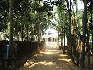
Badiyadka officially known as "Badiadka" is a town and gram panchayat in the Kasaragod district, state of Kerala, India.

Bayar is a village in Kasaragod district in the state of Kerala, India. Bayar is 12 km (7.5 mi) far from the Uppala town.

<span class="mw-page-title-main">Enmakaje</span> Village in Kerala, India

Enmakaje is a village in Kasaragod district in the state of Kerala, India. The administrative capital of the village is Perla, Kasaragod.

<span class="mw-page-title-main">Mangalpady</span> Panchayat in Kerala, India

Mangalpady is a Grama Panchayat in Kasaragod district, Kerala. Uppala is the major town in this panchayat.

<span class="mw-page-title-main">Paivalike</span> Village in Kerala, India

Paivalike is a village in Kasaragod district in the state of Kerala, India. Paivalike is 11 km (6.8 mi) east of Uppala town and 40 km (25 mi) south of Mangalore city.

<span class="mw-page-title-main">Vorkady</span> Gram Panchayat in Kerala, India

Vorkady is a Gram Panchayat in Kasaragod district in the state of Kerala, India.

Bekoor is a village near Uppala town in Kasaragod district in the state of Kerala, India. This locality is located in eastern Uppala, in Uppala-Bayar road, which connects Uppala with Paivalike, Bayar, and leads to Kanyana, Vittal and Puttur in dakshina Kannada district, Karnataka. It is around 3 km from Kaikamba junction and 1 km from Sonkal.

Kidoor is a village in Kasaragod district in the state of Kerala, India.

Meenja is a grama Panchayat in Manjeshwaram Taluk of Kasaragod district in the state of Kerala, India. It consists of 7 revenue villages. Kaliyoor, Koliyoor, Talakala, Meenja, Kadambar, Moodambail and [Kuloor]

<span class="mw-page-title-main">Bantwal taluk</span> Taluka in Karnataka, India

Bantwal taluk is a taluk of Dakshina Kannada district. The headquarters is the town of Bantwal, an eastern suburb of Mangalore.

<span class="mw-page-title-main">Nadubail</span> Village in Kerala, India

Nadubail is a small village in Enmakaje Panchayat, Kasaragod District of Kerala, India. It belongs to North Kerala Division. It is located three kilometers away from Panchayat's headquarters.

Sri Subrahmanyeshwara Higher Secondary School Katukukke is located in Katukukke village in Enmakaje Panchayat, Kerala, India. About 5 km North of Perla town.

<span class="mw-page-title-main">Bandiyod</span>

Bandiyod is a small town in the Kasaragod district of Kerala, India. It is located midway between Mangalore and Kasaragod.

<span class="mw-page-title-main">Kasaragod North</span> Town in Kerala, India

Kasaragod North is a suburb of Kasaragod city in north Kerala. It is located at the mouth of a lagoon formed by the Shiriya river. The following townships, suburbs and villages are part of Kasaragod North:

<span class="mw-page-title-main">History of Kasaragod</span>

Kasaragod District is the northernmost district in the southwestern Indian coastal state of Kerala. The district has a long history starting from pre-historic times to the modern period.

References

  1. "The Kerala Official Language (Legislation) Act, 1969" (PDF).
  2. Perla 671552, Kerala, India - Mapaworld.com Details
  3. - Perla Wikimapaia
  4. Kerala, Directorate of Census Operations. District Census Handbook, Kasaragod (PDF). Thiruvananthapuram: Directorate of Census Operations, Kerala. Retrieved 14 July 2020.