
Palakkad is one of the 14 districts in the Indian state of Kerala. It was carved out of the southeastern region of the former Malabar District on 1 January 1957. It is located at the central region of Kerala and is the second largest district in the state after Idukki. The city of Palakkad is the district headquarters. Palakkad is bordered on the northwest by the Malappuram district, on the southwest by the Thrissur district, on the northeast by Nilgiris district, and on the east by Coimbatore district of Tamil Nadu. The district is nicknamed "The granary of Kerala". Palakkad is the gateway to Kerala due to the presence of the Palakkad Gap, in the Western Ghats. The 2,383 m high Anginda peak, which is situated in the border of Palakkad district, Nilgiris district, and Malappuram district, in Silent Valley National Park, is the highest point of elevation in Palakkad district. Palakkad city is about 347 kilometres (216 mi) northeast of the state capital, Thiruvananthapuram.

Puthunagaram is a town and gram panchayat in the Palakkad district, state of Kerala, India. It is about 10 km south of Palakkad and 8 Km from Kollengode. Palakkad-Pollachi railway line passes through this town.
Alathur is a town, taluk and gram panchayat in Palakkad District, Kerala, India. It is the administrative headquarters of the Alathur Taluk and is situated about 24 km from the district headquarters Palakkad through National Highway 544.Gayathripuzha River ,one of the tributary of Bharathapuzha, flows through Alathur. Alathur is one among the 29 Parliamentary Constituencies in Kerala. A Mini Civil Station is also located here which provides government related services.

Thiruvegappura is a village in Pattambi Taluk Palakkad district in the state of Kerala, India. It is administered by the Thiruvegapura gram panchayat.

Attappadi (HQ:Agali) is a tribal taluk in Kerala state covering an area of 735 km2 (284 sq mi). It is carved out from Mannarkkad taluk in Palakkad district in February 2021. Attappadi Reserve Forest is a protected area comprising 249 km2 of land area in the western parts of Attappadi. It is one among the reserved forests and protected forests of India. Attappadi valley in Palakkad district along with the neighbouring Chaliyar valley of the Nilambur region in Malappuram district is known for natural Gold fields which are also seen in the other regions of Nilgiri Biosphere Reserve.

Muthuthala is a village and gram panchayat. It lies northwest of Pattambi in Palakkad district, of the state of Kerala, India. It is located on the banks of the Bharathapuzha River.

Pattambi is a town, tehsil, and municipality in the Palakkad District of Kerala, India. It is also the administrative headquarters of the Pattambi Taluk.

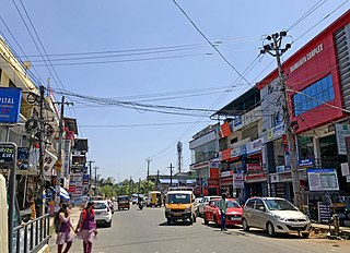
Mannarkkad, formerly known as Mannarghat, is a major municipal town in Palakkad district of the Indian state of Kerala. The Silent Valley National Park and the Attappadi Reserve Forest are located in Mannarkkad Taluk. Mannarkkad is situated 36 km away from district headquarters Palakkad on National Highway 966. It is the traditional seat of the Mannarghat Moopil Nair.

Palakkad, also known as Palghat, historically known as Palakkattussery, is a city and municipality in the Indian state of Kerala. It is the administrative headquarters of Palakkad District. Palakkad is the most densely populated municipality and the fourth-most densely populated city in the state. It was established before Indian independence under British rule and known by the name Palghat. Palakkad is famous for the ancient Palakkad Fort, which is in the heart of the city and was captured and rebuilt by Hyder Ali in 1766 which later fell into the hands of Zamorin in 1784. The city is about 347 kilometres (216 mi) northeast of the state capital, Thiruvananthapuram.
Eranholi is a census town and suburb of Thalassery in Tellicherry Municipality in the state of Kerala, India, and located on Tellichery Mysore highway. The nearest town is Chirakkara. Eranholi bridge built across Eranholi river in 1937 which is entry to Tellicherry.The Eranholi Bridge is a significant bridge of TC Road.

Chittur-Thathamangalam is a town and municipality in Palakkad district of Kerala State, India. It is the headquarters of Chittur taluk, 13 km (8.1 mi) south-east of Palakkad, on the banks of the Kannadipuzha, a major headstream of the Bharathapuzha, the second longest river in Kerala. A Mini Civil Station is also located here which provides government related services. It consists of two areas, Chittur and Thathamangalam which together form the municipality.

Chowara is a small town near Aluva in the Ernakulam district in the state of Kerala, India.

Karadka is a village, block panchayat and grama panchayat in Kasaragod district in the state of Kerala, India.

Parudur is a village and gram panchayat in Pattambi taluk, Palakkad district in the state of Kerala, India. Parudur was originally a part of Kuttippuram Block Panchayat in Tirur Taluk of erstwhile Kozhikode district, before the formation of Malappuram district. After the formation of Malappuram district, Tirur Taluk became a part of Malappuram and Parudur village was transferred to Ottapalam Taluk. Today it forms part of Pattambi taluk.
Vandithavalam is a village in the Palakkad district, state of Kerala, India. It is among the villages administered by the Perumatty Gram Panchayat.

Kumaranellur is a small Village/hamlet in Pattambi Taluk in Palakkad District of Kerala, India. It comes under Kappur Grama Panchayath. It is located 75 km westwards from District headquarters Palakkad, 48 km southwards from the neighbouring district headquarters Malappuram, 27 km from Tirur, 22 km from Valanchery, 20 km from Pattambi, 20 km from Kunnamkulam, 15 km from Ponnani, 14 km from Kuttippuram, 8 km from Thrithala, and 5 km from Edappal town. This Place is in the border of the Palakkad District and Malappuram District. Malappuram District Kuttippuram is North towards this place and Edappal is westward from this place. Kumaranellur basically depends upon neighbouring Ponnani, Edappal, and Kuttippuram in Malappuram district for education and healthcare purposes. It is a part of Thrithala and Ponnani.
Anakkara is a village and grama panchayat in Pattambi taluk, Palakkad district, Kerala, India. It is located on the southern bank of Bharathappuzha river. Anakkara is located about 8 km south of Kuttippuram town. It was a part of Ponnani taluk until 16 June 1969. The border Grama Panchayats of Anakkara are Kuttipuram and Irimbiliyam in Tirur Taluk, Thavanur, Kalady, and Vattamkulam in Ponnani taluk, and Parudur and Pattithara in Pattambi Taluk.

Perinthalmanna is a major town and municipality in Malappuram district, Kerala, India. It serves as the administrative centre for the Perinthalmanna taluk, as well as a revenue division, a community development block, and a police sub-division bearing the same name. It was formerly the headquarters of Valluvanad Taluk, which was one of the two Taluks in the Malappuram Revenue Division of the erstwhile Malabar District during the British Raj. The city is located 23 kilometres (14 mi) southwest of the city of Malappuram at the centre of the Kozhikode–Malappuram–Perinthalmanna–Palakkad National Highway 966.

Palakkad District has four types of administrative hierarchies:
Kodumunda is a small village in Muthuthala and Parudur gramapanchayath, Pattambi Taluk, Palakkad district Kerala. It is a minor trading center in Muthuthala Panchayath. The portions of Kodumunda in Parudur Panchayath are called west Kodumunda. The only railway station in Muthuthala is situated in Kodumunda and is home to four significant temples: Muthassiyarkavu, Cheruneerkara Shiva Temple, Manniyampathoor Saraswathi temple, and Madayil lakshminarasimha temple. Muthassiyarkavu thalapoli and Kodumunda nercha are the major festivals in this village.


