
Grand Cayman is the largest of the three Cayman Islands and the location of the territory's capital, George Town. In relation to the other two Cayman Islands, it is approximately 75 miles (121 km) southwest of Little Cayman and 90 miles (145 km) southwest of Cayman Brac.

Wreck diving is recreational diving where the wreckage of ships, aircraft and other artificial structures are explored. The term is used mainly by recreational and technical divers. Professional divers, when diving on a shipwreck, generally refer to the specific task, such as salvage work, accident investigation or archaeological survey. Although most wreck dive sites are at shipwrecks, there is an increasing trend to scuttle retired ships to create artificial reef sites. Diving to crashed aircraft can also be considered wreck diving. The recreation of wreck diving makes no distinction as to how the vessel ended up on the bottom.

Catalina Island or Isla Catalina is a tropical island located 1.5 miles from the mainland on the south-east corner of the Dominican Republic, near La Altagracia and La Romana. It is an occasional destination for cruise ships on Caribbean routes. In particular, Costa Cruises has a private beach on the island. Their ships anchor offshore and transport passengers to shore via tender.

Little Cayman is one of three Islands that make up the Cayman Islands. It is located in the Caribbean Sea, approximately 60 miles (96 km) northeast of East End, Grand Cayman and five miles (8 km) west of West End, Cayman Brac. Little Cayman is the least populous island of the three, with a permanent population of about 160 (2021) including seasonal residents/homeowners. The majority of the population are expatriate workers from Jamaica, the Philippines, and Honduras and from other Latin American countries as well as Canada, the USA, India, Australia, Scotland, England, and South Africa. There are a handful of local Caymanians estimated as fewer than 20. It is about 10 miles (16 km) long with an average width of 1 mile (1600 m) and most of the island is undeveloped. Almost the entire island is at sea level. The highest elevation is about 40 feet. The rainy season, which consists of mostly light showers, occurs in Mid-April until June and again in mid-September to mid-October. There will be occasional quick rain showers in the early morning hours. The coolest months are from End of November until Mid March as the cold fronts coming in from the North which the temperature can drop into the low'70s. The Hottest and dryest months are in Summer starting mid-June to mid-September with temperatures between the mid-80s and high 90s. There are no large or predatory or venomous animals that pose a threat to humans.

Cayman Brac is an island that is part of the Cayman Islands. It lies in the Caribbean Sea about 145 km (90 mi) north-east of Grand Cayman and 8 km (5.0 mi) east of Little Cayman. It is about 19 km (12 mi) long, with an average width of 2 km (1.2 mi). Its terrain is the most prominent of the three Cayman Islands due to "The Bluff", a limestone outcrop that rises steadily along the length of the island up to 43 m (141 ft) above sea level at the eastern end. The island is named after this prominent feature, as "brac" is a Gaelic name for a bluff.

Sucia Island is located 2.5 miles (4.0 km) north of Orcas Island in the San Juan Islands, San Juan County, Washington, United States. It is the largest of an archipelago of ten islands including Sucia Island, Little Sucia, Ewing, Justice, Herndon, the Cluster Islands islets, and several smaller, unnamed islands. The group of islands is about 2.5 miles (4.0 km) in length and just short of a half mile wide. Sucia island is roughly the shape of a hand. The total land area of all islands is 2.74 km2. The main island of Sucia Island by itself is 2.259 km2. There was a permanent population of four persons as of the 2000 census, all on Sucia Island. Sucia Island State Park is a Washington State Marine Park.

Canoe diving and Kayak diving are recreational diving where the divers paddle to a diving site in a canoe or kayak carrying all their gear in or on the boat to the place they want to dive. Canoe or kayak diving gives the diver independence from dive boat operators, while allowing dives at sites which are too far to comfortably swim, but are sufficiently sheltered.
Tulamben is a small fishing village on the north-east coast of Bali. It is among the most popular dive sites on Bali since the wreck of the Liberty, a US Army Transport ship torpedoed by a Japanese submarine in 1942 lies just off shore. During high-season, up to 100 divers descend to the wreck each day.
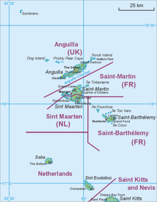
The Saba National Marine Park encompasses the waters and sea bed encircling the Caribbean island of Saba, Kingdom of the Netherlands, from the high water mark to 200 feet (61 m) deep. In total, the marine park covers approximately 5 square miles (13 km2). At the time of its creation in 1987, the government passed the Marine Environment Ordinance to protect the coral reefs and other marine life within the park. The Saba Conservation Foundation manages the Saba National Marine Park, as well as the island's hyperbaric facility and natural sites on land.
Pacific Abyss is a three-part series on British television's (BBC1), which first aired in Sunday 17 August 2008. It is hosted by Kate Humble, Mike Smart and Mike deGruy with filming beginning in April/May 2007.

Palancar Reef is a large coral reef on the southwest side of the island of Cozumel and is part of the Arrecifes de Cozumel National Park. The site, popular with scuba divers, is divided into several sections based on depth and coral formations. Dive depths range from 50 to 110 feet, with coral swim-throughs in many places.
Wreck Alley is an area a few miles off the coast of Mission Beach, San Diego, California with several ships intentionally sunk as artificial reefs and as Scuba diving attractions for wreck divers.

Sinking ships for wreck diving sites is the practice of scuttling old ships to produce artificial reefs suitable for wreck diving, to benefit from commercial revenues from recreational diving of the shipwreck, or to produce a diver training site.
Sund Rock is a designated conservation area on the U.S. state of Washington's Hood Canal. The area is known for abundant and diverse life, including but not limited to Lingcod, Giant Pacific Octopus, Wolf Eel, as well as nudibranch, anemone, and sea cucumber.
Octopus Hole Conservation Area is defined as those waters, tidelands, and bedlands of Hood Canal within a line projected due east from the western shore of Hood Canal on latitude 47°27'01"N for 200 yards, thence southerly 628 yards parallel to the high watermark to latitude 47°26'40", thence due west to shore.

The Maldives, officially the Republic of Maldives, is a small archipelagic state in South Asia. It lies in the Indian Ocean southwest of Sri Lanka and India, about 700 kilometres (430 mi) from the Asian continent's mainland. The chain of 26 atolls stretches across the Equator from Ihavandhippolhu Atoll in the north to Addu Atoll in the south. The land area is roughly 298 square kilometres. Malé is the capital.

Molokini is a crescent-shaped, partially submerged volcanic crater which forms a small, uninhabited islet located in ʻAlalākeiki Channel between the islands of Maui and Kahoʻolawe, within Maui County in Hawaiʻi. It is the remains of one of the seven Pleistocene epoch volcanoes that formed the prehistoric Maui Nui island, during the Quaternary Period of the Cenozoic Era.

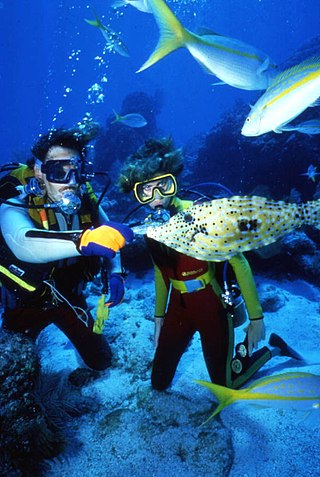
Recreational dive sites are specific places that recreational scuba divers go to enjoy the underwater environment or for training purposes. They include technical diving sites beyond the range generally accepted for recreational diving. In this context all diving done for recreational purposes is included. Professional diving tends to be done where the job is, and with the exception of diver training and leading groups of recreational divers, does not generally occur at specific sites chosen for their easy access, pleasant conditions or interesting features.
The environmental impact of recreational diving is the effects of recreational scuba diving on the underwater environment, which is largely the effects of diving tourism on the marine environment. It is not uncommon for highly trafficked dive destinations to have more adverse effects with visible signs of diving's negative impacts due in large part to divers who have not been trained to sufficient competence in the skills required for the local environment, an inadequate pre-dive orientation, or lack of a basic understanding of biodiversity and the delicate balance of aquatic ecosystems. There may also be indirect positive effects as the environment is recognised by the local communities to be worth more in good condition than degraded by inappropriate use, and conservation efforts get support from dive communities who promote environmental awareness, and teach low impact diving and the importance of respecting marine life. There are also global coral reef monitoring networks in place which include local volunteer divers assisting in the collection of data for scientific monitoring of coral reef systems, which may eventually have a net positive impact on the environment.
