
Puerto Galera, officially the Municipality of Puerto Galera, is a 1st class municipality in the province of Oriental Mindoro, Philippines. According to the 2020 census, it has a population of 41,961 people.

The Coral Sea is a marginal sea of the South Pacific off the northeast coast of Australia, and classified as an interim Australian bioregion. The Coral Sea extends 2,000 kilometres (1,200 mi) down the Australian northeast coast. Most of it is protected by the French Natural Park of the Coral Sea and the Australian Coral Sea Marine Park. The sea was the location for the Battle of the Coral Sea, a major confrontation during World War II between the navies of the Empire of Japan, and the United States and Australia.

Jaco Island is an uninhabited island in East Timor, a country occupying the eastern end of the island of Timor in the Lesser Sunda Islands in Southeast Asia. It lies off the eastern tip with Cape Cutcha of the island of Timor.
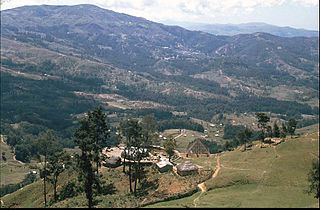
Manufahi is one of the municipalities of East Timor. It has a population of 53,691 and an area of 1,323 km2. The capital of the municipality is Same.

Ombai Strait is an international strait in Southeast Asia. It separates the Alor Archipelago from the islands of Wetar, Atauro, and Timor in the Lesser Sunda Islands. The strait is also the western portion of a pair of international straits, the other one being Wetar Strait; the two straits combine to link the Pacific Ocean with the Indian Ocean.

Wetar Strait is an international strait in Southeast Asia. It separates the island of Wetar from the eastern part of the island of Timor. The strait is also the eastern portion of a pair of international straits, the other one being Ombai Strait; the two straits combine to link the Indian Ocean with the Pacific Ocean.

Raja Ampat, or the Four Kings, is an archipelago located off the northwest tip of Bird's Head Peninsula on the island of New Guinea, in Indonesia's Southwest Papua province. It comprises over 1,500 small islands, cays, and shoals surrounding the four main islands of Misool, Salawati, Batanta, and Waigeo, and the smaller island of Kofiau.

The Loes River is a river in East Timor and one of the few perennial rivers in its north. It combines with its tributaries to make up the country's largest river system, and its catchment or drainage basin extends into the province of East Nusa Tenggara in Indonesia.

Pescador Island is a small limestone island located in the Tañon Strait, a few kilometres from the western coast of the island of Cebu in the Philippines. It is under the jurisdiction of the municipality of Moalboal.

Apo Reef is a coral reef system in the Philippines situated in the western waters of Occidental Mindoro province in the Mindoro Strait. Encompassing 34 square kilometres (13 sq mi), it is considered the world's second-largest contiguous coral reef system, and is the largest in the country. The reef and its surrounding waters are protected areas administered as the Apo Reef Natural Park (ARNP). It is one of the best known and most popular diving regions in the country, and is in the tentative list for UNESCO World Heritage Sites.
The Comoro River is a river in East Timor. It flows north into Ombai Strait, reaching the coast in the north western suburbs of the capital, Dili. In its lower reaches, it is the main and largest of Dili's four major rivers.

East Timor, also known as Timor-Leste, officially the Democratic Republic of Timor-Leste, is a country in Southeast Asia. It comprises the eastern half of the island of Timor - of which the western half is administered by Indonesia - the exclave of Oecusse on the island's north-western half, and the minor islands of Atauro and Jaco. Australia is the country's southern neighbour, separated by the Timor Sea. The country's size is 14,874 square kilometres (5,743 sq mi). Dili is its capital and largest city.

The Coral Triangle (CT) is a roughly triangular area in the tropical waters around the Philippines, Indonesia, Malaysia, Papua New Guinea, the Solomon Islands and Timor-Leste. This area contains at least 500 species of reef-building corals in each ecoregion. The Coral Triangle is located between the Pacific and Indian oceans and encompasses portions of two biogeographic regions: the Indonesian-Philippines Region, and the Far Southwestern Pacific Region. As one of eight major coral reef zones in the world, the Coral Triangle is recognized as a global centre of marine biodiversity and a global priority for conservation. Its biological resources make it a global hotspot of marine biodiversity. Known as the "Amazon of the seas", it covers 5.7 million square kilometres (2,200,000 sq mi) of ocean waters. It contains more than 76% of the world's shallow-water reef-building coral species, 37% of its reef fish species, 50% of its razor clam species, six out of seven of the world's sea turtle species, and the world's largest mangrove forest. In 2014, the Asian Development Bank (ADB) reported that the gross domestic product of the marine ecosystem in the Coral Triangle is roughly $1.2 trillion per year and provides food to over 120 million people. According to the Coral Triangle Knowledge Network, the region annually brings in about $3 billion in foreign exchange income from fisheries exports, and another $3 billion from coastal tourism revenues.

The Maldives, officially the Republic of Maldives, is a small archipelagic state in South Asia. It lies in the Indian Ocean southwest of Sri Lanka and India, about 700 kilometres (430 mi) from the Asian continent's mainland. The chain of 26 atolls stretches across the Equator from Ihavandhippolhu Atoll in the north to Addu Atoll in the south. The land area is roughly 298 square kilometres. Malé is the capital.

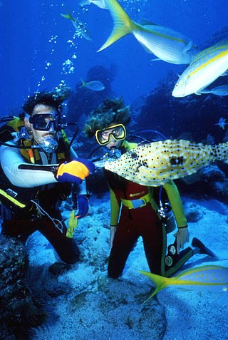
Recreational dive sites are specific places that recreational scuba divers go to enjoy the underwater environment or for training purposes. They include technical diving sites beyond the range generally accepted for recreational diving. In this context all diving done for recreational purposes is included. Professional diving tends to be done where the job is, and with the exception of diver training and leading groups of recreational divers, does not generally occur at specific sites chosen for their easy access, pleasant conditions or interesting features.

Tasitolu is a protected area on the coast of East Timor, 8 kilometres (5.0 mi) west of the capital Dili. The Tasitolu wetlands include three saline lakes, an esplanade, and a beach; it has been designated a Wetland of National Significance. Tasitolu Peace Park was designated in 2002 because of its cultural and historical importance. The Tasitolu Important Bird Area accommodates several near-threatened species. A 2004 reforestation project, which included community member participation, was funded by the national government. Subsequent to the 2006 East Timorese crisis, several hundred people sought refuge at Tasitolu's tent camp, established by the United Nations High Commissioner for Refugees. INTERFET, an Australian-led international military Peace Keeping Force governed by the United Nations, has established a base at Tasitolu.
The environmental impact of recreational diving is the effects of recreational scuba diving on the underwater environment, which is largely the effects of diving tourism on the marine environment. It is not uncommon for highly trafficked dive destinations to have more adverse effects with visible signs of diving's negative impacts due in large part to divers who have not been trained to sufficient competence in the skills required for the local environment, an inadequate pre-dive orientation, or lack of a basic understanding of biodiversity and the delicate balance of aquatic ecosystems. There may also be indirect positive effects as the environment is recognised by the local communities to be worth more in good condition than degraded by inappropriate use, and conservation efforts get support from dive communities who promote environmental awareness, and teach low impact diving and the importance of respecting marine life. There are also global coral reef monitoring networks in place which include local volunteer divers assisting in the collection of data for scientific monitoring of coral reef systems, which may eventually have a net positive impact on the environment.

Tibar Bay is a bay on the north coast of East Timor near Dili, its capital city. The bay forms part of the south shore of Ombai Strait, which separates the Alor Archipelago from the islands of Wetar, Atauro, and Timor in the Lesser Sunda Islands.

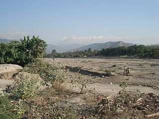
Valu Beach is a public beach at the easternmost tip of mainland East Timor, and the gateway to Jaco Island to its east.

