| R766 road | |
|---|---|
| Route information | |
| Length | 3.7 km (2.3 mi) |
| Location | |
| Primary destinations |
|
| Road network | |
The R766 road is a regional road in Ireland. The road connects Bray with its eastern suburbs and the seaside.
| R766 road | |
|---|---|
| Route information | |
| Length | 3.7 km (2.3 mi) |
| Location | |
| Primary destinations |
|
| Road network | |
The R766 road is a regional road in Ireland. The road connects Bray with its eastern suburbs and the seaside.
The route begins at the junction of Bray Main Street and Quinnsborough Road. The route heads east down the Quinnsborough Road, passing the Carlisle Grounds and Bray Daly Station, crossing the level crossing and heading south along the Strand Road. The Strand Road is southbound only so northbound traffic follows the Meath Road instead. The route then heads west up the hill of the Putland Road. The route terminates at its junction with the R761 at The Vevay.
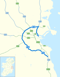
The M50 motorway is a C-shaped orbital motorway in Dublin and the busiest motorway in Ireland. The current route was built in various sections over the course of 27 years, from 1983 to 2010. It begins at Dublin Port, running northward through the Dublin Port Tunnel and along a portion of the Airport Motorway. It then turns west at its junction with the M1, circling the northern, western and southern suburbs of Dublin, before merging with the M11 at Shankill in South East Dublin. The road forms part of European route E01.

The N11 road is a national primary road in Ireland, running for 129 km (80 mi) along the east side of Ireland from Dublin to Wexford. It passes close to Bray, Greystones, Wicklow, Arklow, Gorey, and Enniscorthy. Beyond Wexford, the route continues to Rosslare as the N25. The road forms part of European route E01. As of July 2019 the N11/M11 is of dual carriageway or motorway standard from Dublin as far as Oilgate in County Wexford.

The R445 road is a regional road in Ireland. The route is a non-motorway alternative route to the N7/M7 motorway between Naas and Limerick, and at 170 km it is one of the longest regional roads in Ireland. Indeed, much of the route comprises roads that were formerly part of the N7 between the cities, prior to motorway and other bypasses. Some of the R445 route also comprises local link roads to new N7/M7 route sections.
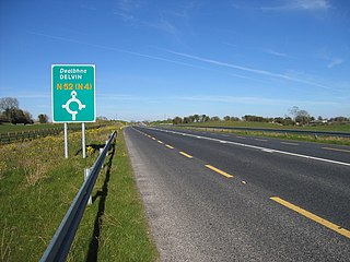
The N52 road is a national secondary road in Ireland. It links the M7 motorway from just south of Nenagh, County Tipperary to the M1 motorway north of Dundalk in County Louth. The route forms a connection between the north east of Ireland and the mid west traversing the midlands. It interchanges with the M6 at Kilbeggan and at Tyrrellspass, the N4 at Mullingar, the N3 at Kells, and the N2 at Ardee before continuing towards Dundalk.

The R756 road is a regional road in Ireland running west–east from Dunlavin to Laragh. Its entire 32 km (20 mi) length is within County Wicklow crossing east–west through the Wicklow Gap.
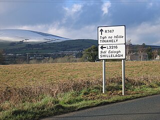
The R747 road is a regional road in Ireland running north-west/south-east from the M9 near Ballitore in County Kildare to Arklow in County Wicklow, a distance of 66 km (41 mi).

The R117 road is a regional road in Ireland. The route (north-south) starts Harcourt Road at the end of the South Circular Road on the southside of Dublin city centre. It crosses the Grand Canal and goes through the suburbs of Ranelagh, Milltown, Windy Arbour, Dundrum, Sandyford, Stepaside and Kilternan before passing through the Scalp into County Wicklow.
The R761 road is a regional road in County Wicklow in Ireland. From its junction with the M11 and R119 in Bray it takes a southerly route to its junction with the R750 in the village of Rathnew, on the outskirts of Wicklow, where it terminates.

The R400 road is a regional road in Ireland, linking Mullingar, County Westmeath to the R419 at Cushina, County Offaly.
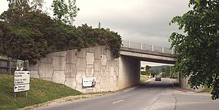
The R724 road is a regional road in County Carlow, Ireland. From its junction with the R448 at Royal Oak on the western edge of Muine Bheag Town it takes an easterly route crossing the River Barrow, the R705 regional road and the Dublin – Kilkenny railway line in the town.
The R415 road is a regional road in Ireland, which runs north-south from its junction with the R403 in Allenwood to the R448 at Crookstown, passing through Kildare town, and crossing the N78 between Kilcullen and Athy. The route is entirely within County Kildare.

The R162 road is a regional road in Ireland, linking Monaghan Town to Navan, County Meath. The route is 80 km (50 mi) long.

The R702 road is a regional road in Ireland which runs west-east from the R712 at Coolgrange in County Kilkenny through Gowran before crossing into County Carlow at Goresbridge. It continues to Borris, passes through the Blackstairs Mountains via the Scullogue Gap into County Wexford and continues east until it terminates at a junction with the R890 in Enniscorthy.

The R105 road is a regional road in north Dublin, Ireland. It travels from the city centre to Howth, and loops at both ends; the road fully encircles Howth Head. Along the way, the road passes through Fairview, the western end of Clontarf, Killester, Raheny, the coastal edge of Kilbarrack and Sutton. Its biggest component is Howth Road.

The R119 road is a regional road in Dún Laoghaire–Rathdown, Ireland.

The R809 road is a regional road in three sections in Dublin and Fingal, Ireland. It connects the R807 in Bettyglen to the R105 in Sutton following a roughly semicircular path that runs north, then east, then south, connecting one point on the coast road of Dublin Bay with another point, further northeast.

The R767 road is a regional road in Ireland which connects J7 of the N11 to Bray Town Hall on Bray Main Street. The majority of the road is known as the Killarney Road.

The R768 road is a regional road in Ireland which connects J7 of the N11 to the junction of the R761 at Irishtown, Bray. The road is commonly known as the Southern Cross or the Southern Bypass, though it is officially known as the Southern Ring Road.

The R918 road is a regional road in Ireland which connects J6 of the N11 to the R761 at Little Bray. The majority of the known as the Dargle Road and the Upper Dargle Road.
The R319 road is a regional road in County Mayo in Ireland. It connects the N59 at Mulranny to Keem Strand, 35.4 kilometres (22.0 mi) away.