
The island of Ireland, comprising Northern Ireland and the Republic of Ireland, has an extensive network of tens of thousands of kilometres of public roads, usually surfaced. These roads have been developed and modernised over centuries, from trackways suitable only for walkers and horses, to surfaced roads including modern motorways. Driving is on the left-hand side of the road. The major routes were established before Irish independence and consequently take little cognisance of the border other than a change of identification number and street furniture. Northern Ireland has had motorways since 1962, and has a well-developed network of primary, secondary and local routes. The Republic started work on its motorway network in the early 1980s; and historically, the road network there was once somewhat less well developed. However, the Celtic Tiger economic boom and an influx of European Union structural funding, saw national roads and regional roads in the Republic come up to international standard quite quickly. In the mid-1990s, for example, the Republic went from having only a few short sections of motorway to a network of motorways, dual carriageways and other improvements on most major routes as part of a National Development Plan. Road construction in Northern Ireland now tends to proceed at a slower pace than in the Republic, although a number of important bypasses and upgrades to dual carriageway have recently been completed or are about to begin.
The N7 road is a national primary road in Ireland, connecting Limerick and Dublin. The majority of the route is motorway standard and is designated as the M7 motorway. At the Rosbrien interchange in Limerick the route continues as the N18 dual carriageway to Shannon and Ennis. The road passes through the midlands of Ireland, and acts as a trunk route out of Dublin for the N8 and N9 national primary routes to Cork and Waterford respectively. It forms part of European route E20.
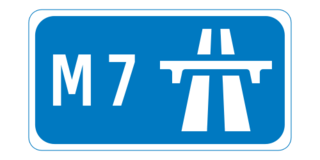
The M7 motorway is a motorway in Ireland. The motorway runs continuously from the outskirts of Naas in County Kildare to Rossbrien on the outskirts of Limerick City. The M7 forms part of the Dublin to Limerick N7 national primary road. The section of the motorway bypassing Naas, an 8 km stretch, was the first section of motorway to open in Ireland, in 1983. Following substantial works to extend the M7 to Limerick, by the end of 2010, the motorway replaced all of the old single-carriageway N7 route which is now designated as R445. At 166.5 km, the M7 is the longest motorway in Ireland.

National Development Plan was the title given by the Irish Government to a scheme of organised large-scale expenditure on (mainly) national infrastructure. The first five-year plan ran from 1988 to 1993, the second was a six-year plan from 1994 to 1999 and the third ran as a seven-year plan from 2000 to 2006. A fourth National Development Plan ran from 2007 to 2011. The main elements of the third plan were the development of a national motorway network between the major cities in Ireland. The upgrading of the rail network was a secondary scheme.

The N17 road is a national primary road in Ireland, and is part of the Atlantic Corridor route. It begins in County Galway and ends in County Sligo. On 27 September 2017 the southern, Tuam–Galway, section was upgraded to motorway status and designated M17.

The N18 road is a national primary road in Ireland, connecting the cities of Limerick and Galway. Ennis and Gort are two major towns on the route, and Shannon Airport is reached via the connecting N19. The west coast route continues on to Sligo as the N17. The section from Limerick to the N19 junction forms part of European route E20, and the entire route is part of the proposed Atlantic Corridor. The section of motorway from Shannon to Claregalway is designated the M18 motorway. The tolled Limerick Tunnel forms part of the route.

The N21 road is a national primary road in Ireland. The route runs from the M20 outside Limerick to Tralee with connecting roads to other parts of County Kerry. It is 84.37 km (52.43 mi) in length. It runs through the towns of Abbeyfeale, Newcastle West, Adare and the village of Templeglantine. Prior to October 2010 the N21 also ran through the town of Castleisland. The town has since been bypassed. Rathkeale was also bypassed in 1992.

A regional road in the Republic of Ireland is a class of road not forming a major route, but nevertheless forming a link in the national route network. There are over 11,600 kilometres of regional roads. Regional roads are numbered with three-digit route numbers, prefixed by "R". The equivalent road category in Northern Ireland are B roads.

The N20 road is a national primary road in Ireland, connecting the cities of Cork and Limerick. Buttevant, Croom, Charleville, Mallow and Blarney are major towns along the route. A short section of the route is motorway standard and is designated as the M20 Motorway.
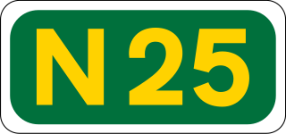
The N25 road is a national primary road in Ireland, forming the route from Cork to Rosslare Europort via Waterford City. The road is part of the E30 European route and a short section is also part of the E01 European route. It forms part of the proposed Atlantic Corridor route.

Transport 21 was an Irish infrastructure plan, announced in November 2005. Its aims were to greatly expand Ireland's transport network. A cost estimate of €34 billion was attached to the plan at the time.

A national primary road is a road classification in Ireland. National primary roads form the major routes between the major urban centres. There are 2649 km of national primary roads. This category of road has the prefix "N" followed by one or two digits. Motorways are prefixed "M" followed by one or two digits.

InterCity is the brand name given to rail services operated by Iarnród Éireann that run between Dublin and other major cities in Ireland. InterCity branding is also used in other European countries by unaffiliated organizations.

The M8 motorway is an inter-urban motorway in Ireland, which forms part of the motorway from the capital Dublin to Cork city. The 149 km motorway commences in the townland of Aghaboe, County Laois and runs through the counties of Kilkenny, Tipperary and Limerick, terminating at the Dunkettle interchange in Cork City. First called for in the Road Needs Study (1998), it was later incorporated into the National Development Plan (2000–2006) and later still formed part of the Irish Government's Transport 21 plan for infrastructural development. The majority of the M8 (115 km) was built between 2006 and 2010. On 28 May 2010, the motorway was completed and had replaced almost all of the single-carriageway N8 except for a short section of urban road in Cork City.
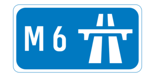
The M6 motorway is a motorway in Ireland, which runs from Dublin to Galway. The M6 extends from its junction with the M4 at Kinnegad all the way west to the outskirts of Galway City, but the Athlone bypass and the approach to Galway city - while of dual carriageway standard - have not been designated motorway and are still signed as N6. The motorway was officially completed and opened to traffic on 18 December 2009, and was the first city-to-city direct major inter-urban route to be completed in Ireland. The M6 and M4, which form the Galway-Dublin route, consist of a grade-separated 2+2 dual carriageway road with a top speed limit of 120 km/h. At approximately 144 km (90 mi), the M6 is the third longest motorway in the state and will be 159 km.

In Ireland, the highest category of road is a motorway, indicated by the prefix M followed by a one- or two-digit number. The motorway network consists entirely of motorway-grade dual carriageways and is largely focused upon Dublin. There are also several three-lane motorways, while Ireland's busiest road, the M50, incorporates four-lane, five-lane, and six-lane stretches.
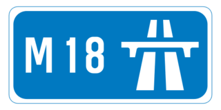
The M18 motorway is an inter-urban motorway in Ireland, forming part of the Limerick, Ennis to Galway national primary road, which, in turn, forms part of the Atlantic Corridor called for as part of the Transport 21 project.
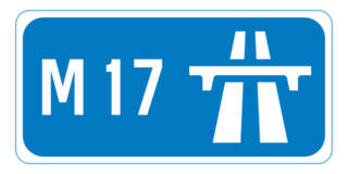
The M17 motorway is an inter-urban motorway in Ireland, forming part of the Sligo to Galway national primary road.
