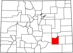
Bent's Old Fort National Historic Site

Last updated

Bent's Old Fort
BentsFort.jpg
Bent's Old Fort
USA Colorado location map.svg
Red pog.svg
Usa edcp location map.svg
Red pog.svg
Location Otero County, Colorado, United States
Nearest city La Junta, Colorado
Coordinates 38°02′26″N103°25′46″W / 38.0406°N 103.4294°W / 38.0406; -103.4294 (Bent's Old Fort)
Area799 acres (3.23 km2) [1]
Built1833
Architect William Bent; Charles Bent
Visitation28,131 (2009) [2]
Website Bent's Old Fort National Historic Site
NRHP reference No. 66000254
Significant dates
Added to NRHPOctober 15, 1966 [3]
Designated NHLJune 3, 1960
Designated NHSDecember 19, 1960 [4]

Bent's Old Fort is a fort located in Otero County in southeastern Colorado, United States. A company owned by Charles Bent and William Bent and Ceran St. Vrain built the fort in 1833 to trade with Southern Cheyenne and Arapaho Plains Indians and trappers for buffalo robes. For much of its 16-year history, the fort was the only major white American permanent settlement on the Santa Fe Trail between Missouri and the Mexican settlements. It was destroyed in 1849.

Contents

The fort was reconstructed and is open to the public. The area of the fort was designated a National Historic Site under the National Park Service on June 3, 1960. It was further designated a National Historic Landmark later that year on December 19, 1960. [4] [5] [6]

History

Approach to Bent's Old Fort, Colorado. Wetlands protecting the north trail. Approach to Fort P6010750.JPG
Approach to Bent's Old Fort, Colorado. Wetlands protecting the north trail.

The adobe fort quickly became the center of the Bent, St. Vrain Company's expanding trade empire, which included Fort Saint Vrain to the north and Fort Adobe to the south, along with company stores in New Mexico at Taos and Santa Fe. The primary trade was with the Southern Cheyenne and Arapaho Indians for buffalo robes.

From 1833 to 1849, the fort was a stopping point along the Santa Fe Trail. It was the only permanent settlement not under the jurisdiction and control of Native Americans or Mexicans. The U.S. Army, explorers, and other travelers stopped at the fort to replenish supplies, such as water and food, and perform needed maintenance to their wagons. The American frontiersman Kit Carson was employed as a hunter by the Bent brothers in 1841, and regularly visited the Fort. [7] Likewise, the explorer John C. Frémont used the Fort as both a staging area and a replenishment junction, for his expeditions. [8] During the Mexican–American War in 1846, the fort became a staging area for Colonel Stephen Watts Kearny's "Army of the West". [9]

Ralph Emerson Twitchell makes the following statement. [10]

Bent's Fort is described as having been a structure built of adobe bricks. It was 180 feet long and 135 feet wide. The walls were 15 feet in height and four feet thick and it was the strongest post at that time west of Ft. Leavenworth. The construction of this fort was commenced in 1828 ... at a point on the Arkansas somewhere between the present cities of Pueblo and Canon City, having been disadvantageously located. Four years were required in which to complete the structure. On the northwest and southeast corners were hexagonal bastions, in which were mounted a number of cannon. The walls of the fort served as walls of the rooms, all of which faced inwardly on a court or plaza. The walls were loopholed for musketry, and the entrance was through large wooden gates of very heavy timbers.

Destruction

Bent's Old Fort, Lower Level Plan HABS COLO,6-LAJUNT,1- (sheet 2 of 4) - Old Fort Bent, La Junta, Otero County, CO 00002v.jpg
Bent's Old Fort, Lower Level Plan

In 1849 when a great cholera epidemic struck the Cheyenne and other Plains Indians, William Bent abandoned Bent's Fort and moved his headquarters north to Fort Saint Vrain on the South Platte. When he returned south in 1852, he relocated his trading business to his log trading post at Big Timbers, near what is now Lamar, Colorado. Later, in the fall of 1853, Bent began building a stone fort on the bluff above Big Timbers, Bent's New Fort, where he conducted his trading business until 1860. [11]

When the fort was reconstructed in 1976, its authenticity was based on the use of archaeological excavations, paintings and original sketches, diaries and other existing historical data from the period.

See also

Notes

  1. "Listing of acreage – December 31, 2011" (XLSX). Land Resource Division, National Park Service. Retrieved March 30, 2012. (National Park Service Acreage Reports)
  2. "NPS Annual Recreation Visits Report". National Park Service. Retrieved March 30, 2012.
  3. "National Register Information System". National Register of Historic Places . National Park Service. January 23, 2007.
  4. 1 2 "Bent's Old Fort". National Historic Landmark summary listing. National Park Service. September 28, 2007. Archived from the original on February 6, 2009.
  5. "Bent's Old Fort or Fort William", April 20, 1984, by Carl McWilliams and Karen Johnson". National Register of Historic Places Inventory-Nomination. National Park Service. 1983.
  6. "Bent's Old Fort or Fort William--Accompanying 20 photos, from 1983". National Register of Historic Places Inventory-Nomination. National Park Service. 1983.
  7. Hampton Slides, Blood and Thunder, at p. 43 (2006) (Anchor Books paperback ed.)
  8. Memoires of My Life--John charles Fremont, Cooper Square Press, 2001, p. 426-428
  9. Magoffin, Susan Shelby; Lamar, Howard R (1982). Drumm, Stella Madeleine (ed.). Down the Santa Fe Trail and Into Mexico: The Diary of Susan Shelby Magoffin, 1846–1847 . Copyright 1926, 1962 by Yale University Press. US: Univ. of Nebraska Press. ISBN   978-0-8032-8116-5.
  10. Ralph Emerson Twitchell, 'The History of the Military Occupation of the Territory of New Mexico from 1846 to 1851 by the Government of the United States Archived September 30, 2016, at the Wayback Machine (1909) p.40
  11. Pages 53 to 65, 94, 102, Halaas and Masich, Halfbreed
  12. Georg MacDonald Fraser, pages 98-109 "Flashman and the Redskins, ISBN   0 330 28004 X
  13. Restaurant Website Archived November 23, 2012, at the Wayback Machine

Related Research Articles

<span class="mw-page-title-main">Santa Fe Trail</span> 19th-century route through central North America between Franklin, MO, and Santa Fe, NM

The Santa Fe Trail was a 19th-century route through central North America that connected Franklin, Missouri, with Santa Fe, New Mexico. Pioneered in 1821 by William Becknell, who departed from the Boonslick region along the Missouri River, the trail served as a vital commercial highway until 1880, when the railroad arrived in Santa Fe. Santa Fe was near the end of El Camino Real de Tierra Adentro which carried trade from Mexico City. The trail was later incorporated into parts of the National Old Trails Road and U.S. Route 66.

<span class="mw-page-title-main">Fort Union National Monument</span> National monument in the United States

Fort Union National Monument is a unit of the National Park Service of the United States, and is located north of Watrous in Mora County, New Mexico. The national monument was founded on June 28, 1954.

<span class="mw-page-title-main">Charles Bent</span> American politician (1799–1847)

Charles Bent was an American businessman and politician who served as the first civilian United States governor of the New Mexico Territory, newly invaded and occupied by the United States during the Mexican-American War by the Military Governor, Stephen Watts Kearny, in September 1846.

<span class="mw-page-title-main">Ceran St. Vrain</span> French–American fur trader (1802–1870)

Ceran St. Vrain, born Ceran de Hault de Lassus de Saint-Vrain, was the son of a French aristocrat who emigrated to the Spanish Louisiana in the late 18th century; his mother was from St. Louis, where he was born. To gain the ability to trade, in 1831 he became a naturalized Mexican citizen in what is now the state of New Mexico. He formed a partnership with American traders William, George and Charles Bent; together they established the trading post of Bent's Fort. It was the only privately held fort in the West.

<span class="mw-page-title-main">William Bent</span> American rancher and frontier trader (1809–1869)

William Wells Bent was a frontier trader and rancher in the American West, with forts in Colorado. He also acted as a mediator among the Cheyenne Nation, other Native American tribes and the expanding United States. With his brothers, Bent established a trade business along the Santa Fe Trail. In the early 1830s Bent built an adobe fort, called Bent's Fort, along the Arkansas River in present-day Colorado. Furs, horses and other goods were traded for food and other household goods by travelers along the Santa Fe trail, fur-trappers, and local Mexican and Native American people. Bent negotiated a peace among the many Plains tribes north and south of the Arkansas River, as well as between the Native American and the United States government.

<span class="mw-page-title-main">Taos Revolt</span> Insurrection in New Mexico Territory in 1847

The Taos Revolt was a popular insurrection in January 1847 by Hispano and Pueblo allies against the United States' occupation of present-day northern New Mexico during the Mexican–American War. Provisional governor Charles Bent and several other Americans were killed by the rebels. In two short campaigns, United States troops and militia crushed the rebellion of the Hispano and Pueblo people. The New Mexicans, seeking better representation, regrouped and fought three more engagements, but after being defeated, they abandoned open warfare. Hatred of New Mexicans for the occupying American army combined with the oft-exercised rebelliousness of Taos residents against authority imposed on them from elsewhere were causes of the revolt. In the aftermath of the revolt the Americans executed at least 28 rebels. The Treaty of Guadalupe Hidalgo in 1848 guaranteed the property rights of New Mexico's Hispanic and American Indian residents.

<span class="mw-page-title-main">Lean Bear</span> Cheyenne peace chief

Lean Bear, alternatively translated as Starving Bear, was a Cheyenne peace chief. He was a member of the Council of Forty-four, a tribal governance devoted to maintaining peace with encroaching United States settlers. Lean Bear's most notable peace deals include the Treaty of Fort Wise and a meeting with US President Abraham Lincoln. His work towards peace between his people and the American settlers in the Southern Plains was cut short when he was killed by the 1st Colorado Cavalry Regiment and violent retaliations ensued.

<span class="mw-page-title-main">Fort Saint Vrain</span> Trading post and fort in Colorado, United States

Fort Saint Vrain was an 1837 fur trading post built by the Bent, St. Vrain Company, and located at the confluence of Saint Vrain Creek and the South Platte River, about 20 miles (32 km) east of the Rocky Mountains in the unorganized territory of the United States, in present-day Weld County, Colorado. A historical marker notes the place where Old Fort St. Vrain once stood, today at the end of Weld County Road 40, located about seven miles north of Fort Vasquez, Colorado. Among those who helped to establish the fort was Ceran St. Vrain, after whom it was named.

The Santa Fe Trail Scenic and Historic Byway is a 188-mile (303 km) National Scenic Byway and Colorado Scenic and Historic Byway located in Prowers, Bent, Otero, and Las Animas counties, Colorado, USA. The byway follows the Santa Fe National Historic Trail through southeastern Colorado and connects to the 381-mile (613 km) Santa Fe Trail Scenic Byway in New Mexico at Raton Pass, a National Historic Landmark at elevation 7,834 feet (2,388 m). The byway visits Amache National Historic Site and Bent's Old Fort National Historic Site, both National Historic Landmarks, and winds between the Spanish Peaks and Raton Mesa, both National Natural Landmarks.

<span class="mw-page-title-main">George Bent</span> Cheyenne-Anglo Confederate soldier

George Bent, also named Ho—my-ike in Cheyenne, was a Cheyenne-Anglo who became a Confederate soldier during the American Civil War and waged war against Americans as a Cheyenne warrior afterward. He was the mixed-race son of Owl Woman, daughter of White Thunder, a Cheyenne chief and keeper of the Medicine Arrows, and the American William Bent, founder of the trading post named Bent's Fort and a trading partnership with his brothers and Ceran St. Vrain. Bent was born near present-day La Junta, Colorado, and was reared among both his mother's people, his father and other European Americans at the fort, and other whites from the age of 10 while attending boarding school in St. Louis, Missouri. He identified as Cheyenne.

<span class="mw-page-title-main">Big Timbers</span> Wooded area in Colorado, United States

Big Timbers is a wooded riparian area in Colorado along both banks of the Arkansas River that is famous as a campsite for Native American tribes and travelers on the Mountain Branch of the Santa Fe Trail.

<span class="mw-page-title-main">Governor Charles Bent House</span> Historic house in New Mexico, United States

The Governor Bent House is the historic home of Governor Charles Bent who served as the first United States territorial governor of New Mexico.

<span class="mw-page-title-main">Owl Woman</span> Cheyenne woman (d. 1847)

Owl Woman was a Cheyenne woman., a daughter of White Thunder, a well-respected medicine man of the Cheyenne tribe. She was married to an Anglo-American trader named William Bent, with whom she had four children. Owl Woman was inducted into the Colorado Women's Hall of Fame for her role in managing relations between Native American tribes and the Anglo-American men.

<span class="mw-page-title-main">Early history of the Arkansas Valley in Colorado</span> 17th to 19th century history of the valley

The early history of the Arkansas Valley in Colorado began in the 1600s and to the early 1800s when explorers, hunters, trappers, and traders of European descent came to the region. Prior to that, Colorado was home to prehistoric people, including Paleo-Indians, Ancestral Puebloans, and Late prehistoric Native Americans.

Andrew Edward Masich is the President and CEO of the Senator John Heinz History Center, an affiliate museum of the Smithsonian Institution. Masich was previously Chairman of the Pennsylvania Historical and Museum Commission (2011-2016).

Bent, St. Vrain & Company was a fur trading and Indian trading business active from 1830 to 1849, in the Republic of Mexico, the Republic of Texas, and in the unorganized territory of the United States.

<span class="mw-page-title-main">Bent's New Fort</span> Archaeological site in Colorado, United States

Bent's New Fort was a historic fort and trading post along the banks of the Arkansas River in what is now Bent County, Colorado, about nine miles west of Lamar, on the Mountain Route branch of the Santa Fe Trail. William Bent operated a trading post with limited success at the site and in 1860 leased the fort to the United States government, which operated it as a military outpost until 1867. In 1862, it was named Fort Lyon. The fort was abandoned after a flood of the Arkansas River in 1867.

Alexander Barclay was an American frontiersman. After working in St. Louis as a bookkeeper and clerk, he worked at Bent's Old Fort. He then ventured westward where he was a trapper, hunter, and trader. Barclay entered into a common-law relationship with Teresita Sandoval, one of the founders of the settlement and trading post El Pueblo. He helped settle Hardscrabble, Colorado and built Fort Barclay in New Mexico.

<span class="mw-page-title-main">Amache Prowers</span> Native American activist, advocate and cattle rancher

Amache Ochinee Prowers, also known as Walking Woman, was a Native American activist, advocate, cattle rancher, and operator of a store on the Santa Fe Trail. Her father was a Cheyenne peace chief who was killed during the Sand Creek massacre on November 29, 1864, after which she became a mediator between Colorado territorial settlers, Mexicans, and Native Americans during the 1860s and 1870s. She was inducted into the Colorado Women's Hall of Fame in 2018.

<span class="mw-page-title-main">Charlotte and Dick Green</span>

Charlotte and Dick Green were enslaved African Americans who worked at Bent's Fort along the Santa Fe Trail in the southwestern frontier, in what is now Colorado. The couple and Dick's brother Andrew came to the fort with Charles and William Bent in the early 1800s and became key figures in the history of the trading post. Charlotte, also called "Black Charlotte", was known for her tasty food and fandango dancing. Dick Green was particularly well known for his role as a soldier, avenging the assassination of then Governor Charles Bent during the Taos Revolt. For his bravery, the Greens were freed and returned to Missouri.

References

Further reading