The M50 motorway is a C-shaped orbital motorway in Dublin and the busiest motorway in Ireland. The current route was built in various sections over the course of 27 years, from 1983 to 2010. It begins at Dublin Port, running northward through the Dublin Port Tunnel and along a portion of the Airport Motorway. It then turns west at its junction with the M1, circling the northern, western and southern suburbs of Dublin, before merging with the M11 at Shankill in South East Dublin. The road forms part of European route E01.

The island of Ireland, comprising Northern Ireland and the Republic of Ireland, has an extensive network of tens of thousands of kilometres of public roads, usually surfaced. These roads have been developed and modernised over centuries, from trackways suitable only for walkers and horses, to surfaced roads including modern motorways. Driving is on the left-hand side of the road. The major routes were established before Irish independence and consequently take little cognisance of the border other than a change of identification number and street furniture. Northern Ireland has had motorways since 1962, and has a well-developed network of primary, secondary and local routes. The Republic started work on its motorway network in the early 1980s; and historically, the road network there was once somewhat less well developed. However, the Celtic Tiger economic boom and an influx of European Union structural funding, saw national roads and regional roads in the Republic come up to international standard quite quickly. In the mid-1990s, for example, the Republic went from having only a few short sections of motorway to a network of motorways, dual carriageways and other improvements on most major routes as part of a National Development Plan. Road construction in Northern Ireland now tends to proceed at a slower pace than in the Republic, although a number of important bypasses and upgrades to dual carriageway have recently been completed or are about to begin.
The N7 road is a national primary road in Ireland, connecting Limerick and Dublin. The majority of the route is motorway standard and is designated as the M7 motorway. At the Rosbrien interchange in Limerick the route continues as the N18 dual carriageway to Galway, Shannon and Ennis. The road passes through the midlands of Ireland, and acts as a trunk route out of Dublin for the N8 and N9 national primary routes to Cork and Waterford respectively. It forms part of European route E20.

The M7 motorway is a motorway in Ireland. The motorway runs continuously from the outskirts of Naas in County Kildare to Rossbrien on the outskirts of Limerick city. The M7 forms part of the Dublin to Limerick N7 national primary road. The section of the motorway bypassing Naas, an 8 km stretch, was the first section of motorway to open in Ireland, in 1983. Following substantial works to extend the M7 to Limerick, by the end of 2010, the motorway replaced all of the old single-carriageway N7 route which is now designated as R445. At 166.5 km, the M7 is the longest motorway in Ireland.

The N11 road is a national primary road in Ireland, running for 129 km (80 mi) along the east side of Ireland from Dublin to Wexford. It passes close to Bray, Greystones, Wicklow, Arklow, Gorey, and Enniscorthy. Beyond Wexford, the route continues to Rosslare as the N25. The road forms part of European route E01. As of July 2019 the N11/M11 is of dual carriageway or motorway standard from Dublin as far as Oilgate in County Wexford.

National Development Plan is the title given by the Irish Government to a scheme of organised large-scale expenditure on (mainly) national infrastructure. The first five-year plan ran from 1988 to 1993, the second was a six-year plan from 1994 to 1999 and the third ran as a seven-year plan from 2000 to 2006. A fourth National Development Plan ran from 2007 to 2011. The main elements of the third plan were the development of a national motorway network between the major cities in Ireland. The upgrading of the rail network was a secondary scheme.

The N4 road is a national primary road in Ireland, running from Dublin to the northwest of Ireland and Sligo town. The M6 to Galway diverges from this route after Kinnegad, while the N5 to Westport diverges at Longford town. Most sections of the N4 that are motorway-standard are designated the M4 motorway.

The N6 road is a national primary road in Ireland from junction 11 on the M4 motorway at Kinnegad to Galway city. The N6 and N4 form a continuous motorway or dual carriageway from Dublin city centre to Galway City passing in an east–west direction through the midlands of Ireland. Most of the road is motorway standard with the exception of the Athlone bypass and stretches of urban road in Galway City, which are the only sections of the road that remain designated as N6 dual carriageway. There is one toll on the road outside Galway city. Major upgrades to the road were completed in December 2009 completing the first intercity motorway/dual carriageway in Ireland and the New Junctions of M6 are built and will be 164 km.

A regional road in the Republic of Ireland is a class of road not forming a major route, but nevertheless forming a link in the national route network. There are over 11,600 kilometres of regional roads. Regional roads are numbered with three-digit route numbers, prefixed by "R". The equivalent road category in Northern Ireland are B roads.

The R445 road is a regional road in Ireland. The route is a non-motorway alternative route to the N7/M7 motorway between Naas and Limerick, and at 170 km it is one of the longest regional roads in Ireland. Indeed, much of the route comprises roads that were formerly part of the N7 between the cities, prior to motorway and other bypasses. Some of the R445 route also comprises local link roads to new N7/M7 route sections.

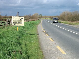
A national secondary road is a category of road in Ireland. These roads form an important part of the national route network but are secondary to the main arterial routes which are classified as national primary roads. National secondary roads are designated with route numbers higher than those used for primary roads, but with the same "N" prefix. Routes N51 and higher are all national secondary roads.

A High-quality dual carriageway (HQDC) is a road category in Ireland. It is defined as an all-purpose dual carriageway road type built to near motorway standards, but without motorway classification or motorway restrictions. High-quality dual carriageways have full grade-separated access and do not have junctions with minor roads. Such roads in the Republic of Ireland have been built as part of the 2000–2006 and 2007–2013 National Development Plans, including interurban routes from Dublin to other cities.

The N62 road is a national secondary road in Ireland. It links the M6 motorway east of Athlone, County Westmeath with junction 6 of the M8 motorway at Kilnoe near Horse and Jockey in County Tipperary, 96.625 kilometres (60.040 mi) to the south. The route also forms a junction with the M7 motorway south of Roscrea.

The N80 road is a national secondary road in Ireland that runs southeastwards from its junction with the N52 and R443 in the town of Tullamore in County Offaly, to the N30 at Ballynahallin, just north of Enniscorthy in County Wexford, a distance of 114.683 km. Total length is 114.683 km (71.261 mi).

The N51 road is a national secondary road in Ireland. West to east, it starts in Delvin, County Westmeath at a junction with the N52. It passes through Athboy, a junction with M3 motorway, Navan and Slane, where it crosses the N2 road, all in County Meath, before crossing the M1 motorway and terminating near Drogheda in County Louth at a roundabout on the R132.

The R420 road is a regional road in Ireland, which runs northwest-southeast from the R446 near Moate in County Westmeath to the R445 just west of Monasterevin. The road travels through the towns of Clara, Tullamore & Portarlington. The route is 35 km (22 mi) long.

Moycashel, previously the barony of Rossaughe, and before that, Delamares country, is a barony in south County Westmeath, in Ireland. It was formed by 1542. It is bordered by three other baronies: Clonlonan to the west, Rathconrath to the north, Moyashel and Magheradernon to the north-east and Fartullagh to the west. The largest population centre is Kilbeggan.

The M6 motorway is a motorway in Ireland, which runs from Dublin to Galway. The M6 extends from its junction with the M4 at Kinnegad all the way west to the outskirts of Galway City, but the Athlone bypass and the approach to Galway city - while of dual carriageway standard - have not been designated motorway and are still signed as N6. The motorway was officially completed and opened to traffic on 18 December 2009, and was the first city-to-city direct major inter-urban route to be completed in Ireland. The M6 and M4, which form the Galway–Dublin route, consist of a grade-separated 2+2 dual carriageway road with a top speed limit of 120 km/h. At approximately 144 km (90 mi), the M6 is the third longest motorway in the state and will be 159 km.

In Ireland, the highest category of road is a motorway, indicated by the prefix M followed by a one- or two-digit number. The motorway network consists entirely of motorway-grade dual carriageways and is largely focused upon Dublin. There are also several three-lane motorways, while Ireland's busiest road, the M50, incorporates four-lane, five-lane, and six-lane stretches.

Delvin is a barony in north-east County Westmeath, in Ireland. It was formed by 1672. It is bordered by County Meath to the east and three other baronies: Fore, Moyashel and Magheradernon and Farbill. The largest centre of population is Delvin.


