Sterling County, Texas | |
|---|---|
| Sterling County Court House off U.S. Highway 87 in Sterling City | |
| Location within the U.S. state of Texas | |
| Coordinates: 31°49′N101°03′W / 31.82°N 101.05°W | |
| Country | |
| State | |
| Founded | 1891 |
| Named for | W. S. Sterling, an early settler |
| Seat | Sterling City |
| Largest city | Sterling City |
| Area | |
• Total | 924 sq mi (2,390 km2) |
| • Land | 923 sq mi (2,390 km2) |
| • Water | 0.1 sq mi (0.26 km2) 0.01% |
| Population (2020) | |
• Total | 1,372 |
• Estimate (2025) | 1,349 |
| • Density | 1.49/sq mi (0.574/km2) |
| Time zone | UTC−6 (Central) |
| • Summer (DST) | UTC−5 (CDT) |
| Congressional district | 11th |
| Website | www |
Sterling County is a county located on the Edwards Plateau in the U.S. state of Texas. As of the 2020 census, its population was 1,372, [1] making it the ninth-least populous county in Texas. Its county seat is Sterling City. [2] The county is named for W. S. Sterling, an early settler in the area. Sterling County was one of 30 prohibition, or entirely dry, counties in the state of Texas, but is now a moist county. [3]
The region was home to the indigenous peoples of the Great Plains including the Comanche, Lipan Apache, Kiowa, and Kickapoo. [4] As ranchers moved in during the 1870s, clashes followed. One deadly fight between area ranchmen and Comanche raiders took place in the 1870s on Lacy Creek, on land now part of the McEntire | Cole Campstool Ranch. W. K. Kellis described it in the Sterling City News-Record as "The Fight at Live Oak Mott," and J. Marvin Hunter later republished the account in Frontier Times.
In 1879, a band of 19 Quahada Comanche under Black Horse left Fort Sill in Indian Territory on May 29 to hunt buffalo. Finding none after a month, they killed a horse on the U Ranch near the headwaters of the Concho River, in Howard County. The Texas Rangers pursued them, and the fight that followed is often described as the last significant battle between the Rangers and the Comanche.
Doyle Phillips disputes the traditional account. In The Comanches' Last Raid Inquiry, he argues that the raiders were probably not Comanche, and possibly Apache, but most likely non-Native horse thieves, and that the raid story covered up the unexplained killing of a Texas Ranger. Phillips also states that several Rangers were dismissed for cowardice after the incident, the first such dismissals in Ranger history. [5]
The area was within the 1842 Fisher–Miller Land Grant, but no settlement resulted. Between 1800 and 1860, Fur traders, Texas Rangers, and federal troops passed through. Camp Elizabeth began as a Ranger camp around 1853 and served as an outpost hospital for Fort Concho from 1874 to 1886. [6]
A few buffalo hunters arrived before the American Civil War. W. S. Sterling settled around 1858, as did fellow hunter S. J. Wiley. [7] Sterling later became a U.S. Marshal in Arizona and was killed in an Apache ambush near Fort Apache. Local legend holds that Frank and Jesse James hid out on Sterling Creek in the 1870s, raising horses and hunting buffalo. [8]
Lasting settlement came after the Civil War, once the buffalo herds were gone and the Native tribes had been forced out of the region. [9]
Texas paid for railroad construction with public land. Under laws dating to the 1850s and carried into the Constitution of 1876, a railroad company surveyed land along its route in blocks of one-square-mile sections, each 640 acres. The company kept the odd-numbered sections, and the even-numbered sections between them went to the state's Permanent School Fund. The company then had 12 years to sell its land, and the result was a checkerboard in which every railroad section was bordered on all four sides by state land.
Cattle outfits, usually the first buyers in an area, bought up the railroad sections. The state sections between them sat unsold and unfenced, so an outfit that owned half the land in a block could graze all of it, moving herds and reaching water without paying anyone. That changed in 1883, when a new homestead law opened the school sections to settlers. As newcomers fenced their land and drought dried up surface water, tensions with the established outfits grew into the Fence Cutting Wars.
In the 1870s, the area was dominated by large land and cattle outfits such as the Half Circle S, established by the Peacock brothers; the MS, set up by Schuster, Henry, and Company; and the "U" Ranch, established by J.D. Earnest and W.J. Holland.
In 1879, Colonel William Randolph McEntire purchased the 80,000-acre (325-km2) "U" Ranch from M.B. Stephenson. Established in 1876 by J.D. Earnest and W.J. Holland, and later sold to M.B. Stephenson in 1879, the "U" Ranch was the first ranch established west of San Angelo in Tom Green County, Texas. The ranch was located about six miles northwest of Sterling City on the North Concho River extending northwestward through Glasscock County to the headwaters of the river in Howard County, the Sterling Creek (headwaters to the mouth of the river) in the east/southeast, the Renderbrook Spade Ranch in Mitchell County in the northeast and J.B. Slaughter's ranch in the northwest. [10] [11] The ranch itself consisted of three headquarters - one on the Concho, one at the mouth of Sterling Creek and one at the headwaters of Sterling Creek - and were twelve to twenty-five miles apart.
After subsequent land acquisitions, the "U" Ranch was enlarged to include over 250,000 acres (1,000 km2) and eventually bordered the Seven-D Ranch in Pecos County in the south/southwest. During the era of the open range, the alternating "odd-numbered" sections of land retained by the State of Texas were freely accessible to the large cattle outfits that owned the "even-numbered" sections of land; therefore, the "U" Ranch controlled an additional 250,000 acres (1,000 km2) of rangeland, bringing the total amount of land owned or controlled by W.R. McEntire's "U" Ranch to roughly 500,000 acres (2,000 km2). During this time, the "U" Ranch grazed upwards of 50,000 head of cattle across five counties, with the cattle being driven to pasturage outside of Texas or to cattle feedlots to increase the animals' weight prior to the final drive to cattle markets in Fort Worth, Kansas City, Chicago, and St. Louis.
Large cattle drives to Colorado City and Fort Worth routinely occurred between 1875 and the mid-1880s, at a time the region was still open rangeland. The "U" Ranch drove the cattle northward to Colorado City, the nearest railroad, and shipped the cattle to Arkansas, Kansas, Nebraska, Wyoming, and Marlow Indian Territory. In 1882, W.R. McEntire, J.B. Wilson, and C.C. Slaughter drove 89 carloads of cattle, mostly overland, to rangeland in Orin Junction, Wyoming that was controlled by the Driskill brothers, who also owned a hotel in Austin, Texas. The cattle weighed 600 to 800 pounds upon arrival and within two years, they weighed almost 1,400 pounds each. By 1888, W.R. McEntire's eldest son, R. Billie McEntire, and his crew were responsible for driving the "U" Ranch cattle to new pasturage outside the state, or often experimenting with various feed types at the feedlots, and subsequently bringing those cattle to the markets as soon as certain market prices were attained. During his last cattle drive in 1893, they began experiencing inclement weather as soon as they left the "U" Ranch towards Colorado City and as they neared the Renderbrook Spade Ranch, a snowy blizzard moved in from the north. R. Billie, knowing the owners, the Snyder brothers, cut the perimeter fence and drove over 1,000 head of cattle southward into the main horse pasture of the Renderbrook Spade Ranch while the McEntire crew weathered the storm at ranch headquarters over several days. With minimal losses after the blizzard, the McEntire crew continued the drive towards Colorado City and the feedlots in Pine Bluff, Arkansas. R. Billie kept the cattle at the feedlots for 10 months waiting for ideal market conditions in Fort Worth. In Arkansas, he married Eudora Fowler and subsequently moved to Dallas to work at American National Bank, which his father, W.R. McEntire, founded and controlled with C.C. Slaughter, the owner of the Lazy S Ranch. R.B. McEntire's younger brother, George, also followed the same path, learning finance at American National Bank in Dallas prior to returning to Sterling County and subsequently either assuming ownership or control of the ranch.
Between 1880 and 1900, W.R. McEntire acquired additional rangeland throughout Glasscock, Howard, Mitchell, Nolan, Sterling, Tom Green, and Reagan Counties, enlarging the "U" Ranch operations to include over 250,000 acres (1,000 km2) with approximately 105,000 acres (420 km2) located in Glasscock and Reagan Counties. The "U" Ranch now extended from 12 miles west of Garden City to Grierson's Spring in Reagan County, included the section of the Goodnight-Loving Trail between the Concho and Pecos Rivers and bordered the Seven-D Ranch in the southwest. Grierson's Spring is located between the head of the Concho River and the Pecos River, about 15 miles southwest of Big Lake in Reagan County and 30 miles east of the Pecos River, while the Seven-D Ranch headquarters was located on Comanche Creek four miles east of Fort Stockton in central Pecos County.
Under the new Homestead Law, settlers began purchasing the “even-numbered” sections from the state for the benefit of the Common School Fund in 1883. In conjunction with the introduction of the fence, these settlers began owning land that was previously controlled by the large cattle outfits, and this eventually led to the Fence Cutting Wars. This acreage was sold by the state on a first-come, first-served basis with the county advertising the availability of land, which resulted in extremely long lines at the county clerks' offices and increased the likelihood that the desired acreage would not be available. As a result of the Common School Fund process, W.R. McEntire, while in Dallas, sent representatives from Tom Green County to acquire as much land as possible and to keep others out of the line until the desired acreage was obtained. North Carolinian James Jefferson Lafayott Glass came to the county in 1883, drawn by his older brother Frank’s stories of cowboy life, and worked herding sheep on Dove Creek near San Angelo and cooking for the Rocking Chair outfit before saving enough to buy a horse and sign on with the Half Circle S. The outfit posted him at a line camp on Lacy Creek, about 17 miles west of Sterling City, and in 1889 he homesteaded that same site, buying his first 640 acres for $1 an acre. The Glass Ranch, which grew to more than 32,000 acres in Sterling and Glasscock counties, was recognized by the Texas Department of Agriculture’s Family Land Heritage Program in 1990. [12] [13] [14]
As the era of the open range began to conclude, W.R. McEntire realized that contiguous acreage would be increasingly important to the success of any cattle outfit, and he began quickly purchasing any available acreage with the prospect of establishing a buffer around the "U" Ranch, or selling or bartering that acquisition for adjoining acreage to his primary operation, either under a single operation and single fence line, or perhaps having access to large, disparate ranches that could provide the ability to easily move livestock between operations. As a reaction to the continued encroachment of squatters and homesteaders from the growing settlement of Sterling City, W.R. McEntire purchased 10,000 acres west of Sterling City in 1884, near the intersection of the Lacy Creek and Concho River.
In 1890, W.R. McEntire sold the 105,000 acres (420 km2) in Glasscock and Reagan Counties, including 3,000 head of cattle and 100 horses, to J.B. Slaughter, which subsequently became the first U Lazy S Ranch. [15] [16] In 1898, J.B. Slaughter sold the acreage and moved his cattle and operations to his new U Lazy S Ranch in Borden and Garza Counties.
In 1896, R. Billie McEntire returned to Sterling County and purchased about 10,000 acres which adjoined the "U" Ranch headquarters and included portions of the Kennedy Ranch, Half Circle S Ranch, and the Peacock-Kellogg Horse Ranch.
The era of the large open-range cattle kings had come to a close by 1890, as settlers buying the state’s even-numbered school sections after 1883, the fencing of land and water, drought, and fence cutting contributed to the bankruptcy of the MS Ranch and Half Circle S Ranch, while the U Ranch consolidated its checkerboard holdings into contiguous acreage by purchasing even-numbered sections, including portions of the former Half Circle S. Of the region’s early large cattle outfits, only the U Ranch survives, through ranches still held by the McEntire family.
In 1906, W. R. McEntire divided his ranching estate between his sons, R. Billie McEntire and George H. McEntire, while his daughter, Lula Elizabeth McEntire, received his non-agricultural property. As of 2026, the ranches descended from the original U Ranch remain owned and operated as separate properties by McEntire’s descendants.
R. Billie McEntire received the Harrison Ranch in Dallas, the N+ Ranch in Sterling County, and cash from the dissolution of McEntire & Co. and investments in the American National Bank in Dallas. That same year, he purchased 10,000 acres in Nolan and Mitchell counties and moved his family to Colorado City, Texas. Around 1915, his four sons—Fowler, James H., W.R. Jr., and R.B. Jr.—formed the McEntire Brothers partnership to manage the family’s ranching operations, which totaled about 20,000 acres split between Sterling County and Nolan/Mitchell counties. The partnership dissolved in 1928 as the brothers took over individual operations. In 1927, R. Billie sold his Sterling County acreage to his sons, with Fowler and James H. later consolidating full ownership.
James H. McEntire established the Campstool Ranch in its current form by 1925, on land originally acquired by his grandfather in 1879/1880. Following James’s death in 1937, his wife, Sudie Rawls McEntire, managed the ranch until 1955, when their daughter, Jamie Sue McEntire Cole, and her husband, Bill James Cole, assumed operations, becoming full owners in 1981. Under Bill Cole’s leadership, the ranch expanded to about 35,000 acres across Crockett, Glasscock, Sterling, and Val Verde counties. In 1963, a sheep feedlot with a 32,000-head capacity was constructed on the ranch, later used primarily for their own livestock. In 1969, the Coles founded Custom Skins, Inc., a San Angelo-based sheepskin tanning company that became a leading domestic and international supplier. By the 1980s, operations expanded into Colorado and California, making the family one of the largest individual producers of sheep and wool in the United States. To support this growth, Cole Trucking was established, operating a dedicated fleet between Texas and California. After selling all livestock in 1989 in anticipation of a market peak, the Coles refocused on Texas, acquiring an additional 40,000 acres between 1989 and 1992. In 2008, they sold a 9,000-acre Sutton County / Schleicher County ranch. Bill Cole was recognized by the Crockett County Soil and Water Conservation District for over 50 years of conservation practices, including brush and wildlife management and erosion control.
George H. McEntire Sr. moved to the U Ranch Headquarters with his wife, Elliott, shortly after their 1906 marriage and managed it for 55 years, at first in partnership with his father under the name McEntire & Son. After his death in January 1962, his children, George H. McEntire Jr. and Virginia McEntire Wilkinson, each inherited 16,233 acres, made up of 4,733 acres from Col. McEntire’s original 9,600-acre tract and 11,500 acres added to the family holdings later. George Jr. continued operating under the U Ranch name, while Virginia and her son, Jack Wilkinson Jr., operated the VJ Ranch.
The county suffered droughts in 1883 and 1886–87. The former ignited fence-cutting wars in the county, and the latter of which bankrupted the Half Circle S ranch. Fence Cutting Wars in Texas lasted for close to five years, 1883–1888. As open range areas gave way to farming homesteaders who fenced their land, cattlemen found it more difficult to feed their herds. In some cases, large land owners also fenced public land as their property. As water and grass became increasingly scarce during droughts, homesteaders and ranch-hands began cutting through fences. Newspapers condemned the fence cutters, and property owners employed their own armed security forces. Texas Governor John Ireland prodded a special assembly to order the fence cutters to cease. In response, the legislature made fence-cutting and pasture-burning crimes punishable with prison time, while at the same time regulating the building of fences. While the practice abated, sporadic incidents of related violence continued through 1888. [17] [18]
The county was established and organized in 1891 from Tom Green County. A competition developed between Sterling City and Cummins for the county seat. Sterling City won, and most of the Cummins population moved to Sterling City by the end of the year. Cummins became a ghost town. [19] County voters in 1898 elected to make Sterling a dry county, prohibiting the sale of alcohol within its boundaries. [3] Sheep ranching was introduced to the area in about 1890. Cotton was first planted in 1889. Sterling City opened its first cotton gin in 1895, with others established later. By 1900, 136 acres (0.55 km2) were planted in cotton, and by 1910, production of the fiber had expanded to 1,626 acres (6.58 km2). Eventually, it became more evident that county lands were most suitable for grazing. The cotton gins eventually failed; by 1920, only 650 acres (2.6 km2) in Sterling County were planted in cotton. Ranching continued to expand in the county. Sterling County experienced a brief boom when the number of farms and ranches in the area increased from 131 in 1920 to 176 by 1925.
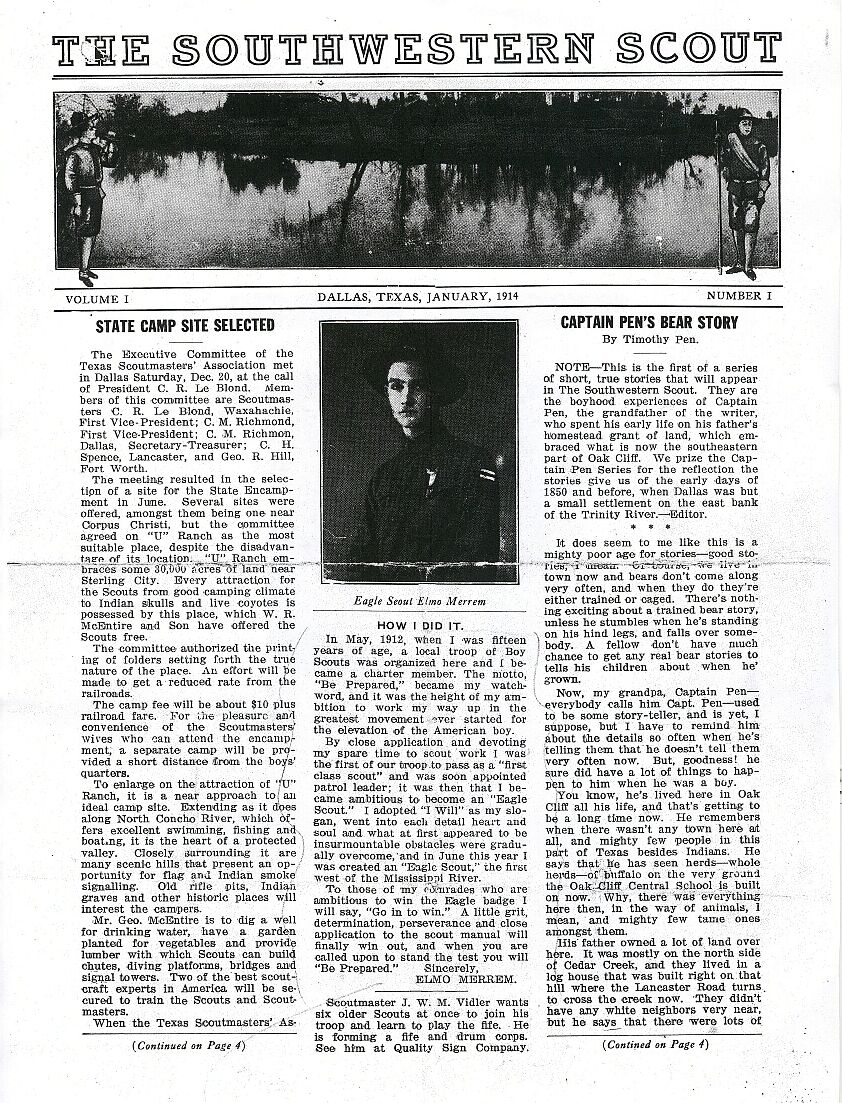
In 1914, Boy Scout State Encampment was hosted by Colonel W.R. McEntire and George McEntire, Sr, on the "U" Ranch. [20] [21]
The county's economy declined during the Great Depression of the 1930s. Oil discovered in Sterling County in 1947 helped to bail out the area's declining economy. By the beginning of 1991, 286,548,000 barrels (45,557,500 m3) of crude had been extracted from within the county. [4]
According to the U.S. Census Bureau, the county has a total area of 924 square miles (2,390 km2), of which 923 square miles (2,390 km2) is land and 0.1 square miles (0.26 km2) (0.01%) is covered by water. [22]
| Census | Pop. | Note | %± |
|---|---|---|---|
| 1900 | 1,127 | — | |
| 1910 | 1,493 | 32.5% | |
| 1920 | 1,053 | −29.5% | |
| 1930 | 1,431 | 35.9% | |
| 1940 | 1,404 | −1.9% | |
| 1950 | 1,282 | −8.7% | |
| 1960 | 1,177 | −8.2% | |
| 1970 | 1,056 | −10.3% | |
| 1980 | 1,206 | 14.2% | |
| 1990 | 1,438 | 19.2% | |
| 2000 | 1,393 | −3.1% | |
| 2010 | 1,143 | −17.9% | |
| 2020 | 1,372 | 20.0% | |
| 2025 (est.) | 1,349 | [23] | −1.7% |
| U.S. Decennial Census [24] 1850–2010 [25] 2010 [26] 2020 [27] | |||
| Race / Ethnicity (NH = Non-Hispanic) | Pop 1980 [28] | Pop 1990 [29] | Pop 2000 [30] | Pop 2010 [26] | Pop 2020 [27] | % 1980 | % 1990 | % 2000 | % 2010 | % 2020 |
|---|---|---|---|---|---|---|---|---|---|---|
| White alone (NH) | 918 | 1,067 | 955 | 733 | 867 | 76.12% | 74.20% | 68.56% | 64.13% | 63.19% |
| Black or African American alone (NH) | 5 | 0 | 1 | 13 | 3 | 0.41% | 0.00% | 0.07% | 1.14% | 0.22% |
| Native American or Alaska Native alone (NH) | 3 | 4 | 3 | 13 | 4 | 0.25% | 0.28% | 0.22% | 1.14% | 0.29% |
| Asian alone (NH) | 0 | 0 | 0 | 0 | 1 | 0.00% | 0.00% | 0.00% | 0.00% | 0.07% |
| Native Hawaiian or Pacific Islander alone (NH) | x [31] | x [32] | 1 | 0 | 2 | x | x | 0.07% | 0.00% | 0.15% |
| Other race alone (NH) | 1 | 1 | 0 | 2 | 2 | 0.08% | 0.07% | 0.00% | 0.17% | 0.15% |
| Mixed race or Multiracial (NH) | x [33] | x [34] | 1 | 17 | 44 | x | x | 0.07% | 1.49% | 3.21% |
| Hispanic or Latino (any race) | 279 | 366 | 432 | 365 | 449 | 23.13% | 25.45% | 31.01% | 31.93% | 32.73% |
| Total | 1,206 | 1,438 | 1,393 | 1,143 | 1,372 | 100.00% | 100.00% | 100.00% | 100.00% | 100.00% |
As of the 2020 census, the county had a population of 1,372. The median age was 40.1 years. 26.0% of residents were under the age of 18 and 19.5% of residents were 65 years of age or older. For every 100 females there were 105.1 males, and for every 100 females age 18 and over there were 102.2 males. [35]
The racial makeup of the county was 77.6% White, 0.2% Black or African American, 0.4% American Indian and Alaska Native, 0.1% Asian, 0.1% Native Hawaiian and Pacific Islander, 8.7% from some other race, and 12.8% from two or more races. Hispanic or Latino residents of any race comprised 32.7% of the population. [36]
Less than 0.1% of residents lived in urban areas, while 100.0% lived in rural areas. [37]
There were 494 households in the county, of which 38.5% had children under the age of 18 living in them. Of all households, 59.5% were married-couple households, 17.6% were households with a male householder and no spouse or partner present, and 18.6% were households with a female householder and no spouse or partner present. About 16.4% of all households were made up of individuals and 9.0% had someone living alone who was 65 years of age or older. [35]
There were 579 housing units, of which 14.7% were vacant. Among occupied housing units, 73.7% were owner-occupied and 26.3% were renter-occupied. The homeowner vacancy rate was 0.3% and the rental vacancy rate was 7.2%. [35]
As of the 2000 census, 1,393 people, 513 households, and 385 families resided in the county. The population density was 2 people per square mile (0.77 people/km2). The 633 housing units averaged 1 units per square mile (0.39 units/km2). The racial makeup of the county was 62.1% White, 1.1% Black, 2.5% from other races, and 34.5% of the population was Hispanic or Latino of any race. [38]
Of the 513 households, 36.80% had children under the age of 18 living with them, 64.10% were married couples living together, 7.00% had a female householder with no husband present, and 24.80% were not families. About 23% of all households were made up of individuals, and 11.30% had someone living alone who was 65 years of age or older. The average household size was 2.67 and the average family size was 3.15.
In the county, the population was distributed as 28.70% under the age of 18, 6.10% from 18 to 24, 29.70% from 25 to 44, 20.80% from 45 to 64, and 14.60% who were 65 years of age or older. The median age was 38 years. For every 100 females, there were 96.50 males. For every 100 females age 18 and over, there were 95.90 males.
The median income for a household in the county was $35,129, and for a family was $37,813. Males had a median income of $28,173 versus $19,615 for females. The per capita income for the county was $16,972. About 13.90% of families and 16.80% of the population were below the poverty line, including 23.30% of those under age 18 and 15.90% of those age 65 or over.
| Year | Republican | Democratic | Third party(ies) | |||
|---|---|---|---|---|---|---|
| No. | % | No. | % | No. | % | |
| 1912 | 4 | 2.22% | 165 | 91.67% | 11 | 6.11% |
| 1916 | 6 | 2.83% | 205 | 96.70% | 1 | 0.47% |
| 1920 | 17 | 9.14% | 152 | 81.72% | 17 | 9.14% |
| 1924 | 25 | 9.29% | 243 | 90.33% | 1 | 0.37% |
| 1928 | 122 | 42.21% | 167 | 57.79% | 0 | 0.00% |
| 1932 | 13 | 3.54% | 354 | 96.46% | 0 | 0.00% |
| 1936 | 14 | 3.52% | 384 | 96.48% | 0 | 0.00% |
| 1940 | 16 | 3.63% | 425 | 96.37% | 0 | 0.00% |
| 1944 | 18 | 5.03% | 330 | 92.18% | 10 | 2.79% |
| 1948 | 17 | 6.34% | 244 | 91.04% | 7 | 2.61% |
| 1952 | 277 | 63.68% | 158 | 36.32% | 0 | 0.00% |
| 1956 | 223 | 59.79% | 150 | 40.21% | 0 | 0.00% |
| 1960 | 182 | 48.53% | 193 | 51.47% | 0 | 0.00% |
| 1964 | 140 | 36.46% | 243 | 63.28% | 1 | 0.26% |
| 1968 | 170 | 45.33% | 151 | 40.27% | 54 | 14.40% |
| 1972 | 286 | 74.67% | 94 | 24.54% | 3 | 0.78% |
| 1976 | 202 | 53.02% | 174 | 45.67% | 5 | 1.31% |
| 1980 | 364 | 62.12% | 218 | 37.20% | 4 | 0.68% |
| 1984 | 577 | 81.27% | 129 | 18.17% | 4 | 0.56% |
| 1988 | 464 | 70.73% | 188 | 28.66% | 4 | 0.61% |
| 1992 | 322 | 50.79% | 127 | 20.03% | 185 | 29.18% |
| 1996 | 394 | 58.89% | 186 | 27.80% | 89 | 13.30% |
| 2000 | 520 | 78.91% | 132 | 20.03% | 7 | 1.06% |
| 2004 | 544 | 88.46% | 71 | 11.54% | 0 | 0.00% |
| 2008 | 520 | 84.01% | 97 | 15.67% | 2 | 0.32% |
| 2012 | 459 | 92.91% | 31 | 6.28% | 4 | 0.81% |
| 2016 | 549 | 86.73% | 70 | 11.06% | 14 | 2.21% |
| 2020 | 584 | 91.39% | 51 | 7.98% | 4 | 0.63% |
| 2024 | 583 | 92.69% | 43 | 6.84% | 3 | 0.48% |
| Year | Republican | Democratic | Third party(ies) | |||
|---|---|---|---|---|---|---|
| No. | % | No. | % | No. | % | |
| 2024 | 553 | 88.62% | 56 | 8.97% | 15 | 2.40% |
| Year | Republican | Democratic | Third party(ies) | |||
|---|---|---|---|---|---|---|
| No. | % | No. | % | No. | % | |
| 2020 | 567 | 91.30% | 47 | 7.57% | 7 | 1.13% |
| Year | Republican | Democratic | Third party(ies) | |||
|---|---|---|---|---|---|---|
| No. | % | No. | % | No. | % | |
| 2022 | 423 | 94.42% | 20 | 4.46% | 5 | 1.12% |
All parts of the county are in the Sterling City Independent School District. [42] Sterling City High School is the district's comprehensive high school.
All of Sterling County is in the service area of Howard County Junior College District. [43]