This is a list of cities that are each surrounded by one other city. A city surrounded by another city or territory is a form of an enclave.
Contents
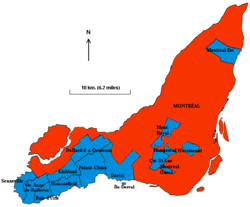
- Canada
- Europe
- Spain
- United Kingdom
- Denmark
- Finland
- Italy
- Bosnia
- Vatican City
- Ukraine
- Asia
- United Arab Emirates
- India
- Taiwan
- Australia
- United States
- Alabama
- Arizona
- Arkansas
- California
- Colorado
- Florida
- Idaho
- Illinois
- Indiana
- Iowa
- Kansas
- Michigan
- Minnesota
- Missouri
- Montana
- Nebraska
- New Jersey
- Ohio
- Oklahoma
- Oregon
- Pennsylvania
- Tennessee
- Texas
- Washington
- Wisconsin
- Japan
- Notes
- References