Big Stone Gap, Virginia

Last updated

Big Stone Gap, Virginia
BSG Main.jpg
Central Big Stone Gap. Little Stone Mountain is visible in the background.
Seal of Big Stone Gap, Virginia.jpg
VAMap-doton-BigStoneGap.PNG
Location in the Commonwealth of Virginia
Coordinates: 36°52′54″N82°44′50″W / 36.88167°N 82.74722°W / 36.88167; -82.74722
CountryUnited States
State Virginia
County Wise
Government
   Mayor Gary Johnson
Area
[1]
  Total5.03 sq mi (13.02 km2)
  Land4.93 sq mi (12.78 km2)
  Water0.09 sq mi (0.24 km2)
Elevation
1,535 ft (468 m)
Population
 (2020)
  Total5,254
  Density1,039.92/sq mi (401.48/km2)
Time zone UTC−5 (EST)
  Summer (DST) UTC−4 (EDT)
ZIP Code
24219
Area code 276 Exchange: 523
FIPS code 51-07480 [2]
GNIS feature ID1496805 [3]
Website bigstonegap.org

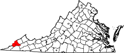
Big Stone Gap is a town in Wise County, Virginia, United States. The town was economically centered around the coal industry for much of its early development. The population was 5,254 at the 2020 census. [4]

Contents

History

The community was formerly known as "Mineral City" and "Three Forks" before officially taking its name in 1888. [5] The "Big Stone Gap" refers to the valley created on the Appalachia Straight, located between the town and Appalachia. The town served as an important center for coal and iron development in the 1880s and 1890s and residents hoped its coal and iron ore deposits would make it "the Pittsburgh of the South." [6]

The Big Stone Gap post office was established in 1856. [7] The Christ Episcopal Church, John Fox, Jr. House, Southwest Virginia Museum Historical State Park, Terrace Park Girl Scout Cabin, June Tolliver House, and C. Bascom Slemp Federal Building are listed on the National Register of Historic Places. [8]

In October 1978, John W. Warner, then the Republican candidate for U.S. Senate from Virginia, and his wife, British-American actress Elizabeth Taylor, stopped in Big Stone Gap to campaign for his upcoming election. At Fraley's Coach House, a local diner where they were each meeting with voters, Taylor choked on a chicken bone in her esophagus and was transported to the nearby Lonesome Pine Regional Hospital. [9] Taylor recovered from the event and later sent a donation to the hospital as a thank you. [10]

In 2014, the American drama romantic comedy film Big Stone Gap , written and directed by Big Stone Gap native Adriana Trigiani and produced by Donna Gigliotti, began filming in the town. The film starred Ashley Judd, Patrick Wilson, Whoopi Goldberg, and others, including local talent for many of the background extras in larger scenes. [11] The movie was based on Trigiani's 2000 novel of the same name and was produced on a $3.5-million budget. The film premiered at the Virginia Film Festival on November 6, 2014 and expanded to a wider release of over 100 theaters in 2015. [12]

Big Stone Gap became the first locality in the nation to pass a resolution in support of the federal Black Lung Disability Trust Fund on August 16, 2018. The measure passed unanimously and urged Congress to support the existing tax rate at the time. [13]

Geography

Big Stone Gap is located at 36°52′02″N82°46′28″W / 36.867165°N 82.774471°W / 36.867165; -82.774471 (36.867165, 82.774471). [14]

According to the United States Census Bureau, the town has a total area of 4.9 square miles (12.6 km2), all of which is land.

Big Stone Gap is at the junction of U.S. Route 23 and U.S. Route 58 Alternate.

Climate

Big Stone Gap has a humid subtropical climate (Köppen climate classification Cfa).

Climate data for Big Stone Gap, Virginia (1991–2020 normals, extremes 1990–present)
MonthJanFebMarAprMayJunJulAugSepOctNovDecYear
Record high °F (°C)75
(24)
76
(24)
84
(29)
88
(31)
91
(33)
100
(38)
102
(39)
96
(36)
97
(36)
91
(33)
83
(28)
75
(24)
102
(39)
Mean daily maximum °F (°C)43.9
(6.6)
48.1
(8.9)
56.9
(13.8)
67.3
(19.6)
74.8
(23.8)
81.4
(27.4)
83.8
(28.8)
83.4
(28.6)
78.8
(26.0)
68.7
(20.4)
57.2
(14.0)
47.5
(8.6)
66.0
(18.9)
Daily mean °F (°C)33.9
(1.1)
37.3
(2.9)
44.7
(7.1)
54.0
(12.2)
62.7
(17.1)
70.2
(21.2)
73.5
(23.1)
72.6
(22.6)
67.2
(19.6)
55.7
(13.2)
44.8
(7.1)
37.3
(2.9)
54.5
(12.5)
Mean daily minimum °F (°C)23.9
(−4.5)
26.4
(−3.1)
32.6
(0.3)
40.8
(4.9)
50.6
(10.3)
59.0
(15.0)
63.2
(17.3)
61.9
(16.6)
55.5
(13.1)
42.6
(5.9)
32.4
(0.2)
27.2
(−2.7)
43.0
(6.1)
Record low °F (°C)−12
(−24)
−17
(−27)
−2
(−19)
19
(−7)
30
(−1)
42
(6)
42
(6)
48
(9)
36
(2)
20
(−7)
11
(−12)
1
(−17)
−17
(−27)
Average precipitation inches (mm)4.87
(124)
4.95
(126)
5.38
(137)
5.03
(128)
5.08
(129)
4.59
(117)
5.49
(139)
4.49
(114)
3.80
(97)
3.14
(80)
3.66
(93)
5.53
(140)
56.01
(1,423)
Average snowfall inches (cm)3.1
(7.9)
2.9
(7.4)
1.3
(3.3)
0.0
(0.0)
0.0
(0.0)
0.0
(0.0)
0.0
(0.0)
0.0
(0.0)
0.0
(0.0)
0.0
(0.0)
0.1
(0.25)
1.8
(4.6)
9.2
(23)
Average precipitation days (≥ 0.01 in)11.711.513.712.113.513.013.511.59.68.410.112.4141.0
Average snowy days (≥ 0.1 in)1.61.30.40.00.00.00.00.00.00.00.10.64.0
Source: NOAA [15] [16]

Demographics

Historical population
CensusPop.Note
1900 1,617
1910 2,59060.2%
1920 3,00916.2%
1930 3,90829.9%
1940 4,33110.8%
1950 5,17319.4%
1960 4,688−9.4%
1970 4,153−11.4%
1980 4,74814.3%
1990 4,7480.0%
2000 4,8562.3%
2010 5,64316.2%
2020 5,254−6.9%
source: [17]

As of the census [2] of 2010, there were 5,643 people, 2,034 households, and 1,075 families residing in the town. The population density was 995.9 people per square mile (384.2/km2). There were 2,197 housing units at an average density of 450.6 per square mile (173.8/km2). The racial makeup of the town was 93.68% White, 4.41% African American, 0.14% Native American, 0.45% Asian, 0.02% Pacific Islander, 0.37% from other races, and 0.93% from two or more races. Hispanic or Latino of any race were 0.60% of the population.

There were 1,995 households, out of which 29.6% had children under the age of 18 living with them, 48.7% were married couples living together, 15.3% had a female householder with no husband present, and 33.2% were non-families. 30.8% of all households were made up of individuals, and 13.8% had someone living alone who was 65 years of age or older. The average household size was 2.34 and the average family size was 2.92.

In the town, the population was spread out, with 23.2% under the age of 18, 9.0% from 18 to 24, 24.9% from 25 to 44, 25.1% from 45 to 64, and 17.9% who were 65 years of age or older. The median age was 40 years. For every 100 females, there were 86.9 males. For every 100 females age 18 and over, there were 80.5 males.

The median income for a household in the town was $21,584, and the median income for a family was $34,306. Males had a median income of $26,707 versus $21,915 for females. The per capita income for the town was $13,284. About 22.4% of families and 25.8% of the population were below the poverty line, including 34.5% of those under age 18 and 15.1% of those age 65 or over.

Education

Public schools

Due to mounting financial burdens caused by a shrinking population and underfunding from the state government, local elected officials voted to consolidate several of the county's schools in 2012, including those in Big Stone Gap. [18]

Union Primary School was formed from the consolidation of Powell Valley Primary School and Appalachia Elementary. A combination of certain grades from Appalachia Elementary and Powell Valley Middle School formed Union Middle School. Finally, Union High School was formed from the consolidation of Appalachia High School and Powell Valley High School. All schools continue to be operated by Wise County Public Schools. [19]

Colleges

Mountain Empire Community College is a public community college for residents in Lee, Wise, Scott, and Dickenson counties, and the City of Norton. The college admitted its first students in 1972 and as of the 2017-18 school year enrolled 3,560 students. [20]

King University, based in Bristol, Tennessee, has a satellite campus in Big Stone Gap located on the Mountain Empire Community College campus.

Museums

Henry Meador Coal Museum Coal Mining Museum.jpg
Henry Meador Coal Museum

Big Stone Gap is home to several museums. The June Tolliver House, located on Jerome Street, is home to the Trail of the Lonesome Pine, the official outdoor drama of Virginia.

Southwest Virginia Museum Southwest Virginia Museum.jpg
Southwest Virginia Museum

The Southwest Virginia Museum Historical State Park is located in the downtown area in the former home of C. Bascom Slemp. Construction of the building was completed in 1895 and purchased by Slemp in 1929. Before his death in 1943, Slemp established the C. Bascom Slemp Foundation and hoped to see the house turned into a museum. In 1946 the state of Virginia acquired the home, and the Slemp Foundation donated the initial collection from Slemp's personal belongings. [21]

Big Stone Gap also hosts the Meador Coal Museum. Meador, to whom the museum is dedicated, collected many of the objects displayed in the museum from his time with the Westmoreland Coal Company during the first half of the 20th century. The museum was dedicated in 1982 after his death. [22]

Federal court

The federal building named for C. Bascom Slemp was built in 1912 and it housed a division of the United States District Court for the Western District of Virginia until the division's closure in 2023.

Wallens Ridge State Prison

Big Stone Gap is home to Wallens Ridge State Prison, a state prison that has been a part of the Commonwealth of Virginia Department of Corrections since 1999. Originally opened as a supermax prison, it has recently been downgraded to a "high level" security facility. Construction and maintenance of the facility generated millions of dollars for the local economy, suppressed from a sagging history of coal mining. [23]

Notable people

Film

Adriana Trigiani, who wrote the script for the movie Big Stone Gap , lobbied to have the 2014 film shot on location. The former gas station that was the setting for Carmine's restaurant in the movie still contains the soda fountain, tables and nostalgic wall posters used during filming. Next to it is the vacant Mutual's Pharmacy, where Ave Marie Mulligan, the movie's main character, worked. [6]

2008 tornado

On March 4, 2008, an EF-1 tornado touched down on Highway 58 and ran through downtown. The tornado caused a 300-yard wide, one-mile long path of damage. It destroyed six homes, caused major damage to 15 homes, and minor damage to 25 others. The tornado hit an area of the town named Poplar Hill.

Related Research Articles

<span class="mw-page-title-main">McDowell County, West Virginia</span> County in West Virginia, United States

McDowell County is a county in the U.S. state of West Virginia. As of the 2020 census, the population was 19,111. Its county seat is Welch. McDowell County is the southernmost county in the state. It was created in 1858 by the Virginia General Assembly and named for Virginia Governor James McDowell. It became a part of West Virginia in 1863, when several Union-affiliated counties seceded from the state of Virginia during the American Civil War. McDowell County is located in the Cumberland Mountains, part of the Appalachia region.

<span class="mw-page-title-main">Boone County, West Virginia</span> County in West Virginia, United States

Boone County is a county in the U.S. state of West Virginia. As of the 2020 census, the population was 21,809. Its county seat is Madison. Boone County is part of the Charleston, WV Metropolitan Statistical Area. Leading industries and chief agricultural products in Boone County include coal, lumber, natural gas, tobacco, and strawberries.

<span class="mw-page-title-main">Wise County, Virginia</span> County in Virginia, United States

Wise County is a county located in the U.S. state of Virginia. The county was formed in 1856 from Lee, Scott, and Russell Counties and named for Henry A. Wise, who was the Governor of Virginia at the time. The county seat is in Wise.

<span class="mw-page-title-main">Lee County, Virginia</span> County in Virginia, United States

Lee County is the westernmost county in the U.S. Commonwealth of Virginia. As of the 2020 census, the population was 22,173. Its county seat is Jonesville.

<span class="mw-page-title-main">Prestonsburg, Kentucky</span> City in Kentucky, United States

Prestonsburg is a small home rule-class city in and the county seat of Floyd County, Kentucky, United States. It is in the eastern part of the state in the valley of the Big Sandy River. The population was 3,255 at the time of the 2010 census, down from 3,612 at the 2000 census.

<span class="mw-page-title-main">Shamokin, Pennsylvania</span> City in Pennsylvania, United States

Shamokin is a city in Northumberland County, Pennsylvania, United States. Surrounded by Coal Township at the western edge of the Anthracite Coal Region in central Pennsylvania's Susquehanna River Valley, the city was named after a Saponi Indian village, Schahamokink. At the 2020 United States census, the population was 6,942.

<span class="mw-page-title-main">Dryden, Virginia</span> Census-designated place in Virginia, United States

Dryden is an unincorporated community and census-designated place (CDP) in Lee County, Virginia, United States. The population was 1,208 at the 2010 census.

<span class="mw-page-title-main">Appalachia, Virginia</span> Town in Virginia, United States

Appalachia is a town in Wise County, Virginia, United States. The population was 1,754 at the 2010 census.

<span class="mw-page-title-main">Pound, Virginia</span> Town in Virginia, United States

Pound is a town in Wise County, Virginia, United States. The population was recorded as 1,037 in the 2010 United States Census.

<span class="mw-page-title-main">Clendenin, West Virginia</span> Town in West Virginia, United States

Clendenin is a town in Kanawha County, West Virginia, United States, situated along the Elk River. The population was 850 at the 2020 census.

<span class="mw-page-title-main">Matewan, West Virginia</span> Town in West Virginia, United States

Matewan is a town in Mingo County, West Virginia, United States at the confluence of the Tug Fork River and Mate Creek. The population was 412 at the 2020 census, down from 499 in 2010. The Norfolk Southern Railway's Pocahontas District passes through the town. It was a key site of the Coal Wars and the location of the Battle of Matewan in 1920.

<span class="mw-page-title-main">Oliver Springs, Tennessee</span> Town in Tennessee, United States

Oliver Springs is a town in Anderson, Morgan, and Roane counties in the U.S. state of Tennessee. Its population was 3,231 at the 2010 census. It is included in the Harriman, Tennessee Micropolitan Statistical Area, which consists of Roane County.

<span class="mw-page-title-main">C. Bascom Slemp</span> American politician

Campbell Bascom Slemp was an American Republican politician. He was a six-time United States congressman from Virginia's 9th congressional district from 1907 to 1923 and served as the presidential secretary to President Calvin Coolidge. As a philanthropist, Slemp set up the "Slemp Foundation", which provides gifts and scholarships to schools and colleges in Southwestern Virginia.

<span class="mw-page-title-main">Campbell Slemp</span> American politician

Campbell Slemp was a farmer and Confederate officer in southwest Virginia who became a Readjuster Democrat after Congressional Reconstruction and served in the Virginia House of Delegates. He eventually joined the Republican Party and won election to the United States House of Representatives from Virginia's 9th congressional district and controlled federal patronage in the Commonwealth from 1903 to 1907. Slemp died unexpectedly at home while in office, after which his son C. Bascom Slemp succeeded to the seat for more than a decade, until being ousted by the rising Byrd Organization.

<span class="mw-page-title-main">Adriana Trigiani</span> American novelist

Adriana Trigiani is an American best-selling author of eighteen books, playwright, television writer/producer, film director/screenwriter/producer, and entrepreneur based in New York City. Trigiani has published a novel a year since 2000.

<span class="mw-page-title-main">Rufus A. Ayers</span> Virginia lawyer/businessman/politician/served as Attorney General of Virginia

Rufus Adolphus Ayers was a Virginia lawyer, businessman, and politician, who served as Attorney General of Virginia.

<span class="mw-page-title-main">Southwest Virginia Museum Historical State Park</span> State park in Virginia, USA

The Southwest Virginia Museum Historical State Park is a Virginia museum, run as a state park, dedicated to preserving the history of the southwestern part of the commonwealth. It is located in Big Stone Gap, in a house built in the 1880s for former Virginia Attorney General, Rufus A. Ayers. It was designed and built by Charles A. Johnson. Construction began in 1888 and was completed in 1895.

<span class="mw-page-title-main">C. Bascom Slemp Federal Building</span> United States historic place

The C. Bascom Slemp Federal Building, also known as the Big Stone Gap Post Office and U.S. Post Office and Courthouse, is a historic courthouse and post office building located in Big Stone Gap, Wise County, Virginia. It was designed by the Office of the Supervising Architect under James Knox Taylor and built between 1911 and 1913. It is a three-story, seven-bay, stone building with a low hipped roof in the Second Renaissance Revival style. The front facade features a three-bay Tuscan order portico consisting of four pairs of coupled, unfluted columns. The building is named for Congressman C. Bascom Slemp.

Stonega is a Census-designated place and coal town located in Wise County, Virginia, United States. It is part of the Big Stone Gap, Virginia micropolitan area. The community was founded in 1895 to provide housing and coking facilities for the Virginia Coal and Iron Company before being leased to the Stonega Coke and Coal Company in 1902. The community was owned and operated as a company town until after World War II. Their post office closed in 2002.

<i>Big Stone Gap</i> (film) 2014 American film

Big Stone Gap is a 2014 American drama romantic comedy film written and directed by Adriana Trigiani and produced by Donna Gigliotti for Altar Identity Studios, a subsidiary of Media Society. Based on Trigiani's 2000 best-selling novel of the same name, the story is set in the actual Virginia town of Big Stone Gap circa 1970s. The film had its world premiere at the Virginia Film Festival on November 6, 2014. The film was released on October 9, 2015, by Picturehouse. The film was released in Blu-Ray by Universal Pictures Home Entertainment on February 2, 2016.

References

  1. "2019 U.S. Gazetteer Files". United States Census Bureau. Retrieved August 7, 2020.
  2. 1 2 "U.S. Census website". United States Census Bureau . Retrieved January 31, 2008.
  3. "US Board on Geographic Names". United States Geological Survey. October 25, 2007. Retrieved January 31, 2008.
  4. "2020 Census Data". United States Census Bureau. Retrieved October 14, 2023.
  5. "Southwest Virginia Museum Historical State Park". Swvamuseum.org. Retrieved January 28, 2019.
  6. 1 2 Hensley, Clayton (July 27, 2014). "Big Stone Gap awaits its time on the big screen". The Knoxville News-Sentinel. Retrieved July 28, 2014.
  7. "Wise County". Jim Forte Postal History. Archived from the original on October 6, 2014. Retrieved September 30, 2014.
  8. "National Register Information System". National Register of Historic Places . National Park Service. July 9, 2010.
  9. Rolfe, Shelley. "From the Archives: In 1978, Elizabeth Taylor choked on a chicken bone in a Virginia restaurant. Read our report at the time". Richmond Times-Dispatch. Retrieved January 28, 2019.
  10. Trigiani, Adraiana. "When Elizabeth Taylor came to Big Stone Gap". Richmond Times-Dispatch. Retrieved January 28, 2019.
  11. "'Big Stone Gap' movie hits Netflix". Bristol Herald Courier . Virginia. Retrieved January 28, 2019.
  12. Harris, Robbie. "Big Stone Gap, the Movie: Love Letter to Southwestern VA Town Goes National". WVTF . Retrieved January 28, 2019.
  13. Young, Terran S. "Gap is leader in taking stand on black lung fund". Coalfield Progress. Retrieved January 28, 2019.
  14. "US Gazetteer files: 2010, 2000, and 1990". United States Census Bureau. February 12, 2011. Retrieved April 23, 2011.
  15. "NowData – NOAA Online Weather Data". National Oceanic and Atmospheric Administration. Retrieved June 28, 2021.
  16. "Station: Big Stone Gap, VA". U.S. Climate Normals 2020: U.S. Monthly Climate Normals (1991-2020). National Oceanic and Atmospheric Administration. Retrieved June 28, 2021.
  17. "Population Finder: Big Stone Gap CDP, Virginia". U.S. Census Bureau. Archived from the original on February 16, 2020. Retrieved November 7, 2011.
  18. "Wise County Board of Supervisors – March 29, 2012 Special Called Meeting". Wisecounty.org. Retrieved January 28, 2019.
  19. Mccown, Debra. "Consolidation of Wise County, Norton city schools takes a step forward". HeraldCourier.com. Retrieved January 28, 2019.
  20. "MECC Enrollment Statistics" (PDF). Mecc.edu. Retrieved January 28, 2019.
  21. "Southwest Virginia Museum Historical State Park". Swvamuseum.org. Retrieved January 28, 2019.
  22. "Big Stone Gap.org: Coal Museum". Bigstonegap.org. Retrieved May 10, 2023.
  23. "Archived copy". Archived from the original on September 4, 2017. Retrieved September 20, 2017.{{cite web}}: CS1 maint: archived copy as title (link)
  24. "Archived copy". Archived from the original on March 12, 2007. Retrieved September 14, 2006.{{cite web}}: CS1 maint: archived copy as title (link)
  25. "Biography by Al Campbell". AllMusic . Retrieved September 3, 2011.