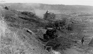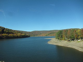
Enfield was a town in Hampshire County, Massachusetts. The town was lost as a result of the creation of the Quabbin Reservoir.

The Quabbin Reservoir is the largest inland body of water in Massachusetts, and was built between 1930 and 1939. Along with the Wachusett Reservoir, it is the primary water supply for Boston, 65 miles (105 km) to the east, and 40 other cities and towns in Greater Boston. The Quabbin also supplies water to three towns west of the reservoir and acts as backup supply for three others. By 1989, it supplied water for 2.5 million people, about 40% of the state's population at the time. It has an aggregate capacity of 412 billion US gallons (1,560 GL) and an area of 38.6 square miles (99.9 km2).

Greenwich was a town in Hampshire County, Massachusetts. The town was lost as a result of the formation of the Quabbin Reservoir in order to supply Boston's growing water needs.
Glenville is an unincorporated community and census-designated place (CDP) in Jackson County, North Carolina, United States. It is now a popular lakeside vacation community with many second homes that sometimes are rented around Lake Glenville, which flooded and destroyed the original town. As of the 2010 census, the year-round population was 110.

The Ashokan Reservoir is a reservoir in Ulster County, New York. It is at the eastern end of the Catskill Park, and is one of several in the region created to provide the City of New York with water. It is the city's deepest reservoir at 190 feet (58 m) near the dam at the former site of Bishop Falls.

Brown's Station was a hamlet in the Esopus Valley of southeastern Ulster County, New York, United States. It was submerged by the waters of the Ashokan Reservoir, an artificial lake built between 1906 and 1915 to supply fresh water to New York City.

The Schoharie Reservoir is a reservoir in the Catskill Mountains of New York State that was created to be one of 19 reservoirs that supplies New York City with water. It was created by impounding Schoharie Creek. Portions of it lie in the towns of Conesville and Gilboa in Schoharie County, Roxbury in Delaware County, and Prattsville in Greene County.

The Pepacton Reservoir, also known as the Downsville Reservoir, is a reservoir in Delaware County, New York on the East Branch of the Delaware River in the Catskill Mountains of New York. Part of the New York City water supply system, it was formed by the construction of Downsville Dam, and impounds over one-quarter of the East Branch's flow.

The Catskill Aqueduct, part of the New York City water supply system, brings water from the Catskill Mountains to Yonkers where it connects to other parts of the system.

The Kensico Reservoir is a reservoir located in the towns of Armonk and Valhalla, New York. The Kensico Reservoir was formed by the old earth and gravel dam, built in 1885, which impounded waters from the Bronx and Byram rivers, and supplied about 18 million gallons daily. The construction of a new masonry dam in 1915, replaced the old dam, and expanded the water supply by bringing water from the Catskill Mountains over a distance of more than 100 miles. It is about 3 miles (5 km) north of downtown White Plains, New York, and about 15 miles (24 km) north of New York City.
The Boyds Corner Reservoir is a small reservoir in Putnam County, New York. It is in the town of Kent, New York, and is about 50 miles north of New York City. It is the northernmost reservoir in the Croton River watershed, but is not part of the New York City water supply system's Croton Watershed. and was formed by impounding the middle of the West Branch of the Croton River, submerging the village of Boyds Corner.

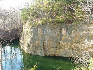
The Blackhand Gorge State Nature Preserve is a 4-mile-long (6.4 km) sandstone formation through which the Licking River flows in Licking County, Ohio, United States. Located 12 miles (19 km) east of Newark near the tiny town of Toboso, 957 acres (387 ha) along the gorge were designated an Ohio Nature Preserve in 1975. The gorge is a capsule of Ohio transportation history, having hosted canal boats, steam railroads, electric interurbans, and automobiles through the years. It is named for the black hand petroglyph that was found on the cliff face by the first settlers to the area. Black Hand Sandstone is a resistant rock that also forms the backbone of the Hocking Hills region.
Isunigu was a Cherokee town on the Keowee River. It was on the west side of the Keowee River, near the mouth of Coneross Creek, in today's Oconee County, South Carolina. Present-day Clemson and Seneca, South Carolina later developed hear here.

Waconda Lake, also known as Glen Elder Reservoir, is a reservoir in Mitchell County and Osborne County, Kansas, United States. Built and managed by the U.S. Bureau of Reclamation for flood control and irrigation, it is also used for recreation. Glen Elder State Park is located on its north shore.
Pactola, also known as Camp Crook, (1875–1950s) is a ghost town in Pennington County, South Dakota, United States. It was an early placer mining town and existed into the early 1950s, when it was submerged under Pactola Lake.


