National Register of Historic Places listings in Mesa County, Colorado

Last updated
Location of Mesa County in Colorado Map of Colorado highlighting Mesa County.svg
Location of Mesa County in Colorado

This is a list of the National Register of Historic Places listings in Mesa County, Colorado.

Contents

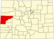
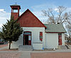
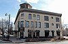
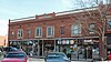
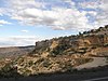
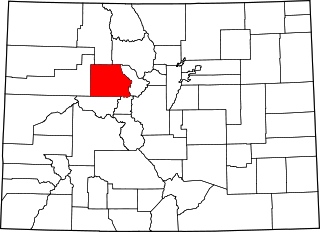
This is intended to be a complete list of the properties and districts on the National Register of Historic Places in Mesa County, Colorado, United States. The locations of National Register properties and districts for which the latitude and longitude coordinates are included below, may be seen in a map. [1]

There are 35 properties and districts listed on the National Register in the county. Another 2 properties were once listed but have been removed.


    This National Park Service list is complete through NPS recent listings posted May 26, 2023. [2]

Contents: Counties in Colorado
Adams - Alamosa - Arapahoe - Archuleta - Baca - Bent - Boulder - Broomfield - Chaffee - Cheyenne - Clear Creek - Conejos - Costilla - Crowley - Custer - Delta - Denver - Dolores - Douglas - Eagle - El Paso - Elbert - Fremont - Garfield - Gilpin - Grand - Gunnison - Hinsdale - Huerfano - Jackson - Jefferson - Kiowa - Kit Carson - La Plata - Lake - Larimer - Las Animas - Lincoln - Logan - Mesa - Mineral - Moffat - Montezuma - Montrose - Morgan - Otero - Ouray - Park - Phillips - Pitkin - Prowers - Pueblo - Rio Blanco - Rio Grande - Routt - Saguache - San Juan - San Miguel - Sedgwick - Summit - Teller - Washington - Weld - Yuma
Map all coordinates using: OpenStreetMap  
Download coordinates as: KML

Current listings

[3] Name on the Register [4] ImageDate listed [5] Location City or townDescription
1 Bloomfield Site January 20, 1983
(#83001324)
Address Restricted
Whitewater
2 Calamity Camp June 1, 2011
(#11000313)
Address Restricted
Gateway Mining Industry in Colorado MPS
3 Cayton Guard Station April 27, 2005
(#05000335)
Forest Service Road 814.1
39°18′20″N107°33′53″W / 39.305614°N 107.564752°W / 39.305614; -107.564752 (Cayton Guard Station)
Silt Log cabin built in 1910 to serve National Forest rangers.
4 Clifton Community Center and Church
Clifton Community Center and Church Clifton Community Center and Church.JPG
Clifton Community Center and Church
June 3, 1982
(#82002307)
F and Front St.
39°05′29″N108°26′57″W / 39.091389°N 108.449167°W / 39.091389; -108.449167 (Clifton Community Center and Church)
Clifton
5 Coates Creek Schoolhouse
Coates Creek Schoolhouse Coates Creek Schoolhouse.JPG
Coates Creek Schoolhouse
February 3, 1993
(#92001839)
D S Rd., 16 miles (26 km) west of Glade Park
38°56′55″N108°58′35″W / 38.948584°N 108.976400°W / 38.948584; -108.976400 (Coates Creek Schoolhouse)
Glade Park One-room schoolhouse.
6 Colorado National Monument Visitor Center Complex
Colorado National Monument Visitor Center Complex Colorado NM visitor center NPS.jpg
Colorado National Monument Visitor Center Complex
July 15, 2003
(#03000647)
Colorado National Monument
39°06′07″N108°43′50″W / 39.101944°N 108.730556°W / 39.101944; -108.730556 (Colorado National Monument Visitor Center Complex)
Fruita
7 Colorado River Bridge
Colorado River Bridge Colorado River Bridge.jpg
Colorado River Bridge
October 15, 2002
(#02001154)
Interstate 70 frontage road at milepost 62.90
39°20′20″N108°11′36″W / 39.338889°N 108.193333°W / 39.338889; -108.193333 (Colorado River Bridge)
De Beque
8 Convicts' Bread Oven
Convicts' Bread Oven Convicts' Bread Oven.JPG
Convicts' Bread Oven
December 31, 1974
(#74000589)
West of Molina on State Highway 65
39°12′02″N108°11′29″W / 39.200556°N 108.191389°W / 39.200556; -108.191389 (Convicts' Bread Oven)
Molina
9 Herbert and Edith Crissey House
Herbert and Edith Crissey House Herbert and Edith Crissey House.JPG
Herbert and Edith Crissey House
May 18, 2003
(#03000402)
218 W. 1st St.
39°06′44″N108°21′07″W / 39.112222°N 108.351944°W / 39.112222; -108.351944 (Herbert and Edith Crissey House)
Palisade
10 Cross Land and Fruit Company Orchards and Ranch
Cross Land and Fruit Company Orchards and Ranch Cross Land and Fruit Company Orchards and Ranch.JPG
Cross Land and Fruit Company Orchards and Ranch
March 28, 1980
(#80000912)
Northeast of Grand Junction at 3079 F Rd.
39°05′28″N108°28′52″W / 39.091111°N 108.481111°W / 39.091111; -108.481111 (Cross Land and Fruit Company Orchards and Ranch)
Grand Junction
11 De Beque House
De Beque House De Beque House.JPG
De Beque House
July 28, 1995
(#95000936)
233 Denver Ave.
39°19′49″N108°13′04″W / 39.330278°N 108.217778°W / 39.330278; -108.217778 (De Beque House)
De Beque
12 Denver and Rio Grande Western Railroad Depot
Denver and Rio Grande Western Railroad Depot Amtrak station in Grand Junction, CO.JPG
Denver and Rio Grande Western Railroad Depot
September 8, 1992
(#92001190)
119 Pitkin Ave.
39°03′51″N108°34′09″W / 39.064167°N 108.569167°W / 39.064167; -108.569167 (Denver and Rio Grande Western Railroad Depot)
Grand Junction
13 Department of Energy Grand Junction Office
Department of Energy Grand Junction Office Department of Energy Grand Junction Office.jpg
Department of Energy Grand Junction Office
July 26, 2016
(#16000470)
2591 Legacy Way
39°02′31″N108°34′21″W / 39.042080°N 108.572517°W / 39.042080; -108.572517 (Department of Energy Grand Junction Office)
Grand Junction
14 Devils Kitchen Picnic Shelter
Devils Kitchen Picnic Shelter Devils Kitchen Picnic Shelter 2012-10-05 12-33-17.jpg
Devils Kitchen Picnic Shelter
April 21, 1994
(#94000309)
Colorado National Monument
39°01′58″N108°37′59″W / 39.032778°N 108.633056°W / 39.032778; -108.633056 (Devils Kitchen Picnic Shelter)
Grand Junction
15 Fruita Bridge
Fruita Bridge Fruita Bridge.JPG
Fruita Bridge
February 4, 1985
(#85000218)
17 1/2 Rd over the Colorado River
39°08′13″N108°43′50″W / 39.136944°N 108.730556°W / 39.136944; -108.730556 (Fruita Bridge)
Fruita
16 Fruita Museum
Fruita Museum Fruita Museum.JPG
Fruita Museum
October 10, 1996
(#96001080)
432 E. Aspen
39°08′59″N108°43′45″W / 39.149722°N 108.729167°W / 39.149722; -108.729167 (Fruita Museum)
Fruita
17 Grand Valley Diversion Dam
Grand Valley Diversion Dam Grand Valley Diversion Dam.JPG
Grand Valley Diversion Dam
October 8, 1991
(#91001485)
Across the Colorado River north of its confluence with Plateau Creek, 8 miles (13 km) northeast of Palisade
39°11′20″N108°16′53″W / 39.188889°N 108.281389°W / 39.188889; -108.281389 (Grand Valley Diversion Dam)
Palisade
18 Handy Chapel
Handy Chapel Handy Chapel.JPG
Handy Chapel
August 19, 1994
(#94001012)
202 White Ave.
39°04′10″N108°34′07″W / 39.069444°N 108.568611°W / 39.069444; -108.568611 (Handy Chapel)
Grand Junction
19 Hotel St. Regis
Hotel St. Regis Hotel St. Regis (Grand Junction, Colorado).JPG
Hotel St. Regis
October 22, 1992
(#92001410)
359 Colorado Ave.
39°03′58″N108°33′56″W / 39.066111°N 108.565556°W / 39.066111; -108.565556 (Hotel St. Regis)
Grand Junction
20 IOOF Hall
IOOF Hall IOOF Hall (De Beque, Colorado).JPG
IOOF Hall
March 25, 1993
(#93000200)
Junction of 4th St. and Curtis Ave.
39°20′00″N108°12′51″W / 39.333333°N 108.214167°W / 39.333333; -108.214167 (IOOF Hall)
De Beque
21 Kettle-Jens House
Kettle-Jens House Kettle-Jens House.JPG
Kettle-Jens House
May 6, 1983
(#83001325)
498 32 Rd.
39°04′37″N108°27′31″W / 39.076944°N 108.458611°W / 39.076944; -108.458611 (Kettle-Jens House)
Clifton
22 Land's End Observatory
Land's End Observatory Land's End Observatory, July 2012.jpg
Land's End Observatory
February 28, 1997
(#97000124)
Land's End Rd., 10 miles (16 km) west of State Highway 65
39°01′30″N108°13′25″W / 39.025°N 108.223611°W / 39.025; -108.223611 (Land's End Observatory)
Whitewater
23 Loma Community Hall
Loma Community Hall Loma Community Hall (Loma, Colorado).jpg
Loma Community Hall
November 22, 1995
(#95001338)
1341 13 Road
39°11′56″N108°48′47″W / 39.198889°N 108.813056°W / 39.198889; -108.813056 (Loma Community Hall)
Loma
24 Margery Building
Margery Building Margery Building.JPG
Margery Building
February 24, 1993
(#93000033)
519-527 Main St.
39°04′02″N108°33′48″W / 39.067222°N 108.563333°W / 39.067222; -108.563333 (Margery Building)
Grand Junction
25 North Seventh Street Historic Residential District
North Seventh Street Historic Residential District North Seventh Street Historic Residential District.JPG
North Seventh Street Historic Residential District
January 5, 1984
(#84000870)
7th St. between Hill and White Aves.
39°04′19″N108°33′37″W / 39.071944°N 108.560278°W / 39.071944; -108.560278 (North Seventh Street Historic Residential District)
Grand Junction
26 Harry and Lilly Phillips House
Harry and Lilly Phillips House Harry and Lilly Phillips House.JPG
Harry and Lilly Phillips House
November 13, 1997
(#97001419)
798 N. Mesa St.
39°10′21″N108°43′58″W / 39.1725°N 108.732778°W / 39.1725; -108.732778 (Harry and Lilly Phillips House)
Fruita
27 Pipe Line School
Pipe Line School Pipe Line School.JPG
Pipe Line School
April 29, 1999
(#99000483)
101 16.5 S Rd.
38°59′50″N108°44′27″W / 38.997222°N 108.740833°W / 38.997222; -108.740833 (Pipe Line School)
Glade Park
28 Rim Rock Drive Historic District
Rim Rock Drive Historic District Rim Rock Drive view.jpg
Rim Rock Drive Historic District
April 21, 1994
(#94000310)
Colorado National Monument
39°03′25″N108°42′04″W / 39.056944°N 108.701111°W / 39.056944; -108.701111 (Rim Rock Drive Historic District)
Grand Junction
29 Saddlehorn Caretaker's House and Garage
Saddlehorn Caretaker's House and Garage Saddlehorn Residence.jpg
Saddlehorn Caretaker's House and Garage
April 21, 1994
(#94000306)
Colorado National Monument
39°06′05″N108°43′59″W / 39.101389°N 108.733056°W / 39.101389; -108.733056 (Saddlehorn Caretaker's House and Garage)
Grand Junction
30 Saddlehorn Comfort Station
Saddlehorn Comfort Station Saddlehorn Comfort Station.jpg
Saddlehorn Comfort Station
April 21, 1994
(#94000305)
Colorado National Monument
39°06′17″N108°44′23″W / 39.104722°N 108.739722°W / 39.104722; -108.739722 (Saddlehorn Comfort Station)
Grand Junction
31 Saddlehorn Utility Area Historic District
Saddlehorn Utility Area Historic District Saddlehorn Warehouse.jpg
Saddlehorn Utility Area Historic District
April 21, 1994
(#94000308)
Colorado National Monument
39°06′05″N108°44′17″W / 39.101389°N 108.738056°W / 39.101389; -108.738056 (Saddlehorn Utility Area Historic District)
Grand Junction
32 Serpents Trail
Serpents Trail Serpent's Trail NPS.jpg
Serpents Trail
April 21, 1994
(#94000307)
Colorado National Monument
39°01′53″N108°38′11″W / 39.031389°N 108.636389°W / 39.031389; -108.636389 (Serpents Trail)
Grand Junction
33 Stranges Grocery
Stranges Grocery Stranges Grocery (Grand Junctio, Colorado).jpg
Stranges Grocery
March 20, 2013
(#13000079)
226 Pitkin Ave.
39°03′53″N108°34′08″W / 39.064748°N 108.568786°W / 39.064748; -108.568786 (Stranges Grocery)
Grand Junction
34 TBM Avenger Aircraft N53503 November 13, 2017
(#100001791)
CAF Rocky Mountain Wing Museum, 780 Heritage Way, Grand Junction Regional Airport
39°07′04″N108°31′31″W / 39.117778°N 108.525278°W / 39.117778; -108.525278 (TBM Avenger Aircraft N53503)
Grand Junction
35 U.S. Post Office
U.S. Post Office U.S. Post Office (Grand Junction, Colorado).JPG
U.S. Post Office
January 31, 1980
(#80000913)
400 Rood Ave.
39°04′07″N108°33′55″W / 39.068611°N 108.565278°W / 39.068611; -108.565278 (U.S. Post Office)
Grand Junction

Former listings

[3] Name on the RegisterImageDate listedDate removedLocationCity or townDescription
1 Black Bridge
Black Bridge OVERALL VIEW OF BRIDGE, LOOKING NORTH FROM SOUTH BANK OF GUNNISON RIVER - Black Bridge, Spanning Gunnison River, Grand Junction, Mesa County, CO HAER COLO,39-GRAJU,2-5.tif
Black Bridge
February 4, 1985
(#85000219)
July 22, 199425 3/10 Rd over the Gunnison River
Grand Junction Damaged by flooding in 1983. Demolished in 1988. [6]
2 Fifth Street Bridge
Fifth Street Bridge OVERALL VIEW AND NORTH PORTAL. VIEW TO SOUTHWEST. - Fifth Street Bridge, U.S. 50 at Colorado River, Grand Junction, Mesa County, CO HAER COLO,39-GRAJU,1-2.tif
Fifth Street Bridge
February 4, 1985
(#85000220)
July 22, 1994Northbound U.S. Highway 50 over the Colorado River
Grand Junction Replaced in 1989. [6]

See also

Related Research Articles

<span class="mw-page-title-main">National Register of Historic Places listings in Jefferson County, Colorado</span> List of National Register of Historic Places in Jefferson County, Colorado, United States

This is a list of the National Register of Historic Places listings in Jefferson County, Colorado.

<span class="mw-page-title-main">National Register of Historic Places listings in Larimer County, Colorado</span> List of National Register of Historic Places in Larimer County, Colorado, United States

This is a list of the National Register of Historic Places listings in Larimer County, Colorado.

<span class="mw-page-title-main">National Register of Historic Places listings in Pueblo County, Colorado</span> List of National Register of Historic Places in Pueblo County, Colorado, United States

This is a list of the National Register of Historic Places listings in Pueblo County, Colorado, USA.

<span class="mw-page-title-main">National Register of Historic Places listings in Clear Creek County, Colorado</span> List of National Register of Historic Places in Clear Creek County, Colorado, United States

This is a list of the National Register of Historic Places listings in Clear Creek County, Colorado.

<span class="mw-page-title-main">National Register of Historic Places listings in Douglas County, Colorado</span> List of National Register of Historic Places in Douglas County, Colorado, United States

This is a list of the National Register of Historic Places listings in Douglas County, Colorado.

<span class="mw-page-title-main">National Register of Historic Places listings in Montezuma County, Colorado</span> List of National Register of Historic Places in Montezuma County, Colorado, United States

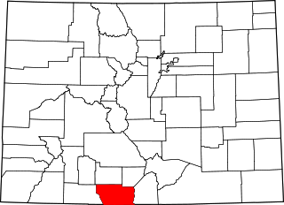
This is a list of the National Register of Historic Places listings in Montezuma County, Colorado.

<span class="mw-page-title-main">National Register of Historic Places listings in Gunnison County, Colorado</span> List of National Register of Historic Places in Gunnison County, Colorado, United States

This is a list of the National Register of Historic Places listings in Gunnison County, Colorado.

<span class="mw-page-title-main">National Register of Historic Places listings in Montrose County, Colorado</span> List of National Register of Historic Places in Montrose County, Colorado, United States

This is a list of the National Register of Historic Places listings in Montrose County, Colorado.

<span class="mw-page-title-main">National Register of Historic Places listings in Arapahoe County, Colorado</span> List of National Register of Historic Places in Arapahoe County, Colorado, United States

This is a list of the National Register of Historic Places listings in Arapahoe County, Colorado.

<span class="mw-page-title-main">National Register of Historic Places listings in Park County, Colorado</span> List of National Register of Historic Places in Park County, Colorado, United States

This is a list of the National Register of Historic Places listings in Park County, Colorado.

<span class="mw-page-title-main">National Register of Historic Places listings in Garfield County, Colorado</span> List of National Register of Historic Places in Garfield County, Colorado, United States

This is a list of the National Register of Historic Places listings in Garfield County, Colorado.

<span class="mw-page-title-main">National Register of Historic Places listings in Adams County, Colorado</span> List of National Register of Historic Places in Adams County, Colorado, United States

This is a list of the National Register of Historic Places listings in Adams County, Colorado.

<span class="mw-page-title-main">National Register of Historic Places listings in Eagle County, Colorado</span> List of National Register of Historic Places in Eagle County, Colorado, United States

This is a list of the National Register of Historic Places listings in Eagle County, Colorado.

<span class="mw-page-title-main">National Register of Historic Places listings in Moffat County, Colorado</span> List of National Register of Historic Places in Moffat County, Colorado, United States

This is a list of the National Register of Historic Places listings in Moffat County, Colorado.

<span class="mw-page-title-main">National Register of Historic Places listings in Rio Blanco County, Colorado</span> List of National Register of Historic Places in Rio Blanco County, Colorado, United States

This is a list of the National Register of Historic Places listings in Rio Blanco County, Colorado.

<span class="mw-page-title-main">National Register of Historic Places listings in Hinsdale County, Colorado</span> List of National Register of Historic Places in Hinsdale County, Colorado, United States

This is a list of the National Register of Historic Places listings in Hinsdale County, Colorado.

<span class="mw-page-title-main">National Register of Historic Places listings in Conejos County, Colorado</span> List of National Register of Historic Places in Conejos County, Colorado, United States

This is a list of the National Register of Historic Places listings in Conejos County, Colorado.

<span class="mw-page-title-main">National Register of Historic Places listings in Lake County, Colorado</span> List of National Register of Historic Places in Lake County, Colorado, United States

This is a list of the National Register of Historic Places listings in Lake County, Colorado.

<span class="mw-page-title-main">National Register of Historic Places listings in San Juan County, Colorado</span> List of National Register of Historic Places in San Juan County, Colorado, United States

This is a list of the National Register of Historic Places listings in San Juan County, Colorado.

<span class="mw-page-title-main">National Register of Historic Places listings in Summit County, Colorado</span> List of National Register of Historic Places in Summit County, Colorado, United States

This is a list of the National Register of Historic Places listings in Summit County, Colorado.

References

  1. The latitude and longitude information provided in this table was derived originally from the National Register Information System, which has been found to be fairly accurate for about 99% of listings. Some locations in this table may have been corrected to current GPS standards.
  2. National Park Service, United States Department of the Interior, "National Register of Historic Places: Weekly List Actions", retrieved May 26, 2023.
  3. 1 2 Numbers represent an alphabetical ordering by significant words. Various colorings, defined here, differentiate National Historic Landmarks and historic districts from other NRHP buildings, structures, sites or objects.
  4. "National Register Information System". National Register of Historic Places . National Park Service. July 9, 2010.
  5. The eight-digit number below each date is the number assigned to each location in the National Register Information System database, which can be viewed by clicking the number.
  6. 1 2 "Colorado Office of Archaeology and Historic Preservation | Properties removed from the National and State Registers". Archived from the original on 2012-08-18. Retrieved 2012-08-17.