National Register of Historic Places listings in Montrose County, Colorado

Last updated

Location of Montrose County in Colorado Map of Colorado highlighting Montrose County.svg
Location of Montrose County in Colorado

This is a list of the National Register of Historic Places listings in Montrose County, Colorado.

Contents

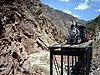
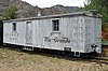
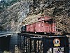
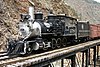
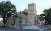
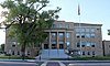
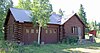
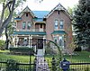
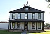
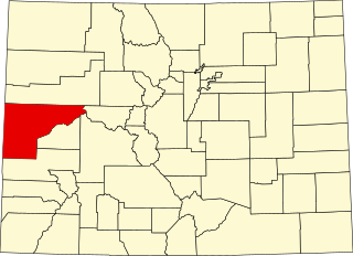
This is intended to be a complete list of the properties and districts on the National Register of Historic Places in Montrose County, Colorado, United States. The locations of National Register properties and districts for which the latitude and longitude coordinates are included below, may be seen in a map. [1]

There are 30 properties and districts listed on the National Register in the county.


    This National Park Service list is complete through NPS recent listings posted March 22, 2024. [2]

Current listings

[3] Name on the Register [4] ImageDate listed [5] Location City or townDescription
1 Benevolent and Protective Order of Elks Lodge
Benevolent and Protective Order of Elks Lodge Benevolent and Protective Order of Elks Lodge (Montrose, Colorado).JPG
Benevolent and Protective Order of Elks Lodge
April 6, 2004
(#04000260)
107 South Cascade Avenue
38°28′43″N107°52′31″W / 38.4786°N 107.8753°W / 38.4786; -107.8753 (Benevolent and Protective Order of Elks Lodge)
Montrose
2 D & RG Narrow Gauge Trestle
D & RG Narrow Gauge Trestle Drgtrestle.JPG
D & RG Narrow Gauge Trestle
June 18, 1976
(#76000172)
Northeast of Cimarron
38°27′02″N107°36′08″W / 38.4506°N 107.60222°W / 38.4506; -107.60222 (D & RG Narrow Gauge Trestle)
Cimarron
3 Denver and Rio Grande Depot
Denver and Rio Grande Depot Denver and Rio Grande Depot - Montrose 2.jpg
Denver and Rio Grande Depot
June 3, 1982
(#82002308)
20 North Rio Grande Avenue
38°28′41″N107°52′45″W / 38.4781°N 107.8792°W / 38.4781; -107.8792 (Denver and Rio Grande Depot)
Montrose
4 Denver & Rio Grande Railroad Box Outfit Car No. 04414
Denver & Rio Grande Railroad Box Outfit Car No. 04414 D&RGW box outfit car 04414.jpg
Denver & Rio Grande Railroad Box Outfit Car No. 04414
July 23, 2009
(#09000568)
82800Q 83rd Road, Cimarron Visitor Center, Curecanti National Recreation Area (CURE)
38°26′31″N107°33′19″W / 38.4419°N 107.5552°W / 38.4419; -107.5552 (Denver & Rio Grande Railroad Box Outfit Car No. 04414)
Cimarron
5 Denver & Rio Grande Western Railroad Boxcar No. 3132
Denver & Rio Grande Western Railroad Boxcar No. 3132 D&RGW boxcar 3132 NPS.jpg
Denver & Rio Grande Western Railroad Boxcar No. 3132
September 2, 2009
(#09000669)
Approximately 1 mile (1.6 km) north by northeast of U.S. Highway 50 at Cimarron, near Morrow Point Dam Road, Curecanti National Recreation Area
38°26′36″N107°33′19″W / 38.4433°N 107.5553°W / 38.4433; -107.5553 (Denver & Rio Grande Western Railroad Boxcar No. 3132)
Cimarron
6 Denver & Rio Grande Western Railroad Caboose No. 0577
Denver & Rio Grande Western Railroad Caboose No. 0577 NarrowGaugeRailroad.JPG
Denver & Rio Grande Western Railroad Caboose No. 0577
April 21, 2009
(#09000222)
Approximately 1 mile (1.6 km) north by northeast of U.S. Highway 50 at Cimarron, adjacent to Morrow Point Dam Road, Curecanti National Recreation Area
38°26′36″N107°33′19″W / 38.4433°N 107.5553°W / 38.4433; -107.5553 (Denver & Rio Grande Western Railroad Caboose No. 0577)
Cimarron
7 Denver & Rio Grande Western Railroad Locomotive No. 278 and Tender
Denver & Rio Grande Western Railroad Locomotive No. 278 and Tender D&RGW loco 278.jpg
Denver & Rio Grande Western Railroad Locomotive No. 278 and Tender
April 21, 2009
(#09000223)

38°26′36″N107°33′19″W / 38.4433°N 107.5553°W / 38.4433; -107.5553 (Denver & Rio Grande Western Railroad Locomotive No. 278 and Tender)
Montrose Was at: "Approximately 1 mile (1.6 km) north by northeast of U.S. Highway 50 at Cimarron, adjacent to Morrow Point Dam Road, Curecanti National Recreation Area"; now at Montrose museum?
8 Denver & Rio Grande Western Railroad Stock Car No. 5620
Denver & Rio Grande Western Railroad Stock Car No. 5620 D&RGW Single Deck Stock Car 5620.JPG
Denver & Rio Grande Western Railroad Stock Car No. 5620
January 27, 2010
(#09001276)
82800Q 83rd Rd. at the Cimarron Visitor Center in the Curecanti National Recreation Area
38°26′36″N107°33′19″W / 38.4433°N 107.5553°W / 38.4433; -107.5553 (Denver & Rio Grande Western Railroad Stock Car No. 5620)
Cimarron
9 Denver & Rio Grande Western Railroad Stock Car No. 5679D
Denver & Rio Grande Western Railroad Stock Car No. 5679D D&RGW Double Deck Stock Car 5679D.JPG
Denver & Rio Grande Western Railroad Stock Car No. 5679D
January 27, 2010
(#09001277)
82800Q 83rd Rd. at the Cimarron Visitor Center in the Curecanti National Recreation Area
38°26′36″N107°33′19″W / 38.4433°N 107.5553°W / 38.4433; -107.5553 (Denver & Rio Grande Western Railroad Stock Car No. 5679D)
Cimarron
10 Dolores River Bridge
Dolores River Bridge Dolores River Bridge.jpg
Dolores River Bridge
October 15, 2002
(#02001150)
State Highway 90 at milepost 15.22
38°18′38″N108°53′09″W / 38.31067°N 108.88577°W / 38.31067; -108.88577 (Dolores River Bridge)
Bedrock Pennsylvania through truss
Dismantled in 2014 [6]
11 Fetz-Keller Ranch Headquarters July 23, 2019
(#100004211)
61789, 61801 CO 90
38°27′01″N107°56′03″W / 38.4504°N 107.9342°W / 38.4504; -107.9342 (Fetz-Keller Ranch Headquarters)
Montrose Boundary increase approved December 3, 2021
12 Gunnison Tunnel
Gunnison Tunnel GunnTunn1909.jpg
Gunnison Tunnel
July 22, 1979
(#79000616)
East of Montrose
38°29′55″N107°40′38″W / 38.4986°N 107.6772°W / 38.4986; -107.6772 (Gunnison Tunnel)
Montrose Irrigation water tunnel, which, at time of completion in 1909, was longest such tunnel in the world
13 Hanging Flume
Hanging Flume Hangingflumewideview.jpg
Hanging Flume
May 15, 1980
(#80000917)
5.7 miles (9.2 km) northwest of Uravan on State Highway 141
38°24′06″N108°47′56″W / 38.4017°N 108.7989°W / 38.4017; -108.7989 (Hanging Flume)
Uravan
14 Henry Huff Cabin August 6, 2019
(#100004228)
Address Restricted
Naturita vicinity
15 Knights of Pythias (KP) Building March 18, 2024
(#100010081)
33 South Cascade Avenue
38°28′44″N107°52′33″W / 38.4789°N 107.8759°W / 38.4789; -107.8759 (Knights of Pythias (KP) Building)
Montrose
16 J. V. Lathrop House
J. V. Lathrop House J.V. Lathrop House.JPG
J. V. Lathrop House
July 8, 1988
(#88001016)
718 Main Street
38°28′55″N107°52′19″W / 38.4819°N 107.8719°W / 38.4819; -107.8719 (J. V. Lathrop House)
Montrose
17 Methodist Episcopal Church of Montrose
Methodist Episcopal Church of Montrose Methodist Episcopal Church of Montrose.JPG
Methodist Episcopal Church of Montrose
November 30, 1999
(#99001407)
19 South Park Avenue
38°28′50″N107°52′24″W / 38.4806°N 107.8733°W / 38.4806; -107.8733 (Methodist Episcopal Church of Montrose)
Montrose
18 Montrose City Hall
Montrose City Hall Montrose City Hall 1.jpg
Montrose City Hall
June 3, 1982
(#82002309)
433 South 1st Street
38°28′45″N107°52′29″W / 38.4792°N 107.8747°W / 38.4792; -107.8747 (Montrose City Hall)
Montrose
19 Montrose County Courthouse
Montrose County Courthouse Montrose County Courthouse (15076304426).jpg
Montrose County Courthouse
February 18, 1994
(#94000040)
320 South 1st Street
38°28′41″N107°52′31″W / 38.4781°N 107.8753°W / 38.4781; -107.8753 (Montrose County Courthouse)
Montrose
20 Montrose Fruit & Produce Association Building
Montrose Fruit & Produce Association Building Montrose Fruit & Produce Association Bldg.jpg
Montrose Fruit & Produce Association Building
July 27, 2020
(#100005380)
39 West Main St.
38°28′37″N107°52′49″W / 38.4769°N 107.8804°W / 38.4769; -107.8804 (Montrose Fruit & Produce Association Building)
Montrose
21 Montrose Masonic Temple, Lodge No. 63
Montrose Masonic Temple, Lodge No. 63 Montrose Masonic Temple, Lodge No. 63.JPG
Montrose Masonic Temple, Lodge No. 63
April 6, 2004
(#04000259)
509513 East Main Street
38°28′51″N107°52′29″W / 38.4808°N 107.8747°W / 38.4808; -107.8747 (Montrose Masonic Temple, Lodge No. 63)
Montrose
22 North Rim Road, Black Canyon of the Gunnison National Park
North Rim Road, Black Canyon of the Gunnison National Park North Rim Road Black Canyon NPS.jpg
North Rim Road, Black Canyon of the Gunnison National Park
September 6, 2005
(#05001181)
Black Canyon of the Gunnison National Park
38°34′23″N107°41′28″W / 38.573056°N 107.691111°W / 38.573056; -107.691111 (North Rim Road, Black Canyon of the Gunnison National Park)
Crawford
23 Rio Grande Southern Railroad Derrick Car
Rio Grande Southern Railroad Derrick Car Rio Grande Southern Railroad Derrick Car.jpg
Rio Grande Southern Railroad Derrick Car
May 10, 2010
(#10000237)
82800Q 83rd Rd, Cimarron Visitor Center, Curecanti National Recreation Area
38°26′36″N107°33′19″W / 38.443333°N 107.555278°W / 38.443333; -107.555278 (Rio Grande Southern Railroad Derrick Car)
Cimarron
24 Shavano Valley Rock Art Site October 12, 2001
(#01001106)
Address Restricted
Boundary increase (listed March 27, 2012, refnum 12000147): Montrose vicinity

Montrose Site of aboriginal art panels. [7]
25 Sherman and Ross Block Building
Sherman and Ross Block Building Sherman and Ross Block Building.JPG
Sherman and Ross Block Building
April 11, 2003
(#03000196)
232236 Main Street
38°28′42″N107°52′38″W / 38.478333°N 107.877222°W / 38.478333; -107.877222 (Sherman and Ross Block Building)
Montrose
26 Silesca Ranger Station
Silesca Ranger Station Silesca Ranger Station.JPG
Silesca Ranger Station
January 12, 2005
(#04001464)
Grand Mesa in the Uncompahgre and Gunnison National Forests
38°19′56″N108°07′29″W / 38.332222°N 108.124722°W / 38.332222; -108.124722 (Silesca Ranger Station)
Grand Mesa
27 Thomas B. Townsend House
Thomas B. Townsend House Thomas B. Townsend House.JPG
Thomas B. Townsend House
September 17, 1980
(#80000916)
222 South 5th Street
38°28′28″N107°52′23″W / 38.474444°N 107.873056°W / 38.474444; -107.873056 (Thomas B. Townsend House)
Montrose
28 US Bureau of Reclamation Project Office Building
US Bureau of Reclamation Project Office Building U.S. Bureau of Reclamation Project Office Building.JPG
US Bureau of Reclamation Project Office Building
November 27, 1991
(#91001685)
601 North Park Avenue
38°29′08″N107°52′43″W / 38.485556°N 107.878611°W / 38.485556; -107.878611 (US Bureau of Reclamation Project Office Building)
Montrose
29 US Post Office-Montrose Main
US Post Office-Montrose Main Montrose Post Office.JPG
US Post Office-Montrose Main
January 22, 1986
(#86000183)
321 South 1st Street
38°28′44″N107°52′36″W / 38.478889°N 107.876667°W / 38.478889; -107.876667 (US Post Office-Montrose Main)
Montrose
30 Ute Memorial Site
Ute Memorial Site Ute Memorial Site.JPG
Ute Memorial Site
February 26, 1970
(#70000167)
2 miles (3.2 km) south of Montrose on U.S. Highway 550
38°26′04″N107°52′02″W / 38.434444°N 107.867222°W / 38.434444; -107.867222 (Ute Memorial Site)
Montrose

See also

Related Research Articles

<span class="mw-page-title-main">National Register of Historic Places listings in El Paso County, Colorado</span> List of National Register of Historic Places in El Paso County, Colorado, United States

This is a list of the National Register of Historic Places listings in El Paso County, Colorado.

<span class="mw-page-title-main">National Register of Historic Places listings in Jefferson County, Colorado</span> List of National Register of Historic Places in Jefferson County, Colorado, United States

This is a list of the National Register of Historic Places listings in Jefferson County, Colorado.

<span class="mw-page-title-main">National Register of Historic Places listings in Pueblo County, Colorado</span> List of National Register of Historic Places in Pueblo County, Colorado, United States

This is a list of the National Register of Historic Places listings in Pueblo County, Colorado, USA.

<span class="mw-page-title-main">National Register of Historic Places listings in Chaffee County, Colorado</span> List of National Register of Historic Places in Chaffee County, Colorado, United States

This is a list of the National Register of Historic Places listings in Chaffee County, Colorado.

<span class="mw-page-title-main">National Register of Historic Places listings in Montezuma County, Colorado</span> List of National Register of Historic Places in Montezuma County, Colorado, United States

This is a list of the National Register of Historic Places listings in Montezuma County, Colorado.

<span class="mw-page-title-main">National Register of Historic Places listings in Mesa County, Colorado</span> List of National Register of Historic Places in Mesa County, Colorado, United States

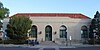
This is a list of the National Register of Historic Places listings in Mesa County, Colorado.

<span class="mw-page-title-main">National Register of Historic Places listings in Fremont County, Colorado</span> List of National Register of Historic Places in Fremont County, Colorado, United States

This is a list of the National Register of Historic Places listings in Fremont County, Colorado.

<span class="mw-page-title-main">National Register of Historic Places listings in Gunnison County, Colorado</span> List of National Register of Historic Places in Gunnison County, Colorado, United States

This is a list of the National Register of Historic Places listings in Gunnison County, Colorado.

<span class="mw-page-title-main">National Register of Historic Places listings in Las Animas County, Colorado</span> List of National Register of Historic Places in Las Animas County, Colorado, United States

This is a list of the National Register of Historic Places listings in Las Animas County, Colorado.

<span class="mw-page-title-main">National Register of Historic Places listings in Park County, Colorado</span> List of National Register of Historic Places in Park County, Colorado, United States

This is a list of the National Register of Historic Places listings in Park County, Colorado.

<span class="mw-page-title-main">National Register of Historic Places listings in Prowers County, Colorado</span> List of National Register of Historic Places in Prowers County, Colorado, United States

This is a list of the National Register of Historic Places listings in Prowers County, Colorado.

<span class="mw-page-title-main">National Register of Historic Places listings in Morgan County, Colorado</span> List of National Register of Historic Places in Morgan County, Colorado, United States

This is a list of the National Register of Historic Places listings in Morgan County, Colorado.

<span class="mw-page-title-main">National Register of Historic Places listings in Alamosa County, Colorado</span>

This is a list of the National Register of Historic Places listings in Alamosa County, Colorado.

<span class="mw-page-title-main">National Register of Historic Places listings in Delta County, Colorado</span> List of National Register of Historic Places in Delta County, Colorado, United States

This is a list of the National Register of Historic Places listings in Delta County, Colorado.

<span class="mw-page-title-main">National Register of Historic Places listings in Moffat County, Colorado</span> List of National Register of Historic Places in Moffat County, Colorado, United States

This is a list of the National Register of Historic Places listings in Moffat County, Colorado.

<span class="mw-page-title-main">National Register of Historic Places listings in Rio Blanco County, Colorado</span> List of National Register of Historic Places in Rio Blanco County, Colorado, United States

This is a list of the National Register of Historic Places listings in Rio Blanco County, Colorado.

<span class="mw-page-title-main">National Register of Historic Places listings in Hinsdale County, Colorado</span> List of National Register of Historic Places in Hinsdale County, Colorado, United States

This is a list of the National Register of Historic Places listings in Hinsdale County, Colorado.

<span class="mw-page-title-main">National Register of Historic Places listings in Teller County, Colorado</span> List of National Register of Historic Places in Teller County, Colorado, United States

This is a list of the National Register of Historic Places listings in Teller County, Colorado.

<span class="mw-page-title-main">National Register of Historic Places listings in Conejos County, Colorado</span> List of National Register of Historic Places in Conejos County, Colorado, United States

This is a list of the National Register of Historic Places listings in Conejos County, Colorado.

<span class="mw-page-title-main">National Register of Historic Places listings in Saguache County, Colorado</span> List of National Register of Historic Places in Saguache County, Colorado, United States

This is a list of the National Register of Historic Places listings in Saguache County, Colorado.

References

  1. The latitude and longitude information provided in this table was derived originally from the National Register Information System, which has been found to be fairly accurate for about 99% of listings. Some locations in this table may have been corrected to current GPS standards.
  2. National Park Service, United States Department of the Interior, "National Register of Historic Places: Weekly List Actions", retrieved March 22, 2024.
  3. Numbers represent an alphabetical ordering by significant words. Various colorings, defined here, differentiate National Historic Landmarks and historic districts from other NRHP buildings, structures, sites or objects.
  4. "National Register Information System". National Register of Historic Places . National Park Service. July 9, 2010.
  5. The eight-digit number below each date is the number assigned to each location in the National Register Information System database, which can be viewed by clicking the number.
  6. "CO 90 Bedrock/Dolores River Bridge - COMPLETED". Colorado Department of Transportation. Retrieved January 5, 2022.
  7. "Shavano Valley Rock Art Site". Colorado Encyclopedia.

38°24′10″N108°16′13″W / 38.4027°N 108.2702°W / 38.4027; -108.2702 (Montrose County, Colorado)