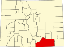
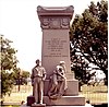
This is intended to be a complete list of the properties and districts on the National Register of Historic Places in Las Animas County, Colorado, United States. The locations of National Register properties and districts for which the latitude and longitude coordinates are included below, may be seen in a map.[1]
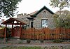
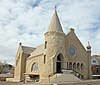
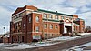
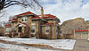
There are 38 properties and districts listed on the National Register in the county, one of which is also a National Historic Landmark. Another 3 properties were once listed but have been removed.
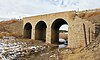
The bridge was disassembled and moved to Pueblo in 1994 or 1995. It is now a pedestrian bridge called Fay's Crossing. It goes over Santa Fe Avenue and carries the Runyon Commuter Trail. The bridge remains on the Colorado State Register of Historic Properties.[9]
This is a list of the National Register of Historic Places listings in Dauphin County, Pennsylvania.
This is a list of the National Register of Historic Places listings in Delaware County, Ohio.
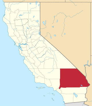
This is a list of the National Register of Historic Places listings in San Bernardino County, California.
This is a list of the National Register of Historic Places listings in Boulder County, Colorado.
This is a list of the National Register of Historic Places listings in El Paso County, Colorado.
This is a list of the National Register of Historic Places listings in Jefferson County, Colorado.
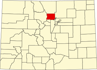
This is a list of the National Register of Historic Places listings in Larimer County, Colorado.
This is a list of the National Register of Historic Places listings in Pueblo County, Colorado, USA.
This is a list of the National Register of Historic Places listings in Weld County, Colorado.
This is a list of the National Register of Historic Places listings in Douglas County, Colorado.
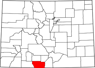
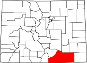
This is a list of the National Register of Historic Places listings in Montezuma County, Colorado.
This is a list of the National Register of Historic Places listings in Grand County, Colorado.
This is a list of the National Register of Historic Places listings in Arapahoe County, Colorado.
This is a list of the National Register of Historic Places listings in Park County, Colorado.
This is a list of the National Register of Historic Places listings in Prowers County, Colorado.
This is a list of the National Register of Historic Places listings in Alamosa County, Colorado.
This is a list of the National Register of Historic Places listings in Adams County, Colorado.
This is a list of the National Register of Historic Places listings in Hinsdale County, Colorado.
This is a list of the National Register of Historic Places listings in Conejos County, Colorado.
This is a complete list of the properties and districts on the National Register of Historic Places in Rocky Mountain National Park, Colorado, United States. The locations of National Register properties and districts for which the latitude and longitude coordinates are included below, may be seen in a map.
References
↑ The latitude and longitude information provided in this table was derived originally from the National Register Information System, which has been found to be fairly accurate for about 99% of listings. Some locations in this table may have been corrected to current GPS standards.
1 2 Numbers represent an alphabetical ordering by significant words. Various colorings, defined here, differentiate National Historic Landmarks and historic districts from other NRHP buildings, structures, sites or objects.
↑ The eight-digit number below each date is the number assigned to each location in the National Register Information System database, which can be viewed by clicking the number.
↑ Location derived from its GNIS feature record; the NRIS lists the site as "Address Restricted".
↑ Location derived from its placement on USGS topographical maps; the NRIS lists the site as "Address Restricted".
This page is based on this Wikipedia article Text is available under the CC BY-SA 4.0 license; additional terms may apply. Images, videos and audio are available under their respective licenses.