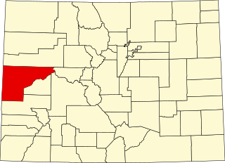
[3] Name on the Register [4] Image Date listed [5] Location City or town Description 1 Ammunition Igloo Ammunition Igloo May 20, 1993 (# 93000379 15001 Denver West Parkway 39°44′33″N 105°10′22″W / 39.7425°N 105.172778°W / 39.7425; -105.172778 (Ammunition Igloo ) Golden 2 Arvada Downtown Arvada Downtown July 15, 1998 (# 98000854 Roughly bounded by Ralston Rd., N. Teller St., Grandview Ave., and N Yukon St. 39°48′04″N 105°04′46″W / 39.801111°N 105.079444°W / 39.801111; -105.079444 (Arvada Downtown ) Arvada 3 Arvada Flour Mill Arvada Flour Mill April 24, 1975 (# 75000521 5580 Wadsworth Boulevard 39°47′54″N 105°04′51″W / 39.798333°N 105.080833°W / 39.798333; -105.080833 (Arvada Flour Mill ) Arvada 4 Astor House Hotel Astor House Hotel March 1, 1973 (# 73000478 822 12th St. 39°45′19″N 105°13′18″W / 39.755278°N 105.221667°W / 39.755278; -105.221667 (Astor House Hotel ) Golden 5 Barnes-Peery House Barnes-Peery House October 12, 2001 (# 01001105 622 Water St. 39°45′29″N 105°13′16″W / 39.758056°N 105.221111°W / 39.758056; -105.221111 (Barnes-Peery House ) Golden 6 James H. Baugh House James H. Baugh House August 14, 2012 (# 12000495 11361 W. 44th Ave. 39°46′43″N 105°07′33″W / 39.778607°N 105.125755°W / 39.778607; -105.125755 (James H. Baugh House ) Wheat Ridge 7 Bear Creek Canyon Scenic Mountain Drive Bear Creek Canyon Scenic Mountain Drive November 15, 1990 (# 90001706 Section of State Highway 74 between Morrison and Idledale 39°39′22″N 105°13′32″W / 39.656111°N 105.225556°W / 39.656111; -105.225556 (Bear Creek Canyon Scenic Mountain Drive ) Morrison 8 Bergen Park Bergen Park November 15, 1990 (# 90001707 State Highway 74 south of Interstate 70 39°41′21″N 105°21′42″W / 39.689167°N 105.361667°W / 39.689167; -105.361667 (Bergen Park ) Evergreen 9 Blue Jay Inn Blue Jay Inn October 1, 1974 (# 74000580 Deckers Rd. (Jefferson CR 126) 39°23′17″N 105°16′23″W / 39.388056°N 105.273056°W / 39.388056; -105.273056 (Blue Jay Inn ) Buffalo Creek 10 Bradford House II Bradford House II February 2, 2001 (# 01000031 North of Killdeer Ln. 39°36′07″N 105°10′19″W / 39.601944°N 105.171944°W / 39.601944; -105.171944 (Bradford House II ) Littleton 11 Bradford House III Archeological Site Upload image April 8, 1980 (# 80000906 On the Ken-Caryl Ranch [6] 39°36′05″N 105°10′35″W / 39.601522338484685°N 105.17632451307063°W / 39.601522338484685; -105.17632451307063 (Bradford House III Archeological Site ) Morrison 12 Robert Boyles Bradford Property Upload image February 2, 2015 (# 14001235 Address restricted 39°35′59″N 105°10′26″W / 39.59983750695969°N 105.173889031689°W / 39.59983750695969; -105.173889031689 (Robert Boyles Bradford Property ) Morrison 13 Brook Forest Inn Brook Forest Inn July 29, 2009 (# 09000567 8136 S. Brook Forest Rd. 39°34′46″N 105°22′56″W / 39.579517°N 105.382108°W / 39.579517; -105.382108 (Brook Forest Inn ) Evergreen 14 Building 710, Defense Civil Preparedness Agency, Region 6 Operations Center Building 710, Defense Civil Preparedness Agency, Region 6 Operations Center March 2, 2000 (# 00000104 Denver Federal Center 39°42′40″N 105°07′13″W / 39.711111°N 105.120278°W / 39.711111; -105.120278 (Building 710, Defense Civil Preparedness Agency, Region 6 Operations Center ) Lakewood 15 Calvary Episcopal Church Calvary Episcopal Church March 3, 1995 (# 95000186 1300 Arapahoe St. 39°45′14″N 105°13′16″W / 39.753889°N 105.221111°W / 39.753889; -105.221111 (Calvary Episcopal Church ) Golden 16 Camp George West Historic District Camp George West Historic District February 11, 1993 (# 92001865 15000 S. Golden Rd. 39°44′12″N 105°10′20″W / 39.736667°N 105.172222°W / 39.736667; -105.172222 (Camp George West Historic District ) Golden 17 Churches Ranch Churches Ranch July 23, 1998 (# 98000883 17999 W. 60th Ave. 39°48′24″N 105°12′20″W / 39.806667°N 105.205556°W / 39.806667; -105.205556 (Churches Ranch ) Arvada 18 Colorado Amphitheater Colorado Amphitheater May 20, 1993 (# 93000378 15001 Denver West Parkway 39°44′36″N 105°10′33″W / 39.743333°N 105.175833°W / 39.743333; -105.175833 (Colorado Amphitheater ) Golden 19 Colorado National Guard Armory Colorado National Guard Armory December 18, 1978 (# 78000860 1301 Arapahoe St. 39°45′13″N 105°13′14″W / 39.753611°N 105.220556°W / 39.753611; -105.220556 (Colorado National Guard Armory ) Golden 20 Colorow Point Park Colorow Point Park November 15, 1990 (# 90001712 900 Colorow Rd. 39°43′55″N 105°14′55″W / 39.731944°N 105.248611°W / 39.731944; -105.248611 (Colorow Point Park ) Golden 21 Conifer Junction Schoolhouse Conifer Junction Schoolhouse February 10, 2014 (# 13001167 26951 Barkley Rd. 39°32′06″N 105°18′28″W / 39.535054°N 105.307914°W / 39.535054; -105.307914 (Conifer Junction Schoolhouse ) Conifer 22 Herman Coors House Herman Coors House October 17, 1997 (# 97001227 1817 Arapahoe St. 39°44′58″N 105°12′58″W / 39.749444°N 105.216111°W / 39.749444; -105.216111 (Herman Coors House ) Golden 23 Corwina Park, O'Fallon Park, Pence Park Corwina Park, O'Fallon Park, Pence Park December 28, 1990 (# 90001708 Roughly the area southeast of Kittredge and the junction of Hwy 74 and Myers Gulch Rds. 39°38′49″N 105°17′13″W / 39.646944°N 105.286944°W / 39.646944; -105.286944 (Corwina Park, O'Fallon Park, Pence Park ) Evergreen 24 Katherine Craig Park Katherine Craig Park June 30, 1995 (# 95000797 Along Interstate 70 /U.S. Highway 40 northwest of Morrison 39°42′42″N 105°17′12″W / 39.711667°N 105.286667°W / 39.711667; -105.286667 (Katherine Craig Park ) Morrison 25 Crown Hill Burial Park Crown Hill Burial Park July 24, 2008 (# 08000708 7777 W. 29th Ave. 39°45′30″N 105°05′34″W / 39.75836°N 105.09269°W / 39.75836; -105.09269 (Crown Hill Burial Park ) Wheat Ridge 26 Davies' Chuck Wagon Diner Davies' Chuck Wagon Diner July 2, 1997 (# 97000619 9495 W. Colfax Ave. 39°44′26″N 105°06′11″W / 39.740556°N 105.103056°W / 39.740556; -105.103056 (Davies' Chuck Wagon Diner ) Lakewood 27 Deaton Sculptured House Deaton Sculptured House February 24, 2004 (# 02000385 24501 Ski Hill Dr. 39°42′02″N 105°16′36″W / 39.700556°N 105.276667°W / 39.700556; -105.276667 (Deaton Sculptured House ) Genesee 28 Dedisse Park Dedisse Park November 15, 1990 (# 90001709 29614 Upper Bear Creek Rd. 39°28′49″N 105°19′42″W / 39.480278°N 105.328333°W / 39.480278; -105.328333 (Dedisse Park ) Evergreen 29 Denver and Intermountain Railroad Interurban No. 25 Denver and Intermountain Railroad Interurban No. 25 January 12, 2012 (# 11001016 W. 6th Ave. & Kipling St. 39°43′38″N 105°06′35″W / 39.727206°N 105.109783°W / 39.727206; -105.109783 (Denver and Intermountain Railroad Interurban No. 25 ) Lakewood 30 Denver and Rio Grande Western Railroad Caboose No. 0578 Denver and Rio Grande Western Railroad Caboose No. 0578 November 4, 2003 (# 02000678 17155 W. 44th Ave. 39°46′17″N 105°11′36″W / 39.771389°N 105.193333°W / 39.771389; -105.193333 (Denver and Rio Grande Western Railroad Caboose No. 0578 ) Golden located at the Colorado Railroad Museum 31 District No. 17 School-Medlen School District No. 17 School-Medlen School April 14, 2015 (# 15000139 South Turkey Creek Road 39°33′41″N 105°13′16″W / 39.5613°N 105.2212°W / 39.5613; -105.2212 (District No. 17 School-Medlen School ) Morrison District school; owned by county historical society. 32 Evergreen Conference District Evergreen Conference District May 1, 1979 (# 79000611 State Highway 74 39°38′13″N 105°18′48″W / 39.636944°N 105.313333°W / 39.636944; -105.313333 (Evergreen Conference District ) Evergreen 33 Everhardt Ranch Upload image May 7, 1980 (# 80000903 Southeast of Evergreen 39°36′06″N 105°16′31″W / 39.601667°N 105.275278°W / 39.601667; -105.275278 (Everhardt Ranch ) Evergreen 34 Fillius Park Fillius Park February 24, 1995 (# 95000108 State Highway 74 northwest of Evergreen 39°41′45″N 105°21′09″W / 39.695833°N 105.3525°W / 39.695833; -105.3525 (Fillius Park ) Evergreen 35 First Presbyterian Church of Golden-Unger House First Presbyterian Church of Golden-Unger House March 14, 1991 (# 91000294 809 15th St. 39°45′09″N 105°13′07″W / 39.7525°N 105.218611°W / 39.7525; -105.218611 (First Presbyterian Church of Golden-Unger House ) Golden 36 The Fort The Fort July 14, 2006 (# 06000585 19192 State Highway 8 39°37′44″N 105°11′31″W / 39.628889°N 105.191944°W / 39.628889; -105.191944 (The Fort ) Morrison Boundary increase approved July 27, 2020. 37 Fruitdale Grade School Fruitdale Grade School March 20, 2013 (# 13000078 10801 W. 44th Ave. 39°46′43″N 105°07′08″W / 39.778661°N 105.118843°W / 39.778661; -105.118843 (Fruitdale Grade School ) Wheat Ridge 38 Genesee Park Genesee Park November 15, 1990 (# 90001710 26771 Genesee Ln. 39°42′53″N 105°18′44″W / 39.714722°N 105.312222°W / 39.714722; -105.312222 (Genesee Park ) Genesee 39 Golden Cemetery Golden Cemetery April 18, 2012 (# 12000200 755 Ulysses St. 39°43′43″N 105°11′49″W / 39.728594°N 105.196829°W / 39.728594; -105.196829 (Golden Cemetery ) Golden 40 Golden High School Golden High School March 14, 1997 (# 97000229 710 10th St. 39°45′30″N 105°13′21″W / 39.758333°N 105.2225°W / 39.758333; -105.2225 (Golden High School ) Golden Old Golden High School is no longer used by the current Golden High School 41 Green Mercantile Store Green Mercantile Store October 1, 1974 (# 74000581 Northwest of Buffalo Creek 39°23′36″N 105°16′38″W / 39.393333°N 105.277222°W / 39.393333; -105.277222 (Green Mercantile Store ) Buffalo Creek 42 Green Mountain Ranch Green Mountain Ranch October 1, 1974 (# 74000582 South of Buffalo Creek on Deckers Rd. 39°17′43″N 105°16′28″W / 39.295278°N 105.274444°W / 39.295278; -105.274444 (Green Mountain Ranch ) Buffalo Creek 43 Hildebrand Ranch Hildebrand Ranch March 13, 1975 (# 75000524 7 miles (11 km) southwest of Littleton off Deer Creek Canyon Rd. 39°33′05″N 105°06′03″W / 39.551389°N 105.100833°W / 39.551389; -105.100833 (Hildebrand Ranch ) Littleton 44 Hill Section, Golden Hill Cemetery Hill Section, Golden Hill Cemetery July 31, 1995 (# 94001230 12000 W. Colfax Ave. 39°44′22″N 105°08′12″W / 39.739444°N 105.136667°W / 39.739444; -105.136667 (Hill Section, Golden Hill Cemetery ) Lakewood 45 Hiwan Homestead Hiwan Homestead April 9, 1974 (# 74000583 Meadow Dr. 39°38′22″N 105°19′21″W / 39.639444°N 105.3225°W / 39.639444; -105.3225 (Hiwan Homestead ) Evergreen 46 Humphrey House Humphrey House December 31, 1974 (# 74000584 620 S. Soda Creek Rd. 39°42′14″N 105°21′53″W / 39.703889°N 105.364722°W / 39.703889; -105.364722 (Humphrey House ) Evergreen 47 Jewish Consumptives' Relief Society Jewish Consumptives' Relief Society June 26, 1980 (# 80000905 6401 W. Colfax Ave. 39°44′37″N 105°04′03″W / 39.743611°N 105.0675°W / 39.743611; -105.0675 (Jewish Consumptives' Relief Society ) Lakewood 48 La Hacienda La Hacienda July 20, 1973 (# 73000477 On State Highway 126 off U.S. Highway 285 39°23′38″N 105°16′16″W / 39.393889°N 105.271111°W / 39.393889; -105.271111 (La Hacienda ) Buffalo Creek 49 Lariat Trail Scenic Mountain Drive Lariat Trail Scenic Mountain Drive November 15, 1990 (# 90001711 Lookout Mountain Rd. south of U.S. Highway 6 to Golden Reservoir 39°44′23″N 105°14′23″W / 39.739722°N 105.239722°W / 39.739722; -105.239722 (Lariat Trail Scenic Mountain Drive ) Golden 50 Little Park Little Park February 24, 1995 (# 95000111 Miller Ln. (State Highway 74 ) southwest of Idledale 39°39′22″N 105°14′45″W / 39.656111°N 105.245833°W / 39.656111; -105.245833 (Little Park ) Idledale 51 LoDaisKa site LoDaisKa site September 25, 2003 (# 03000962 SH 8 At US 285 39°37′39″N 105°11′38″W / 39.6275°N 105.193889°W / 39.6275; -105.193889 (LoDaisKa site ) Morrison 52 Lookout Mountain Park Lookout Mountain Park November 15, 1990 (# 90001713 987½ Lookout Mountain Rd. 39°43′58″N 105°14′28″W / 39.732778°N 105.241111°W / 39.732778; -105.241111 (Lookout Mountain Park ) Golden 53 Lorraine Lodge Lorraine Lodge January 18, 1984 (# 84000858 Southwest of Golden 39°43′35″N 105°14′53″W / 39.726389°N 105.248056°W / 39.726389; -105.248056 (Lorraine Lodge ) Golden 54 Loveland Building and Coors Building Loveland Building and Coors Building May 16, 1996 (# 96000544 1122 and 1120 Washington Ave. 39°45′20″N 105°13′16″W / 39.755556°N 105.221111°W / 39.755556; -105.221111 (Loveland Building and Coors Building ) Golden 55 Magic Mountain site Magic Mountain site August 21, 1980 (# 80000904 Address restricted Golden 56 Midway House Midway House September 18, 1990 (# 90001479 9345 U.S. Highway 285 39°32′47″N 105°16′37″W / 39.546389°N 105.276944°W / 39.546389; -105.276944 (Midway House ) Conifer 57 Morrison Historic District Morrison Historic District September 28, 1976 (# 76000561 State Highway 8 39°39′15″N 105°11′30″W / 39.654167°N 105.191667°W / 39.654167; -105.191667 (Morrison Historic District ) Morrison 58 Morrison Schoolhouse Morrison Schoolhouse September 4, 1974 (# 74000585 226 Spring St. 39°39′07″N 105°11′21″W / 39.651944°N 105.189167°W / 39.651944; -105.189167 (Morrison Schoolhouse ) Morrison 59 Mount Vernon House Mount Vernon House November 20, 1970 (# 70000162 About 1 mile (1.6 km) south of the Golden city limits at the junction of Interstate 70 , State Highway 26 , and Mount Vernon Canyon Rd. 39°41′41″N 105°12′30″W / 39.694722°N 105.208333°W / 39.694722; -105.208333 (Mount Vernon House ) Golden 60 North Fork Historic District North Fork Historic District October 9, 1974 (# 74000586 Both sides of the South Platte River from Pine to South Platte, in the Pike National Forest ; also Longview, Foxton, Argyle and Pine Grove Expansions 39°24′35″N 105°14′57″W / 39.409722°N 105.249167°W / 39.409722; -105.249167 (North Fork Historic District ) Pine and South Platte Second set of boundaries represents a boundary increase of October 8, 2008 61 Office of Civil Defense Emergency Operations Center Office of Civil Defense Emergency Operations Center December 16, 1999 (# 99001541 Denver Federal Center 39°42′56″N 105°07′08″W / 39.715556°N 105.118889°W / 39.715556; -105.118889 (Office of Civil Defense Emergency Operations Center ) Lakewood 62 Peterson House Peterson House September 10, 1981 (# 81000184 7840 W. Ohio Avenue 39°38′24″N 105°07′45″W / 39.64°N 105.129167°W / 39.64; -105.129167 (Peterson House ) Lakewood 63 Pioneer Sod House Pioneer Sod House March 14, 1973 (# 73000479 4610 Robb St. 39°46′51″N 105°07′30″W / 39.780833°N 105.125°W / 39.780833; -105.125 (Pioneer Sod House ) Wheat Ridge 64 Quaintance Block Quaintance Block March 25, 1994 (# 94000261 805 13th St. 39°45′15″N 105°13′13″W / 39.754167°N 105.220278°W / 39.754167; -105.220278 (Quaintance Block ) Golden 65 Queen of Heaven Orphanage Summer Camp Queen of Heaven Orphanage Summer Camp January 14, 2000 (# 99001666 20189 Cabrini Boulevard 39°42′14″N 105°13′39″W / 39.703889°N 105.2275°W / 39.703889; -105.2275 (Queen of Heaven Orphanage Summer Camp ) Golden 66 Red Rocks Park District Red Rocks Park District May 18, 1990 (# 90000725 16351 County Road 93 39°39′41″N 105°12′15″W / 39.661389°N 105.204167°W / 39.661389; -105.204167 (Red Rocks Park District ) Morrison 67 Reno Park Addition Historic District Reno Park Addition Historic District September 29, 1999 (# 99001183 Roughly bounded by Allison St., Ralston Rd., Yukon St., and Reno Dr. 39°47′59″N 105°05′02″W / 39.799722°N 105.083889°W / 39.799722; -105.083889 (Reno Park Addition Historic District ) Arvada 68 Richards Mansion Richards Mansion September 15, 1977 (# 77000379 5349 W. 27th Ave. 39°45′20″N 105°03′25″W / 39.755556°N 105.056944°W / 39.755556; -105.056944 (Richards Mansion ) Wheat Ridge 69 Rio Grande Southern Railroad Engine No. 20 Rio Grande Southern Railroad Engine No. 20 December 14, 2000 (# 00001003 17155 W. 44th Ave. 39°46′20″N 105°11′36″W / 39.772222°N 105.193333°W / 39.772222; -105.193333 (Rio Grande Southern Railroad Engine No. 20 ) Golden located at the Colorado Railroad Museum 70 Rio Grande Southern Railroad, Motor No. 2 Rio Grande Southern Railroad, Motor No. 2 February 14, 1997 (# 97000049 17155 W. 44th Ave. 39°46′17″N 105°11′36″W / 39.771389°N 105.193333°W / 39.771389; -105.193333 (Rio Grande Southern Railroad, Motor No. 2 ) Golden located at the Colorado Railroad Museum 71 Rio Grande Southern Railroad, Motor No. 6 Rio Grande Southern Railroad, Motor No. 6 February 19, 1997 (# 97000050 17155 W. 44th Ave. 39°46′17″N 105°11′36″W / 39.771389°N 105.193333°W / 39.771389; -105.193333 (Rio Grande Southern Railroad, Motor No. 6 ) Golden located at the Colorado Railroad Museum 72 Rio Grande Southern Railroad, Motor No. 7 Rio Grande Southern Railroad, Motor No. 7 February 28, 1997 (# 97000161 17155 W. 44th Ave. 39°46′18″N 105°11′35″W / 39.771667°N 105.193056°W / 39.771667; -105.193056 (Rio Grande Southern Railroad, Motor No. 7 ) Golden located at the Colorado Railroad Museum 73 Rockland Community Church and Cemetery Rockland Community Church and Cemetery August 5, 2009 (# 09000584 24225 Rockland Rd. 39°42′35″N 105°16′23″W / 39.709636°N 105.27295°W / 39.709636; -105.27295 (Rockland Community Church and Cemetery ) Golden 74 Rocky Flats Plant Rocky Flats Plant May 19, 1997 (# 97000377 Approximately 2 miles (3.2 km) southeast of the junction of State Highways 93 and 198 39°53′31″N 105°12′09″W / 39.891944°N 105.2025°W / 39.891944; -105.2025 (Rocky Flats Plant ) Golden 75 Samuel and Albina Romano House Samuel and Albina Romano House September 26, 2016 (# 16000668 16300 S. Golden Rd. 39°44′06″N 105°10′59″W / 39.734872°N 105.182948°W / 39.734872; -105.182948 (Samuel and Albina Romano House ) Golden 76 Rooney Ranch Rooney Ranch February 13, 1975 (# 75000522 South of Golden at the junction of Rooney Rd. and Alameda Parkway 39°41′10″N 105°11′35″W / 39.686111°N 105.193056°W / 39.686111; -105.193056 (Rooney Ranch ) Golden 77 Russell-Graves House Russell-Graves House May 9, 1983 (# 83001296 5605 Yukon St. 39°47′59″N 105°04′56″W / 39.799722°N 105.082222°W / 39.799722; -105.082222 (Russell-Graves House ) Arvada 78 Schnell Farm Schnell Farm February 14, 1997 (# 97000048 3113 S. Wadsworth Boulevard 39°39′37″N 105°04′59″W / 39.660278°N 105.083056°W / 39.660278; -105.083056 (Schnell Farm ) Lakewood 79 John C. Shaffer Barn John C. Shaffer Barn July 12, 2019 (# 100004188 14422 W. Ken Caryl Ave. 39°35′05″N 105°09′36″W / 39.5848°N 105.1599°W / 39.5848; -105.1599 (John C. Shaffer Barn ) Littleton vicinity 80 South Ranch Upload image April 18, 2003 (# 03000227 Address restricted Lakewood 81 Starbuck Park Starbuck Park June 30, 1995 (# 95000796 State Highway 74 through Bear Creek Canyon, south of Idledale 39°39′47″N 105°14′23″W / 39.663056°N 105.239722°W / 39.663056; -105.239722 (Starbuck Park ) Idledale 82 Staunton Ranch-Rural Historic Landscape Upload image December 4, 2012 (# 12000991 11559 Upper Ranch Dr. 39°30′17″N 105°23′24″W / 39.504628°N 105.389948°W / 39.504628; -105.389948 (Staunton Ranch-Rural Historic Landscape ) Pine Extends into Park County 83 Stocke-Walter Addition Historic District Stocke-Walter Addition Historic District September 24, 1999 (# 99001182 Roughly along Saulsbury St., Ralston Rd., Grandview Ave., and Reed St. 39°48′02″N 105°04′26″W / 39.800556°N 105.073889°W / 39.800556; -105.073889 (Stocke-Walter Addition Historic District ) Arvada 84 Stone House Stone House May 1, 1975 (# 75000523 West Yale Avenue and South Estes Street 39°39′56″N 105°05′36″W / 39.665556°N 105.093333°W / 39.665556; -105.093333 (Stone House ) Lakewood 85 Thiede Ranch Upload image January 11, 1996 (# 95001509 22258 Shingle Creek Rd. 39°41′50″N 105°14′54″W / 39.697222°N 105.248333°W / 39.697222; -105.248333 (Thiede Ranch ) Golden 86 Tower of Memories Tower of Memories September 25, 1987 (# 87001725 8500 W. 29th Ave. 39°45′30″N 105°05′32″W / 39.758333°N 105.092222°W / 39.758333; -105.092222 (Tower of Memories ) Wheat Ridge 87 Twelfth Street Historic Residential District Twelfth Street Historic Residential District September 22, 1983 (# 83001321 Roughly bounded by 11th, 13th, Elm, and Arapahoe Sts. 39°45′13″N 105°13′25″W / 39.753611°N 105.223611°W / 39.753611; -105.223611 (Twelfth Street Historic Residential District ) Golden