California Historical Landmarks in El Dorado County

Last updated

This list includes properties and districts listed on the California Historical Landmark listing in El Dorado County, California. Click the "Map of all coordinates" link to the right to view a Google map of all properties and districts with latitude and longitude coordinates in the table below.

Image [1] Landmark nameLocationCity or townSummary
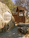
Coloma Road-Coloma Marshall Gold Discovery State Park Main Entrance - panoramio.jpg
Coloma Road-Coloma
748 Coloma Road-Coloma Marshall Gold Discovery State Historic Park
38°48′08″N120°53′34″W / 38.802317°N 120.892767°W / 38.802317; -120.892767 (Coloma Road-Coloma)
Coloma
Small upload photo button.png
Upload Photo
747 Coloma Road-Rescue 4222 Green Valley Rd at Rescue Junction General Store
38°42′40″N120°57′07″W / 38.711167°N 120.952°W / 38.711167; -120.952 (Coloma Road-Rescue)
Rescue
Condemned Bar Folsom Lake 626 - panoramio.jpg
Condemned Bar
572 Condemned Bar Folsom Lake State Recreation Area
Folsom
Small upload photo button.png
Upload Photo
487 Diamond Springs Hwy 49 and China Garden Rd.
38°41′41″N120°48′54″W / 38.694722°N 120.815°W / 38.694722; -120.815 (Diamond Springs)
Diamond Springs
Small upload photo button.png
Upload Photo
486 El Dorado Pleasant Valley Rd & Church St.
38°40′58″N120°50′52″W / 38.682778°N 120.847778°W / 38.682778; -120.847778 (El Dorado)
El Dorado
El Dorado-Nevada House (Mud Springs) - Overland Pony Express Route in California The Overland Pony Express.jpg
El Dorado-Nevada House (Mud Springs) - Overland Pony Express Route in California
700 El Dorado-Nevada House (Mud Springs) - Overland Pony Express Route in California Pleasant Valley Rd. near Church St.
El Dorado
Friday's Station - Overland Pony Express Route in California The Overland Pony Express.jpg
Friday's Station - Overland Pony Express Route in California
728 Friday's Station - Overland Pony Express Route in California Stateline, Hwy 50
38°57′51″N119°56′21″W / 38.964067°N 119.93905°W / 38.964067; -119.93905 (Friday's Station - Overland Pony Express Route in California)
Friday's Station
Small upload photo button.png
Upload Photo
484 Georgetown Georgetown Fire Station
38°54′24″N120°50′20″W / 38.906617°N 120.838933°W / 38.906617; -120.838933 (Georgetown)
Georgetown
Gold discovery site Sutters mill.JPG
Gold discovery site
530 Gold discovery site Marshall Gold Discovery State Historic Park
38°48′00″N120°53′48″W / 38.8°N 120.896667°W / 38.8; -120.896667 (Gold discovery site)
Coloma
Small upload photo button.png
Upload Photo
521 Greenwood State Hwy 193 and Greenwood St.
38°53′48″N120°54′46″W / 38.896667°N 120.912778°W / 38.896667; -120.912778 (Greenwood)
Greenwood
Hangman's Tree Hangman's Tree historic site,) Placerville in California's Sierra Nevada Mountains LCCN2013630994.tif
Hangman's Tree
141 Hangman's Tree 305 Main St.
38°43′42″N120°48′09″W / 38.728283°N 120.80245°W / 38.728283; -120.80245 (Hangman's Tree)
Placerville
Small upload photo button.png
Upload Photo
319 Marshall's Blacksmith Shop State Hwy 193
Kelsey On private property
Marshall Monument Marshall Gold Discovery State Park Main Entrance - panoramio.jpg
Marshall Monument
143 Marshall Monument Marshall Gold Discovery State Historic Park
38°47′48″N120°53′40″W / 38.796567°N 120.894583°W / 38.796567; -120.894583 (Marshall Monument)
Coloma
Small upload photo button.png
Upload Photo
767 Methodist Episcopal Church 1031 Thompson Way
38°43′40″N120°47′40″W / 38.7278°N 120.79445°W / 38.7278; -120.79445 (Methodist Episcopal Church)
Placerville
Moore's (Riverton) - Overland Pony Express Route in California Moore's Monument.JPG
Moore's (Riverton) - Overland Pony Express Route in California
705 Moore's (Riverton) - Overland Pony Express Route in California U.S. Hwy 50 and Ice House Rd.
38°46′16″N120°26′57″W / 38.771183°N 120.449133°W / 38.771183; -120.449133 (Moore's (Riverton) - Overland Pony Express Route in California)
Kyburz
Mormon Island California Historic Places ID 703-4.jpg
Mormon Island
569 Mormon Island Folsom Lake State Recreation Area
38°42′13″N121°07′03″W / 38.7035°N 121.1174°W / 38.7035; -121.1174 (Mormon Island)
Folsom
Mormon Tavern - Overland Pony Express Route in California The Overland Pony Express.jpg
Mormon Tavern - Overland Pony Express Route in California
699 Mormon Tavern - Overland Pony Express Route in California
38°39′22″N121°03′35″W / 38.6561°N 121.05975°W / 38.6561; -121.05975 (Mormon Tavern - Overland Pony Express Route in California)
El Dorado Hills
Mountain Quarries Railroad Bridge Mountain Quarries Bridge 2012-09-16 16-32-00.jpg
Mountain Quarries Railroad Bridge
1051 Mountain Quarries Railroad Bridge
38°54′46″N121°02′25″W / 38.9128°N 121.0403°W / 38.9128; -121.0403 (Mountain Quarries Railroad Bridge)
Auburn, California
Negro Hill Folsom Lake 626 - panoramio.jpg
Negro Hill
570 Negro Hill Folsom Lake State Recreation Area
Folsom
Small upload photo button.png
Upload Photo
475 Old Dry Higgins-Old Hangtown Bedford and Main St.
38°43′47″N120°47′57″W / 38.729717°N 120.799083°W / 38.729717; -120.799083 (Old Dry Higgins-Old Hangtown)
Placerville
Placerville - Overland Pony Express Route in California The Overland Pony Express.jpg
Placerville - Overland Pony Express Route in California
701 Placerville - Overland Pony Express Route in California Main St. & Sacramento St.
38°43′40″N120°48′12″W / 38.727883°N 120.803283°W / 38.727883; -120.803283 (Placerville - Overland Pony Express Route in California)
Placerville
Pleasant Grove House - Overland Pony Express Route in California The Overland Pony Express.jpg
Pleasant Grove House - Overland Pony Express Route in California
703 Pleasant Grove House - Overland Pony Express Route in California Green Valley Rd.
38°41′53″N121°01′14″W / 38.697917°N 121.020667°W / 38.697917; -121.020667 (Pleasant Grove House - Overland Pony Express Route in California)
Rescue
Salmon Falls Salmon Falls Foundation.jpg
Salmon Falls
571 Salmon Falls Folsom Lake State Recreation Area
38°45′29″N121°03′30″W / 38.758056°N 121.058333°W / 38.758056; -121.058333 (Salmon Falls)
Folsom
Small upload photo button.png
Upload Photo
456 Shingle Springs Historic district
38°39′57″N120°55′34″W / 38.665833°N 120.926111°W / 38.665833; -120.926111 (Shingle Springs)
Shingle Springs
Small upload photo button.png
Upload Photo
551 Site of California's First Grange Hall State Hwy 49
38°50′38″N121°00′54″W / 38.843922°N 121.014983°W / 38.843922; -121.014983 (Site of California's First Grange Hall)
Pilot Hill
Sportsman's Hall - Overland Pony Express Route in California The Overland Pony Express.jpg
Sportsman's Hall - Overland Pony Express Route in California
704 Sportsman's Hall - Overland Pony Express Route in California 5622 Old Pony Express Trail
38°45′00″N120°36′41″W / 38.7501°N 120.61125°W / 38.7501; -120.61125 (Sportsman's Hall - Overland Pony Express Route in California)
Cedar Grove
Strawberry Valley House - Overland Pony Express Route in California The Overland Pony Express.jpg
Strawberry Valley House - Overland Pony Express Route in California
707 Strawberry Valley House - Overland Pony Express Route in California Hwy 50
38°47′44″N120°08′54″W / 38.795417°N 120.148333°W / 38.795417; -120.148333 (Strawberry Valley House - Overland Pony Express Route in California)
Strawberry
Small upload photo button.png
Upload Photo
142 Studebaker's Shop 543 Main St.
38°43′46″N120°47′51″W / 38.729417°N 120.7975°W / 38.729417; -120.7975 (Studebaker's Shop)
Placerville
Wakamatsu Tea and Silk Farm Colony Site of Wakamatsu Tea and Silk Farm Colony December 2013.jpg
Wakamatsu Tea and Silk Farm Colony
815 Wakamatsu Tea and Silk Farm Colony Gold Trails Elementary School, 889 Cold Springs Rd.
Gold Hill
Yank's Station - Overland Pony Express Route in California The Overland Pony Express.jpg
Yank's Station - Overland Pony Express Route in California
708 Yank's Station - Overland Pony Express Route in California Yank's Station shopping center
38°51′22″N120°00′47″W / 38.856111°N 120.013056°W / 38.856111; -120.013056 (Yank's Station - Overland Pony Express Route in California)
Meyers
Site of Echo Summit US 50 from Echo Summit towards Lake Tahoe.jpg
Site of Echo Summit
1048 Site of Echo Summit Just off of Hwy 50, in the entrance to the parking lot for Adventure Mountain recreation area.
38°48′51″N120°02′03″W / 38.814295°N 120.034209°W / 38.814295; -120.034209 (Site of Echo Summit)
Echo Summit

Related Research Articles

<span class="mw-page-title-main">National Register of Historic Places listings in San Diego County, California</span>

This is a list of the National Register of Historic Places listings in San Diego County, California.
<span class="mw-page-title-main">National Register of Historic Places listings in Ventura County, California</span>

This is a list of the National Register of Historic Places listings in Ventura County, California.

<span class="mw-page-title-main">National Register of Historic Places listings in Humboldt County, California</span>

This is a list of the National Register of Historic Places listings in Humboldt County, California.

<span class="mw-page-title-main">National Register of Historic Places listings in Riverside County, California</span>

This is a list of the National Register of Historic Places listings in Riverside County, California.
<span class="mw-page-title-main">National Register of Historic Places listings in San Joaquin County, California</span>

This is a list of the National Register of Historic Places listings in San Joaquin County, California.

<span class="mw-page-title-main">National Register of Historic Places listings in Tulare County, California</span>

This is a list of the National Register of Historic Places listings in Tulare County, California.
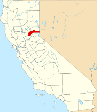
<span class="mw-page-title-main">National Register of Historic Places listings in Nevada County, California</span>

This is a list of the National Register of Historic Places listings in Nevada County, California.

<span class="mw-page-title-main">National Register of Historic Places listings in Shasta County, California</span>

This is a list of the National Register of Historic Places listings in Shasta County, California.
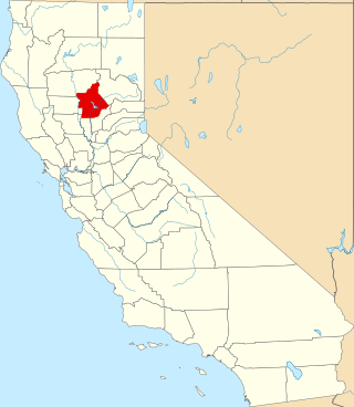
<span class="mw-page-title-main">National Register of Historic Places listings in Butte County, California</span>

This is a list of the National Register of Historic Places listings in Butte County, California.

<span class="mw-page-title-main">National Register of Historic Places listings in Mono County, California</span>

This is a list of the National Register of Historic Places listings in Mono County, California.

<span class="mw-page-title-main">National Register of Historic Places listings in Plumas County, California</span>

This is a list of the National Register of Historic Places listings in Plumas County, California.

<span class="mw-page-title-main">National Register of Historic Places listings in Amador County, California</span>

This is a list of the National Register of Historic Places listings in Amador County, California.
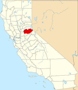
<span class="mw-page-title-main">National Register of Historic Places listings in El Dorado County, California</span>

This is a list of the National Register of Historic Places listings in El Dorado County, California.

<span class="mw-page-title-main">National Register of Historic Places listings in Inyo County, California</span>

This is a list of the National Register of Historic Places listings in Inyo County, California.

<span class="mw-page-title-main">National Register of Historic Places listings in Merced County, California</span>

This is a list of the National Register of Historic Places listings in Merced County, California.

List table of the properties and districts — listed on the California Historical Landmarks — within Calaveras County, California.

Properties and districts listed as California Historical Landmarks within Kern County.

List table of the properties and districts — listed on the California Historical Landmarks in Los Angeles County, Southern California.

List table of the properties and districts — listed on the California Historical Landmarks — within San Bernardino County, Southern California.

References

  1. "California Historical Landmarks By County". Ohp.parks.ca.gov. Retrieved 2019-04-03.

See also