Charsadda چارسده | |
|---|---|
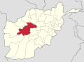
 Charsadda Location within Afghanistan | |
| Coordinates: 34°54′56″N65°17′17″E / 34.9156°N 65.2881°E | |
| Country | |
| Province | Ghor |
| Center | Qale-Zobayd |
| Elevation | 2,100 m (6,900 ft) |
| Population (2012) [1] | |
• Total | 26,600 |
Charsada (Chahar Sada) District is a District of Ghor Province, Afghanistan. [1] It was created from the northwestern part of Chaghcharan District in 2005. The district center is Qale-Zobayd. The population is 26,600.