California Historical Landmarks in Modoc County

Last updated
Map all coordinates using: OpenStreetMap

This list includes properties and districts listed on the California Historical Landmark listing in Modoc County, California. Click the "Map of all coordinates" link to the right to view a Google map of all properties and districts with latitude and longitude coordinates in the table below.

Image [1] Landmark nameLocationCity or townSummary
Battle of Land's Ranch Tule Lake Basin.jpg
Battle of Land's Ranch
108 Battle of Land's Ranch State Hwy. 139, 0.1 mi. S. of jct. with Old Alturas Hwy. (Co. Rd. 114)
41°50′32″N121°18′30″W / 41.8421888888889°N 121.308425°W / 41.8421888888889; -121.308425 (Battle of Land's Ranch)
Bloody Point The Modocs in Their Stronghold.jpg
Bloody Point
8 Bloody Point 2.9 mi. S. of Oregon border on Old Alturas Hwy. (Co. Rd. 114), then 0.7 mi. W. on Co. Rd. 104 at J Canal crossing
41°57′25″N121°21′17″W / 41.9568138888889°N 121.354752777778°W / 41.9568138888889; -121.354752777778 (Bloody Point)
Bonner Grade Wall Canyon Wilderness Study Area NV.jpg
Bonner Grade
15 Bonner Grade Cedar Pass, 6.2 mi. W. of Cedarville on State Hwy. 299
41°33′38″N120°16′06″W / 41.5605138888889°N 120.268263888889°W / 41.5605138888889; -120.268263888889 (Bonner Grade)
Cedarville
Chimney Rock Alturas California 1975.jpg
Chimney Rock
109 Chimney Rock U.S. Hwy. 395
41°35′46″N120°25′26″W / 41.596217°N 120.4239°W / 41.596217; -120.4239 (Chimney Rock)
Alturas
Cressler and Bonner Trading Post Wall Canyon Wilderness Study Area NV.jpg
Cressler and Bonner Trading Post
14 Cressler and Bonner Trading Post Cedarville Park
41°31′44″N120°10′26″W / 41.528933°N 120.173833°W / 41.528933; -120.173833 (Cressler and Bonner Trading Post)
Cedarville
Evans and Bailey Fight Pit River Valley.jpg
Evans and Bailey Fight
125 Evans and Bailey Fight Hilltop, 500 ft. S. of Centerville Rd., 4.9 mi. S.E. of Canby
41°24′56″N120°48′09″W / 41.41565°N 120.802567°W / 41.41565; -120.802567 (Evans and Bailey Fight)
Canby
Fandango Pass Fandango Pass, California, BLM.jpg
Fandango Pass
546 Fandango Pass 3.8 mi. W. of Surprise Valley Rd. (Co. Rd. 1) on Fandango Pass Rd. (Co. Rd. 9)
41°48′08″N120°12′25″W / 41.802114°N 120.206895°W / 41.802114; -120.206895 (Fandango Pass)
Fort Bidwell
Fort Bidwell FortBidwell1877.jpg
Fort Bidwell
430 Fort Bidwell Fort Bidwell Indian Community Center, W. end of Bridge St.
41°51′31″N120°09′32″W / 41.85865°N 120.158812°W / 41.85865; -120.158812 (Fort Bidwell)
Fort Bidwell
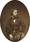
Fremont's Camp John Charles Fremont.jpg
Fremont's Camp
6 Fremont's Camp Old Alturas Hwy. (Co. Rd. 114), 0.7 mi. north of jct. with State Hwy. 139
41°51′16″N121°18′52″W / 41.8545442°N 121.3144719°W / 41.8545442; -121.3144719 (Fremont's Camp)
Copic
Infernal Caverns Battleground 16-Infernal Caverns Battle (26).jpg
Infernal Caverns Battleground
16 Infernal Caverns Battleground Ferry Ranch
41°16′20″N120°34′34″W / 41.272222°N 120.576111°W / 41.272222; -120.576111 (Infernal Caverns Battleground)
Likely
Old Emigrant Trail Pit River Valley.jpg
Old Emigrant Trail
111 Old Emigrant Trail N.W. of Co. Rd. 84
41°25′07″N120°59′48″W / 41.418494°N 120.996573°W / 41.418494; -120.996573 (Old Emigrant Trail)
Canby
Tule Lake War Relocation Center Tule Lake War Relocation Center.jpg
Tule Lake War Relocation Center
850-2 Tule Lake War Relocation Center State Hwy. 139 and Co. Rd. 176
41°53′07″N121°22′29″W / 41.8854027777778°N 121.37465°W / 41.8854027777778; -121.37465 (Tule Lake War Relocation Center)
Newell

Related Research Articles

<span class="mw-page-title-main">National Register of Historic Places listings in Modoc County, California</span>

This is a list of the National Register of Historic Places listings in Modoc County, California.

List table of the properties and districts — listed on the California Historical Landmarks — within Alameda County, Northern California.

List table of the properties and districts — listed on the California Historical Landmarks — within Calaveras County, California.

List table of the properties and districts — listed on the California Historical Landmarks — within Imperial County, Southern California.

This list includes properties and districts listed on the California Historical Landmark listing in Inyo County, California. Click the "Map of all coordinates" link to the right to view a Google map of all properties and districts with latitude and longitude coordinates in the table below.

Properties and districts listed as California Historical Landmarks within Kern County.

List table of the properties and districts — listed on the California Historical Landmarks in Los Angeles County, Southern California.

This list includes properties and districts listed on the California Historical Landmark listing in Monterey County, California, United States. Click the "Map of all coordinates" link to the right to view an online map of all properties and districts with latitude and longitude coordinates in the table below.

List table of the properties and districts — listed on the California Historical Landmarks — within Nevada County, Northern California.

List table of the properties and districts — listed on the California Historical Landmarks — within Orange County, California.

List table of the properties and districts — listed on the California Historical Landmarks — within City and County of San Francisco, California.

List table of the properties and districts listed on the California Historical Landmarks within Riverside County, southern California.

This list includes properties and districts listed on the California Historical Landmark listing in Sacramento County, California. Click the "Map of all coordinates" link to the right to view a Google map of all properties and districts with latitude and longitude coordinates in the table below.

List table of the properties and districts — listed on the California Historical Landmarks — within San Bernardino County, Southern California.

List table of the properties and districts — listed on the California Historical Landmarks — within Santa Cruz County, California.

This is a list of the properties and districts — listed as California Historical Landmarks — within Sonoma County, California.

List table of the properties and districts — listed on the California Historical Landmarks — within San Mateo County, California.

List table of the properties and districts — listed on the California Historical Landmarks — within Santa Barbara County, California.

This list includes properties and districts listed on the California Historical Landmark listing in Tuolumne County, California. Click the "Map of all coordinates" link to the right to view a Google map of all properties and districts with latitude and longitude coordinates in the table below.

This list includes properties and districts listed on the California Historical Landmark listing in Ventura County, California. Click the "Map of all coordinates" link to the right to view a Google map of all properties and districts with latitude and longitude coordinates in the table below.

References

  1. "California Historical Landmarks By County". Ohp.parks.ca.gov. Retrieved 2019-04-03.

See also