California Historical Landmarks in Yuba County

Last updated

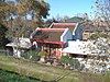
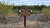
This list includes properties and districts listed on the California Historical Landmark listing in Yuba County, California. Click the "Map of all coordinates" link to the right to view a Google map of all properties and districts with latitude and longitude coordinates in the table below.

Image [1] Landmark nameLocationCity or townSummary
Bok Kai Temple BokKaiTempleFar.JPG
Bok Kai Temple
889 Bok Kai Temple First and D Sts
39°08′06″N121°35′13″W / 39.134994°N 121.586953°W / 39.134994; -121.586953 (Bok Kai Temple)
Marysville Also on the NRHP list as NPS-75000498
Johnson's Ranch Johnson's Ranch plaque.jpg
Johnson's Ranch
493 Johnson's Ranch Tomita Park
39°00′37″N121°25′23″W / 39.0103°N 121.422917°W / 39.0103; -121.422917 (Johnson's Ranch)
Wheatland
Marysville Assembly Center Marysville Assembly Center marker.jpg
Marysville Assembly Center
934 Marysville Assembly Center Arboga Assembly Center Memorial Site and Interpretive Center
39°02′52″N121°34′29″W / 39.04777164152989°N 121.5748032957599°W / 39.04777164152989; -121.5748032957599 (Marysville Assembly Center)
Marysville
Overland Emigrant Trail California historic marker 799-3 at sunset.jpg
Overland Emigrant Trail
799-3 Overland Emigrant Trail Spenceville Rd.
39°02′23″N121°23′06″W / 39.039633°N 121.385033°W / 39.039633; -121.385033 (Overland Emigrant Trail)
Wheatland
Smartsville Church of the Immaculate Conception, Smartsville (2025)-L1006828.jpg
Smartsville
321 Smartsville 8444 Smartville Rd.
39°12′27″N121°17′55″W / 39.2075°N 121.298611°W / 39.2075; -121.298611 (Smartsville)
Smartsville, California California Historic Point of Interest plaque is located at Church of Immaculate Conception. [2]
Timbuctoo Gate at Timbuctoo California on 2019-09-21.jpg
Timbuctoo
320 Timbuctoo Historic district
39°13′01″N121°19′07″W / 39.216944°N 121.318611°W / 39.216944; -121.318611 (Timbuctoo)
Timbuctoo
Wheatland Hop Riot Durst-Hop-Ranch-marker.jpg
Wheatland Hop Riot
1003 Wheatland Hop Riot S. 'A' St. and 6th St.
39°00′46″N121°25′08″W / 39.012667°N 121.418833°W / 39.012667; -121.418833 (Wheatland Hop Riot)
Wheatland

See also

References

  1. "California Historical Landmarks By County". Ohp.parks.ca.gov. Retrieved April 3, 2019.
  2. "Smartsville (No. 321 California Historical Landmark)". sierranevadageotourism.org. Retrieved August 11, 2019.