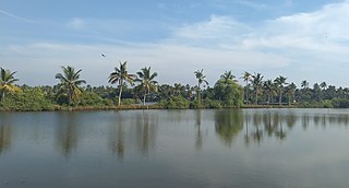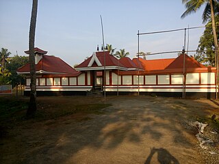
Ernakulam, IPA: [erɐɳɐːguɭɐm]; IAST: Eṟaṇākuḷaṁ, in Malayalam: എറണാകുളം) is a district of Kerala, India, that takes its name from the eponymous city division in Kochi. It is situated in the central part of the state, spans an area of about 3,000 square kilometres (1,200 sq mi), and is home to over 9% of Kerala's population. Its headquarters are located at Kakkanad. The district includes Kochi, also known as the commercial capital of Kerala, which is famous for its ancient Hindu temples, churches, and mosques. The district includes the largest metropolitan region of the state: Greater Cochin. Ernakulam is the district that yields the most revenue and the largest number of industries in the state. Ernakulam is the third most populous district in Kerala, after Malappuram and Thiruvananthapuram. The district also hosts the highest number of international and domestic tourists in Kerala state.
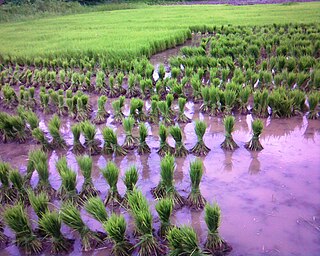
Puthenvelikkara is a village in the Paravur Taluk Ernakulam district of Kerala, India. The Chalakkudy River merges with the Periyar River at Elenthikara in the village of Puthenvelikkara. Puthenvelikkara is on the banks of the river Periyar, Chalakudy and Kottapuram lagoon. It is a centre of agricultural production in the region with its many rice paddy fields.

North Paravur, formerly known as Parur, is a municipality in Ernakulam district in the Indian state of Kerala. It is a northern suburb of the city of Kochi and is situated around 20 km from the city centre. It is also the first place in India to use electronic voting machine during the by-elections in 1982.

Moothakunnam is a small village in the Paravur Taluk, Ernakulam district of Kerala, South India.

Kottuvally is a census town in Paravoor.It is also a village in Paravur Taluk, Ernakulam district in the Indian state of Kerala. The village is situated in the south of the taluk. The nearest town is North Paravur, 4 km away. The Kottuvally panchayath is spread out on both sides of NH-66 road.

Koottukad is a small village in Parur Taluk, Ernakulam district of Kerala state, South India. It is about 25 km from Ernakulam town. It has a large expanses of green plain.

Ezhikkara is a panchayat in Paravur Taluk of Ernakulam District, Kerala. The North Paravur, Chathanad road (9 km) passes through this village. Ezhikkara is situated close to Ernakulam. Ezhikkara is famous for its pokkali fields and prawn farms.

Chittattukara is a census town and panchayat in Paravur Taluk of Ernakulam District, Kerala. Paravur town is situated close to this village, just 2 km. The most ancient and trade centre Pashnam is located at Pattanam, a small area in this village. Many historic monuments were founded out from this area.

Paravur Taluk, IPA: [pɐrɐʋuːr], is a taluk of Ernakulam District in the Indian State of Kerala. North Paravur is the capital of the taluk. Paravur Taluk lies in the north western part of Ernakulam district bordering Thrissur district. The surrounding taluks are Kochi to the west consisting of Vypin Island, Kodungallur to the north, Chalakudy to the north consisting of Mala, Aluva to the east consisting of Angamaly, Nedumbassery and Aluva, Kanayanur to the south consisting of Cochin City. Paravur is a part of Kochi urban agglomeration area. The western parts of taluk are coastal areas with cultivations like prawn and pokkali rice. The eastern parts are fertile lands. The heavy industries of Kochi is located in Udyogmandal area of the taluk.

Kunnukara is a census town and panchayat in Paravur Taluk of Ernakulam district, Kerala, India. The village is situated on the Airport road connecting North Paravur (NH66) and Nedumbassery (NH544). North Paravur is the nearest town, 7 km from this village. Aluva (10 km) and Angamaly (12 km) are also near to Kunnukara. Its administrative headquarters is in Kunnukara Town itself. The Mini Civil Station has four hospitals, all the Govt. offices, a Khadi Unit Supermarkets etc.

Panayikulam is a small village which falls in the Alangad Grama Panchayat, Paravur Taluk, Kerala, India. It is just near to Aluva town. A nice place to live in, easily accessible to Aluva Railway Station at 7 km, Nedumbassery International Airport 10 km and the Kochi City at 15 km. It is a preferred residential locality due to its proximity to the industrial areas, viz Binanipuram, Eloor and Kalamassery, where major factories like FACT, HMT, HIL, TCC, Binani, CMRL etc., are situated. Can commute on daily basis to the InfoPark, Kochi which is almost 12 km away. The place is providing its residents with pure water with no salinity in it and plain beautiful land very close to the Periyar River.It is the birthplace of Famous Film director/Actor Althaf Salim

Pathalam is a suburban region of the city of Kochi, in the state of Kerala, India. It is situated close to Eloor, an industrial district of Kochi. In the state bureaucratic administration, Pathalam is part of the Paravur Taluk in the District of Ernakulam. Pathalam Junction is a four way junction having access to places like Kalamassery NH47, Eloor(1 km), N.Paravur. There is an ESI hospital in Pathalam.
Kunjithai is a small village in Paravur Taluk, Ernakulam district in the state of Kerala, India. It is about 26 km from Ernakulam City. It is a lakeside village with the Pallipuram Lake as its western boundary. The ancient port town Muziris (Pattanam) shares its boundary with Kunjithai.

Karumallur is a village in Paravur Taluk, Ernakulam district in the Indian state of Kerala. Karumalloor is a panchayat in Ernakulam District. The village consists of large tracts of paddy fields. Karumallur is bounded by distributaries of the river Periyar. The panchayat is mainly a rice-based agrarian economy.

Kunnathunad is a Taluk in Ernakulam district in the Indian state of Kerala. Its headquarters is Perumbavoor town.
Maliankara is a village in Paravur Taluk, Ernakulam district of Kerala. It is located near Moothakunnam. It is also a boat ride away from Munambam and accessible by bridge to Pallipuram of Vypin island. Along with Munambam it forms the north-west corner of Ernakulam district where the Periyar River ends in the Arabian sea. It is located west of Kottuvallikadu and east of Pallipuram.Towards the north it is separated by Periyar river to Azhicode which is in Trissur district.
South Paravur is a small village near Udayamperoor, India. It is part of Kanayannur taluk of Ernakulam district. The place is called so to distinguish this village from the town with the same name in the northern end of Ernakulam district.It is very beautiful place with vembanad lake nearby.

Alangad is a village located in Paravur Taluk of Ernakulam District in the Indian state of Kerala. It lies almost in the middle of North Paravur and Aluva. The Kochi city is 15 km away from Alangad.
Ernakuam District has four types of administrative hierarchies:


