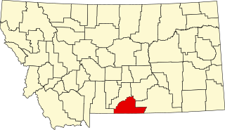
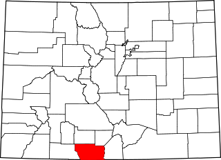
[3] Name on the Register [4] Image Date listed [5] Location City or town Description 1 Barndollar-Gann House Barndollar-Gann House November 7, 1985 (# 85002761 1906 Court St. 38°17′06″N 104°36′34″W / 38.285°N 104.6094°W / 38.285; -104.6094 (Barndollar-Gann House ) Pueblo 2 Baxter House Baxter House February 17, 1978 (# 78000876 325 W. 15th St. 38°16′51″N 104°36′40″W / 38.2808°N 104.6111°W / 38.2808; -104.6111 (Baxter House ) Pueblo 3 Allen J. Beaumont House Allen J. Beaumont House August 18, 1983 (# 83001328 425 W. 15th St. 38°16′51″N 104°36′45″W / 38.2808°N 104.6125°W / 38.2808; -104.6125 (Allen J. Beaumont House ) Pueblo 4 Dr. John A. Black House Complex Dr. John A. Black House Complex November 7, 1985 (# 85002760 102 W. Pitkin Ave. 38°15′24″N 104°37′29″W / 38.2567°N 104.6247°W / 38.2567; -104.6247 (Dr. John A. Black House Complex ) Pueblo 5 Boone Santa Fe Railroad Depot Boone Santa Fe Railroad Depot June 27, 1997 (# 97000618 100 Baker Ave. 38°14′55″N 104°15′23″W / 38.2486°N 104.2564°W / 38.2486; -104.2564 (Boone Santa Fe Railroad Depot ) Boone 6 Bowen Mansion Bowen Mansion January 9, 1978 (# 78000877 229 W. 12th St. 38°16′42″N 104°36′34″W / 38.2783°N 104.6094°W / 38.2783; -104.6094 (Bowen Mansion ) Pueblo 7 Butler House Upload image August 16, 1984 (# 84000880 6916 Broadacre Rd. 38°00′43″N 104°27′17″W / 38.01204°N 104.45480°W / 38.01204; -104.45480 (Butler House ) Avondale Ranch complex on Huerfano River dating from 1865 or 1880. 8 James N. Carlile House James N. Carlile House February 8, 1985 (# 85000297 44 Carlile Pl. 38°16′11″N 104°37′43″W / 38.2697°N 104.6286°W / 38.2697; -104.6286 (James N. Carlile House ) Pueblo 9 Central High School Central High School November 14, 1979 (# 79000619 431 E. Pitkin Ave. 38°15′11″N 104°37′13″W / 38.2531°N 104.6203°W / 38.2531; -104.6203 (Central High School ) Pueblo 10 Central Junior High School-Keating Junior High School Central Junior High School-Keating Junior High School December 7, 2020 (# 100005855 215 East Orman Ave. 38°15′12″N 104°37′32″W / 38.2533°N 104.6256°W / 38.2533; -104.6256 (Central Junior High School-Keating Junior High School ) Pueblo 11 City Park Carousel City Park Carousel April 21, 1983 (# 83001297 City Park 38°15′44″N 104°39′17″W / 38.2622°N 104.6547°W / 38.2622; -104.6547 (City Park Carousel ) Pueblo 12 Colorado Building Colorado Building April 17, 1992 (# 92000315 401-411 N. Main St. 38°16′15″N 104°36′30″W / 38.2708°N 104.6083°W / 38.2708; -104.6083 (Colorado Building ) Pueblo 13 Colorado State Hospital Superintendent's House Colorado State Hospital Superintendent's House September 26, 1985 (# 85002563 13th and Francisco Sts. 38°16′50″N 104°37′26″W / 38.2806°N 104.6239°W / 38.2806; -104.6239 (Colorado State Hospital Superintendent's House ) Pueblo 14 Coronado Lodge Coronado Lodge March 30, 2020 (# 100005146 2130 Lake Ave. 38°13′49″N 104°37′29″W / 38.2304°N 104.6248°W / 38.2304; -104.6248 (Coronado Lodge ) Pueblo 15 Doyle Settlement Doyle Settlement April 10, 1980 (# 80000922 Southeast of Pueblo on Doyle Rd. 38°03′30″N 104°24′51″W / 38.0583°N 104.4142°W / 38.0583; -104.4142 (Doyle Settlement ) Pueblo 16 Nathaniel W. Duke House Nathaniel W. Duke House February 8, 1985 (# 85000229 1409 Craig St. 38°16′48″N 104°37′05″W / 38.28013°N 104.61813°W / 38.28013; -104.61813 (Nathaniel W. Duke House ) Pueblo Queen Anne house of pioneer-era groceries businessman 17 Edison School Edison School June 19, 1985 (# 85001330 900 W. Mesa 38°14′48″N 104°36′06″W / 38.2467°N 104.6017°W / 38.2467; -104.6017 (Edison School ) Pueblo 18 El Pueblo El Pueblo February 16, 1996 (# 96000039 Junction of 1st St. and Union Ave. 38°16′03″N 104°36′35″W / 38.2675°N 104.6097°W / 38.2675; -104.6097 (El Pueblo ) Pueblo 19 First Congregational Church First Congregational Church February 8, 1985 (# 85000230 225 W. Evans 38°15′37″N 104°37′57″W / 38.2603°N 104.6325°W / 38.2603; -104.6325 (First Congregational Church ) Pueblo 20 First Methodist Episcopal Church First Methodist Episcopal Church November 14, 1979 (# 79000620 400 Broadway St. 38°15′19″N 104°37′23″W / 38.2553°N 104.6231°W / 38.2553; -104.6231 (First Methodist Episcopal Church ) Pueblo 21 First Methodist Episcopal Church First Methodist Episcopal Church April 16, 2012 (# 12000201 310 W. 11th St. 38°16′37″N 104°36′39″W / 38.2769°N 104.6107°W / 38.2769; -104.6107 (First Methodist Episcopal Church ) Pueblo 22 Fitch Terrace Fitch Terrace October 2, 1986 (# 86002809 401, 403, 405, 407, 409, and 411 W. 11th St. 38°16′39″N 104°36′42″W / 38.2775°N 104.6117°W / 38.2775; -104.6117 (Fitch Terrace ) Pueblo 23 R.T. Frazier House R.T. Frazier House June 19, 1985 (# 85001329 2121 N. Elizabeth St. 38°17′18″N 104°36′55″W / 38.28834°N 104.61533°W / 38.28834; -104.61533 (R.T. Frazier House ) Pueblo Craftsman -style house built in 1915 for leading saddlemaker R.T. Frazier 24 Galligan House Galligan House June 3, 1982 (# 82002311 501 Colorado Ave. 38°15′19″N 104°37′34″W / 38.2553°N 104.6261°W / 38.2553; -104.6261 (Galligan House ) Pueblo 25 Gast Mansion Gast Mansion June 3, 1982 (# 82002312 1801 Greenwood St. 38°17′02″N 104°36′47″W / 38.283889°N 104.613056°W / 38.283889; -104.613056 (Gast Mansion ) Pueblo 26 Goodnight Barn Goodnight Barn July 30, 1974 (# 74002278 West of Pueblo at State Highway 96 and Siloam Rd. 38°15′26″N 104°41′27″W / 38.257222°N 104.690833°W / 38.257222; -104.690833 (Goodnight Barn ) Pueblo 27 Hazelhurst Hazelhurst December 15, 1978 (# 78000879 905 Berkley Ave. 38°15′03″N 104°37′47″W / 38.250833°N 104.629722°W / 38.250833; -104.629722 (Hazelhurst ) Pueblo 28 Henkel-Duke Mercantile Company Warehouse Henkel-Duke Mercantile Company Warehouse May 17, 1984 (# 84000881 212-222 W. 3rd Ave. 38°16′10″N 104°36′31″W / 38.269444°N 104.608611°W / 38.269444; -104.608611 (Henkel-Duke Mercantile Company Warehouse ) Pueblo 29 Huerfano Bridge Huerfano Bridge February 4, 1985 (# 85000226 U.S. Highway 50 38°13′32″N 104°15′41″E / 38.22553°N 104.26142°E / 38.22553; 104.26142 (Huerfano Bridge ) Boone 5-span filled spandrel arch completed in 1921 30 Indian Petroglyphs and Pictographs Upload image May 3, 1976 (# 76000566 Address Restricted Penrose vicinity Known as "Indian Petroglyphs and Pictographs / Turkey Creek Canyon Rock Art District" by History Colorado , [6] while official NRHP listing name is just "Indian Petroglyphs and Pictographs". 31 Dr. Alexander T. King House and Carriage House Dr. Alexander T. King House and Carriage House April 21, 1983 (# 83001329 229 Quincy St. and 215 W. Routt Ave. 38°15′33″N 104°37′28″W / 38.259167°N 104.624444°W / 38.259167; -104.624444 (Dr. Alexander T. King House and Carriage House ) Pueblo 32 McClelland Orphanage McClelland Orphanage January 30, 1992 (# 91002043 415 E. Abriendo Ave. 38°15′22″N 104°37′00″W / 38.256111°N 104.616667°W / 38.256111; -104.616667 (McClelland Orphanage ) Pueblo 33 Mechanics Building/Masonic Building Mechanics Building/Masonic Building June 16, 1983 (# 83001330 207-211 N. Main St. 38°16′09″N 104°36′30″W / 38.269167°N 104.608333°W / 38.269167; -104.608333 (Mechanics Building/Masonic Building ) Pueblo 34 Minnequa Steel Works Office Building and Dispensary, Colorado Fuel and Iron Company Minnequa Steel Works Office Building and Dispensary, Colorado Fuel and Iron Company June 6, 2002 (# 02000628 215 and 225 Canal St. 38°14′17″N 104°36′45″W / 38.238056°N 104.6125°W / 38.238056; -104.6125 (Minnequa Steel Works Office Building and Dispensary, Colorado Fuel and Iron Company ) Pueblo Designated a National Historic Landmark in 2021; [7] first major steel works west of the Mississippi. 35 Montgomery Ward Building Montgomery Ward Building December 24, 1996 (# 85003697 225 N. Main St. 38°16′10″N 104°36′30″W / 38.269444°N 104.608333°W / 38.269444; -104.608333 (Montgomery Ward Building ) Pueblo 36 Orman-Adams House Orman-Adams House July 13, 1976 (# 76000567 102 W. Orman Ave. 38°15′17″N 104°37′39″W / 38.254722°N 104.6275°W / 38.254722; -104.6275 (Orman-Adams House ) Pueblo 37 Pitkin Place Historic District Pitkin Place Historic District January 31, 1978 (# 78000880 Southern side of the 300 block of W. Pitkin Pl. 38°15′32″N 104°37′40″W / 38.258889°N 104.627778°W / 38.258889; -104.627778 (Pitkin Place Historic District ) Pueblo 38 Frank Pryor House Frank Pryor House February 8, 1985 (# 85000231 1325 Greenwood St. 38°16′47″N 104°36′46″W / 38.279722°N 104.612778°W / 38.279722; -104.612778 (Frank Pryor House ) Pueblo 39 Pueblo Christopher Columbus Monument Pueblo Christopher Columbus Monument August 31, 2011 (# 11000608 Median in 100 block of E. Abriendo Ave. 38°15′34″N 104°37′15″W / 38.259444°N 104.620833°W / 38.259444; -104.620833 (Pueblo Christopher Columbus Monument ) Pueblo 40 Pueblo City Park Zoo Pueblo City Park Zoo July 28, 1995 (# 95000934 3455 Nuckolls Ave. 38°15′43″N 104°39′20″W / 38.261944°N 104.655556°W / 38.261944; -104.655556 (Pueblo City Park Zoo ) Pueblo 41 Pueblo County Courthouse Pueblo County Courthouse June 27, 1975 (# 75000534 10th and Main Sts. 38°16′36″N 104°36′32″W / 38.276667°N 104.608889°W / 38.276667; -104.608889 (Pueblo County Courthouse ) Pueblo 42 Pueblo Federal Building Pueblo Federal Building January 3, 1978 (# 78000881 421 N. Main St. 38°16′16″N 104°36′30″W / 38.271111°N 104.608333°W / 38.271111; -104.608333 (Pueblo Federal Building ) Pueblo 43 Pueblo Mountain Park Pueblo Mountain Park December 6, 1994 (# 94001343 1 mile south of County Road 220 on S. Pine Dr. (State Route 78 ) in the San Isabel National Forest 38°02′41″N 105°00′20″W / 38.044722°N 105.005556°W / 38.044722; -105.005556 (Pueblo Mountain Park ) Beulah 44 Quaker Flour Mill Quaker Flour Mill September 30, 1976 (# 76000568 102 S. Oneida St. 38°15′45″N 104°36′32″W / 38.2625°N 104.608889°W / 38.2625; -104.608889 (Quaker Flour Mill ) Pueblo 45 Ward Rice House Ward Rice House November 7, 1985 (# 85002762 1825 Grand Ave. 38°17′03″N 104°36′42″W / 38.284167°N 104.611667°W / 38.284167; -104.611667 (Ward Rice House ) Pueblo 46 Rood Candy Company Building Rood Candy Company Building May 17, 1984 (# 84000882 408-416 W. 7th St. 38°16′23″N 104°36′43″W / 38.273056°N 104.611944°W / 38.273056; -104.611944 (Rood Candy Company Building ) Pueblo 47 Roselawn Cemetery Roselawn Cemetery June 19, 2017 (# 100001212 1706 Roselawn Rd. 38°14′31″N 104°34′47″W / 38.241985°N 104.579643°W / 38.241985; -104.579643 (Roselawn Cemetery ) Pueblo 48 Rosemount Rosemount July 30, 1974 (# 74000592 419 W. 14th St. 38°16′49″N 104°36′44″W / 38.280278°N 104.612222°W / 38.280278; -104.612222 (Rosemount ) Pueblo 49 Sacred Heart Church Sacred Heart Church February 21, 1989 (# 89000037 1025 N. Grand Ave. 38°16′36″N 104°36′42″W / 38.276667°N 104.611667°W / 38.276667; -104.611667 (Sacred Heart Church ) Pueblo 50 Sacred Heart Orphanage Sacred Heart Orphanage March 3, 1989 (# 89000038 2316 Sprague St. 38°14′27″N 104°38′18″W / 38.240833°N 104.638333°W / 38.240833; -104.638333 (Sacred Heart Orphanage ) Pueblo 51 Santa Fe Avenue Bridge Santa Fe Avenue Bridge October 15, 2002 (# 02001149 U.S. Highway 50 at milepost 1.33 38°15′15″N 104°36′23″W / 38.254167°N 104.606389°W / 38.254167; -104.606389 (Santa Fe Avenue Bridge ) Pueblo 52 Squirrel Creek Recreational Unit Upload image March 28, 2005 (# 05000215 San Isabel National Forest 38°03′03″N 105°02′24″W / 38.050833°N 105.04°W / 38.050833; -105.04 (Squirrel Creek Recreational Unit ) Beulah 53 St. Charles Bridge St. Charles Bridge February 4, 1985 (# 85000228 County Road 65 38°12′03″N 104°32′46″W / 38.200833°N 104.546111°W / 38.200833; -104.546111 (St. Charles Bridge ) Pueblo 54 St. Charles River Bridge Upload image October 15, 2002 (# 02001131 US 50 at milepost 7.77 38°14′44″N 104°29′23″W / 38.245568°N 104.4895908°W / 38.245568; -104.4895908 (St. Charles River Bridge ) Pueblo Replaced in 2006 55 St. John's Greek Orthodox Church St. John's Greek Orthodox Church February 28, 2002 (# 02000123 1000-1010 Spruce St. 38°14′58″N 104°37′00″W / 38.249444°N 104.616667°W / 38.249444; -104.616667 (St. John's Greek Orthodox Church ) Pueblo 56 St. Paul African Methodist Episcopal (AME) Church St. Paul African Methodist Episcopal (AME) Church March 10, 2023 (# 100008733 613 West Mesa Ave. 38°14′46″N 104°37′06″W / 38.2461°N 104.6182°W / 38.2461; -104.6182 (St. Paul African Methodist Episcopal (AME) Church ) Pueblo 57 Star Journal Model Home Star Journal Model Home February 16, 1984 (# 84000886 2920 High St. 38°17′55″N 104°37′33″W / 38.298611°N 104.625833°W / 38.298611; -104.625833 (Star Journal Model Home ) Pueblo 58 Charles H. Stickney House Charles H. Stickney House February 8, 1985 (# 85000232 101 E. Orman Ave. 38°15′16″N 104°37′36″W / 38.254444°N 104.626667°W / 38.254444; -104.626667 (Charles H. Stickney House ) Pueblo 59 J.L. Streit House J.L. Streit House September 20, 1984 (# 84000892 2201 Grand Ave. 38°17′19″N 104°36′42″W / 38.288611°N 104.611667°W / 38.288611; -104.611667 (J.L. Streit House ) Pueblo 60 Temple Emanuel Temple Emanuel March 14, 1996 (# 96000273 1325 N. Grand Ave. 38°16′47″N 104°36′44″W / 38.27965°N 104.61211°W / 38.27965; -104.61211 (Temple Emanuel ) Pueblo Reform Jewish synagogue built in 1900, in Queen Anne style incorporating Richardsonian Romanesque elements 61 Tooke-Nuckolls House Tooke-Nuckolls House November 7, 1985 (# 85002763 38 Carlile Pl. 38°16′10″N 104°37′45″W / 38.269444°N 104.629167°W / 38.269444; -104.629167 (Tooke-Nuckolls House ) Pueblo 62 Tutt Building Tutt Building August 18, 1983 (# 83001331 421 Central Plaza 38°16′07″N 104°36′29″W / 38.268611°N 104.608056°W / 38.268611; -104.608056 (Tutt Building ) Pueblo 63 Union Avenue Historic Commercial District Union Avenue Historic Commercial District December 28, 1982 (# 82001021 Roughly bounded by railroad tracks, Main St., Grand and Victoria Aves. 38°15′51″N 104°36′48″W / 38.264167°N 104.613333°W / 38.264167; -104.613333 (Union Avenue Historic Commercial District ) Pueblo 64 Union Depot Union Depot April 1, 1975 (# 75000535 Victoria and B Sts. 38°15′46″N 104°36′59″W / 38.262778°N 104.616389°W / 38.262778; -104.616389 (Union Depot ) Pueblo 65 Vail Hotel Vail Hotel December 18, 1978 (# 78000882 217 S. Grand Ave. 38°15′59″N 104°37′18″W / 38.266389°N 104.621667°W / 38.266389; -104.621667 (Vail Hotel ) Pueblo 66 Martin Walter House Martin Walter House May 17, 1984 (# 84000894 300 W. Abriendo Ave. 38°15′42″N 104°37′28″W / 38.26159°N 104.62440°W / 38.26159; -104.62440 (Martin Walter House ) Pueblo American Foursquare mansion built for founder of Pueblo Brewery 67 Asbury White House Asbury White House October 11, 1984 (# 84000025 417 W. 11th St. 38°16′38″N 104°36′42″W / 38.277222°N 104.611667°W / 38.277222; -104.611667 (Asbury White House ) Pueblo 68 Young Women's Christian Association Young Women's Christian Association March 24, 1980 (# 80000921 801 N. Santa Fe Ave. 38°16′28″N 104°36′24″W / 38.274444°N 104.606667°W / 38.274444; -104.606667 (Young Women's Christian Association ) Pueblo