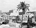
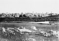
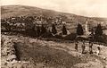
Name Subdistrict Image Date of depopulation Arab population 1948 Land area (dunums) Israeli operation Massacres Status Coordinates Modern location Jaffa Jaffa 26 April 1948 76,920 17,510 Massacre, atrocity 32°03′08″N 34°45′11″E / 32.05222°N 34.75306°E / 32.05222; 34.75306 Haifa (Arab) Haifa 21 April 1948 72,848 54,305 Massacre, atrocity 32°49′0″N 34°59′0″E / 32.81667°N 34.98333°E / 32.81667; 34.98333 Jerusalem (Qatamon ) Jerusalem 28 April 1948 69,693 20,790 various Massacre, atrocity 31°45′40″N 35°12′25″E / 31.761°N 35.207°E / 31.761; 35.207 Tarabin Bedouin Beersheba 5 December 1948 32,665 1,362,475 Yoav /Assaf Some walls 31°20′44″N 34°44′21″E / 31.3455°N 34.7391°E / 31.3455; 34.7391 Lydda Ramle 10 July 1948 19,442 23,723 Massacre, atrocity 31°57′7″N 34°53′17″E / 31.95194°N 34.88806°E / 31.95194; 34.88806 Ramla Ramle 10 July 1948 17,586 40,567 Atrocity 31°56′N 34°52′E / 31.933°N 34.867°E / 31.933; 34.867 'Azazme Bedouin Beersheba 1 May 1950 16,746 5,700,000 Tayaha Bedouin Beersheba 20 October 1948 16,248 2,085,825 Yoav Acre Acre 17 May 1948 14,280 1,29 Ben-Ami Massacre 32°55′40″N 35°04′54″E / 32.92778°N 35.08167°E / 32.92778; 35.08167 Al Majdal Gaza 4 November 1948 11,496 43,680 Yoav 31°40′N 34°34′E / 31.667°N 34.567°E / 31.667; 34.567 Ashkelon Safad (Arab) Safad 11 May 1948 11,055 4,431 Yiftach Atrocity 32°57′57″N 35°29′54″E / 32.96583°N 35.49833°E / 32.96583; 35.49833 Jbarat Bedouin Beersheba 20 October 1948 9,058 379,175 Yoav Salama Jaffa 25 April 1948 7,807 6,471 Hametz Evacuation [ 8] 3 or more Jewish families 32°02′57″N 34°48′18″E / 32.04917°N 34.80500°E / 32.04917; 34.80500 Tel Aviv Hanajreh Bedouin Beersheba 22 December 1948 7,599 78,325 Yoav /Hill 86 al-'Abbasiyya Jaffa 4 May 1948 6,554 20,540 Atrocity 3 or more Jewish families 32°01′51″N 34°53′25″E / 32.03083°N 34.89028°E / 32.03083; 34.89028 Yehud , [ 9] Magshimim , [ 9] Ganne Yehuda , [ 9] Ganne Tiqwa , [ 9] and Savyon [ 9] Beersheba Beersheba 21 October 1948 6,461 3,890 Yoav Massacre, military assault, expulsions 31°15′32″N 34°47′59″E / 31.25889°N 34.79972°E / 31.25889; 34.79972 Yibna Ramle 4 June 1948 6,287 59,554 Barak 3 or more Jewish families 31°51′58″N 34°44′47″E / 31.86611°N 34.74639°E / 31.86611; 34.74639 Yavne , [ 10] Beit Raban , Kfar HaNagid , Beit Gamliel al-Kabri Acre 21 May 1948 6,218 47,428 Ben-Ami Massacre, military assault, fear [ 11] Rubble 33°00′56″N 35°09′03″E / 33.01556°N 35.15083°E / 33.01556; 35.15083 Kabri , [ 12] Ga'aton , [ 12] Me'ona , [ 12] Ein Ya'akov , [ 12] Ma'alot , [ 12] Kefar Vradim [ 12] Tiberias (Arab) Tiberias 18 April 1948 6,160 15,729 Massacre, atrocity 32°47′40″N 35°32′00″E / 32.79444°N 35.53333°E / 32.79444; 35.53333 al-Tira Haifa 16 July 1948 6,113 45,262 Massacre, atrocity 3 or more Jewish families 32°45′43″N 34°58′31″E / 32.76194°N 34.97528°E / 32.76194; 34.97528 HaHotrim , [ 13] [ 14] Tirat Carmel , [ 14] Megadim , [ 14] Kfar Galim , [ 14] Kfar Tzvi Sitrin [ 14] Beisan Beisan 12 May 1948 6,009 28,957 Gideon Massacre 32°30′N 35°30′E / 32.500°N 35.500°E / 32.500; 35.500 Hamama Gaza 4 November 1948 5,812 41,366 Yoav No trace 31°41′29″N 34°35′24″E / 31.69139°N 34.59000°E / 31.69139; 34.59000 Nitzanim , [ 15] Beit Ezra , [ 15] Eshkolot [ 15] al-Faluja Gaza 1 March 1949 5,417 38,038 Rubble 31°37′29″N 34°44′52″E / 31.62472°N 34.74778°E / 31.62472; 34.74778 Kiryat Gat , [ 16] Shahar , [ 16] Noga , [ 16] Nir Chen , [ 16] Nehora [ 16] Isdud Gaza 28 October 1948 5,359 47,871 Yoav /Ha-Har Massacre 31°45′13″N 34°39′43″E / 31.75361°N 34.66194°E / 31.75361; 34.66194 Ashdod Saffuriyya Nazareth 16 July 1948 5,023 55,378 Dekel Atrocity Some houses 32°44′44″N 35°16′43″E / 32.74556°N 35.27861°E / 32.74556; 35.27861 Balad al-Sheikh Haifa 25 April 1948 4,779 9,849 Barak Balad al-Shaykh massacre , atrocity 3 or more Jewish families 32°46′18″N 35°02′32″E / 32.77167°N 35.04222°E / 32.77167; 35.04222 Nesher [ 17] Yazur Jaffa 1 May 1948 4,675 11,807 Hametz Atrocity 1 or 2 Jewish families 32°01′44″N 34°47′58″E / 32.02889°N 34.79944°E / 32.02889; 34.79944 Azor , [ 18] Holon Bayt Dajan Jaffa 25 April 1948 4,454 17,327 Hametz 3 or more Jewish families 32°0′13″N 34°49′46″E / 32.00361°N 34.82944°E / 32.00361; 34.82944 Beit Dagan [ 19] [ 20] Mishmar HaShiv'a [ 20] Hemed [ 20] Ganot [ 20] 'Ajjur Hebron 23 July 1948 4,327 58,074 Yoav Some houses 31°41′28″N 34°55′26″E / 31.69111°N 34.92389°E / 31.69111; 34.92389 Agur , [ 21] Tzafririm , [ 21] Givat Yeshayahu , [ 21] Li-On , [ 21] Tirosh [ 21] Britannia Park [ 22] al-Dawayima Hebron 29 October 1948 4,304 60,585 Yoav Massacre Rubble 31°32′10″N 34°54′43″E / 31.53611°N 34.91194°E / 31.53611; 34.91194 Karmei Katif [ 23] Amatzia Shefa-'Amr Haifa 16 July 1948 4,211 89,985 Dekel 32°48′20″N 35°10′10″E / 32.80556°N 35.16944°E / 32.80556; 35.16944 Samakh Tiberias 28 April 1948 4,014 18,611 Rubble 32°42′18″N 35°35′15″E / 32.70500°N 35.58750°E / 32.70500; 35.58750 Ma'agan [ 24] [ 25] Tel Katzir [ 25] Masada , [ 25] Sha'ar HaGolan [ 25] Ayn Karim Jerusalem 18 July 1948 3,689 15,029 3 or more Jewish families 31°45′55″N 35°8′58″E / 31.76528°N 35.14944°E / 31.76528; 35.14944 al-Safiriyya Jaffa 20 May 1948 3,561 12,842 Hametz 3 or more Jewish families 31°59′36″N 34°51′04″E / 31.99333°N 34.85111°E / 31.99333; 34.85111 Tzafria , [ 26] Kfar Chabad , [ 26] Ahi'ezer [ 26] Tochelet [ 26] Sharir [ 27] Shafrir (at the site of what is now Kfar Chabad ) has been absorbed in the previous, and in the suburbs of Rishon LeZion [ 26] Ijzim Haifa 24 July 1948 3,445 46,905 Shoter Massacre 3 or more Jewish families 32°38′41″N 34°59′17″E / 32.64472°N 34.98806°E / 32.64472; 34.98806 Kerem Maharal [ 28] al-Bassa Acre 14 May 1948 3,422 29,535 Al-Bassa massacre, military assault, expulsion [ 11] Some houses 33°04′34″N 35°08′27″E / 33.07611°N 35.14083°E / 33.07611; 35.14083 Betzet , [ 29] Rosh HaNiqra , [ 29] Shlomi , [ 29] [ 30] Tzahal , [ 29] [ 31] Matzuva [ 29] Kafr 'Ana Jaffa 25 April 1948 3,248 17,353 Hametz No trace 32°1′38″N 34°52′5″E / 32.02722°N 34.86806°E / 32.02722; 34.86806 Neve Monosson [ 32] Yagel [ 32] Or Yehuda [ 33] Bayt Daras Gaza 11 May 1948 3,190 16,357 Massacre, atrocity Rubble 31°43′24″N 34°40′58″E / 31.72333°N 34.68278°E / 31.72333; 34.68278 Giv'ati [ 34] [ 35] Emunim [ 35] Azrikam [ 35] Burayr Gaza 12 May 1948 3,178 46,184 Barak Massacre Some walls 31°34′14″N 34°38′21″E / 31.57056°N 34.63917°E / 31.57056; 34.63917 Bror Hayil , [ 36] [ 37] Tlamim , [ 37] Zohar , [ 37] Sde David , [ 37] Heletz [ 37] Lifta Jerusalem 1 January 1948 2,958 8,743 Atrocity 3 or more Jewish families 31°47′43″N 35°11′47″E / 31.79528°N 35.19639°E / 31.79528; 35.19639 al-Masmiyya al-Kabira Gaza 8 July 1948 2,923 20,687 An-Far 3 or more Jewish families 31°45′27″N 34°47′05″E / 31.75750°N 34.78472°E / 31.75750; 34.78472 Bnei Re'em , [ 12] Hatzav , [ 12] Yinon , [ 12] Ahva [ 12] Aqir Ramle 6 May 1948 2,877 15,825 Atrocity 3 or more Jewish families 31°51′40″N 34°49′23″E / 31.86111°N 34.82306°E / 31.86111; 34.82306 Kiryat Ekron , [ 38] Mazkeret Batya [ 38] Ganei Yohanan [ 38] Bayt Jibrin Hebron 29 October 1948 2,819 56,185 Yoav 3 or more Jewish families 31°36′19″N 34°53′54″E / 31.60528°N 34.89833°E / 31.60528; 34.89833 Beit Guvrin (kibbutz ) [ 39] al-Jura Gaza 4 November 1948 2,807 12,224 Yoav Some houses 31°39′54″N 34°33′15″E / 31.66500°N 34.55417°E / 31.66500; 34.55417 Ashkelon Barbara Gaza 4 November 1948 2,796 13,978 Yoav Some walls 31°37′26″N 34°34′46″E / 31.62389°N 34.57944°E / 31.62389; 34.57944 Mavki'im , [ 40] [ 41] Talmei Yafeh [ 41] Bayt Mahsir Jerusalem 10 May 1948 2,784 16,268 3 or more Jewish families 31°47′40″N 35°02′05″E / 31.79444°N 35.03472°E / 31.79444; 35.03472 Beit Meir , [ 42] [ 43] Mesilat Zion [ 43] Zarnuqa Ramle 27 May 1948 2,761 6,068 Barak Atrocity 1 or 2 Jewish families 31°52′49″N 34°47′23″E / 31.88028°N 34.78972°E / 31.88028; 34.78972 Rehovot , Kvutzat Shiller , Gibton and Givat Brenner Lubya Tiberias 16 July 1948 2,726 39,629 Dekel Rubble 32°46′33″N 35°25′46″E / 32.77583°N 35.42944°E / 32.77583; 35.42944 Lavi , Lavi Pine Forest, South African Park Bayt Nabala Ramle 13 May 1948 2,680 15,051 Some walls 31°59′11″N 34°57′32″E / 31.98639°N 34.95889°E / 31.98639; 34.95889 Kfar Truman , [ 44] and Beit Nehemia [ 44] Dayr al-Qassi Acre 30 October 1948 2,668 34,011 Hiram 3 or more Jewish families 33°02′07″N 35°19′30″E / 33.03528°N 35.32500°E / 33.03528; 35.32500 Mattat , [ 45] Elkosh , [ 45] [ 46] Abirim , [ 45] Netu'a [ 45] Hiribya Gaza 1 November 1948 2,598 22,312 Yoav Some houses 31°36′21″N 34°32′47″E / 31.60583°N 34.54639°E / 31.60583; 34.54639 Zikim , [ 47] Karmia , [ 47] Yad Mordechai [ 47] Wadi al-Hawarith Tulkarm 15 March 1948 2,552 4,447 Atrocity 1 or 2 Jewish families 32°23′56″N 34°52′48″E / 32.39889°N 34.88000°E / 32.39889; 34.88000 Kfar Haroeh , [ 48] Geulei Teiman [ 48] Ayn Ghazal Haifa 24 July 1948 2,517 18,079 Shoter Massacre Some walls 32°37′55″N 34°58′03″E / 32.63194°N 34.96750°E / 32.63194; 34.96750 Ein Ayala ? [ 49] Ofer Bayt Nattif Hebron 21 October 1948 2,494 44,587 Ha-Har Rubble 31°41′44″N 34°59′46″E / 31.69556°N 34.99611°E / 31.69556; 34.99611 Netiv HaLamed-Heh , [ 50] Aviezer , [ 50] Neve Michael [ 50] al-Mansura Tiberias 10 May 1948 2,482 55,583 Hiram Some walls 32°53′39″N 35°25′03″E / 32.89417°N 35.41750°E / 32.89417; 35.41750 Chazon [ 51] Tefashot , [ 51] Kallanit , [ 51] Ravid [ 51] Dayr Aban Jerusalem 19 October 1948 2,436 22,734 Ha-Har Some walls 31°44′35″N 35°00′38″E / 31.74306°N 35.01056°E / 31.74306; 35.01056 Tzora , [ 52] Mahseya , [ 52] Beit Shemesh , [ 52] and Yish'i [ 52] Iraq al-Manshiyya Gaza 1 March 1949 2,332 17,901 Yoav No trace 31°36′17″N 34°46′59″E / 31.60472°N 34.78306°E / 31.60472; 34.78306 Gat , [ 53] Kiryat Gat , [ 53] Sde Moshe [ 53] al-Qubab Ramle 15 May 1948 2,297 13,918 3 or more Jewish families 31°52′00″N 34°57′15″E / 31.86667°N 34.95417°E / 31.86667; 34.95417 Gezer , [ 54] Kefar Bin-Nun , [ 54] [ 55] Mishmar Ayyalon [ 54] Qaqun Tulkarm 5 June 1948 2,285 41,767 Rubble 32°21′36″N 34°59′43″E / 32.36000°N 34.99528°E / 32.36000; 34.99528 HaMa'apil , [ 56] Gan Yoshiya , [ 56] Ometz , [ 56] ´Olesh , [ 56] Haniel , [ 56] Yikon [ 56] Sarafand al-Amar Ramle 20 May 1948 2,262 13,267 Barak 1 or 2 Jewish families 31°57′34″N 34°50′58″E / 31.95944°N 34.84944°E / 31.95944; 34.84944 Zerifin and Nir Zevi al-Maliha Jerusalem 15 July 1948 2,250 6,828 Danny 3 or more Jewish families 31°45′08″N 35°10′55″E / 31.75222°N 35.18194°E / 31.75222; 35.18194 al-Shaykh Muwannis Jaffa 30 March 1948 2,239 15,972 Atrocity 3 or more Jewish families 32°06′50″N 34°48′15″E / 32.11389°N 34.80417°E / 32.11389; 34.80417 Tel Aviv az-Zeeb Acre 14 May 1948 2,216 12,607 Military assault [ 11] Some houses 33°02′57″N 35°06′08″E / 33.04917°N 35.10222°E / 33.04917; 35.10222 al-Mujaydil Nazareth 15 July 1948 2,204 18,836 Dekel Rubble 32°40′40″N 35°14′31″E / 32.67778°N 35.24194°E / 32.67778; 35.24194 Migdal HaEmek , Yifat Abu Kishk Jaffa 30 March 1948 2,204 18,470 Some houses 32°8′11″N 34°51′55″E / 32.13639°N 34.86528°E / 32.13639; 34.86528 Herzliya Khirbat al-Wa'ra al-Sawda' Tiberias 18 April 1948 2,169 7,036 Dekel Massacre Some walls 32°50′02″N 35°28′51″E / 32.83389°N 35.48083°E / 32.83389; 35.48083 al-Khalisa Safad 11 May 1948 2,134 11,280 Yiftach Some houses 33°12′52″N 35°34′02″E / 33.21444°N 35.56722°E / 33.21444; 35.56722 Kiryat Shemona Dayr Tarif Ramle 10 July 1948 2,030 8,756 Danny Atrocity Rubble 31°59′26″N 34°56′23″E / 31.99056°N 34.93972°E / 31.99056; 34.93972 Beit Arif [ 57] al-Maghar Ramle 18 May 1948 2,018 15,390 Barak 3 or more Jewish families 31°50′19″N 34°46′56″E / 31.83861°N 34.78222°E / 31.83861; 34.78222 Beit Elazari [ 58] al-Qubayba Ramle 27 May 1948 1,995 10,737 Barak 1 or 2 Jewish families 31°53′41″N 34°46′17″E / 31.89472°N 34.77139°E / 31.89472; 34.77139 Ge'alya ; [ 59] Kfar Gevirol ; [ 59] Kefar Hanaggid is near settlement land, [ 60] but located on land belonging to Yibna Sabbarin Haifa 12 May 1948 1,972 25,307 Mishmar HaEmek Massacre Rubble 32°34′16″N 35°1′23″E / 32.57111°N 35.02306°E / 32.57111; 35.02306 Ramot Menashe , Amikam al-Walaja Jerusalem 21 October 1948 1,914 17,708 Ha-Har Some houses 31°43′53″N 35°09′49″E / 31.73139°N 35.16361°E / 31.73139; 35.16361 Amminadav [ 61] Bashshit Ramle 13 May 1948 1,879 18,553 1 or 2 Jewish families 31°49′27″N 34°44′48″E / 31.82417°N 34.74667°E / 31.82417; 34.74667 Neve Mivtah [ 62] Meshar , [ 62] Kfar Mordechai , [ 62] Misgav Dov , [ 62] Kannot , [ 62] Shedema , [ 62] and Aseret . [ 62] Hunin Safad 3 May 1948 1,879 14,224 Yiftach Massacre Rubble 33°12′52″N 35°32′41″E / 33.21444°N 35.54472°E / 33.21444; 35.54472 Misgav Am [ 63] Margaliot [ 63] Wadi Hunayn Ramle 17 April 1948 1,879 5,401 Nachshon 1 or 2 Jewish families 31°55′39″N 34°47′43″E / 31.92750°N 34.79528°E / 31.92750; 34.79528 Israel Institute for Biological Research , [ 64] [ 65] Nes Tziyyona , Arab al Bashatwi Beisan 16 May 1948 1,810 20,739 No trace Majdal Yaba Ramle 13 July 1948 1,763 26,632 Danny Rubble 32°04′51.04″N 34°57′24.97″E / 32.0808444°N 34.9569361°E / 32.0808444; 34.9569361 Rosh HaAyin , Givat HaShlosha , Nahshonim , [ 66] Migdal Afek [ 67] al-Salihiyya Safad 25 May 1948 1,763 5,607 Yiftach No trace 33°10′02″N 35°36′45″E / 33.16722°N 35.61250°E / 33.16722; 35.61250 Jimzu Ramle 10 July 1948 1,752 9,681 Danny Some walls 31°55′51″N 34°56′47″E / 31.93083°N 34.94639°E / 31.93083; 34.94639 Moshav Gimzo [ 68] Jiddin Acre 1 July 1948 1,740 7,587 Rubble 32°59′40″N 35°13′19″E / 32.99444°N 35.22194°E / 32.99444; 35.22194 Yehiam , [ 69] Kiryat, and Ga'aton [ 69] [ 70] al-Tantura Haifa 21 May 1948 1,728 14,520 Massacre Some houses 32°36′34″N 34°55′04″E / 32.60944°N 34.91778°E / 32.60944; 34.91778 Nahsholim , [ 71] Dor [ 72] Umm az-Zinat Haifa 15 May 1948 1,705 22,156 Bi’ur Hametz Rubble 32°38′50″N 35°03′47.8″E / 32.64722°N 35.063278°E / 32.64722; 35.063278 Eliakim [ 73] [ 74] al-Na'ani Ramle 14 May 1948 1,705 16,129 Barak Some houses 31°52′20″N 34°52′24″E / 31.87222°N 34.87333°E / 31.87222; 34.87333 Na'an , [ 75] Ramot Me'ir [ 75] al-Birwa Acre 11 June 1948 1,694 13,542 Ben-Ami /Dekel Military assault [ 11] Some houses 32°54′19″N 35°10′49″E / 32.90528°N 35.18028°E / 32.90528; 35.18028 Ahihud , [ 76] Yas'ur [ 76] [ 77] al-Nabi Rubin Ramle 1 June 1948 1,647 31,002 Barak Some houses 31°55′46″N 34°44′02″E / 31.92944°N 34.73389°E / 31.92944; 34.73389 Palmachim , [ 78] Gan Sorek [ 78] Zir'in Jenin 28 May 1948 1,647 23,920 Rubble 32°33′27″N 35°19′40″E / 32.55750°N 35.32778°E / 32.55750; 35.32778 Yizre'el al-Khayriyya Jaffa 25 April 1948 1,647 13,672 Hametz Some houses 32°2′14″N 34°49′41″E / 32.03722°N 34.82806°E / 32.03722; 34.82806 Ramat Pinkas Ariel Sharon Park Innaba Ramle 10 July 1948 1,647 12,857 Danny Rubble 31°54′08″N 34°56′52″E / 31.90222°N 34.94778°E / 31.90222; 34.94778 Kefar Shemu'el [ 79] Karatiyya Gaza 17 July 1948 1,589 13,709 Atrocity Rubble 31°38′37″N 34°43′33″E / 31.64361°N 34.72583°E / 31.64361; 34.72583 Komemiyut , [ 80] Revaha , [ 80] Nehora [ 80] al-Damun Acre 15 July 1948 1,520 20,357 Dekel Military assault [ 11] Rubble 32°52′37″N 35°10′59″E / 32.87694°N 35.18306°E / 32.87694; 35.18306 Ni'ilya Gaza 4 November 1948 1,520 5,233 Yoav Some houses 31°38′46″N 34°34′18″E / 31.64611°N 34.57167°E / 31.64611; 34.57167 Ashkelon [ 81] Tell es-Safi Hebron 9 July 1948 1,496 28,925 An-Far Some walls 31°41′59″N 34°50′49″E / 31.69972°N 34.84694°E / 31.69972; 34.84694 Simsim Gaza 13 May 1948 1,496 16,797 Massacre Rubble 31°34′02″N 34°36′26″E / 31.56722°N 34.60722°E / 31.56722; 34.60722 Gvar'am [ 82] al-Tira Ramle 10 July 1948 1,496 6,956 Danny 3 or more Jewish families 32°01′02″N 34°56′35″E / 32.01722°N 34.94306°E / 32.01722; 34.94306 Tirat Yehuda , [ 83] Giv'at Ko'ah , [ 83] Bareket [ 83] Kafr Saba Tulkarm 15 May 1948 1,473 9,688 Some houses 32°10′52″N 34°56′14″E / 32.18111°N 34.93722°E / 32.18111; 34.93722 Hak'ramim, [ 84] Beit Berl , Kfar Saba , Neve Yamin al-Sindiyana Haifa 12 May 1948 1,450 15,172 Mishmar HaEmek Rubble 32°33′24″N 35°0′08″E / 32.55667°N 35.00222°E / 32.55667; 35.00222 Aviel [ 85] Ghuwayr Abu Shusha Tiberias 21 April 1948 1,438 12,098 Rubble 32°51′13″N 35°30′34″E / 32.85361°N 35.50944°E / 32.85361; 35.50944 Ginosar , [ 86] Livnim [ 86] al-Ghabisiyya Acre 1 May 1948 1,438 11,786 Ben-Ami Atrocity [ 11] Rubble 33°00′02″N 35°09′00″E / 33.00056°N 35.15000°E / 33.00056; 35.15000 Netiv HaShayara [ 87] Ajanjul Ramle 12 July 1948 1,438 11,401 Danny Rubble 31°52′17″N 35°01′26″E / 31.87139°N 35.02389°E / 31.87139; 35.02389 Amqa Acre 10 July 1948 1,438 6,068 Dekel Military assault [ 11] Rubble 32°58′46″N 35°9′48″E / 32.97944°N 35.16333°E / 32.97944; 35.16333 al-Jiyya Gaza 4 November 1948 1,427 8,506 Yoav No trace 31°37′38″N 34°35′51″E / 31.62722°N 34.59750°E / 31.62722; 34.59750 Beit Shikma , [ 88] Ge'a [ 89] [ 90] al-'Abisiyya Safad 25 May 1948 1,415 15,429 Yiftach No trace 33°11′55″N 35°37′59″E / 33.19861°N 35.63306°E / 33.19861; 35.63306 Kfar Szold Qatra Ramle 17 May 1948 1,404 7,853 Some houses 31°49′18.9″N 34°46′39.1″E / 31.821917°N 34.777528°E / 31.821917; 34.777528 Gedera [ 91] and Kidron [ 91] [ 92] al-Mansi Haifa 12 April 1948 1,392 12,272 Mishmar HaEmek Atrocity Some walls 32°35′42″N 35°10′22″E / 32.59500°N 35.17278°E / 32.59500; 35.17278 Midrakh Oz [ 93] Fajja Jaffa 15 May 1948 1,392 4,919 Atrocity Some houses 32°05′18″N 34°54′16″E / 32.08833°N 34.90444°E / 32.08833; 34.90444 Petah Tikva [ 94] Hittin Tiberias 16 July 1948 1,380 22,764 Dekel Rubble 32°48′25″N 35°27′12″E / 32.80694°N 35.45333°E / 32.80694; 35.45333 Arbel , Kefar Zetim az-Zakariyya Hebron 1 June 1950 1,369 15,320 3 or more Jewish families 31°42′30″N 34°56′50″E / 31.70833°N 34.94722°E / 31.70833; 34.94722 Zekharia [ 95] Jusayr Gaza 17 July 1948 1,369 12,361 Some houses 31°39′25″N 34°46′15″E / 31.65694°N 34.77083°E / 31.65694; 34.77083 Menuha , [ 96] Wardon [ 96] al-Muzayri'a Ramle 12 July 1948 1,346 10,822 Danny Rubble 32°02′57″N 34°56′58″E / 32.04917°N 34.94944°E / 32.04917; 34.94944 Mazor [ 97] [ 98] Nechalim [ 98] El'ad [ 99] al-Ja'una Safad 9 May 1948 1,334 839 Yiftach 3 or more Jewish families 32°58′18″N 35°31′58″E / 32.97167°N 35.53278°E / 32.97167; 35.53278 Rosh Pinna Jaba' Haifa 24 July 1948 1,322 7,012 Shoter Rubble 32°39′05″N 34°57′43″E / 32.65139°N 34.96194°E / 32.65139; 34.96194 Geva Karmel [ 12] [ 100] Saidiyeen Bedouin Beersheba 1 May 1950 1,312 1,238,375 Suhmata Acre 30 October 1948 1,311 17,056 Hiram Military assault [ 11] Some walls 33°00′19″N 35°18′14″E / 33.00528°N 35.30389°E / 33.00528; 35.30389 Tzuriel , [ 101] Hosen [ 101] Sa'sa' Safad 30 October 1948 1,311 14,796 Hiram Massacre 3 or more Jewish families 33°01′43″N 35°23′40″E / 33.02861°N 35.39444°E / 33.02861; 35.39444 Sasa [ 102] Naghnaghiya Haifa 12 April 1948 1,311 12,139 Mishmar HaEmek Atrocity Rubble 32°36′12.2″N 35°09′26.9″E / 32.603389°N 35.157472°E / 32.603389; 35.157472 Lajjun Jenin 30 May 1948 1,279 77,242 Gideon Massacre Some houses 32°34′29″N 35°10′40″E / 32.57472°N 35.17778°E / 32.57472; 35.17778 Kibbutz Megiddo [ 103] Saqiya Jaffa 25 April 1948 1,276 5,850 3 or more Jewish families 32°01′44″N 34°50′35″E / 32.02889°N 34.84306°E / 32.02889; 34.84306 Or Yehuda [ 104] al-Jammasin al-Gharbi Jaffa 17 March 1948 1,253 1,365 3 or more Jewish families 32°05′34″N 34°47′50″E / 32.09278°N 34.79722°E / 32.09278; 34.79722 Yasur Gaza 9 June 1948 1,241 16,390 Some houses 31°45′56″N 34°44′53″E / 31.76556°N 34.74806°E / 31.76556; 34.74806 Talmei Yehiel , [ 12] Bnei Ayish [ 12] Saliha Safad 30 October 1948 1,241 11,735 Hiram Massacre Some houses 33°04′31″N 35°28′20″E / 33.07528°N 35.47222°E / 33.07528; 35.47222 Yir'on [ 105] [ 106] and Avivim [ 106] al-Qubayba Hebron 28 October 1948 1,230 11,912 Yoav No trace 31°34′14″N 34°51′16″E / 31.57056°N 34.85444°E / 31.57056; 34.85444 Lakhish Bayt Tima Gaza 18 October 1948 1,230 11,032 Yoav Massacre Rubble 31°37′24″N 34°38′21″E / 31.62333°N 34.63917°E / 31.62333; 34.63917 al-Zuq al-Tahtani Safad 11 May 1948 1,218 11,634 Yiftach Some houses 33°12′54″N 35°36′04″E / 33.21500°N 35.60111°E / 33.21500; 35.60111 Beyt Hillel [ 107] Kuwaykat Acre 10 July 1948 1,218 4,733 Dekel Military assault [ 11] Rubble 32°58′16″N 35°08′48″E / 32.97111°N 35.14667°E / 32.97111; 35.14667 Beit HaEmek [ 108] [ 109] Sarafand al-Kharab Ramle 20 April 1948 1,206 5,503 Nachshon 1 or 2 Jewish families 31°56′11″N 34°48′20″E / 31.93639°N 34.80556°E / 31.93639; 34.80556 Ness Ziona [ 110] Ehewat Bedouin Beersheba 1 May 1950 1,200 1,728,935 Julis Gaza 11 June 1948 1,195 13,584 1 or 2 Jewish families 31°40′54″N 34°39′13″E / 31.68167°N 34.65361°E / 31.68167; 34.65361 Hodaya [ 111] al-Sawafir al-Gharbiyya Gaza 18 May 1948 1,195 7,523 Barak No trace 31°41′57″N 34°42′11″E / 31.69917°N 34.70306°E / 31.69917; 34.70306 Merkaz Shapira , [ 112] Masu'ot Yitzhak , [ 112] al-Na'ima Safad 14 May 1948 1,195 7,155 Yiftach No trace 33°11′17″N 35°35′42″E / 33.18806°N 35.59500°E / 33.18806; 35.59500 Neot Mordechai , [ 113] Kefar Blum , [ 113] and Beyt Hillel [ 113] al-Ghazzawiyya Beisan 20 May 1948 1,183 18,408 No trace 32°30′08″N 35°32′30″E / 32.50222°N 35.54167°E / 32.50222; 35.54167 Qula Ramle 10 July 1948 1,172 4,347 Massacre Rubble 32°02′15″N 34°57′12″E / 32.03750°N 34.95333°E / 32.03750; 34.95333 Tarbikha Acre 1 November 1948 1,160 18,563 Hiram Expulsion [ 11] 3 or more Jewish families 33°04′58″N 35°17′04″E / 33.08278°N 35.28444°E / 33.08278; 35.28444 Shomera , [ 114] [ 115] Even Menachem , [ 115] Shtula , [ 115] Zar'it [ 115] al-Batani al-Gharbi Gaza 13 May 1948 1,137 4,574 Barak Rubble 31°45′29″N 34°41′58″E / 31.75806°N 34.69944°E / 31.75806; 34.69944 al-Sawafir al-Sharqiyya Gaza 18 May 1948 1,125 13,831 Barak No trace 31°42′00″N 34°42′45″E / 31.70000°N 34.71250°E / 31.70000; 34.71250 Ein Tzurim , [ 116] Shafir , [ 116] Zrahia , [ 116] Nir Banim [ 116] Hatta Gaza 17 July 1948 1,125 5,305 Rubble 31°39′06″N 34°44′28″E / 31.65167°N 34.74111°E / 31.65167; 34.74111 Zavdiel , [ 117] Aluma [ 117] Umm Khalid Tulkarm 20 March 1948 1,125 2,894 3 or more Jewish families 32°19′51″N 34°51′55″E / 32.33083°N 34.86528°E / 32.33083; 34.86528 Netanya Qumbaza Haifa 15 February 1948 1,114 31,786 Massacre, atrocity Some houses 32°37′55″N 35°1′34″E / 32.63194°N 35.02611°E / 32.63194; 35.02611 Kerem Maharal [ 118] Zikrin Hebron 22 October 1948 1,114 17,195 Yoav Atrocity Rubble 31°39′48″N 34°51′38″E / 31.66333°N 34.86056°E / 31.66333; 34.86056 Alma Safad 30 October 1948 1,102 19,498 Hiram Some walls 33°3′20″N 35°29′28″E / 33.05556°N 35.49111°E / 33.05556; 35.49111 Alma [ 119] Summil Gaza 8 July 1948 1,102 19,304 Some walls 31°39′56″N 34°47′43″E / 31.66556°N 34.79528°E / 31.66556; 34.79528 Kedma , [ 120] Sgula , [ 120] Menuha , [ 120] Nahala , [ 120] Vardon [ 120] Qazaza Ramle 9 July 1948 1,090 18,829 An-Far Atrocity 31°46′44″N 34°52′34″E / 31.77889°N 34.87611°E / 31.77889; 34.87611 Israel Defense Forces base Bayt Jirja Gaza 30 October 1948 1,090 8,481 Yoav Some houses 31°36′11″N 34°34′51″E / 31.60306°N 34.58083°E / 31.60306; 34.58083 Qaytiyya Safad 19 May 1948 1,090 5,390 Yiftach Rubble 33°11′59″N 35°36′46″E / 33.19972°N 35.61278°E / 33.19972; 35.61278 Kfar Blum , [ 121] possibly Beit Hillel [ 121] al-Kafrayn Haifa 12 April 1948 1,067 10,882 Mishmar HaEmek Rubble 32°34′25″N 35°07′08″E / 32.57361°N 35.11889°E / 32.57361; 35.11889 Safsaf Safad 29 October 1948 1,056 7,391 Hiram Massacre Some houses 33°00′42″N 35°26′44″E / 33.01167°N 35.44556°E / 33.01167; 35.44556 Kfar Hoshen , [ 122] [ 123] Bar Yohai [ 124] Qalunya Jerusalem 3 April 1948 1,056 4,844 Nachshon 1 or 2 Jewish families 31°47′39″N 35°9′27″E / 31.79417°N 35.15750°E / 31.79417; 35.15750 Mevaseret Zion Qastina Gaza 9 July 1948 1,032 12,019 Rubble 31°44′21″N 34°45′44″E / 31.73917°N 34.76222°E / 31.73917; 34.76222 Kfar Warburg , [ 125] Arugot , [ 125] Kfar Ahim , [ 125] Avigdor , [ 125] Kiryat Malakhi [ 125] Barqa Gaza 13 May 1948 1,032 5,206 Some houses 31°46′39″N 34°41′59″E / 31.77750°N 34.69972°E / 31.77750; 34.69972 Mallaha Safad 25 May 1948 1,032 2,168 Yiftach Rubble 33°05′24″N 35°34′55″E / 33.09000°N 35.58194°E / 33.09000; 35.58194 Miska Tulkarm 20 April 1948 1,021 8,076 Rubble 32°13′04″N 34°55′29″E / 32.21778°N 34.92472°E / 32.21778; 34.92472 Sde Warburg , Mishmeret [ 126] Abu Shusha Ramle 14 May 1948 1,009 9,425 Barak Abu Shusha Massacre No trace 31°51′25″N 34°54′56″E / 31.85694°N 34.91556°E / 31.85694; 34.91556 al-'Ubaydiyya Tiberias 3 March 1948 1,009 5,173 Some walls 32°41′00″N 35°33′00″E / 32.68333°N 35.55000°E / 32.68333; 35.55000 al-Mas'udiyya Jaffa 25 December 1947 986 Some houses 32°05′07″N 34°46′54″E / 32.08528°N 34.78167°E / 32.08528; 34.78167 Tel Aviv al-Zanghariyya Safad 4 May 1948 974 27,918 Matateh /Yiftach Some walls 32°56′29″N 35°35′10″E / 32.94139°N 35.58611°E / 32.94139; 35.58611 Elifelet [ 127] Arab al-Nufay'at Haifa 10 April 1948 951 8,937 Some houses 32°25′23″N 34°52′54″E / 32.42306°N 34.88167°E / 32.42306; 34.88167 Mikhmoret [ 128] Ayn al-Zaytun Safad 2 May 1948 951 1,100 Yiftach Ein al-Zeitun massacre , atrocity Some houses 32°59′14″N 35°29′30″E / 32.98722°N 35.49167°E / 32.98722; 35.49167 Sirin Beisan 6 April 1948 940 28,445 Some houses 32°39′15″N 35°30′25″E / 32.65417°N 35.50694°E / 32.65417; 35.50694 Huj Gaza 31 May 1948 940 21,988 Some houses 31°30′35″N 34°37′21″E / 31.50972°N 34.62250°E / 31.50972; 34.62250 Dorot [ 129] Havat Shikmim al-Manshiyya Acre 14 May 1948 940 14,886 Ben-Ami Military assault [ 11] 1 or 2 Jewish families 32°56′06″N 35°05′26″E / 32.93500°N 35.09056°E / 32.93500; 35.09056 Shomrat , [ 130] Bustan HaGalil [ 130] al-Sawalima Jaffa 30 March 1948 928 5,942 No trace 32°06′59″N 34°50′51″E / 32.11639°N 34.84750°E / 32.11639; 34.84750 Neve Sharett Umm al-Faraj Acre 21 May 1948 928 825 Massacre, military assault [ 11] Rubble 33°00′18″N 35°07′16″E / 33.00500°N 35.12111°E / 33.00500; 35.12111 Ben Ami [ 131] Mi'ar Acre 15 July 1948 893 10,788 Dekel Some walls 32°52′27″N 35°14′47″E / 32.87417°N 35.24639°E / 32.87417; 35.24639 Segev , [ 132] Ya'ad [ 132] Manof [ 132] al-Shajara Tiberias 6 May 1948 893 3,754 Rubble 32°45′16″N 35°23′56″E / 32.75444°N 35.39889°E / 32.75444; 35.39889 Ilaniya Tall al-Turmus Gaza 9 July 1948 882 11,508 An-Far Rubble 31°43′30″N 34°46′22″E / 31.72500°N 34.77278°E / 31.72500; 34.77278 Timorim [ 12] al-Sumayriyya Acre 14 May 1948 882 8,542 Ben-Ami Military assault [ 11] Some walls 32°58′19″N 35°05′36″E / 32.97194°N 35.09333°E / 32.97194; 35.09333 Lohamei HaGeta'ot , [ 133] [ 134] Shomrat [ 134] al-Haditha Ramle 12 July 1948 882 7,110 Danny Some houses 31°57′48″N 34°57′07″E / 31.96333°N 34.95194°E / 31.96333; 34.95194 Zawiya Safad 24 May 1948 882 3,958 Yiftach No trace 33°09′19″N 35°35′50″E / 33.15528°N 35.59722°E / 33.15528; 35.59722 Neot Mordechai Qannir Haifa 25 April 1948 870 11,331 Atrocity Rubble 32°31′42″N 35°01′51″E / 32.52833°N 35.03083°E / 32.52833; 35.03083 Regavim [ 135] al-Tina Ramle 8 July 1948 870 7,001 An-Far Rubble 31°44′48″N 34°49′11″E / 31.74667°N 34.81972°E / 31.74667; 34.81972 Khirbat Umm Sabuna Beisan 21 May 1948 868 Gideon Rubble 32°35′10″N 35°32′32″E / 32.58611°N 35.54222°E / 32.58611; 35.54222 Ghabat Kafr Sur Tulkarm 15 May 1948 858 19,666 Some houses 32°17′02″N 34°52′03″E / 32.28389°N 34.86750°E / 32.28389; 34.86750 Beit Yehoshua , [ 136] Kfar Neter , [ 136] Tel Yitzhaq [ 136] Fir'im Safad 26 May 1948 858 2,191 Yiftach Rubble 32°59′07″N 35°31′59″E / 32.98528°N 35.53306°E / 32.98528; 35.53306 Hatzor HaGlilit al-Hamra Beisan 31 May 1948 847 11,511 No trace 32°25′40″N 35°30′01″E / 32.42778°N 35.50028°E / 32.42778; 35.50028 Deir al-Dubban Hebron 23 October 1948 847 7,784 Yoav Rubble 31°40′23″N 34°53′33″E / 31.67306°N 34.89250°E / 31.67306; 34.89250 Luzit , Britannia Park [ 22] Barfiliya Ramle 14 July 1948 847 7,134 Danny 31°54′36″N 34°59′22″E / 31.91000°N 34.98944°E / 31.91000; 34.98944 Dayr Sunayd Gaza 30 October 1948 847 6,081 Yoav Some houses 31°34′28″N 34°33′18″E / 31.57444°N 34.55500°E / 31.57444; 34.55500 al-Jammasin al-Sharqi Jaffa 17 March 1948 847 358 Some houses 32°05′54″N 34°49′44″E / 32.09833°N 34.82889°E / 32.09833; 34.82889 al-Burayj Jerusalem 19 October 1948 835 19,080 Ha-Har 31°44′20″N 34°55′44″E / 31.73889°N 34.92889°E / 31.73889; 34.92889 Sdot Micha , [ 137] Sdot Micha Airbase [ 137] Awlam Tiberias 12 May 1948 835 18,546 Rubble 32°39′59″N 35°29′57″E / 32.66639°N 35.49917°E / 32.66639; 35.49917 Abu Shusha Haifa 9 April 1948 835 8,960 Mishmar HaEmek Rubble 32°36′51″N 35°08′17″E / 32.61417°N 35.13806°E / 32.61417; 35.13806 Mishmar HaEmek Kafr Bir'im Safad 4 November 1948 824 12,250 Hiram Some walls 33°02′37″N 35°24′51″E / 33.04361°N 35.41417°E / 33.04361; 35.41417 Bar'am , [ 138] [ 139] Dovev [ 139] Bayt 'Affa Gaza 10 January 1948 812 5,808 No trace 31°39′41″N 34°42′24″E / 31.66139°N 34.70667°E / 31.66139; 34.70667 al-Dawwara Safad 25 May 1948 812 5,470 Yiftach No trace 33°10′43″N 35°38′02″E / 33.17861°N 35.63389°E / 33.17861; 35.63389 ‘Amir , Sde Nehemia Ma'alul Nazareth 15 July 1948 800 4,698 Dekel Rubble 32°41′44″N 35°14′22″E / 32.69556°N 35.23944°E / 32.69556; 35.23944 Migdal HaEmek , Kfar HaHoresh , Timrat , [ 140] [ 141] and an Israeli military base Kawkaba Gaza 12 May 1948 789 8,542 Barak /Yoav Some walls 31°37′51″N 34°39′46″E / 31.63083°N 34.66278°E / 31.63083; 34.66278 Kokhav Michael [ 142] al-Sawafir al-Shamaliyya Gaza 18 May 1948 789 5,861 Barak Rubble 31°42′48″N 34°42′15″E / 31.71333°N 34.70417°E / 31.71333; 34.70417 al-Farradiyya Safad 1 February 1949 777 19,747 Hiram Rubble 32°55′54″N 35°25′42″E / 32.93167°N 35.42833°E / 32.93167; 35.42833 Parod , Shefer Iraq Suwaydan Gaza 9 November 1948 766 7,529 Yoav No trace 31°38′55″N 34°41′19″E / 31.64861°N 34.68861°E / 31.64861; 34.68861 Yad Natan , [ 143] Otzem , [ 143] Sde Yoav [ 143] al-Butayha Safad 4 May 1948 754 16,690 Matateh /Yiftach Some walls 32°54′59″N 35°37′22″E / 32.91639°N 35.62278°E / 32.91639; 35.62278 Almagor [ 144] Ayn Hawd Haifa 15 July 1948 754 12,605 3 or more Jewish families 32°42′05″N 34°58′48″E / 32.70139°N 34.98000°E / 32.70139; 34.98000 Ein Hod [ 145] [ 146] Nir Etzion [ 146] Arab al-Safa Beisan 20 May 1948 754 12,518 No trace 32°26′27″N 35°32′16″E / 32.44083°N 35.53778°E / 32.44083; 35.53778 al-Batani al-Sharqi Gaza 13 May 1948 754 5,764 Barak Rubble 31°45′07″N 34°43′24″E / 31.75194°N 34.72333°E / 31.75194; 34.72333 Khirbat al-Sarkas Haifa 15 April 1948 751 No trace 32°26′49″N 34°57′37″E / 32.44694°N 34.96028°E / 32.44694; 34.96028 Gan Shmuel , [ 147] Talmei Elazar [ 147] Lid Haifa 9 April 1948 742 13,572 Rubble 32°36′49″N 35°13′27″E / 32.61361°N 35.22417°E / 32.61361; 35.22417 HaYogev [ 148] Najd Gaza 13 May 1948 719 13,576 Some walls 31°33′02″N 34°35′55″E / 31.55056°N 34.59861°E / 31.55056; 34.59861 Sderot , [ 149] Or HaNer [ 150] Indur Nazareth 24 May 1948 719 12,444 Some walls 32°38′11″N 35°22′53″E / 32.63639°N 35.38139°E / 32.63639; 35.38139 Ras Abu 'Ammar Jerusalem 21 October 1948 719 8,342 Ha-Har Rubble 31°44′17″N 35°05′25″E / 31.73806°N 35.09028°E / 31.73806; 35.09028 Tzur Hadassah [ 151] al-Ras al-Ahmar Safad 30 October 1948 719 7,934 Hiram 1 or 2 Jewish families 33°2′28″N 35°27′52″E / 33.04111°N 35.46444°E / 33.04111; 35.46444 Kerem Ben Zimra [ 152] Ishwa Jerusalem 18 July 1948 719 5,522 3 or more Jewish families 31°46′50″N 35°00′40″E / 31.78056°N 35.01111°E / 31.78056; 35.01111 Eshtaol Suba Jerusalem 13 July 1948 719 4,102 Danny Some walls 31°47′5″N 35°7′26″E / 31.78472°N 35.12389°E / 31.78472; 35.12389 Tzova , [ 154] Yedida school Arab Ghawarina / Jidru Haifa 15 April 1948 719 3,428 Arab Zahrat al-Dumayri Haifa 10 April 1948 719 1,387 No trace 32°27′31″N 34°54′24″E / 32.45861°N 34.90667°E / 32.45861; 34.90667 al-Nahr Acre 21 May 1948 708 5,261 Massacre, military assault [ 11] Some houses 33°00′26″N 35°08′29″E / 33.00722°N 35.14139°E / 33.00722; 35.14139 Ben Ami , [ 155] [ 156] Kabri [ 156] Deir Yassin Jerusalem 9 April 1948 708 2,857 Deir Yassin massacre 3 or more Jewish families 31°47′9″N 35°10′41″E / 31.78583°N 35.17806°E / 31.78583; 35.17806 Givat Shaul Beth and Har Nof neighborhoods of Jerusalem Yajur Haifa 25 April 1948 708 2,720 No trace 32°45′31″N 35°03′26″E / 32.75861°N 35.05722°E / 32.75861; 35.05722 Yagur [ 157] Dayr Nakhkhas Hebron 29 October 1948 696 14,476 Yoav Some houses 31°36′57″N 34°55′18″E / 31.61583°N 34.92167°E / 31.61583; 34.92167 Dayshum Safad 30 October 1948 684 23,044 Hiram Rubble 33°04′49″N 35°30′26″E / 33.08028°N 35.50722°E / 33.08028; 35.50722 Dishon [ 158] [ 159] Rantiya Jaffa 10 July 1948 684 4,389 Danny Some houses 32°2′40″N 34°55′17″E / 32.04444°N 34.92139°E / 32.04444; 34.92139 Mazor , [ 160] Nofekh , [ 160] Rinatia [ 160] [ 161] al-Muharraqa Gaza 27 May 1948 673 4,855 Rubble 31°28′01″N 34°36′41″E / 31.46694°N 34.61139°E / 31.46694; 34.61139 Yakhini [ 162] Nuris Jenin 29 May 1948 661 6,256 Rubble 32°32′06″N 35°21′49″E / 32.53500°N 35.36361°E / 32.53500; 35.36361 Saris Jerusalem 16 April 1948 650 10,699 Nachshon Rubble 31°47′53″N 35°04′26″E / 31.79806°N 35.07389°E / 31.79806; 35.07389 Shoresh , Sho'eva , Neve Ilan Bayt Jiz Ramle 30 May 1948 638 8,357 Some houses 31°48′46″N 34°57′15″E / 31.81278°N 34.95417°E / 31.81278; 34.95417 Har'el , [ 163] [ 164] Tzelafon , [ 164] Gizo [ 164] Abu Zurayq Haifa 12 April 1948 638 6,493 Mishmar HaEmek Massacre No trace 32°38′03″N 35°07′34″E / 32.63417°N 35.12611°E / 32.63417; 35.12611 Mughallis Hebron 9 July 1948 626 11,459 An-Far Rubble 31°43′45″N 34°52′57″E / 31.72917°N 34.88250°E / 31.72917; 34.88250 Gefen [ 165] Bayt 'Itab Jerusalem 21 October 1948 626 8,757 Ha-Har Some walls 31°44′06″N 35°03′11″E / 31.73500°N 35.05306°E / 31.73500; 35.05306 Nes Harim [ 166] Ibdis Gaza 8 July 1948 626 4,593 No trace 31°40′39″N 34°41′55″E / 31.67750°N 34.69861°E / 31.67750; 34.69861 Sataf Jerusalem 13 July 1948 626 3,775 Danny Some walls 31°46′9″N 35°7′38″E / 31.76917°N 35.12722°E / 31.76917; 35.12722 Taytaba Safad 1 May 1948 615 8,453 Yiftach Rubble 33°00′48″N 35°28′43″E / 33.01333°N 35.47861°E / 33.01333; 35.47861 al-Masmiyya al-Saghira Gaza 8 July 1948 615 6,478 An-Far No trace 31°45′10″N 34°47′56″E / 31.75278°N 34.79889°E / 31.75278; 34.79889 Masmiya Bet , [ 167] Kfar HaRif [ 168] al-Sakhina Beisan 12 May 1948 615 6,400 Gideon No trace 32°30′59″N 35°27′44″E / 32.51639°N 35.46222°E / 32.51639; 35.46222 Nir David [ 169] Arab al-Bawati Beisan 16 May 1948 603 10,641 Rubble 32°31′41″N 35°32′21″E / 32.52806°N 35.53917°E / 32.52806; 35.53917 Hadatha Tiberias 12 May 1948 603 10,310 Rubble 32°40′53″N 35°29′34″E / 32.68139°N 35.49278°E / 32.68139; 35.49278 Dimra Gaza 28 October 1948 603 8,492 Yoav Rubble 31°33′32″N 34°33′54″E / 31.55889°N 34.56500°E / 31.55889; 34.56500 Erez [ 170] al-Haram Jaffa 3 February 1948 603 8,065 3 or more Jewish families 32°11′17.40″N 34°48′24.13″E / 32.1881667°N 34.8067028°E / 32.1881667; 34.8067028 al-Buwayziyya Safad 11 May 1948 592 14,620 Yiftach Rubble 33°09′22″N 35°34′13″E / 33.15611°N 35.57028°E / 33.15611; 35.57028 Bir Ma'in Ramle 15 July 1948 592 9,319 Danny Some walls 31°53′17″N 35°01′08″E / 31.88806°N 35.01889°E / 31.88806; 35.01889 Makkabim [ 171] Salbit Ramle 15 July 1948 592 6,111 Danny No trace 31°52′10″N 34°59′11″E / 31.86944°N 34.98639°E / 31.86944; 34.98639 Shaalvim [ 172] Abu al-Fadl Ramle 9 May 1948 592 2,870 Barak Atrocity Some houses 31°56′37″N 34°50′53″E / 31.94361°N 34.84806°E / 31.94361; 34.84806 Sitria [ 173] [ 174] Talmey Menashe [ 174] al-Barriyya Ramle 10 July 1948 592 2,831 Danny Some houses 31°53′14″N 34°54′58″E / 31.88722°N 34.91611°E / 31.88722; 34.91611 Azarya , [ 175] [ 176] Beyt Chashmonay [ 176] Kawfakha Gaza 25 May 1948 580 8,569 Rubble 31°28′42″N 34°39′42″E / 31.47833°N 34.66167°E / 31.47833; 34.66167 Nir Akiva [ 177] Iqrit Acre 1 November 1948 568 24,722 Expulsion [ 11] Rubble 33°04′32″N 35°16′31″E / 33.07556°N 35.27528°E / 33.07556; 35.27528 Shomera , [ 178] Even Menachem , [ 178] Goren , [ 178] Gornot ha-Galil [ 178] Idnibba Ramle 9 July 1948 568 8,103 Rubble 31°44′32″N 34°51′22″E / 31.74222°N 34.85611°E / 31.74222; 34.85611 Kfar Menahem al-Manara Tiberias 1 March 1948 568 6,797 Rubble 32°45′17″N 35°32′32″E / 32.75472°N 35.54222°E / 32.75472; 35.54222 Mughr al-Khayt Safad 2 May 1948 568 6,627 Yiftach Some houses 32°59′19″N 35°32′17″E / 32.98861°N 35.53806°E / 32.98861; 35.53806 Chatzor ha-Gelilit and Ro'sh Pinna Ma'dhar Tiberias 12 May 1948 557 11,666 Rubble 32°41′35″N 35°27′51″E / 32.69306°N 35.46417°E / 32.69306; 35.46417 Kefar Qish [ 179] Kafr Sabt Tiberias 22 April 1948 557 9,850 Rubble 32°44′37″N 35°26′27″E / 32.74361°N 35.44083°E / 32.74361; 35.44083 Sdeh Ilan , [ 180] Ilaniya Sharona Umm ash Shauf Haifa 12 May 1948 557 7,426 Mishmar HaEmek Massacre Rubble 32°33′12″N 35°02′55″E / 32.55333°N 35.04861°E / 32.55333; 35.04861 Givat Nili [ 181] al-Burj Ramle 15 July 1948 557 4,708 Danny Some walls 31°54′07″N 35°01′20″E / 31.90194°N 35.02222°E / 31.90194; 35.02222 Kfar Rut [ 182] Ijlil al-Qibliyya Jaffa 3 April 1948 545 15,207 Some houses 32°09′36″N 34°48′42″E / 32.16000°N 34.81167°E / 32.16000; 34.81167 al-Khisas Safad 25 May 1948 545 4,795 Yiftach Massacre Some houses 33°13′30.59″N 35°37′10.00″E / 33.2251639°N 35.6194444°E / 33.2251639; 35.6194444 HaGoshrim al-Murassas Beisan 16 May 1948 534 14,477 No trace 32°33′38″N 35°28′25″E / 32.56056°N 35.47361°E / 32.56056; 35.47361 Qabba'a Safad 26 May 1948 534 13,817 Yiftach Rubble 32°59′55″N 35°32′17″E / 32.99861°N 35.53806°E / 32.99861; 35.53806 Dayr Muhaysin Ramle 6 April 1948 534 10,008 Nachshon Rubble 31°49′37″N 34°55′56″E / 31.82694°N 34.93222°E / 31.82694; 34.93222 Beqoa' [ 183] Khirbat Bayt Lid Tulkarm 5 April 1948 534 5,336 d No trace 32°19′04″N 34°53′33″E / 32.31778°N 34.89250°E / 32.31778; 34.89250 Nordia [ 184] [ 185] Kudna Hebron 22 October 1948 522 15,744 Yoav Rubble 31°38′42″N 34°53′40″E / 31.64500°N 34.89444°E / 31.64500; 34.89444 Beit Nir [ 12] Britannia Park [ 22] al-Lawz Jerusalem 13 July 1948 522 4,502 Danny Rubble 31°46′04″N 35°06′41″E / 31.76778°N 35.11139°E / 31.76778; 35.11139 Allar Jerusalem 22 October 1948 510 12,356 Ha-Har Some houses 31°43′26″N 35°03′45″E / 31.72389°N 35.06250°E / 31.72389; 35.06250 Mata , [ 186] Bar Giora [ 186] Qumya Beisan 26 March 1948 510 4,898 Rubble 32°33′55″N 35°23′45″E / 32.56528°N 35.39583°E / 32.56528; 35.39583 Ein Harod (Ihud) [ 187] Dayr Rafat Jerusalem 18 July 1948 499 13,242 Danny Rubble 31°46′27″N 34°57′31″E / 31.77417°N 34.95861°E / 31.77417; 34.95861 Givat Shemesh [ 188] Kafra Beisan 16 May 1948 499 9,172 Rubble 32°35′35″N 35°29′27″E / 32.59306°N 35.49083°E / 32.59306; 35.49083 Hulayqat Gaza 12 May 1948 487 7,063 No trace 31°35′53″N 34°38′59″E / 31.59806°N 34.64972°E / 31.59806; 34.64972 al-Jura Jerusalem 11 July 1948 487 4,158 Danny Some houses 31°45′25″N 35°08′56″E / 31.75694°N 35.14889°E / 31.75694; 35.14889 Ora [ 189] Jahula Safad 1 May 1948 487 3,869 Yiftach Rubble 33°07′29″N 35°34′02″E / 33.12472°N 35.56722°E / 33.12472; 35.56722 Bir Salim Ramle 9 May 1948 476 3,401 No trace 31°55′33″N 34°49′41″E / 31.92583°N 34.82806°E / 31.92583; 34.82806 Netzer Sereni [ 190] [ 182] al-Dalhamiyya Tiberias 15 April 1948 476 2,852 No trace 32°39′38″N 35°35′52″E / 32.66056°N 35.59778°E / 32.66056; 35.59778 Daniyal Ramle 10 July 1948 476 2,808 Danny 1 or 2 Jewish families 31°55′52″N 34°55′45″E / 31.93111°N 34.92917°E / 31.93111; 34.92917 Kfar Daniel [ 191] [ 192] Qira Haifa 1 March 1948 476 7 Rubble 32°38′42″N 35°06′09″E / 32.64500°N 35.10250°E / 32.64500; 35.10250 Yokneam Moshava , Yokneam Illit , HaZore'a Hawsha Haifa 16 April 1948 464 Some walls 32°47′33″N 35°08′37″E / 32.79250°N 35.14361°E / 32.79250; 35.14361 Arab Suqrir Gaza 25 May 1948 452 40,224 Barak /Nikayon Atrocity Some houses 31°49′31″N 34°39′28″E / 31.82528°N 34.65778°E / 31.82528; 34.65778 Bnei Darom [ 193] Netivot [ 194] Nir Galim , [ 12] [ 195] Ashdod [ 12] Qadas Safad 28 May 1948 452 14,139 Yiftach /Hiram Some walls 33°06′43″N 35°31′39″E / 33.11194°N 35.52750°E / 33.11194; 35.52750 Yiftah , Malkia , Ramot Naftali al-Qudayriyya Safad 4 May 1948 452 12,487 Matateh /Yiftach Massacre Some walls 32°54′09″N 35°30′25″E / 32.90250°N 35.50694°E / 32.90250; 35.50694 Kahal [ 196] al-Samakiyya Tiberias 4 May 1948 441 10,526 Matateh Rubble 32°53′02″N 35°34′37″E / 32.88389°N 35.57694°E / 32.88389; 35.57694 Amnun , [ 197] Korazim [ 197] Beit Lahm Haifa 1 April 1948 429 7,526 32°44′12″N 35°11′29″E / 32.73667°N 35.19139°E / 32.73667; 35.19139 Sajad Ramle 1 June 1948 429 2,795 An-Far 31°47′01″N 34°53′34″E / 31.78361°N 34.89278°E / 31.78361; 34.89278 Israeli military zone Iribbin Acre 30 October 1948 418 11,463 Hiram Rubble 33°04′50″N 35°13′41″E / 33.08056°N 35.22806°E / 33.08056; 35.22806 Adamit , [ 198] Goren [ 198] Dallata Safad 10 May 1948 418 9,074 Yiftach Rubble 33°01′19″N 35°29′56″E / 33.02194°N 35.49889°E / 33.02194; 35.49889 Dalton [ 199] Al-Malkiyya Safad 28 May 1948 418 7,328 Yiftach 33°06′19″N 35°30′23″E / 33.10528°N 35.50639°E / 33.10528; 35.50639 Malkiya [ 200] [ 201] Kafr 'Inan Acre 1 February 1949 418 5,827 Hiram Expulsion [ 11] Some houses 32°55′23″N 35°25′07″E / 32.92306°N 35.41861°E / 32.92306; 35.41861 Kfar Hananya al-Jaladiyya Gaza 8 July 1948 418 4,329 No trace 31°41′55″N 34°44′59″E / 31.69861°N 34.74972°E / 31.69861; 34.74972 al-Muwaylih Jaffa 31 December 1947 418 3,342 Some houses 32°07′28″N 34°55′23″E / 32.12444°N 34.92306°E / 32.12444; 34.92306 Neve Yarak Kirad al-Baqqara Safad 22 April 1948 418 2,262 Yiftach Some walls 33°01′07″N 35°36′04″E / 33.01861°N 35.60111°E / 33.01861; 35.60111 Gadot and Mishmar ha-Yarden al-Mansura Safad 25 May 1948 418 1,544 Yiftach No trace 33°12′59″N 35°38′26″E / 33.21639°N 35.64056°E / 33.21639; 35.64056 She'ar Yashuv [ 202] al-Majdal Tiberias 22 April 1948 418 103 Rubble 32°49′28″N 35°31′00″E / 32.82444°N 35.51667°E / 32.82444; 35.51667 Migdal, Israel al-Muftakhira Safad 16 May 1948 406 9,215 Yiftach Rubble 33°09′25″N 35°38′35″E / 33.15694°N 35.64306°E / 33.15694; 35.64306 Shamir, Israel al-Zahiriyya al-Tahta Safad 10 May 1948 406 6,773 Yiftach Rubble 32°57′47″N 35°29′12″E / 32.96306°N 35.48667°E / 32.96306; 35.48667 Kirad al-Ghannama Safad 22 April 1948 406 3,975 Yiftach Rubble 33°01′05″N 35°37′02″E / 33.01806°N 35.61722°E / 33.01806; 35.61722 Ayyelet ha-Shahar and Gadot Artuf Jerusalem 18 July 1948 406 403 1 or 2 Jewish families 31°46′03″N 35°00′05″E / 31.76750°N 35.00139°E / 31.76750; 35.00139 Naham [ 203] Kafr Lam Haifa 16 July 1948 394 6,838 1 or 2 Jewish families 32°38′15″N 34°56′04″E / 32.63750°N 34.93444°E / 32.63750; 34.93444 HaBonim , [ 204] Ein Ayala [ 205] Tulayl Safad 28 April 1948 394 5,324 Yiftach Some houses 33°03′03″N 35°37′12″E / 33.05083°N 35.62000°E / 33.05083; 35.62000 Sar'a Jerusalem 18 July 1948 394 4,967 Rubble 31°46′41″N 34°59′10″E / 31.77806°N 34.98611°E / 31.77806; 34.98611 Tarum [ 206] al-Dumun Haifa 30 April 1948 394 2,797 Some houses 32°43′58″N 35°01′20″E / 32.73278°N 35.02222°E / 32.73278; 35.02222 Zayta Hebron 17 July 1948 383 10,490 An-Far No trace 31°38′25″N 34°49′25″E / 31.64028°N 34.82361°E / 31.64028; 34.82361 Jilya Ramle 9 July 1948 383 10,347 31°46′06″N 34°51′52″E / 31.76833°N 34.86444°E / 31.76833; 34.86444 al-Tabigha Tiberias 4 May 1948 383 5,389 Matateh Massacre Some walls 32°52′20″N 35°33′00″E / 32.87222°N 35.55000°E / 32.87222; 35.55000 Farwana Beisan 11 May 1948 383 4,996 Some walls 32°27′47″N 35°29′37″E / 32.46306°N 35.49361°E / 32.46306; 35.49361 Rechov [ 207] Chawwat Eden [ 207] Abil al-Qamh Safad 10 May 1948 383 4,615 Yiftach Rubble 33°15′34″N 35°34′51″E / 33.25944°N 35.58083°E / 33.25944; 35.58083 Yuval Barqusya Hebron 9 July 1948 383 3,216 An-Far Massacre Rubble 31°40′46″N 34°49′24″E / 31.67944°N 34.82333°E / 31.67944; 34.82333 al-Ruways Acre 15 July 1948 383 1,163 Dekel Rubble 32°51′50″N 35°10′41″E / 32.86389°N 35.17806°E / 32.86389; 35.17806 al-Nuqayb Tiberias 15 May 1948 371 13,010 Some walls 32°47′57″N 35°38′25″E / 32.79917°N 35.64028°E / 32.79917; 35.64028 Ein Gev Nimrin Tiberias 16 July 1948 371 12,019 Dekel 32°48′15″N 35°25′24″E / 32.80417°N 35.42333°E / 32.80417; 35.42333 Achuzzat Naftali, IDF ammunition depot Wadi Qabbani Tulkarm 1 March 1948 371 9,812 No trace 32°21′44″N 34°55′08″E / 32.36222°N 34.91889°E / 32.36222; 34.91889 HaOgen [ 208] Fara Safad 30 October 1948 371 7,229 Hiram Some houses 33°03′57″N 35°27′29″E / 33.06583°N 35.45806°E / 33.06583; 35.45806 Dayr Ayyub Ramle 6 March 1948 371 6,028 various Some walls 31°49′38″N 35°01′06.45″E / 31.82722°N 35.0184583°E / 31.82722; 35.0184583 Canada Park al-Sammu'i Safad 12 May 1948 360 15,135 Yiftach Some walls 32°57′29″N 35°27′11″E / 32.95806°N 35.45306°E / 32.95806; 35.45306 al-Dirbashiyya Safad 1 May 1948 360 2,883 Yiftach Rubble 33°05′20″N 35°38′49″E / 33.08889°N 35.64694°E / 33.08889; 35.64694 Arab al-Fuqara Haifa 10 April 1948 360 2,714 No trace 32°27′08″N 34°54′21″E / 32.45222°N 34.90583°E / 32.45222; 34.90583 Hadera [ 209] Kawkab al-Hawa Beisan 16 May 1948 348 9,949 Gideon No trace 32°35′43″N 35°31′12″E / 32.59528°N 35.52000°E / 32.59528; 35.52000 Bayt Far Ramle 7 April 1948 348 5,604 Nachshon Rubble 31°48′03″N 34°54′57″E / 31.80083°N 34.91583°E / 31.80083; 34.91583 Tal Shahar [ 210] [ 211] Biyar 'Adas Jaffa 12 April 1948 348 5,492 Some houses 32°09′27″N 34°55′15″E / 32.15750°N 34.92083°E / 32.15750; 34.92083 Adanim , [ 212] Elishama [ 212] al-Tall Acre 21 May 1948 348 Military assault [ 11] Rubble 33°00′31″N 35°08′19″E / 33.00861°N 35.13861°E / 33.00861; 35.13861 Meiron Safad 10 May 1948 336 14,114 Yiftach Some walls 32°58′56″N 35°26′17″E / 32.98222°N 35.43806°E / 32.98222; 35.43806 Meron [ 213] al-Samra Tiberias 21 April 1948 336 12,563 No trace 32°43′23″N 35°37′02″E / 32.72306°N 35.61722°E / 32.72306; 35.61722 HaOn [ 214] [ 215] Burayka Haifa 5 May 1948 336 11,434 Mishmar HaEmek Inaccessible 32°33′29″N 34°58′40″E / 32.55806°N 34.97778°E / 32.55806; 34.97778 al-Sarafand Haifa 16 July 1948 336 5,409 Some houses 32°38′48″N 34°56′08″E / 32.64667°N 34.93556°E / 32.64667; 34.93556 Khubbayza Haifa 12 May 1948 336 4,854 Mishmar HaEmek Rubble 32°33′22″N 35°03′56″E / 32.55611°N 35.06556°E / 32.55611; 35.06556 al-Hamma Tiberias 20 July 1949 336 1,692 Some houses 32°41′10″N 35°39′51″E / 32.68611°N 35.66417°E / 32.68611; 35.66417 Daliyat al-Rawha' Haifa 1 March 1948 325 10,008 Rubble 32°35′28″N 35°04′41″E / 32.59111°N 35.07806°E / 32.59111; 35.07806 Ramot Menashe ? [ 216] Dalia [ 217] Khulda Ramle 6 April 1948 325 9,461 Nachshon Some houses 31°49′10″N 34°54′14″E / 31.81944°N 34.90389°E / 31.81944; 34.90389 Mishmar David [ 218] Kasla Jerusalem 17 July 1948 325 8,004 Rubble 31°46′52″N 35°03′04″E / 31.78111°N 35.05111°E / 31.78111; 35.05111 Ramat Raziel , [ 219] Ksalon [ 219] Shahma Ramle 14 May 1948 325 6,875 31°49′26″N 34°48′40″E / 31.82389°N 34.81111°E / 31.82389; 34.81111 Khiyam al-Walid Safad 1 May 1948 325 4,215 Yiftach Rubble 33°08′39″N 35°39′14″E / 33.14417°N 35.65389°E / 33.14417; 35.65389 Lehavot HaBashan [ 12] al-Mazar Jenin 30 May 1948 313 14,501 Rubble 32°31′28″N 35°21′33″E / 32.52444°N 35.35917°E / 32.52444; 35.35917 Prazon , Meitav , and Gan Ner al-'Umur Jerusalem 21 October 1948 313 4,163 Rubble 31°47′37″N 35°05′56″E / 31.79361°N 35.09889°E / 31.79361; 35.09889 Giv'at Ye'arim [ 220] al-Manshiyya Tulkarm 15 April 1948 302 16,770 Rubble 32°26′57″N 34°59′57″E / 32.44917°N 34.99917°E / 32.44917; 34.99917 Ein ha-Horesh , [ 221] Giv'at Chayirn , [ 221] and Ahituv [ 221] Umm al ‘Amad Haifa 1 April 1948 302 9,225 32°43′46″N 35°10′18″E / 32.72944°N 35.17167°E / 32.72944; 35.17167 al-Bira Beisan 16 May 1948 302 6,866 Some walls 32°36′29″N 35°30′14″E / 32.60806°N 35.50389°E / 32.60806; 35.50389 Umm 'Ajra Beisan 31 May 1948 302 6,443 No trace 32°27′56″N 35°31′21″E / 32.46556°N 35.52250°E / 32.46556; 35.52250 Shif’a [ 222] Bayt Thul Jerusalem 1 April 1948 302 4,629 Nachshon Some walls 31°49′21″N 35°04′26″E / 31.82250°N 35.07389°E / 31.82250; 35.07389 Nataf , [ 223] Neve Ilan [ 224] al-Qabu Jerusalem 22 October 1948 302 3,806 Ha-Har Rubble 31°43′40″N 35°07′10″E / 31.72778°N 35.11944°E / 31.72778; 35.11944 Mevo Beitar 'Akbara Safad 9 May 1948 302 3,224 Yiftach Some houses 32°56′22″N 35°29′58″E / 32.93944°N 35.49944°E / 32.93944; 35.49944 al-Khunayzir Beisan 20 May 1948 302 3,107 No trace 32°25′17″N 35°31′20″E / 32.42139°N 35.52222°E / 32.42139; 35.52222 Tirat Zvi [ 225] Khan al-Duwayr Safad 30 May 1948 302 2,163 Yiftach No trace 33°14′22″N 35°40′19″E / 33.23944°N 35.67194°E / 33.23944; 35.67194 Islin Jerusalem 18 July 1948 302 2,159 Danny Some walls 31°47′05″N 35°00′23″E / 31.78472°N 35.00639°E / 31.78472; 35.00639 Eshtaol [ 226] al-'Ulmaniyya Safad 20 April 1948 302 1,169 Yiftach No trace 33°04′24″N 35°35′20″E / 33.07333°N 35.58889°E / 33.07333; 35.58889 Jabbul Beisan 18 May 1948 290 15,127 Rubble 32°34′01″N 35°30′35″E / 32.56694°N 35.50972°E / 32.56694; 35.50972 al-Samiriyya Beisan 27 May 1948 290 3,873 Some walls 32°26′15″N 35°29′14″E / 32.43750°N 35.48722°E / 32.43750; 35.48722 Sdei Trumot [ 227] Harrawi Safad 25 May 1948 290 3,726 Yiftach No trace 33°5′27″N 35°33′28″E / 33.09083°N 35.55778°E / 33.09083; 35.55778 Biriyya Safad 2 May 1948 278 5,579 Matateh /Yiftach 3 or more Jewish families 32°58′47″N 35°29′52″E / 32.97972°N 35.49778°E / 32.97972; 35.49778 Birya Bayt Naqquba Jerusalem 1 April 1948 278 2,979 Nachshon 3 or more Jewish families 31°48′16″N 35°07′25″E / 31.80444°N 35.12361°E / 31.80444; 35.12361 Beit Nekofa [ 228] Qaddita Safad 11 May 1948 278 2,441 Yiftach Rubble 33°00′20″N 35°28′01″E / 33.00556°N 35.46694°E / 33.00556; 35.46694 Kadita al-Rihaniyya Haifa 30 April 1948 278 1,930 Bi’ur Hametz Rubble 32°37′12″N 35°05′13″E / 32.62000°N 35.08694°E / 32.62000; 35.08694 Ramat HaShofet [ 118] Ein HaEmek [ 118] Wadi Ara Haifa 27 February 1948 267 9,795 Some houses 32°28′31″N 35°01′55″E / 32.47528°N 35.03194°E / 32.47528; 35.03194 Ein Iron , Barkai [ 229] al-Ashrafiyya Beisan 12 May 1948 267 6,711 Gideon No trace 32°28′12″N 35°28′17″E / 32.47000°N 35.47139°E / 32.47000; 35.47139 Lazzaza Safad 21 May 1948 267 1,586 Yiftach No trace 33°12′21″N 35°36′42″E / 33.20583°N 35.61167°E / 33.20583; 35.61167 Beit Hillel al-Hamidiyya Beisan 12 May 1948 255 10,902 Rubble 32°32′39″N 35°30′56″E / 32.54417°N 35.51556°E / 32.54417; 35.51556 Dayr al-Shaykh Jerusalem 21 October 1948 255 6,781 Ha-Har Rubble 31°44′56″N 35°04′02″E / 31.74889°N 35.06722°E / 31.74889; 35.06722 Ghuraba Safad 28 May 1948 255 3,453 Yiftach Some walls 33°07′11″N 35°38′45″E / 33.11972°N 35.64583°E / 33.11972; 35.64583 Gonen [ 230] Yaquq Tiberias 1 May 1948 244 8,507 Rubble 32°53′5″N 35°28′44″E / 32.88472°N 35.47889°E / 32.88472; 35.47889 Hukok [ 231] al-Mazar Haifa 15 July 1948 244 7,976 Atrocity Rubble 32°40′56″N 34°57′52″E / 32.68222°N 34.96444°E / 32.68222; 34.96444 Ein Carmel Khirbat Zalafa Tulkarm 15 April 1948 244 7,713 No trace 32°24′9″N 34°56′44″E / 32.40250°N 34.94556°E / 32.40250; 34.94556 Saydun Ramle 6 April 1948 244 7,487 Nachshon Some houses 31°50′28″N 34°54′17″E / 31.84111°N 34.90472°E / 31.84111; 34.90472 Bayt Susin Ramle 30 May 1948 244 6,481 Rubble 31°48′22″N 34°58′55″E / 31.80611°N 34.98194°E / 31.80611; 34.98194 Ta'oz Yubla Beisan 16 May 1948 244 5,165 No trace 32°34′33″N 35°28′10″E / 32.57583°N 35.46944°E / 32.57583; 35.46944 Bayt Shanna Ramle 15 July 1948 244 3,617 Some houses 31°52′39″N 34°59′13″E / 31.87750°N 34.98694°E / 31.87750; 34.98694 al-Mukhayzin Ramle 20 April 1948 232 12,548 Nachshon No trace 31°48′12″N 34°48′40″E / 31.80333°N 34.81111°E / 31.80333; 34.81111 Chafetz Chayyim , [ 232] Revadim , [ 232] Yad Binyamin , [ 232] Beyt Chilqiyya [ 232] Mansurat al-Khayt Safad 18 January 1948 232 6,735 Massacre Rubble 32°58′15″N 35°36′58″E / 32.97083°N 35.61611°E / 32.97083; 35.61611 Kfar Hanassi ? [ 233] However, Khalidi writes that it is on the land of Tuba [ 234] al-Shawka al-Tahta Safad 14 May 1948 232 2,132 Yiftach Rubble 33°14′19″N 35°38′12″E / 33.23861°N 35.63667°E / 33.23861; 35.63667 Arab al-Samniyya Acre 30 October 1948 232 1,872 Hiram Massacre Some houses 33°02′48″N 35°10′50″E / 33.04667°N 35.18056°E / 33.04667; 35.18056 Ya'ara [ 235] al-Mansura Haifa 28 April 1948 223 Bi’ur Hametz No trace 32°40′28″N 35°05′59″E / 32.67444°N 35.09972°E / 32.67444; 35.09972 al-Latrun Ramle 10 August 1948 220 8,376 Danny /others No trace 31°50′08″N 34°58′49″E / 31.83556°N 34.98028°E / 31.83556; 34.98028 Ra'na Hebron 22 October 1948 220 6,925 Yoav No trace 31°39′54″N 34°52′37″E / 31.66500°N 34.87694°E / 31.66500; 34.87694 Gal On Danna Beisan 28 May 1948 220 6,614 Rubble 32°36′47″N 35°28′28″E / 32.61306°N 35.47444°E / 32.61306; 35.47444 al-Khayma Ramle 9 July 1948 220 5,150 An-Far No trace 31°45′41″N 34°49′39″E / 31.76139°N 34.82750°E / 31.76139; 34.82750 Jarash Jerusalem 21 October 1948 220 3,518 Ha-Har Rubble 31°43′47″N 35°00′58″E / 31.72972°N 35.01611°E / 31.72972; 35.01611 Ijlil al-Shamaliyya Jaffa 3 April 1948 220 2,450 No trace 32°09′36″N 34°48′42″E / 32.16000°N 34.81167°E / 32.16000; 34.81167 Glil Yam [ 236] al-Buwayra Ramle 15 July 1948 220 1,150 Danny Some walls 31°52′27″N 35°00′52″E / 31.87417°N 35.01444°E / 31.87417; 35.01444 Jarisha Jaffa 1 May 1948 220 555 No trace 32°5′43″N 34°48′28″E / 32.09528°N 34.80778°E / 32.09528; 34.80778 Tel Aviv , [ 237] Ramat Gan Wa'arat al-Sarris Haifa 16 April 1948 220 3 or more Jewish families 32°48′50″N 35°07′08″E / 32.81389°N 35.11889°E / 32.81389; 35.11889 Bil'in Gaza 8 July 1948 209 8,036 An-Far Massacre Rubble 31°41′20″N 34°49′11″E / 31.68889°N 34.81972°E / 31.68889; 34.81972 Qedma [ 238] Jubb Yusuf Safad 4 May 1948 197 11,325 Yiftach No trace 32°55′09.19″N 35°32′12.63″E / 32.9192194°N 35.5368417°E / 32.9192194; 35.5368417 Zab'a Beisan 12 May 1948 197 3,968 Gideon No trace 32°33′15″N 35°32′55″E / 32.55417°N 35.54861°E / 32.55417; 35.54861 Beyt Yosef [ 239] Doshen [ 239] al-Shuna Safad 30 April 1948 197 3,660 Yiftach Some houses 32°54′30″N 35°29′13″E / 32.90833°N 35.48694°E / 32.90833; 35.48694 Kharruba Ramle 12 July 1948 197 3,374 Danny Rubble 31°54′44″N 34°57′38″E / 31.91222°N 34.96056°E / 31.91222; 34.96056 al-Mirr Jaffa 1 February 1948 197 51 Some houses 32°06′43″N 34°54′57″E / 32.11194°N 34.91583°E / 32.11194; 34.91583 al-Zuq al-Fawqani Safad 21 May 1948 186 1,832 Yiftach Rubble 33°14′37″N 35°35′30″E / 33.24361°N 35.59167°E / 33.24361; 35.59167 Yuval al-Tira Beisan 15 April 1948 174 10,207 Rubble 32°38′52″N 35°27′26″E / 32.64778°N 35.45722°E / 32.64778; 35.45722 Gazit [ 240] [ 241] 'Atlit Haifa 15 May 1948 174 9,083 32°41′14″N 34°56′18″E / 32.68722°N 34.93833°E / 32.68722; 34.93833 al-Khisas Gaza 4 November 1948 174 6,269 Yoav Rubble 31°38′53″N 34°33′40″E / 31.64806°N 34.56111°E / 31.64806; 34.56111 Ashkelon [ 242] Arab al-'Arida Beisan 20 May 1948 174 2,280 No trace 32°26′28″N 35°30′52″E / 32.44111°N 35.51444°E / 32.44111; 35.51444 Sde Eliyahu [ 243] Raml Zayta Tulkarm 15 March 1948 162 14,837 1 or 2 Jewish families 32°26′6″N 34°56′12″E / 32.43500°N 34.93667°E / 32.43500; 34.93667 Sde Yitzhak , [ 244] Chadera [ 244] Umm Burj Hebron 28 October 1948 162 13,083 Yoav Some walls 31°38′12″N 34°58′11″E / 31.63667°N 34.96972°E / 31.63667; 34.96972 Nehusha [ 245] Ammuqa Safad 24 May 1948 162 2,574 Yiftach Rubble 33°00′22″N 35°31′13″E / 33.00611°N 35.52028°E / 33.00611; 35.52028 Amuka [ 246] al-Sanbariyya Safad 1 May 1948 151 2,532 Yiftach No trace 33°14′05″N 35°37′07″E / 33.23472°N 35.61861°E / 33.23472; 35.61861 Ma'yan Barukh [ 247] and Dafna [ 247] Khirbat Sa'sa' Haifa 28 April 1948 151 Some walls 32°46′27″N 35°07′49″E / 32.77417°N 35.13028°E / 32.77417; 35.13028 al-Manshiyya Safad 24 May 1948 140 Yiftach No trace 33°13′32″N 35°36′24″E / 33.22556°N 35.60667°E / 33.22556; 35.60667 Kabara Haifa 30 April 1948 139 9,831 Rubble 32°32′56″N 34°55′14″E / 32.54889°N 34.92056°E / 32.54889; 34.92056 Ma'ayan Tzvi , [ 248] Ma'agan Michael , [ 248] [ 249] Beit Hanania [ 248] Tall al-Shawk Beisan 12 May 1948 139 3,685 No trace 32°29′49″N 35°27′43″E / 32.49694°N 35.46194°E / 32.49694; 35.46194 al-Butaymat Haifa 1 May 1948 128 8,557 Some walls 32°33′12″N 35°5′38″E / 32.55333°N 35.09389°E / 32.55333; 35.09389 Gal'ed [ 250] Former: Regavim [ 251] al-Fatur Beisan 12 May 1948 128 729 Gideon No trace 32°23′55″N 35°31′36″E / 32.39861°N 35.52667°E / 32.39861; 35.52667 al-Dirdara Safad 30 April 1948 116 6,361 Yiftach No trace 33°03′05″N 35°38′24″E / 33.05139°N 35.64000°E / 33.05139; 35.64000 Masil al-Jizl Beisan 31 May 1948 116 5,873 No trace 32°27′15″N 35°33′26″E / 32.45417°N 35.55722°E / 32.45417; 35.55722 Kfar Ruppin [ 252] Shilta Ramle 18 July 1948 116 5,380 Danny No trace 31°55′04″N 35°01′14″E / 31.91778°N 35.02056°E / 31.91778; 35.02056 Shilat , [ 253] Kfar Ruth [ 253] al-Wayziyya Safad 1 May 1948 116 3,826 Yiftach Rubble 33°0′4″N 35°34′37″E / 33.00111°N 35.57694°E / 33.00111; 35.57694 al-Duhayriyya Ramle 10 July 1948 116 1,341 Some walls 31°56′46″N 34°56′03″E / 31.94611°N 34.93417°E / 31.94611; 34.93417 al-Mansura Ramle 20 April 1948 104 2,328 Barak No trace 31°50′16″N 34°51′26″E / 31.83778°N 34.85722°E / 31.83778; 34.85722 al-Qastal Jerusalem 3 April 1948 104 1,446 Rubble 31°47′44″N 35°8′39″E / 31.79556°N 35.14417°E / 31.79556; 35.14417 Mevaseret Zion [ 254] Castel National Park Ayn al-Mansi Jenin 12 April 1948 104 1,295 No trace 32°35′36″N 35°10′38″E / 32.59333°N 35.17722°E / 32.59333; 35.17722 Nasir al-Din Tiberias 12 April 1948 104 Massacre No trace 32°46′43″N 35°31′24″E / 32.77861°N 35.52333°E / 32.77861; 35.52333 Tiberias Marus Safad 26 May 1948 93 3,183 Hiram Atrocity Rubble 33°01′43.38″N 35°31′41.61″E / 33.0287167°N 35.5282250°E / 33.0287167; 35.5282250 al-Nabi Yusha' Safad 16 May 1948 81 3,617 Yiftach Rubble 33°06′46″N 35°33′22″E / 33.11278°N 35.55611°E / 33.11278; 35.55611 Ramot Naftali Sabalan Safad 30 October 1948 81 1,798 Hiram Some houses 33°0′42″N 35°20′29″E / 33.01167°N 35.34139°E / 33.01167; 35.34139 Bayt Umm al-Mays Jerusalem 21 October 1948 81 1,013 Ha-Har Some walls 31°46′52″N 35°04′55″E / 31.78111°N 35.08194°E / 31.78111; 35.08194 al-Jalama Tulkarm 1 March 1948 81 Rubble 32°23′32″N 35°00′35″E / 32.39222°N 35.00972°E / 32.39222; 35.00972 Dayr al-Hawa Jerusalem 19 October 1948 70 5,907 Ha-Har Rubble 31°45′05″N 35°02′14″E / 31.75139°N 35.03722°E / 31.75139; 35.03722 Ghabbatiyya Safad 30 October 1948 70 2,933 Hiram Some walls 33°00′53″N 35°22′33″E / 33.01472°N 35.37583°E / 33.01472; 35.37583 Sufla Jerusalem 19 October 1948 70 2,061 Ha-Har Rubble 31°44′5″N 35°2′28″E / 31.73472°N 35.04111°E / 31.73472; 35.04111 Umm Kalkha Ramle 7 April 1948 70 1,405 Nachshon No trace 31°48′51″N 34°51′57″E / 31.81417°N 34.86583°E / 31.81417; 34.86583 Yesodot [ 255] [ 256] Dayr Abu Salama Ramle 13 July 1948 70 1,195 Danny Rubble 31°56′57″N 34°57′25″E / 31.94917°N 34.95694°E / 31.94917; 34.95694 Aqqur Jerusalem 13 July 1948 46 5,522 Some walls 31°45′30″N 35°04′56″E / 31.75833°N 35.08222°E / 31.75833; 35.08222 al-Kunayyisa Ramle 10 July 1948 46 3,872 Danny Some walls 31°53′18″N 34°57′27″E / 31.88833°N 34.95750°E / 31.88833; 34.95750 Nitaf Jerusalem 15 April 1948 46 1,401 Some houses 31°50′13″N 35°03′55″E / 31.83694°N 35.06528°E / 31.83694; 35.06528 al Zuwaira PS Beersheba 25 November 1948 46 Uvda Al-Imara Beersheba 13 May 1948 46 No trace 31°18′11″N 34°31′14″E / 31.30306°N 34.52056°E / 31.30306; 34.52056 al-Jammama Beersheba 22 May 1948 46 Some walls 31°29′55″N 34°41′10″E / 31.49861°N 34.68611°E / 31.49861; 34.68611 Ruhama [ 257] Al-Khalasa Beersheba 17 November 1948 46 Yoav Some walls 31°5′50″N 34°39′9″E / 31.09722°N 34.65250°E / 31.09722; 34.65250 Asluj PS Beersheba 26 December 1948 46 Yoav Auja al-Hafir Beersheba 27 December 1948 46 Yoav 30°52′56″N 34°23′38″E / 30.88222°N 34.39389°E / 30.88222; 34.39389 Nessana Ghamr PS Beersheba 5 March 1949 46 Uvda Kurnub PS Beersheba 23 November 1948 46 Uvda 31°01′30″N 35°03′50″E / 31.025°N 35.064°E / 31.025; 35.064 Um Rashrash Beersheba 10 March 1949 46 Uvda Baysamun Safad 25 May 1948 23 2,102 Yiftach No trace 33°5′51″N 35°34′46″E / 33.09750°N 35.57944°E / 33.09750; 35.57944 Yarda, Safad Safad 1 April 1948 23 1,368 Yiftach Some walls 33°0′27″N 35°35′38″E / 33.00750°N 35.59389°E / 33.00750; 35.59389 Ayyelet ha-Shahar [ 258] and Mishmar ha-Yarden [ 258] Fardisya Tulkarm 1 April 1948 23 1,092 Some houses 32°16′41″N 35°00′47″E / 32.27806°N 35.01306°E / 32.27806; 35.01306 Sha'ar Efraim [ 259] Ism Allah Jerusalem 17 July 1948 23 568 Danny 1 or 2 Jewish families 31°46′59″N 34°57′19″E / 31.78306°N 34.95528°E / 31.78306; 34.95528 Dayr 'Amr Jerusalem 17 July 1948 12 3,072 Danny 3 or more Jewish families 31°46′37″N 35°05′48″E / 31.77694°N 35.09667°E / 31.77694; 35.09667 Eitanim [ 260] Abu Kabir Jaffa 26 April 1948 incl. incl. Tel Aviv al-Manara Haifa 1 March 1948 incl. incl. Rubble al-'Urayfiyya Safad 1 April 1948 incl. incl. Yiftach No trace 33°06′38″N 35°38′53″E / 33.11056°N 35.64806°E / 33.11056; 35.64806 al-Ghubayya al-Fawqa Haifa 8 April 1948 incl. incl. Mishmar HaEmek Rubble 32°36′5″N 35°9′5″E / 32.60139°N 35.15139°E / 32.60139; 35.15139 al-Ghubayya al-Tahta Haifa 8 April 1948 incl. incl. Mishmar HaEmek No trace 32°36′27″N 35°8′38″E / 32.60750°N 35.14389°E / 32.60750; 35.14389 Midrakh Oz [ 261] al-Hamra' Safad 1 May 1948 incl. incl. Yiftach Some walls 33°09′11″N 35°38′51″E / 33.15306°N 35.64750°E / 33.15306; 35.64750 al-Husayniyya Safad 21 April 1948 incl. incl. Yiftach Massacre Some walls 33°02′23″N 35°34′58″E / 33.03972°N 35.58278°E / 33.03972; 35.58278 al-Manshiyya Tiberias 3 March 1948 incl. incl. Rubble 32°41′33″N 35°33′29″E / 32.69250°N 35.55806°E / 32.69250; 35.55806 Beit Zera [ 51] al-Mansura Acre 1 November 1948 incl. incl. Hiram Expulsion [ 11] No trace 33°03′50″N 35°20′05″E / 33.06389°N 35.33472°E / 33.06389; 35.33472 Netu'a , [ 262] Mattat , [ 262] Abirim , [ 262] Elkosh [ 262] and Biranit [ 262] al-Nabi Rubin Acre 1 November 1948 incl. incl. Rubble 33°04′49″N 35°17′29″E / 33.08028°N 35.29139°E / 33.08028; 35.29139 Shomera , Even Menachem , Zar'it , Shtula Arab al Zarra'a Beisan 20 May 1948 incl. incl. Arab al-Shamalina Safad 4 May 1948 incl. incl. Yiftach Rubble 32°54′13″N 35°36′08″E / 32.90361°N 35.60222°E / 32.90361; 35.60222 Almagor [ 263] Arab al-Zubayd Safad 20 April 1948 incl. incl. Yiftach Rubble 33°4′44″N 35°34′03″E / 33.07889°N 35.56750°E / 33.07889; 35.56750 Barrat Qisarya Haifa 15 May 1948 incl. incl. Some houses 32°30′34″N 34°55′00″E / 32.50944°N 34.91667°E / 32.50944; 34.91667 Or Akiva [ 264] Bayyarat Hannun Tulkarm 31 March 1948 incl. incl. Some houses 32°17′33″N 34°51′42″E / 32.29250°N 34.86167°E / 32.29250; 34.86167 Eilabun Tiberias 29 October 1948 incl. incl. Hiram Eilabun massacre 32°50′18″N 35°24′03″E / 32.83833°N 35.40083°E / 32.83833; 35.40083 Wadi Hamam Tiberias 22 April 1948 incl. incl. Some walls 32°49′41.8″N 35°29′32.13″E / 32.828278°N 35.4922583°E / 32.828278; 35.4922583 al-Jawfa Jenin 12 May 1948 incl. incl. Some walls 32°29′26″N 35°26′01″E / 32.49056°N 35.43361°E / 32.49056; 35.43361 Ma'ale Gilboa [ 265] al-Kasayir Haifa 16 April 1948 incl. incl. Rubble 32°47′36″N 35°08′19″E / 32.79333°N 35.13861°E / 32.79333; 35.13861 al-Majdal Tulkarm 1 March 1948 incl. incl. No trace 32°23′39″N 34°56′15″E / 32.39417°N 34.93750°E / 32.39417; 34.93750 Khirbat Al-Manara Haifa 21 May 1948 incl. incl. Rubble 32°38′44″N 34°57′52″E / 32.64556°N 34.96444°E / 32.64556; 34.96444 Ofer [ 266] Kerem Maharal [ 266] al-Sawamir Haifa 22 May 1948 incl. incl. Some walls 32°37′43″N 34°57′30″E / 32.62861°N 34.95833°E / 32.62861; 34.95833 Ofer [ 267] Khirbat al-Shuna Haifa 15 March 1948 incl. incl. Some houses 32°32′05″N 34°56′51″E / 32.53472°N 34.94750°E / 32.53472; 34.94750 al-Tannur Jerusalem 21 October 1948 incl. incl. Ha-Har Some houses 31°42′50″N 35°02′50″E / 31.71389°N 35.04722°E / 31.71389; 35.04722 Mata [ 12] al-Taqa Beisan 15 May 1948 incl. incl. Gideon No trace 32°36′42″N 35°32′14″E / 32.61167°N 35.53722°E / 32.61167; 35.53722 Khirbat Karraza Safad 4 May 1948 incl. incl. Some houses 32°54′40″N 35°33′46″E / 32.91111°N 35.56278°E / 32.91111; 35.56278 Chorazin and Amnon Khirbat Ras ‘Ali Haifa 1 April 1948 incl. incl. 32°46′20″N 35°09′17″E / 32.77222°N 35.15472°E / 32.77222; 35.15472 al-Zawiya Beisan 16 May 1948 incl. incl. 32°35′50″N 35°32′26″E / 32.59722°N 35.54056°E / 32.59722; 35.54056 Madahil Safad 30 April 1948 incl. incl. Matateh /Yiftach No trace 33°12′18″N 35°38′30″E / 33.20500°N 35.64167°E / 33.20500; 35.64167 Majd al-Krum Acre 29 October 1948 incl. incl. Hiram Massacre 32°55′17″N 35°15′25″E / 32.92139°N 35.25694°E / 32.92139; 35.25694 Sheikh Badr Jerusalem 28 April 1948 incl. incl. 31°46′20.1″N 35°11′50.04″E / 31.772250°N 35.1972333°E / 31.772250; 35.1972333 Suruh Acre 1 November 1948 incl. incl. Expulsion [ 11] Rubble 33°05′06″N 35°17′35″E / 33.08500°N 35.29306°E / 33.08500; 35.29306 Shomera , [ 268] Even Menachem , [ 268] Kefar Rosenwald , [ 268] Shtula [ 268] Jish Safad 29 October 1948 incl. 12,430 Hiram Massacre 33°1′19″N 35°26′47″E / 33.02194°N 35.44639°E / 33.02194; 35.44639 al-Zabadida Tulkarm 15 May 1948 incl. 10,879 Some houses 32°15′11″N 34°50′14″E / 32.25306°N 34.83722°E / 32.25306; 34.83722 Yakum , [ 269] Ga'ash [ 269] Arab al Subeih Nazareth 19 April 1948 incl. 8,686 al-Jalama Haifa 1 May 1948 incl. 7,713 d Inaccessible 32°43′24″N 35°05′19″E / 32.72333°N 35.08861°E / 32.72333; 35.08861 Tabsur Tulkarm 3 April 1948 incl. 5,328 No trace 32°11′36″N 34°52′38″E / 32.19333°N 34.87722°E / 32.19333; 34.87722 Ra'anana [ 270] and Batzra [ 270] al-Burj Haifa 15 February 1948 incl. 5,291 Some walls 32°30′41″N 34°56′34″E / 32.51139°N 34.94278°E / 32.51139; 34.94278 Binyamina Khirbat Zakariyya Ramle 12 July 1948 incl. 4,538 No trace 31°56′16″N 34°58′12″E / 31.93778°N 34.97000°E / 31.93778; 34.97000 Jindas Ramle 12 July 1948 incl. 4,448 al-Muntar Safad 20 July 1949 incl. 52 Yiftach Rubble 32°59′21″N 35°34′13″E / 32.98917°N 35.57028°E / 32.98917; 35.57028 Total - - 804,517 17,131,675 -