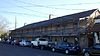
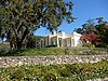
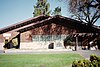
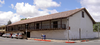
Image [ 1] Landmark name Location City or town Summary Bear Flag Monument 7 Bear Flag Monument Sonoma Plaza 38°17′36″N 122°27′24″W / 38.293233°N 122.4568°W / 38.293233; -122.4568 (Bear Flag Monument ) Sonoma Blue Wing Inn 17 Blue Wing Inn Sonoma State Historic Park 38°17′36″N 122°27′20″W / 38.29345°N 122.455483°W / 38.29345; -122.455483 (Blue Wing Inn ) Sonoma Bodega Bay & Harbor 833 Bodega Bay & Harbor Doran Park 38°19′25″N 123°02′52″W / 38.323611°N 123.047778°W / 38.323611; -123.047778 (Bodega Bay & Harbor ) Bodega Bay Buena Vista Winery 392 Buena Vista Winery 18000 Old Winery Rd. 38°17′58″N 122°25′23″W / 38.299444°N 122.423056°W / 38.299444; -122.423056 (Buena Vista Winery ) Sonoma Also on the NRHP list as NPS-86001902 Cooper's Sawmill 835 Cooper's Sawmill Mirabel and River Rds. 38°29′36″N 122°53′45″W / 38.4934694444444°N 122.895827777778°W / 38.4934694444444; -122.895827777778 (Cooper's Sawmill ) Santa Rosa Cotati Downtown Plaza 879 Cotati Downtown Plaza Downtown plaza 38°19′36″N 122°42′22″W / 38.32655°N 122.706167°W / 38.32655; -122.706167 (Cotati Downtown Plaza ) Cotati Fort Ross 5 Fort Ross Fort Ross State Historic Park , 19005 Coast Hwy 38°30′51″N 123°14′34″W / 38.514289°N 123.242708°W / 38.514289; -123.242708 (Fort Ross ) Jenner Haraszthy Villa 392-1 Haraszthy Villa Castle Rd. near Buena Vista Winery 38°18′02″N 122°25′32″W / 38.30047°N 122.425576°W / 38.30047; -122.425576 (Haraszthy Villa ) Sonoma Icaria-Speranza Commune 981 Icaria-Speranza Commune W side of Asti Rd. 38°46′27″N 122°59′59″W / 38.7742611111111°N 122.999755555556°W / 38.7742611111111; -122.999755555556 (Icaria-Speranza Commune ) Cloverdale Italian Swiss Colony 621 Italian Swiss Colony 38°45′46″N 122°58′26″W / 38.7628388888889°N 122.973961111111°W / 38.7628388888889; -122.973961111111 (Italian Swiss Colony ) Asti Jack London State Historic Park 743 Jack London State Historic Park Jack London State Historic Park 38°21′02″N 122°32′35″W / 38.350556°N 122.543056°W / 38.350556; -122.543056 (Jack London State Historic Park ) Glen Ellen Also on the NRHP list as NPS-66000240 Upload Photo 939 John Medica Gardens 5000 Medica Rd. 35°34′04″N 121°05′51″W / 35.5677805555556°N 121.097405555556°W / 35.5677805555556; -121.097405555556 (John Medica Gardens ) Santa Rosa Twentieth Century Folk Art Luther Burbank Home and Gardens 234 Luther Burbank Home and Gardens 200 Santa Rosa Ave. 38°26′10″N 122°42′42″W / 38.436111°N 122.711667°W / 38.436111; -122.711667 (Luther Burbank Home and Gardens ) Santa Rosa Also on the NRHP list as NPS-66000241 Mission San Francisco de Solano 3 Mission San Francisco de Solano Sonoma State Historic Park 38°17′38″N 122°27′21″W / 38.294012°N 122.455781°W / 38.294012; -122.455781 (Mission San Francisco de Solano ) Sonoma Nash-Patton Adobe 667 Nash-Patton Adobe 579 1st St. E. 38°17′25″N 122°27′25″W / 38.290367°N 122.45695°W / 38.290367; -122.45695 (Nash-Patton Adobe ) Sonoma Petrified Forest 915 Petrified Forest 4100 Petrified Forest Rd. 38°33′20″N 122°38′20″W / 38.555499°N 122.638943°W / 38.555499; -122.638943 (Petrified Forest ) Calistoga Presidio of Sonoma 316 Presidio of Sonoma Sonoma State Historic Park 38°17′37″N 122°27′24″W / 38.2937°N 122.4566°W / 38.2937; -122.4566 (Presidio of Sonoma ) Sonoma Rancho Petaluma Adobe 18 Rancho Petaluma Adobe Petaluma Adobe State Historic Park , 3325 Adobe Rd. 38°15′20″N 122°35′04″W / 38.25547°N 122.58451°W / 38.25547; -122.58451 (Rancho Petaluma Adobe ) Petaluma Also on the NRHP list as NPS-70000151 Saint Teresa of Avila Church, Bodega 820 Saint Teresa of Avila Church, Bodega Bodega Hwy near Bodega Ln. 38°20′46″N 122°58′21″W / 38.346197°N 122.972528°W / 38.346197; -122.972528 (Saint Teresa of Avila Church, Bodega ) Bodega Salvador Vallejo Adobe 501 Salvador Vallejo Adobe 421 1st St. 38°17′37″N 122°27′32″W / 38.2936°N 122.458783°W / 38.2936; -122.458783 (Salvador Vallejo Adobe ) Sonoma Built in 1846 home of Captain Salvador Vallejo [ 2] Sebastiani Vineyards and Winery 739 Sebastiani Vineyards and Winery 394 4th St E 38°17′36″N 122°26′58″W / 38.293367°N 122.449483°W / 38.293367; -122.449483 (Sebastiani Vineyards and Winery ) Sonoma Swiss Hotel 496 Swiss Hotel 18 W. Spain St. 38°17′38″N 122°27′29″W / 38.2938°N 122.457967°W / 38.2938; -122.457967 (Swiss Hotel ) Sonoma Temelec Hall 237 Temelec Hall 220 Temelec Circle 38°16′00″N 122°29′34″W / 38.266667°N 122.492778°W / 38.266667; -122.492778 (Temelec Hall ) Temelec Union Hotel & Union Hall 627 Union Hotel & Union Hall 35 Napa and 1st St. 38°17′31″N 122°27′31″W / 38.2918555555556°N 122.458747222222°W / 38.2918555555556; -122.458747222222 (Union Hotel & Union Hall ) Sonoma Vallejo Estate 4 Vallejo Estate Corner of Spain and West 3rd Streets 38°17′50″N 122°27′40″W / 38.297222°N 122.461111°W / 38.297222; -122.461111 (Vallejo Estate ) Sonoma Also on the NRHP list as NPS-72000262 Walters Ranch Hop Kiln 893 Walters Ranch Hop Kiln 7501 Sonoma Hwy. 38°32′10″N 122°52′04″W / 38.536134°N 122.867848°W / 38.536134; -122.867848 (Walters Ranch Hop Kiln ) Healdsburg William Hood House 692 William Hood House 7501 Sonoma Hwy. 38°26′37″N 122°34′36″W / 38.443611°N 122.576667°W / 38.443611; -122.576667 (William Hood House ) Santa Rosa Also on the NRHP list as NPS-97001658