History of Kasaragod

Last updated

Road sign in Kasaragod town Malkassignboard.JPG
Road sign in Kasaragod town

Kasaragod District is the northernmost district in the southwestern Indian coastal state of Kerala. The district has a long history starting from pre-historic times to the modern period.

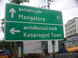
The district's northern border Thalappady is located just 10 km south to Mangalore on the southwestern Malabar coast of India. Kasaragod town is located on the estuary where the Chandragiri River, which is also the longest river in the district, empties into Arabian Sea.

The historic hill of Ezhimala is located on the southern portion of Kavvayi Backwaters of Nileshwaram. Kasaragod is home to several forts which include Arikady fort, Bekal Fort, Chandragiri Fort, and Hosdurg Fort (Puthiya Kotta fort). Bekal Fort is also the largest fort in Kerala.

Tulunad, where Tulu is traditionally spoken, is said to be bound on the south by the Chandragiri river and fort, thus including Kasaragod city within the Tulunad region. [1] [2]

Local bodies in Kasaragod district Local Self Governance in Kasaragod District.svg
Local bodies in Kasaragod district

Ancient era

Ananthapadmanabhaswamy temple at Ananthapura, Kumbla Anantapura Lake Temple.jpg
Ananthapadmanabhaswamy temple at Ananthapura, Kumbla

The Ancient Tamil Works of Sangam Age records that the area covering the district was part of Puzhinadu which consists of the coastal belt from Kozhikode to Mangalore. Politically the area was part of the Ezhimala Kingdom with its Capital at Ezhimala in present day Kannur district. The most famous King of Ezhimala was Nannan whose Kingdom extended up to Gudalur and northern parts of Coimbatore. Poozhinad, along with Karkanad which included the eastern regions of Ezhimala dynasty (Wayanad-Gudalur region with some portions of Kodagu), had its capital at Ezhimala. The Mooshaka kings were considered descendants of Nannan. By the 14th century, Mooshaka Kingdom was known as Kolathirinad and the rulers as Kolathiris.

The Kolathunad Kingdom at the peak of its power reportedly extended from Netravati River (Mangalore) in the north [3] to Korapuzha (Kozhikode) in the south with Arabian Sea on the west and Kodagu hills on the eastern boundary, also including the isolated islands of Lakshadweep in Arabian Sea. [4]

Medieval era

Malik Dinar Mosque, Thalangara, Kasaragod, is one of the oldest mosques in India. Malikdeenar Mosque in the Morning.jpg
Malik Dinar Mosque, Thalangara, Kasaragod, is one of the oldest mosques in India.
Maipady palace Maipady palace.jpg
Maipady palace
Arikady fort at Kumbla Arikady fort.jpg
Arikady fort at Kumbla

Kasaragod, about 50 km south of Mangalore city, was an important centre of trade in earlier times. Ramacharitam , probably the oldest literary work written in Old Malayalam, which dates back to 12th century CE, is thought to have written in Kasargod district as its manuscripts were discovered from Nileshwaram and the poem mentions about Ananthapura Lake Temple in Kumbla in detail. [5] Kasaragod was known to the Arabs by the name Harkwillia. [6] The Malik Dinar Mosque in Kasaragod town is one of the oldest Masjids in the Indian Subcontinent. [7] According to Qissat Shakarwati Farmad , the Masjids at Kodungallur, Kollam, Madayi, Barkur, Mangalore, Kasaragod, Kannur, Dharmadam, Panthalayini, and Chaliyam, were built during the era of Malik Dinar, and they are among the oldest Masjids in Indian Subcontinent. [8] It is believed that Malik Dinar died at Thalangara in Kasaragod town. [7] Many Arab travelers visiting Kerala between the 9th and the 14th centuries visited Kasaragod, which was an important trade centre then. Duarte Barbosa, a Portuguese traveler who visited Kumbla, near Kasaragod Town in 1514 recorded that rice being exported for coir to Maldives. [6] According to Barbosa, the people in the southwestern Malabar coast of India from Kumbla in the north to Kanyakumari in the south had spoken a unique language, which they called as "Maliama" (Malayalam). [9]

Until 16th century CE, Kasargod town was known by the name Kanhirakode (may be by the meaning, 'The land of Kanhira Trees') in Malayalam. [10] The Kumbla dynasty, who swayed over the land of southern Tulu Nadu wedged between Chandragiri River and Netravati River (including present-day Taluks of Manjeshwar and Kasaragod) from Maipady Palace at Kumbla, had also been vassals to the Kolathunadu kingdom of North Malabar, before the Carnatic conquests of Vijayanagara Empire. [11] The Kumbla dynasty had a mixed lineage of Malayali Nairs and Tuluva Brahmins. [12] They also claimed their origin from Cheraman Perumals of Kerala. [12] Francis Buchanan-Hamilton states that the customs of Kumbla dynasty were similar to those of the contemporary Malayali kings. [12]

The Kolathiri Dominion emerged into ten independent principalities i.e., Kadathanadu (Vadakara), Randathara or Poyanad (Dharmadom), Kottayam (Thalassery), Nileshwaram, Iruvazhinadu (Panoor), Kurumbranad etc., under separate royal chieftains due to the outcome of internal dissensions. [13] Many portions of the present-day Hosdurg taluk (Kanhangad) and Vellarikundu were parts of the Nileshwaram dynasty, who were relatives to both Kolathunadu as well as Zamorin of Calicut, in the early medieval period. [14] The areas north to the Chandragiri river (present-day Taluks of Manjeshwaram and Kasaragod) were ruled by the Kumbala dynasty. According to local legends, the region between Talapadi and Kavvayi rivers which constituted the erstwhile Kasaragod taluk, consisted of 32 Tulu and 32 Malayalam villages. [12]

Kannada kingdoms focused on Kasaragod in the 16th century CE. The Vijayanagara empire attacked and annexed Kasaragod from the Kolathiri Raja with Nileshwaram as one of the capital in the 16th century. During the decline of the Vijayanagara empire, the administration of this area was vested with Ikkeri Nayakas. [6] At the onset of collapse of the Vijayanagara empire, Venkappa Nayaka declared independence to Ikkery. Kumbla, Chandragiri, and Bekal are considered to be the chain of forts constructed or renovated by Shivappa Nayaka. [6]

The Chandragiri Fort is built on the southern bank of the estuary of Chandragiri River, just opposite to Kasaragod town. The Bekal Fort at Bekal, Pallikkara, which is situated in the midway between Kasaragod and Kanhangad, and is also largest fort in Kerala, was built in 1650 by Shivappa Nayaka of Keladi. [15]

SeaFromBakel.jpg
Panoramic view from inside Bekal Fort, the largest fort in Kerala

Colonial era

Sunset at Valiyaparamba beach Valiyaparamba Beach sun set.jpg
Sunset at Valiyaparamba beach
A map of Malabar District (Malayalam district) drawn by Francis Buchanan-Hamilton in 1807. The portion to the south of Kasaragod's Payaswini/Chandragiri river of British South Canara district was also included in the Malayalam region (just above the blue shaded region). Buchanan Journey map.jpg
A map of Malabar District (Malayalam district) drawn by Francis Buchanan-Hamilton in 1807. The portion to the south of Kasaragod's Payaswini/Chandragiri river of British South Canara district was also included in the Malayalam region (just above the blue shaded region).

Francis Buchanan, the family doctor of Arthur Wellesley, visited Kasaragod in 1800. [6] In his travelogue, he recorded information on places like Athiraparambu, Kavvayi, Nileshwaram, Bekal, Chandragiri and Manjeshwar. [6] On 19 January 1801, Francis speaks of visiting a Siva temple at Pulla (Pallikere), beyond which, the country rises into open rising lands, all the way to Chandragiri river and Chandragiri fort, which he describes as the northern border of the Malayala. He says that the country on the north of the Chandragiri fort and river is called by Hindus as Tuluva, the Tulu country. [16] [17] In 1763, Hyder Ali raided Bedanoor (Bidnur), the capital of the Ikkery Naiks. His son Tippu Sultan raided much of Malabar region in Kerala. As per the Treaty of Seringapatam of 1792, Tippu surrendered Malabar, except Kanara to the British. The British occupied Kanara only after the death of Tippu Sultan. [6] it is said that Kinavoor Molom (Sree Dharma Shashtha Temple) is belonging to Karinthalam (one of 64 Brahmin villages in old Kerala). Initially South Canara was placed under the Bombay presidency. [18] Later on 16 April 1862, South Canara was transferred to Madras Presidency and Kasaragod taluk was formed by replacing the erstwhile Bekal taluk. [18] Kasaragod was the second-most populated Taluk in South Canara only after to Mangalore taluk, and also the second-largest Taluk. [19]

Post-Independence

Kavvayi Backwaters of Nileshwaram Kottappuram-nileshwaram-house-boat.jpg
Kavvayi Backwaters of Nileshwaram
Kanhangad Municipal Office KanhangadMulticipalOffice1.jpg
Kanhangad Municipal Office

Before the formation of Kerala, Kasargod was a part of South Canara district of erstwhile Madras Presidency. However, in 19th century CE, Kasargod Taluk witnessed many struggles to separate the region from South Canara and to merge it with the Malabar District as it was the only Malayalam-majority region in South Canara. Kasargod became a part of Kannur district of Kerala following the reorganization of states and the formation of Kerala on 1 November 1956. [20] Later Kasargod was divided into two Taluks for the ease of administration - Kasargod and Hosdurg. Kasargod was declared a district in the year 1984. The inclusion of Kasaragod with Kerala has been a contentious issue as there is a sizeable population that speaks Tulu and Kannada. At the time of the 1951 Census of India, only 72.0% of the district's population chose their mother tongue as Malayalam. [21] 14.2% chose Tulu and 6.3% chose Kannada. [21] But it is noted that as per the 2011 census report only 8.8% and 4.2% of the total population in the district speak Tulu and Kannada respectively as their mother tongue. In 2012, the Second Oommen Chandy ministry appointed a commission under the leadership the former Chief Secretary P. Prabhakaran to study about the backwardness and issues faced by this northernmost district of Kerala and to draw up special package for the district. [22] In 2013, two more taluks, Manjeshwaram and Vellarikundu, were formed in the district. [23]

Related Research Articles

<span class="mw-page-title-main">Kasaragod</span> Municipal city in Kerala, India

Kasaragod is a municipal town and administrative headquarters of Kasaragod district in the state of Kerala, India. Established in 1966, Kasaragod was the first municipal town in the district. It is the northernmost district of Kerala and is also known as Sapta Bhasha Sangama Bhumi.

<span class="mw-page-title-main">Bekal Fort</span> Place in Kerala, India

Bekal Fort is a medieval fort built by Shivappa Nayaka of Keladi in 1650 AD, at Bekal. It is the largest fort in Kerala, spreading over 40 acres (160,000 m2).

<span class="mw-page-title-main">Kanara</span> Region in Karnataka, India

Kanara or Canara, also known as Karavali, is the historically significant stretch of land situated by the southwestern coast of India, alongside the Arabian Sea in the present-day Indian state of Karnataka. The subregion comprises three civil districts, namely: Uttara Kannada, Udupi, and Dakshina Kannada. Kassergode was included prior to the States Reorganisation Act.

<span class="mw-page-title-main">Kannur district</span> District in Kerala, India

Kannur is one of the 14 districts along the west coast in the state of Kerala, India. The city of Kannur is the district headquarters and gives the district its name. The old name, Cannanore, is the anglicized form of the Malayalam name "Kannur". Kannur district is bounded by Kasaragod District to the north, Kozhikode district to the south, Mahé district to the southwest and Wayanad District to the southeast. To the east, the district is bounded by the Western Ghats, which forms the border with the state of Karnataka. The Arabian Sea lies to the west. Paithalmala is the highest point in Kannur District (1,372m). Enclosed within the southern part of the district is the Mahé district of the Union Territory of Puducherry. The district was established in 1957.

<span class="mw-page-title-main">Tulu Nadu</span> Region and proposed state in southern India

Tulu Nadu or Tulunad is a region and a proposed state on the southwestern coast of India. The Tulu people, known as 'Tuluva', speakers of Tulu, a Dravidian language, are the preponderant ethnic group of this region. South Canara, an erstwhile district and a historical area, encompassing the undivided territory of the contemporary Dakshina Kannada and Udupi districts of Karnataka State and Kasaragod district of Kerala state forms the cultural area of the Tuluver.

<span class="mw-page-title-main">Kanhangad</span> Municipality in Kerala, India

Kanhangad is a major town, located in the Kasaragod District, state of Kerala, India.

<span class="mw-page-title-main">South Canara</span> District of British India in Madras, British Raj

South Canara was a district of the Madras Presidency of British India, located at 13.00°N 75.40°E. It comprised the towns of Kassergode and Udipi and adjacent villages, with the administration at Mangalore city. South Canara was one of the most heterogeneous areas of Madras Presidency, with Tulu, Malayalam, Kannada, Konkani, Marathi, Urdu, and Beary languages being spoken side by side. It was succeeded by the Tulu-speaking areas of Dakshina Kannada district, the Malayalam-speaking area of Kasaragod district and the Amindivi islands sub-division of the Laccadives, in the year 1956.

<span class="mw-page-title-main">Chandragiri River</span> River in India

The Chandragiri River, also known as the Payaswini River in Karnataka and as the Perumpuzha River in Kerala, is the longest river in Kasaragod district, Kerala, India. The River Is A Historical Treasure Of Chemnad. It was named after the Mauryan emperor Chandragupta Maurya.

<span class="mw-page-title-main">Malabar District</span> Administrative district of Bombay and later Madras from 1792 to 1956

Malabar District, also known as Malayalam District, was an administrative district on the southwestern Malabar Coast of Bombay Presidency (1792–1800), Madras Presidency (1800–1937), Madras Province (1937–1950) and finally, Madras State (1950–1956) in India. It was the most populous and the third-largest district in the erstwhile Madras State. The historic town of Calicut was the admisnitrative headquarters of this district.

<span class="mw-page-title-main">Mushika dynasty</span> Malayalam dynasty

Mushika dynasty, also spelled Mushaka, was a minor dynastic power that held sway over the region in and around Mount Ezhi (Ezhimala) in present-day North Malabar, Kerala, India. The country of the Mushikas, ruled by an ancient lineage of the Hehaya clan of the same name, appears in early historic (pre-Pallava) south India and it is believed that Mushika dynasty has their descents from Heheya Kingdom. Early Tamil poems contain several references to the exploits of Nannan of Ezhimalai. Nannan was known as a great enemy of the pre-Pallava Chera chieftains. The clan also had matrimonial alliances with the Chera, Pandya and Chola chieftains. The Kolathunadu (Kannur) Kingdom, which was the descendant of Mushika dynasty, at the peak of its power, reportedly extended from Netravati River (Mangalore) in the north to Korapuzha (Kozhikode) in the south with Arabian Sea on the west and Kodagu hills on the eastern boundary, also including the isolated islands of Lakshadweep in the Arabian Sea.

Nelliyalam is a panchayat town in The Nilgiris district in the Indian state of Tamil Nadu. As of 2011, the town had a population of 44,590.

<span class="mw-page-title-main">Kumbla</span> Town in Kerala, India

Kumbla is a small town in Kasaragod district of Kerala state in India. It is located 12 km north of Kasaragod town.

<span class="mw-page-title-main">Kasaragod district</span> District in Kerala, India

Kasaragod is one of the 14 districts in the southern Indian state of Kerala. Its northern border Thalappady is located just 9 km south to Ullal, which is the southernmost portion of the major port city Mangalore, on the southwestern Malabar coast of India.

<span class="mw-page-title-main">Devala, India</span> Village in Tamil Nadu, India

Devala is a town in the Nilgiris district of Tamil Nadu. It is situated at about 17 km from Gudalur on the Gudalur–Pandalur road. It is close to the Kerala-Tamil Nadu border, with Nilambur on the Kerala side.

<span class="mw-page-title-main">North Malabar</span> Geographical / Historical Area in India

North Malabar refers to the geographic area of southwest India covering the state of Kerala's present day Kasaragod, Kannur, and Wayanad districts, and the taluks of Vatakara and Koyilandy in the Kozhikode District of Kerala and the entire Mahé Sub-Division of the Union Territory of Puducherry. Traditionally North Malabar has been defined as the northern portion of the erstwhile Malabar District which lies between Chandragiri River and Korapuzha River. The region between Netravathi River and Chandragiri River, which included the portions between Mangalore and Kasaragod, are also often included in the term North Malabar, as the Kumbla dynasty in the southernmost region of Tulu Nadu, had a mixed lineage of Malayali Nairs and Tuluva Brahmins.

<span class="mw-page-title-main">Tulu Nadu state movement</span> Formation of separate Tulu Nadu state from Karnataka and Kerala

Tulu Nadu State movement is aimed at increasing Tulu Nadu's influence and political power through the formation of separate Tulu Nadu state from Karnataka and Kerala. Tulu Nadu is a region on the south-western coast of India. It consists of the Dakshina Kannada and Udupi districts of Karnataka and Kasargod district up to the Chandragiri river in Kerala. The Chandragiri River has traditionally been considered a boundary between Tulu Nadu and Kerala from the fourth century AD onwards. The first call for a separate Tulu Nadu state was made just after the Quit India Movement in 1942 by Srinivas Updhyaya Paniyadi, a banker and a press owner from Udupi. Mangalore is the largest and the chief city of Tulu Nadu. Tulu activists have been demanding a separate Tulu Nadu state since the late 2000s, considering language and culture as the basis for their demand.

Kundah taluk is a taluk of Nilgiris district of the Indian state of Tamil Nadu. The headquarters of the taluk is the town of Kundah and consists of seven revenue villages. Being Balacola, Kil Kundah, Mulligoor, Bikkatty, Kinnakorai, Ithalar and Mel Kundah.

Pandalur taluk is a taluk of Nilgiris district of the Indian state of Tamil Nadu. The headquarters of the taluk is the town of Pandalur.

<span class="mw-page-title-main">History of Kannur</span>

Kannur, formerly known in English as Cannanore, Arabic as Kannanur, and Portuguese as Cananor, is a city and a Municipal Corporation in North Malabar region, state of Kerala, India. It is the largest city in North Malabar, which is the northernmost region of Kerala. It is sometimes identified Kolathunadu, which was ruled by the Kolathiris. In the 12th and 13th centuries there was trade with Persia and Arabia.

Wayanad district, which is home to Edakkal Caves, has human settlement from prehistoric era. Wayanad is the sole Plateau in Kerala. The tribal dialects of Wayanad like the Ravula language and the Paniya language are closely related to Malayalam.

References

  1. Steever, Sanford B. (15 April 2015). The Dravidian Languages. Taylor & Francis. pp. 158–159. ISBN   9781136911644.
  2. Bhat, N. Shyam (1998). South Kanara, 1799-1860, A Study in Colonial Administration and Regional Response. Mittal Publications. p. 6. ISBN   9788170995869.
  3. Sreedhara Menon, A. (2007). Kerala Charitram (2007 ed.). Kottayam: DC Books. p. 175. ISBN   978-8126415885 . Retrieved 19 July 2020.
  4. District Census Handbook, Kasaragod (2011) (PDF). Thiruvananthapuram: Directorate of Census Operation, Kerala. p. 9.
  5. http://sdeuoc.ac.in/sites/default/files/sde_videos/SLM-MA-Mal-Aadyakala%20Malayala%20kavitha%20%281%29.pdf Archived 8 June 2021 at the Wayback Machine [ bare URL PDF ]
  6. 1 2 3 4 5 6 7 "Kasaragod History". Government of Kerala. Archived from the original on 25 September 2008. Retrieved 11 March 2009.
  7. 1 2 Pg 58, Cultural heritage of Kerala: an introduction, A. Sreedhara Menon, East-West Publications, 1978
  8. Prange, Sebastian R. Monsoon Islam: Trade and Faith on the Medieval Malabar Coast. Cambridge University Press, 2018. 98.
  9. Barbosa, Duarte (1989). The Book of Duarte Barbosa: An Account of the countries bordering on the Indian Ocean and their inhabitants (Volume 2). Asian Educational Services. pp. 1–7. ISBN   9788120604513.
  10. S. Muhammad Hussain Nainar (1942). Tuhfat-al-Mujahidin: An Historical Work in The Arabic Language. University of Madras.
  11. M. Vijayanunni. 1981 Census Handbook- Kasaragod District (PDF). Directorate of Census Operations, Kerala.
  12. 1 2 3 4 Sreedhara Menon, A. (2007). A Survey of Kerala History (2007 ed.). Kottayam: DC Books. ISBN   9788126415786.
  13. Logan, William (2010). Malabar Manual (Volume-I). New Delhi: Asian Educational Services. pp. 631–666. ISBN   9788120604476.
  14. The Hindu staff reporter (21 November 2011). "Neeleswaram fete to showcase its heritage". The Hindu. Retrieved 24 November 2016.
  15. "A Portion of Kasaragod's Bekal Forts Observation Post Caves in". The Hindu. 12 August 2019.
  16. Buchanan, Francis Hamilton (1807). A Journey from Madras Through the Countries of Mysore, Canara, and Malabar. Cadell.
  17. M., Amruth (2004). "Forest-Agriculture Linkage and its Implications on Forest Management: A study of Delampady panchayat" (PDF).
  18. 1 2 M. Vijayanunni. 1981 Census Handbook- Kasaragod District (PDF). Directorate of Census Operations, Kerala. p. 11.
  19. Government of Madras (1953). 1951 Census Handbook- South Canara District (PDF). Madras Government Press.
  20. "Kasargod After District Formation". Kasargod District. Archived from the original on 10 April 2009. Retrieved 11 March 2009.
  21. 1 2 J. I. Arputhanathan (1955). South Kanara, The Nilgiris, Malabar and Coimbatore Districts (Village-wise Mother-tongue Data for Bilingual or Multilingual Taluks) (PDF). Madras Government Press.
  22. Roy Mathew (24 May 2012). "Commission to draw up package for Kasaragod". The Hindu.
  23. "12 new taluks to be formed in Kerala". The Hindu. 21 March 2013.

Further reading

General

History

Languages

District Census Handbooks