Related Research Articles

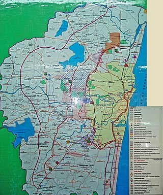
Tambaram is a city located within the Chennai Metropolitan Area in the Indian State of Tamil Nadu. The city is governed by Tambaram City Municipal Corporation.
Pammal is a neighbourhood of Tambaram located within the Chennai Metropolitan Area around 22 kilometers from Chennai Central Railway Station, in proximity to Pallavaram on the western side of the Grand Southern Trunk Road close to Chennai International Airport. It is 7 kilometers away from Tambaram. The neighborhood is served by Pallavaram Railway Station of the Chennai Suburban Railway Network.Formerly a Municipality ,Pammal was merged to Tambaram City Municipal Corporation in 2021.
Anakaputhur is a neighbourhood in Tambaram, which is part of the Chennai Metropolitan Area in the Indian state of Tamil Nadu. It is located next to Pammal on the western side. Anakaputhur was once famous for its traditional weaving business, which has declined due to modern competition. As of 2011, the town had a population of 48,050.Formerly a municipality,it was merged into Tambaram Municipal Corporation in 2021.
Iyyappanthangal is a neighborhood to the west of Chennai, Tamilnadu, India. It comes under Mangadu Municipality of Chennai Metropolitan Area (CMA), governed by CMDA. It is located 20 kilometres (12 mi) away from Fort St George on the Mount-Poonamallee Road. The nearest railway stations are at Guindy about 11 kilometres (6.8 mi) away and Avadi about 12 kilometres (7.5 mi) away. The Porur Junction where a much-needed road overbridge on the busy Guindy–Poonamallee stretch was built after a very long delay of nearly five years is just about 2 km from Iyyapanthangal and the Poonamallee Junction is just about 6 km from the town.
Grand Southern Trunk Road or National Highway 45 is an arterial road in the Indian state of Tamil Nadu. It is also known as Chennai–Trichy Highway. The road starts from Kathipara Junction in St Thomas Mount, Chennai towards Tiruchirappalli. It branches out from Anna Salai.

The Chennai Suburban Railway is a commuter rail system in the city of Chennai, Tamil Nadu, India, operated by the Southern Railways branch of Indian Railways. It is the second largest suburban rail network in terms of route length and the third largest in terms of commuters in India. Around 1,000 services are operated daily between 4:00 a.m. and midnight. It is the longest suburban circular route in India covering of 235.5 km (146.3 mi).
The Chennai Metropolitan Development Authority (CMDA), formerly known as the Madras Metropolitan Development Authority (MMDA), is the nodal planning agency of Chennai in the Indian state of Tamil Nadu. The CMDA administers the Chennai Metropolitan Region, spread over an area of 5,904 km2 (2,280 sq mi) and covers the districts of Chennai, Thiruvallur, Chengalpattu, Ranipet and Kancheepuram. It was set up for the purposes of planning, co-ordination, supervising, promoting and securing the planned development of the Chennai Metropolitan Area. It coordinates the development activities of the municipal corporations, municipalities and other local authorities.
The Greater Chennai Metropolitan Area, or simply the Chennai Metropolitan Area (CMA), is the fourth-most populous metropolitan area in India, the 22nd-most in Asia, and the 40th-most in the world. The CMA consists of the core city of Chennai, which is coterminous with the Chennai district, and its suburbs in Kanchipuram, Chengalpattu, Thiruvallur, and Ranipet districts. The Chennai Metropolitan Development Authority (CMDA) is the nodal agency that handles town planning and development within the metro area. In 1974, an area encompassing 1,189 km2 (459 sq mi) around the city was designated as the CMA and the CMDA was designated as the authority to plan the growth of the city and the area around it. Subsequently in October 2022 the area of CMA was expanded five-fold to 5,904 km2 (2,280 sq mi).
Chennai Monorail was a proposal for a number of lines as part of mass transit system for the Indian city of Chennai. Originally the city planned to use monorail on all lines but many were subsequently changed to railways as part of the Chennai Metro.
The Outer Ring Road, officially State Highway 234, is a major transport corridor along the periphery of Chennai Metropolitan Area (CMA) by the Chennai Metropolitan Development Authority (CMDA). It is 62 km long connecting GST Road at Perungalathur, GST Road at Vandalur, NH 48 at Nazarethpettai, NH 716 at Pattabiram to NH 16 at Vijayanaallur and to TPP road at Minjur. On 29 August 2010, the then Tamil Nadu Deputy Chief Minister M. K. Stalin laid the foundation for the first phase of the project from Vandalur to Nemilichery covering a distance of 30 kilometres (19 mi). The Chennai ORR generally covers Avadi North, West and South, Redhills, Minjur and Tambaram neighbourhoods. Chennai Outer ring road had a plan of Chennai metro rail CMRL which is going to build up at gap between two roads.

Pallavaram railway station is one of the railway stations of the Chennai Beach–Chengelpet section of the Chennai Suburban Railway Network. It serves the neighbourhood of Pallavaram, Pammal, Nagalkeni, Anakaputhur, Pozhichalur, Cowl Bazaar, Kolapakkam, Gerugambakkam, Kovoor, Thandalam, Tharapakkam, Thiruneermalai, Kundrathur, Mangadu, and Keelkattalai. It is situated about 23 km (14 mi) from Chennai Beach, and has an elevation of 4 m (13 ft) above sea level.
Chennai is home to the second largest vehicular population in India, behind New Delhi. The total road network in the city's metropolitan area is 2,780 km. With Chennai's vehicular population having experienced a surge in the late 1990s, several flyovers were built to reduce the traffic congestion in the city. Of about ₹ 15,600 million invested by the state government between 2005 and 2016, Chennai cornered a major chunk of the investment. As of 2016, there were 42 functional flyovers in the city and about 30 bridges, catering to the city's vehicular population of about 12 million, including about 600,000 cars. In addition, more than 36 flyovers are in the pipeline.
Coimbatore Metro, also known as Kovai Metro, is a proposed rapid transit system for Coimbatore, Tamil Nadu.
Pallavaram Corporation was a corporation planned by the government of the Indian state of Tamil Nadu. In 2011, Chennai Corporation extended its city limits. In 2017, Pallavaram, Avadi and Tambaram was announced for the upgrade into corporations. But later in year 2019, Avadi is upgraded as municipal corporation, while Pallavaram remained as a municipality, and a part of the newly created Chengalpattu district. The proposed Chennai Pallavaram Corporation would have been a satellite corporation adjacent to the Greater Chennai Corporation.
Pallavaram–Kundrathur–Poonamallee Road or State Highway 113A is an arterial road in Chennai City connecting Grand Southern Trunk Road in Pallavaram with Trunk Road in Kumananchavadi in Poonamallee running for a length of 13 kilometres (8.1 mi). The road is also known as Pammal Main Road. The road runs through Pammal, Anakaputhur, Kundrathur, Mangadu and Kumanan Chavadi.
Pallavaram–Thuraipakkam Radial Road is an arterial road in Chennai connecting Grand Southern Trunk Road in Pallavaram with Rajiv Gandhi Salai in Thuraipakkam. The road was constructed by State Highways in 2000. Construction of Road divides Pallavaram Eri on the either side of the road. Now Lake is available only on the Northern Side of the Road.
The Purple Line or Line 3 is one of the three lines of Chennai Metro, Phase 2 Project. The under construction line stretches from Madhavaram Milk Colony to Kilambakkam. The line will consist of 47 stations, out of which 28 are underground and 19 are elevated.
The Orange Line or Line 4 is one of the three lines of Chennai Metro, Phase 2 Project. The under construction line stretches from Light House to Poonamallee Bypass. The line will consist of 27 stations, out of which 9 are underground and 18 are elevated.
The Red Line or Line 5 is one of the three lines of Chennai Metro, Phase 2 Project. The under construction line stretches from Madhavaram Milk Colony to Sholinganallur. The line will consist of 45 stations, out of which 6 are underground, 1 at grade and 38 are elevated. The government has announced feasibility studies to extend metro rail's corridor-5 from Koyambedu to Avadi via Thirumangalam, Mogappair and Ambattur. At present, the proposed corridor-5 links Madhavaram with Sholinganallur via Koyambedu, Alandur and Madipakkam.
References
- ↑ Singh, Neha (13 February 2020). "CMRL begins feasibility study of Light Metro Rail to link Tambaram-Velachery". Metro Rail News. Retrieved 4 June 2020.
- ↑ Kabirdoss, Yogesh (26 November 2018). "Government orders study, monorail gets a push". The Times of India. Retrieved 4 June 2020.
- ↑ Simhan, T. E. Raja. "TN kickstarts Rs 16,650-cr Monorail project". @businessline. Retrieved 4 June 2020.
- ↑ "Chennai Comprehensive Transportation Study" (PDF). Archived (PDF) from the original on 10 August 2013.
- ↑ "Rs 1.5 trillion to change how we travel". The New Indian Express. Retrieved 24 November 2020.
| Organisations |
| ||||||||||
|---|---|---|---|---|---|---|---|---|---|---|---|
| Air |
| ||||||||||
| Rail |
| ||||||||||
| Road |
| ||||||||||
| Water | |||||||||||
| Suburban rail |
| ||||||||
|---|---|---|---|---|---|---|---|---|---|
| Rapid transit |
| ||||||||
| Monorail |
| ||||||||
| Metrolite |
| ||||||||
| Tram |
| ||||||||
| Authority | |||||||||||||||
|---|---|---|---|---|---|---|---|---|---|---|---|---|---|---|---|
| Related organisations | |||||||||||||||
| Zones | |||||||||||||||
| Rolling stock | |||||||||||||||
| Manufacturing units |
| ||||||||||||||
| Railway depots |
| ||||||||||||||
| Main lines and suburban lines |
| ||||||||||||||
| Passenger trains (List) |
| ||||||||||||||
| Training institutes |
| ||||||||||||||
| Trade unions | |||||||||||||||
| Related articles | |||||||||||||||
| Transport by cities | |||||||||
|---|---|---|---|---|---|---|---|---|---|
| Road |
| ||||||||
| Rail |
| ||||||||
| Air |
| ||||||||
| Water |
| ||||||||
| Space |
| ||||||||