Solar eclipse of September 23, 1699

Last updated
Solar eclipse of September 23, 1699
Hybrid eclipse
SE1699Sep23H.png
Map
Gamma 0.6999
Magnitude 1.0095
Maximum eclipse
Duration49 s (0 min 49 s)
Coordinates 41°48′N40°42′E / 41.8°N 40.7°E / 41.8; 40.7
Max. width of band46 km (29 mi)
Times (UTC)
Greatest eclipse10:16:12
References
Saros 139 (12 of 71)
Catalog # (SE5000) 8786

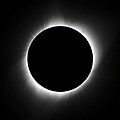
A total solar eclipse occurred on September 23, 1699. [1] A solar eclipse occurs when the Moon passes between Earth and the Sun, thereby totally or partly obscuring the image of the Sun for a viewer on Earth. A total solar eclipse occurs when the Moon's apparent diameter is larger than the Sun's, [2] blocking all direct sunlight, turning day into darkness. Totality occurs in a narrow path across Earth's surface, with the partial solar eclipse visible over a surrounding region thousands of kilometres wide.

Contents

A narrow path of totality just clipped the north-east corner of Scotland, including Wick. [3]

Giovanni Domenico Cassini produced the first ever map of a solar eclipse for this event, showing the line of centrality, partial eclipse, and the limits of the eclipse. [4] [5] In Scotland, the eclipse was total to the north of Caithness for a brief interval, and a near total eclipse was observed in Edinburgh. [6] [7] From England, Samuel Pepys noted an eclipse of the Sun, although it was dated September 3, 1699. [8] The total eclipse was recorded from the Crimean peninsula by a Jewish rabbi named Debar Śepatayim, who interpreted it as a sign. [9] Coincidentally, 1699 marked the final year of the Maunder Minimum. [10]

See also

References

  1. "NASA Besselian elements". NASA Eclipse Website. Retrieved 2025-09-07.
  2. Mobberley, Martin (2007). Total Solar Eclipses and How to Observe Them. Astronomers' Observing Guides. Springer Science & Business Media. pp. 8–10. ISBN   9780387698281.
  3. "Hybrid Solar Eclipse of 1699 September 23". NASA Eclipse Website. Retrieved 2025-09-07.
  4. Edney, Matthew H.; Pedley, Mary Sponberg, eds. (2020). Cartography in the European Enlightenment. The History of Cartography. Vol. 4. University of Chicago Press. pp. 357–358. ISBN   978-0-226-33922-1.
  5. van Gent, Robert H. "Early 18th-Century Maps of Solar Eclipse Paths" (PDF). Institute for History and Foundations of Mathematics and the Natural Sciences, University of Utrecht. Retrieved 2025-09-07.
  6. Chambers, George Frederick (1909). The Story of Eclipses. Library of valuable knowledge. University Society, Incorporated. p. 132.
  7. Johnson, S. J. (October 1892). Turner, H. H.; Common, A. A. (eds.). "Correspondance". The Observatory. 15. Red Lion Court, Fleet Street, London: Taylor and Francis: 377.
  8. Pepys, Samuel (2015). Delphi Complete Works of Samuel Pepys (Illustrated). Six. Vol. 2. Delphi Classics.
  9. Lekhno, Rabbi David; et al. (2021). Debar Śepatayim: An Ottoman Hebrew Chronicle from the Crimea (1683-1730). Written by Krymchak Rabbi David Lekhno. Academic Studies Press. ISBN   9781644696194. ...darkness fell on the face of all the earth, till it was completely eclipsed and the stars were seen in the firmament; and this was for a sign and a token of the future, ...
  10. Hoyt, D. V.; Schatten, K. H. (1997). The role of the sun in climate change. Oxford University Press. pp. 23–24. ISBN   9780195357486.