List of solar eclipses in the 20th century

Last updated

Total solar eclipse of June 8, 1937, from Kanton Island. Kanton total eclipse June8, 1937.jpg
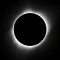
Total solar eclipse of June 8, 1937, from Kanton Island.

During the 20th century, there were 228 solar eclipses of which 78 were partial, 73 were annular, 71 were total and 6 were hybrids between total and annular eclipses. Of these, two annular and three total eclipses were non-central, [1] in the sense that the very center (axis) of the Moon's shadow will miss the Earth (for more information see gamma). [2] In the 20th century, the greatest number of eclipses in one year is five, in 1935, though the years 1917, 1946, 1964, 1982 and 2000 had four eclipses each. One month, July 2000, featured two solar eclipses, on 1 July and 31 July. The predictions given here are by Fred Espenak of NASA's Goddard Space Flight Center. [1]

Contents

The longest measured duration in which the Moon completely covered the Sun, known as totality, was during the solar eclipse of June 20, 1955. This total solar eclipse had a maximum duration of 7 minutes and 7.74 seconds. The longest possible duration of a total solar eclipse is 7 minutes and 32 seconds. The longest annular solar eclipse of the 20th century took place on December 14, 1955, with a duration of 12 minutes and 9.17 seconds. The maximum possible duration is 12 minutes and 29 seconds. Two instances of back-to-back hybrid solar eclipses within a period of less than six months occurred in the 20th century. The eclipse of June 17, 1909, was the second hybrid eclipse in the span of less than one year, the first one being on December 23, 1908, and the eclipse of 29 March 1987, was the second hybrid eclipse in the span of less than one year, the first one being on 3 October 1986. [a]

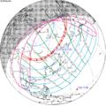
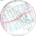
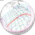
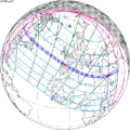
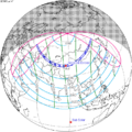
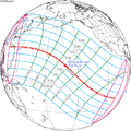
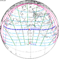
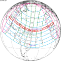
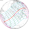
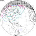
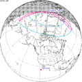
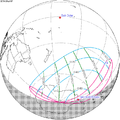
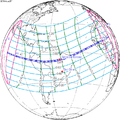
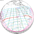
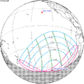
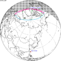
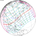
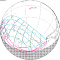
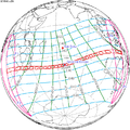
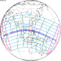
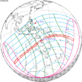
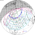
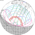
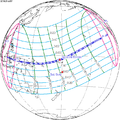
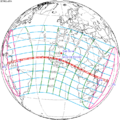
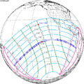
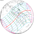
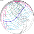
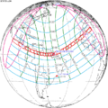
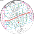
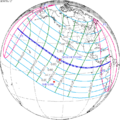
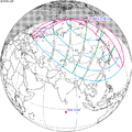
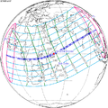
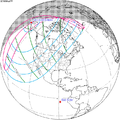
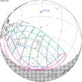
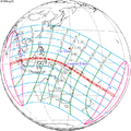
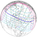
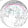
The table contains the date and time of the greatest eclipse (in dynamical time), which in this case is the time when the axis of the Moon's shadow cone passes closest to the centre of Earth; this is in (Ephemeris Time). The number of the saros series that the eclipse belongs to is given, followed by the type of the eclipse (either total, annular, partial or hybrid), the gamma of the eclipse (how centrally the shadow of the Moon strikes the Earth), and the magnitude of the eclipse (the fraction of the Sun's diameter obscured by the Moon). For total and annular eclipses, the duration of the eclipse is given, as well as the location of the greatest eclipse (the point of maximum eclipse) and the path width of the total or annular eclipse. The geographical areas from which the eclipse can be seen are listed along with a chart illustrating each eclipse's respective path. [3]

Notable eclipses of the 20th century

Eclipses

DateTime of
greatest eclipse
(Terrestrial Time)
Saros Type Gamma Magnitude Central
duration
(min:s)
LocationPath widthGeographical areaChartRef(s)
kmmi
May 18, 1901 5:33:48136Total−0.36261.0686:29 1°42′S98°24′E / 1.7°S 98.4°E / -1.7; 98.4 238148Total: French Madagascar, Réunion, British Mauritius, Dutch East Indies and British New Guinea

Partial: East Africa, South Asia, Southeast Asia, Australia, Western Oceania

SE1901May18T.png [a] [6]
November 11, 1901 7:28:21141Annular0.47580.921611:01 10°48′N68°54′E / 10.8°N 68.9°E / 10.8; 68.9 336209Annular: Sicily, British Malta, Ottoman Tripolitania, Egypt, Ottoman Empire, Emirate of Jabal Shammar, Aden Protectorate, Muscat and Oman, British Raj, British Ceylon, Siam, French Indochina, Bombay Reef in the Paracel Islands and Philippines

Partial: North Africa, East Africa, Asia, Northern Australia

SE1901Nov11A.png [a] [6]
April 8, 1902 14:05:06108Partial1.50240.0643 71°42′N142°24′W / 71.7°N 142.4°W / 71.7; -142.4 Partial: Northern Canada SE1902Apr08P.png [a] [6]
May 7, 1902 22:34:16146Partial−1.08310.8593 70°00′S125°06′W / 70.0°S 125.1°W / -70.0; -125.1 Partial: Eastern Oceania SE1902May07P.png [a] [6]
October 31, 1902 8:00:18151Partial1.15560.696 70°48′N100°48′E / 70.8°N 100.8°E / 70.8; 100.8 Partial: Northern Europe, Eastern Europe, Northern Middle East, South Asia, East Asia, North Asia SE1902Oct31P.png [a] [6]
March 29, 1903 1:35:23118Annular0.84130.97671:53 56°12′N130°18′E / 56.2°N 130.3°E / 56.2; 130.3 15395Annular: China, Russia and Northern Canada

Partial: Southeast Asia, East Asia, North Asia, Alaska, Northwestern North America

SE1903Mar29A.png [a] [6]
September 21, 1903 4:39:52123Total−0.89671.03162:12 58°00′S77°12′E / 58.0°S 77.2°E / -58.0; 77.2 241150Total: Antarctica

Partial: Southeast Africa, Southern Australia, New Zealand, Antarctica

SE1903Sep21T.png [a] [6]
March 17, 1904 5:40:44128Annular0.12990.93678:07 5°36′N94°42′E / 5.6°N 94.7°E / 5.6; 94.7 237147Annular: German East Africa, Portuguese East Africa, Grande Comore Island, British Seychelles, Sumatra, Siam, French Indochina, the Paracel Islands and the American Philippines

Partial: East Africa, South Asia, Southeast Asia, East Asia

SE1904Mar17A.png [a] [6]
September 9, 1904 20:44:21133Total−0.16251.07096:20 3°42′S134°30′W / 3.7°S 134.5°W / -3.7; -134.5 234145Total: German New Guinea and Chile

Partial: Oceania, Western South America

SE1904Sep09T.png [a] [6]
March 6, 1905 5:12:26138Annular−0.57680.92697:58 39°30′S117°24′E / 39.5°S 117.4°E / -39.5; 117.4 334208Annular: Australia, New Caledonia and New Hebrides

Partial: Madagascar, Antarctica, Australia, Oceania

SE1905Mar06A.png [a] [6]
August 30, 1905 13:07:26143Total0.57081.04773:46 42°30′N4°18′W / 42.5°N 4.3°W / 42.5; -4.3 192119Total: Canada, Spain, French Algeria, French Tunisia, Ottoman Tripolitania, Egypt, Ottoman Empire, Aden Protectorate and Muscat and Oman

Partial: Eastern North America, Europe, North Africa, Central Africa, West Asia

SE1905Aug30T.png [a] [6]
February 23, 1906 7:43:20148Partial−1.24790.5386 71°24′S170°18′W / 71.4°S 170.3°W / -71.4; -170.3 Partial: Antarctica, Southern Australia SE1906Feb23P.png [a] [6]
July 21, 1906 13:14:19115Partial−1.36370.3355 68°36′S33°18′W / 68.6°S 33.3°W / -68.6; -33.3 Partial: Argentina and Chile SE1906Jul21P.png [a] [6]
August 20, 1906 1:12:50153Partial1.37310.3147 70°48′N66°24′W / 70.8°N 66.4°W / 70.8; -66.4 Partial: Northern Russia, Alaska, Western Canada, Pacific Northwest SE1906Aug20P.png [a] [6]
January 14, 1907 6:05:43120Total0.86281.02812:25 38°18′N86°24′E / 38.3°N 86.4°E / 38.3; 86.4 189117Total: Russian Empire and China

Partial: Asia

SE1907Jan14T.png [a] [6]
July 10, 1907 15:24:32125Annular−0.63130.94567:23 16°54′S50°54′W / 16.9°S 50.9°W / -16.9; -50.9 258160Annular: Chile, Bolivia and Brazil

Partial: South America, Southern Central America

SE1907Jul10A.png [a] [6]
January 3, 1908 21:45:22130Total0.19341.04374:14 11°48′S145°06′W / 11.8°S 145.1°W / -11.8; -145.1 14993Total: British Western Pacific Territories and Costa Rica

Partial: Northern Oceania, Hawaii, Southern North America, Central America, Western Caribbean, Western South America

SE1908Jan03T.png [a] [6]
June 28, 1908 16:29:51135Annular0.13890.96554:00 31°24′N67°12′W / 31.4°N 67.2°W / 31.4; -67.2 12678Annular: Mexico, Florida, Mauritania, Senegal, French Sudan, Upper Volta and British Gold Coast

Partial: Northern South America, North America, Caribbean, West Africa, North Africa, Western Europe

SE1908Jun28A.png [a] [6]
December 23, 1908 11:44:28140Hybrid−0.49851.00240:12 54°18′S0°30′W / 54.3°S 0.5°W / -54.3; -0.5 106.2Annular: Chile, Argentina, Uruguay and Brazil

Partial: South America, Antarctica, Southern Africa

SE1908Dec23H.png [a] [6]
June 17, 1909 23:18:38145Hybrid0.89571.00650:24 89°12′N123°36′E / 89.2°N 123.6°E / 89.2; 123.6 5132Total: Russia, Ellesmere Island and Greenland

Partial: East Asia, Northern North America

SE1909Jun17H.png [a] [6]
December 12, 1909 19:44:48150Partial−1.24560.5424 65°00′S86°00′E / 65.0°S 86.0°E / -65.0; 86.0 Partial: Antarctica, New Zealand SE1909Dec12P.png [a] [6]
May 9, 1910 5:42:13117Total−0.94371.064:15 48°12′S125°12′E / 48.2°S 125.2°E / -48.2; 125.2 594369Total: Wilkes Land and Tasmania

Partial: Antarctica, Australia, Southeast Asia

SE1910May09T.png [a] [6]
November 2, 1910 2:08:32122Partial1.06030.8515 61°54′N155°06′W / 61.9°N 155.1°W / 61.9; -155.1 Partial: Northeast Asia, Alaska, Hawaii SE1910Nov02P.png [a] [6]
April 28, 1911 22:27:22127Total−0.22941.05624:57 1°54′N151°54′W / 1.9°N 151.9°W / 1.9; -151.9 190120Total: Australia, Tonga, American Samoa and Cook Islands

Partial: Oceania, Southern North America, Central America, Western Caribbean

SE1911Apr28T.png [a] [7]
October 22, 1911 4:13:02132Annular0.32240.9653:47 6°18′N121°24′E / 6.3°N 121.4°E / 6.3; 121.4 13383Annular: Russian Empire, China, French Indochina, Territory of Papua and British Western Pacific Territories

Partial: South Asia, Southeast Asia, East Asia, Australia, Oceania

SE1911Oct22A.png [a] [7]
April 17, 1912 11:34:22137Hybrid0.5281.00030:02 38°24′N11°18′W / 38.4°N 11.3°W / 38.4; -11.3 10.62Total: Portugal and Spain

Annular: Venezuela, Brazil, British Guyana, Dutch Guiana, France, Belgium, Netherlands, Germany and Russian Empire
Partial: Eastern South America, Eastern North America, West Africa, Europe, West Asia

SE1912Apr17H.png [a] [7]
October 10, 1912 13:36:14142Total−0.41491.02291:55 28°06′S40°06′W / 28.1°S 40.1°W / -28.1; -40.1 8553Total: Ecuador, Colombia, Peru and Brazil

Partial: Central America, Caribbean, South America, Antarctica, Southern Africa

SE1912Oct10T.png [a] [7]
April 6, 1913 17:33:07147Partial1.31470.4244 61°12′N175°42′E / 61.2°N 175.7°E / 61.2; 175.7 Partial: Eastern Russia, Northwestern North America SE1913Apr06P.png [a] [7]
August 31, 1913 20:52:12114Partial1.45120.1513 61°30′N26°48′W / 61.5°N 26.8°W / 61.5; -26.8 Partial: Eastern Canada, Greenland SE1913Aug31P.png [a] [7]
September 30, 1913 4:45:49152Partial−1.10050.8252 61°00′S11°36′E / 61.0°S 11.6°E / -61.0; 11.6 Partial: Southern Africa, Antarctica SE1913Sep30P.png [a] [7]
February 25, 1914 0:13:01119Annular−0.94160.92485:35 62°06′S113°18′W / 62.1°S 113.3°W / -62.1; -113.3 839521Annular: Antarctica

Partial: Antarctica, New Zealand, Southern South America

SE1914Feb25A.png [a] [7]
August 21, 1914 12:34:27124Total0.76551.03282:14 54°30′N27°06′E / 54.5°N 27.1°E / 54.5; 27.1 170110Total: Canada, Greenland, Norway, Sweden, Russian Empire, Ottoman Empire, Persia and British Raj

Partial: Northeast North America, Europe, North Africa, East Africa, Middle East

SE1914Aug21T.png [a] [7]
February 14, 1915 4:33:20129Annular−0.20240.97892:04 24°00′S120°42′E / 24.0°S 120.7°E / -24.0; 120.7 7748Annular: Australia, Papua and German New Guinea

Partial: Antarctica, Australia, Oceania, Southeast Asia

SE1915Feb14A.png [a] [7]
August 10, 1915 22:52:25134Annular0.01240.98531:33 16°24′N161°24′W / 16.4°N 161.4°W / 16.4; -161.4 5232Annular: Pacific Ocean

Partial: Northeast Asia, Northern Oceania, Hawaii

SE1915Aug10A.png [a] [7]
February 3, 1916 16:00:21139Total0.49871.0282:36 11°06′N67°42′W / 11.1°N 67.7°W / 11.1; -67.7 10867Total: Colombia, Venezuela, Guadeloupe, Saint Martin and Saint Barthélemy

Partial: North America, Central America, Northern South America, Northwest Africa, Western Europe

SE1916Feb03T.png [a] [7]
July 30, 1916 2:06:10144Annular−0.77090.94476:24 29°00′S132°24′E / 29.0°S 132.4°E / -29.0; 132.4 313194Annular: Australia

Partial: Southeast Asia, Australia, Oceania, Antarctica

SE1916Jul30A.png [a] [7]
December 24, 1916 20:46:22111Partial−1.53210.0114 65°42′S32°06′E / 65.7°S 32.1°E / -65.7; 32.1 Partial: Antarctica SE1916Dec24P.png [a] [7]
January 23, 1917 7:28:31149Partial1.15080.7254 62°18′N25°36′E / 62.3°N 25.6°E / 62.3; 25.6 Partial: Northeast Africa, Europe, West Asia, Central Asia SE1917Jan23P.png [a] [7]
June 19, 1917 13:16:21116Partial1.28570.4729 66°12′N150°06′E / 66.2°N 150.1°E / 66.2; 150.1 Partial: Northern North America, Northern Europe, North Asia SE1917Jun19P.png [a] [7]
July 19, 1917 2:42:42154Partial−1.51010.0863 63°42′S101°48′E / 63.7°S 101.8°E / -63.7; 101.8 Partial: Antarctica SE1917Jul19P.png [a] [7]
December 14, 1917 9:27:20121Annular−0.91570.97911:17 88°00′S124°48′E / 88.0°S 124.8°E / -88.0; 124.8 189117Annular: Antarctica

Partial: Antarctica, Southern South America, Australia

SE1917Dec14A.png [a] [7]
June 8, 1918 22:07:43126Total0.46581.02922:23 50°54′N152°00′W / 50.9°N 152.0°W / 50.9; -152.0 11270Total: Washington, Oregon, Idaho, Utah, Wyoming, Colorado, Kansas, Oklahoma, Arkansas, Louisiana, Mississippi, Alabama and Florida

Partial: Northeast Asia, North America

SE1918Jun08T.png [a] [7]
December 3, 1918 15:22:02131Annular−0.23870.93837:06 36°06′S53°42′W / 36.1°S 53.7°W / -36.1; -53.7 236147Annular: Chile, Argentina, Uruguay, South West Africa and Portuguese Angola

Partial: South America, Antarctica, Southern Africa, Central Africa

SE1918Dec03A.png [a] [7]
May 29, 1919 13:08:55136Total−0.29551.07196:51 4°24′N16°42′W / 4.4°N 16.7°W / 4.4; -16.7 244152Total: Peru, Chile, Bolivia, Brazil, Liberia, Ivory Coast, Principe, Río Muni, French Equatorial Africa, Belgian Congo, Rhodesia, German East Africa, Nyasaland and Mozambique

Partial: South America, Africa

SE1919May29T.png [a] [7]
November 22, 1919 15:14:12141Annular0.45490.919811:37 6°54′N48°54′W / 6.9°N 48.9°W / 6.9; -48.9 341212Annular: Texas, Cuba, Haiti, Dominican Republic, Venezuela, Saint Vincent and the Grenadines, Barbados, the Gambia, Senegal, French Guinea, Mauritania, French Sudan

Partial: North America, Caribbean, Northern South America, West Africa, Western Europe

SE1919Nov22A.png [a] [7]
May 18, 1920 6:14:55146Partial−1.02390.9734 69°06′S107°42′E / 69.1°S 107.7°E / -69.1; 107.7 Partial: Australia, Antarctica SE1920May18P.png [a] [7]
November 10, 1920 15:52:15151Partial1.12870.742 69°54′N29°48′W / 69.9°N 29.8°W / 69.9; -29.8 Partial: Canada, United States, Northwest Africa, Western Europe SE1920Nov10P.png [a] [7]
April 8, 1921 9:15:01118Annular0.88690.97531:50 64°30′N5°36′E / 64.5°N 5.6°E / 64.5; 5.6 192119Annular: Scotland, Norway

Partial: North Africa, Europe, Central Asia, Russian SFSR

SE1921Apr08A.png [a] [8]
October 1, 1921 12:35:58123Total−0.93831.02931:52 66°06′S56°06′W / 66.1°S 56.1°W / -66.1; -56.1 291181Total: Antarctica

Partial: South America, Antarctica

SE1921Oct01T.png [a] [8]
March 28, 1922 13:05:26128Annular0.17110.93817:50 12°18′N18°00′W / 12.3°N 18.0°W / 12.3; -18.0 233145Annular: Peru, Brazil, French West Africa, British Gambia, French Algeria, Italian Libya, Egypt, Kingdom of Hejaz and Sultanate of Nejd, and British Kuwait

Partial: South America, Caribbean, North Africa, Central Africa, Europe, Middle East

SE1922Mar28A.png [a] [8]
September 21, 1922 4:40:31133Total−0.2131.06785:59 10°42′S104°30′E / 10.7°S 104.5°E / -10.7; 104.5 226140Total: Ethiopia, Italian Somaliland and Australia

Partial: East Africa, South Asia, Southeast Asia, Australia, Oceania

SE1922Sep21T.png [a] [8]
March 17, 1923 12:44:58138Annular−0.54380.9317:51 33°00′S2°24′E / 33.0°S 2.4°E / -33.0; 2.4 305190Annular: Chile, Argentina, Falkland Islands, South West Africa, Bechuanaland Protectorate, Southern Rhodesia, Portuguese Mozambique, Nyasaland and French Madagascar

Partial: Southern South America, Southern Africa, Central Africa, Antarctica

SE1923Mar17A.png [a] [8]
September 10, 1923 20:47:29143Total0.51491.0433:37 34°42′N121°48′W / 34.7°N 121.8°W / 34.7; -121.8 167104Total: Shiashkotan, California, Mexico and British Honduras

Partial: Far East Russia, North America, Central America, Caribbean, Northern South America

SE1923Sep10T.png [a] [8]
March 5, 1924 15:44:20148Partial−1.22320.5819 71°54′S55°36′E / 71.9°S 55.6°E / -71.9; 55.6 Partial: Antarctica, Southern Africa SE1924Mar05P.png [a] [8]
July 31, 1924 19:58:20115Partial−1.44590.192 69°36′S146°00′W / 69.6°S 146.0°W / -69.6; -146.0 Partial: None SE1924Jul31P.png [a] [8]
August 30, 1924 8:23:00153Partial1.31230.4245 71°30′N172°54′E / 71.5°N 172.9°E / 71.5; 172.9 Partial: Greenland, Russian SFSR, Northeast Asia SE1924Aug30P.png [a] [8]
January 24, 1925 14:54:03120Total0.86611.03042:32 40°30′N49°36′W / 40.5°N 49.6°W / 40.5; -49.6 206128Total: Minnesota, Wisconsin, Michigan, Ontario, Pennsylvania, New York, New Jersey, Connecticut, Rhode Island and Massachusetts

Partial: North America, Central America, Caribbean, Northern South America, West Africa, Western Europe

SE1925Jan24T.png [a] [8]
July 20, 1925 21:48:42125Annular−0.71930.94367:15 25°18′S150°00′W / 25.3°S 150.0°W / -25.3; -150.0 300190Annular: New Zealand and French Polynesia

Partial: Eastern Australia, Oceania

SE1925Jul20A.png [a] [8]
January 14, 1926 6:36:58130Total0.19731.0434:11 10°06′S82°18′E / 10.1°S 82.3°E / -10.1; 82.3 14791Total: French Equatorial Africa, Belgian Congo, Anglo-Egyptian Sudan, British Uganda, British Kenya, Italian Somaliland, British Seychelles, Dutch East Indies, North Borneo and Philippines

Partial: East Africa, Middle East, South Asia, Southeast Asia, East Asia, Australia

SE1926Jan14T.png [a] [8]
July 9, 1926 23:06:02135Annular0.05380.9683:51 25°36′N165°06′W / 25.6°N 165.1°W / 25.6; -165.1 11571Annular: Pulo Anna and Merir, Wake Island and Midway Atoll

Partial: Northeast Asia, Northern Oceania, Hawaii, Southern North America, Central America

SE1926Jul09A.png [a] [8]
January 3, 1927 20:22:53140Annular−0.49560.99950:03 52°48′S124°48′W / 52.8°S 124.8°W / -52.8; -124.8 21.2Annular: New Zealand, Chile, Argentina, Uruguay and Brazil

Partial: Oceania, Antarctica, South America

SE1927Jan03A.png [a] [8]
June 29, 1927 6:23:27145Total0.81631.01280:50 78°06′N73°48′E / 78.1°N 73.8°E / 78.1; 73.8 7748Total: United Kingdom, Norway, Sweden, Finland, Soviet Union and Amukta

Partial: Europe, North Africa, North Asia, Northern North America

SE1927Jun29T.png [a] [8]
December 24, 1927 3:59:41150Partial−1.24160.549 66°06′S47°42′W / 66.1°S 47.7°W / -66.1; -47.7 Partial: Antarctica SE1927Dec24P.png [a] [8]
May 19, 1928 13:24:20117Total (non-central)1.00481.014 63°18′S22°30′E / 63.3°S 22.5°E / -63.3; 22.5 Total: None

Partial: Extreme Southern South America, Southern Africa

SE1928May19T.png [a] [8]
June 17, 1928 20:27:28155Partial1.51070.0375 65°36′N70°36′E / 65.6°N 70.6°E / 65.6; 70.6 Partial: Northern Soviet Union SE1928Jun17P.png [a] [8]
November 12, 1928 9:48:24122Partial1.08610.8078 62°36′N81°06′E / 62.6°N 81.1°E / 62.6; 81.1 Partial: Northeast Africa, Europe, West Asia, Central Asia, South Asia SE1928Nov12P.png [a] [8]
May 9, 1929 6:10:34127Total−0.28871.05625:07 1°36′N92°42′E / 1.6°N 92.7°E / 1.6; 92.7 193120Total: Dutch East Indies, Federated Malay States, Siam, French Indochina and Philippines

Partial: Southeast Africa, South Asia, Southeast Asia, East Asia, Australia

SE1929May09T.png [a] [8]
November 1, 1929 12:05:10132Annular0.35140.96493:54 4°30′N3°06′E / 4.5°N 3.1°E / 4.5; 3.1 13483Annular: Spanish Sahara, French West Africa, British Gold Coast, French Togoland, Portuguese São Tomé and Príncipe, French Equatorial Africa, Belgian Congo, Northern Rhodesia, British Tanganyika and British Seychelles

Partial: Africa, Europe, Middle East

SE1929Nov01A.png [a] [8]
April 28, 1930 19:03:34137Hybrid0.4731.00030:01 39°24′N121°12′W / 39.4°N 121.2°W / 39.4; -121.2 10.62Total: California, Nevada, Oregon, Idaho and Montana

Annular: Montana, Canada and Dominion of Newfoundland
Partial: Hawaii, North America, Northern Soviet Union

SE1930Apr28H.png [a] [8]
October 21, 1930 21:43:53142Total−0.38041.0231:55 30°30′S161°06′W / 30.5°S 161.1°W / -30.5; -161.1 8452Total: Niuafoʻou, Chile and Santa Cruz Province, Argentina

Partial: Australia, Oceania, Antarctica, Southern South America

SE1930Oct21T.png [a] [8]
April 18, 1931 0:45:35147Partial1.26430.5107 61°30′N58°54′E / 61.5°N 58.9°E / 61.5; 58.9 Partial: East Asia, North Asia SE1931Apr18P.png [a] [9]
September 12, 1931 4:41:25114Partial1.5060.0471 61°12′N152°48′W / 61.2°N 152.8°W / 61.2; -152.8 Partial: Alaska SE1931Sep12P.png [a] [9]
October 11, 1931 12:55:40152Partial−1.06070.9005 61°12′S119°30′W / 61.2°S 119.5°W / -61.2; -119.5 Partial: Southern and Central South America, Antarctica SE1931Oct11P.png [a] [9]
March 7, 1932 7:55:50119Annular−0.96730.92775:19 60°42′S134°24′E / 60.7°S 134.4°E / -60.7; 134.4 1,083673Annular: Antarctica and Tasmania

Partial: Antarctica, Australia, Southeast Asia

SE1932Mar07A.png [a] [9]
August 31, 1932 20:03:41124Total0.83071.02571:45 54°30′N79°30′W / 54.5°N 79.5°W / 54.5; -79.5 15596Total: Northwest Territories, Quebec, Vermont, New Hampshire, Maine and Massachusetts

Partial: Far East Soviet Union, North America, Central America, Caribbean, Northern South America

SE1932Aug31T.png [a] [9]
February 24, 1933 12:46:39129Annular−0.21910.98411:32 20°48′S2°06′W / 20.8°S 2.1°W / -20.8; -2.1 5836Annular: Chile, Argentina, Portuguese Angola, French Equatorial Africa, Belgian Congo, Anglo-Egyptian Sudan, Ethiopia, French Somaliland, Italian Eritrea and British Raj

Partial: Southern and Central South America, Antarctica, Africa, Middle East

SE1933Feb24A.png [a] [9]
August 21, 1933 5:49:11134Annular0.08690.98012:04 16°54′N95°54′E / 16.9°N 95.9°E / 16.9; 95.9 7144Annular: Italian Libya, Egypt, Mandatory Palestine, French Mandate for Syria and the Lebanon, Iraq, Persia, Afghanistan, British Raj, Siam, Dutch East Indies, North Borneo and Australia

Partial: Northeast Africa, Eastern Europe, Asia, Australia

SE1933Aug21A.png [a] [9]
February 14, 1934 0:38:41139Total0.48681.03212:53 13°12′N161°42′E / 13.2°N 161.7°E / 13.2; 161.7 12376Total: Dutch East Indies, North Borneo and the South Seas Mandate

Partial: East Asia, Southeast Asia, Australia, Northern Oceania, Hawaii, Western North America

SE1934Feb14T.png [a] [9]
August 10, 1934 8:37:48144Annular−0.6890.94366:33 24°30′S34°36′E / 24.5°S 34.6°E / -24.5; 34.6 280170Annular: Portuguese West Africa, South West Africa, Rhodesia, Bechuanaland Protectorate, Mozambique, Transvaal and Swaziland

Partial: Southern Africa, Central Africa, East Africa, Antarctica

SE1934Aug10A.png [a] [9]
January 5, 1935 5:35:46111Partial−1.53810.0013 64°42′S110°12′W / 64.7°S 110.2°W / -64.7; -110.2 Partial: None SE1935Jan05P.png [a] [9]
February 3, 1935 16:16:20149Partial1.14380.739 62°30′N115°24′W / 62.5°N 115.4°W / 62.5; -115.4 Partial: North America SE1935Feb03P.png [a] [9]
June 30, 1935 19:59:46116Partial1.36230.3375 65°12′N39°06′E / 65.2°N 39.1°E / 65.2; 39.1 Partial: Northern Europe, Northern Soviet Union, Greenland SE1935Jun30P.png [a] [9]
July 30, 1935 9:16:28154Partial−1.42590.2315 62°54′S5°54′W / 62.9°S 5.9°W / -62.9; -5.9 Partial: Antarctica SE1935Jul30P.png [a] [9]
December 25, 1935 17:59:52121Annular−0.92280.97521:30 83°30′S9°24′E / 83.5°S 9.4°E / -83.5; 9.4 234145Annular: Antarctica

Partial: Antarctica, Southern South America, New Zealand

SE1935Dec25A.png [a] [9]
June 19, 1936 5:20:31126Total0.53891.03292:31 56°06′N104°42′E / 56.1°N 104.7°E / 56.1; 104.7 13282Total: Greece, Turkey, Soviet Union, China and Hokkaido

Partial: Europe, Northeast Africa, Asia, Northern North America

SE1936Jun19T.png [a] [9]
December 13, 1936 23:28:12131Annular−0.24930.93497:25 37°48′S172°36′W / 37.8°S 172.6°W / -37.8; -172.6 251156Annular: Australia, New Zealand and Oeno Island

Partial: Australia, Oceania, Antarctica

SE1936Dec13A.png [a] [9]
June 8, 1937 20:41:02136Total−0.22531.07517:04 9°54′N130°30′W / 9.9°N 130.5°W / 9.9; -130.5 250160Total: Gilbert and Ellice Islands and Peru

Partial: Oceania, Hawaii, Southern North America, Central America, Caribbean, Western South America

SE1937Jun08T.png [a] [9]
December 2, 1937 23:05:45141Annular0.43890.918412:00 6°54′N48°54′W / 6.9°N 48.9°W / 6.9; -48.9 344214Annular: Ogasawara, Tokyo, South Seas Mandate and Gilbert and Ellice Islands

Partial: East Asia, Northern Oceania, Hawaii, Western North America

SE1937Dec02A.png [a] [9]
May 29, 1938 13:50:19146Total−0.96071.05524:05 52°42′S22°00′W / 52.7°S 22.0°W / -52.7; -22.0 675419Total: South Orkney Islands, South Georgia, Zavodovski Island and Visokoi Island

Partial: Southern and Central South America, Southern Africa

SE1938May29T.png [a] [9]
November 21, 1938 23:52:25151Partial1.10770.7781 68°54′N162°00′W / 68.9°N 162.0°W / 68.9; -162.0 Partial: Northeast Asia, Hawaii, Western North America SE1938Nov21P.png [a] [9]
April 19, 1939 16:45:53118Annular0.93880.97311:49 73°06′N129°06′W / 73.1°N 129.1°W / 73.1; -129.1 285177Annular: Alaska, Canada, Franz Josef Land, Ushakov Island and Vize Island

Partial: North America, Western Europe

SE1939Apr19A.png [a] [9]
October 12, 1939 20:40:23123Total−0.97371.02661:32 72°48′S155°06′E / 72.8°S 155.1°E / -72.8; 155.1 418260Total: Antarctica

Partial: Eastern Australia, Oceania, Extreme Southern South America, Antarctica

SE1939Oct12T.png [a] [9]
April 7, 1940 20:21:21128Annular0.2190.93947:30 19°12′N128°30′W / 19.2°N 128.5°W / 19.2; -128.5 230140Annular: Gilbert and Ellice Islands, Mexico, Texas, Louisiana, Mississippi, Alabama, Georgia, Florida and South Carolina

Partial: Eastern Oceania, Hawaii, North America, Central America, Caribbean, Northern South America

SE1940Apr07A.png [a] [9]
October 1, 1940 12:44:06133Total−0.25731.06455:35 17°30′S18°12′W / 17.5°S 18.2°W / -17.5; -18.2 218135Total: Colombia, Brazil, Venezuela and South Africa

Partial: Caribbean, South America, Central Africa, Southern Africa

SE1940Oct01T.png [a] [9]
March 27, 1941 20:08:08138Annular−0.50250.93557:41 26°12′S110°54′W / 26.2°S 110.9°W / -26.2; -110.9 276171Annular: Peru, Bolivia and Brazil

Partial: Oceania, Central America, Caribbean, Western South America, Antarctica

SE1941Mar27A.png [a] [10]
September 21, 1941 4:34:03143Total0.46491.03793:22 27°18′N119°06′E / 27.3°N 119.1°E / 27.3; 119.1 14389Total: Soviet Union, China, Taiwan, Okinawa Prefecture and South Seas Mandate

Partial: Asia, Northern Australia, Northern Oceania

SE1941Sep21T.png [a] [10]
March 16, 1942 23:37:07148Partial−1.19080.6393 72°12′S76°48′E / 72.2°S 76.8°E / -72.2; 76.8 Partial: Antarctica, Southern Oceania SE1942Mar16P.png [a] [10]
August 12, 1942 2:45:12115Partial−1.52440.0561 70°24′S99°54′E / 70.4°S 99.9°E / -70.4; 99.9 Partial: Antarctica SE1942Aug12P.png [a] [10]
September 10, 1942 15:39:32153Partial1.25710.523 71°54′N50°00′E / 71.9°N 50.0°E / 71.9; 50.0 Partial: Northern North America, Europe, North Africa SE1942Sep10P.png [a] [10]
February 4, 1943 23:38:10120Total0.87341.03312:39 43°36′N175°06′E / 43.6°N 175.1°E / 43.6; 175.1 229142Total: China, Primorsky Krai, Hokkaido, Kunashir Island, Alaska and Yukon

Partial: East Asia, Hawaii, Western North America

SE1943Feb04T.png [a] [10]
August 1, 1943 4:16:13125Annular−0.80410.94096:59 34°48′S108°36′E / 34.8°S 108.6°E / -34.8; 108.6 367228Annular: Île Amsterdam

Partial: Madagascar, Australia, Indonesia, Malaysia and Wilkes Land

SE1943Aug01A.png [a] [10]
January 25, 1944 15:26:42130Total0.20251.04284:09 7°36′S50°12′W / 7.6°S 50.2°W / -7.6; -50.2 14691Total: Peru, Brazil, British Sierra Leone and French West Africa

Partial: Southern North America, Central America, Caribbean, South America, Western Europe, West Africa, Central Africa

SE1944Jan25T.png [a] [10]
July 20, 1944 5:43:13135Annular−0.03140.973:42 19°00′N95°42′E / 19.0°N 95.7°E / 19.0; 95.7 10867Annular: British Uganda, Anglo-Egyptian Sudan, British Kenya, Ethiopia, British Somaliland, British Raj, Burma, Thailand, French Indochina, Philippines and the Territory of New Guinea

Partial: East Africa, West Asia, Central Asia, South Asia, Southeast Asia, East Asia, Australia

SE1944Jul20A.png [a] [10]
January 14, 1945 5:01:43140Annular−0.49370.9970:15 51°06′S110°18′E / 51.1°S 110.3°E / -51.1; 110.3 127.5Annular: Eastern Cape, Tasmania and Furneaux Group

Partial: Southern Africa, Antarctica, Australia, Oceania

SE1945Jan14A.png [a] [10]
July 9, 1945 13:27:46145Total0.73561.0181:15 70°00′N17°12′W / 70.0°N 17.2°W / 70.0; -17.2 9257Total: Oregon, Idaho, Montana, Canada, Greenland, Scandinavia, Soviet Union and Central Asia

Partial: North America, Europe, North Africa, West Asia, Soviet Union

SE1945Jul09T.png [a] [10]
January 3, 1946 12:16:11150Partial−1.23920.5529 67°06′S177°36′E / 67.1°S 177.6°E / -67.1; 177.6 Partial: Antarctica, Extreme Southern South America SE1946Jan03P.png [a] [10]
May 30, 1946 21:00:24117Partial−1.07110.8865 64°06′S101°00′W / 64.1°S 101.0°W / -64.1; -101.0 Partial: Eastern Oceania, Western South America SE1946May30P.png [a] [10]
June 29, 1946 3:51:58155Partial1.43610.1802 66°36′N50°48′W / 66.6°N 50.8°W / 66.6; -50.8 Partial: Northern Europe, Greenland, Canada SE1946Jun29P.png [a] [10]
November 23, 1946 17:37:12122Partial1.1050.7758 63°24′N45°18′W / 63.4°N 45.3°W / 63.4; -45.3 Partial: Canada, United States, Caribbean, Northern South America SE1946Nov23P.png [a] [10]
May 20, 1947 13:47:47127Total−0.35281.05575:13 0°12′N21°24′W / 0.2°N 21.4°W / 0.2; -21.4 196122Total: Chile, Argentina, Paraguay, Brazil, Liberia, French West Africa, British Gold Coast, French Togoland, British Nigeria, French Cameroons, French Equatorial Africa, Belgian Congo, British Uganda, British Tanganyika and British Kenya

Partial: South America, Africa

SE1947May20T.png [a] [10]
November 12, 1947 20:05:37132Annular0.37430.9653:59 3°00′N117°24′W / 3.0°N 117.4°W / 3.0; -117.4 13584Annular: Peru, Ecuador, Colombia and Brazil

Partial: Hawaii, North America, Central America, Caribbean, Western South America

SE1947Nov12A.png [a] [10]
May 9, 1948 2:26:04137Annular0.41330.99990:00 39°48′N131°12′E / 39.8°N 131.2°E / 39.8; 131.2 0.20.12Annular: Car Nicobar, Burma, Siam, French Indochina, North Vietnam, China, South Korea, Rebun Island, Kuril Islands and Alaska

Partial: South Asia, Southeast Asia, East Asia, Northeast Asia, Alaska, Northwest Canada

SE1948May09A.png [a] [10]
November 1, 1948 5:59:18142Total−0.35171.02311:56 33°06′S76°12′E / 33.1°S 76.2°E / -33.1; 76.2 8452Total: Belgian Congo, Uganda Protectorate, British Kenya, British Seychelles and British Mauritius

Partial: East Africa, Southern Africa, Antarctica, Australia

SE1948Nov01T.png [a] [10]
April 28, 1949 7:48:53147Partial1.20680.6092 61°54′N55°42′W / 61.9°N 55.7°W / 61.9; -55.7 Partial: North Africa, Europe, Soviet Union, Greenland, Northern Canada SE1949Apr28P.png [a] [10]
October 21, 1949 21:13:01152Partial−1.0270.9638 61°30′S107°30′E / 61.5°S 107.5°E / -61.5; 107.5 Partial: Australia, Oceania, Antarctica SE1949Oct21P.png [a] [10]
March 18, 1950 15:32:01119Annular (non-central)0.99880.962 60°54′S40°54′E / 60.9°S 40.9°E / -60.9; 40.9 Annular: Antarctica

Partial: Extreme Southern South America, Antarctica, Southern Africa

SE1950Mar18A.png [a] [10]
September 12, 1950 3:38:47124Total0.89031.01821:45 54°48′N172°18′E / 54.8°N 172.3°E / 54.8; 172.3 13483Total: Soviet Union and the Semichi Islands

Partial: Northeast Asia, Alaska, Hawaii, Northwest Canada

SE1950Sep12T.png [a] [10]
March 7, 1951 20:53:40129Annular−0.2420.98960:59 17°42′S123°30′W / 17.7°S 123.5°W / -17.7; -123.5 3824Annular: New Zealand, Costa Rica, Nicaragua and San Andrés Island

Partial: Oceania, Western South America, Southern North America, Central America, Caribbean

SE1951Mar07A.png [a] [11]
September 1, 1951 12:51:51134Annular0.15570.97472:36 16°30′N8°30′W / 16.5°N 8.5°W / 16.5; -8.5 9157Annular: Tennessee, North Carolina, Virginia, Spanish Sahara, French West Africa, British Gold Coast, French Equatorial Africa, Belgian Congo, Northern Rhodesia, Portuguese Mozambique, Nyasaland and French Madagascar

Partial: Eastern North America, Caribbean, Northern South America, Europe, Africa

SE1951Sep01A.png [a] [11]
February 25, 1952 9:11:35139Total0.46971.03663:09 15°36′N32°42′E / 15.6°N 32.7°E / 15.6; 32.7 13886Total: French Equatorial Africa, Belgian Congo, Anglo-Egyptian Sudan, Arabia, Persia and the Soviet Union

Partial: Africa, Europe, West Asia, Central Asia, South Asia

SE1952Feb25T.png [a] [11]
August 20, 1952 15:13:35144Annular−0.61020.9426:40 21°42′S64°06′W / 21.7°S 64.1°W / -21.7; -64.1 280170Annular: Peru, Chile, Bolivia, Argentina, Paraguay, Brazil and Uruguay

Partial: Central America, Caribbean, South America

SE1952Aug20A.png [a] [11]
February 14, 1953 0:59:30149Partial1.13310.7596 61°54′N104°54′E / 61.9°N 104.9°E / 61.9; 104.9 Partial: East Asia, Northeast Asia, Alaska SE1953Feb14P.png [a] [11]
July 11, 1953 2:44:14116Partial1.43880.2015 64°18′N71°42′W / 64.3°N 71.7°W / 64.3; -71.7 Partial: Canada, Greenland, Pacific Northwest SE1953Jul11P.png [a] [11]
August 9, 1953 15:55:03154Partial−1.3440.3729 62°12′S114°42′W / 62.2°S 114.7°W / -62.2; -114.7 Partial: Antarctica, Extreme Southern South America SE1953Aug09P.png [a] [11]
January 5, 1954 2:32:01121Annular−0.92960.9721:42 79°06′S120°48′W / 79.1°S 120.8°W / -79.1; -120.8 278173Annular: Antarctica

Partial: Antarctica, Oceania

SE1954Jan05A.png [a] [11]
June 30, 1954 12:32:38126Total0.61351.03572:35 60°30′N4°12′E / 60.5°N 4.2°E / 60.5; 4.2 15395Total: Nebraska, South Dakota, Minnesota, Wisconsin, Canada, Greenland, Iceland, Norway, Sweden, eastern Europe, Iran, Afghanistan, Pakistan and India

Partial: Eastern North America, Europe, North Africa, West Asia, Central Asia, South Asia

SE1954Jun30T.png [a] [11]
December 25, 1954 7:36:42131Annular−0.25760.93237:39 38°24′S68°12′E / 38.4°S 68.2°E / -38.4; 68.2 262163Annular: South West Africa, South Africa, Indonesia and Portuguese Timor

Partial: Southern Africa, Antarctica, Southeast Asia, Australia

SE1954Dec25A.png [a] [11]
June 20, 1955 4:10:42136Total−0.15281.07767:08 14°48′N117°00′E / 14.8°N 117.0°E / 14.8; 117.0 254158Total: British Seychelles, crossing Ceylon, Burma, Thailand, Cambodia, Laos, South Vietnam, Paracel Islands, the Philippines, Nukumanu Islands, Ontong Java Atoll

Partial: South Asia, Southeast Asia, East Asia, Australia, Oceania

SE1955Jun20T.png [a] [11]
December 14, 1955 7:02:25141Annular0.42660.917612:09 2°06′N72°12′E / 2.1°N 72.2°E / 2.1; 72.2 346215Annular: French Equatorial Africa, Libya, Anglo-Egyptian Sudan, French Somaliland, British Somaliland, the Trust Territory of Somaliland, the Maldives, Andaman and Nicobar Islands, Burma, Thailand, Cambodia, Laos, North Vietnam and South Vietnam, China, British Hong Kong, Taiwan, and Ryukyu Islands

Partial: East Africa, Asia

SE1955Dec14A.png [a] [11]
June 8, 1956 21:20:39146Total−0.89341.05814:45 40°48′S140°42′W / 40.8°S 140.7°W / -40.8; -140.7 429267Total: None

Partial: Oceania

SE1956Jun08T.png [a] [11]
December 2, 1956 8:00:35151Partial1.09230.8047 67°54′N64°36′E / 67.9°N 64.6°E / 67.9; 64.6 Partial: Europe, Northeast Africa, Asia SE1956Dec02P.png [a] [11]
April 30, 1957 0:05:28118Annular (non-central)0.99920.9799 70°36′N40°18′E / 70.6°N 40.3°E / 70.6; 40.3 Annular: Soviet Union and Bear Island

Partial: East Asia, Northeast Asia, Alaska, Canada, Northwestern United States

SE1957Apr30A.png [a] [11]
October 23, 1957 4:54:02123Total (non-central)1.00221.0013 71°12′S23°06′W / 71.2°S 23.1°W / -71.2; -23.1 Total: None

Partial: Southern Africa, Antarctica, New Zealand

SE1957Oct23T.png [a] [11]
April 19, 1958 3:27:17128Annular0.2750.94087:07 26°30′N123°36′E / 26.5°N 123.6°E / 26.5; 123.6 228142Annular: The Maldives, Nicobar Islands, Burma, Thailand, Cambodia, Laos, North Vietnam and South Vietnam, China, British Hong Kong, Taiwan, Ryukyu Islands and Japan

Partial: Asia

SE1958Apr19A.png [a] [11]
October 12, 1958 20:55:28133Total−0.29511.06085:11 24°00′S142°24′W / 24.0°S 142.4°W / -24.0; -142.4 209130Total: Tokelau, Cook Islands, French Polynesia, Chile and Argentina

Partial: Eastern Australia, Oceania, Western South America

SE1958Oct12T.png [a] [11]
April 8, 1959 3:24:08138Annular−0.45460.94017:26 19°06′S137°36′E / 19.1°S 137.6°E / -19.1; 137.6 247153Annular: Australia, Milne Bay Province, British Solomon Islands, Gilbert and Ellice Islands, Tokelau and Swains Island

Partial: Australia, Antarctica, Southeast Asia, Oceania

SE1959Apr08A.png [a] [11]
October 2, 1959 12:27:00143Total0.42071.03253:02 20°24′N1°24′W / 20.4°N 1.4°W / 20.4; -1.4 12075Total: Massachusetts, New Hampshire, Canary Islands, Morocco, Spanish Sahara, French Mauritania, Mali Federation, French Niger, British Nigeria, British Cameroons and French Cameroons, French Chad, French Central Africa, Sudan, Ethiopia and the Trust Territory of Somaliland

Partial: Eastern North America, Eastern Caribbean, Europe, Africa, West Asia, Central Asia

SE1959Oct02T.png [a] [11]
March 27, 1960 7:25:07148Partial−1.15370.7058 72°06′S151°54′E / 72.1°S 151.9°E / -72.1; 151.9 Partial: Antarctica, Australia SE1960Mar27P.png [a] [11]
September 20, 1960 22:59:56153Partial1.20570.6139 72°06′N74°06′W / 72.1°N 74.1°W / 72.1; -74.1 Partial: Eastern Soviet Union, Alaska, Canada, United States, Northern Mexico SE1960Sep20P.png [a] [11]
February 15, 1961 8:19:48120Total0.8831.0362:45 47°24′N40°00′E / 47.4°N 40.0°E / 47.4; 40.0 258160Total: France, Monaco, Italy, San Marino, SFR Yugoslavia, Albania, Bulgaria, Romania and the Soviet Union

Partial: Europe, North Africa, Northeast Africa, West Asia, Central Asia, South Asia

SE1961Feb15T.png [a] [12]
August 11, 1961 10:46:47125Annular−0.88590.93756:35 45°48′S4°00′E / 45.8°S 4.0°E / -45.8; 4.0 499310Annular: Antarctica

Partial: Eastern South America, Southern Africa, Antarctica

SE1961Aug11A.png [a] [12]
February 5, 1962 0:12:38130Total0.21071.0434:08 4°12′S178°06′E / 4.2°S 178.1°E / -4.2; 178.1 14791Total: Indonesia, Netherlands New Guinea, the Territory of Papua New Guinea and the British Solomon Islands

Partial: East Asia, Australia, Oceania, Hawaii, Western North America

SE1962Feb05T.png [a] [12]
July 31, 1962 12:25:33135Annular−0.1130.97163:33 12°00′N5°42′W / 12.0°N 5.7°W / 12.0; -5.7 10364Annular: Venezuela, Roraima, Guyana, Dutch Guiana, Senegal, Gambia Colony and Protectorate, Mali, Upper Volta, Ghana, Togo, Dahomey, Nigeria, Cameroon, Congo-Brazzaville, Congo-Léopoldville, Tanganyika, Portuguese Mozambique, French Comoros, Mayotte and the Malagasy Republic

Partial: Caribbean, Northern South America, Africa, Southern Europe, Middle East

SE1962Jul31A.png [a] [12]
January 25, 1963 13:37:12140Annular−0.48980.99510:25 48°12′S15°00′W / 48.2°S 15.0°W / -48.2; -15.0 2012Annular: Chile, Argentina, South Africa, Basutoland and Malagasy Republic

Partial: Southern and Central South America, Antarctica, Southern Africa, Eastern Africa

SE1963Jan25A.png [a] [12]
July 20, 1963 20:36:13145Total0.65711.02241:40 61°42′N119°36′W / 61.7°N 119.6°W / 61.7; -119.6 10163Total: Hokkaido, Kuril Islands, Alaska, Maine and Canada

Partial: Eastern Soviet Union, North America, Central America, Caribbean, Far Northern Europe, Northern South America

SE1963Jul20T.png [a] [12]
January 14, 1964 20:30:08150Partial−1.23540.5591 68°12′S43°06′E / 68.2°S 43.1°E / -68.2; 43.1 Partial: Antarctica, Extreme Southern South America SE1964Jan14P.png [a] [12]
June 10, 1964 4:34:07117Partial−1.13930.7545 65°00′S135°54′E / 65.0°S 135.9°E / -65.0; 135.9 Partial: Australia, Western Oceania SE1964Jun10P.png [a] [12]
July 9, 1964 11:17:53155Partial1.36230.3221 67°36′N172°54′W / 67.6°N 172.9°W / 67.6; -172.9 Partial: Canada, Greenland, Eastern Soviet Union SE1964Jul09P.png [a] [12]
December 4, 1964 1:31:54122Partial1.11930.7518 64°18′N173°18′W / 64.3°N 173.3°W / 64.3; -173.3 Partial: Northeast Asia, Southwest Alaska, Hawaii SE1964Dec04P.png [a] [12]
May 30, 1965 21:17:31127Total−0.42251.05445:15 2°30′S133°48′W / 2.5°S 133.8°W / -2.5; -133.8 198123Total: Northland Region, Manuae, Manuae, Motu One and Peru

Partial: Oceania, Mexico, Central America, Caribbean, Western South America

SE1965May30T.png [a] [12]
November 23, 1965 4:14:51132Annular0.39060.96564:02 1°42′N119°48′E / 1.7°N 119.8°E / 1.7; 119.8 13483Annular: Soviet Union, Afghanistan, Pakistan, India, China, Nepal, Sikkim, Burma, Sainyabuli Province, Cambodia, South Vietnam, Spratly Islands, Brunei, Malaysia, Indonesia, the Territory of Papua New Guinea and Gilbert and Ellice Islands

Partial: Asia, Australia, Oceania

SE1965Nov23A.png [a] [12]
May 20, 1966 9:39:02137Annular0.34670.99910:05 39°12′N26°24′E / 39.2°N 26.4°E / 39.2; 26.4 31.9Annular: Guinea, Mali, Algeria, Libya, Greece, Turkey, the Soviet Union and China

Partial: North Africa, Central Africa, Northeast Africa, Europe, West Asia, Central Asia, North Asia, South Asia

SE1966May20A.png [a] [12]
November 12, 1966 14:23:28142Total−0.331.02341:57 35°36′S48°12′W / 35.6°S 48.2°W / -35.6; -48.2 8452Total: Peru, Chile, Bolivia, Argentina and Brazil

Partial: Central America, Caribbean, South America, Antarctica, Southern Africa

SE1966Nov12T.png [a] [12]
May 9, 1967 14:42:48147Partial1.14220.7201 62°30′N168°06′W / 62.5°N 168.1°W / 62.5; -168.1 Partial: North America, Northern Europe SE1967May09P.png [a] [12]
November 2, 1967 5:38:56152Total (non-central)1.00071.0126 62°00′S27°48′W / 62.0°S 27.8°W / -62.0; -27.8 Total: None

Partial: Southern Africa, Antarctica

SE1967Nov02T.png [a] [12]
March 28, 1968 23:00:30119Partial−1.0370.899 61°00′S79°48′W / 61.0°S 79.8°W / -61.0; -79.8 Partial: Eastern Oceania, Antarctica SE1968Mar28P.png [a] [12]
September 22, 1968 11:18:46124Total0.94511.00990:40 56°12′N64°00′E / 56.2°N 64.0°E / 56.2; 64.0 10465Total: Soviet Union and the Xinjiang

Partial: Europe, Northeast Africa, West Asia, Central Asia, South Asia

SE1968Sep22T.png [a] [12]
March 18, 1969 4:54:57129Annular−0.27040.99540:26 14°48′S116°18′E / 14.8°S 116.3°E / -14.8; 116.3 169.9Annular: Indonesia, Faraulep and Gaferut

Partial: Madagascar, Antarctica, Australia, Southeast Asia, East Asia, Northern Oceania

SE1969Mar18A.png [a] [12]
September 11, 1969 19:58:59134Annular0.22010.9693:11 15°36′N114°06′W / 15.6°N 114.1°W / 15.6; -114.1 11471Annular: Peru, Bolivia and Mato Grosso

Partial: North America, Central America, Caribbean, Western South America

SE1969Sep11A.png [a] [12]
March 7, 1970 17:38:30139Total0.44731.04143:28 18°12′N94°42′W / 18.2°N 94.7°W / 18.2; -94.7 15395Total: Mexico, Florida, Georgia, South Carolina, North Carolina, Virginia, Maryland, Nantucket, the Canadian Maritimes and northern Miquelon-Langlade

Partial: Hawaii, North America, Central America, Caribbean, Northern South America

SE1970Mar07T.png [a] [12]
August 31, 1970 21:55:30144Annular−0.53640.946:47 20°18′S164°00′W / 20.3°S 164.0°W / -20.3; -164.0 258160Annular: Territory of Papua and New Guinea, Gilbert and Ellice Islands, West Samoa and American Samoa

Partial: Eastern Australia, Oceania, Antarctica

SE1970Aug31A.png [a] [12]
February 25, 1971 9:38:07149Partial1.11880.7872 61°24′N33°30′W / 61.4°N 33.5°W / 61.4; -33.5 Partial: North Africa, Europe SE1971Feb25P.png [a] [13]
July 22, 1971 9:31:55116Partial1.5130.0689 63°30′N177°00′E / 63.5°N 177.0°E / 63.5; 177.0 Partial: Eastern Soviet Union, Northern Alaska SE1971Jul22P.png [a] [13]
August 20, 1971 22:39:31154Partial−1.26590.508 61°42′S135°24′E / 61.7°S 135.4°E / -61.7; 135.4 Partial: Australia, Oceania, Antarctica SE1971Aug20P.png [a] [13]
January 16, 1972 11:03:22121Annular−0.93650.96921:53 74°54′S107°42′E / 74.9°S 107.7°E / -74.9; 107.7 321199Annular: Antarctica

Partial: Antarctica, Extreme Southern South America

SE1972Jan16A.png [a] [13]
July 10, 1972 19:46:38126Total0.68721.03792:36 63°30′N94°12′W / 63.5°N 94.2°W / 63.5; -94.2 175109Total: Soviet Union, Alaska, Northern Canada, Quebec and the Canadian Maritimes

Partial: Northern Soviet Union, North America, Caribbean, Northern South America, Northern Europe

SE1972Jul10T.png [a] [13]
January 4, 1973 15:46:21131Annular−0.26440.93037:49 37°54′S51°12′W / 37.9°S 51.2°W / -37.9; -51.2 271168Annular: Chile and Argentina

Partial: Southern and Central South America, Antarctica, West Africa, Southern Africa

SE1973Jan04A.png [a] [13]
June 30, 1973 11:38:41136Total−0.07851.07927:04 18°48′N5°36′E / 18.8°N 5.6°E / 18.8; 5.6 256159Total: Guyana, Dutch Guiana, Santo Antão, Mauritania, Mali, Algeria, Niger, Chad, Sudan, Uganda, Kenya, Somalia, and the British Seychelles

Partial: Eastern South America, Africa, Southern Europe, Middle East

SE1973Jun30T.png [a] [13]
December 24, 1973 15:02:44141Annular0.41710.917412:02 1°06′N48°30′W / 1.1°N 48.5°W / 1.1; -48.5 345214Annular: Mexico, Nicaragua, Costa Rica, Panama, Colombia, Venezuela, Brazil, Guyana, Dutch Guiana, French Guiana, Portuguese Cape Verde, Mauritania, Spanish Sahara, Mali and Algeria

Partial: Eastern North America, Central America, Caribbean, Northern and Central South America, Western Europe, West Africa

SE1973Dec24A.png [a] [13]
June 20, 1974 4:48:04146Total−0.82391.05925:09 32°06′S103°42′E / 32.1°S 103.7°E / -32.1; 103.7 344214Total: Île Amsterdam and Western Australia

Partial: Madagascar, Indonesia, Australia, South Island, New Zealand

SE1974Jun20T.png [a] [13]
December 13, 1974 16:13:13151Partial1.07970.8266 66°48′N69°24′W / 66.8°N 69.4°W / 66.8; -69.4 Partial: North America, Caribbean, Extreme Northern South America, Iberian Peninsula SE1974Dec13P.png [a] [13]
May 11, 1975 7:17:33118Partial1.06470.8636 69°42′N80°12′W / 69.7°N 80.2°W / 69.7; -80.2 Partial: North Africa, Europe, North Asia, Greenland, Northern Canada SE1975May11P.png [a] [13]
November 3, 1975 13:15:54123Partial−1.02480.9588 70°24′S161°42′W / 70.4°S 161.7°W / -70.4; -161.7 Partial: Southern South America, Antarctica SE1975Nov03P.png [a] [13]
April 29, 1976 10:24:18128Annular0.33780.94216:41 34°00′N18°18′E / 34.0°N 18.3°E / 34.0; 18.3 227141Annular: North Africa, Greece, Turkey, Middle East, central Asia, India and China

Partial: Canadian Maritimes, North Africa, Central Africa, Europe, Middle East, Central Asia, South Asia

SE1976Apr29A.png [a] [13]
October 23, 1976 5:13:45133Total−0.3271.05724:46 30°00′S92°18′E / 30.0°S 92.3°E / -30.0; 92.3 199124Total: Tanzania, Seychelles and Australia

Partial: East Africa, Indonesia, Australia, Antarctica, Western Oceania

SE1976Oct23T.png [a] [13]
April 18, 1977 10:31:30138Annular−0.3990.94497:04 11°54′S28°18′E / 11.9°S 28.3°E / -11.9; 28.3 220140Annular: South West Africa, Angola, Zambia, southeastern Zaire, Malawi, Tanzania, and the Seychelles

Partial: Eastern Brazil, Southern Africa, Central Africa, East Africa, Antarctica, Middle East, South Asia

SE1977Apr18A.png [a] [13]
October 12, 1977 20:27:27143Total0.38361.02692:37 14°06′N123°36′W / 14.1°N 123.6°W / 14.1; -123.6 9962Total: Colombia and Venezuela

Partial: North America, Central America, Caribbean, Northern South America

SE1977Oct12T.png [a] [13]
April 7, 1978 15:03:47148Partial−1.10810.7883 71°54′S23°18′E / 71.9°S 23.3°E / -71.9; 23.3 Partial: Antarctica, Southern South America, Southern Africa SE1978Apr07P.png [a] [13]
October 2, 1978 6:28:43153Partial1.16160.6905 72°00′N159°36′E / 72.0°N 159.6°E / 72.0; 159.6 Partial: North Asia, East Asia SE1978Oct02P.png [a] [13]
February 26, 1979 16:55:06120Total0.89811.03912:49 52°06′N94°30′W / 52.1°N 94.5°W / 52.1; -94.5 298185Total: Washington, Oregon, Idaho, Montana, North Dakota, Saskatchewan, Manitoba, Ontario, Quebec, the Northwest Territories and Greenland

Partial: North America, Central America, Caribbean, Western Europe

SE1979Feb26T.png [a] [13]
August 22, 1979 17:22:38125Annular−0.96320.93296:03 59°36′S108°30′W / 59.6°S 108.5°W / -59.6; -108.5 953592Annular: Antarctica

Partial: Southern South America, Antarctica

SE1979Aug22A.png [a] [13]
February 16, 1980 8:54:01130Total0.22241.04344:08 0°06′S47°06′E / 0.1°S 47.1°E / -0.1; 47.1 14993Total: Angola, Zaire, Tanzania, Kenya, India, Bangladesh, Burma, China

Partial: Africa, West Asia, Central Asia, South Asia, Southeast Asia

SE1980Feb16T.png [a] [13]
August 10, 1980 19:12:21135Annular−0.19150.97273:23 4°36′N108°54′W / 4.6°N 108.9°W / 4.6; -108.9 10062Annular: Tabuaeran, Peru, Bolivia, Paraguay and Brazil

Partial: Eastern Oceania, Hawaii, Southern United States, Mexico, Central America, Caribbean, South America

SE1980Aug10A.png [a] [13]
February 4, 1981 22:09:24140Annular−0.48380.99370:33 44°24′S140°48′W / 44.4°S 140.8°W / -44.4; -140.8 2516Annular: Tasmania and Stewart Island

Partial: Eastern Australia, Oceania, Antarctica, Western South America

SE1981Feb04A.png [a] [14]
July 31, 1981 3:46:37145Total0.57921.02582:02 53°18′N134°06′E / 53.3°N 134.1°E / 53.3; 134.1 10867Total: Soviet Union

Partial: Northern Europe, Asia, Alaska, Western Canada, Greenland

SE1981Jul31T.png [a] [14]
January 25, 1982 4:42:53150Partial−1.23110.5663 69°18′S91°42′W / 69.3°S 91.7°W / -69.3; -91.7 Partial: Antarctica, New Zealand SE1982Jan25P.png [a] [14]
June 21, 1982 12:04:33117Partial−1.21020.6168 65°54′S13°12′E / 65.9°S 13.2°E / -65.9; 13.2 Partial: Southern Africa SE1982Jun21P.png [a] [14]
July 20, 1982 18:44:44155Partial1.28860.4643 68°36′N64°12′E / 68.6°N 64.2°E / 68.6; 64.2 Partial: Northern Soviet Union, Northern Alaska, Northern Canada, Greenland, Northern Europe SE1982Jul20P.png [a] [14]
December 15, 1982 9:32:09122Partial1.12930.735 65°18′N56°54′E / 65.3°N 56.9°E / 65.3; 56.9 Partial: Northeast Africa, Europe, Middle East, South Asia, Central Asia SE1982Dec15P.png [a] [14]
June 11, 1983 4:43:33127Total−0.49471.05245:11 6°12′S114°12′E / 6.2°S 114.2°E / -6.2; 114.2 199124Total: Christmas Islands, Indonesia, Papua New Guinea and Vanuatu

Partial: Madagascar, Southeast Asia, Australia, Western Oceania

SE1983Jun11T.png [a] [14]
December 4, 1983 12:31:15132Annular0.40150.96664:01 0°54′N4°42′W / 0.9°N 4.7°W / 0.9; -4.7 13181Annular: Cape Verde, Annobón Island, Gabon, the People's Republic of Congo, Zaire, Uganda, Sudan, Kenya, Ethiopia and Somalia

Partial: Northern South America, Southern Europe, Africa, Middle East

SE1983Dec04A.png [a] [14]
May 30, 1984 16:45:41137Annular0.27550.9980:11 37°30′N76°42′W / 37.5°N 76.7°W / 37.5; -76.7 74.3Annular: Mexico, Louisiana, Mississippi, Alabama, Georgia, South Carolina, North Carolina, Virginia, Azores, Morocco and Algeria

Partial: Hawaii, North America, Central America, Caribbean, Northern South America, Western Europe, Northwest Africa

SE1984May30A.png [a] [14]
November 22, 1984 22:54:17142Total−0.31321.02372:00 37°48′S173°36′W / 37.8°S 173.6°W / -37.8; -173.6 8553Total: Indonesia and Papua New Guinea

Partial: Indonesia, Australia, Oceania, Antarctica, Extreme Southern South America

SE1984Nov22T.png [a] [14]
May 19, 1985 21:29:38147Partial1.0720.8406 63°12′N81°06′E / 63.2°N 81.1°E / 63.2; 81.1 Partial: Northeast Asia, Alaska, Canada, Greenland SE1985May19P.png [a] [14]
November 12, 1985 14:11:27152Total−0.97951.0388 68°36′S142°36′W / 68.6°S 142.6°W / -68.6; -142.6 Total: Antarctica

Partial: Southern South America, Antarctica

SE1985Nov12T.png [a] [14]
April 9, 1986 6:21:22119Partial−1.08220.8236 61°12′S161°24′E / 61.2°S 161.4°E / -61.2; 161.4 Partial: Antarctica, Australia, Indonesia, New Zealand SE1986Apr09P.png [a] [14]
October 3, 1986 19:06:15124Hybrid0.99311.000020:00 59°54′N37°06′W / 59.9°N 37.1°W / 59.9; -37.1 10.62Total: None

Partial: North America, Central America, Caribbean, Northern South America, Iceland

SE1986Oct03H.png [a] [14]
March 29, 1987 12:49:47129Hybrid−0.30531.00130:08 12°18′S2°18′W / 12.3°S 2.3°W / -12.3; -2.3 53.1Annular: Argentina, Gabon, Equatorial Guinea, Cameroon, Central African Republic, Sudan, Ethiopia, Djibouti and Somaliland

Partial: Southern and Central South America, Antarctica, Africa, Middle East

SE1987Mar29H.png [a] [14]
September 23, 1987 3:12:22134Annular0.27870.96343:49 14°18′N138°24′E / 14.3°N 138.4°E / 14.3; 138.4 13785Annular: Soviet Union, China, Mongolia, Okinawa Islands, the Federal States of Micronesia, Papua New Guinea, Solomon Islands, Rotuma Islands of Fiji, Wallis Islands and West Samoa

Partial: South Asia, Southeast Asia, East Asia, Australia, Oceania, Hawaii

SE1987Sep23A.png [a] [14]
March 18, 1988 1:58:56139Total0.41881.04643:46 20°42′N140°00′E / 20.7°N 140.0°E / 20.7; 140.0 169105Total: Indonesia and the Philippines

Partial: South Asia, Southeast Asia, East Asia, Northeast Asia, Australia, Alaska

SE1988Mar18T.png [a] [14]
September 11, 1988 4:44:29144Annular−0.46810.93776:57 20°00′S94°24′E / 20.0°S 94.4°E / -20.0; 94.4 258160Annular: Somalia and Macquarie Island

Partial: East Africa, Middle East, South Asia, Southeast Asia, Australia, New Zealand

SE1988Sep11A.png [a] [14]
March 7, 1989 18:08:41149Partial1.09810.8268 61°12′N169°48′W / 61.2°N 169.8°W / 61.2; -169.8 Partial: Hawaii, Alaska, Canada, Western and Central United States, Northwest Mexico, Greenland SE1989Mar07P.png [a] [14]
August 31, 1989 5:31:47154Partial−1.19280.6344 61°18′S23°36′E / 61.3°S 23.6°E / -61.3; 23.6 Partial: Southern Africa, Antarctica SE1989Aug31P.png [a] [14]
January 26, 1990 19:31:24121Annular−0.94570.9672:03 71°00′S22°12′W / 71.0°S 22.2°W / -71.0; -22.2 373232Annular: Antarctica

Partial: Antarctica, Southern and Eastern South America, New Zealand

SE1990Jan26A.png [a] [14]
July 22, 1990 3:03:07126Total0.75971.03912:33 65°12′N168°54′E / 65.2°N 168.9°E / 65.2; 168.9 201125Total: Finland, Soviet Union, Andreanof Islands and Amukta

Partial: Eastern Europe, North Asia, Alaska, Western Canada, Western United States, Hawaii

SE1990Jul22T.png [a] [14]
January 15, 1991 23:53:51131Annular−0.27270.9297:53 36°24′S170°24′W / 36.4°S 170.4°W / -36.4; -170.4 277172Annular: Western Australia, Tasmania, New Zealand and French Polynesia

Partial: Indonesia, Australia, Oceania, Antarctica

SE1991Jan15A.png [a] [15]
July 11, 1991 19:07:01136Total−0.00411.086:53 22°00′N105°12′W / 22.0°N 105.2°W / 22.0; -105.2 258160Total: Hawaii, Mexico, Guatemala, El Salvador, Honduras, Nicaragua, Costa Rica, Panama, Colombia and Brazil

Partial: Southern Canada, United States, Mexico, Central America, Caribbean, South America

SE1991Jul11T.png [a] [15]
January 4, 1992 23:05:37141Annular0.40910.917911:41 1°00′N169°42′W / 1.0°N 169.7°W / 1.0; -169.7 340210Annular: Federal States of Micronesia, Nauru, Kiribati, Baker Island, Palmyra Atoll, Kingman Reef and California

Partial: Northeast Asia, Northern Australia, Oceania, Hawaii, Western North America

SE1992Jan04A.png [a] [15]
June 30, 1992 12:11:22146Total−0.75121.05925:21 25°12′S9°30′W / 25.2°S 9.5°W / -25.2; -9.5 294183Total: Uruguay and Rio Grande do Sul, Brazil

Partial: Central South America, West Africa, Central Africa, Southern Africa

SE1992Jun30T.png [a] [15]
December 24, 1992 0:31:41151Partial1.07110.8422 65°42′N155°42′E / 65.7°N 155.7°E / 65.7; 155.7 Partial: East Asia, Northeast Asia, Alaska SE1992Dec24P.png [a] [15]
May 21, 1993 14:20:15118Partial1.13720.7352 68°48′N162°18′E / 68.8°N 162.3°E / 68.8; 162.3 Partial: Alaska, Canada, Greenland, United States, Northern Europe SE1993May21P.png [a] [15]
November 13, 1993 21:45:51123Partial−1.04110.928 69°36′S58°18′E / 69.6°S 58.3°E / -69.6; 58.3 Partial: Australia, New Zealand, Antarctica, Southern South America SE1993Nov13P.png [a] [15]
May 10, 1994 17:12:27128Annular0.40770.94316:13 41°30′N84°06′W / 41.5°N 84.1°W / 41.5; -84.1 230140Annular: Mexico, Arizona, New Mexico, Texas, Oklahoma, Kansas, Missouri, Illinois, Indiana, Michigan, Ohio, Pennsylvania, New York, Massachusetts, Vermont, New Hampshire, Maine, Ontario, Nova Scotia, Quebec, Azores and Morocco

Partial: Eastern Russia, North America, Central America, Caribbean, Western Europe, West Africa

SE1994May10A.png [a] [15]
November 3, 1994 13:40:06133Total−0.35221.05354:23 35°24′S34°12′W / 35.4°S 34.2°W / -35.4; -34.2 189117Total: Peru, Chile, Bolivia, Argentina, Paraguay, Brazil and Gough Island

Partial: Central America, South America, Antarctica, Southern Africa

SE1994Nov03T.png [a] [15]
April 29, 1995 17:33:20138Annular−0.33820.94976:37 4°48′S79°24′W / 4.8°S 79.4°W / -4.8; -79.4 196122Annular: Peru, Ecuador, Colombia and Brazil

Partial: South America, Mexico, Central America, Florida, Caribbean, West Africa

SE1995Apr29A.png [a] [15]
October 24, 1995 4:33:30143Total0.35181.02132:10 8°24′N113°12′E / 8.4°N 113.2°E / 8.4; 113.2 7848Total: Iran, Afghanistan, Pakistan, India, Bangladesh, Burma, Thailand, Cambodia, Vietnam, Spratly Islands, Sabah, Philippines and Indonesia

Partial: Northeast Africa, Asia, Australia, Northern Oceania

SE1995Oct24T.png [a] [15]
April 17, 1996 22:38:12148Partial−1.0580.8799 71°18′S104°00′W / 71.3°S 104.0°W / -71.3; -104.0 Partial: Antarctica, New Zealand, Eastern Oceania SE1996Apr17P.png [a] [15]
October 12, 1996 14:03:04153Partial1.12270.7575 71°42′N32°06′E / 71.7°N 32.1°E / 71.7; 32.1 Partial: Eastern Canada, Greenland, Europe, North Africa, Middle East SE1996Oct12P.png [a] [15]
March 9, 1997 1:24:51120Total0.91831.0422:50 57°48′N130°42′E / 57.8°N 130.7°E / 57.8; 130.7 356221Total: Kazakhstan, Russia, Mongolia, Xinjiang and Northeastern China

Partial: Southeast Asia, East Asia, Alaska, Western Canada

SE1997Mar09T.png [a] [15]
September 2, 1997 0:04:48125Partial−1.03520.8988 71°48′S114°18′E / 71.8°S 114.3°E / -71.8; 114.3 Partial: Australia, Oceania, Antarctica SE1997Sep02P.png [a] [15]
February 26, 1998 17:29:27130Total0.23911.04414:09 4°42′N82°42′W / 4.7°N 82.7°W / 4.7; -82.7 15194Total: Galápagos Islands, Panama, Colombia, the Paraguaná Peninsula, Aruba, Curaçao, Bonaire, Montserrat, Guadeloupe and Antigua and Barbuda

Partial: Mexico, Southern and Eastern United States, Central America, Caribbean, Northern South America, West Africa, Iberian Peninsula

SE1998Feb26T.png [a] [15]
August 22, 1998 2:07:11135Annular−0.26440.97343:14 3°00′S145°24′E / 3.0°S 145.4°E / -3.0; 145.4 9962Annular: Indonesia, Malaysia, Papua New Guinea, Solomon Islands and Vanuatu

Partial: Southeast Asia, East Asia, Australia, Oceania

SE1998Aug22A.png [a] [15]
February 16, 1999 6:34:38140Annular−0.47260.99280:40 39°48′S93°54′E / 39.8°S 93.9°E / -39.8; 93.9 2918Annular: Prince Edward Islands and Australia

Partial: Southern Africa, Antarctica, Australia, Indonesia, the Philippines, Western Oceania

SE1999Feb16A.png [a] [15]
August 11, 1999 11:04:09145Total0.50621.02862:23 45°06′N24°18′E / 45.1°N 24.3°E / 45.1; 24.3 11270Total: United Kingdom, France, Belgium, Luxembourg, Germany, Austria, Slovenia, Croatia, Hungary, FR Yugoslavia, Romania, Bulgaria, Turkey, Syria, Iraq, Iran, Pakistan and India

Partial: Eastern Canada, Greenland, Europe, North Africa, Middle East, Central Asia, South Asia, China

SE1999Aug11T.png [a] [15]
February 5, 2000 12:50:27150Partial−1.22330.5795 70°12′S134°06′E / 70.2°S 134.1°E / -70.2; 134.1 Partial: Antarctica SE2000Feb05P.png [a] [15]
July 1, 2000 19:33:34117Partial−1.28210.4768 66°54′S109°30′W / 66.9°S 109.5°W / -66.9; -109.5 Partial: Extreme Southern South America SE2000Jul01P.png [a] [15]
July 31, 2000 2:14:08155Partial1.21660.6034 69°30′N59°54′W / 69.5°N 59.9°W / 69.5; -59.9 Partial: Northern Russia, Northeastern Scandinavia, Alaska, Western Canada, Greenland, Western United States SE2000Jul31P.png [a] [15]
December 25, 2000 17:35:57122Partial1.13670.7228 66°18′N74°06′W / 66.3°N 74.1°W / 66.3; -74.1 Partial: North America, Caribbean SE2000Dec25P.png [a] [15]

See also

Related Research Articles

<span class="mw-page-title-main">Solar eclipse</span> Natural phenomenon wherein the Sun is obscured by the Moon

A solar eclipse occurs when the Moon passes between Earth and the Sun, thereby obscuring the view of the Sun from a small part of Earth, totally or partially. Such an alignment occurs approximately every six months, during the eclipse season in its new moon phase, when the Moon's orbital plane is closest to the plane of Earth's orbit. In a total eclipse, the disk of the Sun is fully obscured by the Moon. In partial and annular eclipses, only part of the Sun is obscured. Unlike a lunar eclipse, which may be viewed from anywhere on the night side of Earth, a solar eclipse can only be viewed from a relatively small area of the world. As such, although total solar eclipses occur somewhere on Earth every 18 months on average, they recur at any given place only once every 360 to 410 years.

<span class="mw-page-title-main">Solar eclipse of August 1, 2008</span> Total eclipse

A total solar eclipse occurred at the Moon's descending node of orbit on Friday, August 1, 2008, with a magnitude of 1.0394. A solar eclipse occurs when the Moon passes between Earth and the Sun, thereby totally or partly obscuring the image of the Sun for a viewer on Earth. A total solar eclipse occurs when the Moon's apparent diameter is larger than the Sun's, blocking all direct sunlight, turning day into darkness. Totality occurs in a narrow path across Earth's surface, with the partial solar eclipse visible over a surrounding region thousands of kilometres wide. Occurring about 2.4 days after perigee, the Moon's apparent diameter was larger.

<span class="mw-page-title-main">Solar eclipse of May 20, 2012</span> 21st-century annular solar eclipse

An annular solar eclipse occurred at the Moon’s descending node of orbit between Sunday, May 20 and Monday, May 21, 2012, with a magnitude of 0.9439. A solar eclipse occurs when the Moon passes between Earth and the Sun, thereby totally or partly obscuring the image of the Sun for a viewer on Earth. An annular solar eclipse occurs when the Moon's apparent diameter is smaller than the Sun's, blocking most of the Sun's light and causing the Sun to look like an annulus (ring). An annular eclipse appears as a partial eclipse over a region of the Earth thousands of kilometres or miles wide. Occurring about 1.3 days after apogee, the Moon's apparent diameter was smaller.

<span class="mw-page-title-main">Solar eclipse of August 2, 2027</span> Total eclipse

A total solar eclipse will occur at the Moon's descending node of orbit on Monday, August 2, 2027, with a magnitude of 1.079. A solar eclipse occurs when the Moon passes between Earth and the Sun, thereby totally or partly obscuring the image of the Sun for a viewer on Earth. A total solar eclipse occurs when the Moon's apparent diameter is larger than the Sun's, blocking all direct sunlight, turning day into darkness. Totality occurs in a narrow path across Earth's surface, with the partial solar eclipse visible over a surrounding region thousands of kilometres wide. Occurring about 2.5 hours before perigee, the Moon's apparent diameter will be larger.

<span class="mw-page-title-main">Solar eclipse of May 30, 1984</span> 20th-century annular solar eclipse

An annular solar eclipse occurred at the Moon's ascending node of orbit on Wednesday, May 30, 1984, with a magnitude of 0.998. A solar eclipse occurs when the Moon passes between Earth and the Sun, thereby totally or partly obscuring the image of the Sun for a viewer on Earth. An annular solar eclipse occurs when the Moon's apparent diameter is smaller than the Sun's, blocking most of the Sun's light and causing the Sun to look like an annulus (ring). The Moon's apparent diameter was near the average diameter because it occurred 6.6 days after apogee and 7.8 days before perigee.

<span class="mw-page-title-main">Solar eclipse of March 29, 1987</span> Total eclipse

A total solar eclipse occurred at the Moon's ascending node of orbit on Sunday, March 29, 1987, with a magnitude of 1.0013. It was a hybrid event, with only a fraction of its path as total, and longer sections at the start and end as an annular eclipse. The eclipse lasted a maximum of only 7.57 seconds. A solar eclipse occurs when the Moon passes between Earth and the Sun, thereby totally or partly obscuring the image of the Sun for a viewer on Earth. An annular solar eclipse occurs when the Moon's apparent diameter is smaller than the Sun's, blocking most of the Sun's light and causing the Sun to look like an annulus (ring). An annular eclipse appears as a partial eclipse over a region of the Earth thousands of kilometres wide. The Moon's apparent diameter was larger because it occurred 4.7 days after perigee and 7.8 days before apogee.

<span class="mw-page-title-main">Solar eclipse of April 20, 2023</span>

A total solar eclipse occurred at the Moon’s ascending node of orbit on Thursday, April 20, 2023, with a magnitude of 1.0132. It was a hybrid event, a narrow total eclipse, and beginning and ending as an annular eclipse. A solar eclipse occurs when the Moon passes between Earth and the Sun thereby totally or partly obscuring the Sun for a viewer on Earth. A hybrid solar eclipse is a rare type of solar eclipse that changes its appearance from annular to total and back as the Moon's shadow moves across the Earth's surface. Totality occurs between the annularity paths across the surface of the Earth, with the partial solar eclipse visible over a surrounding region thousands of kilometres wide. Hybrid solar eclipses are extremely rare, occurring in only 3.1% of solar eclipses in the 21st century. Occurring about 4.1 days after perigee, the Moon's apparent diameter was larger.

<span class="mw-page-title-main">Solar eclipse of July 2, 2038</span> Future annular solar eclipse

An annular solar eclipse will occur at the Moon's ascending node of orbit on Friday, July 2, 2038, with a magnitude of 0.9911. A solar eclipse occurs when the Moon passes between Earth and the Sun, thereby totally or partly obscuring the image of the Sun for a viewer on Earth. An annular solar eclipse occurs when the Moon's apparent diameter is smaller than the Sun's, blocking most of the Sun's light and causing the Sun to look like an annulus (ring). An annular eclipse appears as a partial eclipse over a region of the Earth thousands of kilometres wide. Occurring about 6 days after apogee, the Moon's apparent diameter will be smaller.

<span class="mw-page-title-main">Solar eclipse of November 25, 2049</span> Total eclipse

A total solar eclipse will occur at the Moon's ascending node of orbit on Thursday, November 25, 2049, with a magnitude of 1.0057. It is a hybrid event, with only a fraction of its path as total, and longer sections at the start and end as an annular eclipse. A solar eclipse occurs when the Moon passes between Earth and the Sun, thereby totally or partly obscuring the image of the Sun for a viewer on Earth. An annular solar eclipse occurs when the Moon's apparent diameter is smaller than the Sun's, blocking most of the Sun's light and causing the Sun to look like an annulus (ring). An annular eclipse appears as a partial eclipse over a region of the Earth thousands of kilometres wide. Occurring about 3.2 days before perigee, the Moon's apparent diameter will be larger.

<span class="mw-page-title-main">Solar eclipse of September 22, 2052</span> Future annular solar eclipse

An annular solar eclipse will occur at the Moon's ascending node of orbit between Sunday, September 22 and Monday, September 23, 2052, with a magnitude of 0.9734. A solar eclipse occurs when the Moon passes between Earth and the Sun, thereby totally or partly obscuring the image of the Sun for a viewer on Earth. An annular solar eclipse occurs when the Moon's apparent diameter is smaller than the Sun's, blocking most of the Sun's light and causing the Sun to look like an annulus (ring). An annular eclipse appears as a partial eclipse over a region of the Earth thousands of kilometres wide. Occurring about 5.9 days before apogee, the Moon's apparent diameter will be smaller.

<span class="mw-page-title-main">Solar eclipse of March 20, 2053</span> Future annular solar eclipse

An annular solar eclipse will occur at the Moon's descending node of orbit on Thursday, March 20, 2053, with a magnitude of 0.9919. A solar eclipse occurs when the Moon passes between Earth and the Sun, thereby totally or partly obscuring the image of the Sun for a viewer on Earth. An annular solar eclipse occurs when the Moon's apparent diameter is smaller than the Sun's, blocking most of the Sun's light and causing the Sun to look like an annulus (ring). An annular eclipse appears as a partial eclipse over a region of the Earth thousands of kilometres wide. Occurring about 5.6 days before perigee, the Moon's apparent diameter will be larger.

<span class="mw-page-title-main">Solar eclipse of July 12, 2056</span> Future annular solar eclipse

An annular solar eclipse will occur at the Moon's ascending node of orbit on Wednesday, July 12, 2056, with a magnitude of 0.9878. A solar eclipse occurs when the Moon passes between Earth and the Sun, thereby totally or partly obscuring the image of the Sun for a viewer on Earth. An annular solar eclipse occurs when the Moon's apparent diameter is smaller than the Sun's, blocking most of the Sun's light and causing the Sun to look like an annulus (ring). An annular eclipse appears as a partial eclipse over a region of the Earth thousands of kilometres wide. Occurring about 5.8 days after apogee, the Moon's apparent diameter will be smaller.

<span class="mw-page-title-main">Solar eclipse of February 28, 2063</span> Future annular solar eclipse

An annular solar eclipse will occur at the Moon's ascending node of orbit on Wednesday, February 28, 2063, with a magnitude of 0.9293. A solar eclipse occurs when the Moon passes between Earth and the Sun, thereby totally or partly obscuring the image of the Sun for a viewer on Earth. An annular solar eclipse occurs when the Moon's apparent diameter is smaller than the Sun's, blocking most of the Sun's light and causing the Sun to look like an annulus (ring). An annular eclipse appears as a partial eclipse over a region of the Earth thousands of kilometres wide. Occurring about 2.7 days after apogee, the Moon's apparent diameter will be smaller.

<span class="mw-page-title-main">Solar eclipse of June 11, 2067</span> Future annular solar eclipse

An annular solar eclipse will occur at the Moon's descending node of orbit on Saturday, June 11, 2067, with a magnitude of 0.967. A solar eclipse occurs when the Moon passes between Earth and the Sun, thereby totally or partly obscuring the image of the Sun for a viewer on Earth. An annular solar eclipse occurs when the Moon's apparent diameter is smaller than the Sun's, blocking most of the Sun's light and causing the Sun to look like an annulus (ring). An annular eclipse appears as a partial eclipse over a region of the Earth thousands of kilometres wide. Occurring about 4.3 days before apogee, the Moon's apparent diameter will be smaller.

<span class="mw-page-title-main">Solar eclipse of June 28, 1889</span> 19th-century annular solar eclipse

An annular solar eclipse occurred at the Moon's ascending node of orbit on Friday, June 28, 1889, with a magnitude of 0.9471. A solar eclipse occurs when the Moon passes between Earth and the Sun, thereby totally or partly obscuring the image of the Sun for a viewer on Earth. An annular solar eclipse occurs when the Moon's apparent diameter is smaller than the Sun's, blocking most of the Sun's light and causing the Sun to look like an annulus (ring). An annular eclipse appears as a partial eclipse over a region of the Earth thousands of kilometres wide. Occurring about 1.1 days after apogee, the Moon's apparent diameter was smaller.

<span class="mw-page-title-main">Solar eclipse of April 28, 1930</span> Total eclipse

A total solar eclipse occurred at the Moon's ascending node of orbit on Monday, April 28, 1930, with a magnitude of 1.0003. It was a hybrid event, with only a fraction of its path as total, and longer sections at the start and end as an annular eclipse. A solar eclipse occurs when the Moon passes between Earth and the Sun, thereby totally or partly obscuring the image of the Sun for a viewer on Earth. A total solar eclipse occurs when the Moon's apparent diameter is larger than the Sun's, blocking all direct sunlight, turning day into darkness. Totality occurs in a narrow path across Earth's surface, with the partial solar eclipse visible over a surrounding region thousands of kilometres wide. The Moon's apparent diameter was near the average diameter because it occurred 7.2 days after apogee and 6 days before perigee.

<span class="mw-page-title-main">Solar eclipse of April 17, 1912</span> Total eclipse

A total solar eclipse occurred at the Moon's ascending node of orbit on Wednesday, April 17, 1912, with a magnitude of 1.0003. It was a hybrid event, starting and ending as an annular eclipse, with only a small portion of totality. A solar eclipse occurs when the Moon passes between Earth and the Sun, thereby totally or partly obscuring the image of the Sun for a viewer on Earth. A total solar eclipse occurs when the Moon's apparent diameter is larger than the Sun's, blocking all direct sunlight, turning day into darkness. Totality occurs in a narrow path across Earth's surface, with the partial solar eclipse visible over a surrounding region thousands of kilometres wide. Occurring 7.4 days after apogee and 5.5 days before perigee, the Moon's apparent diameter was larger.

<span class="mw-page-title-main">Solar eclipse of March 28, 1922</span> 20th-century annular solar eclipse

An annular solar eclipse occurred at the Moon's descending node of orbit on Tuesday, March 28, 1922, with a magnitude of 0.9381. A solar eclipse occurs when the Moon passes between Earth and the Sun, thereby totally or partly obscuring the image of the Sun for a viewer on Earth. An annular solar eclipse occurs when the Moon's apparent diameter is smaller than the Sun's, blocking most of the Sun's light and causing the Sun to look like an annulus (ring). An annular eclipse appears as a partial eclipse over a region of the Earth thousands of kilometres wide. Occurring about 2.75 days after apogee, the Moon's apparent diameter was smaller.

References

  1. 1 2 "Five Million Catalog of Solar Eclipses". NASA. Archived from the original on 11 February 2012. Retrieved 2 August 2008.
  2. "Glossary of Solar Eclipse Terms". NASA. 13 March 2008. Archived from the original on 18 August 2019. Retrieved 31 August 2008.
  3. "Key to Catalog of Solar Eclipses". NASA. Archived from the original on 22 March 2019. Retrieved 2 August 2008.
  4. F. W. Dyson, A. S. Eddington, and C. Davidson, "A Determination of the Deflection of Light by the Sun's Gravitational Field, from Observations Made at the Total Eclipse of May 29, 1919" Philosophical Transactions of the Royal Society of London. Series A, Containing Papers of a Mathematical or Physical Character (1920): 291–333, on 332.
  5. Mulkin, Barb (1981). "In Flight: The Story of Los Alamos Eclipse Missions, p.42" (PDF). Los Alamos National Laboratory. Retrieved 14 July 2010.
  6. 1 2 3 4 5 6 7 8 9 10 11 12 13 14 15 16 17 18 19 20 21 22 23 "Solar Eclipses: 1901–1910". NASA. 27 March 2008. Archived from the original on 30 May 2008. Retrieved 28 July 2024.
  7. 1 2 3 4 5 6 7 8 9 10 11 12 13 14 15 16 17 18 19 20 21 22 23 24 "Solar Eclipses: 1911–1920". NASA. 27 March 2008. Archived from the original on 30 May 2008. Retrieved 28 July 2024.
  8. 1 2 3 4 5 6 7 8 9 10 11 12 13 14 15 16 17 18 19 20 21 22 23 "Solar Eclipses: 1921–1930". NASA. 27 March 2008. Archived from the original on 30 May 2008. Retrieved 28 July 2024.
  9. 1 2 3 4 5 6 7 8 9 10 11 12 13 14 15 16 17 18 19 20 21 22 23 24 "Solar Eclipses: 1931–1940". NASA. 27 March 2008. Archived from the original on 30 May 2008. Retrieved 28 July 2024.
  10. 1 2 3 4 5 6 7 8 9 10 11 12 13 14 15 16 17 18 19 20 21 22 23 "Solar Eclipses: 1941–1950". NASA. 27 March 2008. Archived from the original on 30 May 2008. Retrieved 28 July 2024.
  11. 1 2 3 4 5 6 7 8 9 10 11 12 13 14 15 16 17 18 19 20 21 22 "Solar Eclipses: 1951–1960". NASA. 27 March 2008. Archived from the original on 30 May 2008. Retrieved 28 July 2024.
  12. 1 2 3 4 5 6 7 8 9 10 11 12 13 14 15 16 17 18 19 20 21 22 "Solar Eclipses: 1961–1970". NASA. 27 March 2008. Archived from the original on 30 May 2008. Retrieved 28 July 2024.
  13. 1 2 3 4 5 6 7 8 9 10 11 12 13 14 15 16 17 18 19 20 21 22 "Solar Eclipses: 1971–1980". NASA. 27 March 2008. Archived from the original on 30 May 2008. Retrieved 28 July 2024.
  14. 1 2 3 4 5 6 7 8 9 10 11 12 13 14 15 16 17 18 19 20 21 22 "Solar Eclipses: 1981–1990". NASA. 27 March 2008. Archived from the original on 30 May 2008. Retrieved 28 July 2024.
  15. 1 2 3 4 5 6 7 8 9 10 11 12 13 14 15 16 17 18 19 20 21 22 23 "Solar Eclipses: 1991–2000". NASA. 27 March 2008. Archived from the original on 30 May 2008. Retrieved 28 July 2024.

Bibliography

  1. "Catalog of Solar Eclipses: 1901 to 2000". NASA. Archived from the original on 18 January 2019. Retrieved 27 July 2024.