List of solar eclipses in the 19th century

Last updated

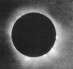
During the 19th century, there were 242 solar eclipses of which 87 were partial, 77 were annular, 63 were total and 15 were hybrids between total and annular eclipses. [1] [2] In the 19th century, the greatest number of eclipses in one year is five, in 1805, though the years 1801, 1812, 1819, 1823, 1830, 1841, 1848, 1859, 1870, and 1880 had four eclipses each. Two months, January 1805 and December 1880, featured two solar eclipses, on January 1 and January 30 in 1805 and on December 2 and December 31 in 1880. The predictions given here are by Fred Espenak of NASA's Goddard Space Flight Center. [1]

Contents

The longest measured duration in which the Moon completely covered the Sun, known as totality, was during the solar eclipse of August 7, 1850. This total solar eclipse had a maximum duration of 6 minutes and 50 seconds. The longest possible duration of a total solar eclipse is 7 minutes and 32 seconds. The longest annular solar eclipse of the 19th century took place on October 30, 1883, with a duration of 10 minutes and 17 seconds. The maximum possible duration is 12 minutes and 29 seconds. Four instances of back-to-back hybrid solar eclipses within a period of less than six months occurred in the 19th century. The first instance occurred on June 6 and November 29, 1807; the second instance occurred on June 16 and December 9, 1825; the third instance occurred on October 20, 1827 and April 14, 1828; and the fourth instance occurred on October 30, 1845 and April 25, 1846. [a]

The table contains the date and time of the greatest eclipse (in dynamical time), which in this case is the time when the axis of the Moon's shadow cone passes closest to the centre of Earth; this is in (Ephemeris Time). The number of the saros series that the eclipse belongs to is given, followed by the type of the eclipse (either total, annular, partial or hybrid), the gamma of the eclipse (how centrally the shadow of the Moon strikes the Earth), and the magnitude of the eclipse (the fraction of the Sun's diameter obscured by the Moon). For total and annular eclipses, the duration of the eclipse is given, as well as the location of the greatest eclipse (the point of maximum eclipse) and the path width of the total or annular eclipse. The geographical areas from which the eclipse can be seen are listed along with a chart illustrating each eclipse's respective path. [3]

Eclipses

DateTime of
greatest eclipse
(Terrestrial Time)
Saros Type Gamma Magnitude Central
duration
(min:s)
LocationPath widthGeographical areaChartRef(s)
kmmi
March 14, 180115:45:35107Partial−1.44330.1873 61°12′S40°36′E / 61.2°S 40.6°E / -61.2; 40.6 SE1801Mar14P.png [a] [4]
April 13, 1801 4:08:06145Partial1.31530.4208 61°18′N11°42′E / 61.3°N 11.7°E / 61.3; 11.7 SE1801Apr13P.png [a] [4]
September 8, 1801 5:54:40112Partial1.46570.1614 61°06′N168°30′W / 61.1°N 168.5°W / 61.1; -168.5 SE1801Sep08P.png [a] [4]
October 7, 1801 19:42:34150Partial−1.35520.3505 61°12′S141°18′E / 61.2°S 141.3°E / -61.2; 141.3 SE1801Oct07P.png [a] [4]
March 4, 1802 5:14:29117Total−0.69421.04283:02 44°00′S131°30′E / 44.0°S 131.5°E / -44.0; 131.5 196122Total: Antarctica, Australia, Vanuatu SE1802Mar04T.png [a] [4]
August 28, 1802 7:12:00122Annular0.75690.93675:35 51°18′N105°42′E / 51.3°N 105.7°E / 51.3; 105.7 354220Annular: Greenland, Svalbard, Russia, Mongolia, China, Ryukyu Islands SE1802Aug28A.png [a] [4]
February 21, 1803 21:18:46127Total−0.00741.04924:09 11°06′S135°54′W / 11.1°S 135.9°W / -11.1; -135.9 163101Total: Norfolk Island, French Polynesia, Mexico, Southern Florida, Bahamas SE1803Feb21T.png [a] [4]
August 17, 1803 8:25:03132Annular−0.00490.96573:47 13°36′N54°42′E / 13.6°N 54.7°E / 13.6; 54.7 12477Annular: Western Sahara, Mauritania, Mali, Algeria, Libya, Egypt, Saudi Arabia, Yemen SE1803Aug17A.png [a] [4]
February 11, 180411:16:33137Hybrid0.70531.00000:00 26°42′N4°30′W / 26.7°N 4.5°W / 26.7; -4.5 00Hybrid: Mauritania, Algeria, Italy, Croatia, Slovenia, Hungary, Slovakia, Poland, Belarus, Russia SE1804Feb11H.png [a] [4]
August 5, 180415:57:13142Total−0.76231.01441:20 29°18′S77°06′W / 29.3°S 77.1°W / -29.3; -77.1 7547Total: Chile, Argentina SE1804Aug05T.png [a] [4]
January 1, 18051:14:57109Partial−1.53150.0642 65°00′S42°06′W / 65.0°S 42.1°W / -65.0; -42.1 Saros109 78van81 SE1805Jan01P.jpg [a] [4]
January 30, 180518:57:01147Partial1.46500.1675 62°42′N152°48′W / 62.7°N 152.8°W / 62.7; -152.8 SE1805Jan30P.gif [a] [4]
June 26, 180523:27:40114Partial1.04610.9357 65°30′N9°54′W / 65.5°N 9.9°W / 65.5; -9.9 SE1805Jun26P.gif [a] [4]
July 26, 18056:14:19152Partial−1.45710.1405 63°12′S42°48′E / 63.2°S 42.8°E / -63.2; 42.8 SE1805Jul26Pb.gif [a] [4]
December 21, 18050:17:38119Annular−0.87510.91346:27 83°06′S143°48′W / 83.1°S 143.8°W / -83.1; -143.8 692430Annular: Antarctica SE1805Dec21A.gif [a] [4]
June 16, 1806 16:24:27124Total0.32031.06044:55 42°12′N64°36′W / 42.2°N 64.6°W / 42.2; -64.6 210130Total: Mexico, Arizona, New Mexico, Texas, Oklahoma, Colorado, Kansas, Missouri, Iowa, Illinois, Indiana, Michigan, Ohio, Pennsylvania, New York, Connecticut, Massachusetts, Rhode Island, Vermont, New Hampshire, Maine, Western Sahara, Mauritania, Mali, Niger SE1806Jun16T.png [a] [4]
December 10, 18062:19:40129Annular−0.16270.95914:32 32°24′S143°24′E / 32.4°S 143.4°E / -32.4; 143.4 15194Annular: Australia, Tonga SE1806Dec10A.gif [a] [4]
June 6, 18075:18:31134Hybrid−0.45771.00550:38 4°42′S100°24′E / 4.7°S 100.4°E / -4.7; 100.4 2113Hybrid: Indonesia, Australia SE1807Jun06H.png [a] [4]
November 29, 180711:42:09139Hybrid0.53771.01351:26 11°06′N3°54′E / 11.1°N 3.9°E / 11.1; 3.9 5534Hybrid: Mauritania, Mali, Burkina Faso, Benin, Nigeria, Cameroon, Chad, Sudan, Saudi Arabia, United Arab Emirates, Iran SE1807Nov29H.png [a] [4]
May 25, 180811:02:35144Partial−1.26650.5064 68°24′S27°48′E / 68.4°S 27.8°E / -68.4; 27.8 SE1808May25P.png [a] [4]
October 19, 180816:55:30111Partial−1.44430.1687 71°18′S160°48′E / 71.3°S 160.8°E / -71.3; 160.8 SE1808Oct19P.png [a] [4]
November 18, 18082:30:03149Partial1.18750.6564 69°12′N162°36′E / 69.2°N 162.6°E / 69.2; 162.6 SE1808Nov18P.gif [a] [4]
April 14, 180920:07:11116Annular0.87410.94294:35 65°48′N157°18′W / 65.8°N 157.3°W / 65.8; -157.3 435270Annular: Alaska, Northern Canada, Greenland SE1809Apr14A.png [a] [4]
October 9, 18097:38:42121Total−0.79041.01371:02 55°06′S38°24′E / 55.1°S 38.4°E / -55.1; 38.4 7748Total: Antarctica SE1809Oct09T.gif [a] [4]
April 4, 18101:41:19126Annular0.10310.99670:21 11°06′N153°48′E / 11.1°N 153.8°E / 11.1; 153.8 127.5Annular: Indonesia SE1810Apr04A.gif [a] [4]
September 28, 181016:37:25131Annular−0.06970.96813:45 5°48′S72°48′W / 5.8°S 72.8°W / -5.8; -72.8 11571Annular: Ecuador, Peru, Brazil, Bolivia SE1810Sep28A.png [a] [4]
March 24, 181114:12:13136Total−0.61901.04163:27 35°12′S18°00′W / 35.2°S 18.0°W / -35.2; -18.0 176109Total: Southern Chile, Southern Argentina, Falkland Islands, Namibia, Botswana, Zimbabwe, Mozambique SE1811Mar24T.png [a] [4]
September 17, 181118:43:45141Annular0.67980.93456:51 43°00′N85°54′W / 43.0°N 85.9°W / 43.0; -85.9 330210Annular: Alaska, Canada, North Dakota, Minnesota, Wisconsin, Michigan, Illinois, Indiana, Ohio, Pennsylvania, West Virginia, Virginia, Maryland, Delaware, North Carolina, Bermuda SE1811Sep17A.png [a] [4]
February 12, 181220:28:40108Partial1.35440.3422 70°42′N168°48′W / 70.7°N 168.8°W / 70.7; -168.8 SE1812Feb12P.gif [a] [4]
March 13, 18126:19:31146Partial−1.29140.4594 71°54′S173°18′W / 71.9°S 173.3°W / -71.9; -173.3 SE1812Mar13P.png [a] [4]
August 7, 18125:15:50113Partial−1.42050.2343 70°00′S67°00′E / 70.0°S 67.0°E / -70.0; 67.0 SE1812Aug07P.png [a] [4]
September 5, 181219:04:10151Partial1.39390.2874 71°48′N4°30′E / 71.8°N 4.5°E / 71.8; 4.5 SE1812Sep05P.gif [a] [4]
February 1, 18138:58:27118Annular0.71510.98201:53 27°54′N40°24′E / 27.9°N 40.4°E / 27.9; 40.4 9157Annular: Morocco, Algeria, Libya, Egypt, Saudi Arabia, Iraq, Iran, Turkmenistan, Uzbekistan, Kyrgyzstan, Kazakhstan, Southern Russia SE1813Feb01A.gif [a] [4]
July 27, 181314:55:35123Total−0.60061.03413:27 17°24′S47°24′W / 17.4°S 47.4°W / -17.4; -47.4 14489Total: Chile, Peru, Bolivia, Brazil SE1813Jul27T.gif [a] [4]
January 21, 181414:24:47128Annular0.02530.93508:28 18°36′S33°24′W / 18.6°S 33.4°W / -18.6; -33.4 242150Annular: Peru, Bolivia, Brazil, São Tomé and Príncipe, Gabon, Equatorial Guinea, Cameroon, Republic of the Congo, Central African Republic, Democratic Republic of the Congo SE1814Jan21A.gif [a] [4]
July 17, 18146:30:29133Total0.16411.07746:33 30°54′N84°42′E / 30.9°N 84.7°E / 30.9; 84.7 254158Total: Chad, Sudan, Egypt, Saudi Arabia, Bahrain, Qatar, Iran, Afghanistan, Pakistan, India, Nepal, China, Myanmar, Philippines SE1814Jul17T.png [a] [4]
January 10, 181513:57:06138Annular−0.66260.91437:55 63°42′S23°36′W / 63.7°S 23.6°W / -63.7; -23.6 438272Annular: Antarctic Peninsula SE1815Jan10A.png [a] [4]
July 6, 181523:43:07143Total0.90621.05933:13 88°06′N162°42′W / 88.1°N 162.7°W / 88.1; -162.7 470290Total: Russia, Northern Canada SE1815Jul06T.png [a] [4]
December 30, 181514:38:39148Partial−1.31300.4273 66°42′S146°24′E / 66.7°S 146.4°E / -66.7; 146.4 SE1815Dec30P.gif [a] [4]
May 27, 18163:13:24115Annular−0.94920.97911:54 48°00′S153°30′E / 48.0°S 153.5°E / -48.0; 153.5 238148Annular: Antarctica, New Zealand SE1816May27A.gif [a] [4]
November 19, 1816 10:17:23120Total0.84071.02332:00 35°00′N41°30′E / 35.0°N 41.5°E / 35.0; 41.5 14489Total: Norway, Sweden, Poland, Ukraine, Romania, Turkey, Syria, Iraq, Iran, Afghanistan, Pakistan, India, Western China SE1816Nov19T.png [a] [4]
May 16, 18176:58:14125Annular−0.20490.94836:30 7°54′N78°30′E / 7.9°N 78.5°E / 7.9; 78.5 194121Annular: South Africa, Lesotho, Eswatini, Mozambique, Madagascar, Maldives, India, Sri Lanka, Myanmar, Thailand, Laos, Vietnam, Philippines, Palau SE1817May16A.gif [a] [4]
November 9, 18171:53:53130Total0.14871.05364:42 8°54′S150°54′E / 8.9°S 150.9°E / -8.9; 150.9 179111Total: China, Eastern India, Myanmar, Philippines, Palau, Papua New Guinea, Vanuatu, Fiji, Tonga, Niue, Cook Islands, French Polynesia SE1817Nov09T.png [a] [4]
May 5, 18187:15:49135Annular0.54400.94645:05 45°48′N52°30′E / 45.8°N 52.5°E / 45.8; 52.5 233145Annular: Benin, Nigeria, Niger, Chad, Libya, Sudan, Egypt, Israel, Jordan, Syria, Iraq, Turkey, Iran, Armenia, Azerbaijan, Georgia, Russia, Kazakhstan SE1818May05A.png [a] [4]
October 29, 181817:07:10140Total−0.55241.02411:51 43°06′S99°24′W / 43.1°S 99.4°W / -43.1; -99.4 9861Total: None SE1818Oct29T.png [a] [4]
March 25, 181923:44:30107Partial−1.47220.1329 61°12′S87°54′W / 61.2°S 87.9°W / -61.2; -87.9 SE1819Mar25P.png [a] [4]
April 24, 181911:31:59145Partial1.25790.5225 61°42′N108°00′W / 61.7°N 108.0°W / 61.7; -108.0 SE1819Apr24P.png [a] [4]
September 19, 181913:03:47112Partial1.52580.0595 61°00′N75°36′E / 61.0°N 75.6°E / 61.0; 75.6 Saros112 72van72 SE1819Sep19P.jpg [a] [4]
October 19, 18193:27:17150Partial−1.32260.4085 61°30′S16°24′E / 61.5°S 16.4°E / -61.5; 16.4 SE1819Oct19P.png [a] [4]
March 14, 182013:37:15117Total−0.72001.04673:20 41°30′S5°42′E / 41.5°S 5.7°E / -41.5; 5.7 220140Total: Antarctica, South Africa, Namibia, Botswana, Zimbabwe, Mozambique, Madagascar SE1820Mar14T.gif [a] [4]
September 7, 1820 13:59:58122Annular0.82500.93295:49 51°36′N8°42′E / 51.6°N 8.7°E / 51.6; 8.7 432268Annular: Greenland, Norway, Denmark, Netherlands, Germany, France, Czech Republic, Austria, Switzerland, Slovenia, Croatia, Italy, Bosnia and Herzegovina, Montenegro, Albania, Greece, Libya, Egypt, Israel, Jordan, Saudi Arabia, Iraq, Kuwait SE1820Sep07A.png [a] [4]
March 4, 18215:50:13127Total−0.02831.05064:14 8°00′S96°18′E / 8.0°S 96.3°E / -8.0; 96.3 168104Total: Lesotho, South Africa, Indonesia, Singapore, Malaysia, Philippines SE1821Mar04T.gif [a] [4]
August 27, 182115:19:42132Annular0.06710.96613:38 13°36′N47°48′W / 13.6°N 47.8°W / 13.6; -47.8 12376Annular: Mexico, Arizona, New Mexico, Texas, Arkansas, Louisiana, Mississippi, Alabama, Georgia, South Carolina SE1821Aug27A.png [a] [4]
February 21, 182219:40:40137Annular0.69140.99960:02 28°36′N132°18′W / 28.6°N 132.3°W / 28.6; -132.3 21.2Annular: California, Nevada, Oregon, Idaho, Montana, Canada SE1822Feb21A.png [a] [4]
August 16, 182223:14:34142Total−0.69051.01731:35 26°06′S173°30′E / 26.1°S 173.5°E / -26.1; 173.5 8050Total: Australia, New Caledonia SE1822Aug16T.png [a] [4]
January 12, 18239:20:12109Partial−1.54130.0484 64°00′S173°00′W / 64.0°S 173.0°W / -64.0; -173.0 SE1823Jan12P.png [a] [4]
February 11, 18233:03:02147Partial1.45460.1856 62°00′N76°42′E / 62.0°N 76.7°E / 62.0; 76.7 SE1823Feb11P.gif [a] [4]
July 8, 18236:56:28114Partial1.11820.7958 64°36′N132°00′W / 64.6°N 132.0°W / 64.6; -132.0 SE1823Jul08P.gif [a] [4]
August 6, 182313:45:42152Partial−1.38710.2753 62°30′S79°18′W / 62.5°S 79.3°W / -62.5; -79.3 SE1823Aug06P.png [a] [4]
January 1, 18248:21:09119Annular−0.88210.91396:21 79°54′S116°12′E / 79.9°S 116.2°E / -79.9; 116.2 705438Annular: Antarctica SE1824Jan01A.gif [a] [4]
June 26, 1824 23:46:33124Total0.39591.05784:31 46°36′N171°24′W / 46.6°N 171.4°W / 46.6; -171.4 207129Total: China, North Korea, South Korea, Japan SE1824Jun26T.png [a] [4]
December 20, 182410:40:36129Annular−0.16850.96104:15 33°18′S20°24′E / 33.3°S 20.4°E / -33.3; 20.4 14489Annular: Brazil, South Africa, Madagascar SE1824Dec20Am.gif [a] [4]
June 16, 182512:19:03134Hybrid−0.38121.00360:25 1°00′N6°00′W / 1.0°N 6.0°W / 1.0; -6.0 138.1Hybrid: Bolivia, Brazil, Angola, Democratic Republic of the Congo, Zambia, Mozambique, Madagascar SE1825Jun16H.png [a] [4]
December 9, 182520:21:45139Hybrid0.52961.01481:34 9°12′N127°24′W / 9.2°N 127.4°W / 9.2; -127.4 6037Hybrid: Mexico, Florida SE1825Dec09H.png [a] [4]
June 5, 182617:39:05144Partial−1.18870.6407 67°24′S82°30′W / 67.4°S 82.5°W / -67.4; -82.5 SE1826Jun05P.png [a] [4]
October 31, 18261:20:39111Partial−1.46960.1222 70°36′S21°12′E / 70.6°S 21.2°E / -70.6; 21.2 SE1826Oct31P.png [a] [4]
November 29, 182611:14:08149Partial1.17640.6770 68°12′N19°54′E / 68.2°N 19.9°E / 68.2; 19.9 SE1826Nov29P.gif [a] [4]
April 26, 18273:11:14116Annular0.93160.94583:53 74°48′N73°24′E / 74.8°N 73.4°E / 74.8; 73.4 559347Annular: Russia, Northern Canada SE1827Apr26A.gif [a] [4]
October 20, 182715:42:05121Hybrid−0.82521.00700:30 62°18′S87°36′W / 62.3°S 87.6°W / -62.3; -87.6 4327Hybrid: Antarctica SE1827Oct20H.gif [a] [4]
April 14, 18289:19:38126Hybrid0.14981.00290:18 17°54′N37°42′E / 17.9°N 37.7°E / 17.9; 37.7 106.2Hybrid: Equatorial Guinea, Cameroon, Central African Republic, Sudan, Saudi Arabia, United Arab Emirates, Iran, Pakistan, India, Nepal, Myanmar, China Saros126 37van72 SE1828Apr14H.jpg [a] [4]
October 9, 18280:07:47131Annular−0.11390.96234:26 12°30′S173°00′E / 12.5°S 173.0°E / -12.5; 173.0 13785Annular: Philippines, Palau, Fiji, Tonga, Pitcairn Islands SE1828Oct09A.png [a] [4]
April 3, 182922:18:36136Total−0.58031.04744:05 28°30′S142°36′W / 28.5°S 142.6°W / -28.5; -142.6 192119Total: None SE1829Apr03T.png [a] [4]
September 28, 18291:46:53141Annular0.62440.93177:43 34°54′N164°18′E / 34.9°N 164.3°E / 34.9; 164.3 323201Annular: Russia, Northeastern China, Northern Japan, Hawaii SE1829Sep28A.png [a] [4]
February 23, 18305:04:13108Partial1.37160.3100 71°18′N49°00′E / 71.3°N 49.0°E / 71.3; 49.0 SE1830Feb23P.gif [a] [4]
March 24, 183014:38:43146Partial−1.26220.5148 72°00′S47°42′E / 72.0°S 47.7°E / -72.0; 47.7 SE1830Mar24P.png [a] [4]
August 18, 183012:13:35113Partial−1.48650.1171 70°42′S50°12′W / 70.7°S 50.2°W / -70.7; -50.2 SE1830Aug18P.png [a] [4]
September 17, 18302:08:12151Partial1.33250.3930 72°06′N115°36′W / 72.1°N 115.6°W / 72.1; -115.6 SE1830Sep17P.gif [a] [4]
February 12, 183117:21:45118Annular0.72880.98071:57 31°54′N88°18′W / 31.9°N 88.3°W / 31.9; -88.3 10062Annular: Mexico, Texas, Louisiana, Mississippi, Alabama, Georgia, South Carolina, North Carolina, Virginia, Maryland, Delaware, New Jersey, Massachusetts, Canada SE1831Feb12A.gif [a] [4]
August 7, 183122:15:59123Total−0.66911.03493:20 24°54′S160°54′W / 24.9°S 160.9°W / -24.9; -160.9 15898Total: Australia SE1831Aug07T.gif [a] [4]
February 1, 183222:30:14128Annular0.03550.93448:35 15°18′S154°24′W / 15.3°S 154.4°W / -15.3; -154.4 245152Annular: Papua New Guinea, Vanuatu, Fiji, Tonga, Niue, Cook Islands, French Polynesia SE1832Feb01A.gif [a] [4]
July 27, 183214:01:06133Total0.09191.07766:46 24°30′N27°54′W / 24.5°N 27.9°W / 24.5; -27.9 252157Total: Mexico, Guatemala, Belize, Honduras, Cayman Islands, Jamaica, Cuba, Haiti, Turks and Caicos Islands, Bahamas, Western Sahara, Mauritania, Mali, Burkina Faso, Niger, Benin, Nigeria, Cameroon, Central African Republic, Republic of the Congo, Democratic Republic of the Congo, Uganda, Rwanda, Tanzania SE1832Jul27T.png [a] [4]
January 20, 183321:56:55138Annular−0.65300.91557:59 60°36′S137°24′W / 60.6°S 137.4°W / -60.6; -137.4 426265Annular: Chile, Argentina SE1833Jan20A.png [a] [4]
July 17, 18337:08:02143Total0.83481.05913:29 77°30′N92°30′E / 77.5°N 92.5°E / 77.5; 92.5 357222Total: Iceland, Russian Far East SE1833Jul17T.png [a] [4]
January 9, 183422:55:31148Partial−1.30430.4418 67°48′S11°18′E / 67.8°S 11.3°E / -67.8; 11.3 SE1834Jan09P.png [a] [4]
June 7, 183410:08:38115Partial−1.02910.9295 64°36′S55°24′E / 64.6°S 55.4°E / -64.6; 55.4 SE1834Jun07P.gif [a] [4]
November 30, 183418:56:35120Total0.84971.02332:02 34°54′N91°36′W / 34.9°N 91.6°W / 34.9; -91.6 15093Total: Canada, Montana, Wyoming, Nebraska, Colorado, Kansas, Oklahoma, Missouri, Arkansas, Mississippi, Alabama, Georgia, South Carolina SE1834Nov30T.gif [a] [4]
May 27, 183513:35:42125Annular−0.28460.94866:44 5°18′N20°12′W / 5.3°N 20.2°W / 5.3; -20.2 196122Annular: Chile, Argentina, Paraguay, Brazil, Sierra Leone, Guinea, Liberia, Côte d'Ivoire, Mali, Burkina Faso, Ghana, Togo, Benin, Nigeria, Cameroon, Chad, Central African Republic, Democratic Republic of the Congo, Uganda, Kenya SE1835May27A.gif [a] [4]
November 20, 183510:31:58130Total0.16491.05104:35 10°42′S21°36′E / 10.7°S 21.6°E / -10.7; 21.6 171106Total: Mauritania, Senegal, Mali, Burkina Faso, Côte d'Ivoire, Ghana, São Tomé and Príncipe, Gabon, Republic of the Congo, Democratic Republic of the Congo, Angola, Zambia, Mozambique, Malawi, Madagascar SE1835Nov20T.png [a] [4]
May 15, 183614:01:39135Annular0.46990.95094:47 45°06′N44°24′W / 45.1°N 44.4°W / 45.1; -44.4 203126Annular: El Salvador, Honduras, Nicaragua, Jamaica, Cuba, Haiti, Bahamas, Turks and Caicos Islands, Ireland, United Kingdom, Germany, Denmark, Sweden, Poland, Lithuania, Belarus, Ukraine, Russia, Kazakhstan SE1836May15A.png [a] [4]
November 9, 18361:29:26140Total−0.53271.01911:28 46°06′S136°48′E / 46.1°S 136.8°E / -46.1; 136.8 7748Total: Australia SE1836Nov09T.png [a] [4]
April 5, 18377:35:30107Partial−1.50800.0651 61°18′S145°36′E / 61.3°S 145.6°E / -61.3; 145.6 SE1837Apr05P.png [a] [4]
May 4, 183718:48:28145Partial1.19340.6381 62°18′N133°54′E / 62.3°N 133.9°E / 62.3; 133.9 SE1837May04P.png [a] [4]
October 29, 183711:19:24150Partial−1.29670.4542 61°54′S110°30′W / 61.9°S 110.5°W / -61.9; -110.5 SE1837Oct29P.png [a] [4]
March 25, 183821:52:16117Total−0.75241.05053:39 39°42′S118°18′W / 39.7°S 118.3°W / -39.7; -118.3 249155Total: Antarctica SE1838Mar25T.gif [a] [4]
September 18, 183820:55:56122Annular0.88670.92896:06 52°24′N90°36′W / 52.4°N 90.6°W / 52.4; -90.6 562349Annular: Canada, Minnesota, Wisconsin, Michigan, Indiana, Ohio, Pennsylvania, Kentucky, New York, New Jersey, West Virginia, Delaware, Maryland, Virginia, North Carolina SE1838Sep18A.gif [a] [4]
March 15, 183914:13:42127Total−0.05581.05204:20 5°06′S29°30′W / 5.1°S 29.5°W / -5.1; -29.5 172107Total: Chile, Argentina, Paraguay, Brazil, Guinea, Guinea-Bissau, Senegal, Mali, Mauritania, Algeria, Niger, Libya, Egypt SE1839Mar15T.gif [a] [4]
September 7, 183922:23:26132Annular0.13240.96613:34 12°48′N152°42′W / 12.8°N 152.7°W / 12.8; -152.7 12376Annular: Japan, Hawaii SE1839Sep07A.png [a] [4]
March 4, 18403:58:22137Annular0.67270.99950:03 30°36′N101°42′E / 30.6°N 101.7°E / 30.6; 101.7 21.2Annular: India, Bangladesh, Myanmar, China, Mongolia, Russian Far East SE1840Mar04A.png [a] [4]
August 27, 18406:37:32142Total−0.62231.01951:45 24°18′S62°54′E / 24.3°S 62.9°E / -24.3; 62.9 8352Total: Angola, Democratic Republic of the Congo, Zambia, Malawi, Tanzania, Mozambique, Comoros, Madagascar SE1840Aug27T.png [a] [4]
January 22, 184117:24:16109Partial−1.55160.0316 63°06′S56°36′E / 63.1°S 56.6°E / -63.1; 56.6 SE1841Jan22P.png [a] [4]
February 21, 184111:03:56147Partial1.44060.2095 61°30′N52°24′W / 61.5°N 52.4°W / 61.5; -52.4 SE1841Feb21P.gif [a] [4]
July 18, 184114:25:14114Partial1.19030.6556 63°42′N106°12′E / 63.7°N 106.2°E / 63.7; 106.2 SE1841Jul18P.gif [a] [4]
August 16, 184121:20:24152Partial−1.31930.4059 61°54′S158°00′E / 61.9°S 158.0°E / -61.9; 158.0 SE1841Aug16P.png [a] [4]
January 11, 184216:25:41119Annular−0.88820.91516:15 75°48′S1°24′E / 75.8°S 1.4°E / -75.8; 1.4 710440Annular: Antarctica SE1842Jan11A.png [a] [4]
July 8, 1842 7:06:27124Total0.47261.05434:05 50°06′N83°36′E / 50.1°N 83.6°E / 50.1; 83.6 204127Total: Portugal, Spain, Andorra, France, Monaco, Italy, Austria, Slovenia, Hungary, Slovakia, Poland, Ukraine, Belarus, Russia, Kazakhstan, Mongolia, China, Ryukyu Islands, Northern Mariana Islands SE1842Jul08T.png [a] [4]
December 31, 184219:04:24129Annular−0.17270.96343:54 33°06′S103°12′W / 33.1°S 103.2°W / -33.1; -103.2 13584Annular: Tonga, Peru, Bolivia, Brazil SE1842Dec31A.gif [a] [4]
June 27, 184319:17:03134Hybrid−0.30381.00110:07 5°54′N111°00′W / 5.9°N 111.0°W / 5.9; -111.0 42.5Hybrid: Peru, Bolivia, Paraguay SE1843Jun27H.png [a] [4]
December 21, 18435:03:26139Total0.52271.01651:43 8°00′N101°00′E / 8.0°N 101.0°E / 8.0; 101.0 6641Total: Saudi Arabia, Oman, India, Andaman and Nicobar Islands, Thailand, Vietnam, Philippines SE1843Dec21T.png [a] [4]
June 16, 18440:13:22144Partial−1.10920.7778 66°24′S168°18′E / 66.4°S 168.3°E / -66.4; 168.3 SE1844Jun16P.png [a] [4]
November 10, 18449:51:45111Partial−1.49010.0847 69°48′S119°18′W / 69.8°S 119.3°W / -69.8; -119.3 SE1844Nov10P.png [a] [4]
December 9, 184420:01:39149Partial1.16820.6924 67°06′N123°00′W / 67.1°N 123.0°W / 67.1; -123.0 SE1844Dec09P.gif [a] [4]
May 6, 184510:09:00116Annular0.99450.94623:15 73°24′N110°36′W / 73.4°N 110.6°W / 73.4; -110.6 Annular: Northern Canada SE1845May06An.gif [a] [4]
October 30, 1845 23:51:58121Hybrid−0.85371.00050:02 69°06′S144°30′E / 69.1°S 144.5°E / -69.1; 144.5 31.9Hybrid: Antarctica SE1845Oct30H.png [a] [4]
April 25, 184616:50:30126Hybrid0.20371.00880:53 24°48′N76°12′W / 24.8°N 76.2°W / 24.8; -76.2 3119Hybrid: Mexico, Guatemala, Belize, Cuba, Bahamas, Canary Islands, Western Sahara, Mauritania, Algeria SE1846Apr25H.gif [a] [4]
October 20, 18467:46:12131Annular−0.15060.95675:05 18°42′S57°18′E / 18.7°S 57.3°E / -18.7; 57.3 15999Annular: Ghana, Togo, Benin, Nigeria, Cameroon, Central African Republic, Republic of the Congo, Democratic Republic of the Congo, Rwanda, Burundi, Tanzania, Madagascar, Australia SE1846Oct20A.png [a] [4]
April 15, 18476:16:13136Total−0.53391.05304:44 21°36′S95°00′E / 21.6°S 95.0°E / -21.6; 95.0 206128Total: Australia SE1847Apr15T.png [a] [4]
October 9, 18479:00:23141Annular0.57740.92908:35 27°42′N52°48′E / 27.7°N 52.8°E / 27.7; 52.8 323201Annular: Ireland, United Kingdom, France, Belgium, Luxembourg, Germany, Switzerland, Italy, Austria, Slovenia, Croatia, Hungary, Bosnia and Herzegovina, Serbia, Montenegro, Kosovo, Romania, Bulgaria, North Macedonia, Greece, Turkey, Syria, Iraq, Iran, Kuwait, United Arab Emirates, Oman, India, Myanmar, Thailand, Laos, Vietnam SE1847Oct09A.png [a] [4]
March 5, 184813:31:35108Partial1.39500.2662 71°48′N91°42′W / 71.8°N 91.7°W / 71.8; -91.7 SE1848Mar05P.gif [a] [4]
April 3, 1848 22:49:07146Partial−1.22640.5834 71°48′S89°00′W / 71.8°S 89.0°W / -71.8; -89.0 SE1848Apr03P.png [a] [4]
August 28, 184819:18:22113Partial−1.54740.0090 71°18′S169°36′W / 71.3°S 169.6°W / -71.3; -169.6 SE1848Aug28P.png [a] [4]
September 27, 18489:21:19151Partial1.27730.4875 72°12′N121°54′E / 72.2°N 121.9°E / 72.2; 121.9 SE1848Sep27P.gif [a] [4]
February 23, 18491:38:09118Annular0.74740.97961:58 36°42′N144°18′E / 36.7°N 144.3°E / 36.7; 144.3 10867Annular: China, Japan, Alaska SE1849Feb23A.gif [a] [4]
August 18, 18495:40:49123Total−0.73431.03493:07 32°54′S83°30′E / 32.9°S 83.5°E / -32.9; 83.5 172107Total: None SE1849Aug18T.gif [a] [4]
February 12, 18506:29:37128Annular0.05030.93458:35 11°00′S85°36′E / 11.0°S 85.6°E / -11.0; 85.6 245152Annular: Angola, Democratic Republic of the Congo, Zambia, Malawi, Mozambique, Madagascar, Indonesia, Malaysia, Brunei, Philippines SE1850Feb12A.gif [a] [4]
August 7, 185021:33:54133Total0.02151.07696:50 17°42′N141°48′W / 17.7°N 141.8°W / 17.7; -141.8 249155Total: Hawaii SE1850Aug07T.png [a] [4]
February 1, 18515:54:27138Annular−0.64130.91758:01 56°24′S106°54′E / 56.4°S 106.9°E / -56.4; 106.9 409254Annular: Australia, Norfolk Island SE1851Feb01A.png [a] [4]
July 28, 1851 14:33:42143Total0.76431.05773:41 68°00′N19°36′W / 68.0°N 19.6°W / 68.0; -19.6 296184Total: Alaska, Canada, Greenland, Iceland, Norway, Sweden, Denmark, Poland, Lithuania, Belarus, Ukraine, Russia, Georgia, Armenia, Azerbaijan SE1851Jul28T.png [a] [4]
January 21, 1852 7:12:16148Partial−1.29480.4577 68°54′S124°18′W / 68.9°S 124.3°W / -68.9; -124.3 SE1852Jan21P.png [a] [4]
June 17, 185216:59:50115Partial−1.11110.7828 65°36′S57°18′W / 65.6°S 57.3°W / -65.6; -57.3 SE1852Jun17P.gif [a] [4]
December 11, 18523:40:44120Total0.85511.02372:05 35°12′N133°54′E / 35.2°N 133.9°E / 35.2; 133.9 15697Total: Russia, Mongolia, China, North Korea, South Korea, Japan SE1852Dec11T.gif [a] [4]
June 6, 185320:07:21125Annular−0.36860.94866:59 1°30′N117°54′W / 1.5°N 117.9°W / 1.5; -117.9 203126Annular: Cook Islands, French Polynesia, Ecuador, Peru, Brazil SE1853Jun06A.gif [a] [4]
November 30, 1853 19:15:39130Total0.17631.04854:28 12°00′S109°00′W / 12.0°S 109.0°W / -12.0; -109.0 164102Total: Peru, Bolivia, Brazil SE1853Nov30T.png [a] [4]
May 26, 1854 20:42:53135Annular0.39180.95514:32 43°18′N140°06′W / 43.3°N 140.1°W / 43.3; -140.1 178111Annular: Marshall Islands, Canada, Washington, Idaho, Montana, North Dakota, Minnesota, Michigan, New York, Vermont, New Hampshire, Massachusetts, Maine SE1854May26A.png [a] [4]
November 20, 18549:56:58140Hybrid−0.51791.01441:07 48°54′S12°42′E / 48.9°S 12.7°E / -48.9; 12.7 5735Hybrid: Brazil SE1854Nov20H.png [a] [4]
May 16, 18552:01:12145Partial1.12490.7624 62°54′N16°36′E / 62.9°N 16.6°E / 62.9; 16.6 SE1855May16P.png [a] [4]
November 9, 1855 19:17:51150Partial−1.27670.4892 62°30′S121°00′E / 62.5°S 121.0°E / -62.5; 121.0 SE1855Nov09P.png [a] [4]
April 5, 18566:01:01117Total−0.79061.05393:56 39°06′S119°12′E / 39.1°S 119.2°E / -39.1; 119.2 285177Total: Antarctica, Australia SE1856Apr05T.gif [a] [4]
September 29, 18563:59:44122Annular0.94200.92466:21 54°18′N169°06′E / 54.3°N 169.1°E / 54.3; 169.1 831516Annular: Russian Far East SE1856Sep29A.gif [a] [4]
March 25, 1857 22:29:38127Total−0.08921.05344:28 2°24′S153°24′W / 2.4°S 153.4°W / -2.4; -153.4 177110Total: Australia, Niue, Cook Islands, Mexico SE1857Mar25T.png [a] [4]
September 18, 18575:36:05132Annular0.19120.96593:34 11°36′N100°00′E / 11.6°N 100.0°E / 11.6; 100.0 12578Annular: Turkey, Armenia, Azerbaijan, Iran, Turkmenistan, Afghanistan, Pakistan, India, Nepal, China, Bangladesh, Myanmar, Thailand, Indonesia, Australia SE1857Sep18A.png [a] [4]
March 15, 185812:05:28137Annular0.64610.99960:02 32°42′N20°54′W / 32.7°N 20.9°W / 32.7; -20.9 21.2Annular: Trinidad and Tobago, United Kingdom, Norway, Sweden, Finland, Russia SE1858Mar15A.png [a] [4]
September 7, 1858 14:09:29142Total−0.56091.02101:50 23°54′S49°48′W / 23.9°S 49.8°W / -23.9; -49.8 8553Total: Peru, Brazil, Bolivia SE1858Sep07T.png [a] [4]
February 3, 18591:22:42109Partial−1.56590.0077 62°24′S72°06′W / 62.4°S 72.1°W / -62.4; -72.1 SE1859Feb03P.png [a] [4]
March 4, 185918:54:49147Partial1.41930.2461 61°12′N178°48′W / 61.2°N 178.8°W / 61.2; -178.8 SE1859Mar04P.gif [a] [4]
July 29, 185921:56:57114Partial1.25980.5205 63°00′N16°00′W / 63.0°N 16.0°W / 63.0; -16.0 SE1859Jul29P.gif [a] [4]
August 28, 18595:02:00152Partial−1.25690.5261 61°30′S33°42′E / 61.5°S 33.7°E / -61.5; 33.7 SE1859Aug28P.gif [a] [4]
January 23, 1860 0:27:31119Annular−0.89690.91686:07 71°48′S117°12′W / 71.8°S 117.2°W / -71.8; -117.2 719447Annular: Antarctica SE1860Jan23A.png [a] [4]
July 18, 1860 14:26:24124Total0.54871.05003:39 52°30′N20°18′W / 52.5°N 20.3°W / 52.5; -20.3 198123Total: Oregon, Washington, Idaho, Montana, Canada, Spain, Algeria, Tunisia, Libya, Egypt, Sudan, Eritrea SE1860Jul18T.png [a] [4]
January 11, 18613:29:23129Annular−0.17670.96643:30 31°48′S132°42′E / 31.8°S 132.7°E / -31.8; 132.7 12376Annular: Australia, Kiribati SE1861Jan11A.gif [a] [4]
July 8, 18612:10:26134Annular−0.22310.99790:14 10°00′N145°48′E / 10.0°N 145.8°E / 10.0; 145.8 74.3Annular: Indonesia, Malaysia, Thailand, Philippines, Tonga SE1861Jul08A.png [a] [4]
December 31, 186113:49:06139Total0.51861.01861:55 7°48′N31°36′W / 7.8°N 31.6°W / 7.8; -31.6 7446Total: Venezuela, Trinidad and Tobago, Senegal, Mauritania, Mali, Algeria, Tunisia, Libya, Greece SE1861Dec31T.png [a] [4]
June 27, 18626:42:21144Partial−1.02520.9222 65°24′S60°48′E / 65.4°S 60.8°E / -65.4; 60.8 SE1862Jun27P.png [a] [4]
November 21, 186218:29:48111Partial−1.50510.0580 68°48′S99°06′E / 68.8°S 99.1°E / -68.8; 99.1 SE1862Nov21P.png [a] [4]
December 21, 18624:53:03149Partial1.16330.7016 66°00′N93°36′E / 66.0°N 93.6°E / 66.0; 93.6 SE1862Dec21P.gif [a] [4]
May 17, 186317:00:45116Partial1.06270.8606 69°12′N126°48′E / 69.2°N 126.8°E / 69.2; 126.8 SE1863May17P.gif [a] [4]
November 11, 1863 8:09:03121Annular−0.87590.99430:22 75°24′S15°06′E / 75.4°S 15.1°E / -75.4; 15.1 4226Annular: Antarctica SE1863Nov11A.png [a] [4]
May 6, 18640:16:48126Hybrid0.26211.01461:25 31°36′N171°30′E / 31.6°N 171.5°E / 31.6; 171.5 5232Hybrid: Malaysia, Philippines SE1864May06H.gif [a] [4]
October 30, 186415:30:31131Annular−0.18160.95145:41 24°18′S59°18′W / 24.3°S 59.3°W / -24.3; -59.3 181112Annular: Peru, Chile, Bolivia, Argentina, Paraguay, Brazil SE1864Oct30A.png [a] [4]
April 25, 1865 14:08:34136Total−0.48261.05845:23 14°48′S25°48′W / 14.8°S 25.8°W / -14.8; -25.8 219136Total: Chile, Argentina, Uruguay, Brazil, Angola, Zambia, Mozambique SE1865Apr25T.png [a] [4]
October 19, 1865 16:21:14141Annular0.53660.92639:27 21°18′N60°12′W / 21.3°N 60.2°W / 21.3; -60.2 326203Annular: Washington, Oregon, Idaho, Montana, Wyoming, South Dakota, Nebraska, Colorado, Kansas, Iowa, Missouri, Illinois, Indiana, Arkansas, Kentucky, Tennessee, North Carolina, South Carolina, Alabama, Georgia, Cape Verde, Senegal, Mauritania, Mali SE1865Oct19A.png [a] [4]
March 16, 186621:51:25108Partial1.42410.2114 72°00′N129°12′E / 72.0°N 129.2°E / 72.0; 129.2 SE1866Mar16P.gif [a] [4]
April 15, 18666:51:40146Partial−1.18460.6637 71°24′S136°36′E / 71.4°S 136.6°E / -71.4; 136.6 SE1866Apr15P.png [a] [4]
October 8, 186616:44:22151Partial1.22960.5693 71°54′N3°00′W / 71.9°N 3.0°W / 71.9; -3.0 SE1866Oct08P.gif [a] [4]
March 6, 18679:46:48118Annular0.77160.97871:57 42°18′N18°24′E / 42.3°N 18.4°E / 42.3; 18.4 11873Annular: Morocco, Algeria, Italy, Bosnia and Herzegovina, Montenegro, Albania, Kosovo, Serbia, Romania, Moldova, Ukraine, Russia SE1867Mar06A.gif [a] [4]
August 29, 1867 13:13:07123Total−0.79401.03442:51 41°06′S34°54′W / 41.1°S 34.9°W / -41.1; -34.9 189117Total: Chile, Argentina, Uruguay SE1867Aug29T.png [a] [4]
February 23, 186814:21:31128Annular0.07060.93488:30 6°06′S33°00′W / 6.1°S 33.0°W / -6.1; -33.0 244152Annular: Peru, Bolivia, Brazil, Sierra Leone, Liberia, Guinea, Côte d'Ivoire, Mali, Burkina Faso, Ghana, Niger, Nigeria, Chad, Libya, Sudan SE1868Feb23A.gif [a] [4]
August 18, 1868 5:12:10133Total−0.04431.07566:47 10°36′N102°12′E / 10.6°N 102.2°E / 10.6; 102.2 245152Total: Ethiopia, Eritrea, Djibouti, Yemen, India, Myanmar, Thailand, Cambodia, Vietnam, Malaysia, Brunei, Indonesia, Papua New Guinea SE1868Aug18T.png [a] [4]
February 11, 186913:46:39138Annular−0.62520.92018:02 51°18′S9°42′W / 51.3°S 9.7°W / -51.3; -9.7 387240Annular: South Africa, Lesotho, Madagascar SE1869Feb11A.png [a] [4]
August 7, 1869 22:01:05143Total0.69601.05513:48 59°06′N133°12′W / 59.1°N 133.2°W / 59.1; -133.2 254158Total: Russian Far East, Alaska, Canada, Montana, North Dakota, South Dakota, Minnesota, Nebraska, Iowa, Missouri, Illinois, Indiana, Kentucky, Tennessee, Virginia, West Virginia, North Carolina, South Carolina SE1869Aug07T.png [a] [4]
January 31, 187015:26:25148Partial−1.28290.4781 69°54′S100°00′E / 69.9°S 100.0°E / -69.9; 100.0 SE1870Jan31P.png [a] [4]
June 28, 187023:46:43115Partial−1.19490.6335 66°36′S169°24′W / 66.6°S 169.4°W / -66.6; -169.4 SE1870Jun28P.gif [a] [4]
July 28, 187011:02:31153Partial1.50440.0742 69°12′N170°54′E / 69.2°N 170.9°E / 69.2; 170.9 SE1870Jul28Pb.gif [a] [4]
December 22, 1870 12:27:33120Total0.85851.02482:11 35°42′N1°30′W / 35.7°N 1.5°W / 35.7; -1.5 165103Total: Portugal, Spain, Algeria, Tunisia, Italy, Greece, Turkey, Bulgaria, Ukraine, Russia SE1870Dec22T.png [a] [4]
June 18, 18712:35:01125Annular−0.45500.94817:14 3°30′S144°42′E / 3.5°S 144.7°E / -3.5; 144.7 214133Annular: Indonesia, Papua New Guinea, Wallis and Futuna, Samoa, American Samoa, Cook Islands SE1871Jun18A.gif [a] [4]
December 12, 1871 4:03:38130Total0.18361.04654:23 12°42′S119°24′E / 12.7°S 119.4°E / -12.7; 119.4 15798Total: India, Sri Lanka, Indonesia, Australia, Solomon Islands, Kiribati SE1871Dec12T.png [a] [4]
June 6, 18723:20:03135Annular0.30950.95904:20 40°30′N124°48′E / 40.5°N 124.8°E / 40.5; 124.8 15798Annular: India, Bangladesh, Myanmar, China, North Korea, Russia, Japan SE1872Jun06A.gif [a] [4]
November 30, 187218:29:33140Hybrid−0.50811.00990:47 51°12′S111°48′W / 51.2°S 111.8°W / -51.2; -111.8 4025Hybrid: None SE1872Nov30H.png [a] [4]
May 26, 18739:08:56145Partial1.05130.8971 63°42′N99°36′W / 63.7°N 99.6°W / 63.7; -99.6 SE1873May26P.png [a] [4]
November 20, 1873 3:22:52150Partial−1.26240.5138 63°12′S9°30′W / 63.2°S 9.5°W / -63.2; -9.5 SE1873Nov20P.png [a] [4]
April 16, 1874 14:00:53117Total−0.83841.05694:11 39°54′S0°54′W / 39.9°S 0.9°W / -39.9; -0.9 335208Total: Antarctica, South Africa, Namibia, Lesotho SE1874Apr16T.png [a] [4]
October 10, 187411:13:33122Annular0.98890.91936:28 58°36′N72°00′E / 58.6°N 72.0°E / 58.6; 72.0 Annular: Russia, Kazakhstan SE1874Oct10An.gif [a] [4]
April 6, 1875 06:37:26127Total−0.12921.05474:37 0°12′S84°48′E / 0.2°S 84.8°E / -0.2; 84.8 182113Total: Myanmar, Thailand, Cambodia, Laos, Vietnam, China SE1875Apr06T.png [a] [4]
September 29, 187512:58:09132Annular0.24280.96563:36 10°00′N10°06′W / 10.0°N 10.1°W / 10.0; -10.1 12779Annular: New York, Vermont, New Hampshire, Massachusetts, Maine, Mauritania, Senegal, Guinea, Liberia, Côte d'Ivoire, Angola, Zambia, Malawi, Mozambique SE1875Sep29A.png [a] [4]
March 25, 187620:05:06137Annular0.61430.99990:01 34°48′N141°06′W / 34.8°N 141.1°W / 34.8; -141.1 10.62Annular: Hawaii, Canada, Greenland SE1876Mar25A.png [a] [4]
September 17, 187621:49:15142Total−0.50541.02201:53 24°36′S164°30′W / 24.6°S 164.5°W / -24.6; -164.5 8653Total: Niue SE1876Sep17T.png [a] [4]
March 15, 187702:38:09147Partial1.39240.2917 61°00′N56°42′E / 61.0°N 56.7°E / 61.0; 56.7 SE1877Mar15P.gif [a] [4]
August 9, 18775:30:24114Partial1.32770.3889 62°18′N138°36′W / 62.3°N 138.6°W / 62.3; -138.6 SE1877Aug09P.gif [a] [4]
September 7, 187712:48:42152Partial−1.19850.6382 61°12′S91°48′W / 61.2°S 91.8°W / -61.2; -91.8 SE1877Sep07P.gif [a] [4]
February 2, 18788:27:52119Annular−0.90710.91915:59 67°54′S122°24′E / 67.9°S 122.4°E / -67.9; 122.4 729453Annular: Antarctica, Australia SE1878Feb02A.gif [a] [4]
July 29, 1878 21:47:18124Total0.62331.04503:11 53°48′N124°00′W / 53.8°N 124.0°W / 53.8; -124.0 191119Total: Russian Far East, Alaska, Canada, Washington, Idaho, Montana, Wyoming, Colorado, Kansas, Oklahoma, Texas, Louisiana, Cuba, Haiti, Dominican Republic SE1878Jul29T.png [a] [4]
January 22, 1879 11:53:08129Annular−0.18240.97003:03 29°48′S8°30′E / 29.8°S 8.5°E / -29.8; 8.5 11068Annular: Argentina, Uruguay, Brazil, Namibia, Botswana, Zambia, Democratic Republic of the Congo, Malawi, Tanzania SE1879Jan22A.gif [a] [4]
July 19, 18799:04:32134Annular−0.14400.99420:39 13°00′N42°54′E / 13.0°N 42.9°E / 13.0; 42.9 2012Annular: Guinea, Mali, Burkina Faso, Niger, Chad, Sudan, Eritrea, Somalia SE1879Jul19A.png [a] [4]
January 11, 188022:34:25139Total0.51361.02122:07 8°18′N164°06′W / 8.3°N 164.1°W / 8.3; -164.1 8452Total: Northern Mariana Islands, Marshall Islands, California, Nevada, Utah, Wyoming SE1880Jan11T.png [a] [4]
July 7, 188013:10:28144Annular−0.94060.94415:47 46°24′S33°24′W / 46.4°S 33.4°W / -46.4; -33.4 611380Annular: Falkland Islands SE1880Jul07A.png [a] [4]
December 2, 18803:11:33111Partial−1.51720.0369 67°48′S42°54′W / 67.8°S 42.9°W / -67.8; -42.9 SE1880Dec02P.png [a] [4]
December 31, 188013:45:01149Partial1.15910.7096 65°00′N49°30′W / 65.0°N 49.5°W / 65.0; -49.5 SE1880Dec31P.gif [a] [4]
May 27, 188123:48:41116Partial1.13450.7370 68°12′N13°18′E / 68.2°N 13.3°E / 68.2; 13.3 SE1881May27P.gif [a] [4]
November 21, 188116:31:10121Annular−0.89310.98870:43 81°12′S114°30′W / 81.2°S 114.5°W / -81.2; -114.5 9056Annular: Antarctica SE1881Nov21A.png [a] [4]
May 17, 1882 7:36:27126Total0.32691.02001:50 38°24′N61°36′E / 38.4°N 61.6°E / 38.4; 61.6 7245Total: Burkina Faso, Ghana, Niger, Nigeria, Chad, Libya, Egypt, Saudi Arabia, Iraq, Iran, Turkmenistan, Uzbekistan, Tajikistan, Kyrgyzstan, China SE1882May17T.png [a] [4]
November 10, 188223:22:21131Annular−0.20560.94656:14 29°12′S177°00′W / 29.2°S 177.0°W / -29.2; -177.0 201125Annular: Indonesia, Papua New Guinea, New Caledonia SE1882Nov10A.png [a] [4]
May 6, 1883 21:53:49136Total−0.42501.06345:58 8°06′S144°36′W / 8.1°S 144.6°W / -8.1; -144.6 229142Total: Cook Islands SE1883May06T.png [a] [4]
October 30, 188323:50:54141Annular0.50300.923810:17 15°36′N174°54′W / 15.6°N 174.9°W / 15.6; -174.9 331206Annular: China, North Korea, Japan SE1883Oct30A.png [a] [4]
March 27, 18846:02:11108Partial1.46020.1436 72°00′N7°42′W / 72.0°N 7.7°W / 72.0; -7.7 SE1884Mar27P.gif [a] [4]
April 25, 188414:46:17146Partial−1.13650.7563 70°42′S4°36′E / 70.7°S 4.6°E / -70.7; 4.6 SE1884Apr25P.png [a] [4]
October 19, 18840:17:42151Partial1.18920.6385 71°30′N130°12′W / 71.5°N 130.2°W / 71.5; -130.2 SE1884Oct19P.gif [a] [4]
March 16, 188517:45:43118Annular0.80300.97781:55 48°54′N106°06′W / 48.9°N 106.1°W / 48.9; -106.1 13282Annular: California, Nevada, Oregon, Idaho, Montana, Canada, Greenland SE1885Mar16A.gif [a] [4]
September 8, 1885 20:51:52123Total−0.84891.03322:31 49°36′S156°30′W / 49.6°S 156.5°W / -49.6; -156.5 211131Total: New Zealand, Antarctica SE1885Sep08T.png [a] [4]
March 5, 188622:05:26128Annular0.09710.93578:20 0°30′S150°06′W / 0.5°S 150.1°W / -0.5; -150.1 241150Annular: Papua New Guinea, Solomon Islands, Fiji, Tokelau, Mexico SE1886Mar05A.gif [a] [4]
August 29, 1886 12:55:23133Total−0.10591.07356:36 3°30′N15°18′W / 3.5°N 15.3°W / 3.5; -15.3 240150Total: Panama, Colombia, Venezuela, Curaçao, Trinidad and Tobago, Grenada, Saint Vincent and the Grenadines, Barbados, Angola, Zambia, Zimbabwe, Mozambique, Madagascar SE1886Aug29T.png [a] [4]
February 22, 188721:33:04138Annular−0.60400.92328:01 45°42′S126°30′W / 45.7°S 126.5°W / -45.7; -126.5 362225Annular: Chile SE1887Feb22A.png [a] [4]
August 19, 1887 5:32:05143Total0.63131.05183:50 50°36′N111°54′E / 50.6°N 111.9°E / 50.6; 111.9 221137Total: Germany, Poland, Belarus, Lithuania, Russia, Mongolia, China, North Korea, Japan SE1887Aug19T.png [a] [4]
February 11, 188823:38:15148Partial−1.26850.5029 70°42′S35°42′W / 70.7°S 35.7°W / -70.7; -35.7 SE1888Feb11P.png [a] [4]
July 9, 18886:30:52115Partial−1.27970.4832 67°36′S78°48′E / 67.6°S 78.8°E / -67.6; 78.8 SE1888Jul09P.png [a] [4]
August 7, 188818:05:46153Partial1.43680.1983 70°06′N53°00′E / 70.1°N 53.0°E / 70.1; 53.0 SE1888Aug07P.gif [a] [4]
January 1, 1889 21:16:50120Total0.86031.02622:17 36°42′N137°36′W / 36.7°N 137.6°W / 36.7; -137.6 175109Total: Aleutian Islands, California, Nevada, Idaho, Wyoming, Montana, North Dakota, Canada SE1889Jan01T.png [a] [4]
June 28, 1889 9:00:00125Annular−0.54310.94717:22 9°36′S47°18′E / 9.6°S 47.3°E / -9.6; 47.3 232144Annular: Namibia, Botswana, Zimbabwe, Zambia, Malawi, Mozambique, Tanzania SE1889Jun28A.png [a] [4]
December 22, 1889 12:54:15130Total0.18881.04494:18 12°42′S12°48′W / 12.7°S 12.8°W / -12.7; -12.8 15294Total: Venezuela, Trinidad and Tobago, French Guiana, Angola, Democratic Republic of the Congo, Burundi, Rwanda, Tanzania, Kenya, Somalia SE1889Dec22T.png [a] [4]
June 17, 18909:55:05135Annular0.22460.96254:09 36°30′N29°18′E / 36.5°N 29.3°E / 36.5; 29.3 14087Annular: Guinea-Bissau, Gambia, Senegal, Mauritania, Mali, Algeria, Libya, Greece, Turkey, Syria, Iraq, Iran, Afghanistan, Pakistan, India, Nepal, Bangladesh, Myanmar, Thailand, Laos SE1890Jun17A.png [a] [4]
December 12, 18903:05:28140Hybrid−0.50161.00590:28 52°48′S123°54′E / 52.8°S 123.9°E / -52.8; 123.9 2415Hybrid: None SE1890Dec12H.png [a] [4]
June 6, 189116:15:36145Annular0.97540.99810:06 74°30′N163°48′E / 74.5°N 163.8°E / 74.5; 163.8 3321Annular: Russian Far East SE1891Jun06A.png [a] [4]
December 1, 189111:31:08150Partial−1.25140.5326 64°06′S140°54′W / 64.1°S 140.9°W / -64.1; -140.9 SE1891Dec01P.png [a] [4]
April 26, 1892 21:55:20117Total−0.88701.05914:19 42°30′S119°24′W / 42.5°S 119.4°W / -42.5; -119.4 414257Total: Antarctica SE1892Apr26T.png [a] [4]
October 20, 189218:36:06122Partial1.02860.9054 61°24′N33°18′W / 61.4°N 33.3°W / 61.4; -33.3 SE1892Oct20P.gif [a] [4]
April 16, 1893 14:36:11127Total−0.17631.05564:47 1°18′N34°36′W / 1.3°N 34.6°W / 1.3; -34.6 186116Total: Chile, Argentina, Paraguay, Brazil, Senegal, Gambia, Mauritania, Mali, Niger, Chad, Sudan SE1893Apr16T.png [a] [4]
October 9, 189320:30:22132Annular0.28670.96523:41 8°06′N123°00′W / 8.1°N 123.0°W / 8.1; -123.0 13081Annular: Peru, Bolivia SE1893Oct09A.png [a] [4]
April 6, 18943:53:41137Hybrid0.57401.00010:01 36°42′N102°24′E / 36.7°N 102.4°E / 36.7; 102.4 10.62Hybrid: India, Bangladesh, China, Mongolia, Russia, Alaska SE1894Apr06H.png [a] [4]
September 29, 18945:39:02142Total−0.45731.02261:55 26°06′S78°30′E / 26.1°S 78.5°E / -26.1; 78.5 8553Total: Democratic Republic of the Congo, Uganda, Kenya, Somalia, Seychelles SE1894Sep29T.png [a] [4]
March 26, 189510:09:33147Partial1.35650.3531 61°00′N64°48′W / 61.0°N 64.8°W / 61.0; -64.8 SE1895Mar26P.gif [a] [4]
August 20, 189513:09:16114Partial1.39110.2665 61°48′N97°42′E / 61.8°N 97.7°E / 61.8; 97.7 SE1895Aug20P.gif [a] [4]
September 18, 189520:44:01152Partial−1.14700.7369 61°00′S140°42′E / 61.0°S 140.7°E / -61.0; 140.7 SE1895Sep18P.gif [a] [4]
February 13, 189616:23:13119Annular−0.92200.92185:48 64°36′S3°30′E / 64.6°S 3.5°E / -64.6; 3.5 761473Annular: Antarctica SE1896Feb13A.png [a] [4]
August 9, 1896 5:09:00124Total0.69631.03922:43 54°24′N132°12′E / 54.4°N 132.2°E / 54.4; 132.2 182113Total: Norway, Sweden, Finland, Russia, Japan SE1896Aug09T.png [a] [4]
February 1, 189720:15:15129Annular−0.19030.97422:34 27°06′S115°42′W / 27.1°S 115.7°W / -27.1; -115.7 9458Annular: Colombia, Venezuela, Trinidad and Tobago SE1897Feb01A.gif [a] [4]
July 29, 189715:56:58134Annular−0.06400.98991:05 15°18′N59°00′W / 15.3°N 59.0°W / 15.3; -59.0 3522Annular: Mexico, Bahamas, Turks and Caicos Islands, British Virgin Islands, Sint Maarten, Antigua and Barbuda, Brazil SE1897Jul29A.png [a] [4]
January 22, 1898 7:19:12139Total0.50791.02442:21 9°30′N63°36′E / 9.5°N 63.6°E / 9.5; 63.6 9660Total: Nigeria, Cameroon, Chad, Central African Republic, South Sudan, Kenya, Ethiopia, Somalia, India, Nepal, China SE1898Jan22T.png [a] [4]
July 18, 189819:36:54144Annular−0.85470.94506:11 35°42′S130°06′W / 35.7°S 130.1°W / -35.7; -130.1 385239Annular: None SE1898Jul18A.png [a] [4]
December 13, 189811:58:13111Partial−1.52520.0231 66°48′S174°30′E / 66.8°S 174.5°E / -66.8; 174.5 SE1898Dec13P.png [a] [4]
January 11, 189922:38:02149Partial1.15590.7158 64°00′N167°30′E / 64.0°N 167.5°E / 64.0; 167.5 SE1899Jan11P.gif [a] [4]
June 8, 18996:33:43116Partial1.20890.6076 67°12′N98°54′W / 67.2°N 98.9°W / 67.2; -98.9 SE1899Jun08P.gif [a] [4]
December 3, 1899 0:57:28121Annular−0.90610.98361:01 86°36′S121°30′E / 86.6°S 121.5°E / -86.6; 121.5 14087Annular: Antarctica SE1899Dec03A.png [a] [4]
May 28, 1900 14:53:56126Total0.39431.02492:10 44°48′N46°30′W / 44.8°N 46.5°W / 44.8; -46.5 9257Total: Mexico, Texas, Louisiana, Mississippi, Alabama, Georgia, South Carolina, North Carolina, Virginia, Portugal, Spain, Algeria, Tunisia, Libya, Egypt SE1900May28T.png [a] [4]
November 22, 1900 7:19:43131Annular−0.22450.94216:42 33°06′S64°48′E / 33.1°S 64.8°E / -33.1; 64.8 220140Annular: Angola, Zambia, Zimbabwe, Mozambique, Madagascar, Australia SE1900Nov22A.png [a] [4]

See also

Related Research Articles

<span class="mw-page-title-main">Solar eclipse of July 22, 2009</span> Total eclipse

A total solar eclipse occurred at the Moon's descending node of orbit on Wednesday, July 22, 2009, with a magnitude of 1.07991. A solar eclipse occurs when the Moon passes between Earth and the Sun, thereby totally or partly obscuring the image of the Sun for a viewer on Earth. A total solar eclipse occurs when the Moon's apparent diameter is larger than the Sun's, blocking all direct sunlight, turning day into darkness. Totality occurs in a narrow path across Earth's surface, with the partial solar eclipse visible over a surrounding region thousands of kilometres wide. Occurring about 5.5 hours after perigee, the Moon's apparent diameter was larger.

<span class="mw-page-title-main">Solar eclipse of November 23, 2003</span> Total eclipse

A total solar eclipse occurred at the Moon's descending node of orbit between Sunday, November 23 and Monday, November 24, 2003, with a magnitude of 1.0379. A solar eclipse occurs when the Moon passes between Earth and the Sun, thereby totally or partly obscuring the image of the Sun for a viewer on Earth. A total solar eclipse occurs when the Moon's apparent diameter is larger than the Sun's, blocking all direct sunlight, turning day into darkness. Totality occurs in a narrow path across Earth's surface, with the partial solar eclipse visible over a surrounding region thousands of kilometres wide. Occurring about 25 minutes before perigee, the Moon's apparent diameter was near its maximum. Perigee did occur just past the greatest point of this eclipse.

<span class="mw-page-title-main">Solar eclipse of August 2, 2027</span> Total eclipse

A total solar eclipse will occur at the Moon's descending node of orbit on Monday, August 2, 2027, with a magnitude of 1.079. A solar eclipse occurs when the Moon passes between Earth and the Sun, thereby totally or partly obscuring the image of the Sun for a viewer on Earth. A total solar eclipse occurs when the Moon's apparent diameter is larger than the Sun's, blocking all direct sunlight, turning day into darkness. Totality occurs in a narrow path across Earth's surface, with the partial solar eclipse visible over a surrounding region thousands of kilometres wide. Occurring about 2.5 hours before perigee, the Moon's apparent diameter will be larger.

<span class="mw-page-title-main">Solar eclipse of March 29, 1987</span> Total eclipse

A total solar eclipse occurred at the Moon's ascending node of orbit on Sunday, March 29, 1987, with a magnitude of 1.0013. It was a hybrid event, with only a fraction of its path as total, and longer sections at the start and end as an annular eclipse. The eclipse lasted a maximum of only 7.57 seconds. A solar eclipse occurs when the Moon passes between Earth and the Sun, thereby totally or partly obscuring the image of the Sun for a viewer on Earth. An annular solar eclipse occurs when the Moon's apparent diameter is smaller than the Sun's, blocking most of the Sun's light and causing the Sun to look like an annulus (ring). An annular eclipse appears as a partial eclipse over a region of the Earth thousands of kilometres wide. The Moon's apparent diameter was larger because it occurred 4.7 days after perigee and 7.8 days before apogee.

<span class="mw-page-title-main">Solar eclipse of December 14, 1955</span> 20th-century annular solar eclipse

An annular solar eclipse occurred at the Moon's ascending node of orbit on Wednesday, December 14, 1955, with a magnitude of 0.9176. A solar eclipse occurs when the Moon passes between Earth and the Sun, thereby totally or partly obscuring the image of the Sun for a viewer on Earth. An annular solar eclipse occurs when the Moon's apparent diameter is smaller than the Sun's, blocking most of the Sun's light and causing the Sun to look like an annulus (ring). An annular eclipse appears as a partial eclipse over a region of the Earth thousands of kilometres wide. Occurring about 1 day before apogee, the Moon's apparent diameter was smaller.

<span class="mw-page-title-main">Solar Saros 133</span> Saros cycle series 133 for solar eclipses

Saros cycle series 133 for solar eclipses occurs at the Moon's ascending node, repeating every 18 years, 11 days, containing 72 eclipses, 53 of which are umbral. The first eclipse in the series was on 13 July 1219 and the last will be on 5 September 2499. The most recent eclipse was a total eclipse on 13 November 2012 and the next will be a total eclipse on 25 November 2030.

<span class="mw-page-title-main">Solar Saros 136</span> Saros cycle series 136 for solar eclipses

Saros cycle series 136 for solar eclipses occurs at the Moon's descending node, repeating every 18 years, 11 days, containing 71 eclipses, 56 of which are umbral. The first eclipse in the series was on 14 June 1360 and the last will be on 30 July 2622. The most recent eclipse was a total eclipse on 22 July 2009 and the next will be a total eclipse on 2 August 2027.

<span class="mw-page-title-main">Solar eclipse of November 22, 1919</span> 20th-century annular solar eclipse

An annular solar eclipse occurred at the Moon's ascending node of orbit on Saturday, November 22, 1919, with a magnitude of 0.9198. A solar eclipse occurs when the Moon passes between Earth and the Sun, thereby totally or partly obscuring the image of the Sun for a viewer on Earth. An annular solar eclipse occurs when the Moon's apparent diameter is smaller than the Sun's, blocking most of the Sun's light and causing the Sun to look like an annulus (ring). An annular eclipse appears as a partial eclipse over a region of the Earth thousands of kilometres wide. Occurring only 11 hours before apogee, the Moon's apparent diameter was smaller.

<span class="mw-page-title-main">Solar eclipse of December 2, 1937</span> 20th-century annular solar eclipse

An annular solar eclipse occurred at the Moon's ascending node of orbit between Thursday, December 2 and Friday, December 3, 1937, with a magnitude of 0.9184. A solar eclipse occurs when the Moon passes between Earth and the Sun, thereby totally or partly obscuring the image of the Sun for a viewer on Earth. An annular solar eclipse occurs when the Moon's apparent diameter is smaller than the Sun's, blocking most of the Sun's light and causing the Sun to look like an annulus (ring). An annular eclipse appears as a partial eclipse over a region of the Earth thousands of kilometres wide. Occurring about 18 hours before apogee, the Moon's apparent diameter was smaller.

<span class="mw-page-title-main">Solar eclipse of April 13, 1801</span> Partial solar eclipse April 13, 1801

A partial solar eclipse occurred at the Moon's ascending node of orbit on Monday, April 13, 1801, with a magnitude of 0.4208. A solar eclipse occurs when the Moon passes between Earth and the Sun, thereby totally or partly obscuring the image of the Sun for a viewer on Earth. A partial solar eclipse occurs in the polar regions of the Earth when the center of the Moon's shadow misses the Earth.

<span class="mw-page-title-main">Solar eclipse of September 8, 1801</span> Partial solar eclipse September 8, 1801

A partial solar eclipse occurred at the Moon's descending node of orbit on Tuesday, September 8, 1801, with a magnitude of 0.1614. A solar eclipse occurs when the Moon passes between Earth and the Sun, thereby totally or partly obscuring the image of the Sun for a viewer on Earth. A partial solar eclipse occurs in the polar regions of the Earth when the center of the Moon's shadow misses the Earth.

<span class="mw-page-title-main">Solar eclipse of August 28, 1802</span> Annular Solar eclipse August 28, 180

An annular solar eclipse occurred at the Moon's descending node of orbit on Saturday, August 28, 1802, with a magnitude of 0.9367. A solar eclipse occurs when the Moon passes between Earth and the Sun, thereby totally or partly obscuring the image of the Sun for a viewer on Earth. An annular solar eclipse occurs when the Moon's apparent diameter is smaller than the Sun's, blocking most of the Sun's light and causing the Sun to look like an annulus (ring). An annular eclipse appears as a partial eclipse over a region of the Earth thousands of kilometres wide. Occurring only about 3 hours after apogee, the Moon's apparent diameter was smaller.

<span class="mw-page-title-main">Solar eclipse of March 4, 1802</span> Total Solar eclipse March 4, 1802

A total solar eclipse occurred at the Moon's ascending node of orbit on Thursday, March 4, 1802, with a magnitude of 1.0428. A solar eclipse occurs when the Moon passes between Earth and the Sun, thereby totally or partly obscuring the image of the Sun for a viewer on Earth. A total solar eclipse occurs when the Moon's apparent diameter is larger than the Sun's, blocking all direct sunlight, turning day into darkness. Totality occurs in a narrow path across Earth's surface, with the partial solar eclipse visible over a surrounding region thousands of kilometres wide. Occurring about 1 day after perigee, the Moon's apparent diameter was larger.

<span class="mw-page-title-main">Solar eclipse of August 17, 1803</span> Annular Solar eclipse August 17, 1803

An annular solar eclipse occurred at the Moon's descending node of orbit on Wednesday, August 17, 1803, with a magnitude of 0.9657. A solar eclipse occurs when the Moon passes between Earth and the Sun, thereby totally or partly obscuring the image of the Sun for a viewer on Earth. An annular solar eclipse occurs when the Moon's apparent diameter is smaller than the Sun's, blocking most of the Sun's light and causing the Sun to look like an annulus (ring). An annular eclipse appears as a partial eclipse over a region of the Earth thousands of kilometres wide. Occurring about 4.5 days before apogee, the Moon's apparent diameter was smaller.

References

  1. 1 2 "Five Million Catalog of Solar Eclipses". NASA. Archived from the original on February 11, 2012. Retrieved August 2, 2008.
  2. "Glossary of Solar Eclipse Terms". NASA. March 13, 2008. Archived from the original on August 18, 2019. Retrieved August 31, 2008.
  3. "Key to Catalog of Solar Eclipses". NASA. Archived from the original on March 22, 2019. Retrieved August 2, 2008.
  4. 1 2 3 4 5 6 7 8 9 10 11 12 13 14 15 16 17 18 19 20 21 22 23 24 25 26 27 28 29 30 31 32 33 34 35 36 37 38 39 40 41 42 43 44 45 46 47 48 49 50 51 52 53 54 55 56 57 58 59 60 61 62 63 64 65 66 67 68 69 70 71 72 73 74 75 76 77 78 79 80 81 82 83 84 85 86 87 88 89 90 91 92 93 94 95 96 97 98 99 100 101 102 103 104 105 106 107 108 109 110 111 112 113 114 115 116 117 118 119 120 121 122 123 124 125 126 127 128 129 130 131 132 133 134 135 136 137 138 139 140 141 142 143 144 145 146 147 148 149 150 151 152 153 154 155 156 157 158 159 160 161 162 163 164 165 166 167 168 169 170 171 172 173 174 175 176 177 178 179 180 181 182 183 184 185 186 187 188 189 190 191 192 193 194 195 196 197 198 199 200 201 202 203 204 205 206 207 208 209 210 211 212 213 214 215 216 217 218 219 220 221 222 223 224 225 226 227 228 229 230 231 232 233 234 235 236 237 238 239 240 241 242 "Solar Eclipses: 1801–1900". NASA. Retrieved November 4, 2024.

Bibliography

  1. "Catalog of Solar Eclipses: 1801 to 1900". NASA. Archived from the original on January 18, 2019. Retrieved November 3, 2024.