
The Beaches is a neighbourhood in Toronto, Ontario, Canada. It is so named because of its four beaches situated on Lake Ontario. It is located east of downtown within the "Old" City of Toronto. The approximate boundaries of the neighbourhood are from Victoria Park Avenue on the east to Kingston Road on the north, along Dundas Street to Coxwell Avenue on the west, south to Lake Ontario. The Beaches is part of the east-central district of Toronto.

Greater Victoria is located in British Columbia, Canada, on the southern tip of Vancouver Island. It is a cultural rather than political entity, usually defined as the thirteen easternmost municipalities of the Capital Regional District (CRD) on Vancouver Island as well as some adjacent areas and nearby islands. The Capital Regional District administers some aspects of public administration for the whole metro region; other aspects are administered by the individual member municipalities of Greater Victoria. Roughly, Greater Victoria consists of all land and nearby islands east of a line drawn from the southern end of Finlayson Arm to the eastern shore of Sooke Harbour, along with some lands on the northern shore of Sooke Harbour.

Fernwood is a neighbourhood near downtown Victoria, British Columbia, Canada, bounded by the neighbourhoods of North/South Jubilee, North Park, Fairfield, Rockland, Hillside-Quadra, Oaklands and Harris Green.

Oak Bay is a municipality incorporated in 1906 that is located on the southern tip of Vancouver Island, in the Canadian province of British Columbia. It is one of thirteen member municipalities of the Capital Regional District, and is bordered to the east by the city of Victoria and to the north by the district of Saanich.
The District of North Saanich is located on the Saanich Peninsula of British Columbia, approximately 25 km (16 mi) north of Victoria on southern Vancouver Island. It is one of the 13 Greater Victoria municipalities. The District is surrounded on three sides by 20 km (12 mi) of ocean shoreline, and consists of rural/residential areas, a large agricultural base and is home to the Victoria International Airport and the Swartz Bay Ferry Terminal.

Marpole, originally a Musqueam village named c̓əsnaʔəm, is a mostly residential neighbourhood of 23,832 in 2011, located on the southern edge of the city of Vancouver, British Columbia, immediately northeast of Vancouver International Airport. It is approximately bordered by Angus Drive to the west, 57th Avenue to the north, Fraser Street to the east and the Fraser River to the south. It has undergone many changes in the 20th century, with the influx of traffic and development associated with the construction of the Oak Street Bridge and the Arthur Laing Bridge.
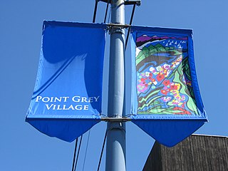
West Point Grey is a neighbourhood in the northwest of the city of Vancouver, British Columbia, Canada. It is located on Point Grey and is bordered by 16th Avenue to the south, Alma Street to the east, English Bay to the north, and Blanca Street to the west. Notable beaches within the West Point Grey boundary include Spanish Banks, Locarno and Jericho. Immediately to the south is Pacific Spirit Regional Park and to the east is Kitsilano.

Fairview is a neighbourhood on the west side of the city of Vancouver, British Columbia, Canada. It runs from 16th Avenue in the south, to Burrard Street in the west, to Cambie Street in the east, and to False Creek in the north.

Cadboro Bay is a bay near the southern tip of Vancouver Island and its adjacent neighbourhood in the municipalities of Saanich and Oak Bay in Greater Victoria, British Columbia, Canada.
Fairfield is a neighbourhood of Victoria, British Columbia. It is bounded by the James Bay, Downtown, Harris Green, Fernwood, Rockland, and Gonzales neighbourhoods, and meets the Strait of Juan de Fuca to the south.

Tam O'Shanter-Sullivan is a neighbourhood in the east end of the city of Toronto, in the district of Scarborough. The neighbourhood is bordered by Huntingwood Drive to the North, Kennedy Road to the East, Highway 401 to the South and Victoria Park to the West. The neighbourhood, which includes the Tam O'Shanter and Sullivan communities, takes its name from Tam O’Shanter Golf Course and O'Sullivan's Corners.

The Queensway-Humber Bay, known officially as Stonegate-Queensway, is a neighbourhood in the southwest of Toronto, Ontario, Canada. It is located in the southeast area of the former City of Etobicoke.

James Bay is a high density neighbourhood of Victoria, British Columbia, Canada. It is the oldest residential neighbourhood on the West coast of North America that is north of San Francisco. James Bay occupies the south side of the Inner Harbour close to downtown. Access to the neighbourhood is along Belleville Street, Government Street, Douglas Street and Dallas Road.

Gordon Head is a seaside neighbourhood in the municipality of Saanich in Greater Victoria, British Columbia, Canada. Gordon Head lies north of McKenzie Avenue and east of the Blenkinsop Valley. The University of Victoria is located partly within Gordon Head along the southeast boundary. Finnerty Road separates Gordon Head from the adjacent neighbourhood of Cadboro Bay. The local area is dominated physically by Mount Douglas, a coastline along Haro Strait, and the central plateau.

Highland Park is a residential neighbourhood in the northwest quadrant of Calgary, Alberta. It is bounded to the north by McKnight Boulevard, to the east by Edmonton Trail, to the south by 32 Avenue N and to the west by 4 Street W. Confederation Park and Nose Hill Park are located in close proximity. The Queens Park Cemetery occupies the southwestern corner of the neighbourhood, and the Highland golf course is developed in the north.

The Upper Beaches is a neighbourhood in Toronto, Ontario, Canada. It is directly north of the Beaches area. It stretches from Coxwell Avenue in the west to Victoria Park in the east. The southern border is Kingston Road, while the northern boundary is generally considered to be the Canadian National Railway tracks between Gerrard Street and Danforth Avenue. The western part of the area was originally called Norway, and the larger area was once part of the Town of East Toronto. The name "Upper Beaches" was first used by developers and real estate agents around the period of 2001 to 2003 for the selling of houses on redeveloped land in the area, and was used as a marketing tag to attract buyers. The area was never considered part of the Beaches neighbourhood but was close to it. The city's current name for this area is East End Danforth, though that is rarely used. The city also includes the buildings along and just north of Danforth Avenue in the neighbourhood. The western portion between Woodbine Avenue and Coxwell is referred to by the city as Woodbine Corridor.
The city of Sault Ste. Marie, Ontario, Canada contains a significant number of named residential neighbourhoods, including Bayview, Broadview Gardens, Brookfield, Buckley, Carpin Beach, Cedar Heights, East Korah, Eastside, Fort Creek, Grandview Gardens, Korah, Manitou Park, McQueen, Meadow Park, Nokomis Beach, Odena, The P Patch, Pointe aux Pins, Pointe des Chênes, Pointe Louise and Steelton.

Little Portugal is a neighbourhood and ethnic enclave in Toronto, Ontario, Canada. It is located west of downtown in the "Old" City of Toronto. It is bound on the west by Lansdowne Avenue, on the north by College Street, on the east by Bathurst Street and on the south by the Go Transit and Union Pearson Express railway tracks. The area is mainly residential, with Portuguese businesses along Dundas Street West and College Street. The area west of Dufferin Street was a part of the former Town of Brockton. The area to the east of Dufferin and south of Dundas Street is also known as "Beaconsfield Village" dating back to the days of the sub-division of lots in the area around Beaconsfield Avenue.
Birch Cliff is a neighbourhood in Toronto, Ontario, Canada. It is located in the southwest part of the old city of Scarborough running along the shore of Lake Ontario atop the western part of the Scarborough Bluffs. Birch Cliff has a large Irish population. About one-third of Birch Cliff residents are of Irish origin.
Victoria West, commonly called Vic West, is an historic neighbourhood of the city of Victoria, British Columbia, Canada, located just west of downtown across Victoria Harbour, bordering on the Township of Esquimalt.
