List of places in Colorado: P–Z

Last updated
The 64 counties of the U.S. State of Colorado.

Map all coordinates using: OpenStreetMap

This is a list of more than 4,000 places in the U.S. State of Colorado . [1] [2]

Contents

For additional information, please see the following:

Colorado places: A B C D E F G H I J K L M N O P Q R S T U V W X Y Z

A–F

G–O

P

PlaceCountyTypeZIP codeCoordinates
Pacific El Paso County former post office NANA
Pacific RailroadSedgwick Countysee Transcontinental Railroad
Pactolus Gilpin County unincorporated community 80422 39°55′04″N105°27′52″W / 39.91778°N 105.46444°W / 39.91778; -105.46444 (Pactolus)
Padroni Logan County census-designated place 80745 40°46′55″N103°10′24″W / 40.78194°N 103.17333°W / 40.78194; -103.17333 (Padroni CDP)
Pagoda Routt County ghost town NA 40°20′13″N107°24′57″W / 40.33694°N 107.41583°W / 40.33694; -107.41583 (Pagoda (historical))
Pagosa Junction Archuleta County unincorporated community 81147 37°02′17″N107°11′57″W / 37.03806°N 107.19917°W / 37.03806; -107.19917 (Pagosa Junction)
Pagosa Springs Archuleta County seat home rule town 81147, 81157 37°16′10″N107°00′35″W / 37.26944°N 107.00972°W / 37.26944; -107.00972 (Pagosa Springs)
Paige City Summit County former post office 80424NA
Paisaje Conejos County unincorporated community 81120 37°04′04″N106°03′38″W / 37.06778°N 106.06056°W / 37.06778; -106.06056 (Paisaje)
Palisade Mesa County statutory town 81526 39°06′37″N108°21′03″W / 39.11028°N 108.35083°W / 39.11028; -108.35083 (Palisade)
PalisadesMesa Countysee Palisade
Pallas Routt County former post office NANA
PalmerEl Paso Countysee Palmer Lake
PalmerFremont Countysee Coaldale
Palmer Lake El Paso County statutory town 80133 39°07′20″N104°55′02″W / 39.12222°N 104.91722°W / 39.12222; -104.91722 (Palmer Lake)
Palos Verdes Arapahoe County Centennial neighborhood 80111 39°36′21″N104°55′06″W / 39.60583°N 104.91833°W / 39.60583; -104.91833 (Palos Verdes)
Pando Eagle County ghost town NA 39°27′26″N106°20′01″W / 39.45722°N 106.33361°W / 39.45722; -106.33361 (Pando (historical))
Pandora San Miguel County unincorporated community 81435 37°56′00″N107°47′08″W / 37.93333°N 107.78556°W / 37.93333; -107.78556 (Pandora)
Panorama Heights Jefferson County unincorporated community 80401 39°43′20″N105°14′25″W / 39.72222°N 105.24028°W / 39.72222; -105.24028 (Panorama Heights)
Paoli Phillips County statutory town 80746 40°36′44″N102°28′22″W / 40.61222°N 102.47278°W / 40.61222; -102.47278 (Paoli)
Paonia Delta County statutory town 81428 38°52′06″N107°35′31″W / 38.86833°N 107.59194°W / 38.86833; -107.59194 (Paonia)
Paonia State Park Gunnison County Colorado state park 81415 38°57′42″N107°20′23″W / 38.9617°N 107.3396°W / 38.9617; -107.3396 (Paonia State Park)
Papeton El Paso County Colorado Springs neighborhood 80907 38°52′35″N104°48′07″W / 38.87639°N 104.80194°W / 38.87639; -104.80194 (Papeton)
Parachute Garfield County home rule town 81635 39°27′07″N108°03′10″W / 39.45194°N 108.05278°W / 39.45194; -108.05278 (Parachute)
Paradise Acres Jefferson County Arvada neighborhood 80005 39°49′44″N105°06′02″W / 39.82889°N 105.10056°W / 39.82889; -105.10056 (Paradise Acres)
Paradise Hills Jefferson County unincorporated community 80401 39°42′45″N105°15′06″W / 39.71250°N 105.25167°W / 39.71250; -105.25167 (Paradise Hills)
Paradox Montrose County unincorporated community 81429 38°22′06″N108°57′44″W / 38.36833°N 108.96222°W / 38.36833; -108.96222 (Paradox)
Paragon Estates Boulder County census-designated place 80303 39°58′49″N105°10′53″W / 39.98028°N 105.18139°W / 39.98028; -105.18139 (Paragon Estates CDP)
Paramount Heights Jefferson County Wheat Ridge neighborhood 80215 39°45′28″N105°06′51″W / 39.75778°N 105.11417°W / 39.75778; -105.11417 (Paramount Heights)
Pargin La Plata County former post office NANA
Park Center Fremont County census-designated place 81212 38°29′01″N105°13′26″W / 38.48361°N 105.22389°W / 38.48361; -105.22389 (Park Center CDP)
Park CityLake Countysee Adelaide, Lake County
Park City Park County ghost town NA 39°16′42″N106°05′35″W / 39.27833°N 106.09306°W / 39.27833; -106.09306 (Park City (historical))
Park Cone Gunnison County mountain peak NA 38°47′48″N106°36′10″W / 38.79667°N 106.60278°W / 38.79667; -106.60278 (Park Cone)
Park East Arapahoe County Aurora neighborhood 80010 39°43′18″N104°51′11″W / 39.72167°N 104.85306°W / 39.72167; -104.85306 (Park East)
Park Hill Denver Denver neighborhood 80207 39°45′44″N104°55′21″W / 39.7621°N 104.9224°W / 39.7621; -104.9224 (Park Hill, Denver)
Park Hill Larimer County mountain pass NA 40°21′42″N105°27′57″W / 40.36167°N 105.46583°W / 40.36167; -105.46583 (Park Hill)
Park Meadows Douglas County Lone Tree neighborhood 80124 39°33′46″N104°52′35″W / 39.56278°N 104.87639°W / 39.56278; -104.87639 (Park Meadows)
Park SidingJefferson Countysee Foxton
Park Slope Jefferson County Arvada neighborhood 80002 39°47′36″N105°05′27″W / 39.79333°N 105.09083°W / 39.79333; -105.09083 (Park Slope)
Park View Arapahoe County Centennial neighborhood 80015 39°36′46″N104°44′59″W / 39.61278°N 104.74972°W / 39.61278; -104.74972 (Park View)
Park View Estates Arapahoe County Aurora neighborhood 80011 39°43′18″N104°50′00″W / 39.72167°N 104.83333°W / 39.72167; -104.83333 (Park View Estates)
Parkborough Arapahoe County Centennial neighborhood 80015 39°36′41″N104°44′23″W / 39.61139°N 104.73972°W / 39.61139; -104.73972 (Parkborough)
Parkdale Fremont County unincorporated community NANA
Parker Douglas County home rule town 80134, 80138 39°31′07″N104°45′41″W / 39.51861°N 104.76139°W / 39.51861; -104.76139 (Parker)
Parker Highlands Elbert County unincorporated community 80138 39°28′17″N104°39′02″W / 39.47139°N 104.65056°W / 39.47139; -104.65056 (Parker Highlands)
Parkview Mountain [lower-alpha 1] Grand County mountain peak NA 40°19′48″N106°08′10″W / 40.33000°N 106.13611°W / 40.33000; -106.13611 (Parkview Mountain)
Jackson County
Parkville Saguache County unincorporated community 81155 38°13′38″N106°06′02″W / 38.22722°N 106.10056°W / 38.22722; -106.10056 (Parkville)
Parkville [lower-alpha 2] Summit County ghost town NA 39°29′56″N106°57′00″W / 39.49889°N 106.95000°W / 39.49889; -106.95000 (Parkville (historical))
Parkway Estates Jefferson County Arvada neighborhood 80003 39°50′13″N105°04′34″W / 39.83694°N 105.07611°W / 39.83694; -105.07611 (Parkway Estates)
Parlin Gunnison County unincorporated community 81239 38°30′10″N106°43′42″W / 38.50278°N 106.72833°W / 38.50278; -106.72833 (Parlin)
Parma Alamosa County unincorporated community 81144 37°32′14″N106°02′19″W / 37.53722°N 106.03861°W / 37.53722; -106.03861 (Parma)
Rio Grande County
Parras Plaza Las Animas County unincorporated community 81091 37°10′38″N104°57′23″W / 37.17722°N 104.95639°W / 37.17722; -104.95639 (Parras Plaza)
Parrish Prowers County unincorporated community 81047 38°07′18″N102°23′05″W / 38.12167°N 102.38472°W / 38.12167; -102.38472 (Parrish)
Parrott City La Plata County ghost town NANA
Parry Peak Clear Creek County mountain peak NA 39°50′17″N105°42′48″W / 39.83806°N 105.71333°W / 39.83806; -105.71333 (Parry Peak)
Grand County
Parshall Grand County census-designated place 80468 40°03′20″N106°10′34″W / 40.05556°N 106.17611°W / 40.05556; -106.17611 (Parshall CDP)
Pass Creek Pass Costilla County mountain pass NA 37°37′14″N105°13′46″W / 37.62056°N 105.22944°W / 37.62056; -105.22944 (Pass Creek Pass)
Huerfano County
Patches Las Animas County former post office NANA
Patt Las Animas County former post office NANA
Patterson Crossing Las Animas County ghost town NA 37°13′03″N104°12′30″W / 37.21750°N 104.20833°W / 37.21750; -104.20833 (Patterson Crossing (historical))
Patterson Place Gunnison County unincorporated community 81434 39°06′50″N107°25′03″W / 39.11389°N 107.41750°W / 39.11389; -107.41750 (Patterson Place)
Pauley Huerfano County former post office NANA
Paulus Jackson County former post office NANA
Pawnee Morgan County former post office NANA
Pawnee Hills Elbert County unincorporated community 80107 39°23′35″N104°38′18″W / 39.39306°N 104.63833°W / 39.39306; -104.63833 (Pawnee Hills)
Pawnee National Grassland Weld County national Grassland NA 40°42′28″N104°27′29″W / 40.70778°N 104.45806°W / 40.70778; -104.45806 (Pawnee National Grassland)
Pawnee Pass Boulder County mountain pass NA 40°04′33″N105°38′06″W / 40.07583°N 105.63500°W / 40.07583; -105.63500 (Pawnee Pass)
Grand County
Paxton Montrose County former post office NANA
Paymaster Montezuma County former post office NANA
Payne Delta County unincorporated community 81419 38°48′06″N107°54′07″W / 38.80167°N 107.90194°W / 38.80167; -107.90194 (Payne)
Pea Green Corner Montrose County unincorporated community 81425 38°39′00″N108°05′42″W / 38.65000°N 108.09500°W / 38.65000; -108.09500 (Pea Green Corner)
Peabodys Park County ghost town NA 39°20′53″N105°55′38″W / 39.34806°N 105.92722°W / 39.34806; -105.92722 (Peabodys (historical))
Peaceful Valley Boulder County unincorporated community 80540 40°07′53″N105°29′52″W / 40.13139°N 105.49778°W / 40.13139; -105.49778 (Peaceful Valley)
Peachblow Eagle County former post office NANA
Peak Seven West Summit County unincorporated community 80424 39°30′00″N106°03′50″W / 39.50000°N 106.06389°W / 39.50000; -106.06389 (Peak Seven West)
Pear Park Mesa County unincorporated community 81504 39°04′13″N108°28′19″W / 39.07028°N 108.47194°W / 39.07028; -108.47194 (Pear Park)
Pearl Jackson County ghost town NA 40°59′07″N106°32′49″W / 40.98528°N 106.54694°W / 40.98528; -106.54694 (Pearl (historical))
Pearl Lake State Park Routt County Colorado state park 80428 40°47′10″N106°53′49″W / 40.7862°N 106.8969°W / 40.7862; -106.8969 (Pearl Lake State Park)
Pearl Pass Gunnison County mountain pass NA 38°58′46″N106°49′24″W / 38.97944°N 106.82333°W / 38.97944; -106.82333 (Pearl Pass)
Pitkin County
Pearmont Grand County former post office NANA
Peckham Weld County unincorporated community 80645 40°18′14″N104°45′04″W / 40.30389°N 104.75111°W / 40.30389; -104.75111 (Peckham)
Peconic Kit Carson County unincorporated community 80807 39°19′15″N102°08′56″W / 39.32083°N 102.14889°W / 39.32083; -102.14889 (Peconic)
Peebles FortOtero Countysee Milk Fort
Peeples Delta County unincorporated community 81416 38°49′19″N108°20′30″W / 38.82194°N 108.34167°W / 38.82194; -108.34167 (Peeples)
Peetz Logan County statutory town 80747 40°57′46″N103°06′45″W / 40.96278°N 103.11250°W / 40.96278; -103.11250 (Peetz)
Pella Grand County former post office NANA
PembertonDouglas Countysee Westcreek
PeneoldJackson Countysee Gould
Penn Boulder County former post office NANA
Penrose Fremont County census-designated place 81240 38°25′17″N105°00′01″W / 38.42139°N 105.00028°W / 38.42139; -105.00028 (Penrose CDP)
Peoria Arapahoe County census-designated place 80103 39°39′54″N104°08′44″W / 39.66500°N 104.14556°W / 39.66500; -104.14556 (Peoria CDP)
Peoria Park Arapahoe County Aurora neighborhood 80014 39°40′44″N104°51′07″W / 39.67889°N 104.85194°W / 39.67889; -104.85194 (Peoria Park)
Perigo Gilpin County ghost town NA 39°52′45″N105°31′51″W / 39.87917°N 105.53083°W / 39.87917; -105.53083 (Perigo (historical))
Perin La Plata County former post office NANA
Perins La Plata County former post office NANA
Perl-Mack Adams County former post office 80221NA
Perry Douglas County former post office NANA
Perry Rio Grande County former post office NANA
Perry Park Douglas County census-designated place 80118 39°15′34″N104°58′57″W / 39.25944°N 104.98250°W / 39.25944; -104.98250 (Perry Park CDP)
Pershing Routt County former post office NANA
Petersburg Arapahoe County former post office NANA
Peterson Army Air Field El Paso County historic U.S. Army air field 80914 38°48′46″N104°42′36″W / 38.81278°N 104.71000°W / 38.81278; -104.71000 (Peterson Army Air Field (historical))
Peterson Space Force Base El Paso County U.S. Space Force 80914 38°49′25″N104°41′42″W / 38.82361°N 104.69500°W / 38.82361; -104.69500 (Peterson Space Force Base)
PetraLarimer Countysee Stout
Pettingell Peak Grand County high point mountain peak NA 39°43′43″N105°54′18″W / 39.72861°N 105.90500°W / 39.72861; -105.90500 (Pettingell Peak)
Clear Creek County
Peyton El Paso County census-designated place 80831 39°01′59″N104°29′25″W / 39.03306°N 104.49028°W / 39.03306; -104.49028 (Peyton CDP)
Pheasant Run Arapahoe County Aurora neighborhood 80015 39°38′10″N104°48′46″W / 39.63611°N 104.81278°W / 39.63611; -104.81278 (Pheasant Run)
Philadelphia Toboggan Company Carousel No. 6Kit Carson Countysee Burlingon Carousel
Phillipsburg Jefferson County unincorporated community 80127 39°32′18″N105°11′13″W / 39.53833°N 105.18694°W / 39.53833; -105.18694 (Phillipsburg)
Phippsburg Routt County census-designated place 80469 40°13′49″N106°57′03″W / 40.23028°N 106.95083°W / 40.23028; -106.95083 (Phippsburg CDP)
Phoenix Gilpin County ghost town NA 39°55′43″N105°32′08″W / 39.92861°N 105.53556°W / 39.92861; -105.53556 (Phoenix (historical))
Phoenix Peak Mineral County high point mountain peak NA 37°56′11″N106°51′59″W / 37.93639°N 106.86639°W / 37.93639; -106.86639 (Phoenix Peak)
Saguache County
Piceance Rio Blanco County former post office NANA
Pictou Huerfano County unincorporated community 81089 37°38′19″N104°48′49″W / 37.63861°N 104.81361°W / 37.63861; -104.81361 (Pictou)
Piedmont Las Animas County ghost town NA 37°08′16″N104°33′07″W / 37.13778°N 104.55194°W / 37.13778; -104.55194 (Piedmont (historical))
Piedra Archuleta County former post office NANA
Piedra Hinsdale County census-designated place 81127 37°26′30″N107°10′06″W / 37.44167°N 107.16833°W / 37.44167; -107.16833 (Piedra CDP)
Piedra Pass Mineral County mountain pass NA 37°34′17″N107°00′04″W / 37.57139°N 107.00111°W / 37.57139; -107.00111 (Piedra Pass)
Pieplant Gunnison County former post office NANA
Pieplant Mill Gunnison County ghost town NA 38°56′17″N106°33′34″W / 38.93806°N 106.55944°W / 38.93806; -106.55944 (Pieplant Mill (historical))
Pierce Weld County statutory town 80650 40°38′08″N104°45′19″W / 40.63556°N 104.75528°W / 40.63556; -104.75528 (Pierce)
Pike National Forest Clear Creek County national Forest NA 39°10′31″N105°27′10″W / 39.17528°N 105.45278°W / 39.17528; -105.45278 (Pike National Forest)
Teller County
Park County
Jefferson County
Douglas County
El Paso County
Pikes Peak El Paso County high point mountain peak
national historic landmark
NA 38°50′26″N105°02′42″W / 38.8405839°N 105.0449035°W / 38.8405839; -105.0449035 (Pikes Peak)
Pike's Stockade Conejos County national historic landmark 81151 37°17′37″N105°48′37″W / 37.2936205°N 105.8102975°W / 37.2936205; -105.8102975 (Pike's Stockade)
Pike-San Isabel Village Park County unincorporated community 80449 39°03′07″N105°43′14″W / 39.05194°N 105.72056°W / 39.05194; -105.72056 (Pike-San Isabel Village)
Pikeview El Paso County Colorado Springs neighborhood 80919 38°54′55″N104°49′20″W / 38.91528°N 104.82222°W / 38.91528; -104.82222 (Pikeview)
Pilot Cheyenne County former post office NANA
Pine Jefferson County unincorporated community 80470 39°24′36″N105°19′26″W / 39.41000°N 105.32389°W / 39.41000; -105.32389 (Pine)
Pine Bluff Mesa County former post office NANA
Pine Brook Hill Boulder County census-designated place 80304 40°02′50″N105°18′37″W / 40.04722°N 105.31028°W / 40.04722; -105.31028 (Pine Brook Hill CDP)
Pine Crest El Paso County Palmer Lake neighborhood 80133 39°06′45″N104°54′30″W / 39.11250°N 104.90833°W / 39.11250; -104.90833 (Pine Crest)
Pine GroveJefferson Countysee Pine
Pine Junction Jefferson County unincorporated community 80470 39°27′58″N105°23′45″W / 39.46611°N 105.39583°W / 39.46611; -105.39583 (Pine Junction)
Pine Nook Douglas County unincorporated community 80135 39°23′03″N105°04′17″W / 39.38417°N 105.07139°W / 39.38417; -105.07139 (Pine Nook)
Pine Valley Boulder County unincorporated community 80540 40°11′30″N105°28′59″W / 40.19167°N 105.48306°W / 40.19167; -105.48306 (Pine Valley)
Pine Valley Clear Creek County census-designated place 80439 39°41′34″N105°24′38″W / 39.69278°N 105.41056°W / 39.69278; -105.41056 (Pine Valley CDP)
Pine Valley Douglas County unincorporated community 80138 39°31′32″N104°44′30″W / 39.52556°N 104.74167°W / 39.52556; -104.74167 (Pine Valley)
Pinecliffe Boulder County unincorporated community 80471 39°55′55″N105°25′42″W / 39.93194°N 105.42833°W / 39.93194; -105.42833 (Pinecliffe)
Gilpin County
Pineriver La Plata County former post office NANA
Pinewood Larimer County former post office NANA
Pinewood Springs Larimer County unincorporated community 80540 40°16′24″N105°21′24″W / 40.27333°N 105.35667°W / 40.27333; -105.35667 (Pinewood Springs)
Piney Creek Arapahoe County Centennial neighborhood 80015 39°37′03″N104°47′30″W / 39.61750°N 104.79167°W / 39.61750; -104.79167 (Piney Creek)
Piney Creek Ranches Arapahoe County Centennial neighborhood 80016 39°35′54″N104°45′53″W / 39.59833°N 104.76472°W / 39.59833; -104.76472 (Piney Creek Ranches)
Pinkhamton Larimer County former post office NANA
Pinnacle Bent County former post office NANA
Pinnacle Routt County former post office NANA
Pinneo Washington County ghost town NA 40°12′34″N103°26′19″W / 40.20944°N 103.43861°W / 40.20944; -103.43861 (Pinneo (historical))
Piñon Montrose County unincorporated community 81008 38°16′00″N108°24′02″W / 38.26667°N 108.40056°W / 38.26667; -108.40056 (Piñon)
Piñon Pueblo County ghost town NA 38°26′00″N104°36′27″W / 38.43333°N 104.60750°W / 38.43333; -104.60750 (Piñon (historical))
Piñon Acres La Plata County unincorporated community 81301 37°13′40″N107°49′02″W / 37.22778°N 107.81722°W / 37.22778; -107.81722 (Piñon Acres)
Piñon Canyon Maneuver Site Las Animas County United States Army reservation 81082 37°29′33″N103°52′34″W / 37.49250°N 103.87611°W / 37.49250; -103.87611 (Piñon Canyon Maneuver Site)
Piñon Mesa High Point Mesa County County mountain peak NA 38°49′33″N108°46′19″W / 38.82583°N 108.77194°W / 38.82583; -108.77194 (Piñon Mesa High Point)
Pioneer Mobile Gardens Adams County unincorporated community 80221 39°48′38″N105°01′22″W / 39.81056°N 105.02278°W / 39.81056; -105.02278 (Pioneer Mobile Gardens)
Pitkin Gunnison County statutory town 81241 38°36′33″N106°31′00″W / 38.60917°N 106.51667°W / 38.60917; -106.51667 (Pitkin)
Pittsburg Gunnison County ghost town NA 38°57′08″N107°03′45″W / 38.95222°N 107.06250°W / 38.95222; -107.06250 (Pittsburg (historical))
Placerville San Miguel County census-designated place 81430 38°00′18″N108°02′22″W / 38.00500°N 108.03944°W / 38.00500; -108.03944 (Placerville CDP)
Placita Pitkin County unincorporated community 81623 39°07′56″N107°15′46″W / 39.13222°N 107.26278°W / 39.13222; -107.26278 (Placita)
Plain Summit County former post office NANA
Plains Prowers County former post office NANA
Plainview Jefferson County unincorporated community 80403 39°53′37″N105°16′35″W / 39.89361°N 105.27639°W / 39.89361; -105.27639 (Plainview)
Plateau Mesa County former post office NANA
Plateau City Mesa County unincorporated community 81624 39°14′14″N107°58′54″W / 39.23722°N 107.98167°W / 39.23722; -107.98167 (Plateau City)
Platner Washington County unincorporated community 80743 40°09′19″N103°04′03″W / 40.15528°N 103.06750°W / 40.15528; -103.06750 (Platner)
Platoro Conejos County unincorporated community 81120 37°21′07″N106°31′58″W / 37.35194°N 106.53278°W / 37.35194; -106.53278 (Platoro)
Platt Park Denver Denver neighborhood 80210 39°41′15″N104°58′49″W / 39.6876°N 104.9804°W / 39.6876; -104.9804 (Platt Park, Denver)
Platte Park County former post office NANA
Platte Cañon Douglas County former post office NANA
Platte Cañon Jefferson County former post office 80127NA
Platte Springs Park County ghost town NA 39°03′49″N105°21′31″W / 39.06361°N 105.35861°W / 39.06361; -105.35861 (Platte Springs (historical))
Platte Station Park County former post office NANA
Platte Valley Weld County former post office 80644NA
Platteville Weld County statutory town 80651 40°12′54″N104°49′22″W / 40.21500°N 104.82278°W / 40.21500; -104.82278 (Platteville)
Pleasant ValleyFremont Countysee Howard
Pleasant View Jefferson County unincorporated community 80401 39°44′03″N105°10′18″W / 39.73417°N 105.17167°W / 39.73417; -105.17167 (Pleasant View)
Pleasant View Montezuma County unincorporated community 81331 37°35′22″N108°45′54″W / 37.58944°N 108.76500°W / 37.58944; -108.76500 (Pleasant View)
Pleasant View Ridge Boulder County unincorporated community 80504 40°07′00″N105°03′20″W / 40.11667°N 105.05556°W / 40.11667; -105.05556 (Pleasant View Ridge)
Pleasanton Fremont County unincorporated community 81222 38°21′54″N105°44′52″W / 38.36500°N 105.74778°W / 38.36500; -105.74778 (Pleasanton)
Plum Bush Washington County former post office NANA
Plum Valley Las Animas County former post office NANA
Plumbs Weld County unincorporated community 80516 40°05′16″N105°02′38″W / 40.08778°N 105.04389°W / 40.08778; -105.04389 (Plumbs)
Plumer Ouray County former post office NANA
Point Lookout Montezuma County former post office NANA
Point of Rocks Huerfano County former post office NANA
Poncha Pass Chaffee County mountain pass NA 38°25′20″N106°05′13″W / 38.42222°N 106.08694°W / 38.42222; -106.08694 (Poncha Pass)
Saguache County
Poncha Springs Chaffee County statutory town 81242 38°30′46″N106°04′38″W / 38.51278°N 106.07722°W / 38.51278; -106.07722 (Poncha Springs)
Poncho SpringsChaffee Countysee Poncha Springs
Ponderosa East Douglas County unincorporated community 80138 39°32′46″N104°40′14″W / 39.54611°N 104.67056°W / 39.54611; -104.67056 (Ponderosa East)
Ponderosa Hills Douglas County unincorporated community 80138 39°32′41″N104°43′55″W / 39.54472°N 104.73194°W / 39.54472; -104.73194 (Ponderosa Hills)
Ponderosa Park Elbert County census-designated place 80107 39°23′55″N104°38′08″W / 39.39861°N 104.63556°W / 39.39861; -104.63556 (Ponderosa Park CDP)
Pony Estates Boulder County unincorporated community 80020 39°57′39″N105°03′25″W / 39.96083°N 105.05694°W / 39.96083; -105.05694 (Pony Estates)
Pony Express National Historic Trail [10] [11] Sedgwick County national historic trail 80744 40°56′35″N102°21′30″W / 40.94306°N 102.35833°W / 40.94306; -102.35833 (Fort Julesburg (historical))
PoolRoutt Countysee Milner
Porter La Plata County former post office NANA
Portland Fremont County unincorporated community 81226 38°23′28″N105°01′30″W / 38.39111°N 105.02500°W / 38.39111; -105.02500 (Portland)
Portland Ouray County census-designated place 81432 38°05′21″N107°41′43″W / 38.08917°N 107.69528°W / 38.08917; -107.69528 (Portland CDP)
Post at JulesburgSedgwick Countysee Fort Sedgwick
Poudre City Larimer County ghost town 80512 40°41′54″N105°37′29″W / 40.69833°N 105.62472°W / 40.69833; -105.62472 (Poudre City (historical))
Poudre Park Larimer County unincorporated community 80512 40°41′10″N105°18′17″W / 40.68611°N 105.30472°W / 40.68611; -105.30472 (Poudre Park)
Poughkeepsie San Juan County former post office NANA
Powars Weld County unincorporated community 80621 40°02′27″N104°48′29″W / 40.04083°N 104.80806°W / 40.04083; -104.80806 (Powars)
Powder Wash Moffat County ghost town NA 40°56′45″N108°18′41″W / 40.94583°N 108.31139°W / 40.94583; -108.31139 (Powder Wash (historical))
Powderhorn Gunnison County unincorporated community 81243 38°16′37″N107°05′45″W / 38.27694°N 107.09583°W / 38.27694; -107.09583 (Powderhorn)
Powell Las Animas County former post office NANA
Prairie Washington County former post office NANA
Prairie Trail Ranches Elbert County unincorporated community 80138 39°28′11″N104°37′56″W / 39.46972°N 104.63222°W / 39.46972; -104.63222 (Prairie Trail Ranches)
Preston Summit County ghost town NA 39°29′45″N106°01′16″W / 39.49583°N 106.02111°W / 39.49583; -106.02111 (Preston (historical))
Price Archuleta County former post office NANA
Price Creek Moffat County former post office NANA
Pride Baca County former post office NANA
Primero Las Animas County ghost town NA 37°08′33″N104°44′30″W / 37.14250°N 104.74167°W / 37.14250; -104.74167 (Primero (historical))
Primos Boulder County former post office NANA
Princeton Chaffee County unincorporated community 81211 38°59′36″N106°13′12″W / 38.99333°N 106.22000°W / 38.99333; -106.22000 (Princeton)
Pritchett Baca County statutory town 81064 37°22′13″N102°51′35″W / 37.37028°N 102.85972°W / 37.37028; -102.85972 (Pritchett)
Proctor Logan County unincorporated community 80736 40°48′25″N102°57′06″W / 40.80694°N 102.95167°W / 40.80694; -102.95167 (Proctor)
Progress Baca County former post office NANA
Prospect Boulder County Longmont neighborhood 80504 40°08′08″N105°06′20″W / 40.13556°N 105.10556°W / 40.13556; -105.10556 (Prospect)
Prospect Gunnison County former post office NANA
Prospect Heights Fremont County Cañon City neighborhood 81212 38°25′35″N105°14′15″W / 38.42639°N 105.23750°W / 38.42639; -105.23750 (Prospect Heights)
Prospect Valley Weld County unincorporated community 80643 40°04′25″N104°24′54″W / 40.07361°N 104.41500°W / 40.07361; -104.41500 (Prospect Valley)
Providence Gunnison County former post office NANA
Prowers Bent County unincorporated community 81044 38°04′55″N102°46′04″W / 38.08194°N 102.76778°W / 38.08194; -102.76778 (Prowers)
Pruden Saguache County former post office NANA
Pryor Huerfano County unincorporated community 81089 37°30′29″N104°42′51″W / 37.50806°N 104.71417°W / 37.50806; -104.71417 (Pryor)
Ptarmigan Pass Eagle County mountain pass NA 39°29′35″N106°15′12″W / 39.49306°N 106.25333°W / 39.49306; -106.25333 (Ptarmigan Pass)
Summit County
Ptarmigan Pass [lower-alpha 3] Grand County mountain pass NA 40°18′38″N105°42′04″W / 40.31056°N 105.70111°W / 40.31056; -105.70111 (Ptarmigan Pass)
Larimer County
Ptarmigan Pass Grand County mountain pass NA 39°41′11″N106°00′13″W / 39.68639°N 106.00361°W / 39.68639; -106.00361 (Ptarmigan Pass)
Summit County
Pueblo [lower-alpha 4] [12] Pueblo County seat home rule city 81001-81012 38°15′16″N104°36′33″W / 38.25444°N 104.60917°W / 38.25444; -104.60917 (Pueblo)
Pueblo Army Air Base Pueblo County historic U.S. Army air base 81001 38°17′38″N104°29′57″W / 38.29389°N 104.49917°W / 38.29389; -104.49917 (Pueblo Army Air Base (historical))
Pueblo Chemical Depot Pueblo County United States Army depot 81006 38°18′51″N104°19′53″W / 38.31417°N 104.33139°W / 38.31417; -104.33139 (Pueblo Chemical Depot)
Pueblo de LecheOtero Countysee Milk Fort
Pueblo West Pueblo County census-designated place 81007 38°21′18″N104°43′36″W / 38.35500°N 104.72667°W / 38.35500; -104.72667 (Pueblo West CDP)
Puerto Blanco Mineral County mountain pass NA 37°30′47″N107°01′20″W / 37.51306°N 107.02222°W / 37.51306; -107.02222 (Puerto Blanco)
Pulaski Las Animas County former post office NANA
Pullen Larimer County former post office NANA
Pulliam Weld County unincorporated community 80534 40°19′14″N104°56′38″W / 40.32056°N 104.94389°W / 40.32056; -104.94389 (Pulliam)
Pultney Crowley County unincorporated community 81062 38°09′44″N104°02′52″W / 38.16222°N 104.04778°W / 38.16222; -104.04778 (Pultney)
Puma Routt County former post office NANA
Puma CityPark Countysee Tarryall (founded 1896)
Puma Peak Park County mountain peak NA 39°09′26″N105°34′53″W / 39.15722°N 105.58139°W / 39.15722; -105.58139 (Puma Peak)
Punkin Center Lincoln County unincorporated community 80821, 81063 38°51′07″N103°42′02″W / 38.85194°N 103.70056°W / 38.85194; -103.70056 (Punkin Center)
Purcell Weld County unincorporated community 80610 40°38′18″N104°36′06″W / 40.63833°N 104.60167°W / 40.63833; -104.60167 (Purcell)
Puritan Weld County ghost town NA 40°05′06″N104°59′57″W / 40.08500°N 104.99917°W / 40.08500; -104.99917 (Puritan (historical))
Puzzle Pass La Plata County mountain pass NA 37°24′20″N108°02′02″W / 37.40556°N 108.03389°W / 37.40556; -108.03389 (Puzzle Pass)
Puzzler Boulder County former post office NANA
Pyke Saguache County former post office NANA
Pyramid Rio Blanco County former post office NANA
Pyramid Peak Pitkin County mountain peak NA 39°04′18″N106°57′00″W / 39.07167°N 106.95000°W / 39.07167; -106.95000 (Pyramid Peak)
Pyrolite Fremont County former post office NANA

Q

PlaceCountyTypeZIP codeCoordinates
Quail Hill Adams County Westminster neighborhood 80023 39°57′47″N105°00′08″W / 39.96306°N 105.00222°W / 39.96306; -105.00222 (Quail Hill)
Quaker Acres Jefferson County unincorporated community 80007 39°49′50″N105°11′14″W / 39.83056°N 105.18722°W / 39.83056; -105.18722 (Quaker Acres)
Quandary Peak [lower-alpha 5] Summit County mountain peak NA 39°23′50″N106°06′23″W / 39.39722°N 106.10639°W / 39.39722; -106.10639 (Quandary Peak)
Quarry Montezuma County former post office NANA
Quartz Gunnison County former post office NANA
QuartzvilleGunnison Countysee Pitkin
Quartzville Park County ghost town NA 39°20′42″N106°04′38″W / 39.34500°N 106.07722°W / 39.34500; -106.07722 (Quartzville (historical))
Quebec Huerfano County former post office NANA
Queen Beach Kiowa County former post office NANA
Queensborough Arapahoe County Aurora neighborhood 80012 39°42′00″N104°51′06″W / 39.70000°N 104.85167°W / 39.70000; -104.85167 (Queensborough)
Querida Custer County ghost town NA 38°07′34″N105°20′04″W / 38.12611°N 105.33444°W / 38.12611; -105.33444 (Querida (historical))
Quimby Adams County Thornton neighborhood 80229 39°52′24″N104°56′38″W / 39.87333°N 104.94389°W / 39.87333; -104.94389 (Quimby)

R

PlaceCountyTypeZIP codeCoordinates
Rabbit Ears Pass [lower-alpha 3] Grand County mountain pass NA 40°23′05″N106°36′42″W / 40.38472°N 106.61167°W / 40.38472; -106.61167 (Rabbit Ears Pass)
Jackson County
Radiant Fremont County former post office NANA
Radium Grand County unincorporated community NANA
Ragged Mountain Gunnison County former post office NANA
Rago Washington County ghost town NA 40°00′07″N103°24′56″W / 40.00194°N 103.41556°W / 40.00194; -103.41556 (Rago (historical))
Railroad Pass Mineral County mountain pass NA 37°27′40″N106°44′31″W / 37.46111°N 106.74194°W / 37.46111; -106.74194 (Railroad Pass)
Rainbow Cut Jefferson County mountain pass NA 39°53′51″N105°16′41″W / 39.89750°N 105.27806°W / 39.89750; -105.27806 (Rainbow Cut)
Rainbow Hills Jefferson County unincorporated community 80439 39°42′48″N105°20′19″W / 39.71333°N 105.33861°W / 39.71333; -105.33861 (Rainbow Hills)
Rainbow Ridge Jefferson County Arvada neighborhood 80002 39°47′38″N105°08′03″W / 39.79389°N 105.13417°W / 39.79389; -105.13417 (Rainbow Ridge)
Ralston Jefferson County former post office NANA
Ralston Estates Jefferson County Arvada neighborhood 80004 39°48′59″N105°08′48″W / 39.81639°N 105.14667°W / 39.81639; -105.14667 (Ralston Estates)
Ralston Valley Jefferson County Arvada neighborhood 80004 39°49′37″N105°09′07″W / 39.82694°N 105.15194°W / 39.82694; -105.15194 (Ralston Valley)
Ralstons Jefferson County former post office NANA
Ramah El Paso County statutory town 80832 39°07′18″N104°09′57″W / 39.12167°N 104.16583°W / 39.12167; -104.16583 (Ramah)
Ramon Las Animas County former post office NANA
Rand Jackson County unincorporated community 80473 40°27′14″N106°10′53″W / 40.45389°N 106.18139°W / 40.45389; -106.18139 (Rand)
Randall Otero County unincorporated community 81050 38°05′44″N103°34′47″W / 38.09556°N 103.57972°W / 38.09556; -103.57972 (Randall)
Rangely Rio Blanco County statutory town 81648 40°05′15″N108°48′17″W / 40.08750°N 108.80472°W / 40.08750; -108.80472 (Rangely)
RangleyRio Blanco Countysee Rangely
Rapson Las Animas County former post office NANA
Rathbone Summit County former post office NANA
Raton Las Animas County former post office NANA
Raton Mesa Las Animas County national natural landmark NA 37°05′52″N104°27′46″W / 37.0978686°N 104.4627319°W / 37.0978686; -104.4627319 (Fishers Peak)
Raton Pass Las Animas County national historic landmark NA 36°59′28″N104°29′12″W / 36.9911344°N 104.4866544°W / 36.9911344; -104.4866544 (Raton Pass)
Colfax County, New Mexico
Rattlesnake Butte Huerfano County former post office NANA
Raven Garfield County former post office NANA
Ravens Mesa County former post office NANA
Ravensbeque Mesa County former post office NANA
Ravenwood Huerfano County former post office NANA
Rawlings Bent County former post office NANA
Raymer [lower-alpha 6] Weld County statutory town 80742 40°36′29″N103°50′33″W / 40.60806°N 103.84250°W / 40.60806; -103.84250 (Raymer)
Raymond Boulder County unincorporated community 80540 40°09′18″N105°27′52″W / 40.15500°N 105.46444°W / 40.15500; -105.46444 (Raymond)
Read Delta County unincorporated community 81416 38°45′58″N107°58′34″W / 38.76611°N 107.97611°W / 38.76611; -107.97611 (Read)
Red Buffalo Pass Eagle County mountain pass NA 39°37′20″N106°10′37″W / 39.62222°N 106.17694°W / 39.62222; -106.17694 (Red Buffalo Pass)
Summit County
Red Cliff Eagle County statutory town 81649 39°30′44″N106°22′05″W / 39.51222°N 106.36806°W / 39.51222; -106.36806 (Red Cliff)
Red Dirt Pass [lower-alpha 3] Jackson County mountain pass NA 40°49′28″N106°53′52″W / 40.82444°N 106.89778°W / 40.82444; -106.89778 (Red Dirt Pass)
Routt County
Red Elephant Clear Creek County former post office NANA
Red Feather Lakes Larimer County census-designated place 80545 40°48′26″N105°35′11″W / 40.80722°N 105.58639°W / 40.80722; -105.58639 (Red Feather Lakes CDP)
Red Hill Pass Park County mountain pass NA 39°16′03″N105°57′40″W / 39.2674141°N 105.9612036°W / 39.2674141; -105.9612036 (Red Hill Pass)
Red Lion Logan County ghost town NA 40°53′30″N102°40′37″W / 40.89167°N 102.67694°W / 40.89167; -102.67694 (Red Lion (historical))
Red Mesa La Plata County former post office NANA
Red Mountain Grand County former post office NANA
Red Mountain Gunnison County former post office NANA
Red Mountain Ouray County ghost town NA 37°54′13″N107°42′09″W / 37.90361°N 107.70250°W / 37.90361; -107.70250 (Red Mountain (historical))
Red Mountain Pass Larimer County mountain pass NA 40°58′59″N105°56′12″W / 40.98306°N 105.93667°W / 40.98306; -105.93667 (Red Mountain Pass)
Red Mountain Pass Ouray County mountain pass NA 37°53′56″N107°42′43″W / 37.8988840°N 107.7120057°W / 37.8988840; -107.7120057 (Red Mountain Pass)
San Juan County
Red Rocks Park Jefferson County national historic landmark 80465 39°39′56″N105°12′21″W / 39.6655433°N 105.2058221°W / 39.6655433; -105.2058221 (Red Rocks Park)
Red Table Mountain Eagle County mountain peak NA 39°25′05″N106°46′16″W / 39.41806°N 106.77111°W / 39.41806; -106.77111 (Red Table Mountain)
Red Wing Huerfano County unincorporated community 81040 37°44′10″N105°17′24″W / 37.73611°N 105.29000°W / 37.73611; -105.29000 (Red Wing)
RedcliffEagle Countysee Red Cliff
Redcloud Peak Hinsdale County mountain peak NA 37°56′28″N107°25′18″W / 37.94111°N 107.42167°W / 37.94111; -107.42167 (Redcloud Peak)
Redlands Mesa County census-designated place 81507 39°05′19″N108°39′30″W / 39.08861°N 108.65833°W / 39.08861; -108.65833 (Redlands CDP)
Redmesa La Plata County unincorporated community 81326 37°05′40″N108°10′13″W / 37.09444°N 108.17028°W / 37.09444; -108.17028 (Redmesa)
Redmond Larimer County unincorporated community 80528 40°28′44″N105°02′27″W / 40.47889°N 105.04083°W / 40.47889; -105.04083 (Redmond)
Reds Place Larimer County ghost town NA 40°43′50″N105°52′18″W / 40.73056°N 105.87167°W / 40.73056; -105.87167 (Reds Place (historical))
Redstone Pitkin County census-designated place 81623 39°10′56″N107°14′18″W / 39.18222°N 107.23833°W / 39.18222; -107.23833 (Redstone CDP)
Redvale Montrose County census-designated place 81431 38°10′34″N108°24′45″W / 38.17611°N 108.41250°W / 38.17611; -108.41250 (Redvale CDP)
Redwing Huerfano County former post office NANA
Regis Denver Denver neighborhood 80212 39°47′15″N105°02′38″W / 39.7876°N 105.0438°W / 39.7876; -105.0438 (Regis, Denver)
Regnier Baca County former post office NANA
Reilly Canyon Las Animas County unincorporated community 81020 37°15′16″N104°42′36″W / 37.25444°N 104.71000°W / 37.25444; -104.71000 (Reilly Canyon)
Renaraye Montezuma County former post office NANA
Rene Otero County former post office NANA
Resort Jefferson County former post office NANA
Resurrection Mill Lake County unincorporated community 80461 39°14′07″N106°16′37″W / 39.23528°N 106.27694°W / 39.23528; -106.27694 (Resurrection Mill)
Rex Larimer County unincorporated community 80535 40°47′20″N105°10′42″W / 40.78889°N 105.17833°W / 40.78889; -105.17833 (Rex)
Rexford Summit County ghost town NA 39°32′02″N105°53′45″W / 39.53389°N 105.89583°W / 39.53389; -105.89583 (Rexford (historical))
Rhone Mesa County unincorporated community 81521 39°07′36″N108°40′42″W / 39.12667°N 108.67833°W / 39.12667; -108.67833 (Rhone)
Richards Baca County former post office NANA
Richfield Conejos County unincorporated community 81140 37°16′40″N105°56′42″W / 37.27778°N 105.94500°W / 37.27778; -105.94500 (Richfield)
Richlawn Hills Douglas County unincorporated community 80134 39°27′57″N104°46′57″W / 39.46583°N 104.78250°W / 39.46583; -104.78250 (Richlawn Hills)
Richmond Pass Ouray County mountain pass NA 37°56′50″N107°42′09″W / 37.94722°N 107.70250°W / 37.94722; -107.70250 (Richmond Pass)
Rico Dolores County home rule town 81332 37°41′34″N108°01′49″W / 37.69278°N 108.03028°W / 37.69278; -108.03028 (Rico)
Ridge Jefferson County former post office 80002NA
Ridgewood Boulder County unincorporated community 80466 39°57′57″N105°25′25″W / 39.96583°N 105.42361°W / 39.96583; -105.42361 (Ridgewood)
Ridgewood Park Arapahoe County Littleton neighborhood 80120 39°35′25″N105°01′07″W / 39.59028°N 105.01861°W / 39.59028; -105.01861 (Ridgewood Park)
Ridgway Ouray County home rule town 81432 38°09′10″N107°45′42″W / 38.15278°N 107.76167°W / 38.15278; -107.76167 (Ridgway)
Ridgway State Park Ouray County Colorado state park 81432 38°12′58″N107°44′06″W / 38.2160°N 107.7351°W / 38.2160; -107.7351 (Ridgway State Park)
Rifle Garfield County home rule city 81650 39°32′05″N107°46′59″W / 39.53472°N 107.78306°W / 39.53472; -107.78306 (Rifle)
Rifle Falls State Park Garfield County Colorado state park 81650 39°40′39″N107°41′52″W / 39.6775°N 107.6978°W / 39.6775; -107.6978 (Rifle Falls State Park)
Rifle Gap State Park Garfield County Colorado state park 81650 39°37′56″N107°45′22″W / 39.6322°N 107.7562°W / 39.6322; -107.7562 (Rifle Gap State Park)
Riflesight Notch Grand County mountain pass NA 39°53′57″N105°42′29″W / 39.89917°N 105.70806°W / 39.89917; -105.70806 (Riflesight Notch)
Riland Garfield County former post office NANA
Rinn Weld County unincorporated community 80504 40°08′20″N104°59′56″W / 40.13889°N 104.99889°W / 40.13889; -104.99889 (Rinn)
RiNo Denver Denver neighborhood 80216 39°46′00″N104°59′01″W / 39.7666°N 104.9837°W / 39.7666; -104.9837 (RiNo, Denver)
Rio Alto Saguache County former post office NANA
Rio Blanco Rio Blanco County unincorporated community 81650 39°44′16″N107°56′43″W / 39.73778°N 107.94528°W / 39.73778; -107.94528 (Rio Blanco)
Rio Grande Alamosa County former post office NANA
Rio Grande National Forest Saguache County national forest NA 37°43′32″N106°36′47″W / 37.72556°N 106.61306°W / 37.72556; -106.61306 (Rio Grande National Forest)
Mineral County
Conejos County
Rio Grande County
Hinsdale County
San Juan County
Alamosa County
Archuleta County
Custer County
Rio Grande Pyramid Hinsdale County mountain peak NA 37°40′46″N107°23′32″W / 37.67944°N 107.39222°W / 37.67944; -107.39222 (Rio Grande Pyramid)
Rioblanco Rio Blanco County former post office 81650NA
Ripple Creek Pass Garfield County mountain pass NA 40°06′43″N107°17′44″W / 40.11194°N 107.29556°W / 40.11194; -107.29556 (Ripple Creek Pass)
Rito Alto Saguache County former post office NANA
Riva Chase Jefferson County unincorporated community 80401 39°41′46″N105°15′26″W / 39.69611°N 105.25722°W / 39.69611; -105.25722 (Riva Chase)
Rivas Moffat County former post office NANA
River Bend Elbert County former post office NANA
River Portal Montrose County former post office NANA
Riverdale Bent County unincorporated community 81054 38°03′31″N103°19′00″W / 38.05861°N 103.31667°W / 38.05861; -103.31667 (Riverdale)
Riverside Boulder County unincorporated community 80540 40°10′32″N105°26′14″W / 40.17556°N 105.43722°W / 40.17556; -105.43722 (Riverside)
Riverside Chaffee County unincorporated community 81211 38°56′18″N106°11′02″W / 38.93833°N 106.18389°W / 38.93833; -106.18389 (Riverside)
Riverview Jefferson County unincorporated community 80425 39°23′51″N105°16′05″W / 39.39750°N 105.26806°W / 39.39750; -105.26806 (Riverview)
Roach Jackson County former post office NANA
Roan Mesa County former post office 81521NA
Roaring Fork Pitkin County former post office NANA
Robb Yuma County unincorporated community 80758 40°06′09″N102°22′19″W / 40.10250°N 102.37194°W / 40.10250; -102.37194 (Robb)
Robert Fisher's FortPueblo Countysee El Pueblo
Roberta Otero County unincorporated community 81050 37°59′47″N103°40′33″W / 37.99639°N 103.67583°W / 37.99639; -103.67583 (Roberta)
RobinsonFremont Countysee Adelaide, Fremont County
Robinson Summit County former post office NANA
Robinson Place Moffat County ghost town NA 40°24′21″N108°59′09″W / 40.40583°N 108.98583°W / 40.40583; -108.98583 (Robinson Place (historical))
RobyLas Animas Countysee Model
Rock Butte Elbert County former post office NANA
Rock Cliff Saguache County former post office NANA
Rock Creek Boulder County Superior neighborhood 80027 39°56′10″N105°09′23″W / 39.93611°N 105.15639°W / 39.93611; -105.15639 (Rock Creek)
Rock CreekEl Paso Countysee Rock Creek Park
Rock Creek Pueblo County former post office NANA
Rock Creek Park El Paso County census-designated place 80926 38°42′04″N104°50′05″W / 38.70111°N 104.83472°W / 38.70111; -104.83472 (Rock Creek Park CDP)
Rock Crossing Pueblo County ghost town NA 37°46′12″N104°07′27″W / 37.77000°N 104.12417°W / 37.77000; -104.12417 (Rock Crossing (historical))
Rock Cut Larimer County mountain pass NA 40°24′38″N105°43′50″W / 40.41056°N 105.73056°W / 40.41056; -105.73056 (Rock Cut)
Rock Ridge Douglas County former post office NANA
Rockdale Chaffee County ghost town NA 38°59′29″N106°24′42″W / 38.99139°N 106.41167°W / 38.99139; -106.41167 (Rockdale (historical))
Rockland Huerfano County former post office NANA
Rockland Logan County unincorporated community 80731 40°30′38″N102°43′12″W / 40.51056°N 102.72000°W / 40.51056; -102.72000 (Rockland)
Rockport Weld County unincorporated community 80612 40°53′55″N104°47′48″W / 40.89861°N 104.79667°W / 40.89861; -104.79667 (Rockport)
Rockrimmon El Paso County Colorado Springs neighborhood 80919 38°54′17″N104°51′30″W / 38.90472°N 104.85833°W / 38.90472; -104.85833 (Rockrimmon)
Rockvale Fremont County statutory town 81244 38°22′11″N105°09′50″W / 38.36972°N 105.16389°W / 38.36972; -105.16389 (Rockvale)
Rockville Boulder County former post office 80455NA
Rockwood La Plata County unincorporated community 81301 37°29′27″N107°48′07″W / 37.49083°N 107.80194°W / 37.49083; -107.80194 (Rockwood)
Rocky Mesa County former post office NANA
Rocky Park County former post office NANA
Rocky Flats Plant Jefferson County historic defence plant 80007 39°53′29″N105°12′52″W / 39.89139°N 105.21444°W / 39.89139; -105.21444 (Rocky Flats Plant (historical))
Rocky Ford Otero County statutory town 81067 38°03′09″N103°43′13″W / 38.05250°N 103.72028°W / 38.05250; -103.72028 (Rocky Ford)
Rocky Ford Auxiliary Army Air Field Number 1 Crowley County historic U.S. Army air field 81067 38°08′03″N103°41′15″W / 38.13417°N 103.68750°W / 38.13417; -103.68750 (Rocky Ford Auxiliary Army Air Field Number 1 (historical))
Rocky Mountain Arsenal Adams County historic U.S. Army depot 80022 39°50′01″N104°50′31″W / 39.83361°N 104.84194°W / 39.83361; -104.84194 (Rocky Mountain Arsenal (historical))
Rocky Mountain National Park [13] Larimer County national park 80517 40°21′20″N105°41′50″W / 40.35556°N 105.69722°W / 40.35556; -105.69722 (Rocky Mountain National Park)
Grand County
Boulder County
Rocky Mountain National Park Administration Building Larimer County national historic landmark 80517 40°21′59″N105°33′40″W / 40.3662840°N 105.5610180°W / 40.3662840; -105.5610180 (Rocky Mountain National Park Administration Building)
Rocky Mountain Post Office Denver Denver International Airport post office 80249 39°50′59″N104°40′29″W / 39.84972°N 104.67472°W / 39.84972; -104.67472 (Rocky Mountain Post Office)
Rocky Ridge Douglas County former post office NANA
Rodley Baca County former post office NANA
Roe Montrose County unincorporated community 81403 38°32′16″N107°56′41″W / 38.53778°N 107.94472°W / 38.53778; -107.94472 (Roe)
Rogers Yuma County former post office NANA
Rogers Mesa Delta County unincorporated community 81419 38°46′45″N107°47′35″W / 38.77917°N 107.79306°W / 38.77917; -107.79306 (Rogers Mesa)
Rogers Pass [lower-alpha 3] Gilpin County mountain pass NA 39°52′15″N105°41′47″W / 39.87083°N 105.69639°W / 39.87083; -105.69639 (Rogers Pass)
Grand County
Rogersville Ouray County former post office NANA
Roggen Weld County unincorporated community 80652 40°10′03″N104°22′20″W / 40.16750°N 104.37222°W / 40.16750; -104.37222 (Roggen)
Rolla Adams County Commerce City neighborhood 80640 39°52′09″N104°53′29″W / 39.86917°N 104.89139°W / 39.86917; -104.89139 (Rolla)
Rolling Hills Jefferson County Wheat Ridge neighborhood 80033 39°45′56″N105°06′55″W / 39.76556°N 105.11528°W / 39.76556; -105.11528 (Rolling Hills)
Rollins Pass [lower-alpha 3] Boulder County mountain pass NA 39°56′03″N105°40′58″W / 39.93417°N 105.68278°W / 39.93417; -105.68278 (Rollins Pass)
Grand County
Rollinsville Gilpin County census-designated place 80474 39°55′23″N105°30′49″W / 39.92306°N 105.51361°W / 39.92306; -105.51361 (Rollinsville CDP)
Romeo Conejos County statutory town 81148 37°10′20″N105°59′07″W / 37.17222°N 105.98528°W / 37.17222; -105.98528 (Romeo)
Romley Chaffee County ghost town NA 38°40′30″N106°22′12″W / 38.67500°N 106.37000°W / 38.67500; -106.37000 (Romley (historical))
Roosevelt National Forest Larimer County national forest NA 40°32′08″N105°35′07″W / 40.53556°N 105.58528°W / 40.53556; -105.58528 (Roosevelt National Forest)
Boulder County
Gilpin County
Jefferson County
Rosa El Paso County former post office NANA
Rosedale Denver Denver neighborhood 80210 39°40′17″N104°58′58″W / 39.6713°N 104.9829°W / 39.6713; -104.9829 (Rosedale, Denver)
Rosedale Jefferson County unincorporated community 80439 39°38′24″N105°22′59″W / 39.64000°N 105.38306°W / 39.64000; -105.38306 (Rosedale)
Rosedale Weld County unincorporated community 80620 40°23′07″N104°41′55″W / 40.38528°N 104.69861°W / 40.38528; -104.69861 (Rosedale)
Rosemont Teller County ghost town NA 38°44′32″N104°57′25″W / 38.74222°N 104.95694°W / 38.74222; -104.95694 (Rosemont (historical))
Roses Cabin Hinsdale County former post office NANA
Rosevale Mesa County unincorporated community 81507 39°03′36″N108°34′49″W / 39.06000°N 108.58028°W / 39.06000; -108.58028 (Rosevale)
Rosita Custer County unincorporated community 81252 38°05′50″N105°20′10″W / 38.09722°N 105.33611°W / 38.09722; -105.33611 (Rosita)
Roswell El Paso County Colorado Springs neighborhood 80907 38°52′25″N104°49′10″W / 38.87361°N 104.81944°W / 38.87361; -104.81944 (Roswell)
Roubideau Delta County former post office NANA
RoudebushEagle Countysee Mitchell
Round Oak Huerfano County former post office NANA
Roundup Junction Montezuma County ghost town NA 37°28′58″N108°09′44″W / 37.48278°N 108.16222°W / 37.48278; -108.16222 (Roundup Junction (historical))
Rouse Huerfano County unincorporated community 81089 37°29′27″N104°42′42″W / 37.49083°N 104.71167°W / 37.49083; -104.71167 (Rouse)
Routt Moffat County former post office NANA
Routt Routt County former post office NANA
Routt National Forest Routt County national forest NA 40°32′32″N106°45′25″W / 40.54222°N 106.75694°W / 40.54222; -106.75694 (Routt National Forest)
Jackson County
Rio Blanco County
Grand County
Moffat County
Garfield County
Rowe Prowers County former post office NANA
Rowena Boulder County unincorporated community 80455 40°04′37″N105°23′22″W / 40.07694°N 105.38944°W / 40.07694; -105.38944 (Rowena)
Roxborough Douglas County unincorporated community 80125 39°28′09″N105°05′08″W / 39.46917°N 105.08556°W / 39.46917; -105.08556 (Roxborough)
Roxborough Park Douglas County census-designated place 80125 39°26′57″N105°04′29″W / 39.44917°N 105.07472°W / 39.44917; -105.07472 (Roxborough Park CDP)
Roxborough State Park Douglas County Colorado state park
national natural landmark
80125 39°25′38″N105°03′52″W / 39.4272°N 105.0645°W / 39.4272; -105.0645 (Roxborough State Park)
Roy Weld County unincorporated community 80643 40°06′35″N104°33′56″W / 40.10972°N 104.56556°W / 40.10972; -104.56556 (Roy)
Royal Gorge Fremont County former post office NANA
Ruby Gunnison County unincorporated community 81434 38°51′58″N107°05′44″W / 38.86611°N 107.09556°W / 38.86611; -107.09556 (Ruby)
Ruby Pitkin County ghost town NA 39°01′15″N106°36′33″W / 39.02083°N 106.60917°W / 39.02083; -106.60917 (Ruby (historical))
Ruby City Ouray County former post office NANA
Ruby Hill Denver Denver neighborhood 80223 39°41′10″N105°00′41″W / 39.68611°N 105.01139°W / 39.68611; -105.01139 (Ruby Hill, Denver)
Ruction Jackson County former post office NANA
Rudolph Montrose County former post office NANA
Ruedi Eagle County ghost town NA 39°21′59″N106°47′53″W / 39.36639°N 106.79806°W / 39.36639; -106.79806 (Ruedi (historical))
Ruff Baca County former post office NANA
Rugby Las Animas County unincorporated community 81020 37°28′12″N104°39′54″W / 37.47000°N 104.66500°W / 37.47000; -104.66500 (Rugby)
Ruin Canyon Montezuma County former post office NANA
Rule Bent County former post office NANA
Rulison Garfield County unincorporated community 81650 39°29′50″N107°56′26″W / 39.49722°N 107.94056°W / 39.49722; -107.94056 (Rulison)
Running Creek Elbert County former post office NANA
Rush El Paso County unincorporated community 80833 38°50′24″N104°05′32″W / 38.84000°N 104.09222°W / 38.84000; -104.09222 (Rush)
Russell Costilla County unincorporated community 81133 37°33′19″N105°17′16″W / 37.55528°N 105.28778°W / 37.55528; -105.28778 (Russell)
Russell Gulch Gilpin County unincorporated community 80427 39°46′43″N105°32′13″W / 39.77861°N 105.53694°W / 39.77861; -105.53694 (Russell Gulch)
Russell Lakes Saguache County national natural landmark NA 37°56′41″N106°07′12″W / 37.9448092°N 106.1199637°W / 37.9448092; -106.1199637 (Russell Lakes)
Russellville Douglas County former post office NANA
Rustic Larimer County unincorporated community 80512 40°41′57″N105°34′53″W / 40.69917°N 105.58139°W / 40.69917; -105.58139 (Rustic)
Ruxton Bent County unincorporated community 81054 37°44′53″N103°08′48″W / 37.74806°N 103.14667°W / 37.74806; -103.14667 (Ruxton)
Rye Pueblo County statutory town 81069 37°55′25″N104°55′49″W / 37.92361°N 104.93028°W / 37.92361; -104.93028 (Rye)

S

PlaceCountyTypeZIP codeCoordinates
Sable Adams County Aurora neighborhood 80239 39°45′59″N104°49′52″W / 39.76639°N 104.83111°W / 39.76639; -104.83111 (Sable)
Sableridge Arapahoe County Aurora neighborhood 80012 39°41′31″N104°49′25″W / 39.69194°N 104.82361°W / 39.69194; -104.82361 (Sableridge)
Saddle Notch Larimer County mountain pass NA 40°23′53″N105°18′57″W / 40.39806°N 105.31583°W / 40.39806; -105.31583 (Saddle Notch)
Saddle Ridge Morgan County census-designated place 80701 40°18′47″N103°48′08″W / 40.31306°N 103.80222°W / 40.31306; -103.80222 (Saddle Ridge CDP)
Saddlebrook Douglas County Parker neighborhood 80138 39°31′00″N104°44′02″W / 39.51667°N 104.73389°W / 39.51667; -104.73389 (Saddlebrook)
Sage Gunnison County former post office NANA
Sago Montezuma County former post office NANA
Saguache [lower-alpha 7] [14] Saguache County seat statutory town 81149 38°05′15″N106°08′31″W / 38.08750°N 106.14194°W / 38.08750; -106.14194 (Saguache)
Saint Ann Highlands Boulder County census-designated place 80466 39°59′14″N105°27′21″W / 39.98722°N 105.45583°W / 39.98722; -105.45583 (St. Ann Highlands CDP)
Saint Charles Pueblo County ghost town NA 38°08′20″N104°37′17″W / 38.13889°N 104.62139°W / 38.13889; -104.62139 (Saint Charles (historical))
Saint Cloud Larimer County former post office 80536NA
Saint Elmo Chaffee County ghost town NA 38°42′17″N106°20′53″W / 38.70472°N 106.34806°W / 38.70472; -106.34806 (Saint Elmo (historical))
Saint Kevin Lake County former post office NANA
Saint Louis Pass Grand County mountain pass NA 39°47′46″N105°55′51″W / 39.79611°N 105.93083°W / 39.79611; -105.93083 (Saint Louis Pass)
Saint Marys Huerfano County former post office NANA
Saint Mary's Clear Creek County census-designated place 80452 39°48′59″N105°38′52″W / 39.81639°N 105.64778°W / 39.81639; -105.64778 (St. Mary's CDP)
Saint Peter El Paso County former post office NANA
Saint Petersburg Logan County unincorporated community 80728 40°33′20″N102°49′02″W / 40.55556°N 102.81722°W / 40.55556; -102.81722 (Saint Petersburg)
Saint Thomas Las Animas County ghost town NA 37°08′04″N104°33′27″W / 37.13444°N 104.55750°W / 37.13444; -104.55750 (Saint Thomas (historical))
St. Vrain [lower-alpha 8] Weld County ghost town 80651 40°16′37″N104°51′10″W / 40.2770°N 104.8527°W / 40.2770; -104.8527 (Saint Vrain (historical))
St. Vrain State Park Weld County Colorado state park 80504 40°10′35″N104°59′05″W / 40.1765°N 104.9847°W / 40.1765; -104.9847 (St. Vrain State Park)
Saint Vrains Weld County unincorporated community 80516 40°02′13″N104°57′17″W / 40.03694°N 104.95472°W / 40.03694; -104.95472 (Saint Vrains)
Saints John Summit County ghost town NA 39°34′18″N105°52′54″W / 39.57167°N 105.88167°W / 39.57167; -105.88167 (Saints John (historical))
Salem Arapahoe County former post office NANA
Salida Chaffee County seat statutory city 81201, 81227 38°32′05″N105°59′56″W / 38.53472°N 105.99889°W / 38.53472; -105.99889 (Salida)
Salina Boulder County unincorporated community 80302 40°03′02″N105°22′21″W / 40.05056°N 105.37250°W / 40.05056; -105.37250 (Salina)
Salt Creek Pueblo County census-designated place 81006 38°14′20″N104°35′17″W / 38.23889°N 104.58806°W / 38.23889; -104.58806 (Salt Creek CDP)
Sample Fremont County unincorporated community 81212 38°28′20″N105°21′20″W / 38.47222°N 105.35556°W / 38.47222; -105.35556 (Sample)
Sams San Miguel County unincorporated community 81430 38°06′14″N107°57′27″W / 38.10389°N 107.95750°W / 38.10389; -107.95750 (Sams)
Sams Divide Delta County mountain pass NA 38°50′04″N107°31′19″W / 38.83444°N 107.52194°W / 38.83444; -107.52194 (Sams Divide)
San Acacio Costilla County census-designated place 81151 37°12′31″N105°34′00″W / 37.20861°N 105.56667°W / 37.20861; -105.56667 (San Acacio CDP)
San Antonia Las Animas County former post office NANA
San Antonio Conejos County unincorporated community 81120 37°01′15″N106°01′41″W / 37.02083°N 106.02806°W / 37.02083; -106.02806 (San Antonio)
San Bernardo San Miguel County former post office NANA
San Francisco Pass Las Animas County mountain pass NA 37°02′20″N104°21′06″W / 37.03889°N 104.35167°W / 37.03889; -104.35167 (San Francisco Pass)
San Isabel Custer County unincorporated community 81069 37°59′15″N105°03′16″W / 37.98750°N 105.05444°W / 37.98750; -105.05444 (San Isabel)
San Isabel Saguache County former post office NANA
San Isabel National Forest Chaffee County national forest NA 38°44′27″N106°16′40″W / 38.74083°N 106.27778°W / 38.74083; -106.27778 (San Isabel National Forest)
Custer County
Lake County
Huerfano County
Fremont County
Pueblo County
Saguache County
Las Animas County
Park County
Costilla County
Summit County
San IsidroLas Animas Countysee Abeyta
San Jose Las Animas County former post office NANA
San JuanHinsdale Countysee San Juan City
San Juan City [lower-alpha 9] Hinsdale County ghost town 81130 37°47′10″N107°08′39″W / 37.7862°N 107.1443°W / 37.7862; -107.1443 (San Juan City (historical))
San Juan National Forest Archuleta County national forest NA 37°29′38″N107°39′02″W / 37.49389°N 107.65056°W / 37.49389; -107.65056 (San Juan National Forest)
Conejos County
Dolores County
Hinsdale County
La Plata County
Mineral County
Montezuma County
Rio Grande County
San Miguel County
San Juan County
San Luis [lower-alpha 10] Costilla County seat statutory town 81152 37°12′03″N105°25′26″W / 37.20083°N 105.42389°W / 37.20083; -105.42389 (San Luis)
San Luis de la Culebra [lower-alpha 10] Costilla Countysee San Luis
San Luis Pass [lower-alpha 3] Mineral County mountain pass NA 37°58′14″N106°58′22″W / 37.97056°N 106.97278°W / 37.97056; -106.97278 (San Luis Pass)
Saguache County
San Luis Peak [lower-alpha 11] Saguache County mountain peak NA 37°59′12″N106°55′53″W / 37.98667°N 106.93139°W / 37.98667; -106.93139 (San Luis Peak)
San Miguel [lower-alpha 12] Taos County, New Mexico see Costilla, New Mexico
San Miguel Las Animas County ghost town NA 37°05′58″N104°23′44″W / 37.09944°N 104.39556°W / 37.09944; -104.39556 (San Miguel (historical))
San Miguel San Miguel County unincorporated community 80435 37°56′49″N107°50′09″W / 37.94694°N 107.83583°W / 37.94694; -107.83583 (San Miguel)
San Pablo Costilla County unincorporated community 81152 37°08′57″N105°23′49″W / 37.14917°N 105.39694°W / 37.14917; -105.39694 (San Pablo)
San Pedro Costilla County unincorporated community 81152 37°09′35″N105°24′09″W / 37.15972°N 105.40250°W / 37.15972; -105.40250 (San Pedro)
San PedroLas Animas Countysee Starkville
San RafaelConejos Countysee Paisaje
Sanatorium Jefferson County former post office 80214NA
Sanborn Lincoln County former post office NANA
Sand Arroyo Baca County former post office NANA
Sand Creek Larimer County national natural landmark 80549 40°59′45″N105°46′05″W / 40.9957404°N 105.7681064°W / 40.9957404; -105.7681064 (Chimney Rock)
Albany County, Wyoming
Sand Creek Massacre National Historic Site [15] Kiowa County national historic site 81036 38°33′51″N102°31′01″W / 38.56417°N 102.51694°W / 38.56417; -102.51694 (Sand Creek Massacre National Historic Site)
Sand Creek Pass Larimer County mountain pass NA 40°53′52″N105°49′47″W / 40.89778°N 105.82972°W / 40.89778; -105.82972 (Sand Creek Pass)
Sand Mountain North [lower-alpha 13] Routt County mountain peak NA 40°45′49″N107°03′27″W / 40.76361°N 107.05750°W / 40.76361; -107.05750 (Sand Mountain North)
Sandown Denver Denver neighborhood 80216 39°46′21″N104°54′05″W / 39.77250°N 104.90139°W / 39.77250; -104.90139 (Sandown, Denver)
Sandys Fort Pass San Miguel County mountain pass NA 37°58′07″N108°24′43″W / 37.96861°N 108.41194°W / 37.96861; -108.41194 (Sandys Fort Pass)
Sanford Conejos County home rule town 81151 37°15′30″N105°54′17″W / 37.25833°N 105.90472°W / 37.25833; -105.90472 (Sanford)
Sangre de Cristo Saguache County former post office NANA
Sangre de Cristo Pass Costilla County mountain pass NA 37°37′10″N105°11′42″W / 37.61944°N 105.19500°W / 37.61944; -105.19500 (Sangre de Cristo Pass)
Huerfano County
Santa Clara Huerfano County former post office NANA
Santa Fe National Historic Trail [16] [17] [18] multiple counties national historic trail NA 38°02′56″N102°07′27″W / 38.04889°N 102.12417°W / 38.04889; -102.12417 (Santa Fe National Historic Trail)
Santa Maria Park County unincorporated community 80448 39°26′59″N105°38′00″W / 39.44972°N 105.63333°W / 39.44972; -105.63333 (Santa Maria)
Santa Maria Pass Mineral County mountain pass NA 37°46′41″N107°04′38″W / 37.77806°N 107.07722°W / 37.77806; -107.07722 (Santa Maria Pass)
Sapinero Gunnison County unincorporated community 81230 38°27′34″N107°18′08″W / 38.45944°N 107.30222°W / 38.45944; -107.30222 (Sapinero)
Sarcillo Las Animas County unincorporated community 81082 37°07′32″N104°45′34″W / 37.12556°N 104.75944°W / 37.12556; -104.75944 (Sarcillo)
Sargents Saguache County unincorporated community 81248 38°24′15″N106°24′54″W / 38.40417°N 106.41500°W / 38.40417; -106.41500 (Sargents)
Sarinda Logan County former post office NANA
Satank Garfield County unincorporated community 81623 39°24′50″N107°13′42″W / 39.41389°N 107.22833°W / 39.41389; -107.22833 (Satank)
Saugus Lincoln County former post office NANA
Saunders Delta County unincorporated community 81416 38°45′37″N108°00′36″W / 38.76028°N 108.01000°W / 38.76028; -108.01000 (Saunders)
Sawpit San Miguel County statutory town 81430 37°59′43″N108°00′06″W / 37.99528°N 108.00167°W / 37.99528; -108.00167 (Sawpit)
Sawtooth Mountain Saguache County mountain peak NA 38°16′26″N106°52′03″W / 38.27389°N 106.86750°W / 38.27389; -106.86750 (Sawtooth Mountain)
Saxton Delta County unincorporated community 81416 38°46′06″N107°58′17″W / 38.76833°N 107.97139°W / 38.76833; -107.97139 (Saxton)
Scenic Heights Jefferson County Arvada neighborhood 80004 39°48′46″N105°05′06″W / 39.81278°N 105.08500°W / 39.81278; -105.08500 (Scenic Heights)
Schistos Saguache County former post office NANA
Schley Elbert County former post office NANA
Schlueter Washington County former post office NANA
Schofield Pass Gunnison County mountain pass NA 39°00′54″N107°02′48″W / 39.01500°N 107.04667°W / 39.01500; -107.04667 (Schofield Pass)
Scholl Grand County former post office NANA
Schramm Yuma County unincorporated community 80759 40°06′50″N102°36′22″W / 40.11389°N 102.60611°W / 40.11389; -102.60611 (Schramm)
Schriever Space Force Base El Paso County U.S. Space Force 80912 38°48′09″N104°30′58″W / 38.80250°N 104.51611°W / 38.80250; -104.51611 (Schriever Space Force Base)
Scissors Huerfano County former post office NANA
Scofield Gunnison County former post office NANA
Scranton Adams County former post office NANA
Searle Pass Summit County mountain pass NA 39°27′31″N106°13′40″W / 39.45861°N 106.22778°W / 39.45861; -106.22778 (Searle Pass)
Security El Paso County unincorporated community 80928-80931
80911, 80925
38°45′30″N104°44′35″W / 38.75833°N 104.74306°W / 38.75833; -104.74306 (Security)
Security-Widefield El Paso County census-designated place 80928-80931
80911, 80925
38°44′56″N104°42′51″W / 38.74889°N 104.71417°W / 38.74889; -104.71417 (Security-Widefield CDP)
Sedalia Douglas County census-designated place 80135 39°26′23″N104°58′12″W / 39.43972°N 104.97000°W / 39.43972; -104.97000 (Sedalia CDP)
Sedgewick Saguache County ghost town NA 38°16′45″N106°08′52″W / 38.27917°N 106.14778°W / 38.27917; -106.14778 (Sedgewick (historical))
Sedgwick Sedgwick County statutory town 80749 40°56′11″N102°31′32″W / 40.93639°N 102.52556°W / 40.93639; -102.52556 (Sedgwick)
SeebarseeYuma Countysee Laird
Segreganset Kiowa County former post office NANA
Segundo Las Animas County census-designated place 81082 37°07′21″N104°44′23″W / 37.12250°N 104.73972°W / 37.12250; -104.73972 (Segundo CDP)
Seguro Huerfano County former post office NANA
Seibert Kit Carson County statutory town 80834 39°17′57″N102°52′09″W / 39.29917°N 102.86917°W / 39.29917; -102.86917 (Seibert)
Selak Grand County former post office NANA
Sellar Pitkin County former post office NANA
Selma Logan County unincorporated community 80736 40°46′17″N103°01′52″W / 40.77139°N 103.03111°W / 40.77139; -103.03111 (Selma)
Semper Jefferson County Arvada neighborhood 80003 39°51′22″N105°03′53″W / 39.85611°N 105.06472°W / 39.85611; -105.06472 (Semper)
Sequndo Las Animas County unincorporated community 81082 37°07′15″N104°43′20″W / 37.12083°N 104.72222°W / 37.12083; -104.72222 (Sequndo)
Serene Weld County ghost town NANA
Serviceberry Gap Moffat County mountain pass NA 40°25′49″N108°48′46″W / 40.43028°N 108.81278°W / 40.43028; -108.81278 (Serviceberry Gap)
Seton Baca County former post office NANA
Setonsburg Baca County former post office NANA
Settlers Village Arapahoe County Aurora neighborhood 80012 39°42′01″N104°48′53″W / 39.70028°N 104.81472°W / 39.70028; -104.81472 (Settlers Village)
Seven Castles Eagle County former post office NANA
Seven Hills Arapahoe County Aurora neighborhood 80013 39°39′30″N104°45′41″W / 39.65833°N 104.76139°W / 39.65833; -104.76139 (Seven Hills)
Seven Hills Boulder County census-designated place 80302 40°02′10″N105°19′56″W / 40.03611°N 105.33222°W / 40.03611; -105.33222 (Seven Hills CDP)
Seven Lakes Teller County ghost town NA 38°46′54″N105°00′31″W / 38.78167°N 105.00861°W / 38.78167; -105.00861 (Seven Lakes (historical))
Sevenmile Plaza Rio Grande County unincorporated community 81132 37°38′53″N106°14′15″W / 37.64806°N 106.23750°W / 37.64806; -106.23750 (Sevenmile Plaza)
Severance Weld County statutory town 80546 40°31′27″N104°51′04″W / 40.52417°N 104.85111°W / 40.52417; -104.85111 (Severance)
Seward Teller County former post office NANA
SeymourSan Miguel Countysee Sawpit
Shaffers Crossing Jefferson County unincorporated community 80470 39°28′43″N105°22′06″W / 39.47861°N 105.36833°W / 39.47861; -105.36833 (Shaffers Crossing)
Shamballah-Ashrama Douglas County unincorporated community 80135 39°20′35″N105°02′00″W / 39.34306°N 105.03333°W / 39.34306; -105.03333 (Shamballah-Ashrama)
Shamrock Adams County ghost town NA 39°53′07″N103°48′59″W / 39.88528°N 103.81639°W / 39.88528; -103.81639 (Shamrock (historical))
Sharpsdale Huerfano County former post office NANA
Shavano Chaffee County ghost town NA 38°36′10″N106°17′25″W / 38.60278°N 106.29028°W / 38.60278; -106.29028 (Shavano (historical))
Shaw Lincoln County ghost town NA 39°33′02″N103°21′39″W / 39.55056°N 103.36083°W / 39.55056; -103.36083 (Shaw (historical))
Shaw Heights Adams County census-designated place 80031 39°51′24″N105°02′21″W / 39.85667°N 105.03917°W / 39.85667; -105.03917 (Shaw Heights CDP)
Shawnee Park County unincorporated community 80475 39°25′16″N105°33′15″W / 39.42111°N 105.55417°W / 39.42111; -105.55417 (Shawnee)
Sheep Mountain Grand County mountain peak NA 40°21′40″N106°15′56″W / 40.36111°N 106.26556°W / 40.36111; -106.26556 (Sheep Mountain)
Jackson County
Sheephorn Eagle County unincorporated community 80423 39°53′32″N106°28′01″W / 39.89222°N 106.46694°W / 39.89222; -106.46694 (Sheephorn)
Sheffield Denver former post office NANA
Shelton Boulder County former post office NANA
Shelton Otero County unincorporated community 81067 38°05′00″N103°36′23″W / 38.08333°N 103.60639°W / 38.08333; -103.60639 (Shelton)
Shenandoah Arapahoe County Aurora neighborhood 80015 39°37′37″N104°48′27″W / 39.62694°N 104.80750°W / 39.62694; -104.80750 (Shenandoah)
Shenandoah Montrose County former post office NANA
Shenandoah-Dives (Mayflower) Mill San Juan County national historic landmark NA 37°49′44″N107°37′39″W / 37.8288855°N 107.6275605°W / 37.8288855; -107.6275605 (Shenandoah-Dives (Mayflower) Mill)
Sheridan Arapahoe County home rule city 80110 39°38′49″N105°01′31″W / 39.64694°N 105.02528°W / 39.64694; -105.02528 (Sheridan)
Sheridan Green Jefferson County Westminster neighborhood 80020 39°53′48″N105°03′54″W / 39.89667°N 105.06500°W / 39.89667; -105.06500 (Sheridan Green)
Sheridan Lake Kiowa County statutory town 81071 38°28′00″N102°17′32″W / 38.46667°N 102.29222°W / 38.46667; -102.29222 (Sheridan Lake)
Sherman Eagle County former post office NANA
Sherman Hinsdale County former post office NANA
Sherrelwood Adams County census-designated place 80221 39°50′20″N105°00′05″W / 39.83889°N 105.00139°W / 39.83889; -105.00139 (Sherrelwood CDP)
Sherrelwood Estates Adams County unincorporated community 80221 39°50′41″N105°00′34″W / 39.84472°N 105.00944°W / 39.84472; -105.00944 (Sherrelwood Estates)
Sherwood Farms Jefferson County Arvada neighborhood 80007 39°49′56″N105°10′29″W / 39.83222°N 105.17472°W / 39.83222; -105.17472 (Sherwood Farms)
Shields Yuma County former post office NANA
Shirley Chaffee County ghost town NA 38°25′28″N106°07′42″W / 38.42444°N 106.12833°W / 38.42444; -106.12833 (Shirley (historical))
Shirley El Paso County ghost town NA 38°54′04″N104°39′12″W / 38.90111°N 104.65333°W / 38.90111; -104.65333 (Shirley (historical))
Shirley Saguache County former post office NANA
Shistos Saguache County former post office NANA
Shoshone Garfield County former post office NANA
Shrine Pass Eagle County mountain pass NA 39°32′50″N106°14′32″W / 39.54722°N 106.24222°W / 39.54722; -106.24222 (Shrine Pass)
Summit County
Shumway Huerfano County former post office NANA
Side Creek Arapahoe County Aurora neighborhood 80017 39°41′18″N104°45′58″W / 39.68833°N 104.76611°W / 39.68833; -104.76611 (Side Creek)
Sidney Pitkin County former post office NANA
Sidney Routt County former post office NANA
Sierra Estates Jefferson County Arvada neighborhood 80005 39°50′09″N105°06′17″W / 39.83583°N 105.10472°W / 39.83583; -105.10472 (Sierra Estates)
Sierra Ridge Douglas County census-designated place 80134 39°31′43″N104°49′02″W / 39.52861°N 104.81722°W / 39.52861; -104.81722 (Sierra Ridge CDP)
Sierra Vista Jefferson County Arvada neighborhood 80005 39°50′09″N105°06′48″W / 39.83583°N 105.11333°W / 39.83583; -105.11333 (Sierra Vista)
Sigman Adams County former post office NANA
Signal El Paso County former post office NANA
Sikes Fremont County unincorporated community 81253 38°15′30″N105°04′29″W / 38.25833°N 105.07472°W / 38.25833; -105.07472 (Sikes)
Sillsville Gunnison County unincorporated community 81230 38°26′48″N106°45′40″W / 38.44667°N 106.76111°W / 38.44667; -106.76111 (Sillsville)
Siloam Pueblo County ghost town NA 38°15′05″N104°58′33″W / 38.25139°N 104.97583°W / 38.25139; -104.97583 (Siloam (historical))
Silt Garfield County home rule town 81652 39°32′55″N107°39′22″W / 39.54861°N 107.65611°W / 39.54861; -107.65611 (Silt)
Silver Cliff Custer County statutory town 81252 38°08′07″N105°26′47″W / 38.13528°N 105.44639°W / 38.13528; -105.44639 (Silver Cliff)
Silver Creek Clear Creek County ghost town NANA
Silver Heights Douglas County unincorporated community 80108 39°25′05″N104°51′57″W / 39.41806°N 104.86583°W / 39.41806; -104.86583 (Silver Heights)
Silver Lake Summit County former post office NANA
Silver Ledge San Juan County former post office NANA
Silver Park Custer County former post office NANA
Silver Pass Mineral County mountain pass NA 37°27′16″N107°43′46″W / 37.45444°N 107.72944°W / 37.45444; -107.72944 (Silver Pass)
Silver Plume Clear Creek County statutory town 80476 39°41′46″N105°43′33″W / 39.69611°N 105.72583°W / 39.69611; -105.72583 (Silver Plume)
Silver Plume Historic DistrictClear Creek Countysee Georgetown-Silver Plume Historic District
Silver Springs Boulder County unincorporated community 80302 40°00′56″N105°27′16″W / 40.01556°N 105.45444°W / 40.01556; -105.45444 (Silver Springs)
Silver Springs Park County unincorporated community 80470 39°27′33″N105°23′46″W / 39.45917°N 105.39611°W / 39.45917; -105.39611 (Silver Springs)
Silver Spruce Boulder County unincorporated community 80302 40°00′17″N105°20′52″W / 40.00472°N 105.34778°W / 40.00472; -105.34778 (Silver Spruce)
Silverdale Chaffee County former post office NANA
Silverdale Clear Creek County ghost town NA 39°41′30″N105°41′46″W / 39.69167°N 105.69611°W / 39.69167; -105.69611 (Silverdale (historical))
SilverplumeClear Creek Countysee Silver Plume
Silverthorne Summit County home rule town 80497-80498 39°37′56″N106°04′27″W / 39.63222°N 106.07417°W / 39.63222; -106.07417 (Silverthorne)
Silverton San Juan County seat statutory town 81433 37°48′43″N107°39′52″W / 37.81194°N 107.66444°W / 37.81194; -107.66444 (Silverton)
Silverton Historic District San Juan County national historic landmark 81433 37°48′46″N107°39′46″W / 37.8128640°N 107.6627670°W / 37.8128640; -107.6627670 (Silverton Historic District)
Simla Elbert County statutory town 80835 39°08′30″N104°05′02″W / 39.14167°N 104.08389°W / 39.14167; -104.08389 (Simla)
Simpson Adams County former post office NANA
Simpson Las Animas County ghost town NA 37°29′52″N104°10′02″W / 37.49778°N 104.16722°W / 37.49778; -104.16722 (Simpson (historical))
Sinbad Montrose County former post office NANA
Singleton Park County unincorporated community 80475 39°26′35″N105°36′07″W / 39.44306°N 105.60194°W / 39.44306; -105.60194 (Singleton)
Sinnard Larimer County unincorporated community 80524 40°35′18″N105°00′12″W / 40.58833°N 105.00333°W / 40.58833; -105.00333 (Sinnard)
Sitton Pueblo County former post office NANA
16th Street MallDenversee Downtown Denver
Skinner Fremont County former post office NANA
Skinners El Paso County unincorporated community 80911 38°46′08″N104°45′41″W / 38.76889°N 104.76139°W / 38.76889; -104.76139 (Skinners)
Skull Creek Moffat County former post office NANA
Sky Village Jefferson County unincorporated community 80465 39°33′02″N105°14′50″W / 39.55056°N 105.24722°W / 39.55056; -105.24722 (Sky Village)
Skyland Denver Denver neighborhood 80205 39°45′30″N104°57′00″W / 39.7582°N 104.9500°W / 39.7582; -104.9500 (Skyland, Denver)
Skyline Estates Jefferson County Arvada neighborhood 80002 39°47′46″N105°07′05″W / 39.79611°N 105.11806°W / 39.79611; -105.11806 (Skyline Estates)
Skyline Vista Adams County Westminster neighborhood 80030 39°49′50″N105°01′12″W / 39.83056°N 105.02000°W / 39.83056; -105.02000 (Skyline Vista)
SlaghtsPark Countysee Shawnee
Slagle Pass Gunnison County mountain pass NA 38°17′17″N107°37′46″W / 38.28806°N 107.62944°W / 38.28806; -107.62944 (Slagle Pass)
Ouray County
Slate Creek Summit County unincorporated community 80498 39°47′03″N106°09′48″W / 39.78417°N 106.16333°W / 39.78417; -106.16333 (Slate Creek)
Slater Moffat County unincorporated community 81653 40°56′52″N107°29′52″W / 40.94778°N 107.49778°W / 40.94778; -107.49778 (Slater)
Slavonia Routt County ghost town NA 40°47′04″N106°42′15″W / 40.78444°N 106.70417°W / 40.78444; -106.70417 (Slavonia (historical))
Sleepy Cat Peak Rio Blanco County mountain peak NA 40°07′39″N107°32′02″W / 40.12750°N 107.53389°W / 40.12750; -107.53389 (Sleepy Cat Peak)
Slick Rock San Miguel County unincorporated community 81325 38°02′34″N108°53′19″W / 38.04278°N 108.88861°W / 38.04278; -108.88861 (Slick Rock)
Sligo Weld County former post office NANA
Sloan Weld County unincorporated community 80643 40°03′06″N104°29′17″W / 40.05167°N 104.48806°W / 40.05167; -104.48806 (Sloan)
Sloan Lake Denver Denver neighborhood 80212 39°45′00″N105°02′25″W / 39.7500°N 105.0404°W / 39.7500; -105.0404 (Sloan's Lake, Denver)
Sloss Eagle County former post office NANA
Slumgullion Earthflow Hinsdale County national natural landmark NA 37°59′55″N107°14′42″W / 37.9986086°N 107.2450542°W / 37.9986086; -107.2450542 (Slumgullion Earthflow)
Slumgullion Pass Hinsdale County mountain pass NA 37°59′08″N107°13′20″W / 37.9855531°N 107.2222758°W / 37.9855531; -107.2222758 (Slumgullion Pass)
Smeltertown Chaffee County census-designated place 81201 38°33′08″N106°00′30″W / 38.55222°N 106.00833°W / 38.55222; -106.00833 (Smeltertown CDP)
Smith Canyon Las Animas County former post office NANA
Smith Hill Gilpin County unincorporated community 80422 39°46′42″N105°27′31″W / 39.77833°N 105.45861°W / 39.77833; -105.45861 (Smith Hill)
Smith Place Gunnison County unincorporated community 81243 38°12′06″N107°03′35″W / 38.20167°N 107.05972°W / 38.20167; -107.05972 (Smith Place)
Smoky Hill Trail [17] [19] [20] [21] multiple counties historic trail NA 39°01′30″N103°11′02″W / 39.02500°N 103.18389°W / 39.02500; -103.18389 (Smoky Hill Trail)
Smuggler San Miguel County former post office NANA
Sneffels Ouray County ghost town NA 37°58′31″N107°44′59″W / 37.97528°N 107.74972°W / 37.97528; -107.74972 (Sneffels (historical))
SnipesMesa Countysee Molina
Snow Water Springs Jefferson County unincorporated community 80135 39°15′53″N105°13′01″W / 39.26472°N 105.21694°W / 39.26472; -105.21694 (Snow Water Springs)
Snowden Lake County former post office NANA
Snowmass Gunnison County former post office NANA
Snowmass Pitkin County unincorporated community 81654 39°19′54″N106°59′10″W / 39.33167°N 106.98611°W / 39.33167; -106.98611 (Snowmass)
Snowmass Mountain Gunnison County mountain peak NA 39°07′07″N107°03′59″W / 39.11861°N 107.06639°W / 39.11861; -107.06639 (Snowmass Mountain)
Pitkin County
Snowmass Village Pitkin County home rule town 81615 39°12′47″N106°56′16″W / 39.21306°N 106.93778°W / 39.21306; -106.93778 (Snowmass Village)
Snyder Morgan County census-designated place 80750 40°19′51″N103°35′31″W / 40.33083°N 103.59194°W / 40.33083; -103.59194 (Snyder CDP)
Soda Spring Lake County former post office NANA
Solar Huerfano County former post office NANA
Somerset Gunnison County census-designated place 81434 38°55′36″N107°28′21″W / 38.92667°N 107.47250°W / 38.92667; -107.47250 (Somerset CDP)
Somerset Village Arapahoe County Aurora neighborhood 80017 39°41′42″N104°47′18″W / 39.69500°N 104.78833°W / 39.69500; -104.78833 (Somerset Village)
Sopris Las Animas County unincorporated community 81082 37°08′05″N104°33′52″W / 37.13472°N 104.56444°W / 37.13472; -104.56444 (Sopris)
Sopris Plaza Las Animas County ghost town NA 37°08′26″N104°34′32″W / 37.14056°N 104.57556°W / 37.14056; -104.57556 (Sopris Plaza (historical))
Sorrento Cheyenne County former post office NANA
South ArkansasChaffee Countysee Poncha Springs
South Bald Mountain [lower-alpha 14] Larimer County mountain peak NA 40°45′09″N105°41′46″W / 40.75250°N 105.69611°W / 40.75250; -105.69611 (South Bald Mountain)
South Boulder Gilpin County former post office NANA
South Cañon Garfield County former post office NANA
South Denver Denver former statutory town 80209-80210 39°42′46″N104°59′16″W / 39.71278°N 104.98778°W / 39.71278; -104.98778 (South Denver (historical))
South Fork Rio Grande County statutory town 81154 37°40′12″N106°38′23″W / 37.67000°N 106.63972°W / 37.67000; -106.63972 (South Fork)
South Fork Pass Pitkin County mountain pass NA 39°10′16″N106°35′18″W / 39.17111°N 106.58833°W / 39.17111; -106.58833 (South Fork Pass)
South Park Park County former post office NANA
South Park Hill Denver Denver neighborhood 80220 39°44′45″N104°55′16″W / 39.7457°N 104.9212°W / 39.7457; -104.9212 (South Park Hill, Denver)
South Platte Jefferson County unincorporated community 80135 39°24′27″N105°10′17″W / 39.40750°N 105.17139°W / 39.40750; -105.17139 (South Platte)
South Platte Logan County former post office NANA
South Platte Trail [11] [20] [21] [22] multiple counties historic trail NA 39°55′50″N104°52′04″W / 39.93056°N 104.86778°W / 39.93056; -104.86778 (South Platte Trail)
South Pueblo Pueblo County former statutory town 81004 38°14′13″N104°37′15″W / 38.23694°N 104.62083°W / 38.23694; -104.62083 (South Pueblo)
South River Peak Mineral County mountain peak NA 37°34′27″N106°58′53″W / 37.57417°N 106.98139°W / 37.57417; -106.98139 (South River Peak)
South Roggen Weld County unincorporated community 80652 40°06′08″N104°20′19″W / 40.10222°N 104.33861°W / 40.10222; -104.33861 (South Roggen)
South Side Otero County former post office NANA
Southern Ute La Plata County census-designated place 81137 37°04′30″N107°35′36″W / 37.07500°N 107.59333°W / 37.07500; -107.59333 (Southern Ute CDP)
Southern Ute Indian Reservation Archuleta County Indian Reservation 81137 37°06′29″N107°38′37″W / 37.10806°N 107.64361°W / 37.10806; -107.64361 (Southern Ute Indian Reservation)
La Plata County
Montezuma County
Southfield Park Arapahoe County Centennial neighborhood 80111 39°36′02″N104°50′36″W / 39.60056°N 104.84333°W / 39.60056; -104.84333 (Southfield Park)
Southglenn Arapahoe County Centennial neighborhood 80122 39°35′14″N104°57′10″W / 39.58722°N 104.95278°W / 39.58722; -104.95278 (Southglenn)
Southmoor Park Denver Denver neighborhood 80237 39°38′12″N104°54′44″W / 39.6368°N 104.9123°W / 39.6368; -104.9123 (Southmoor Park, Denver)
Southpark Arapahoe County Littleton neighborhood 80120 39°34′30″N105°01′13″W / 39.57500°N 105.02028°W / 39.57500; -105.02028 (Southpark)
Southwater El Paso County former post office NANA
Spanish Saguache County former post office NANA
Spanish Bar Clear Creek County former post office NANA
Spanish Fort [18] Costilla County historic Spanish Army fort 81055 37°36′26″N105°12′39″W / 37.60722°N 105.21083°W / 37.60722; -105.21083 (Spanish Fort (historical))
Spanish PeakHuerfano Countysee La Veta
Spanish Peaks Huerfano County former post office NANA
Spanish Peaks Huerfano County national natural landmark NA 37°22′32″N104°59′37″W / 37.3756661°N 104.9936861°W / 37.3756661; -104.9936861 (West Spanish Peak)
Las Animas County
Spanish Village Weld County unincorporated community 80644 40°23′04″N104°32′47″W / 40.38444°N 104.54639°W / 40.38444; -104.54639 (Spanish Village)
SparMineral Countysee Spar City
Spar City Mineral County unincorporated community 81130 37°42′26″N106°58′06″W / 37.70722°N 106.96833°W / 37.70722; -106.96833 (Spar City)
Spargo Montezuma County former post office NANA
Sparkill Pitkin County former post office NANA
Sparks Moffat County former post office NANA
Sparrow Pueblo County former post office NANA
Specimen Mountain Grand County mountain peak NA 40°26′40″N105°48′31″W / 40.44444°N 105.80861°W / 40.44444; -105.80861 (Specimen Mountain)
Larimer County
Speer Denver Denver neighborhood 80203 39°43′06″N104°58′45″W / 39.7184°N 104.9791°W / 39.7184; -104.9791 (Speer, Denver)
Spence Washington County former post office NANA
Spencer Gunnison County former post office NANA
Spencer Heights Larimer County unincorporated community 80512 40°40′27″N105°47′04″W / 40.67417°N 105.78444°W / 40.67417; -105.78444 (Spencer Heights)
Sperryvale Pueblo County former post office NANA
Sphinx Park Jefferson County unincorporated community 80470 39°25′28″N105°18′54″W / 39.42444°N 105.31500°W / 39.42444; -105.31500 (Sphinx Park)
Spicer Jackson County former post office NANA
Spinney Park County former post office NANA
Spinney Mountain State Park Park County Colorado state park 80827 38°59′31″N105°40′25″W / 38.9920°N 105.6737°W / 38.9920; -105.6737 (Spinney Mountain State Park)
Spivak Jefferson County Lakewood neighborhood 80214 39°44′41″N105°04′05″W / 39.74472°N 105.06806°W / 39.74472; -105.06806 (Spivak)
Spook City Saguache County ghost town NA 38°13′48″N106°11′50″W / 38.23000°N 106.19722°W / 38.23000; -106.19722 (Spook City (historical))
Sprague Pass [lower-alpha 3] Grand County mountain pass NA 40°20′04″N105°43′42″W / 40.33444°N 105.72833°W / 40.33444; -105.72833 (Sprague Pass)
Larimer County
Spring Gunnison County former post office NANA
Spring Creek Meadows Arapahoe County unincorporated community 80013 39°38′26″N104°44′48″W / 39.64056°N 104.74667°W / 39.64056; -104.74667 (Spring Creek Meadows)
Spring Creek Pass [lower-alpha 3] Hinsdale County mountain pass NA 37°56′27″N107°09′33″W / 37.9408311°N 107.1592184°W / 37.9408311; -107.1592184 (Spring Creek Pass)
Spring Gulch Pitkin County former post office NANA
Spring Hill Jefferson County unincorporated community 80465 39°38′07″N105°09′01″W / 39.63528°N 105.15028°W / 39.63528; -105.15028 (Spring Hill)
Spring Mesa Jefferson County Arvada neighborhood 80007 39°50′16″N105°11′55″W / 39.83778°N 105.19861°W / 39.83778; -105.19861 (Spring Mesa)
Spring Ranch Jefferson County unincorporated community 80401 39°41′59″N105°18′56″W / 39.69972°N 105.31556°W / 39.69972; -105.31556 (Spring Ranch)
Spring Valley Douglas County former post office NANA
Springdale Boulder County unincorporated community 80302 40°06′35″N105°21′30″W / 40.10972°N 105.35833°W / 40.10972; -105.35833 (Springdale)
Springer Park County former post office NANA
Springfield Baca County seat statutory town 81073 37°24′30″N102°36′52″W / 37.40833°N 102.61444°W / 37.40833; -102.61444 (Springfield)
Springvale Las Animas County former post office NANA
Spruce Douglas County ghost town NA 39°09′24″N104°52′42″W / 39.15667°N 104.87833°W / 39.15667; -104.87833 (Spruce (historical))
Spruce Mountain Delta County mountain peak NA 39°11′50″N107°31′18″W / 39.19722°N 107.52167°W / 39.19722; -107.52167 (Spruce Mountain)
Mesa County
Sprucedale Jefferson County unincorporated community 80439 39°35′20″N105°21′08″W / 39.58889°N 105.35222°W / 39.58889; -105.35222 (Sprucedale)
Sprucewood Douglas County unincorporated community 80135 39°20′56″N105°07′15″W / 39.34889°N 105.12083°W / 39.34889; -105.12083 (Sprucewood)
Spurgin Weld County former post office NANA
Squaretop Archuleta County former post office NANA
Squaw Creek Eagle County former post office NANA
Squaw Point Dolores County former post office NANA
Squirrel Creek El Paso County former post office NANA
Stage Weld County unincorporated community 80650 40°36′42″N104°44′34″W / 40.61167°N 104.74278°W / 40.61167; -104.74278 (Stage)
Stage Canyon Las Animas County former post office NANA
Stagecoach State Park Routt County Colorado state park 80467 40°17′03″N106°50′57″W / 40.2842°N 106.8492°W / 40.2842; -106.8492 (Stagecoach State Park)
Stamford Las Animas County former post office NANA
Standish Gunnison County former post office NANA
Stanley Costilla County former post office NANA
Stanley Park Jefferson County unincorporated community 80439 39°37′06″N105°17′34″W / 39.61833°N 105.29278°W / 39.61833; -105.29278 (Stanley Park)
StapletonDenversee Central Park, Denver
Stapleton Montezuma County unincorporated community 81323 37°29′56″N108°24′17″W / 37.49889°N 108.40472°W / 37.49889; -108.40472 (Stapleton)
StarbuckJefferson Countysee Idledale
Starkville Las Animas County statutory town 81082 37°06′55″N104°31′27″W / 37.11528°N 104.52417°W / 37.11528; -104.52417 (Starkville)
Starr Phillips County former post office NANA
State Bridge Eagle County unincorporated community 80423 39°51′28″N106°38′59″W / 39.85778°N 106.64972°W / 39.85778; -106.64972 (State Bridge)
State Forest State Park Jackson County Colorado state park 80480 40°35′54″N105°57′15″W / 40.5984°N 105.9543°W / 40.5984; -105.9543 (State Forest State Park)
Larimer County
Staunton State Park Park County Colorado state park 80470 39°29′26″N105°23′00″W / 39.4905°N 105.3834°W / 39.4905; -105.3834 (Staunton State Park)
Jefferson County
Steamboat II Routt County unincorporated community 80487 40°30′29″N106°54′24″W / 40.50806°N 106.90667°W / 40.50806; -106.90667 (Steamboat II)
Steamboat Lake State Park Routt County Colorado state park 80428 40°47′57″N106°57′44″W / 40.7992°N 106.9622°W / 40.7992; -106.9622 (Steamboat Lake State Park)
Steamboat Springs Routt County seat home rule city 80487-80488
80477
40°29′06″N106°49′54″W / 40.48500°N 106.83167°W / 40.48500; -106.83167 (Steamboat Springs)
Steffens Yuma County former post office NANA
Stelbars Lindland Jackson County ghost town NA 40°34′28″N106°03′53″W / 40.57444°N 106.06472°W / 40.57444; -106.06472 (Stelbars Lindland (historical))
Stem Beach Pueblo County unincorporated community 81004 38°09′50″N104°38′37″W / 38.16389°N 104.64361°W / 38.16389; -104.64361 (Stem Beach)
Stepping Stone Douglas County census-designated place 80134 39°30′50″N104°49′16″W / 39.51389°N 104.82111°W / 39.51389; -104.82111 (Stepping Stone CDP)
Sterling [11] Logan County seat home rule city 80751 40°37′32″N103°12′28″W / 40.62556°N 103.20778°W / 40.62556; -103.20778 (Sterling)
Sterling Park County former post office NANA
Sterling Ranch Douglas County census-designated place 80125 39°29′36″N105°02′51″W / 39.49333°N 105.04750°W / 39.49333; -105.04750 (Sterling Ranch CDP)
Stevens Gunnison County former post office NANA
Stevenson Baca County former post office NANA
Stewart Kiowa County former post office NANA
Stillwater Grand County former post office 80447NA
Stockade Bent County former post office NANA
Stockville Las Animas County former post office NANA
Stockyards Denver Denver post office 80216 39°50′59″N104°40′29″W / 39.84972°N 104.67472°W / 39.84972; -104.67472 (Stockyards Post Office)
Stollsteimer Archuleta County unincorporated community 81147 37°08′30″N107°21′17″W / 37.14167°N 107.35472°W / 37.14167; -107.35472 (Stollsteimer)
Stone City Pueblo County ghost town NA 38°26′55″N104°51′40″W / 38.44861°N 104.86111°W / 38.44861; -104.86111 (Stone City (historical))
Stone Man Pass [lower-alpha 3] Boulder County mountain pass NA 40°15′34″N105°39′10″W / 40.25944°N 105.65278°W / 40.25944; -105.65278 (Stone Man Pass)
Grand County
Stone Ridge Park Arapahoe County Aurora neighborhood 80017 39°41′03″N104°47′44″W / 39.68417°N 104.79556°W / 39.68417; -104.79556 (Stone Ridge Park)
Stonegate Douglas County census-designated place 80134 39°32′08″N104°48′12″W / 39.53556°N 104.80333°W / 39.53556; -104.80333 (Stonegate CDP)
Stoneham Weld County unincorporated community 80754 40°36′20″N103°40′00″W / 40.60556°N 103.66667°W / 40.60556; -103.66667 (Stoneham)
Stoner Montezuma County unincorporated community 81323 37°35′22″N108°19′12″W / 37.58944°N 108.32000°W / 37.58944; -108.32000 (Stoner)
Stonewall Chaffee County ghost town NA 38°37′52″N106°21′35″W / 38.63111°N 106.35972°W / 38.63111; -106.35972 (Stonewall (historical))
StonewallLas Animas Countysee Stonewall Gap
Stonewall Gap Las Animas County census-designated place 81091 37°09′38″N105°02′03″W / 37.16056°N 105.03417°W / 37.16056; -105.03417 (Stonewall Gap CDP)
Stonington Baca County unincorporated community 81090 37°17′37″N102°11′15″W / 37.29361°N 102.18750°W / 37.29361; -102.18750 (Stonington)
Stony Pass San Juan County mountain pass NA 37°47′43″N107°32′58″W / 37.79528°N 107.54944°W / 37.79528; -107.54944 (Stony Pass)
Storm Pass Gunnison County mountain pass NA 38°42′44″N107°10′37″W / 38.71222°N 107.17694°W / 38.71222; -107.17694 (Storm Pass)
Storm Pass Larimer County mountain pass NA 40°17′34″N105°34′27″W / 40.29278°N 105.57417°W / 40.29278; -105.57417 (Storm Pass)
Stormy Peaks Pass Larimer County mountain pass NA 40°31′00″N105°35′22″W / 40.51667°N 105.58944°W / 40.51667; -105.58944 (Stormy Peaks Pass)
Stout [lower-alpha 15] Larimer County ghost town NANA
Stove Prairie Landing Larimer County ghost town NA 40°40′57″N105°23′21″W / 40.68250°N 105.38917°W / 40.68250; -105.38917 (Stove Prairie Landing (historical))
Strange Las Animas County former post office NANA
Strasburg Adams County census-designated place 80136 39°43′05″N104°19′10″W / 39.71806°N 104.31944°W / 39.71806; -104.31944 (Strasburg CDP)
Arapahoe County
Stratmoor El Paso County census-designated place 80906 38°46′23″N104°46′43″W / 38.77306°N 104.77861°W / 38.77306; -104.77861 (Stratmoor CDP)
Stratmoor Hills El Paso County unincorporated community 80906 38°46′59″N104°47′40″W / 38.78306°N 104.79444°W / 38.78306; -104.79444 (Stratmoor Hills)
Stratton Kit Carson County statutory town 80836 39°18′12″N102°36′17″W / 39.30333°N 102.60472°W / 39.30333; -102.60472 (Stratton)
Stratton Teller County ghost town NA 38°44′52″N105°09′00″W / 38.74778°N 105.15000°W / 38.74778; -105.15000 (Stratton (historical))
Stratton Meadows El Paso County Colorado Springs neighborhood 80905 38°48′12″N104°48′42″W / 38.80333°N 104.81167°W / 38.80333; -104.81167 (Stratton Meadows)
StreaterAlamosa Countysee Mosca
Stringtown Lake County unincorporated community 80461 39°14′01″N106°19′09″W / 39.23361°N 106.31917°W / 39.23361; -106.31917 (Stringtown)
Strong Huerfano County ghost town NA 37°42′45″N104°54′08″W / 37.71250°N 104.90222°W / 37.71250; -104.90222 (Strong (historical))
Strontia Douglas County former post office NANA
Strontia Springs Jefferson County former post office NANA
Stuart Kiowa County ghost town NA 38°28′17″N102°11′41″W / 38.47139°N 102.19472°W / 38.47139; -102.19472 (Stuart (historical))
Stuart Hole Larimer County mountain pass NA 40°49′46″N105°27′25″W / 40.82944°N 105.45694°W / 40.82944; -105.45694 (Stuart Hole)
Stunner Conejos County former post office NANA
Stunner Pass Conejos County mountain pass NA 37°21′43″N106°33′28″W / 37.36194°N 106.55778°W / 37.36194; -106.55778 (Stunner Pass)
Sublime El Paso County former post office NANA
Suffolk El Paso County former post office NANA
Sugar Prowers County unincorporated community 81052 38°09′01″N102°40′07″W / 38.15028°N 102.66861°W / 38.15028; -102.66861 (Sugar)
Sugar City Crowley County statutory town 81076 38°13′55″N103°39′47″W / 38.23194°N 103.66306°W / 38.23194; -103.66306 (Sugar City)
Sugar Junction Rio Grande County unincorporated community 81144 37°34′04″N106°06′45″W / 37.56778°N 106.11250°W / 37.56778; -106.11250 (Sugar Junction)
Sugarloaf Boulder County census-designated place 80302 40°01′08″N105°24′28″W / 40.01889°N 105.40778°W / 40.01889; -105.40778 (Sugarloaf CDP)
Sullivan Arapahoe County unincorporated community 80231 39°40′17″N104°53′53″W / 39.67139°N 104.89806°W / 39.67139; -104.89806 (Sullivan)
Sullivan Denver Denver post office 80237 39°39′01″N104°53′17″W / 39.65028°N 104.88806°W / 39.65028; -104.88806 (Sullivan Post Office)
Sulphur Rio Blanco County former post office NANA
Sulphur Cave and Spring Routt County national natural landmark 80487 40°29′01″N106°50′24″W / 40.4836973°N 106.8401306°W / 40.4836973; -106.8401306 (Sulphur Cave and Spring)
Sulphur SpringsGrand Countysee Hot Sulphur Springs
Sulphur Springs Park County former post office NANA
Sultan Mountain San Juan County mountain peak NA 37°47′09″N107°42′13″W / 37.78583°N 107.70361°W / 37.78583; -107.70361 (Sultan Mountain)
Sultana San Miguel County former post office NANA
Summer Lake Arapahoe County Aurora neighborhood 80015 39°38′11″N104°46′02″W / 39.63639°N 104.76722°W / 39.63639; -104.76722 (Summer Lake)
Summer Valley Arapahoe County Aurora neighborhood 80013 39°38′33″N104°46′52″W / 39.64250°N 104.78111°W / 39.64250; -104.78111 (Summer Valley)
Summerville Boulder County unincorporated community 80302 40°03′25″N105°23′40″W / 40.05694°N 105.39444°W / 40.05694; -105.39444 (Summerville)
Summit Rio Grande County former post office NANA
Summit Lake Clear Creek County national natural landmark NA 39°35′54″N105°38′40″W / 39.5983532°N 105.6443243°W / 39.5983532; -105.6443243 (Summit Lake)
Summit ParkTeller Countysee Woodland Park
Summit Pass [lower-alpha 3] Rio Grande County mountain pass NA 37°24′51″N106°38′43″W / 37.41417°N 106.64528°W / 37.41417; -106.64528 (Summit Pass)
Summit Peak [lower-alpha 16] Archuleta County high point mountain peak NA 37°21′02″N106°41′49″W / 37.35056°N 106.69694°W / 37.35056; -106.69694 (Summit Peak)
Summitville Rio Grande County ghost town NA 37°25′50″N106°35′32″W / 37.43056°N 106.59222°W / 37.43056; -106.59222 (Summitville (historical))
Sun Valley Denver Denver neighborhood 80204 39°44′02″N105°01′18″W / 39.7338°N 105.0217°W / 39.7338; -105.0217 (Sun Valley, Denver)
Sun View El Paso County former post office NANA
Sunbeam Moffat County unincorporated community 81640 40°33′03″N108°11′45″W / 40.55083°N 108.19583°W / 40.55083; -108.19583 (Sunbeam)
Sundown Arapahoe County Aurora neighborhood 80015 39°37′48″N104°49′20″W / 39.63000°N 104.82222°W / 39.63000; -104.82222 (Sundown)
Sunland Jefferson County Arvada neighborhood 80003 39°49′58″N105°04′29″W / 39.83278°N 105.07472°W / 39.83278; -105.07472 (Sunland)
Sunlight Garfield County former post office NANA
Sunlight Peak La Plata County mountain peak NA 37°37′38″N107°35′45″W / 37.62722°N 107.59583°W / 37.62722; -107.59583 (Sunlight Peak)
Sunnyside Boulder County unincorporated community 80302 40°00′13″N105°22′54″W / 40.00361°N 105.38167°W / 40.00361; -105.38167 (Sunnyside)
Sunnyside Denver Denver neighborhood 80211 39°46′36″N105°00′41″W / 39.7768°N 105.0113°W / 39.7768; -105.0113 (Sunnyside, Denver)
Sunnyside Hinsdale County former post office NANA
Sunnyside Mineral County unincorporated community 81130 37°50′46″N106°57′37″W / 37.84611°N 106.96028°W / 37.84611; -106.96028 (Sunnyside)
Sunnyside Saddle San Juan County mountain pass NA 37°54′23″N107°37′06″W / 37.90639°N 107.61833°W / 37.90639; -107.61833 (Sunnyside Saddle)
Sunnyslope Estates Broomfield Broomfield neighborhood 80023 39°56′33″N105°02′24″W / 39.94250°N 105.04000°W / 39.94250; -105.04000 (Sunnyslope Estates)
Sunnyvale Arapahoe County Aurora neighborhood 80010 39°43′24″N104°52′21″W / 39.72333°N 104.87250°W / 39.72333; -104.87250 (Sunnyvale)
Sunol Fremont County former post office NANA
Sunset Boulder County unincorporated community 80302 40°02′09″N105°28′08″W / 40.03583°N 105.46889°W / 40.03583; -105.46889 (Sunset)
Sunset Pueblo County Pueblo post office 81005 38°14′29″N104°38′46″W / 38.24139°N 104.64611°W / 38.24139; -104.64611 (Sunset Post Office)
Sunset City Fremont County ghost town NA 38°24′45″N105°25′02″W / 38.41250°N 105.41722°W / 38.41250; -105.41722 (Sunset City (historical))
Sunset Ridge Adams County Westminster neighborhood 80031 39°51′58″N105°02′04″W / 39.86611°N 105.03444°W / 39.86611; -105.03444 (Sunset Ridge)
Sunshine Boulder County census-designated place 80302 40°03′49″N105°22′11″W / 40.06361°N 105.36972°W / 40.06361; -105.36972 (Sunshine CDP)
Sunshine Peak Hinsdale County mountain peak NA 37°55′22″N107°25′32″W / 37.92278°N 107.42556°W / 37.92278; -107.42556 (Sunshine Peak)
Sunshine Saddle Boulder County mountain pass NA 40°04′22″N105°21′39″W / 40.07278°N 105.36083°W / 40.07278; -105.36083 (Sunshine Saddle)
Sunstream Jefferson County Westminster neighborhood 80021 39°52′04″N105°06′05″W / 39.86778°N 105.10139°W / 39.86778; -105.10139 (Sunstream)
Superior Boulder County statutory town 80027 39°57′10″N105°10′07″W / 39.95278°N 105.16861°W / 39.95278; -105.16861 (Superior)
Jefferson County
Supreme Estates Jefferson County unincorporated community 80007 39°49′42″N105°10′17″W / 39.82833°N 105.17139°W / 39.82833; -105.17139 (Supreme Estates)
Surber El Paso County former post office NANA
Surinda Logan County former post office NANA
Surrey Ridge Douglas County unincorporated community 80108 39°29′52″N104°52′57″W / 39.49778°N 104.88250°W / 39.49778; -104.88250 (Surrey Ridge)
Suttle Gunnison County former post office NANA
Swallows Pueblo County ghost town NA 38°18′08″N104°51′37″W / 38.30222°N 104.86028°W / 38.30222; -104.86028 (Swallows (historical))
Swallows Nest Montezuma County ghost town NA 37°09′26″N108°28′04″W / 37.15722°N 108.46778°W / 37.15722; -108.46778 (Swallows Nest (historical))
Swampy Pass Gunnison County mountain pass NA 38°47′57″N107°09′27″W / 38.79917°N 107.15750°W / 38.79917; -107.15750 (Swampy Pass)
Swan Chaffee County ghost town NA 38°40′48″N106°02′31″W / 38.68000°N 106.04194°W / 38.68000; -106.04194 (Swan (historical))
Swan Summit County former post office NANA
Swandyke Summit County ghost town NA 39°30′30″N105°53′32″W / 39.50833°N 105.89222°W / 39.50833; -105.89222 (Swandyke (historical))
SwanseaDenversee Elyria-Swansea, Denver
Sweetwater Kiowa County former post office NANA
Sweitzer Lake State Park Delta County Colorado state park 81416 38°42′50″N108°02′03″W / 38.7139°N 108.0341°W / 38.7139; -108.0341 (Sweitzer Lake State Park)
Swift Lincoln County former post office NANA
Swinford Adams County former post office NANA
Swink Otero County statutory town 81077 38°00′52″N103°37′42″W / 38.01444°N 103.62833°W / 38.01444; -103.62833 (Swink)
Switzerland Park Boulder County unincorporated community 80302 40°00′05″N105°26′05″W / 40.00139°N 105.43472°W / 40.00139; -105.43472 (Switzerland Park)
Sylvan Lake State Park Eagle County Colorado state park 81631 39°28′40″N106°44′02″W / 39.4779°N 106.7339°W / 39.4779; -106.7339 (Sylvan Lake State Park)
Sylvanite Chaffee County former post office NANA
Sylvanite San Juan County former post office NANA
Symes Jefferson County former post office 80135NA

T

PlaceCountyTypeZIP codeCoordinates
Tabasco Las Animas County former post office NANA
Tabeguache Huerfano County former post office NANA
Tabeguache Peak Chaffee County mountain peak NA 38°37′32″N106°15′02″W / 38.62556°N 106.25056°W / 38.62556; -106.25056 (Tabeguache Peak)
Tabernash Grand County census-designated place 80478 39°58′44″N105°50′40″W / 39.97889°N 105.84444°W / 39.97889; -105.84444 (Tabernash CDP)
Table Mountain Pueblo County former post office 81069NA
Table Rock El Paso County ghost town NANA
Tabor Arapahoe County former post office NANA
Tabor Boulder County Erie neighborhood 80026 40°03′05″N105°04′27″W / 40.05139°N 105.07417°W / 40.05139; -105.07417 (Tabor)
Tabor Lake County former post office NANA
Taclamur Fremont County former post office NANA
Tacoma La Plata County ghost town NA 37°31′25″N107°46′55″W / 37.52361°N 107.78194°W / 37.52361; -107.78194 (Tacoma (historical))
Tacoma Lake County former post office NANA
Tacony Lake County former post office NANA
TailholtWeld Countysee Severance
Tall Timber Boulder County census-designated place 80302 40°00′55″N105°20′59″W / 40.01528°N 105.34972°W / 40.01528; -105.34972 (Tall Timber CDP)
TalpaHuerfano Countysee Farisita
Tamarac Teller County Woodland Park neighborhood 80863 39°00′55″N105°03′55″W / 39.01528°N 105.06528°W / 39.01528; -105.06528 (Tamarac)
Tampa Weld County unincorporated community 80643 40°09′00″N104°27′20″W / 40.15000°N 104.45556°W / 40.15000; -104.45556 (Tampa)
Tanglewood Acres Custer County unincorporated community 81252 38°05′38″N105°33′42″W / 38.09389°N 105.56167°W / 38.09389; -105.56167 (Tanglewood Acres)
Tanks Peak Moffat County mountain peak NA 40°25′33″N108°45′57″W / 40.42583°N 108.76583°W / 40.42583; -108.76583 (Tanks Peak)
Tarryall Park County unincorporated community 80827 39°07′19″N105°28′32″W / 39.12194°N 105.47556°W / 39.12194; -105.47556 (Tarryall)
Tarryall City [lower-alpha 17] Park County ghost town NANA
Taylor Eagle County former post office NANA
Taylor Creek Pass Eagle County mountain pass NA 39°25′29″N106°58′09″W / 39.42472°N 106.96917°W / 39.42472; -106.96917 (Taylor Creek Pass)
Taylor Pass Gunnison County mountain pass NA 39°01′13″N106°45′20″W / 39.02028°N 106.75556°W / 39.02028; -106.75556 (Taylor Pass)
Pitkin County
Taylorville Pueblo County former post office NANA
Teller Grand County former post office NANA
Teller Mineral County former post office NANA
Telluride San Miguel County seat home rule town 81435 37°56′15″N107°48′44″W / 37.93750°N 107.81222°W / 37.93750; -107.81222 (Telluride)
Telluride Historic District San Miguel County national historic landmark 81435 37°56′15″N107°48′45″W / 37.9375170°N 107.8124040°W / 37.9375170; -107.8124040 (Telluride Historic District)
Tellurium Hinsdale County former post office NANA
Templeton El Paso County Colorado Springs neighborhood 80918 38°53′43″N104°45′25″W / 38.89528°N 104.75694°W / 38.89528; -104.75694 (Templeton)
Ten Mile Summit County former post office NANA
Tennessee Pass Eagle County mountain pass NA 39°21′44″N106°18′38″W / 39.36210°N 106.31043°W / 39.36210; -106.31043 (Tennessee Pass)
Lake County
Tennessee Pass Eagle County former post office NANA
Tennessee Pass Lake County former post office NANA
Tennyson Park Adams County Arvada neighborhood 80003 39°48′40″N105°02′55″W / 39.81111°N 105.04861°W / 39.81111; -105.04861 (Tennyson Park)
Tercio Las Animas County ghost town NA 37°03′07″N104°59′48″W / 37.05194°N 104.99667°W / 37.05194; -104.99667 (Tercio (historical))
Terrace Conejos County former post office NANA
Tetons Saguache County former post office NANA
TexasFremont Countysee Hillside
Texas Creek (1872)Fremont Countysee Hillside
Texas Creek (1885) Fremont County unincorporated community 81223 38°24′47″N105°34′50″W / 38.41306°N 105.58056°W / 38.41306; -105.58056 (Texas Creek)
Texas Ranch Bent County former post office NANA
Thatcher Las Animas County unincorporated community 81059 37°32′45″N104°06′30″W / 37.54583°N 104.10833°W / 37.54583; -104.10833 (Thatcher)
The Bluffs Jefferson County unincorporated community 80465 39°35′11″N105°13′34″W / 39.58639°N 105.22611°W / 39.58639; -105.22611 (The Bluffs)
The Broadlands Broomfield Broomfield neighborhood 80023 39°57′04″N105°01′44″W / 39.95111°N 105.02889°W / 39.95111; -105.02889 (The Broadlands)
The Forks Larimer County former post office NANA
The Gap Moffat County mountain pass NA 40°33′15″N108°43′49″W / 40.55417°N 108.73028°W / 40.55417; -108.73028 (The Gap)
The Gate Gunnison County canyon narrows NA 38°14′53″N107°15′31″W / 38.24806°N 107.25861°W / 38.24806; -107.25861 (The Gate)
The Gate Saguache County canyon narrows NA 38°21′47″N106°11′01″W / 38.36306°N 106.18361°W / 38.36306; -106.18361 (The Gate)
The Gunsight Grand County mountain pass NA 40°12′45″N106°20′59″W / 40.21250°N 106.34972°W / 40.21250; -106.34972 (The Gunsight)
The Highlands Jefferson County Arvada neighborhood 80003 39°49′58″N105°04′06″W / 39.83278°N 105.06833°W / 39.83278; -105.06833 (The Highlands)
The Keyhole Boulder County rock gap NA 40°15′39″N105°37′16″W / 40.26083°N 105.62111°W / 40.26083; -105.62111 (The Keyhole)
Larimer County
The Meadows Bent County former post office NANA
The Narrows Gunnison County mountain pass NA 39°03′16″N107°24′37″W / 39.05444°N 107.41028°W / 39.05444; -107.41028 (The Narrows)
The Narrows Las Animas County mountain pass NA 37°07′20″N103°42′42″W / 37.12222°N 103.71167°W / 37.12222; -103.71167 (The Narrows)
The Notch Boulder County mountain gap NA 40°15′14″N105°36′20″W / 40.25389°N 105.60556°W / 40.25389; -105.60556 (The Notch)
The Notch Hinsdale County mountain pass NA 37°27′33″N107°26′34″W / 37.45917°N 107.44278°W / 37.45917; -107.44278 (The Notch)
Mineral County
The Pinery Douglas County census-designated place 80134 39°26′46″N104°45′33″W / 39.44611°N 104.75917°W / 39.44611; -104.75917 (The Pinery CDP)
The Pond Jefferson County Arvada neighborhood 80005 39°51′15″N105°06′20″W / 39.85417°N 105.10556°W / 39.85417; -105.10556 (The Pond)
The Ridge At Stony Creek Jefferson County unincorporated community 80128 39°35′08″N105°05′39″W / 39.58556°N 105.09417°W / 39.58556; -105.09417 (The Ridge At Stony Creek)
The Saddle Garfield County mountain pass NA 39°25′55″N108°25′12″W / 39.43194°N 108.42000°W / 39.43194; -108.42000 (The Saddle)
The Saddle Larimer County mountain pass NA 40°28′45″N105°39′25″W / 40.47917°N 105.65694°W / 40.47917; -105.65694 (The Saddle)
The Saddle Montrose County mountain pass NA 38°32′45″N108°13′50″W / 38.54583°N 108.23056°W / 38.54583; -108.23056 (The Saddle)
The Shoulder Rio Blanco County mountain pass NA 40°00′10″N108°36′22″W / 40.00278°N 108.60611°W / 40.00278; -108.60611 (The Shoulder)
The Valley Jefferson County unincorporated community 80127 39°34′31″N105°09′46″W / 39.57528°N 105.16278°W / 39.57528; -105.16278 (The Valley)
The Village at Castle PinesDouglas Countysee Castle Pines Village
The Window Hinsdale County mountain saddle NA 37°40′08″N107°23′34″W / 37.66889°N 107.39278°W / 37.66889; -107.39278 (The Window)
Thedalund Adams County former post office NANA
Theisen Routt County former post office NANA
Thirtynine Mile Mountain Park County mountain peak NA 38°49′57″N105°33′19″W / 38.83250°N 105.55528°W / 38.83250; -105.55528 (Thirtynine Mile Mountain)
Thistledown Ouray County unincorporated community 81427 37°59′37″N107°41′59″W / 37.99361°N 107.69972°W / 37.99361; -107.69972 (Thistledown)
Thomasville Pitkin County unincorporated community 81642 39°21′37″N106°42′09″W / 39.36028°N 106.70250°W / 39.36028; -106.70250 (Thomasville)
Thornburgh Rio Blanco County ghost town NA 40°12′25″N107°41′45″W / 40.20694°N 107.69583°W / 40.20694; -107.69583 (Thornburgh (historical))
Thornton Adams County home rule city 80241, 80023,
80221, 80229,
80233, 80260,
80602
39°52′05″N104°58′19″W / 39.86806°N 104.97194°W / 39.86806; -104.97194 (Thornton)
Weld County
Thornton Mineral County former post office 81154NA
Thunder Butte [lower-alpha 18] Douglas County high point mountain peak NA 39°10′19″N105°11′51″W / 39.17194°N 105.19750°W / 39.17194; -105.19750 (Thunder Butte)
Thunder Pass [lower-alpha 3] Grand County mountain pass NA 40°28′47″N105°52′17″W / 40.47972°N 105.87139°W / 40.47972; -105.87139 (Thunder Pass)
Jackson County
Thunderbird Estates Arapahoe County unincorporated community 80018 39°42′52″N104°42′29″W / 39.71444°N 104.70806°W / 39.71444; -104.70806 (Thunderbird Estates)
Thurman Washington County unincorporated community 80801 39°35′46″N103°13′03″W / 39.59611°N 103.21750°W / 39.59611; -103.21750 (Thurman)
Tiffany La Plata County unincorporated community 81137 37°01′58″N107°32′17″W / 37.03278°N 107.53806°W / 37.03278; -107.53806 (Tiffany)
Tiger Summit County ghost town NA 39°31′22″N105°57′44″W / 39.52278°N 105.96222°W / 39.52278; -105.96222 (Tiger (historical))
Tigiwon Eagle County ghost town NA 39°31′24″N106°25′13″W / 39.52333°N 106.42028°W / 39.52333; -106.42028 (Tigiwon (historical))
Tijeras Las Animas County unincorporated community 81082 37°07′33″N104°39′47″W / 37.12583°N 104.66306°W / 37.12583; -104.66306 (Tijeras)
Timber Hill San Juan County former post office NANA
Timberline Pass Larimer County mountain pass NA 40°22′32″N105°40′20″W / 40.37556°N 105.67222°W / 40.37556; -105.67222 (Timberline Pass)
Timberton Park County former post office NANA
Timnath Larimer County home rule town 80547 40°31′45″N104°59′07″W / 40.52917°N 104.98528°W / 40.52917; -104.98528 (Timnath)
Timpas Otero County unincorporated community 81059 37°49′05″N103°46′27″W / 37.81806°N 103.77417°W / 37.81806; -103.77417 (Timpas)
Tin CupGunnison Countysee Tincup
Tincup Gunnison County unincorporated community 81210 38°45′16″N106°28′42″W / 38.75444°N 106.47833°W / 38.75444; -106.47833 (Tincup)
Tincup Pass [lower-alpha 3] Chaffee County mountain pass NA 38°42′55″N106°26′04″W / 38.71528°N 106.43444°W / 38.71528; -106.43444 (Tincup Pass)
Gunnison County
Tinsdale Jefferson County former post office NANA
Tioga Huerfano County unincorporated community 81089 37°41′56″N104°55′39″W / 37.69889°N 104.92750°W / 37.69889; -104.92750 (Tioga)
Tipperary Weld County former post office NANA
Tiptop Gilpin County former post office NANA
Tiptop Grand County former post office NANA
Titusville Fremont County former post office NANA
Tobe Las Animas County unincorporated community NA 37°13′09″N103°36′42″W / 37.21917°N 103.61167°W / 37.21917; -103.61167 (Tobe)
Tobin Logan County unincorporated community 80726 40°50′03″N102°52′22″W / 40.83417°N 102.87278°W / 40.83417; -102.87278 (Tobin)
Todd Creek Adams County census-designated place 80602 39°58′46″N104°52′21″W / 39.97944°N 104.87250°W / 39.97944; -104.87250 (Todd Creek CDP)
Toledo Prowers County former post office NANA
Toliafero Gunnison County former post office NANA
Tolland Gilpin County unincorporated community 80474 39°54′18″N105°35′21″W / 39.90500°N 105.58917°W / 39.90500; -105.58917 (Tolland)
Tollerburg Las Animas County former post office NANA
Tollgate Arapahoe County Aurora neighborhood 80017 39°42′01″N104°47′28″W / 39.70028°N 104.79111°W / 39.70028; -104.79111 (Tollgate)
Toltec Huerfano County former post office NANA
Toltec La Plata County former post office NANA
Tomah Douglas County unincorporated community 80109 39°18′07″N104°53′24″W / 39.30194°N 104.89000°W / 39.30194; -104.89000 (Tomah)
Tomboy San Miguel County ghost town NA 37°56′12″N107°45′16″W / 37.93667°N 107.75444°W / 37.93667; -107.75444 (Tomboy (historical))
Tomichi Dome Gunnison County mountain peak NA 38°29′06″N106°31′44″W / 38.48500°N 106.52889°W / 38.48500; -106.52889 (Tomichi Dome)
Tomichi Pass Gunnison County mountain pass NA 38°36′13″N106°23′00″W / 38.60361°N 106.38333°W / 38.60361; -106.38333 (Tomichi Pass)
Tonville Weld County unincorporated community 80603 40°00′33″N104°42′14″W / 40.00917°N 104.70389°W / 40.00917; -104.70389 (Tonville)
Toof Fremont County former post office NANA
Toonerville Bent County unincorporated community NA 37°46′30″N103°09′51″W / 37.77500°N 103.16417°W / 37.77500; -103.16417 (Toonerville)
Toponas Routt County unincorporated community 80479 40°03′37″N106°48′29″W / 40.06028°N 106.80806°W / 40.06028; -106.80806 (Toponas)
Tordal Estates Summit County unincorporated community 80424 39°23′04″N106°03′01″W / 39.38444°N 106.05028°W / 39.38444; -106.05028 (Tordal Estates)
Torres Las Animas County unincorporated community 81091 37°04′10″N105°03′22″W / 37.06944°N 105.05611°W / 37.06944; -105.05611 (Torres)
Torres Rio Grande County unincorporated community 81144 37°36′24″N106°12′16″W / 37.60667°N 106.20444°W / 37.60667; -106.20444 (Torres)
Torreys Peak Clear Creek County mountain peak NA 39°38′34″N105°49′16″W / 39.64278°N 105.82111°W / 39.64278; -105.82111 (Torreys Peak)
Summit County
Torrington Teller County former post office NANA
Tosh Routt County former post office NANA
Touraine Teller County former post office NANA
TouristHuerfano Countysee Walsenburg
Tourtellotte Pitkin County former post office NANA
Tourtellotte Park Pitkin County former post office NANA
Towaoc [lower-alpha 19] Montezuma County census-designated place 81334 37°12′45″N108°43′35″W / 37.21250°N 108.72639°W / 37.21250; -108.72639 (Towaoc CDP)
Tower Arapahoe County Aurora post office 80015 39°37′09″N104°46′15″W / 39.61917°N 104.77083°W / 39.61917; -104.77083 (Tower Post Office)
Tower Mountain San Juan County mountain peak NA 37°51′27″N107°37′23″W / 37.85750°N 107.62306°W / 37.85750; -107.62306 (Tower Mountain)
Towner Kiowa County census-designated place 81071 38°28′13″N102°04′50″W / 38.47028°N 102.08056°W / 38.47028; -102.08056 (Towner CDP)
Townsend Washington County former post office NANA
Trail Rider Pass Gunnison County mountain pass NA 39°06′17″N107°02′56″W / 39.10472°N 107.04889°W / 39.10472; -107.04889 (Trail Rider Pass)
Pitkin County
Trail Ridge Larimer County former post office 80517 40°26′29″N105°45′13″W / 40.44139°N 105.75361°W / 40.44139; -105.75361 (Trail Ridge Post Office (historical))
Trail Ridge High Point Larimer County mountain highway 80517 40°25′42″N105°45′34″W / 40.42826°N 105.75953°W / 40.42826; -105.75953 (Trail Ridge High Point)
Trail Side Morgan County census-designated place 80701 40°14′57″N103°50′36″W / 40.24917°N 103.84333°W / 40.24917; -103.84333 (Trail Side CDP)
Transcontinental Railroad [11] Sedgwick County railroad 80737 40°59′07″N102°15′48″W / 40.98528°N 102.26333°W / 40.98528; -102.26333 (Transcontinental Railroad)
Trapper Routt County ghost town NA 40°06′14″N106°52′47″W / 40.10389°N 106.87972°W / 40.10389; -106.87972 (Trapper (historical))
Travois Arapahoe County unincorporated community 80016 39°33′57″N104°44′22″W / 39.56583°N 104.73944°W / 39.56583; -104.73944 (Travois)
Treasure Archuleta County unincorporated community 81147 37°18′45″N106°57′56″W / 37.31250°N 106.96556°W / 37.31250; -106.96556 (Treasure)
Treasure Mountain Gunnison County mountain peak NA 39°01′27″N107°07′22″W / 39.02417°N 107.12278°W / 39.02417; -107.12278 (Treasure Mountain)
Treasure Pass Mineral County mountain pass NA 37°27′55″N107°48′23″W / 37.46528°N 107.80639°W / 37.46528; -107.80639 (Treasure Pass)
Triangle Pass Gunnison County mountain pass NA 38°59′40″N106°54′28″W / 38.99444°N 106.90778°W / 38.99444; -106.90778 (Triangle Pass)
Pitkin County
Trilby Corner Larimer County unincorporated community 80525 40°29′41″N105°04′39″W / 40.49472°N 105.07750°W / 40.49472; -105.07750 (Trilby Corner)
Trimble La Plata County unincorporated community 81301 37°23′25″N107°50′47″W / 37.39028°N 107.84639°W / 37.39028; -107.84639 (Trimble)
Trimble Pass La Plata County mountain pass NA 37°34′47″N107°35′51″W / 37.57972°N 107.59750°W / 37.57972; -107.59750 (Trimble Pass)
Trinchera Las Animas County unincorporated community 81081 37°02′32″N104°02′51″W / 37.04222°N 104.04750°W / 37.04222; -104.04750 (Trinchera)
Trinidad [18] Las Animas County seat home rule city 81082 37°10′10″N104°30′02″W / 37.16944°N 104.50056°W / 37.16944; -104.50056 (Trinidad)
Trinidad Lake State Park Las Animas County Colorado state park 81082 37°08′48″N104°34′17″W / 37.1468°N 104.5714°W / 37.1468; -104.5714 (Trinidad Lake State Park)
Trouble Hill Hinsdale County mountain pass NA 37°49′02″N107°14′12″W / 37.81722°N 107.23667°W / 37.81722; -107.23667 (Trouble Hill)
Troublesome Grand County unincorporated community 80459 40°03′39″N106°17′30″W / 40.06083°N 106.29167°W / 40.06083; -106.29167 (Troublesome)
Troublesome Pass [lower-alpha 3] Grand County mountain pass NA 40°19′41″N106°12′45″W / 40.32806°N 106.21250°W / 40.32806; -106.21250 (Troublesome Pass)
Jackson County
Trout Clear Creek County former post office NANA
Trout Ouray County former post office NANA
Trout Creek Routt County former post office NANA
Trout Creek Pass Chaffee County mountain pass NA 38°54′36″N105°58′30″W / 38.91000°N 105.97500°W / 38.91000; -105.97500 (Trout Creek Pass)
Park County
Trout Lake San Miguel County former post office NANA
Troutdale Jefferson County unincorporated community 80439 39°38′13″N105°20′53″W / 39.63694°N 105.34806°W / 39.63694; -105.34806 (Troutdale)
Troy Las Animas County former post office NANA
Truckton El Paso County unincorporated community 80864 38°44′17″N104°10′56″W / 38.73806°N 104.18222°W / 38.73806; -104.18222 (Truckton)
Trujillo Archuleta County unincorporated community 81147 37°06′02″N107°02′49″W / 37.10056°N 107.04694°W / 37.10056; -107.04694 (Trujillo)
Trujillo Homesteads Alamosa County national historic landmark NA 37°44′02″N105°44′11″W / 37.73382°N 105.73636°W / 37.73382; -105.73636 (Trujillo Homesteads)
Trull Routt County former post office NANA
Trumbull Jefferson County unincorporated community 80135 39°15′47″N105°13′10″W / 39.26306°N 105.21944°W / 39.26306; -105.21944 (Trumbull)
Trump Park County ghost town NA 38°50′57″N105°47′18″W / 38.84917°N 105.78833°W / 38.84917; -105.78833 (Trump (historical))
Truro Park County former post office NANA
Tuck Baca County former post office NANA
Tucker Gunnison County former post office NANA
Tuckerville La Plata County ghost town NA 37°29′33″N107°29′07″W / 37.49250°N 107.48528°W / 37.49250; -107.48528 (Tuckerville (historical))
TumichiGunnison Countysee Parlin
Tungsten Boulder County ghost town NA 39°58′19″N105°28′34″W / 39.97194°N 105.47611°W / 39.97194; -105.47611 (Tungsten (historical))
Tunnel Mesa County former post office NANA
Turkey CreekEl Paso Countysee Lytle
Turkey Creek Jefferson County former post office NANA
Turner Gunnison County former post office NANA
Turret Chaffee County unincorporated community 81201 38°38′25″N105°59′20″W / 38.64028°N 105.98889°W / 38.64028; -105.98889 (Turret)
Tuttle Kit Carson County ghost town NA 39°29′51″N102°30′39″W / 39.49750°N 102.51083°W / 39.49750; -102.51083 (Tuttle (historical))
Twelve Mile Grand County former post office NANA
Twelvemile Corner Morgan County unincorporated community 80701 40°04′24″N103°47′34″W / 40.07333°N 103.79278°W / 40.07333; -103.79278 (Twelvemile Corner)
Twilight Peak [lower-alpha 20] San Juan County mountain peak NA 37°39′47″N107°43′37″W / 37.66306°N 107.72694°W / 37.66306; -107.72694 (Twilight Peak)
Twin Cedars Douglas County unincorporated community 80135 39°21′35″N105°10′02″W / 39.35972°N 105.16722°W / 39.35972; -105.16722 (Twin Cedars)
Twin Forks Jefferson County unincorporated community 80465 39°35′34″N105°13′11″W / 39.59278°N 105.21972°W / 39.59278; -105.21972 (Twin Forks)
Twin Lakes Adams County census-designated place 80221 39°49′22″N105°00′13″W / 39.82278°N 105.00361°W / 39.82278; -105.00361 (Twin Lakes CDP)
Twin Lakes Lake County census-designated place 81251 39°06′13″N106°19′08″W / 39.10361°N 106.31889°W / 39.10361; -106.31889 (Twin Lakes CDP)
Twin Mills Logan County ghost town NA 40°34′25″N103°07′35″W / 40.57361°N 103.12639°W / 40.57361; -103.12639 (Twin Mills (historical))
Twin Sisters Peaks Larimer County mountain peaks NA 40°17′19″N105°31′03″W / 40.28861°N 105.51750°W / 40.28861; -105.51750 (Twin Sisters Peaks)
Twin Spruce Jefferson County unincorporated community 80403 39°53′21″N105°21′31″W / 39.88917°N 105.35861°W / 39.88917; -105.35861 (Twin Spruce)
Two Buttes Baca County statutory town 81084 37°33′40″N102°23′52″W / 37.56111°N 102.39778°W / 37.56111; -102.39778 (Two Buttes)
Two Elk Pass Eagle County mountain pass NA 39°35′33″N106°17′39″W / 39.59250°N 106.29417°W / 39.59250; -106.29417 (Two Elk Pass)
Tyler Douglas County former post office NANA
Tyner Jackson County former post office NANA
Tyrone Las Animas County unincorporated community 81059 37°27′15″N104°12′30″W / 37.45417°N 104.20833°W / 37.45417; -104.20833 (Tyrone)

U

PlaceCountyTypeZIP codeCoordinates
U.S. Air Force AcademyEl Paso Countysee the United States Air Force Academy
Ula [lower-alpha 21] Custer County ghost town NA 38°09′00″N105°30′07″W / 38.15000°N 105.50194°W / 38.15000; -105.50194 (Ula (historical))
Una Garfield County unincorporated community 81635 39°23′59″N108°06′31″W / 39.39972°N 108.10861°W / 39.39972; -108.10861 (Una)
Unaweep Mesa County former post office NANA
Uncapaghre La Plata County former post office 81403NA
Uncompahgre Montrose County unincorporated community 81403 38°22′41″N107°49′07″W / 38.37806°N 107.81861°W / 38.37806; -107.81861 (Uncompahgre)
Uncompahgre CityOuray Countysee Ouray
Uncompahgre National Forest Montrose County national forest NA 38°15′46″N108°06′45″W / 38.26278°N 108.11250°W / 38.26278; -108.11250 (Uncompahgre National Forest)
Mesa County
San Miguel County
Ouray County
Gunnison County
Hinsdale County
San Juan County
Delta County
Uncompahgre Peak [lower-alpha 22] Hinsdale County high point mountain peak NA 38°04′17″N107°27′45″W / 38.07139°N 107.46250°W / 38.07139; -107.46250 (Uncompahgre Peak)
Undercliffe Pueblo County former post office NANA
Underhill Costilla County former post office NANA
Uneva Pass Summit County mountain pass NA 39°32′46″N106°11′00″W / 39.54611°N 106.18333°W / 39.54611; -106.18333 (Uneva Pass)
Union Morgan County unincorporated community 80750 40°22′36″N103°30′04″W / 40.37667°N 103.50111°W / 40.37667; -103.50111 (Union)
Union Pacific RailroadSedgwick Countysee Transcontinental Railroad
Union Station Denver Denver neighborhood 80202 39°45′11″N105°00′00″W / 39.75306°N 105.00000°W / 39.75306; -105.00000 (Union Station, Denver)
United States Air Force Academy El Paso County U.S. Air Force 80840-80841 38°59′55″N104°51′15″W / 38.99861°N 104.85417°W / 38.99861; -104.85417 (United States Air Force Academy)
United States Air Force Academy, Cadet Area El Paso County national historic landmark 80840 39°00′31″N104°53′25″W / 39.0086350°N 104.8902880°W / 39.0086350; -104.8902880 (United States Air Force Academy, Cadet Area)
University Denver Denver neighborhood 80210 39°40′30″N104°57′55″W / 39.6750°N 104.9652°W / 39.6750; -104.9652 (University, Denver)
University Hills Denver Denver neighborhood 80210 39°39′55″N104°56′50″W / 39.66528°N 104.94722°W / 39.66528; -104.94722 (University Hills, Denver)
University Park Denver Denver neighborhood 80210 39°40′43″N104°58′10″W / 39.67861°N 104.96944°W / 39.67861; -104.96944 (University Park, Denver)
Upper Bear Creek Clear Creek County census-designated place 80439 39°37′55″N105°24′55″W / 39.63194°N 105.41528°W / 39.63194; -105.41528 (Upper Bear Creek CDP)
Upper Witter Gulch Clear Creek County census-designated place 80439 39°39′29″N105°25′16″W / 39.65806°N 105.42111°W / 39.65806; -105.42111 (Upper Witter Gulch CDP)
Uranium Montrose County ghost town NA 38°25′52″N108°54′17″W / 38.43111°N 108.90472°W / 38.43111; -108.90472 (Uravan (historical))
Uravan Montrose County ghost town NA 38°22′06″N108°44′11″W / 38.36833°N 108.73639°W / 38.36833; -108.73639 (Uravan (historical))
Urmston Jefferson County former post office 80470NA
Utah Junction Adams County unincorporated community 80216 39°48′02″N104°59′53″W / 39.80056°N 104.99806°W / 39.80056; -104.99806 (Utah Junction)
Utaline Mesa County ghost town NA 39°07′37″N109°02′32″W / 39.12694°N 109.04222°W / 39.12694; -109.04222 (Utaline (historical))
Ute Huerfano County former post office NANA
UteMesa Countysee Grand Junction
Ute Montrose County unincorporated community 81431 38°15′20″N108°16′16″W / 38.25556°N 108.27111°W / 38.25556; -108.27111 (Ute)
Ute Mountain Ute Indian Reservation Montezuma County Indian Reservation 81334 37°06′14″N108°39′46″W / 37.10389°N 108.66278°W / 37.10389; -108.66278 (Ute Mountain Ute Indian Reservation)
La Plata County
Ute Pass Grand County mountain pass NA 39°49′27″N106°06′19″W / 39.82417°N 106.10528°W / 39.82417; -106.10528 (Ute Pass)
Summit County
Ute Pass Jackson County mountain pass NA 40°48′33″N106°03′07″W / 40.80917°N 106.05194°W / 40.80917; -106.05194 (Ute Pass)
Larimer County
Ute Pass [lower-alpha 3] Jackson County mountain pass NA 40°47′20″N106°38′22″W / 40.78889°N 106.63944°W / 40.78889; -106.63944 (Ute Pass)
Routt County
Ute Pass Saguache County mountain pass NA 38°10′10″N106°07′41″W / 38.16944°N 106.12806°W / 38.16944; -106.12806 (Ute Pass)
Ute Pass Teller County mountain pass NA 38°56′30″N105°09′27″W / 38.94167°N 105.15750°W / 38.94167; -105.15750 (Ute Pass)
Ute Peak [lower-alpha 23] Montezuma County mountain peak NA 37°17′02″N108°46′42″W / 37.28389°N 108.77833°W / 37.28389; -108.77833 (Ute Peak)
Utleyville Baca County ghost town NA 37°16′16″N103°01′53″W / 37.27111°N 103.03139°W / 37.27111; -103.03139 (Utleyville (historical))

V

PlaceCountyTypeZIP codeCoordinates
Vadner Conejos County former post office NANA
Vail Eagle County home rule town 81657-81658 39°38′25″N106°22′27″W / 39.64028°N 106.37417°W / 39.64028; -106.37417 (Vail)
Vail Pass Eagle County mountain pass NA 39°31′50″N106°13′02″W / 39.5305420°N 106.2172469°W / 39.5305420; -106.2172469 (Vail Pass)
Summit County
Valdai Jackson County former post office NANA
Valdez Las Animas County census-designated place 81082 37°07′22″N104°41′26″W / 37.12278°N 104.69056°W / 37.12278; -104.69056 (Valdez CDP)
Valentine Larimer County Loveland post office 80537 40°23′52″N105°04′29″W / 40.39778°N 105.07472°W / 40.39778; -105.07472 (Valentine Post Office)
Vallecito La Plata County unincorporated community 81122 37°22′31″N107°35′02″W / 37.37528°N 107.58389°W / 37.37528; -107.58389 (Vallecito)
Vallery Morgan County former post office NANA
Valley Kit Carson County former post office NANA
Valley View Pueblo County unincorporated community 81023 38°04′06″N104°58′37″W / 38.06833°N 104.97694°W / 38.06833; -104.97694 (Valley View)
Vallie Fremont County ghost town NA 38°23′39″N105°46′21″W / 38.39417°N 105.77250°W / 38.39417; -105.77250 (Vallie (historical))
Vallorso Las Animas County unincorporated community 81082 37°16′58″N104°38′42″W / 37.28278°N 104.64500°W / 37.28278; -104.64500 (Vallorso)
Valmont Boulder County census-designated place 80301 40°02′03″N105°12′21″W / 40.03417°N 105.20583°W / 40.03417; -105.20583 (Valmont CDP)
Valverde Denver Denver neighborhood 80223 39°43′03″N105°00′55″W / 39.7175°N 105.0152°W / 39.7175; -105.0152 (Valverde, Denver)
Vanadium San Miguel County ghost town NA 37°58′01″N107°58′18″W / 37.96694°N 107.97167°W / 37.96694; -107.97167 (Vanadium (historical))
Vance San Miguel County former post office NANA
Vance Junction San Miguel County unincorporated community 81435 37°56′08″N107°53′55″W / 37.93556°N 107.89861°W / 37.93556; -107.89861 (Vance Junction)
Vancorum Montrose County unincorporated community 81422 38°13′54″N108°35′44″W / 38.23167°N 108.59556°W / 38.23167; -108.59556 (Vancorum)
Vansville Kit Carson County former post office NANA
Varros Las Animas County former post office NANA
Vasquez Pass [lower-alpha 3] Clear Creek County mountain pass NA 39°47′16″N105°49′45″W / 39.78778°N 105.82917°W / 39.78778; -105.82917 (Vasquez Pass)
Grand County
Vastine Rio Grande County unincorporated community 81144 37°38′04″N106°06′12″W / 37.63444°N 106.10333°W / 37.63444; -106.10333 (Vastine)
Vega Mesa County former post office NANA
Vega Ranch Las Animas County former post office NANA
Vega State Park Mesa County Colorado state park 81624 39°13′18″N107°47′48″W / 39.2217°N 107.7968°W / 39.2217; -107.7968 (Vega State Park)
Velasquez Plaza Las Animas County unincorporated community 81091 37°07′25″N104°46′57″W / 37.12361°N 104.78250°W / 37.12361; -104.78250 (Velasquez Plaza)
Venable Pass Custer County mountain pass NA 38°03′56″N105°37′32″W / 38.06556°N 105.62556°W / 38.06556; -105.62556 (Venable Pass)
Saguache County
Verde Pueblo County former post office NANA
Verdun Prowers County former post office NANA
Vermilion Jefferson County former post office NANA
Vermilion Peak San Juan County high point mountain peak NA 37°47′58″N107°49′43″W / 37.79944°N 107.82861°W / 37.79944; -107.82861 (Vermilion Peak)
San Miguel County
Vernal Montrose County unincorporated community 81403 38°23′23″N107°49′45″W / 38.38972°N 107.82917°W / 38.38972; -107.82917 (Vernal)
Verne Delta County former post office NANA
Vernon Yuma County census-designated place 80755 39°56′24″N102°18′26″W / 39.94000°N 102.30722°W / 39.94000; -102.30722 (Vernon CDP)
Vernon Gardens Jefferson County unincorporated community 80401 39°43′57″N105°11′18″W / 39.73250°N 105.18833°W / 39.73250; -105.18833 (Vernon Gardens)
Vestal Peak [lower-alpha 24] San Juan County mountain peak NA 37°41′22″N107°36′10″W / 37.68944°N 107.60278°W / 37.68944; -107.60278 (Vestal Peak)
Vesuvius Boulder County former post office NANA
Veta Pass Costilla County mountain pass NA 37°29′07″N105°10′30″W / 37.48528°N 105.17500°W / 37.48528; -105.17500 (Veta Pass)
Huerfano County
Veta Pass Costilla County former post office NANA
Huerfano County
Veteran Saguache County former post office NANA
VicetoLa Plata Countysee Vallecito
Vicksburg Chaffee County ghost town NA 38°59′57″N106°22′40″W / 38.99917°N 106.37778°W / 38.99917; -106.37778 (Vicksburg (historical))
Victor Teller County statutory city 80860 38°42′36″N105°08′24″W / 38.71000°N 105.14000°W / 38.71000; -105.14000 (Victor)
Viejo San Acacio Costilla County unincorporated community 81151 37°12′10″N105°30′30″W / 37.20278°N 105.50833°W / 37.20278; -105.50833 (Viejo San Acacio)
Vigil Las Animas County unincorporated community 81091 37°09′40″N104°56′30″W / 37.16111°N 104.94167°W / 37.16111; -104.94167 (Vigil)
Vilas Baca County statutory town 81087 37°22′25″N102°26′47″W / 37.37361°N 102.44639°W / 37.37361; -102.44639 (Vilas)
Villa Grove Saguache County unincorporated community 81155 38°14′55″N105°56′57″W / 38.24861°N 105.94917°W / 38.24861; -105.94917 (Villa Grove)
Villa Park Denver Denver neighborhood 80204 39°43′46″N105°02′22″W / 39.7294°N 105.0395°W / 39.7294; -105.0395 (Villa Park, Denver)
Village Otero County former post office NANA
Village East Arapahoe County Aurora neighborhood 80012 39°41′00″N104°51′03″W / 39.68333°N 104.85083°W / 39.68333; -104.85083 (Village East)
Village Green Arapahoe County Aurora neighborhood 80012 39°41′38″N104°48′49″W / 39.69389°N 104.81361°W / 39.69389; -104.81361 (Village Green)
Village of Five Parks Jefferson County Arvada neighborhood 80005 39°50′55″N105°09′35″W / 39.84861°N 105.15972°W / 39.84861; -105.15972 (Village of Five Parks)
Village Pines Douglas County unincorporated community 80116 39°22′48″N104°43′26″W / 39.38000°N 104.72389°W / 39.38000; -104.72389 (Village Pines)
VillagroveSaguache Countysee Villa Grove
Villegreen Las Animas County unincorporated community 81049 37°18′21″N103°31′13″W / 37.30583°N 103.52028°W / 37.30583; -103.52028 (Villegreen)
Vim Weld County former post office NANA
Vineland Pueblo County census-designated place 81006 38°14′41″N104°27′36″W / 38.24472°N 104.46000°W / 38.24472; -104.46000 (Vineland CDP)
Viola Las Animas County ghost town NA 37°08′00″N104°36′02″W / 37.13333°N 104.60056°W / 37.13333; -104.60056 (Viola (historical))
Virginia Douglas County former post office NANA
VirginiaGunnison Countysee Tincup
Virginia CityGunnison Countysee Tincup
Virginia Dale Larimer County unincorporated community 80536 40°57′17″N105°20′57″W / 40.95472°N 105.34917°W / 40.95472; -105.34917 (Virginia Dale)
Virginia ValeDenversee Washington Virginia Vale, Denver
Virginia Village Denver Denver neighborhood 80222 39°41′22″N104°55′21″W / 39.6894°N 104.9224°W / 39.6894; -104.9224 (Virginia Village, Denver)
Virginius Ouray County former post office NANA
Vista Pointe Douglas County unincorporated community 80134 39°32′23″N104°50′03″W / 39.53972°N 104.83417°W / 39.53972; -104.83417 (Vista Pointe)
Vollmar Weld County unincorporated community 80621 40°08′06″N104°50′20″W / 40.13500°N 104.83889°W / 40.13500; -104.83889 (Vollmar)
Vona Kit Carson County statutory town 80861 39°18′13″N102°44′35″W / 39.30361°N 102.74306°W / 39.30361; -102.74306 (Vona)
Vroman Otero County unincorporated community 81067 38°05′23″N103°48′37″W / 38.08972°N 103.81028°W / 38.08972; -103.81028 (Vroman)
Vulcan Garfield County former post office NANA
Vulcan Gunnison County ghost town NA 38°20′44″N107°00′05″W / 38.34556°N 107.00139°W / 38.34556; -107.00139 (Vulcan (historical))

W

PlaceCountyTypeZIP codeCoordinates
Wabash Saguache County former post office NANA
Wachtel Weld County former post office NANA
Wadleigh Park County former post office NANA
Wages Yuma County former post office NANA
Wagon Wheel Gap Mineral County canyon narrows NA 37°46′25″N106°49′52″W / 37.77361°N 106.83111°W / 37.77361; -106.83111 (Wagon Wheel Gap)
Wagon Wheel Gap Mineral County unincorporated community 81154 37°46′12″N106°47′52″W / 37.77000°N 106.79778°W / 37.77000; -106.79778 (Wagon Wheel Gap)
Wah Keeney Park Jefferson County unincorporated community 80439 39°39′37″N105°20′26″W / 39.66028°N 105.34056°W / 39.66028; -105.34056 (Wah Keeney Park)
WaitCrowley Countysee Sugar City
Waitley Washington County former post office NANA
Wakeman Phillips County former post office NANA
Walden Jackson County seat statutory town 80480 40°43′54″N106°17′01″W / 40.73167°N 106.28361°W / 40.73167; -106.28361 (Walden)
Wales Yuma County former post office NANA
Walker Weld County unincorporated community 80651 40°15′52″N104°57′08″W / 40.26444°N 104.95222°W / 40.26444; -104.95222 (Walker)
Wall Rock Moffat County former post office NANA
Wallace Village Jefferson County Westminster neighborhood 80021 39°53′00″N105°05′34″W / 39.88333°N 105.09278°W / 39.88333; -105.09278 (Wallace Village)
Wallett Kit Carson County former post office NANA
Walls La Plata County former post office NANA
Wallstreet Boulder County unincorporated community 80302 40°02′20″N105°23′27″W / 40.03889°N 105.39083°W / 40.03889; -105.39083 (Wallstreet)
Walnut Grove Jefferson County Westminster neighborhood 80021 39°53′16″N105°06′12″W / 39.88778°N 105.10333°W / 39.88778; -105.10333 (Walnut Grove)
Walsen Huerfano County seat former post office NANA
Walsenburg Huerfano County seat statutory city 81089 37°37′27″N104°46′49″W / 37.62417°N 104.78028°W / 37.62417; -104.78028 (Walsenburg)
WalsenburghHuerfano Countysee Walsenburg
Walsh Baca County statutory town 81090 37°23′10″N102°16′42″W / 37.38611°N 102.27833°W / 37.38611; -102.27833 (Walsh)
Waltonia Larimer County unincorporated community 80515 40°24′50″N105°21′47″W / 40.41389°N 105.36306°W / 40.41389; -105.36306 (Waltonia)
Walts Corner Las Animas County ghost town NA 37°10′08″N103°52′48″W / 37.16889°N 103.88000°W / 37.16889; -103.88000 (Walts Corner (historical))
Wandcrest Park Jefferson County unincorporated community 80470 39°26′08″N105°23′38″W / 39.43556°N 105.39389°W / 39.43556; -105.39389 (Wandcrest Park)
Wandering View Adams County Westminster neighborhood 80031 39°53′18″N105°01′49″W / 39.88833°N 105.03028°W / 39.88833; -105.03028 (Wandering View)
Wapiti Summit County seat former post office NANA
Ward Boulder County home rule town 80481 40°04′20″N105°30′30″W / 40.07222°N 105.50833°W / 40.07222; -105.50833 (Ward)
Ward DistrictBoulder Countysee Ward
Wareland Bent County ghost town NA 39°05′33″N103°12′57″W / 39.09250°N 103.21583°W / 39.09250; -103.21583 (Wareland (historical))
Waremont Pueblo County former post office NANA
Wareville San Miguel County former post office NANA
Warrantsville Huerfano County former post office NANA
Warren Weld County ghost town NA 40°57′35″N104°53′32″W / 40.95972°N 104.89222°W / 40.95972; -104.89222 (Warren (historical))
Warwick Prowers County unincorporated community 81047 38°07′26″N102°16′27″W / 38.12389°N 102.27417°W / 38.12389; -102.27417 (Warwick)
Washburn Adams County former post office 80640NA
Washington Park Denver Denver neighborhood 80209 39°42′01″N104°57′55″W / 39.7003°N 104.9652°W / 39.7003; -104.9652 (Washington Park, Denver)
Washington Park West Denver Denver neighborhood 80209 39°42′14″N104°58′45″W / 39.7040°N 104.9793°W / 39.7040; -104.9793 (Washington Park West, Denver)
Washington Virginia Vale Denver Denver neighborhood 80224 39°42′11″N104°54′47″W / 39.7030°N 104.9130°W / 39.7030; -104.9130 (Washington Virginia Vale, Denver)
Wason [lower-alpha 25] Mineral County ghost town NANA
Water Valley Kiowa County former post office NANA
Waterman Garfield County former post office NANA
Waterton Jefferson County water purification facility 80127 39°29′37″N105°05′19″W / 39.49361°N 105.08861°W / 39.49361; -105.08861 (Waterton)
Watervale Las Animas County former post office NANA
Watkins Arapahoe County census-designated place 80137 39°41′50″N104°34′43″W / 39.69722°N 104.57861°W / 39.69722; -104.57861 (Watkins CDP)
Adams County
Watonga Saguache County former post office NANA
Watson Pitkin County former post office NANA
Watson Divide Pitkin County mountain pass NA 39°17′48″N106°57′04″W / 39.29667°N 106.95111°W / 39.29667; -106.95111 (Watson Divide)
Wattenberg Weld County unincorporated community 80621 40°01′40″N104°50′12″W / 40.02778°N 104.83667°W / 40.02778; -104.83667 (Wattenberg)
Waugh Mountain [lower-alpha 26] Fremont County mountain peak NA 38°36′09″N105°41′44″W / 38.60250°N 105.69556°W / 38.60250; -105.69556 (Waugh Mountain)
Wauneta Yuma County unincorporated community 80758 40°17′35″N102°15′17″W / 40.29306°N 102.25472°W / 40.29306; -102.25472 (Wauneta)
Waunita Gunnison County former post office 81230 38°30′51″N106°30′30″W / 38.51417°N 106.50833°W / 38.51417; -106.50833 (Waunita Hot Springs)
Waunita Hot Springs Gunnison County unincorporated community 81230 38°30′51″N106°30′30″W / 38.51417°N 106.50833°W / 38.51417; -106.50833 (Waunita Hot Springs)
Waunita Pass Gunnison County mountain pass NA 38°34′42″N106°30′34″W / 38.57833°N 106.50944°W / 38.57833; -106.50944 (Waunita Pass)
Waverly Alamosa County unincorporated community 81101 37°25′47″N106°00′22″W / 37.42972°N 106.00611°W / 37.42972; -106.00611 (Waverly)
Waverly El Paso County former post office NANA
Waverly Larimer County unincorporated community 80524 40°44′11″N105°04′36″W / 40.73639°N 105.07667°W / 40.73639; -105.07667 (Waverly)
Wayne El Paso County former post office NANA
Wayside Costilla County former post office NANA
Weaver Mineral County ghost town NA 37°53′02″N106°55′52″W / 37.88389°N 106.93111°W / 37.88389; -106.93111 (Weaver (historical))
Webb Prowers County former post office NANA
Weber Montezuma County unincorporated community 81328 37°18′45″N108°17′21″W / 37.31250°N 108.28917°W / 37.31250; -108.28917 (Weber)
Webster Park County ghost town NA 39°27′27″N105°43′13″W / 39.45750°N 105.72028°W / 39.45750; -105.72028 (Webster (historical))
Webster Pass [lower-alpha 3] Park County mountain pass NA 39°31′52″N105°49′58″W / 39.53111°N 105.83278°W / 39.53111; -105.83278 (Webster Pass)
Summit County
WeirSedgwick Countysee Julesburg
Weissport El Paso County former post office NANA
WeitzerOtero Countysee Vroman
Welby Adams County census-designated place 80229 39°50′25″N104°57′56″W / 39.84028°N 104.96556°W / 39.84028; -104.96556 (Welby CDP)
Welcome Delta County former post office NANA
Weld (1869)Weld Countysee Fort Lupton
Weld (1900) Weld County former post office NANA
Weldon Valley Morgan County former post office NANA
Weldona Morgan County census-designated place 80653 40°20′54″N103°58′10″W / 40.34833°N 103.96944°W / 40.34833; -103.96944 (Weldona CDP)
Weller Park County unincorporated community 80475 39°26′51″N105°37′14″W / 39.44750°N 105.62056°W / 39.44750; -105.62056 (Weller)
Wellington Larimer County statutory town 80549 40°42′14″N105°00′31″W / 40.70389°N 105.00861°W / 40.70389; -105.00861 (Wellington)
Wellington Downs Jefferson County Arvada neighborhood 80003 39°48′26″N105°03′28″W / 39.80722°N 105.05778°W / 39.80722; -105.05778 (Wellington Downs)
Wellons Lincoln County former post office NANA
Wellshire Denver Denver neighborhood 80210 39°40′18″N104°58′08″W / 39.67167°N 104.96889°W / 39.67167; -104.96889 (Wellshire)
Wellsville Fremont County unincorporated community 81201 38°29′12″N105°54′36″W / 38.48667°N 105.91000°W / 38.48667; -105.91000 (Wellsville)
Welty Weld County unincorporated community 80513 40°19′40″N105°01′04″W / 40.32778°N 105.01778°W / 40.32778; -105.01778 (Welty)
Weminuche Pass Hinsdale County mountain pass NA 37°40′52″N107°19′02″W / 37.68111°N 107.31722°W / 37.68111; -107.31722 (Weminuche Pass)
Wenger Las Animas County former post office NANA
Wentworth Baca County former post office NANA
Wentz Weld County former post office NANA
West Bijou Site Arapahoe County national natural landmark 80018 39°40′52″N104°44′09″W / 39.68100°N 104.73588°W / 39.68100; -104.73588 (West Bijou Site)
West Buffalo Peak Chaffee County mountain peak NA 38°59′31″N106°07′28″W / 38.99194°N 106.12444°W / 38.99194; -106.12444 (West Buffalo Peak)
Park County
West Burlington Kit Carson County unincorporated community 80807 39°18′12″N102°18′35″W / 39.30333°N 102.30972°W / 39.30333; -102.30972 (West Burlington)
West Colfax Denver Denver neighborhood 80204 39°44′25″N105°02′22″W / 39.7404°N 105.0394°W / 39.7404; -105.0394 (West Colfax, Denver)
West Elk Peak [lower-alpha 27] Gunnison County mountain peak NA 38°43′05″N107°11′57″W / 38.71806°N 107.19917°W / 38.71806; -107.19917 (West Elk Peak)
West End El Paso County Colorado Springs neighborhood 80904 38°50′47″N104°51′50″W / 38.84639°N 104.86389°W / 38.84639; -104.86389 (West End)
West Farm Prowers County unincorporated community 81052 38°05′34″N102°33′31″W / 38.09278°N 102.55861°W / 38.09278; -102.55861 (West Farm)
West Gap La Plata County mountain pass NA 37°11′45″N107°58′44″W / 37.19583°N 107.97889°W / 37.19583; -107.97889 (West Gap)
West Highland Denver Denver neighborhood 80212 39°45′50″N105°02′21″W / 39.7640°N 105.0393°W / 39.7640; -105.0393 (West Highland, Denver)
West Las AnimasBent Countysee Las Animas
West Maroon Pass Gunnison County mountain pass NA 39°02′09″N106°59′51″W / 39.03583°N 106.99750°W / 39.03583; -106.99750 (West Maroon Pass)
Pitkin County
West Meadows Jefferson County unincorporated community 80127 39°36′28″N105°08′21″W / 39.60778°N 105.13917°W / 39.60778; -105.13917 (West Meadows)
West Pleasant View Jefferson County census-designated place 80401 39°43′55″N105°10′42″W / 39.73194°N 105.17833°W / 39.73194; -105.17833 (West Pleasant View CDP)
West PortalGrand Countysee Hideaway Park
West Spanish Peak [lower-alpha 28] Las Animas County high point mountain peak NA 37°22′32″N104°59′37″W / 37.3756661°N 104.9936861°W / 37.3756661; -104.9936861 (West Spanish Peak)
Huerfano County
West Vail Eagle County Vail neighborhood 81657 39°37′49″N106°24′53″W / 39.63028°N 106.41472°W / 39.63028; -106.41472 (West Vail)
West Vancorum Montrose County unincorporated community 81422 38°13′40″N108°36′02″W / 38.22778°N 108.60056°W / 38.22778; -108.60056 (West Vancorum)
Westcliffe Custer County seat statutory town 81252 38°08′05″N105°27′57″W / 38.13472°N 105.46583°W / 38.13472; -105.46583 (Westcliffe)
Westcreek Douglas County census-designated place 80135 39°08′59″N105°09′45″W / 39.14972°N 105.16250°W / 39.14972; -105.16250 (Westcreek CDP)
Western Hills Adams County unincorporated community 80221 39°49′56″N104°59′50″W / 39.83222°N 104.99722°W / 39.83222; -104.99722 (Western Hills)
Westfork Montezuma County former post office NANA
Westgate Jefferson County Lakewood neighborhood 80227 39°40′16″N105°05′35″W / 39.67111°N 105.09306°W / 39.67111; -105.09306 (Westgate)
Westhaven Jefferson County Wheat Ridge neighborhood 80033 39°46′03″N105°06′18″W / 39.76750°N 105.10500°W / 39.76750; -105.10500 (Westhaven)
Westlake Larimer County former post office NANA
Westminster Adams County home rule city 80030-80031
80035-80036
80003, 80005
80020, 80021
80023, 80221
80234, 80241
80260
39°50′12″N105°02′14″W / 39.83667°N 105.03722°W / 39.83667; -105.03722 (Westminster)
Jefferson County
Westminster Hills Adams County Westminster neighborhood 80031 39°50′42″N105°02′45″W / 39.84500°N 105.04583°W / 39.84500; -105.04583 (Westminster Hills)
Weston Las Animas County census-designated place 81091 37°08′45″N104°52′06″W / 37.14583°N 104.86833°W / 37.14583; -104.86833 (Weston CDP)
Weston Park County former post office NANA
Weston Pass Lake County mountain pass NA 39°07′53″N106°10′56″W / 39.13139°N 106.18222°W / 39.13139; -106.18222 (Weston Pass)
Park County
Westplains Logan County unincorporated community 80745 40°51′53″N103°29′52″W / 40.86472°N 103.49778°W / 40.86472; -103.49778 (Westplains)
Westside Denver Denver neighborhood 80204 39°44′16″N105°00′04″W / 39.73778°N 105.00111°W / 39.73778; -105.00111 (Westside, Denver)
Westview Adams County Westminster neighborhood 80234 39°53′27″N105°00′05″W / 39.89083°N 105.00139°W / 39.89083; -105.00139 (Westview)
Westwood Denver Denver neighborhood 80219 39°42′14″N105°02′21″W / 39.7040°N 105.0391°W / 39.7040; -105.0391 (Westwood, Denver)
Wetmore Custer County unincorporated community 81253 38°14′17″N105°05′05″W / 38.23806°N 105.08472°W / 38.23806; -105.08472 (Wetmore)
Wetterhorn Peak Hinsdale County mountain peak NA 38°03′38″N107°30′39″W / 38.06056°N 107.51083°W / 38.06056; -107.51083 (Wetterhorn Peak)
OurayCounty
Wezel Lincoln County ghost town NA 38°47′54″N103°27′17″W / 38.79833°N 103.45472°W / 38.79833; -103.45472 (Wezel (historical))
Wheat Ridge Jefferson County home rule city 80033-80034 39°45′58″N105°04′38″W / 39.76611°N 105.07722°W / 39.76611; -105.07722 (Wheat Ridge)
Wheatland El Paso County former post office NANA
Wheatland Larimer County former post office NANA
Wheeler Summit County former post office NANA
Wheeler Geologic Area Mineral County former National Monument NA 37°53′02″N106°47′01″W / 37.88389°N 106.78361°W / 37.88389; -106.78361 (Wheeler Geologic Area)
Wheeler Junction Summit County unincorporated community 80443 39°30′22″N106°08′32″W / 39.50611°N 106.14222°W / 39.50611; -106.14222 (Wheeler Junction)
Wheelman Boulder County unincorporated community 80302 40°00′13″N105°22′26″W / 40.00361°N 105.37389°W / 40.00361; -105.37389 (Wheelman)
Whetstone Mountain Gunnison County mountain peak NA 38°49′20″N106°58′48″W / 38.82222°N 106.98000°W / 38.82222; -106.98000 (Whetstone Mountain)
Williams Peak Grand County mountain peak NA 39°52′38″N106°12′23″W / 39.87722°N 106.20639°W / 39.87722; -106.20639 (Williams Peak)
Summit County
Whiskey Pass Costilla County mountain pass NA 37°12′08″N105°10′03″W / 37.20222°N 105.16750°W / 37.20222; -105.16750 (Whiskey Pass)
Whispering Pine Boulder County unincorporated community 80466 39°58′11″N105°29′09″W / 39.96972°N 105.48583°W / 39.96972; -105.48583 (Whispering Pine)
White Lincoln County former post office NANA
White Cross Hinsdale County former post office NANA
White Earth Saguache County former post office NANA
White Pine Gunnison County former post office 81230NA
White Pine Pass Larimer County mountain pass NA 40°36′13″N105°27′34″W / 40.60361°N 105.45944°W / 40.60361; -105.45944 (White Pine Pass)
White River Rio Blanco County former post office NANA
White River Summit County former post office NANA
White River City Rio Blanco County unincorporated community 81641 40°05′27″N108°13′27″W / 40.09083°N 108.22417°W / 40.09083; -108.22417 (White River City)
White River National Forest Eagle County national forest NA 39°33′39″N106°53′33″W / 39.56083°N 106.89250°W / 39.56083; -106.89250 (White River National Forest)
Pitkin County
Garfield County
Summit County
Rio Blanco County
Mesa County
Gunnison County
Routt County
Moffat County
White Rock Pueblo County former post office NANA
Whitecross Hinsdale County ghost town NA 37°56′38″N107°28′40″W / 37.94389°N 107.47778°W / 37.94389; -107.47778 (Whitecross (historical))
Whitehorn Fremont County unincorporated community 81201 38°38′38″N105°52′42″W / 38.64389°N 105.87833°W / 38.64389; -105.87833 (Whitehorn)
Whitepine Gunnison County unincorporated community 81230 38°32′30″N106°23′37″W / 38.54167°N 106.39361°W / 38.54167; -106.39361 (Whitepine)
Whiterock Pueblo County unincorporated community 81039 37°51′57″N104°06′52″W / 37.86583°N 104.11444°W / 37.86583; -104.11444 (Whiterock)
Whitewater Mesa County unincorporated community 81527 38°59′28″N108°27′12″W / 38.99111°N 108.45333°W / 38.99111; -108.45333 (Whitewater)
Whitman Weld County former post office NANA
Whitney Boulder County former post office NANA
Whittier Denver Denver neighborhood 80205 39°45′25″N104°57′58″W / 39.7570°N 104.9660°W / 39.7570; -104.9660 (Whittier, Denver)
Wide Acres Arapahoe County Littleton neighborhood 80120 39°34′06″N105°02′04″W / 39.56833°N 105.03444°W / 39.56833; -105.03444 (Wide Acres)
Wideawake Gilpin County ghost town NA 39°51′00″N105°31′18″W / 39.85000°N 105.52167°W / 39.85000; -105.52167 (Wideawake (historical))
Widefield El Paso County unincorporated community 80911 38°44′00″N104°43′12″W / 38.73333°N 104.72000°W / 38.73333; -104.72000 (Widefield)
Wiggins Morgan County statutory town 80654 40°13′50″N104°04′22″W / 40.23056°N 104.07278°W / 40.23056; -104.07278 (Wiggins)
Wigwam El Paso County unincorporated community 80817 38°32′22″N104°38′08″W / 38.53944°N 104.63556°W / 38.53944; -104.63556 (Wigwam)
Wiladel Washington County unincorporated community 80801 39°44′35″N103°00′36″W / 39.74306°N 103.01000°W / 39.74306; -103.01000 (Wiladel)
Wilbur Fremont County former post office NANA
Wild Horse Chaffee County former post office NANA
Wild Horse Cheyenne County unincorporated community 80862 38°49′33″N103°00′42″W / 38.82583°N 103.01167°W / 38.82583; -103.01167 (Wild Horse)
Wild Horse Pueblo County unincorporated community 81007 38°19′45″N104°40′07″W / 38.32917°N 104.66861°W / 38.32917; -104.66861 (Wild Horse)
Wildcat Weld County unincorporated community 80651 40°15′33″N104°53′05″W / 40.25917°N 104.88472°W / 40.25917; -104.88472 (Wildcat)
Wilde Prowers County former post office NANA
Wilds Larimer County former post office NANA
Wildwood Jefferson County Wheat Ridge neighborhood 80033 39°46′14″N105°06′09″W / 39.77056°N 105.10250°W / 39.77056; -105.10250 (Wildwood)
Wiley Prowers County statutory town 81092 38°09′15″N102°43′11″W / 38.15417°N 102.71972°W / 38.15417; -102.71972 (Wiley)
Wilkerson Pass Park County mountain pass NA 39°02′17″N105°31′32″W / 39.03806°N 105.52556°W / 39.03806; -105.52556 (Wilkerson Pass)
Willard Logan County unincorporated community 80741 40°33′16″N103°29′11″W / 40.55444°N 103.48639°W / 40.55444; -103.48639 (Willard)
Willey Lumber Camp Jackson County ghost town NA 40°30′10″N105°53′57″W / 40.50278°N 105.89917°W / 40.50278; -105.89917 (Willey Lumber Camp (historical))
Williams Pass [lower-alpha 3] Chaffee County mountain pass NA 38°38′30″N106°23′22″W / 38.64167°N 106.38944°W / 38.64167; -106.38944 (Williams Pass)
Gunnison County
Williamsburg Fremont County statutory town 81226 38°22′55″N105°09′07″W / 38.38194°N 105.15194°W / 38.38194; -105.15194 (Williamsburg)
Will-O-The-Wisp Park County unincorporated community 80421 39°27′41″N105°24′37″W / 39.46139°N 105.41028°W / 39.46139; -105.41028 (Will-O-The-Wisp)
WillowMineral Countysee Creede
Willow Brook Jefferson County unincorporated community 80465 39°36′28″N105°10′14″W / 39.60778°N 105.17056°W / 39.60778; -105.17056 (Willow Brook)
Willow Creek Arapahoe County Centennial neighborhood 80112 39°34′23″N104°53′41″W / 39.57306°N 104.89472°W / 39.57306; -104.89472 (Willow Creek)
Willow Creek Routt County former post office NANA
Willow Creek Pass [lower-alpha 3] Grand County mountain pass NA 40°21′02″N106°05′32″W / 40.35056°N 106.09222°W / 40.35056; -106.09222 (Willow Creek Pass)
Jackson County
Willow Gulch Dolores County former post office NANA
Willow Park Arapahoe County Aurora neighborhood 80012 39°41′10″N104°48′52″W / 39.68611°N 104.81444°W / 39.68611; -104.81444 (Willow Park)
Willow Pass Pitkin County mountain pass NA 39°06′33″N106°59′08″W / 39.10917°N 106.98556°W / 39.10917; -106.98556 (Willow Pass)
Willow Springs Jefferson County unincorporated community 80465 39°36′42″N105°10′52″W / 39.61167°N 105.18111°W / 39.61167; -105.18111 (Willow Springs)
Willowville Jefferson County former post office NANA
Wilson Pueblo County former post office NANA
Wilson San Miguel County former post office NANA
Wilson Peak San Miguel County mountain peak NA 37°51′37″N107°59′05″W / 37.86028°N 107.98472°W / 37.86028; -107.98472 (Wilson Peak)
Wilson Place Moffat County ghost town NA 40°45′43″N108°53′37″W / 40.76194°N 108.89361°W / 40.76194; -108.89361 (Wilson Place (historical))
Wind River Pass Larimer County mountain pass NA 40°17′44″N105°32′36″W / 40.29556°N 105.54333°W / 40.29556; -105.54333 (Wind River Pass)
Windham Ouray County former post office NANA
Windom Peak [lower-alpha 29] La Plata County high point mountain peak NA 37°37′17″N107°35′30″W / 37.62139°N 107.59167°W / 37.62139; -107.59167 (Windom Peak)
Windsor Denver Denver neighborhood 80247 39°42′14″N104°52′31″W / 39.7039°N 104.8753°W / 39.7039; -104.8753 (Windsor, Denver)
WindsorMoffat Countysee Craig
Windsor Weld County home rule town 80550-80551 40°28′39″N104°54′05″W / 40.47750°N 104.90139°W / 40.47750; -104.90139 (Windsor)
Larimer County
Windy Gap Boulder County mountain pass NA 39°59′47″N105°33′33″W / 39.99639°N 105.55917°W / 39.99639; -105.55917 (Windy Gap)
Windy Gap Grand County mountain pass NA 40°06′39″N106°00′10″W / 40.11083°N 106.00278°W / 40.11083; -106.00278 (Windy Gap)
Windy Gap Montezuma County mountain pass NA 37°28′30″N108°05′30″W / 37.47500°N 108.09167°W / 37.47500; -108.09167 (Windy Gap)
Windy Hills Douglas County unincorporated community 80138 39°29′08″N104°41′15″W / 39.48556°N 104.68750°W / 39.48556; -104.68750 (Windy Hills)
Windy Pass Archuleta County mountain pass NA 37°23′27″N107°04′35″W / 37.39083°N 107.07639°W / 37.39083; -107.07639 (Windy Pass)
Windy Pass Mineral County mountain pass NA 37°25′36″N106°51′14″W / 37.42667°N 106.85389°W / 37.42667; -106.85389 (Windy Pass)
Windy Saddle Jefferson County mountain pass NA 39°44′14″N105°14′48″W / 39.73722°N 105.24667°W / 39.73722; -105.24667 (Windy Saddle)
Winfield Chaffee County ghost town NA 38°59′05″N106°26′27″W / 38.98472°N 106.44083°W / 38.98472; -106.44083 (Winfield (historical))
Wingo Pitkin County unincorporated community 81654 39°20′45″N107°00′37″W / 39.34583°N 107.01028°W / 39.34583; -107.01028 (Wingo)
Winnview Arapahoe County former post office NANA
Winona Larimer County former post office NANA
Winston Logan County former post office NANA
Winter Park Grand County home rule town 80482 39°53′30″N105°45′47″W / 39.89167°N 105.76306°W / 39.89167; -105.76306 (Winter Park)
Witherbee Yuma County former post office NANA
Wixson Divide Custer County mountain pass NA 38°06′45″N105°10′32″W / 38.11250°N 105.17556°W / 38.11250; -105.17556 (Wixson Divide)
Wolcott Eagle County census-designated place 81655 39°42′12″N106°40′48″W / 39.70333°N 106.68000°W / 39.70333; -106.68000 (Wolcott CDP)
Wolf Creek Elbert County former post office NANA
Wolf Creek Pass Mineral County mountain pass NA 37°28′59″N106°48′07″W / 37.48318°N 106.80207°W / 37.48318; -106.80207 (Wolf Creek Pass)
Wolhurst Arapahoe County Littleton neighborhood 80120 39°34′14″N105°02′00″W / 39.57056°N 105.03333°W / 39.57056; -105.03333 (Wolhurst)
Wondervu Boulder County unincorporated community 80403 39°55′32″N105°23′42″W / 39.92556°N 105.39500°W / 39.92556; -105.39500 (Wondervu)
Wood Creek Jefferson County Westminster neighborhood 80003 39°50′03″N105°03′28″W / 39.83417°N 105.05778°W / 39.83417; -105.05778 (Wood Creek)
Wood Run Jefferson County Arvada neighborhood 80005 39°50′48″N105°06′15″W / 39.84667°N 105.10417°W / 39.84667; -105.10417 (Wood Run)
Wood Valley Pueblo County former post office NANA
Woodgate Arapahoe County Aurora neighborhood 80015 39°37′38″N104°48′51″W / 39.62722°N 104.81417°W / 39.62722; -104.81417 (Woodgate)
Woodland Park Teller County home rule city 80863, 80866 38°59′38″N105°03′25″W / 38.99389°N 105.05694°W / 38.99389; -105.05694 (Woodland Park)
Woodmen El Paso County former post office NANA
Woodmoor El Paso County census-designated place 80132 39°06′23″N104°50′44″W / 39.10639°N 104.84556°W / 39.10639; -104.84556 (Woodmoor CDP)
Woodrim Arapahoe County Aurora neighborhood 80014 39°40′42″N104°49′00″W / 39.67833°N 104.81667°W / 39.67833; -104.81667 (Woodrim)
Woodrow Washington County unincorporated community 80757 39°59′18″N103°35′30″W / 39.98833°N 103.59167°W / 39.98833; -103.59167 (Woodrow)
Woodstock Gunnison County former post office NANA
Woody Creek Pitkin County census-designated place 81656 39°16′15″N106°53′18″W / 39.27083°N 106.88833°W / 39.27083; -106.88833 (Woody Creek CDP)
Wootton Las Animas County former post office NANA
Wormington Las Animas County former post office NANA
Wortman Lake County former post office NANA
Wray Yuma County seat home rule city 80758 40°04′33″N102°13′24″W / 40.07583°N 102.22333°W / 40.07583; -102.22333 (Wray)
Wulstenville Custer County former post office NANA

X

PlaceCountyTypeZIP codeCoordinates
Xenia Washington County unincorporated community 80483 40°09′40″N103°20′42″W / 40.16111°N 103.34500°W / 40.16111; -103.34500 (Xenia)

Y

PlaceCountyTypeZIP codeCoordinates
Yachita Las Animas County former post office NANA
Yale Kit Carson County former post office NANA
YampaMoffat Countysee Craig
Yampa Routt County statutory town 80483 40°09′09″N106°54′31″W / 40.15250°N 106.90861°W / 40.15250; -106.90861 (Yampa)
Yampa River State Park Routt County Colorado state park 81639 40°29′34″N107°18′31″W / 40.4929°N 107.3086°W / 40.4929; -107.3086 (Yampa River State Park)
Moffat County
Yankee Clear Creek County unincorporated community 80452 39°49′35″N105°37′26″W / 39.82639°N 105.62389°W / 39.82639; -105.62389 (Yankee (historical))
Yankee Hill Gilpin County former post office NANA
Yarmony Routt County former post office NANA
YatesClear Creek Countysee Bakerville
Yeiser Las Animas County former post office NANA
Yellow Jacket Montezuma County unincorporated community 81335 37°32′04″N108°43′02″W / 37.53444°N 108.71722°W / 37.53444; -108.71722 (Yellow Jacket)
Yellow Jacket Pass Routt County mountain pass NA 40°18′11″N106°52′13″W / 40.30306°N 106.87028°W / 40.30306; -106.87028 (Yellow Jacket Pass)
Yellowjacket Pass Archuleta County mountain pass NA 37°15′45″N107°26′55″W / 37.26250°N 107.44861°W / 37.26250; -107.44861 (Yellowjacket Pass)
Yellowjacket Pass Rio Blanco County mountain pass NA 40°08′54″N107°09′25″W / 40.14833°N 107.15694°W / 40.14833; -107.15694 (Yellowjacket Pass)
Yellowstone Creek Huerfano County former post office NANA
YettaLas Animas Countysee Tyrone
Yoder El Paso County unincorporated community 80864 38°50′22″N104°13′19″W / 38.83944°N 104.22194°W / 38.83944; -104.22194 (Yoder)
Yoman Elbert County former post office NANA
Yorktown Clear Creek County former post office NANA
Yorkville Fremont County unincorporated community 81212 38°17′32″N105°17′25″W / 38.29222°N 105.29028°W / 38.29222; -105.29028 (Yorkville)
Youghal Moffat County former post office NANA
Young La Plata County former post office NANA
Yucca House National Monument [23] Montezuma County national monument 81330 37°14′52″N108°41′10″W / 37.24778°N 108.68611°W / 37.24778; -108.68611 (Yucca House National Monument)
Yule Pass Gunnison County mountain pass NA 39°00′01″N107°05′53″W / 39.00028°N 107.09806°W / 39.00028; -107.09806 (Yule Pass)
Yuma Yuma County home rule city 80759 40°07′20″N102°43′31″W / 40.12222°N 102.72528°W / 40.12222; -102.72528 (Yuma)

Z

PlaceCountyTypeZIP codeCoordinates
Zamara Las Animas County unincorporated community 81091 37°09′14″N104°55′14″W / 37.15389°N 104.92056°W / 37.15389; -104.92056 (Zamara)
Zapato Alamosa County former post office NANA
Zenobia Peak Moffat County mountain peak NA 40°36′26″N108°52′12″W / 40.60722°N 108.87000°W / 40.60722; -108.87000 (Zenobia Peak)
Zilar Weld County former post office NANA
Zinzer Rio Grande County unincorporated community 81144 37°33′37″N106°05′40″W / 37.56028°N 106.09444°W / 37.56028; -106.09444 (Zinzer)
Zirkel Jackson County former post office NANA
ZitaWeld Countysee Galeton
Zuck Prowers County former post office NANA
Zuni Adams County unincorporated community 80221 39°48′12″N105°01′18″W / 39.80333°N 105.02167°W / 39.80333; -105.02167 (Zuni)

Related Research Articles

<span class="mw-page-title-main">Grays Peak</span> Mountain in the state of Colorado

Grays Peak is the tenth-highest summit of the Rocky Mountains of North America and the U.S. state of Colorado. The prominent 14,278-foot (4352 m) fourteener is the highest summit of the Front Range and the highest point on the Continental Divide and the Continental Divide Trail in North America. Grays Peak is located in Arapahoe National Forest, 3.9 miles (6.2 km) southeast by east of Loveland Pass on the Continental Divide between Clear Creek and Summit counties. The peak is the highest point in both counties.

<span class="mw-page-title-main">Uncompahgre Peak</span> Mountain in Colorado, United States

Uncompahgre Peak is the sixth highest summit of the Rocky Mountains of North America and the U.S. state of Colorado. The prominent 14,321-foot (4365.0 m) fourteener is the highest summit of the San Juan Mountains and the highest point in the drainage basin of the Colorado River and the Gulf of California. It is located in the Uncompahgre Wilderness in the northern San Juans, in northern Hinsdale County approximately 7 miles (11 km) west of the town of Lake City.

<span class="mw-page-title-main">Mount Sneffels</span> Mountain in Colorado, United States

Mount Sneffels is the highest summit of the Sneffels Range in the Rocky Mountains of North America. The prominent 14,158-foot (4315.4 m) fourteener is located in the Mount Sneffels Wilderness of Uncompahgre National Forest, 6.7 miles (10.8 km) west by south of the City of Ouray in Ouray County, Colorado, United States. The summit of Mount Sneffels is the highest point in Ouray County.

<span class="mw-page-title-main">Ute Mountain</span> Mountain in Colorado, US

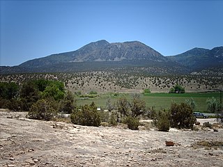
Ute Mountain, also known as Ute Peak or Sleeping Ute Mountain, is a peak within the Ute Mountains, a small mountain range in the southwestern corner of Colorado. It is on the northern edge of the Ute Mountain Ute Tribe Reservation. The Reservation forms the southwestern corner of the state and of Montezuma County.

<span class="mw-page-title-main">Greenhorn Mountain</span> Mountain in Colorado, United States

Greenhorn Mountain is the highest summit of the Wet Mountains range in the Rocky Mountains of North America. The prominent 12,352-foot (3,765 m) peak is located in the Greenhorn Mountain Wilderness of San Isabel National Forest, 5.2 miles (8.4 km) southwest by west of the Town of Rye, Colorado, United States, on the boundary between Huerfano and Pueblo counties. The summit of Greenhorn Mountain is the highest point in Pueblo County, Colorado. The peak's summit rises above timberline, which is about 11,500 feet (3,500 m) in south-central Colorado.

<span class="mw-page-title-main">Lookout Mountain (Colorado)</span> Mountain in Colorado, United States

Lookout Mountain is a foothill on the eastern flank of the Front Range of the Rocky Mountains of North America. The 7,377-foot (2,249 m) peak is located in Lookout Mountain Park, 1.7 miles (2.7 km) west-southwest of downtown Golden in Jefferson County, Colorado, United States.

<span class="mw-page-title-main">Index of Colorado-related articles</span>

This is an alphabetical list of articles related to the U.S. State of Colorado.

<span class="mw-page-title-main">Pikes Peak</span> Mountain in the Rocky Mountains, Colorado, United States of America

Pikes Peak is the highest summit of the southern Front Range of the Rocky Mountains in North America. The ultra-prominent 14,115-foot (4,302.31 m) fourteener is located in Pike National Forest, 12 miles (19 km) west of downtown Colorado Springs, Colorado. The town of Manitou Springs lies at its base.

<span class="mw-page-title-main">Hagues Peak</span> Mountain in Colorado, United States

Hagues Peak is the highest summit of the Mummy Range in the Rocky Mountains of North America. The 13,573-foot (4,137 m) thirteener is in the Rocky Mountain National Park Wilderness, 9.9 miles (15.9 km) northwest of the Town of Estes Park, Colorado, United States. Hagues Peak is the highest point in Larimer County, Colorado.

References

  1. 1 2 3 4 5 6 7 8 9 10 11 12 "Geographic Names Information System query". United States Department of the Interior, United States Geological Survey . Retrieved June 4, 2023.
  2. 1 2 3 4 5 6 7 8 9 10 Elliott, Donald R.; Elliott, Doris L. Salmen (1999). "Place Names of Colorado" (PDF). Colorado Council of Genealogical Societies, Inc. Retrieved August 20, 2021.
  3. "State of Colorado Census Designated Places - BAS20 - Data as of January 1, 2020". United States Census Bureau. January 1, 2020. Retrieved August 20, 2021.
  4. 1 2 "Colorado Counties". State of Colorado, Department of Local Affairs, Division of Local Government. Retrieved August 20, 2021.
  5. "National Register of Historic Places". United States Department of the Interior, National Park Service . Retrieved August 20, 2021.
  6. "Active Colorado Municipalities". State of Colorado, Department of Local Affairs, Division of Local Government. Retrieved August 20, 2021.
  7. "State of Colorado Incorporated Places - Current/TAB20 - Data as of January 1, 2020". United States Census Bureau. January 1, 2020. Retrieved August 20, 2021.
  8. Bauer, William H.; Ozment, James L.; Willard, John H. (1990). Colorado Post Offices 1859-1989. Golden, Colorado: Colorado Railroad Historical Foundation. ISBN   0-918654-42-4.
  9. "Colorado Post Offices". United States Postal Service . Retrieved August 20, 2021.
  10. "Pony Express National Historic Trail". United States Department of the Interior, National Park Service . Retrieved July 19, 2021.
  11. 1 2 3 4 Scott, Glenn R. (1989). "Historic trail maps of the Sterling 1 degree by 2 degrees Quadrangle, northeastern Colorado". United States Department of the Interior, United States Geological Survey . Retrieved July 19, 2021.
  12. Scott, Glenn R. (1975). "Historic trail map of the Pueblo 1 degree x 2 degrees Quadrangle, Colorado". United States Department of the Interior, United States Geological Survey . Retrieved July 23, 2021.
  13. "Rocky Mountain National Park". United States Department of the Interior, National Park Service . Retrieved July 19, 2021.
  14. Merkl, Dameon (February 26, 2013), "What's in a Colorado name pronunciation?", The Denver Post , retrieved March 7, 2013
  15. "Sand Creek Massacre National Historic Site". United States Department of the Interior, National Park Service . Retrieved July 19, 2021.
  16. "Santa Fe National Historic Trail". United States Department of the Interior, National Park Service . Retrieved July 19, 2021.
  17. 1 2 Scott, Glenn R. (1995). "Historic trail map of the Lamar 1 degree by 2 degrees Quadrangle, Colorado and Kansas". United States Department of the Interior, United States Geological Survey . Retrieved July 19, 2021.
  18. 1 2 3 Scott, Glenn R. (2001). "Historic trail map of the Trinidad 1 degree by 2 degrees quadrangle, southern Colorado". United States Department of the Interior, United States Geological Survey . Retrieved July 19, 2021.
  19. Scott, Glenn R. (1994). "Historic trail map of the Limon 1 degree x 2 degrees Quadrangle, Colorado and Kansas". Imap. United States Department of the Interior, United States Geological Survey. doi: 10.3133/i2468 . Retrieved July 19, 2021.
  20. 1 2 Scott, Glenn R. (1999). "Historic trail map of the Denver 1 degree by 2 degrees Quadrangle, central Colorado". Imap. United States Department of the Interior, United States Geological Survey. doi: 10.3133/i2639 . Retrieved July 19, 2021.
  21. 1 2 Scott, Glenn R. (1976). "Historic trail map of the Greater Denver area, Colorado". United States Department of the Interior, United States Geological Survey . Retrieved July 19, 2021.
  22. Scott, Glenn R.; Shwayder, Carol Rein (1993). "Historic trail map of the Greeley 1 degree by 2 degrees Quadrangle, Colorado and Wyoming". United States Department of the Interior, United States Geological Survey . Retrieved July 19, 2021.
  23. "Yucca House National Monument". United States Department of the Interior, National Park Service . Retrieved July 19, 2021.

Colorado places: A B C D E F G H I J K L M N O P Q R S T U V W X Y Z

See also

Notes

  1. Parkview Mountain is the highest summit of the Rabbit Ears Range.
  2. Parkville was the original seat of Summit County, Colorado Territory.
  3. 1 2 3 4 5 6 7 8 9 10 11 12 13 14 15 16 17 18 This pass crosses the Continental Divide of the Americas.
  4. Pueblo was the seat of Fountain County, Jefferson Territory and then Pueblo County, Colorado Territory.
  5. Quandary Peak is the highest summit of the Tenmile Range.
  6. The Raymer Post Office closed on May 14, 1895, but reopened as the New Raymer Post Office on November 13, 1909. The Town of Raymer, the State of Colorado, and the United States Census Bureau prefer the original name.
  7. The name "Saguache" is pronounced /səˈwæ/ . This name comes from the Ute language noun "sawup" /səˈwʌp/ meaning "sand dunes". The Spanish language version of this name is usually spelled "Saguache", while the English language version is usually spelled "Sawatch".
  8. St. Vrain was the original seat of St. Vrain's County, Jefferson Territory and then Weld County, Colorado Territory.
  9. San Juan City was the original seat of Hinsdale County.
  10. 1 2 Initially named San Luis de la Culebra, Territorio de Nuevo México upon its dedication on June 21, 1851, San Luis is the oldest continuously occupied town in Colorado.
  11. San Luis Peak is the highest summit of the La Garita Mountains.
  12. San Miguel was the original seat of Costilla County. In 1863, the Costilla County seat was moved 17 miles (27 km) north to San Luis. It wasn't until 1869, that surveys revealed that San Miguel, now renamed Costilla, was actually located in the New Mexico Territory.
  13. Sand Mountain North is the highest summit of the Elkhead Mountains.
  14. South Bald Mountain is the highest summit of the Laramie Mountains.
  15. Most of the town of Stout is now submerged in Horsetooth Reservoir.
  16. Summit Peak is the highest summit of the Southern San Juan Mountains.
  17. Tarryall City was the original seat of Park County, Jefferson Territory and then Park County, Colorado Territory.
  18. Thunder Butte is the highest summit of the Rampart Range.
  19. Towaoc is the headquarters of the Ute Mountain Ute Tribe.
  20. Twilight Peak is the highest summit of the West Needle Mountains.
  21. Ula was the original seat of Custer County.
  22. Uncompahgre Peak is the highest summit of the San Juan Mountains.
  23. Ute Peak is the summit of Ute Mountain.
  24. Vestal Peak is the highest summit of the Grenadier Range.
  25. Wason was the original seat of Mineral County.
  26. Waugh Mountain is the highest summit of the South Park Hills.
  27. West Elk Peak is the highest summit of the West Elk Mountains.
  28. West Spanish Peak is the highest summit of the Spanish Peaks.
  29. Windom Peak is the highest summit of the Needle Mountains.

References


    38°59′50″N105°32′52″W / 38.9972°N 105.5478°W / 38.9972; -105.5478 (State of Colorado)